
Park Closure
Temporary Closure of The Needles District
Canyonlands National Park has temporarily closed The Needles district to all uses, including the backcountry, until further notice due to the Babylon Fire near Blanding, UT. The Babylon Fire is located within Bears Ears National Monument and is not currently burning within Canyonlands National Park, but it is progressing toward the park and UT 211.
More infoCaution
Wildfire Smoke Impacts
Smoke and poor air quality may be present due to the Babylon Fire near Blanding, UT. Visitors are encouraged to check conditions before visiting.
More infoCaution
No Wood or Charcoal Fires Allowed - Stage 2 Fire Restrictions in Effect
All fires are prohibited. Only petroleum or propane-fueled stoves or grills are allowed in backcountry campsites, campgrounds, and picnic areas. Fireworks are never allowed. Smoke only inside vehicles or in developed areas over 3 feet from flammables.
More infoInformation
Expect delays due to paving on Potash Road/SR-279
Paving crews will be working weekdays from 7 am to 7 pm from June 8 through mid-July. Expect closures along the road shoulders in active work zones, and short delays with alternating one-way traffic controlled by a flagging operation.
Information
Trip-planning tips for 2026
Planning to visit Canyonlands this year? To ensure the best experience, please anticipate potentially long wait times at the entrance station. If overlook or trailhead parking is full, plan to return a little later. Please avoid parking on vegetation and roadways to help preserve this beautiful place for everyone to enjoy.
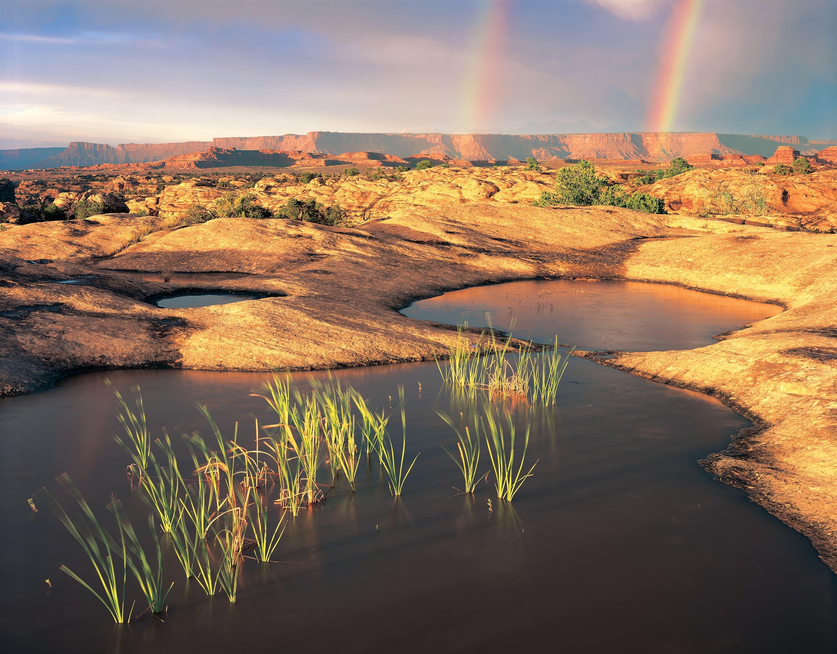
Canyonlands National Park
UT · Moab
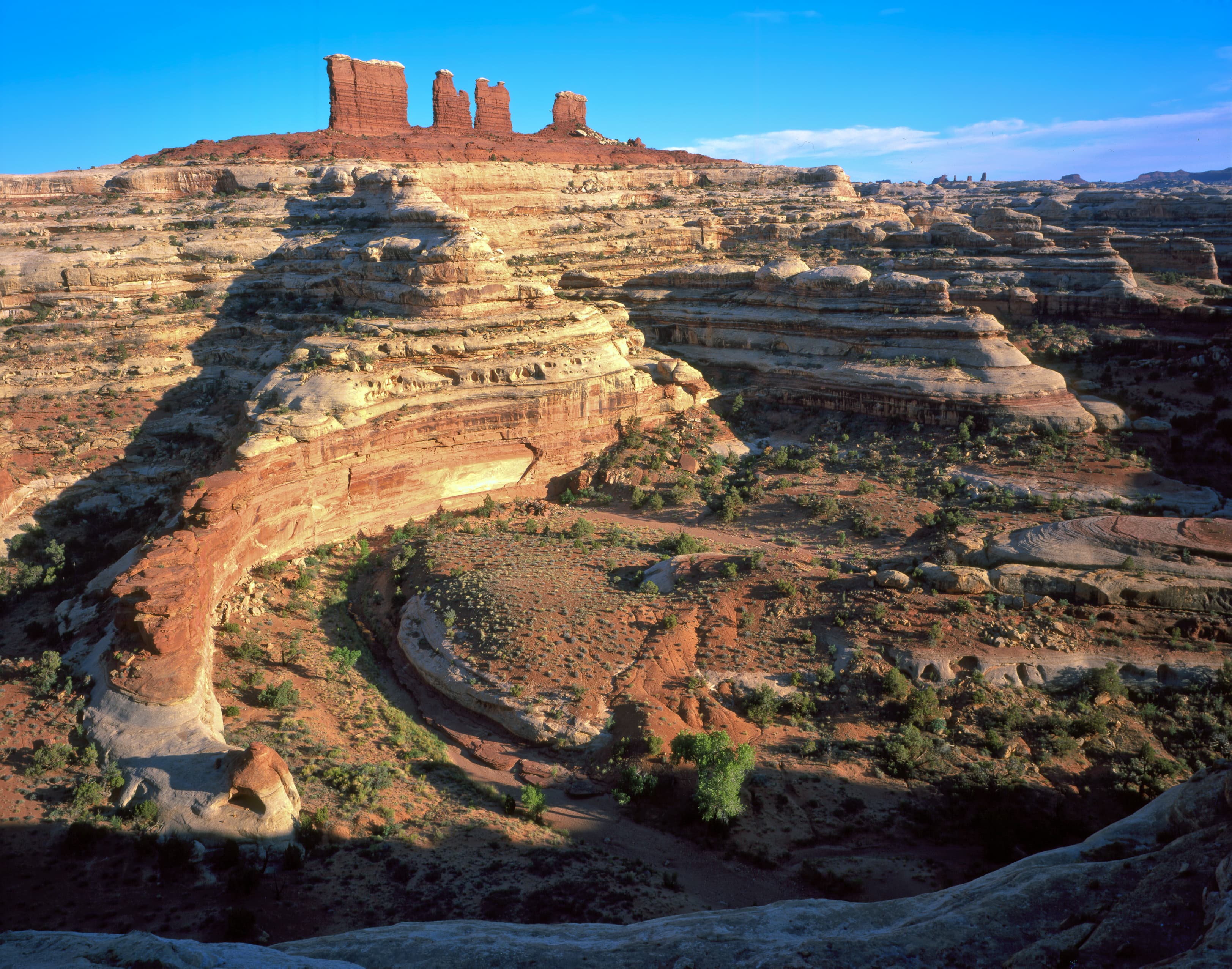
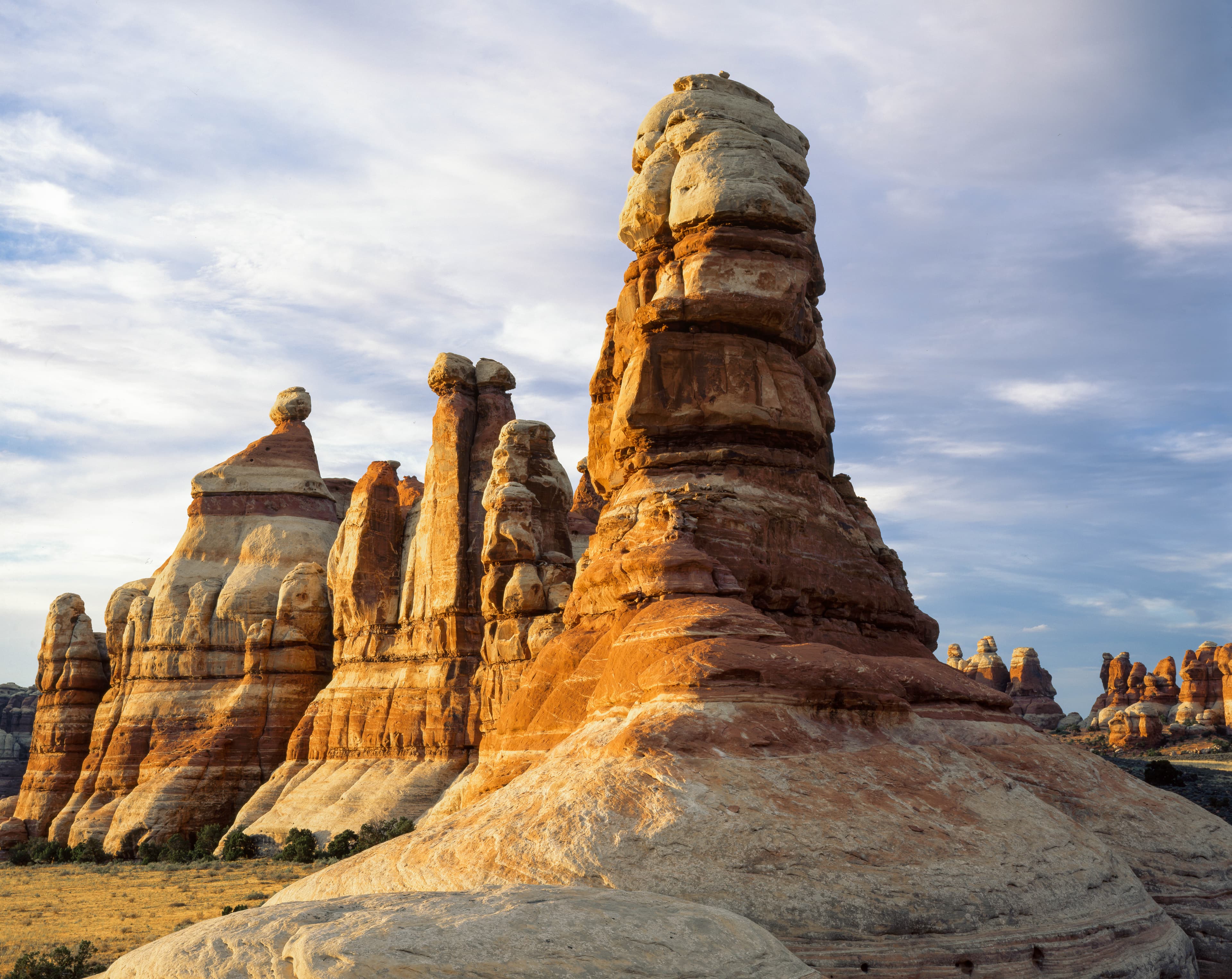
Canyonlands is a wilderness of canyons, buttes, and spires carved by the Colorado River and Green River. The park is divided into four distinct districts; no roads join them together. The districts share similar desert ecosystems, but each one provides unique opportunities for adventure and discovery.
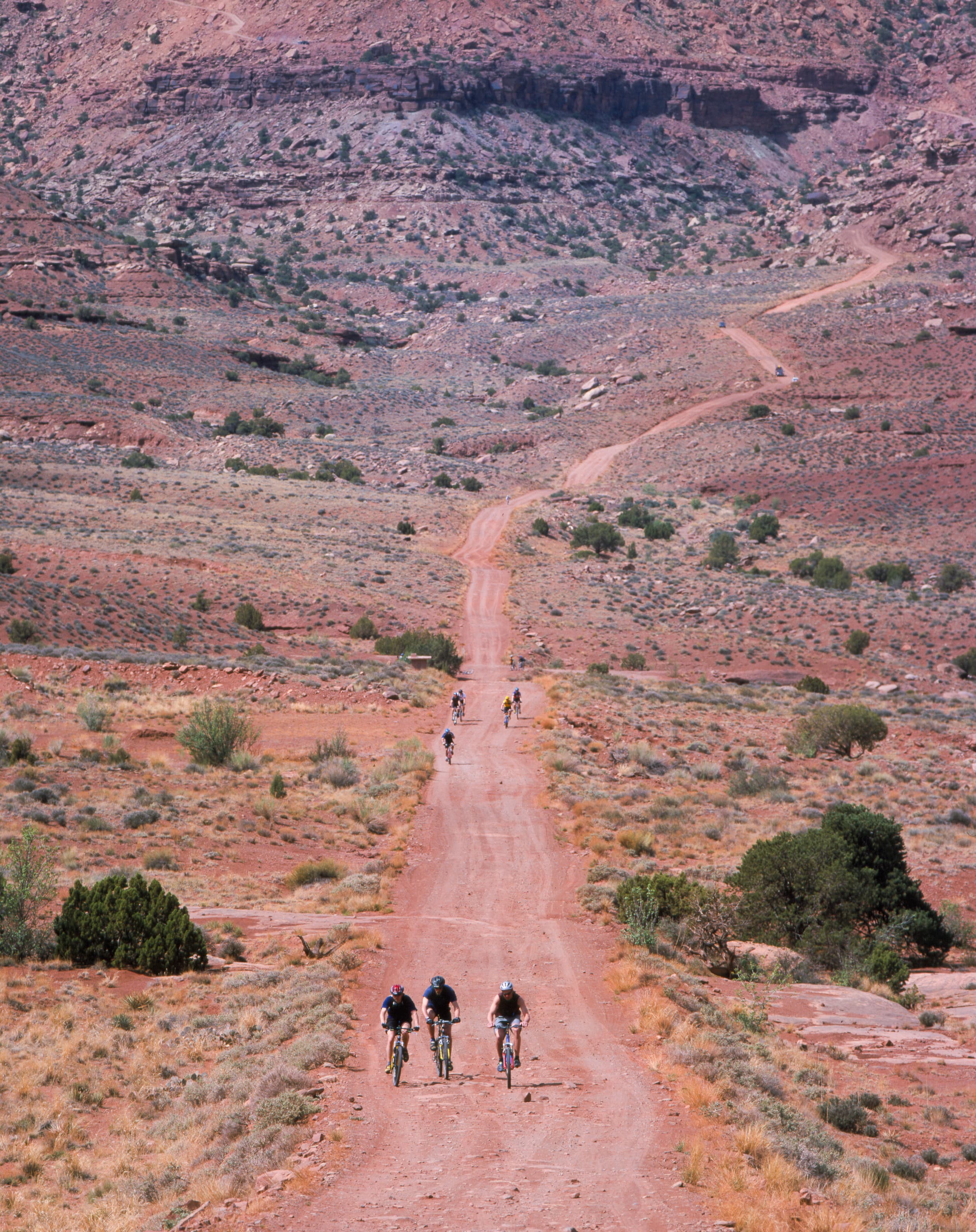
Riding guide
Highlights
Canyonlands National Park is vast, dramatic, and unapologetically rugged.
Riding
Rideable terrain here is noted as 60 miles, giving riders a clearer sense of scale before they ever unload. Stock use is allowed in specific areas of the park, primarily along approved backcountry roads rather than traditional single-track trails. Expect wide-open desert travel, sandy stretches, rocky shelves, and dramatic canyon-edge views. This is not shaded forest riding. It is exposed, expansive, and wild.
Rideable terrain
60 miles
Trailer parking
Needles District – Cave Spring Trailhead (Best Overall Option) Why it works well: One of the largest trailhead parking areas in the Needles District Access to backcountry roads leading into Salt Creek and Horse Canyon Suitable for truck and horse-trailer rigs Common starting point for longer stock trips This area connects to several backcountry routes where horses are allowed. Horseshoe Canyon West Rim Trailhead Why riders use it: Large open staging area on BLM land Direct access to the trail descending into Horseshoe Canyon Primitive camping nearby Horseback riding is allowed on the old road route into Horseshoe Canyon with a permit. Mineral Bottom Trailhead / Horsethief Area Why it works well: Access to White Rim Road, a long backcountry route where horses are permitted Large dirt staging area Popular for multi-day backcountry trips Horses are allowed on backcountry roads like the White Rim Road with permits. Elephant Hill Trailhead Why riders use it: Large trailhead parking area Access to rugged Needles District backcountry routes Suitable for trailers if arriving early
Horse regulations
Where Horses Are Allowed Horses and other pack stock are permitted only on designated backcountry roads. They are not allowed on hiking trails, developed viewpoints, or paved park roads except where necessary to cross. Stock travel is most common on routes such as portions of the White Rim Road and other approved dirt roads. Cross-country travel is prohibited. Permits Required • Overnight trips require a backcountry permit. • Permits are limited and often require advance reservations. • Day riding does not require a permit. Grazing & Feed • Grazing is prohibited. • Only certified weed-free feed is allowed. • Loose hay and grain are not permitted. • Feed must not be scattered on the ground. • Pack out unused feed and manure. Securing Stock • Use highlines or appropriate restraints to protect vegetation. • Avoid tying to fragile desert plants or small trees. • Keep stock away from water sources and sensitive riparian areas. Group Size • Group size limits apply and include both people and animals. • Check current limits when obtaining a permit. Environmental Protection • Desert soils are extremely fragile and slow to recover. • Stay strictly on designated roads. • Do not disturb cryptobiotic soil crust. • Removal of natural features is prohibited.
Getting here
Use 2282 Resource Blvd, Moab, Utah as your primary planning reference before you haul in. Needles District – Cave Spring Trailhead (Best Overall Option) Why it works well: One of the largest trailhead parking areas in the Needles District Access to backcountry roads leading into Salt Creek and Horse Canyon Suitable for truck and horse-trailer rigs Common starting point for longer stock trips This area connects to several backcountry routes where horses are allowed. Horseshoe Canyon West Rim Trailhead Why riders use it: Large open staging area on BLM land Direct access to the trail descending into Horseshoe Canyon Primitive camping nearby Horseback riding is allowed on the old road route into Horseshoe Canyon with a permit. Mineral Bottom Trailhead / Horsethief Area Why it works well: Access to White Rim Road, a long backcountry route where horses are permitted Large dirt staging area Popular for multi-day backcountry trips Horses are allowed on backcountry roads like the White Rim Road with permits. Elephant Hill Trailhead Why riders use it: Large trailhead parking area Access to rugged Needles District backcountry routes Suitable for trailers if arriving early
Planning your visit
Canyonlands National Park is divided into three distinct, non-connected districts: Island in the Sky (mesa top), The Needles (backcountry spires), and The Maze (remote canyons), offering diverse geological, hiking, and 4WD opportunities. Key areas include the easily accessible Island in the Sky for panoramic views, and the rugged Needles for hiking. Must Knows of Visiting • This is extreme desert exposure. There is little to no shade on most stock-permitted routes. Summer temperatures regularly exceed 100°F. Spring and fall are the safest riding seasons. • Water is scarce. There are no reliable natural water sources along most backcountry roads. You must haul all water for both horse and rider. • Riding is limited to designated dirt roads. There are no traditional single-track equestrian trails. Cross-country travel is prohibited. • Sand and slickrock footing are common. Expect deep sand in some sections and hard, rocky shelves in others. Sure-footed horses are essential. • Permits are required for overnight trips and are limited. Popular routes such as White Rim Road book well in advance. • Cell service is unreliable to nonexistent in the backcountry. Download maps, carry paper navigation, and share your itinerary. • Desert storms can create flash flood risk, especially in washes and low areas. Always check weather forecasts. • Cryptobiotic soil crust is extremely fragile and legally protected. Stay strictly on roads and avoid stepping onto dark, crusted soil surfaces. • Fuel and services are limited near the park. Plan staging, fuel, and supplies before arrival.
Where to stay
Arches and Canyonlands National Park HQ is the main visitor-contact point tied to this destination, which is helpful when you want current conditions, maps, and stock-use updates before riding. This entry reads best as a bring-your-own-horse destination rather than a horse-rental stop, and amenities should be confirmed directly before travel. For a polished trip plan, pair the ride with lodging, fuel, and resupply planning in or near Moab before heading deeper into federal-land access points.
Entrance fees & passes
- $30.00
Entrance - Private Vehicle
Admits one private, non-commercial vehicle (15 passenger capacity or less) and all its occupants.
- $25.00
Entrance - Motorcycle
Valid for 7 days. Admits up to 2 private, non-commercial motorcycles with up to 4 total passengers.
- $15.00
Entrance - Per Person
Admits one individual with no car. Typically used for bicyclists, hikers, and pedestrians. Youth 15 and under are admitted free.
- $55.00
Annual Entrance - Park
Valid for one year through the month of purchase. Admits one (1) private, non-commercial vehicle or its pass holder to Arches and Canyonlands national parks, and Natural Bridges and Hovenweep national monuments. U.S. residents only.
Park map
Trails
No trails synced for this park yet.
Campgrounds
Island in the Sky (Willow Flat) Campground
12 sites
Island in the Sky Campground (Willow Flat) has 12 sites, first-come, first-served. The campground is open year-round. The spectacular Green River Overlook is nearby. Nightly camping fee is $15 per site. Sites fill quickly spring through fall. There are toilets, picnic tables, and fire rings in the campground. There is no water at the campground. You can get drinking water outside the visitor center spring through fall.
The Needles Campground
26 sites
The Needles Campground has 26 individual sites. Nightly camping fee for an individual site is $20. You can reserve some individual sites spring through fall. Other times of the year, individual sites are first-come, first-served. There are toilets, picnic tables, and fire rings in the campground. This park district also has three group campsites described on a separate page.
Reserve a siteThe Needles District Group Campsites
3 sites
The Needles district has three group campsites in different locations, which can accommodate up to 15, 25, or 50 campers (respectively). Group campsites may be reserved for nights between mid-March and mid-November.
Reserve a site
Points of interest
Alcove Spring Trail
POIAfter descending 1,400 ft (4276 m) past a large alcove, the trail meanders in a wide canyon to the base of the notable Moses and Zeus towers.
Aztec Butte: The Value of Storage
POIAztec Butte Trail
POIThis trail climbs two sandstone buttes to outstanding views and stone granaries built by Indigenous people centuries ago.
Big Spring Canyon Overlook and Trailhead
POIBig Spring rests at the end of the Needles Park Road. From the overlook, unique rock spires and multi-colored sandstone benches line the bend in the canyon. The presence of the spring allows trees and plants to flourish in the spring and summer months.
Big Spring Canyon Overlook: Protecting Wilderness
POIBig Spring Canyon to Elephant Canyon Loop Trail
POIThis loop features extended hiking on slickrock benches and mesa tops overlooking canyons. Excellent views of sheer cliff walls and other rock formations. Must climb two ladders.
Big Spring Canyon to Wooden Shoe Canyon Loop Trail
POIA great introduction to the landscape of The Needles, this route connects two canyons for a loop across varied terrain.
Buck Canyon Overlook
POIFrom a paved overlook at 6,240 feet (1,902 m) in elevation, enjoy sweeping vistas to the west and across the Colorado River canyon.
Buck Canyon: Tracks in the Canyon
POICampground Amphitheatre: Discover the Night
POICandlestick Tower Overlook
POIFrom this small roadside pullout, you can see sweeping views of Canyonlands and several prominent rock features, once of which, resembles a group of candlesticks.
Canyonlands' Cave Spring Trail
POIWater is scarce in this desert. From this trailhead, hike a short, 0.6-mile (1 km) loop leading to a historic cowboy camp and prehistoric rock markings, all made possible by a small but essential natural spring.
Cave Spring: Water to Live By
POIChesler Park Loop and Joint Trail
POIThis trail provides many great panoramas of the Needles formations. The Joint Trail winds through deep, narrow fractures in the rock.
Chesler Park Viewpoint Trail
POIThis popular trail leads to a pass overlooking a scenic expanse of desert grasses and shrubs surrounded by sandstone spires.
Colorado River Overlook
POIThis overlook is 7 miles down a rugged, unpaved road. You must have a high-clearance, four-wheel-drive vehicle or mountain bike. No permit required; no camping allowed.
Confluence Overlook Trail
POIUnlike other Needles hikes, this trail traverses dry, open country along the northern edge of the geologic faults that shaped the Needles. The trail ends at a cliff overlooking the junction of the Green and Colorado rivers 1,000 ft (304 m) below.
Druid Arch Trail
POIThis trail offers one of the most spectacular views in The Needles. It follows the first part of the Chesler Park trail, then branches off to travel along the bottom of Elephant Canyon through deep sand and loose rock. The last 1.25 mile at the upper end is steep with one ladder and some scrambling.
Elephant Hill Access Road: The Needles
POIFort Bottom Trail
POIFort Bottom Ruin is an ancient stone structure overlooking the Green River, built by Indigenous inhabitants of the Canyonlands area centuries ago. It is only reachable from the 4WD White Rim Road (permit required).
Gooseberry Trail
POIThe steepest trail in this district of Canyonlands, Gooseberry descends over a thousand feet of scree slopes and switchbacks across sheer cliffs.
Gooseneck Overlook Trail
POIThis short walk from the 4WD White Rim Road (permit required) ends abruptly at an overlook of a meandering gooseneck bend in the Colorado River.
Grand View Point: Carving the Canyons
POIGrand View Point: Grand View Point Overlook
POIGrand View Point Overlook and Trail
POIGrand View Point offers a spectacular view of the Canyonlands area. From this panoramic viewpoint at 6,080 feet elevation, you can see distant mountains, canyons, basins, and the four-wheel-drive White Rim Road far below. A short trail leads to even more views.
Green River Overlook
POIBest mesa-top view of the Green River far below. Can be lovely for sunset.
Green River Overlook: Green River Overlook
POIGreen River Overlook: What Shall We Find?
POIHorseshoe Canyon
POIHorseshoe Canyon contains some of the most significant pictographs in North America. The Great Gallery, the best-known panel in Horseshoe Canyon, includes well-preserved, life-sized figures with intricate designs. Other impressive sights include spring wildflowers, sheer sandstone walls, and mature cottonwood groves along the intermittent stream in the canyon bottom. Horseshoe Canyon was added to Canyonlands National Park in 1971.
Island in the Sky Entrance Station
POIIsland in the Sky Visitor Center: There's Something in the Air
POILathrop Trail
POIThe Lathrop Trail crosses a wide grassland on the mesa top, enjoys views of Colorado River, then descends into the canyon below. For a moderate trail option, hikers often turn around at the canyon rim. Continuing down to the White Rim Road means a strenuous hike back out.
Mesa Arch: Keeping it Together
POIMesa Arch Trail
POIShort hike to a natural stone arch perched at the mesa's edge, framing views of La Sal Mountains and the canyon below.
Moses and Zeus Towers Trail
POIMoses and Zeus are two prominent towers overlooking Taylor Canyon. This trail leads to their base. Reaching this trail requires a hike down Alcove Spring Trail (11.2 mi/18.3 km roundtrip) or a permit to drive the 4WD White Rim Road.
Murphy Loop Trail
POIA great full-day hike with 1,400 feet (440 m) elevation change, the Murphy Loop Trail offers outstanding views from atop the Murphy Hogback and White Rim Road.
Murphy Point Trail
POIThis mostly level hike leads past a historic corral on the mesa top. The trail ends with panoramic views of Candlestick Tower, the Green River, and the White Rim Road.
Neck Spring Trail
POIA walk back in time, this loop trail passes historic ranching features and two springs where cowboys watered cattle.
Orange Cliffs Overlook
POIEnjoy panoramic views across the canyon of the Green River to the dazzling sandstone cliffs of the aptly named Orange Cliffs unit of Glen Canyon Recreation Area.
Orange Cliffs Overlook: Protecting Wilderness
POIPeekaboo Trail
POISteep slopes and nearby cliff edges make this a challenging route. Two ladders must be climbed.
Pets in Canyonlands
POIPets and owners have a special bond, but a national park is not always the best place for pets. Canyonlands National Park is a designated natural area, and its purpose is to preserve and protect the park's natural environment, cultural resources, wildlife, and scenic beauty.
Pothole Point Trail
POIThis short loop trail (0.6 mi/1 km) crosses sandstone dimpled with pockets called potholes, which may be filled with surprising aquatic life.
Scenic Drive Picnic Area: Life in the Balance
POIShafer Canyon Overlook: Anatomy of a Canyon
POIShafer Canyon Overlook: Dropping into the Canyons
POIShafer Trail Viewpoint
POIThe Shafer Trail Viewpoint at Island in the Sky provides an incredible view of this iconic road that descends 1,500 feet (457 m) down colorful sandstone walls to the canyon basin.
Slickrock: Big Spring Canyon
POISlickrock: Keeping it Together
POISlickrock: Lower Little Spring Canyon
POISlickrock: Panorama
POISlickrock Trail
POIThis trail features expansive 360-degree views into Big Spring Canyon and Little Spring Canyon, with the La Sal Mountains and Abajo Mountains in the background. Geology guide available at trailhead.
Slickrock: Upper Little Spring Canyon
POIStone Storehouse Trail
POIVisit one of the best preserved ancient structures in the park, built over 1,000 years ago.
Syncline Trail
POIThe Syncline Trail follows the canyons around Upheaval Dome and requires navigating steep switchbacks, climbing and scrambling through boulder fields, and a 1,300-foot (396 m) elevation change. Most park rescues occur on this trail.
The Needles Entrance Station
POIUpheaval Dome
POIWhat created this unusually circular and tilted geologic formation? For the best view, hike the one-mile roundtrip (1.5 km) trail to the first overlook (climbing 100 feet/30 meters).
Upheaval Dome Overlook: A Mystery
POIUpheaval Dome Overlooks Trail
POITwo short but steep hikes lead to overlooks of a spectacular and colorful geologic feature; Upheaval Dome.
Whale Rock Trail
POIThis trail leads up the side of a sandstone dome, ending with broad views of the Island in the Sky. Great for kids who like to scramble on rock.
White Rim Overlook Trail
POIWalk to an east-facing overlook for views of the Colorado River, Monument Basin, and La Sal Mountains.
Wilhite Trail
POIA primitive trail with steep switchbacks drops 1,600 feet (488 m) into a long, sandy wash. Follow the wash to the White Rim Road. No shade.
Wooden Shoe Arch Overlook
POIJust like it says, this roadside overlook offers a great view of large sandstone arch shaped like a classic Dutch wooden shoe.
Wooden Shoe Arch Overlook: Wooden Shoe Arch
POIWooden Shoe Canyon to Lost Canyon Loop Trail
POIA wonderful loop hike with some difficult sections climbing between two canyons. One ladder must be climbed.
Things to do
Auto Touring in Canyonlands
There are hundreds of miles of unpaved roads in Canyonlands, providing access to various campsites, trailheads, and viewpoints in the park's backcountry. Most roads require high-clearance, low range four-wheel-drive. Roads range in difficulty from intermediate to extremely technical. Research your route thoroughly before attempting these roads.
Backcountry Camping in Canyonlands
What better way to connect with this wilderness of countless canyons than on foot? Canyonlands offers hundreds of miles of hiking trails with designated campsites for overnight backcountry travel.
Duration: 1-14 Days
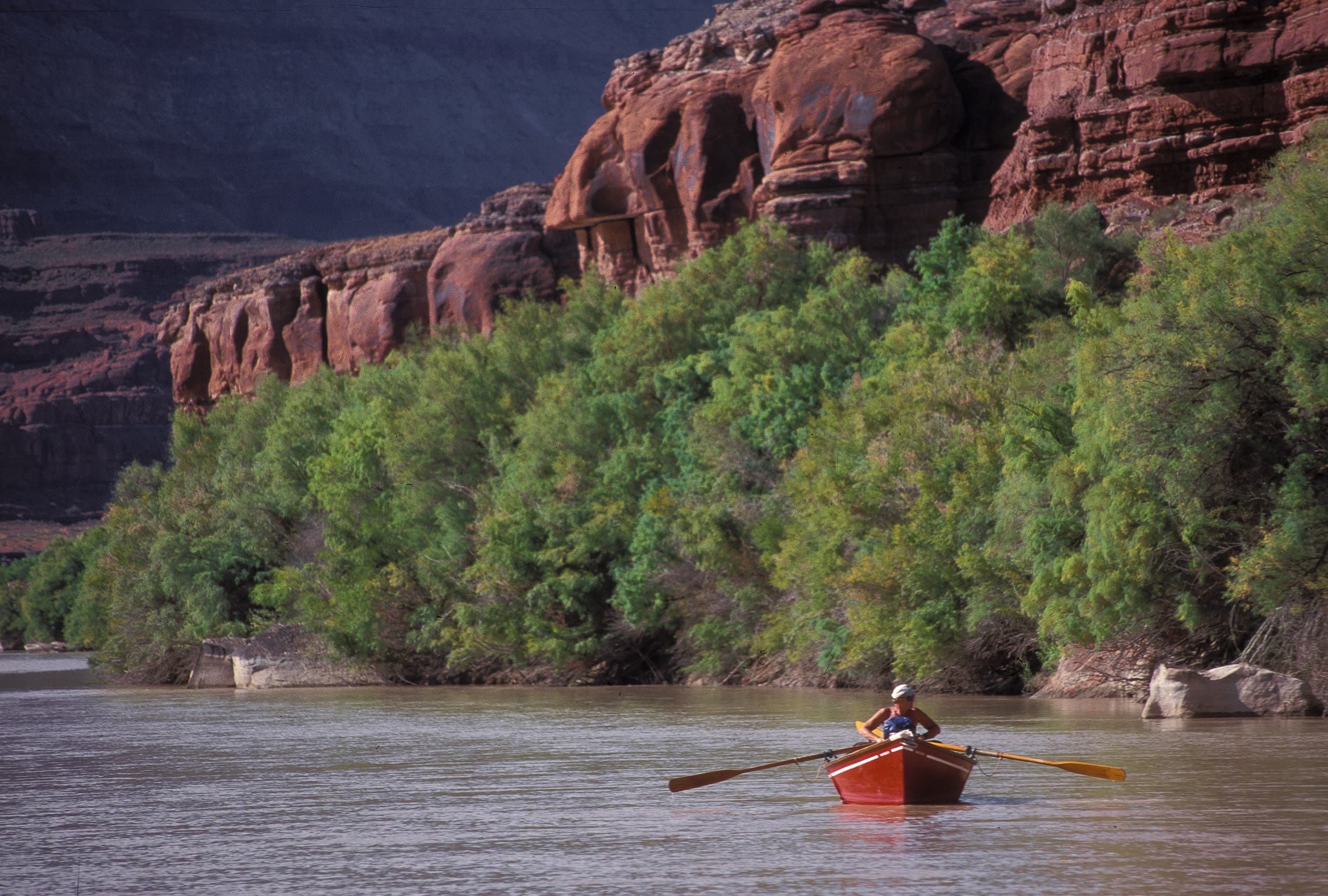
Boating in Canyonlands
The Colorado and Green rivers have played a significant role in shaping the landscape of Canyonlands. Boating is a great way to see the park from the bottom up, and affords boaters a unique perspective.
Duration: 1-12 Days
Canyonlands Junior Ranger Program
There are a few ways to become a junior ranger at Canyonlands. Free junior ranger booklets are available at park visitor centers, or you can download them from the park website. Filled with fun activities, these books reveal the wonders of Canyonlands to kids and parents alike. After completing certain exercises, you can earn a junior ranger badge and signed certificate.
Experience the Shafer Trail
The Shafer Trail is a challenging, unpaved backcountry road for recreational users seeking the experience of a lifetime. High-clearance 4WD vehicles with a low range gear (4LO) are required. ATVs, OHVs, or UTVs are not permitted inside the park.
Duration: 1 Hour
Hiking at Canyonlands
Canyonlands has hundreds of miles of hiking trails which explore the park’s natural and cultural features. Both Island in the Sky and The Needles provide ample opportunities for short walks, day hikes and backpacking trips. Due to its remoteness, The Maze is primarily a backpacking destination.
Rock Climbing at Canyonlands
The sandstone towers at the Island in the Sky attract the most rock climbers. We do not see many climbers in the rest of the park due to the poor rock quality and a lack of established routes.
Visitor centers
Canyonlands Backcountry Office
The central backcountry office is located at park administrative offices south of Moab. Rangers can answer questions about backcountry travel over phone or email and issue permits online.
Get directionsHans Flat Ranger Station
The remote Hans Flat (Maze) Ranger Station is normally open daily year-round. This ranger contact station has a picnic table and vault toilet, and a small selection of books and maps for sale. There are no services, food, gas, trash collection, electricity for visitor use, nor potable water in The Maze. The nearest communities with amenities are Hanksville (68 miles) and Green River (86 miles).
Get directionsIsland in the Sky Visitor Center
The Island in the Sky Visitor Center offers exhibits, book & map sales, park orientation film, backcountry permits, general information, vault toilets, and park rangers on duty. You can get drinking water inside (during open hours) or outside (24 hours a day) during summer and fall. Water is only available inside (during open hours) in winter.
Get directionsThe Needles Visitor Center
The Needles Visitor Center normally offers exhibits, book & map sales, backcountry permits, information, picnic area, and park rangers on duty. The park orientation movie (15 minutes) is available on demand. Water is available year-round. When the visitor center is closed in winter, you must self-register for backcountry permits outside the visitor center entrance.
Get directions
Hours of operation
Open Year-round
Canyonlands National Park is generally open 24 hours a day, year-round.
Mon
All Day
Tue
All Day
Wed
All Day
Thu
All Day
Fri
All Day
Sat
All Day
Sun
All Day
Activities
Weather
Canyonlands is part of the Colorado Plateau, a "high desert" region that experiences wide temperature fluctuations, sometimes over 40 degrees in a single day. The temperate (and most popular) seasons are spring (April-May) and fall (mid-September-October), when daytime highs average 60 to 80 F and lows average 30 to 50 F. Summer temperatures often exceed 100 F, making strenuous exercise difficult. Winters are cold, with highs averaging 30 to 50 F, and lows averaging 0 to 20 F.
Contact
Photos
Stay near this park
No horse-friendly stays listed near Canyonlands National Park yet. Know a great barn or property? Help fellow riders by listing it.
List your propertyDirections
Canyonlands National Park is cut into three land districts by the Green and Colorado rivers. Island in the Sky, in the north of the park, is about 40 minutes from Moab, UT via UT 313. The Needles district is in the southeast corner of Canyonlands, about 90 minutes from Moab or an hour from Monticello, UT via UT 211. The Maze district, in the west of the park, is the most remote and challenging; its ranger station is down 46 miles of dirt road from UT 24. All roads in The Maze require high-clearance 4WD.
Source: nps.gov