
Danger
Stage 2 Fire Restrictions in Effect
Until further notice, the following are PROHIBITED in all park areas: (1) Building, maintaining, attending, or using a fire or campfire, including charcoal fires or pellet grills, or any other open burning. Properly shielded, self-contained propane or liquid-fueled camp stoves and grills, lanterns, or other heated devices with on/off switches are permitted. (2) All smoking, except within a personally-owned enclosed vehicle. (3) Discharging or using any kind of fireworks or other pyrotechnic devices.
More infoCurecanti National Recreation Area
CO · Gunnison
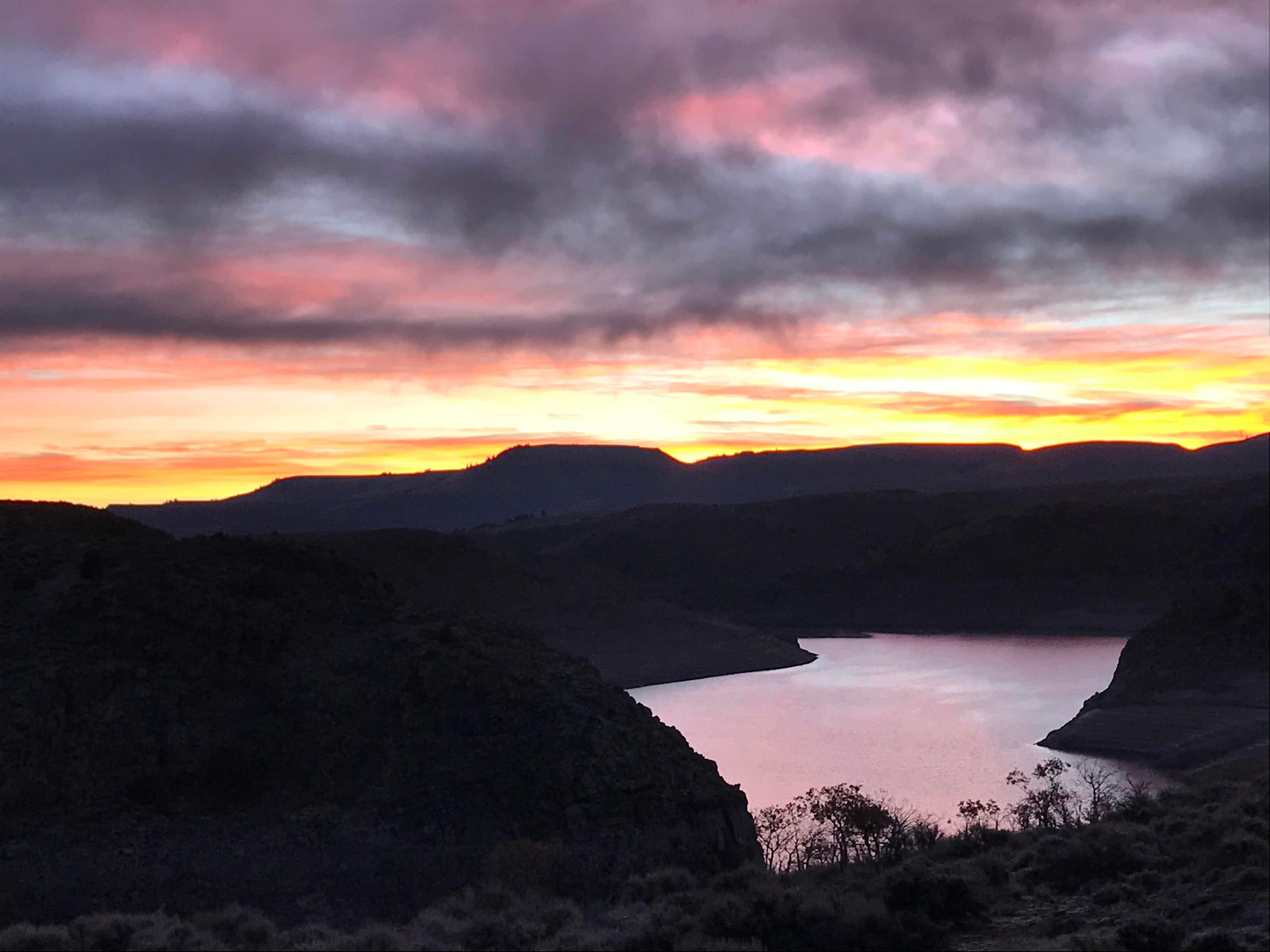
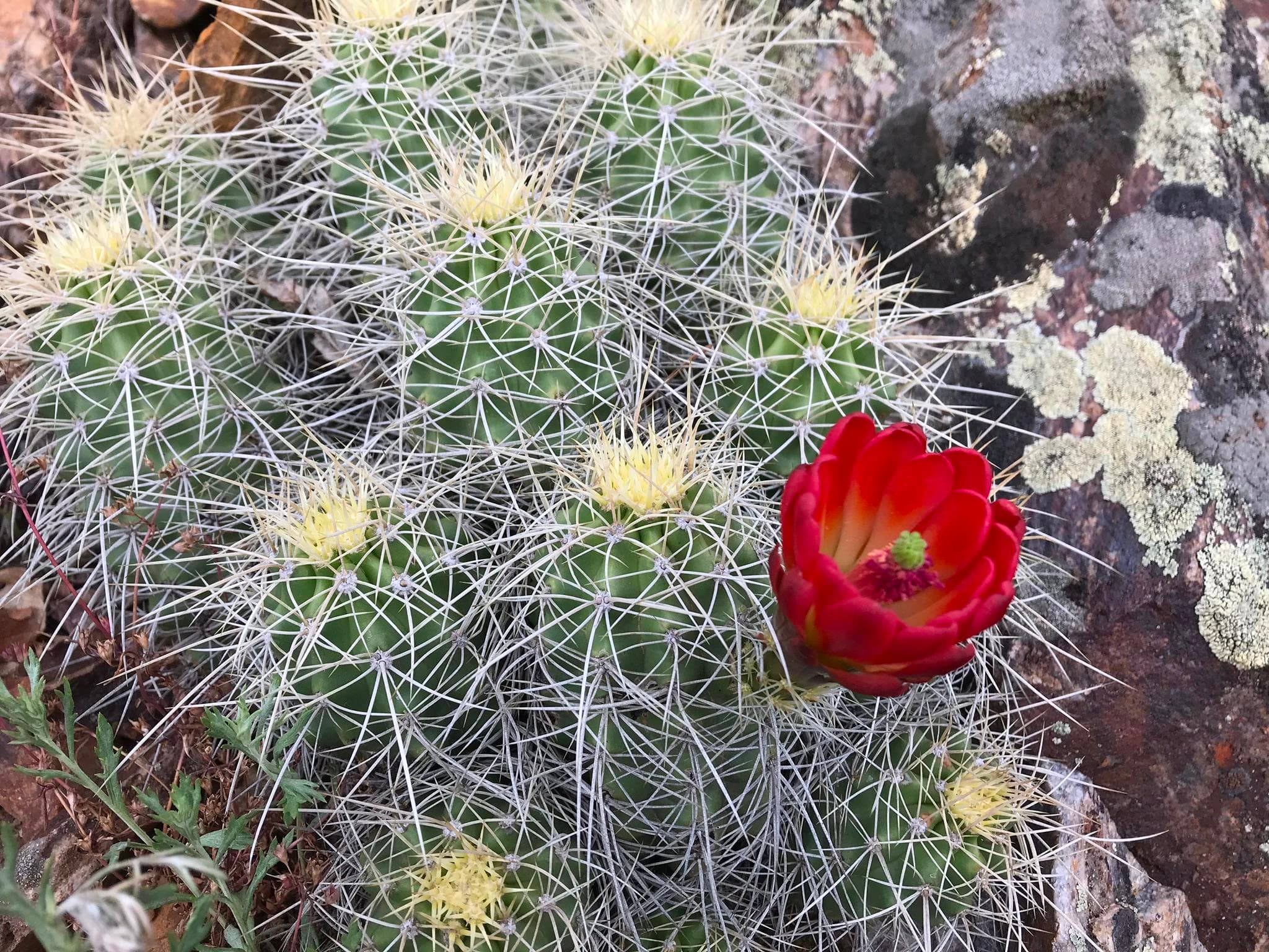
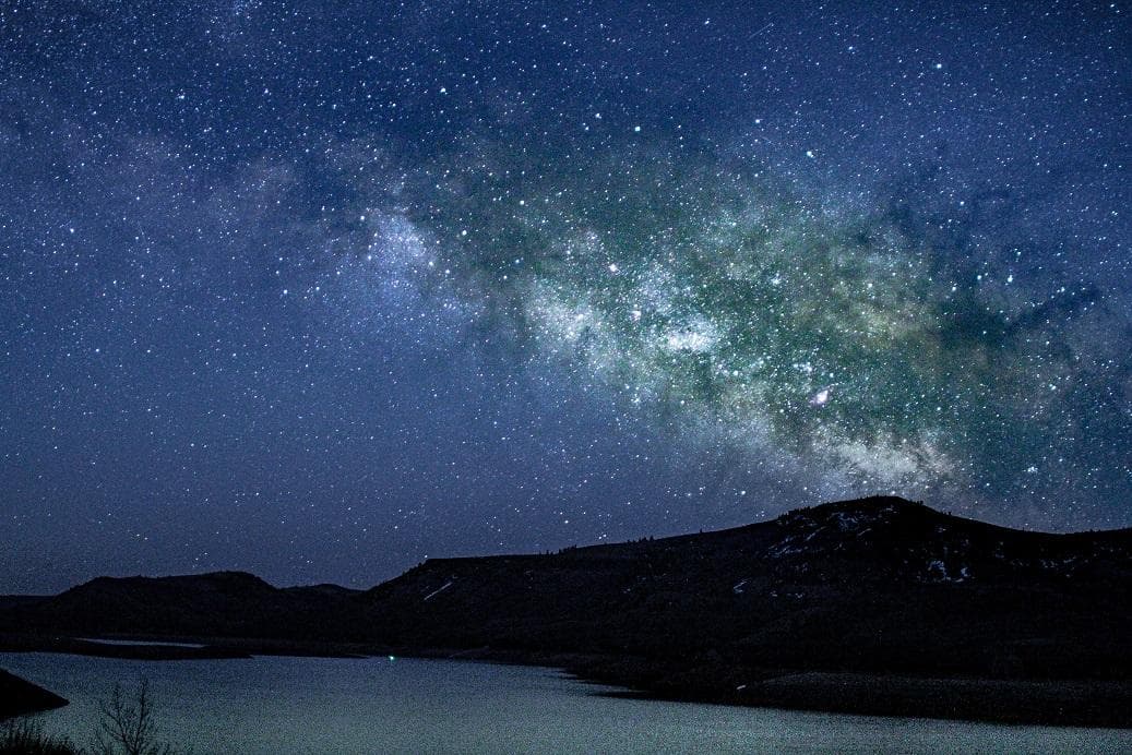
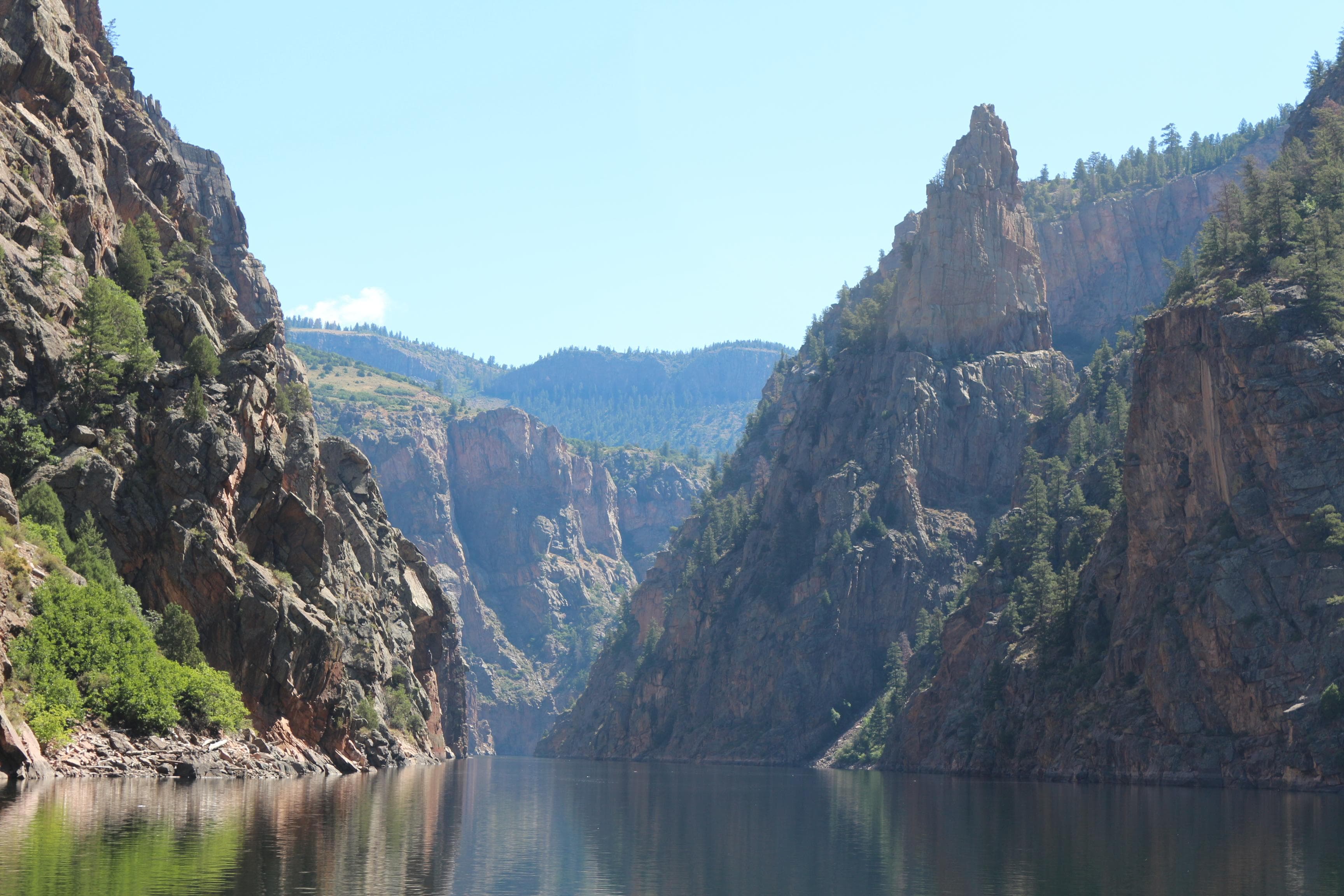
Three reservoirs and surrounding lands make up this recreation area in western Colorado. It is a landscape of tradeoffs; natural and human made features exist together. Geologic wonders are abundant from the sagebrush shrublands to forests. Visitors can experience the park year-round on both land and water.
Riding guide
Horses provided
Highlights
Curecanti National Recreation Area in western Colorado stretches across a dramatic landscape of high desert mesas, deep reservoirs…
Riding
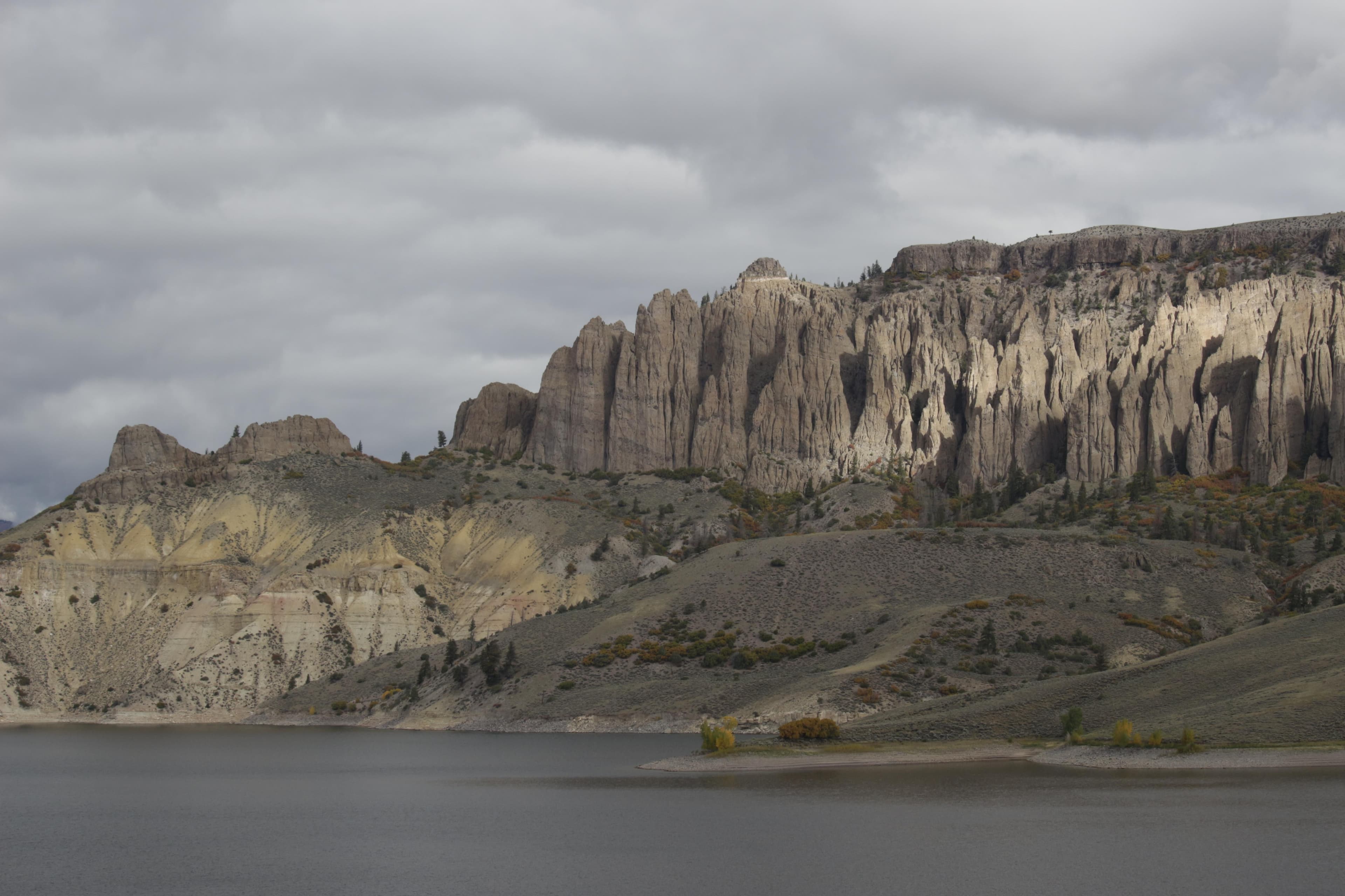
Rideable terrain here is noted as 4 miles, giving riders a clearer sense of scale before they ever unload. For equestrians, riding opportunities within the recreation area are limited but scenic, with access primarily along the lower section of the Dillon Pinnacles Trail. This route travels through sagebrush flats and rocky desert terrain before approaching towering volcanic spires rising above Blue Mesa Reservoir. The trail provides expansive views of the surrounding canyon country and connects to additional riding opportunities on nearby national forest and wilderness lands.
Rideable terrain
4 miles
Trailer parking
Dillon Pinnacles Trailhead (Middle Bridge / Highway 50) Primary staging area for riders accessing the Dillon Pinnacles Trail, which is the main trail within Curecanti National Recreation Area open to horseback riding. This trailhead is located near Middle Bridge along U.S. Highway 50 and provides direct access to the lower section of the Dillon Pinnacles Trail before it continues toward surrounding public lands. Why riders use it Direct access to the Dillon Pinnacles Trail Designated trailhead commonly used by equestrians Convenient access from Highway 50 near Blue Mesa Reservoir Ponderosa Campground (Soap Creek Area) Ponderosa Campground is one of the most equestrian-friendly areas in the recreation area and is often used by riders staging horses for day rides or overnight trips. The campground includes horse facilities and space for trailers within the campground layout. Why riders use it Horse corrals and hitching posts available Horse loading ramp provided Suitable for overnight horse camping Dry Gulch Campground Dry Gulch Campground provides additional staging and camping options for riders traveling with horses near Blue Mesa Reservoir. Horse trailers can park at campsites, and riders may stage horses for rides into nearby public lands surrounding the recreation area. Why riders use it Horse-friendly campground with space for trailers Small horse corral available Good option for riders planning overnight stays or longer trips
Horse regulations
Horseback riding at Curecanti National Recreation Area is permitted in limited areas and is managed to protect the park’s fragile high desert ecosystems, steep canyon terrain, and sensitive shoreline habitats around Blue Mesa Reservoir. Riders should review park guidelines before visiting and plan accordingly, as equestrian access and facilities within the recreation area are limited. However, several core regulations and best practices apply for riders in the park. Riding Is Only Allowed on Designated Trails Horses and other pack animals are permitted only on designated routes within the recreation area, including the lower section of the Dillon Pinnacles Trail. Riding off trail or in closed areas is prohibited in order to protect fragile soils, vegetation, and wildlife habitat. Access and Trail Conditions Equestrian access within the recreation area is limited, and riders should be prepared for rocky high-desert terrain and exposed conditions. Trails may be narrow or steep in places, and riders should maintain control of their horses at all times. Feed and Invasive Species Control To help protect native ecosystems, riders must bring: Certified weed-free hay or feed Clean trailers, tack, and hooves before entering riding areas These measures help prevent the spread of invasive plant species. Stock Control and Trail Courtesy Riders are expected to: Maintain control of horses at all times Ride single file where trails are narrow Yield appropriately to hikers and other trail users Avoid damaging vegetation or creating new trails Waterways and Sensitive Areas Horses should be kept away from fragile shoreline areas and sensitive habitats along the reservoirs and canyon slopes. Riders should avoid allowing horses to enter protected waterways unless the trail specifically crosses these areas. Camping With Horses Horse camping is allowed in designated areas such as Ponderosa Campground and Dry Gulch Campground, where equestrian facilities may be available. Riders should follow campground regulations and practice Leave No Trace principles when camping with horses.
Getting here
Use 102 Elk Creek, Gunnison, Colorado as your primary planning reference before you haul in. Dillon Pinnacles Trailhead (Middle Bridge / Highway 50) Primary staging area for riders accessing the Dillon Pinnacles Trail, which is the main trail within Curecanti National Recreation Area open to horseback riding. This trailhead is located near Middle Bridge along U.S. Highway 50 and provides direct access to the lower section of the Dillon Pinnacles Trail before it continues toward surrounding public lands. Why riders use it Direct access to the Dillon Pinnacles Trail Designated trailhead commonly used by equestrians Convenient access from Highway 50 near Blue Mesa Reservoir Ponderosa Campground (Soap Creek Area) Ponderosa Campground is one of the most equestrian-friendly areas in the recreation area and is often used by riders staging horses for day rides or overnight trips. The campground includes horse facilities and space for trailers within the campground layout. Why riders use it Horse corrals and hitching posts available Horse loading ramp provided Suitable for overnight horse camping Dry Gulch Campground Dry Gulch Campground provides additional staging and camping options for riders traveling with horses near Blue Mesa Reservoir. Horse trailers can park at campsites, and riders may stage horses for rides into nearby public lands surrounding the recreation area. Why riders use it Horse-friendly campground with space for trailers Small horse corral available Good option for riders planning overnight stays or longer trips
Planning your visit
Riding within Curecanti National Recreation Area is limited and primarily permitted on designated routes such as the lower section of the Dillon Pinnacles Trail. Horses are not allowed on most hiking trails, shoreline recreation areas, or in closed resource protection zones. Riders must remain on designated trails at all times. Trail access within the recreation area is limited, and riders should expect rocky high-desert terrain with exposed sections and limited shade. Maintain control of your horse and ride cautiously, especially on narrow or uneven trail sections. Horse trailer staging is most commonly done at the Dillon Pinnacles Trailhead near Middle Bridge along U.S. Highway 50. Additional staging and horse-friendly camping areas can be found at campgrounds such as Ponderosa Campground and Dry Gulch Campground. Horse facilities are limited within the recreation area. Riders should plan to be largely self-sufficient and bring adequate water, feed, and equipment for both horses and riders. Use certified weed-free hay or feed to help prevent the spread of invasive plant species. Cleaning trailers, hooves, and tack before entering riding areas is strongly encouraged. Keep horses away from fragile shoreline habitats and sensitive vegetation along the reservoirs and canyon slopes unless the trail specifically crosses these areas. Horse camping is available in designated campgrounds such as Ponderosa Campground and Dry Gulch Campground. Riders staying overnight should follow campground rules and practice Leave No Trace principles.
Where to stay
Elk Creek Visitor Center is the main visitor-contact point tied to this destination, which is helpful when you want current conditions, maps, and stock-use updates before riding. Guided or concession-based riding support is noted here, so riders who are not hauling their own horses may still find an access path into the experience. For a polished trip plan, pair the ride with lodging, fuel, and resupply planning in or near Gunnison before heading deeper into federal-land access points.
Park map
Trails
No trails synced for this park yet.
Campgrounds
Cimarron Campground
21 sites
Cimarron Campground is located 20 miles (32 km) east of Montrose, CO on U.S. Highway 50 at the site of Cimarron, a historic narrow gauge railroad town. The campground accommodates tents to medium sized RVs. All sites are first-come, first-served and the campground rarely fills. Railroad exhibits are adjacent to the campground. Crystal Reservoir near Morrow Point Dam is approximately 1.5 miles away (2.4 km).
Dry Gulch Campground
9 sites · 1 horse-friendly
Dry Gulch Campground is located 17 miles west of Gunnison just north of U.S. Highway 50. The campground is shaded by large cottonwood trees and can accommodate tents or medium sized RVs. All sites are first-come first-served. A horse corral is available. Elevation: 7560 feet
East Elk Creek Group Campground
1 sites
East Elk Creek is a group campsite that can accommodate a total of 50 people. The site is located 16.5 miles west of Gunnison just north of U.S. Highway 50. The campsites are located under large cottonwood trees, and space is available for tents or RVs. Elevation: 7535 feet
Reserve a siteEast Portal Campground
15 sites
East Portal Campground is located within Curecanti National Recreation Area, but is adjacent to and only accessible from Black Canyon National Park ($30 entrance fee). This small campground is located at the bottom of the canyon along the Gunnison River, shaded by box elder trees. The campground is closed in winter. East Portal Road is closed to vehicles in winter but open to pedestrians and cyclists. The Bureau of Reclamation determines when East Portal Road closes. Elevation: 6526 feet (1989 m)
Reserve a siteElk Creek Campground
155 sites
Elk Creek Campground is located 16 miles west of Gunnison on U.S. Highway 50 on the shore of Blue Mesa Reservoir. We recommend making reservations prior to coming to Curecanti because cell service may be unavailable. All sites can be reserved and can be made the same day. All types of camping from tents to large RVs can be accommodated. Very few sites have trees. This is the only campground with electric hookups (Loops C and D) at Curecanti. Elevation: 7540 feet
Reserve a siteGateview Campground
6 sites
Gateview Campground is located in a deep, narrow canyon at the extreme south end of the Lake Fork Arm of Blue Mesa Reservoir. Take CO Highway 149 7 miles west of Powderhorn, then 6 miles north on the gravel Blue Mesa Cutoff Road. All sites are first-come first-served. Gateview is best suited for tent camping. Due to the narrow gravel road, even small RVs or pop-up trailers are not recommended. Elevation: 7538 feet
Lake Fork Campground
90 sites
The campground is located 27 miles west of Gunnison on CO Highway 92 near the intersection with U.S. Highway 50 on the shore of Blue Mesa Reservoir. We recommend making reservations at recreation.gov prior to coming to Curecanti because cell service and first-come, first-served sites may be unavailable. Reservations may be made on recreation.gov from mid-May to mid-September. Tents and large RVs can be accommodated. The campground is paved except for the tent walk-in sites. Elevation: 7580 feet
Reserve a sitePonderosa Campground
28 sites · 2 horse-friendly
Ponderosa Campground is located at the northwest end of the Soap Creek Arm of Blue Mesa Reservoir. From U.S. Highway 50, follow CO Highway 92 1/2 mile past Blue Mesa Dam to Soap Creek Road. Proceed 7 miles north on the gravel Soap Creek Road. Tents and medium sized RVs can be accommodated at Ponderosa. All sites are first-come first-served. Elevation: 7880 feet Note: During dry conditions, the first 7 miles of Soap Creek Road are passable to trailers and RVs. Rain can make the Soap Creek Road impassable.
Red Creek Campground
1 sites
Red Creek Campground is located 19 miles west of Gunnison just north of U.S. Highway 50. There is only 1 site--a group site available by reservation only. The group site can accommodate a maximum of 20 people. RVs longer than 22 feet are not recommended due to a lack of space to turn around. Elevation: 7542 feet
Reserve a siteStevens Creek Campground
53 sites
The campground is located 12 miles west of Gunnison on U.S. Highway 50 on the shore of Blue Mesa Reservoir. Tents to large RVs can be accommodated. The 53 sites are surrounded by sage and rabbitbrush. There is no natural shade. This campground uses the Recreation.gov app's Scan & Pay option. Please have the app downloaded before arrival. Registration for campsites are in-person through the app. Elevation: 7540 feet
Reserve a site
Points of interest
East Portal
POIEast Portal is within the boundary of Curecanti National Recreation Area, but only accessible from the South Rim of Black Canyon of the Gunnison National Park. East Portal is named for the Gunnison Tunnel and the town that developed around its construction
Pioneer Point Overlook
POI
Things to do
Boat on Blue Mesa Reservoir
Blue Mesa Reservoir, the largest body of water in Colorado, has 96 miles of shoreline and provides opportunities for motorboating, paddleboarding, kayaking, canoeing, and more.
Boat on Crystal Reservoir
Crystal Reservoir provides backcountry flatwater boating opportunities. Hand-carried craft only. Access is from Mesa Creek Trail located at Cimarron.
Boat on Morrow Point Reservoir
For the more adventurous, Morrow Point Reservoir is a great location for canoeing or kayaking. The easiest access to launch hand-carried craft is via the Pine Creek Trail.
Drive CO Highway 92
Colorado (CO) Highway 92 crosses over Blue Mesa Dam and winds along the north rim of the Black Canyon, providing access to scenic overlooks and trailheads.
Duration: 2-4 Hours
Drive U.S. Highway 50
U.S. Highway 50 travels west from Gunnison and brings you into Curecanti National Recreation Area. The highway follows along the Gunnison River before reaching Blue Mesa Reservoir, continuing along its edge and crossing two bridges.
Duration: 2-4 Hours
Fishing at Curecanti
Fishing is allowed along the Gunnison River and all three reservoirs of Curecanti National Recreation Area. All Colorado State fishing regulations apply.
Hike Crystal Creek Trail
Winding through abundant wildflowers, Gambel oak, aspens, conifers and a recovering burn area, Crystal Creek Trail is ideal for spring or fall hiking.
Duration: 2-3 Hours
Hike Curecanti Creek Trail
After descending from the high rim of the Upper Black Canyon of the Gunnison, the trail follows Curecanti Creek as it descends toward Morrow Point Reservoir.
Duration: 2-3 Hours
Hike Dillon Pinnacles
Ascending through sagebrush, ponderosa pine and riparian habitats, this 1.9-mile (3.2 km) trail offers spectacular views of Blue Mesa Reservoir, the distant San Juan Mountain peaks, and the eroded volcanic Dillon Pinnacles.
Duration: 2-3 Hours
Hike Hermits Rest Trail
Zigzagging through oak, pine, juniper, and fir, hikers descend more than 1750 ft (531 m) to a wooded camp and picnic sites on the shores of Morrow Point Reservoir.
Duration: 2-3 Hours
Hike Mesa Creek Trail
This trail crosses Crystal Reservoir via footbridge and meanders along the river's edge for views of the sheer canyon walls.
Duration: 1-2 Hours
Hike Neversink Trail
This short trail is located nearest to Gunnison along the Gunnison River and provides good birdwatching opportunities.
Duration: 30-60 Minutes
Hike Pine Creek Trail
This trail follows Pine Creek as it cascades into the depths of the upper Black Canyon to Morrow Point Reservoir. It follows the old narrow gauge railroad bed along the reservoir.
Duration: 1-2 Hours
Visitor centers
Elk Creek Visitor Center
This visitor center provides information, exhibits, book and map sales, restrooms, and outdoor seating. Water is available inside when the building is open.
Get directions
Webcams
Elk Creek Webcam
Currently unavailable.
Hours of operation
Curecanti National Recreation Area
Open 24 hours per day, 365 days a year.
Mon
All Day
Tue
All Day
Wed
All Day
Thu
All Day
Fri
All Day
Sat
All Day
Sun
All Day
Activities
Weather
During spring and fall, temperatures range from 44°F to 70°F (7°C to 34°C) with overnight lows from the teens to about freezing (-9°C to 2°C). In summer, temperatures are usually in the 70°F to 80°F (21°C to 27°C). Nights are usually 40°F to 50°F (4°C to 10°C). The wind often picks up at 12 pm and continues through the afternoon. Thunderstorms are common. In winter, temperatures usually reach 20°F to 30°F (-7°C to -1°C) and lows often dip below zero (-18°C).
Contact
Photos
Stay near this park
No horse-friendly stays listed near Curecanti National Recreation Area yet. Know a great barn or property? Help fellow riders by listing it.
List your propertyDirections
Curecanti is located between the Colorado towns of Gunnison (to the east), Montrose (to the west), and Lake City (to the south). The West Elk Mountain Wilderness area borders Curecanti to the north. U.S. Highway 50 runs the length of Curecanti east to west.
Source: nps.gov