
Park Closure
Old Mine Road North Construction Closure Begins April 6, 2026
Old Mine Road between Jager Road and Route 206 will close to all traffic beginning on April 6, 2026. Contractors will work to rehabilitate a 3.5-mile stretch of road. The construction area will be closed to all traffic for the safety of park visitors and contractors.
More infoPark Closure
Dingmans Falls Trail, Road, and Access Closed for Bridge Replacement
Dingmans Falls site is closed for a bridge replacement project and trail rehabilitation. All traffic, including pedestrian, cyclist, and vehicle traffic, is prohibited on the road and trail during construction.
More infoInformation
Possible Delays on Old Mine Road due to Van Campens bridge repairs
Due to a bridge repair project over the Van Campens Brook, visitors on Old Mine Road may encounter delays over Summer 2025. The road will remain open, with single-lane traffic during working hours.
Information
Main Street Walpack Bridge Closed Until Further Notice
Main Street in Walpack Center is closed at the Flatbrook Bridge due to structural damage to the bridge.
Delaware Water Gap National Recreation Area
NJ · PA · East Stroudsburg
Situated within the most densely populated region of the United States, Delaware Water Gap National Recreation Area provides a unique opportunity to experience tranquil landscapes, rich human history, and striking scenery along 40 miles of the longest free-flowing river east of the Mississippi. The park offers year-round recreation including hiking, paddling, fishing, and hunting.
Riding guide
Highlights
Delaware Water Gap National Recreation Area stretches for more than 70,000 acres along the Delaware River where forested…
Riding
Rideable terrain here is noted as 13-15 miles, giving riders a clearer sense of scale before they ever unload. For equestrians, the recreation area offers a small but scenic selection of designated horseback riding routes, including the Conashaugh View Trail system and the Upper Ridge Road Trail. These trails travel through wooded hillsides, old farm roads, and peaceful forest corridors, offering riders a chance to experience the park’s remote interior landscapes away from the more heavily visited river recreation areas. The terrain is generally moderate with rolling hills, forest footing, and occasional ridge views overlooking the surrounding valley.
Rideable terrain
13-15 miles
Trailer parking
Conashaugh View Trailhead (Flatbrookville / Walpack Area) Primary staging area for riders accessing the Conashaugh View Trail system within Delaware Water Gap National Recreation Area. This trailhead sits in a quiet rural section of the park and provides direct access to one of the longest designated horseback riding routes in the recreation area. Why riders use it Direct access to the Conashaugh View equestrian trail network Gravel parking area commonly used by horse trailers Located in a quieter section of the park with low traffic Upper Ridge Road Trailhead (Millbrook Village Area) This trailhead provides access to the Upper Ridge Road Trail on the New Jersey side of the recreation area. Riders often stage here for shorter rides along the historic ridge road that travels through wooded hills above the Delaware River valley. Why riders use it Access to the Upper Ridge Road horseback trail Convenient parking area near Millbrook Village Good option for shorter rides with scenic ridge views Walpack Center Parking Area Walpack Center provides an additional staging option for riders exploring the remote interior sections of the recreation area. This quiet historic area offers access to nearby park roads and trails used by equestrians. Why riders use it Quiet location with light visitor traffic Access to interior park roads and trails Good alternative staging area when main trailheads are busy
Horse regulations
Horseback riding at Delaware Water Gap National Recreation Area is permitted on a limited number of designated trails and park roads and is managed to protect the park’s forests, historic landscapes, and wildlife habitats along the Delaware River corridor. Equestrian use is concentrated on specific routes such as the Conashaugh View Trail system and Upper Ridge Road. Riders should review park guidelines before visiting and plan accordingly, as horse access is limited to certain areas. However, several core regulations and best practices apply for riders in the park. Riding Is Only Allowed on Designated Trails Horses and other pack animals are permitted only on designated equestrian routes, including the Conashaugh View Trail system and Upper Ridge Road. Riding on hiking-only trails, off established routes, or in closed areas is prohibited in order to protect natural resources and historic sites. Trail Access and Conditions Equestrian trails in the park travel through forested hills, old roads, and ridge-top terrain. Trails may become muddy or slippery after rain, and riders should avoid riding during wet conditions to help prevent trail damage. Feed and Invasive Species Control To help protect native ecosystems, riders must bring: Certified weed-free hay or feed Clean trailers, tack, and hooves before entering riding areas These measures help prevent the spread of invasive plant species. Stock Control and Trail Courtesy Riders are expected to: Maintain control of horses at all times Ride single file where trails are narrow Yield appropriately to hikers and other trail users Avoid damaging vegetation or creating new trails Sensitive Areas and Wildlife Horses should remain on designated routes and avoid wetlands, riverbanks, and other sensitive habitats unless the trail specifically crosses these areas. Camping With Horses Horse camping facilities are not provided within Delaware Water Gap National Recreation Area. Riders planning overnight trips with horses should arrange accommodations outside the park and return for day rides on the designated equestrian routes.
Getting here
Use 6414 Milford Rd, East Stroudsburg, Pennsylvania as your primary planning reference before you haul in. Conashaugh View Trailhead (Flatbrookville / Walpack Area) Primary staging area for riders accessing the Conashaugh View Trail system within Delaware Water Gap National Recreation Area. This trailhead sits in a quiet rural section of the park and provides direct access to one of the longest designated horseback riding routes in the recreation area. Why riders use it Direct access to the Conashaugh View equestrian trail network Gravel parking area commonly used by horse trailers Located in a quieter section of the park with low traffic Upper Ridge Road Trailhead (Millbrook Village Area) This trailhead provides access to the Upper Ridge Road Trail on the New Jersey side of the recreation area. Riders often stage here for shorter rides along the historic ridge road that travels through wooded hills above the Delaware River valley. Why riders use it Access to the Upper Ridge Road horseback trail Convenient parking area near Millbrook Village Good option for shorter rides with scenic ridge views Walpack Center Parking Area Walpack Center provides an additional staging option for riders exploring the remote interior sections of the recreation area. This quiet historic area offers access to nearby park roads and trails used by equestrians. Why riders use it Quiet location with light visitor traffic Access to interior park roads and trails Good alternative staging area when main trailheads are busy
Planning your visit
Riding within Delaware Water Gap National Recreation Area is limited to designated equestrian routes such as the Conashaugh View Trail system and Upper Ridge Road. Horses are not allowed on hiking-only trails or in closed areas of the park. Riders must remain on marked routes at all times. The park’s horse trails travel through wooded ridges, old park roads, and forested mountain terrain along the Delaware River valley. Trails may become muddy or slippery after rain, and riders should avoid riding during wet conditions to help protect the trail surface. Horse trailer staging is commonly done at trailheads such as the Conashaugh View Trailhead and Upper Ridge Road access areas. These locations provide access to the park’s primary horseback riding routes, though parking space for larger rigs may be limited. Horse facilities within the recreation area are minimal. Riders should plan to be self-sufficient and bring water, feed, and all necessary supplies for both horses and riders. Use certified weed-free hay or feed to help prevent the spread of invasive plant species. Cleaning trailers, hooves, and tack before entering riding areas is recommended to help protect the park’s ecosystems. Keep horses on designated routes and away from wetlands, riverbanks, and other sensitive habitats unless the trail specifically crosses these areas. Horse camping is not available within Delaware Water Gap National Recreation Area. Riders planning overnight trips should arrange accommodations outside the park and return for day rides on the designated equestrian routes.
Where to stay
Bushkill Meeting Center is the main visitor-contact point tied to this destination, which is helpful when you want current conditions, maps, and stock-use updates before riding. This entry reads best as a bring-your-own-horse destination rather than a horse-rental stop, and amenities should be confirmed directly before travel. For a polished trip plan, pair the ride with lodging, fuel, and resupply planning in or near East Stroudsburg before heading deeper into federal-land access points.
Entrance fees & passes
- $10.00
Entrance - Private Vehicle
Entrance fee for beaches and boat launches. Fee is good for one vehicle and it's passengers (up to 7 people).
- $45.00
Annual Entrance - Park
Annual seasonal pass for expanded amenity fee areas. Passes can be purchased from park visitor centers or staffed fee booths located at Milford Beach, Smithfield Beach, and Turtle Beach.
Park map
Trails
No trails synced for this park yet.
Campgrounds
Dingmans Campground
136 sites
Dingmans Campground is a 136-site rustic campground located in Dingmans Ferry, Pennsylvania. Dingmans Campground offers a variety of settings with campsites along the river, forest campsites, as well as RV, water, and electric campsites. Group campsites for 20 to 40 people available. Camping is available from April until October most years. Telephone 570-828-1551 for details.
Mohican Outdoor Center
16 sites
Primitive group campsites in a wooded setting adjacent to the Appalachian National Scenic Trail in New Jersey; Drinking water available; Call 603-466-2727 for additional information regarding lodge or cabin rentals.
Reserve a siteRiver Camping
62 sites
The Middle Delaware Scenic and Recreational River offers 62 primitive campsites along the water. These sites are available for overnight paddling trips along the Delaware River. Reservations for these boat-in only sites can be made on Recreation.gov. For overnight vehicle parking, please visit https://www.nps.gov/dewa/planyourvisit/index.htm to register your vehicle.
Reserve a siteRivers Bend Group Campground
5 sites
Primitive group campsites for parties of 5 to 15 people per site in an open area with some trees next to and above the river. Drinking water available. Parking available for up to six vehicles per site.
Reserve a siteValley View Group Campground
5 sites
Primitive group campsites in an open area with some trees next to the river. Drinking water available at the nearby Bushkill Access. Groups of 5 to 15 people can reserve these sites. Only Site One is handicap accessible.
Reserve a siteWorthington State Forest Campground
0 sites
The park has 78 tent and trailer sites along two miles of river frontage. Each site contains a picnic table and a fire ring. Showers, modern toilet facilities and drinking water are available. Sites 1-23 are available for tent camping only and sites 29 -82 are available for tents, travel trailers and motorhomes.
Reserve a site
Points of interest
Bushkill Access
POIBushkill Access is a recreational fee site along Route 209 that has a boat launch and McDade Recreational Trail parking. Swimming is not permitted at this river access.
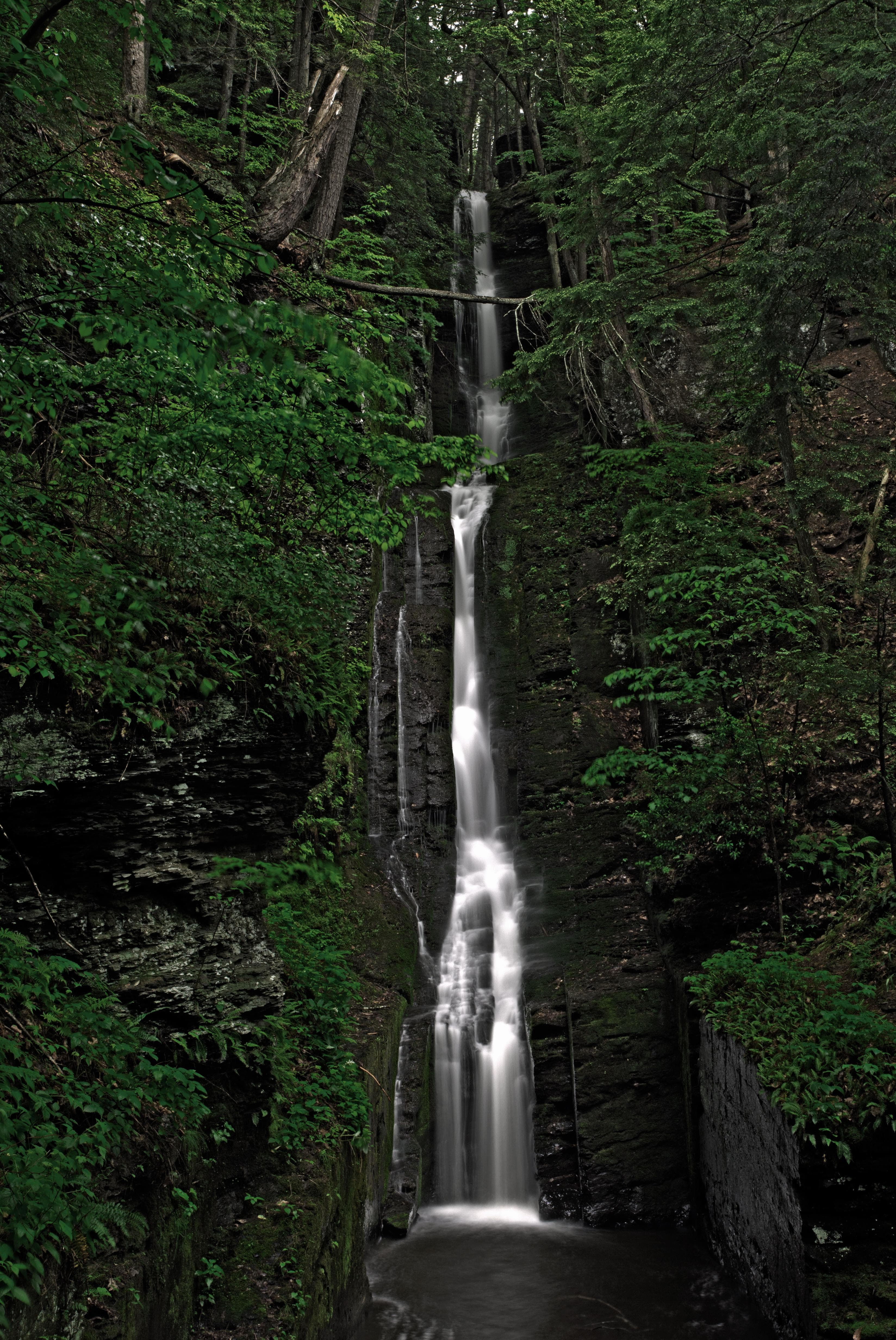
Buttermilk Falls
POIButtermilk Falls is the tallest waterfall in New Jersey. There is also a steep hike to the Appalachian Trail that begins from this location. Access to Buttermilk Falls is extremely limited in the winter months.
Dingmans Access
POIDingmans Access is a recreational fee area with river access. There is one large boat launch for personal paddle and motor vessels. The historic Dingmans Bridge is just north of the launch. Swimming is not permitted at this site.
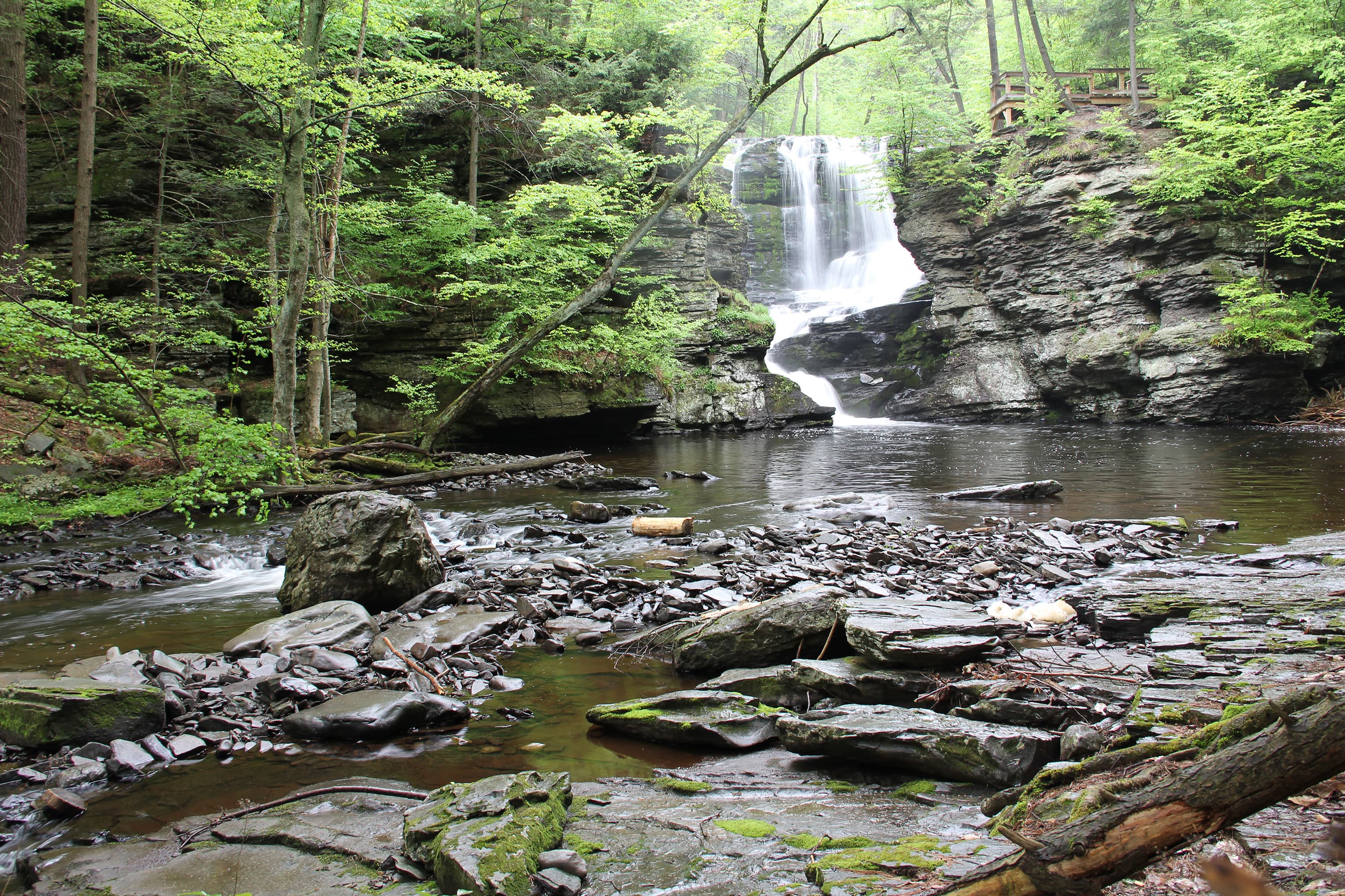
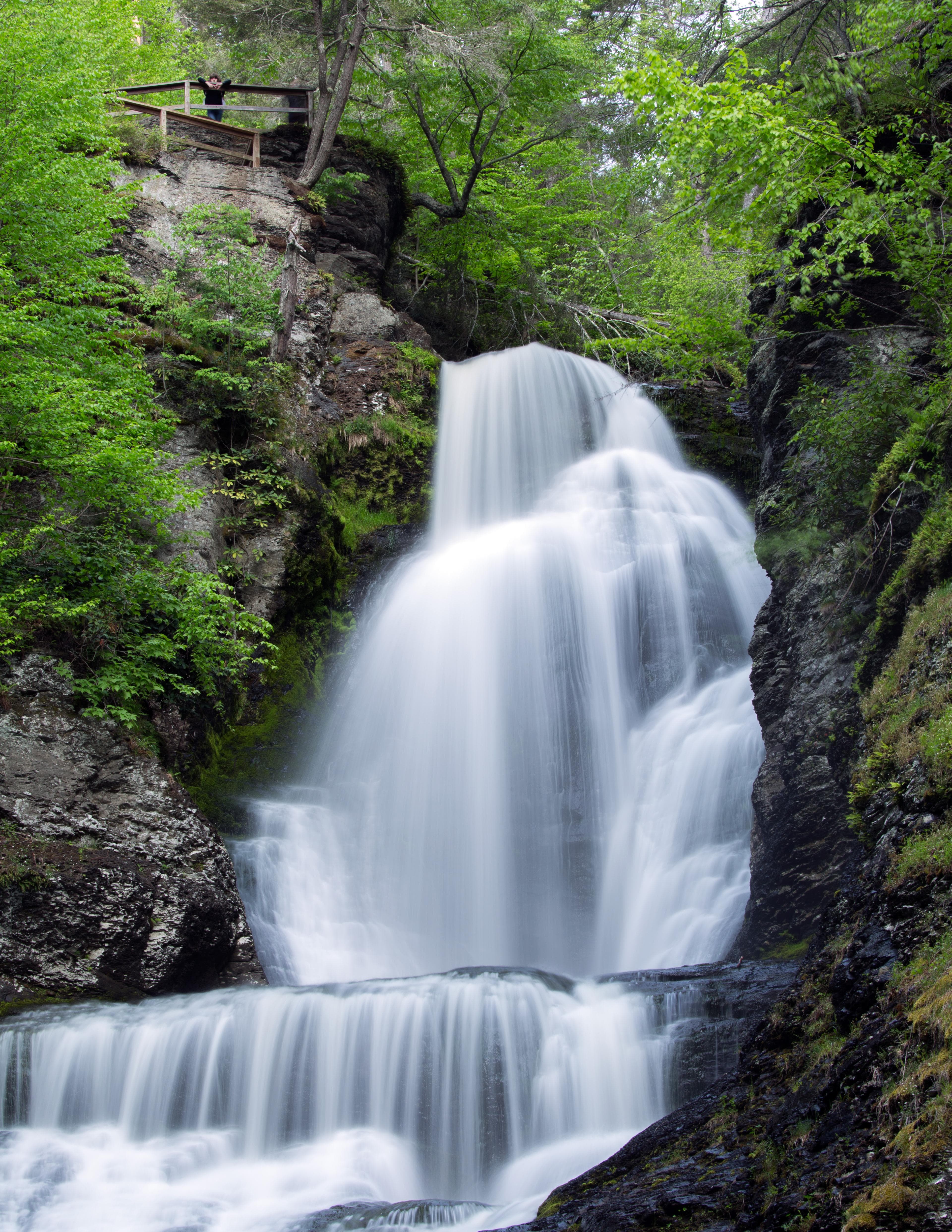
Dingmans Falls
POITake a short hike to two beautiful waterfalls. This trail is ADA accessible. Pets are not permitted on this trail.
Eshback Access
POIEshback Access is a rustic and rocky river access and parking area for the McDade Recreational Trail. This access is for launching motor and paddle boats only. Due to the uneven terrain and natural erosion of this access, there is no ADA Accessible parking or amenities. Swimming and picnicking are not permitted at Eshback Access.
George W. Childs Park
POIGeorge W. Childs Park is ADA Accessible from the parking area to the first two viewing platforms. Beyond those viewing platforms, hikers can take walkways and stairs down along the ravine to view multiple waterfalls. Pets are NOT permitted at this site.
Hackers Falls Trail
POIKittatinny Point
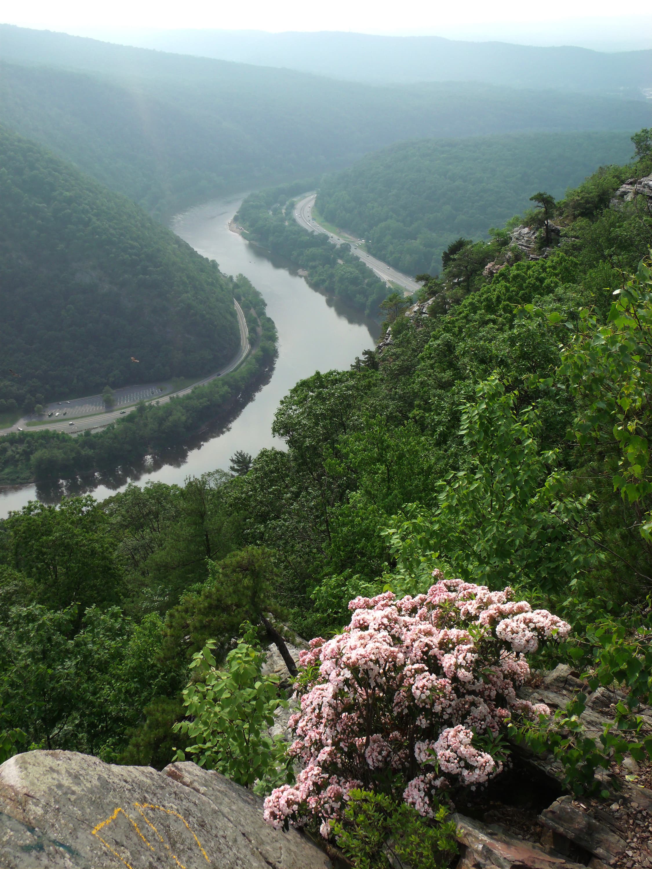
POIKittatinny Point is a picnic area and boat launch river access where you can see the Delaware Water Gap.
Lower Hornbecks Creek
POILower Hornbecks Creek Trail is a great trail for families or beginner hikers. Without a lot of elevation gain and beautiful scenery, it is worth the walk!
Milford Beach
POIMilford Beach is a recreational fee area where visitors have river access to swim or launch personal boats. The McDade Recreational Trail's northern terminus is near the boat launches for visitor use.
Millbrook Village
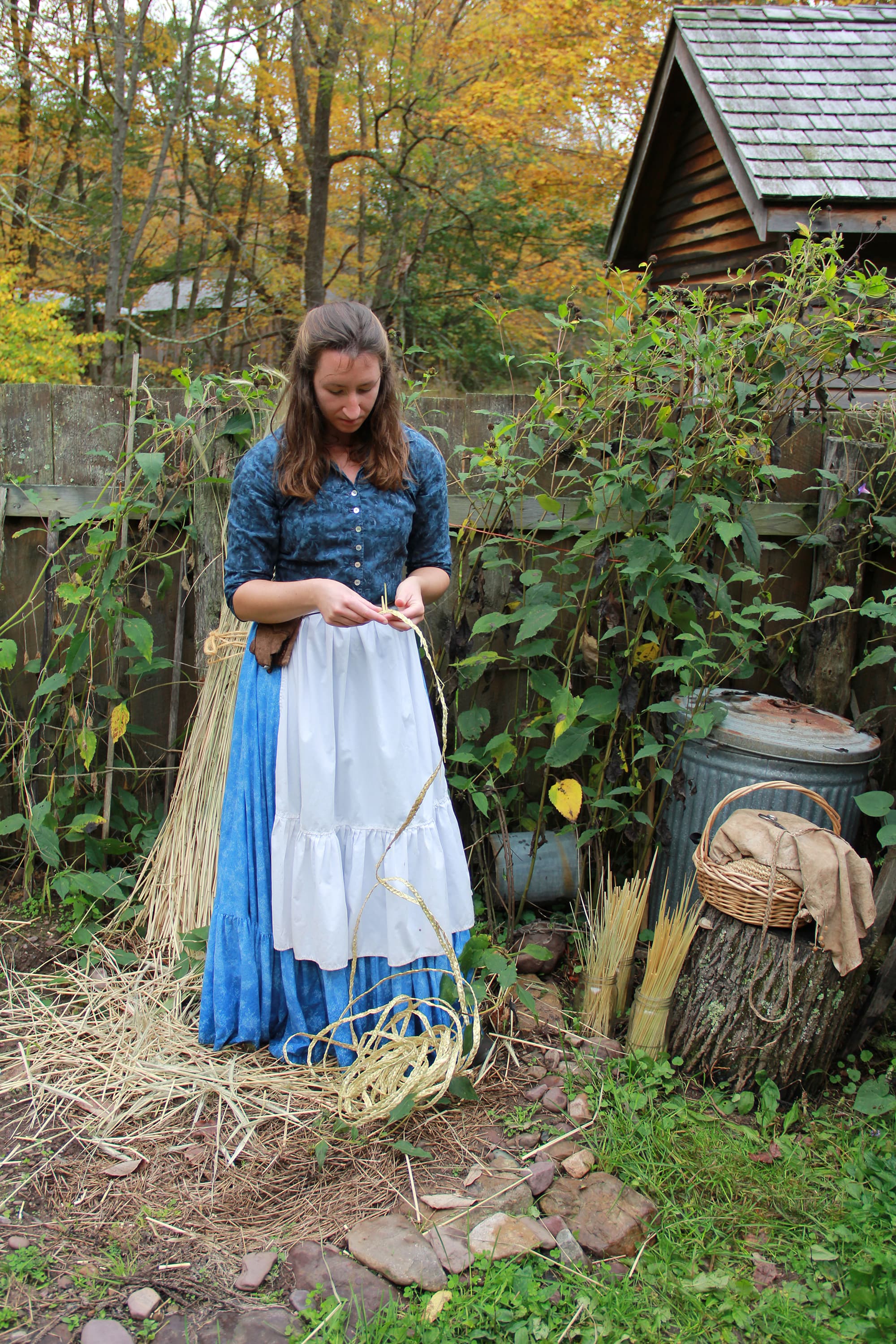
POIMillbrook Village is an interpretive 19th century village that is open for self-guided walks, ranger events, and volunteer demonstrations.
Peters Valley School of Craft
POIPeters Valley School of Craft's campus is made up of the former village of Bevans. This campus is for fine arts students and instructors. Self-guided tours of the historic grounds and studios are available during the summer on Saturday and Sunday afternoons.
Raymondskill Falls
POIRaymondskill Falls Trail offers a large reward for a short hike. Enjoy the rushing water from two viewing platforms! Pets are NOT permitted on this trail.
Smithfield Beach
POISmithfield Beach is a recreational fee site in the park that has river access for swimming, a personal boat launch, and a commercial launch. A large grassy area has picnic tables and scattered trees for shade.
The Foster-Armstrong House
POIThe Foster Armstrong House is a docent-managed local history museum that is open on select weekends for tours and an open house.
Tumbling Waters
POITumbling Waters is a tiered waterfall set low down in a ravine. The trail to access this waterfall is moderate and can be found at Pocono Environmental Education Center.
Upper Hornbecks Creek Trail
POIA hike into a ravine along the Hornbecks Creek. This trail can be accessed from Emery Road or from trails within Pocono Environmental Education Center.
Van Campen Inn
POIThe Van Campen Inn is a historic home on Old Mine Road that is opened by Walpack Historical Society docents on select days throughout the year for educational tours.
Walpack Center
POIWalpack Center is a historic town in New Jersey where Walpack Historical Center docents host open houses on select days throughout the year.
Things to do
Biking on the McDade Recreational Trail
Biking on the McDade Recreational Trail
Easy Hike Along Hornbecks Creek
An easy, one-mile out and back hike along the Lower Hornbecks Creek will lead visitors to a small waterfall, but the waterfall is only part of the view!
Hike the Cliff Trail
The Cliff Trial along the Raymondskill Ridge has gorgeous scenic views and just enough elevation gain to get the heart pumping.
Duration: 1-4 Hours
Millbrook Village
Take a walk around Millbrook Village.
Snowshoe and Cross-country Ski on the McDade Trail
Snowshoeing and cross-country skiing on the McDade Recreational Trail.
Tour Old Mine Road
Take a tour of Old Mine Road.
Duration: 1-3 Hours
Visitor centers
Bushkill Meeting Center
A visitor center with restrooms, a bookstore, and passport stamps. The building and bathrooms are accessible.
Get directionsKittatinny Point Visitor Center
A seasonal visitor center in the heart of the Delaware Water Gap with picnic areas, boat launches, and hiking trails.
Get directions
Hours of operation
Delaware Water Gap National Recreation Area
Park roads are open 24-hours a day. Most day-use areas within the park are open sunrise to sunset (such as trailhead parking lots, Millbrook Village, and all picnic areas).
Mon
All Day
Tue
All Day
Wed
All Day
Thu
All Day
Fri
All Day
Sat
All Day
Sun
All Day
Activities
Weather
Spring: Temperatures usually range from lows of 26 F to highs of 80 F with average rainfall of 5 inches. Summer: Temperatures usually range from lows of 55 F to highs of 85 F with average rainfall of 4 inches. Fall: Temperatures usually range from lows of 30 F to highs of 83F. Fall foliage is at its peak sometime in October as daily mountain temperatures vary frequently and influence the change. Winter: Temperatures usually range from lows of 15 F to highs of 49 F.
Contact
Photos
Stay near this park
No horse-friendly stays listed near Delaware Water Gap National Recreation Area yet. Know a great barn or property? Help fellow riders by listing it.
List your propertyDirections
Delaware Water Gap National Recreation Area is a long, narrow park that sits between two major interstates, I-80 at the south and I-84 at the north. US 209 is the main north/south road through the park on the Pennsylvania side and Old Mine Road is the main north/south road though the park on the New Jersey side.
Source: nps.gov