
Danger
Extreme Heat Warning July 1 to 4
The National Weather Service has announced an Extreme Heat Warning from July 1 through July 4. This includes dangerously hot conditions with heat index values up to 110 degrees. Please keep you and your family safe during this time. Our safety protocols for outdoor interpretive programs are: In the event of a heat index more than 91 degrees, programs will be shortened and modified. In the event of a heat index more than 103 degrees, thunderstorms or tornado warnings, all programs will be canceled.
More infoPark Closure
Observation Tower and Pennsylvania Memorial Observation Level Closure
For visitor, staff, and first responder safety, all three metal observation towers and the Pennsylvania Memorial observation level will be closed beginning at 11 am on July 1. These structures will remain closed until the conclusion of the local Gettysburg area fireworks demonstration currently scheduled for the evening of July 4 (rain date - July 5.)
Park Closure
David Wills House Closure
The David Wills House is currently closed. No known reopening date is available. Please visit our David Wills House web page for more information and a 3D tour of the house.
More infoGettysburg National Military Park
PA · Gettysburg
The Battle of Gettysburg was a turning point in the Civil War, the Union victory that ended General Robert E. Lee's second and most ambitious invasion of the North. Often referred to as the "High Water Mark of the Rebellion", Gettysburg was the Civil War's bloodiest battle and was also the inspiration for President Abraham Lincoln's immortal "Gettysburg Address".
Riding guide
Horses provided
Highlights
Gettysburg National Military Park preserves the historic landscape where one of the most significant battles of the American…
Riding
Rideable terrain here is noted as 17 miles, giving riders a clearer sense of scale before they ever unload. For equestrians, the park offers a designated network of bridle trails that wind through quiet wooded sections and historic fields across the southern portion of the battlefield. These trails provide riders with a unique opportunity to experience the landscape from the saddle, following routes that pass near important historic locations while traveling through peaceful forest corridors and open meadows. The terrain is generally gentle with moderate footing, making it well suited for relaxed trail riding.
Rideable terrain
17 miles
Trailer parking
Gettysburg Bridle Trail Parking Area (Primary Staging Area) Location South Confederate Avenue near the intersection with South Cavalry Field Road, within Gettysburg National Military Park. Why riders use it Designated equestrian parking area for the park’s bridle trail system Direct access to the Gettysburg Bridle Trail Loop and connecting horse trails Located within the southern portion of the battlefield where most equestrian routes are located Facilities Gravel parking lot suitable for horse trailers Adequate space to maneuver trailers and unload horses Immediate access to marked bridle trails from the parking area This is generally considered the main equestrian staging location for riders exploring the park’s designated horse trails. South Cavalry Field Parking Area Location South Cavalry Field Road in the southern section of Gettysburg National Military Park. Why riders use it Provides access to portions of the bridle trail system near the South Cavalry Field historic area Less crowded than some central battlefield parking areas Convenient access to the southern loop of the horse trail network Facilities Open parking area with room for trailers Access to nearby bridle trail segments Scenic historic battlefield surroundings Bushman Hill Area Pull-Offs Location Along Bushman Hill Road near the southern boundary of Gettysburg National Military Park. Why riders use it Occasional roadside pull-offs where riders may stage trailers Access to nearby bridle trail segments and quiet battlefield areas Alternative staging option when primary parking areas are busy Important note Because these areas are along historic battlefield roads, riders should ensure trailers do not block traffic or interfere with park operations and should confirm permitted staging locations before unloading horses.
Horse regulations
Horses Are Allowed Only on Designated Bridle Trails Horseback riding within Gettysburg National Military Park is limited to a specific network of designated bridle trails maintained for equestrian use. These trails pass through wooded areas and historic sections of the battlefield, primarily in the southern portion of the park. Important notes: Horses are not allowed on hiking trails, tour roads, sidewalks, or open battlefield fields unless the route is specifically marked as a bridle trail. Riders should always check posted trail signage and park information before entering a trail. Stay on Designated Routes To protect the historic battlefield landscape and natural habitats: Horses must remain on established bridle trails at all times. Riders should avoid traveling across historic fields, monuments, stone walls, or protected areas. Leaving the trail can damage vegetation and historically significant terrain. Respect Historic Battlefield Features Gettysburg protects important Civil War resources and monuments. Riders must: Avoid riding near monuments, historic structures, and stone walls Stay clear of fenced or marked preservation areas Avoid disturbing any artifacts or historic features Protecting these resources helps preserve the battlefield for future generations. Trail Etiquette Bridle trails in the park are shared with hikers and other visitors. Riders should: Slow to a walk when approaching others Announce themselves when passing Maintain control of horses at all times Courtesy helps ensure safe shared use of the trails. Protect Natural Resources The park protects forests, wildlife habitat, and historic landscapes. Riders should: Avoid damaging vegetation or creating new trails Keep horses away from wetlands and sensitive areas Pack out trash and manure where required Visitors are encouraged to follow Leave No Trace principles while riding within the park.
Getting here
Use 1195 Baltimore Pike, Gettysburg, Pennsylvania as your primary planning reference before you haul in. Gettysburg Bridle Trail Parking Area (Primary Staging Area) Location South Confederate Avenue near the intersection with South Cavalry Field Road, within Gettysburg National Military Park. Why riders use it Designated equestrian parking area for the park’s bridle trail system Direct access to the Gettysburg Bridle Trail Loop and connecting horse trails Located within the southern portion of the battlefield where most equestrian routes are located Facilities Gravel parking lot suitable for horse trailers Adequate space to maneuver trailers and unload horses Immediate access to marked bridle trails from the parking area This is generally considered the main equestrian staging location for riders exploring the park’s designated horse trails. South Cavalry Field Parking Area Location South Cavalry Field Road in the southern section of Gettysburg National Military Park. Why riders use it Provides access to portions of the bridle trail system near the South Cavalry Field historic area Less crowded than some central battlefield parking areas Convenient access to the southern loop of the horse trail network Facilities Open parking area with room for trailers Access to nearby bridle trail segments Scenic historic battlefield surroundings Bushman Hill Area Pull-Offs Location Along Bushman Hill Road near the southern boundary of Gettysburg National Military Park. Why riders use it Occasional roadside pull-offs where riders may stage trailers Access to nearby bridle trail segments and quiet battlefield areas Alternative staging option when primary parking areas are busy Important note Because these areas are along historic battlefield roads, riders should ensure trailers do not block traffic or interfere with park operations and should confirm permitted staging locations before unloading horses.
Planning your visit
Horseback Riding Is Limited to Designated Bridle Trails Gettysburg National Military Park provides a specific network of bridle trails for equestrian use. Horses are not allowed on most walking paths, tour roads, sidewalks, or across the open battlefield fields. Riders should know: Only trails marked as bridle trails allow horseback riding Riders must remain on designated routes at all times Trail access is concentrated primarily in the southern portion of the battlefield Checking trail maps and signage before riding is recommended. The Bridle Trail System Is About 17 Miles The park maintains roughly 17 Miles of horse trails that wind through wooded sections and historic landscapes. These trails provide: Loop-style riding routes through forest and farmland Connections between several historic battlefield areas A quiet riding environment away from the busiest visitor zones Most equestrian riding in the park occurs within this dedicated trail network. Trails Are Shared With Other Visitors Bridle trails are multi-use routes shared with hikers and other visitors. Riders should: Slow to a walk when approaching others Announce themselves when passing Maintain full control of horses at all times Courtesy helps ensure safe shared use of the trails. Limited Equestrian Facilities Horse-specific amenities in the park are limited. Expect: One primary horse trailer parking area near the bridle trailhead Few hitching posts or horse facilities Primitive staging conditions compared to some trail parks Riders should bring water, feed, and any necessary equipment. Historic Battlefield Landscape Gettysburg protects one of the most important Civil War battlefields in the United States. Riders should: Avoid monuments, stone walls, and historic structures Stay on established bridle trails to protect the battlefield terrain Respect fencing and preservation areas Protecting these resources helps preserve the battlefield’s historic integrity. Rolling Fields and Woodland Terrain The riding landscape at Gettysburg includes: Open farmland and historic fields Forested hills and wooded trail corridors Rolling terrain typical of south-central Pennsylvania Wildlife sightings may include white-tailed deer, hawks, foxes, and a variety of songbirds along the trails.
Where to stay
Gettysburg National Military Park Museum and Visitor Center is the main visitor-contact point tied to this destination, which is helpful when you want current conditions, maps, and stock-use updates before riding. Guided or concession-based riding support is noted here, so riders who are not hauling their own horses may still find an access path into the experience. For a polished trip plan, pair the ride with lodging, fuel, and resupply planning in or near Gettysburg before heading deeper into federal-land access points.
Park map
Trails
No trails synced for this park yet.
Campgrounds
No campgrounds listed for this park.
Points of interest
140th New York Infantry Regiment Monument
POI16th Michigan Infantry Regiment Monument
POI1. Little and Big Round Top from the Valley of Death Then & Now
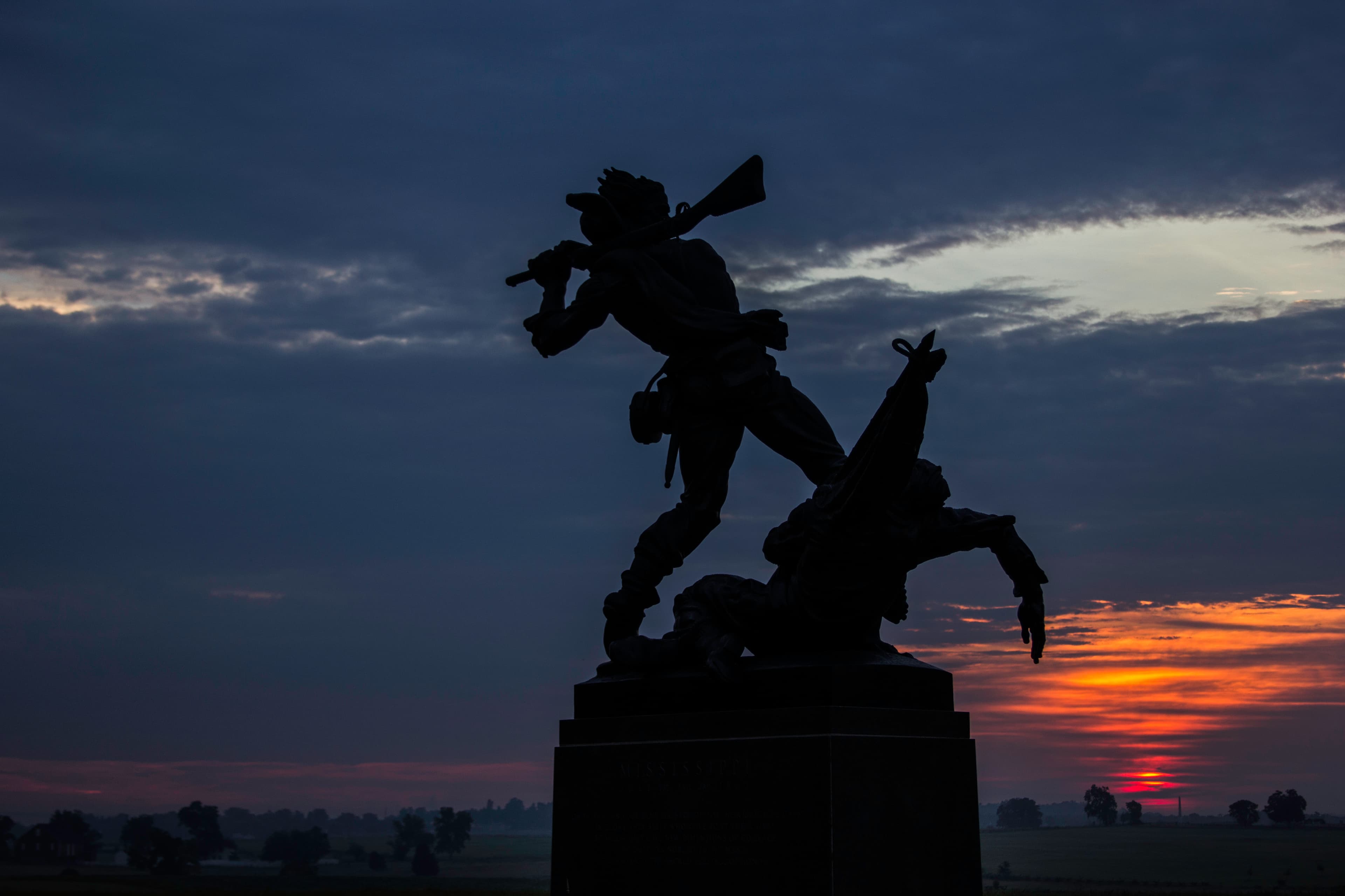
POIFrom this angle, it is easy to see why many soldiers called Little Round Top, ‘the mountain’. With its steep incline and rocky ground, one can only imagine how daunting it would be to try and ascend the slopes while under fire. On July 2, the Union army would gain the upper hand with their claim on this valuable piece of geography.
1st Massachusetts Battery Monument
POIThis artillery, along with the other cannons and monuments located throughout the cemetery, not only mark the specific locations of US artillery and infantry during the fighting, but also reflect the importance of Cemetery Hill during all three days of the battle. This high, open hill dominated the surrounding countryside in 1863. By posting artillery here, the US Army could control a large part of the battlefield.
1st New Jersey Cavalry Monument
POIDiscovering no sign of Stuart, the 1st New Jersey Cavalry moved forward around 2 pm from the Lott House to this position to investigate Rummel’s Woods. Within moments, dismounted Confederates from Brig. Gen. Albert Jenkins’ Virginia Brigade appeared from behind the Rummel house and barn, formed a line and opened fire. The US troops held their ground and repelled the Confederates.
20th Maine Infantry Regiment Monument
POI20th Massachusetts Monument
POI44th New York Infantry Monument
POI5th United States Artillery, Battery D (Hazlett's Battery) Monument
POI69th Pennsylvania Monument
POIThis monument to the 69th Pennsylvania, dedicated in 1887, is unique in that it is the only regimental monument on the field to include markers for each of the ten companies in the regiment. The company markers are connected to each other by a chain to symbolize that the 69th’s line bent, but did not break, during Pickett’s Charge.
72nd Pennsylvania Monument
POIDuring Pickett’s Charge, after Confederates drove the 71st Pennsylvania from the Angle, the 72nd advanced and came under heavy fire. The regiment remained in this position and suffered heavy losses. In 1888, the veterans of the 72nd requested permission to place a monument near the stone wall. After some controversy about the monument's placement, in was erected and remains one of the more evocative monuments on this part of the field.
91st Pennsylvania Monument – 50th Anniversary of the Battle of Gettysburg Then & Now
POIVeterans of the 91st Pennsylvania infantry and friends pose for a photo in front of the regiment’s monument during the 50th Anniversary of the Battle of Gettysburg in July, 1913. Erected in 1889, the monument honors those from this regiment who fought and sacrificed their lives at Gettysburg. The regiment brought with it 258 men to the field—of those, 3 were killed and 16 were wounded.
Abraham Brian Farm
POIThe home of Abraham Brian sits along the northern end of Cemetery Ridge. The area around the farm would become the scene of heavy fighting on July 3, 1863. Abraham Brian and his family were part of the African American community of Gettysburg. The family left their home when Confederate troops entered Pennsylvania, fearing capture and enslavement. Following the battle, they returned to find their home greatly damaged by war.
ANNIVERSARY ATTENDEES LOUNGE ON THE PENNSYLVANIA MEMORIAL STAIRS Then & Now
POIThe Pennsylvania Memorial was dedicated in 1910 and stands 110 feet tall, making it the largest monument at Gettysburg. A spiral staircase inside the northwest column takes visitors to the top of the monument where a sweeping view of the battlefield can be seen. On the base and interior of the memorial are bronze tablets which list the regiments and batteries that fought at Gettysburg. There are also two statues on each side of the memorial—these include notable figures such
Battery L, 1st Ohio Artillery Monument
POIThis monument stands on the position of Battery L of the 1st Ohio Light Artillery who defended the northern slope of Little Round Top on July 2, 1863
Battery M, 2nd US Artillery Marker
POIOn the morning of July 3, this ground was occupied by a brigade of four Michigan regiments and a battery of horse artillery under the command of newly promoted Brig. Gen. George A. Custer.
Bivouac of the Dead Plaque
POIThis plaque is one of many dotted throughout the cemetery that contains lines from the poem, "Bivouac of the Dead."
Confederate Dead near Plum Run in the Slaughter Pen Then & Now
POIThis photograph depicts two dead Confederate soldiers in the Slaughter Pen. Years of weather and traffic have shifted some of the rocks in this area, but enough has remained unchanged that the location can be easily determined. The terms “Slaughter Pen” and “Devil’s Den” were often used interchangeably following the battle, making some photographs difficult to place based on title alone.
Confederate Dead near the Edge of the Rose Woods, Gardner Stereo #235 Then & Now
POIAnother image from Gardner and O’Sullivan’s Rose Woods series, this photograph depicts a group of Confederate dead gathered for burial. These men were likely from either Georgia or South Carolina regiments, which fought in and around the Rose Woods on July 2, 1863.
Confederate Dead Near the Edge of the Rose Woods, Gardner Stereo #256 Then & Now
POIAnother image from Gardner and O’Sullivan’s Rose Woods series. By comparing the bodies, one can see that the first Then & Now photograph of the same group was taken just a few steps northeast of this photo, facing west. The photographers’ darkroom wagon can be seen in the background of the original photo.
Confederate Dead near the Edge of the Rose Woods, Gardner Stereo #257 Then & Now
POIThis photo was one of a series of well-known photographs taken by Timothy O’Sullivan and Alexander Gardner on July 5 or 6, 1863, near the edge of the Rose Woods. The dead soldier nearest to boulder is lying in a shallow grave.
CONFEDERATE “SHARPSHOOTER” IN ORIGINAL LOCATION NEAR DEVIL’S DEN Then & Now
POIThis photograph, taken by Alexander Gardner's assistant Timothy O'Sullivan, depicts a dead Confederate soldier at the likely location of his death on the western side of Devil’s Den. The body of this soldier would be moved by the photographers from this location to another one some 40 yards away, where he would become the subject of one of Gettysburg’s most indelible images.
Confederate “Sharpshooter” near Devil’s Den, Gardner Stereo #263 Then & Now
POIThere were six separate images produced by Gardner and O’Sullivan of this “sharpshooter” on July 5 or 6, 1863. At a time when a single photograph required time and expensive materials to produce, there must have been something about this particular body which captured the photographers’ attention. Notably, the man’s youthful features and the lack of gore on the body present a somewhat sanitized and romanticized version of death at Gettysburg.
Cress Ridge
POIFrom this commanding position on Cress Ridge, General Stuart prepared his cavalry and artillery to attack Gregg’s and Custer’s position. Stuart arranged his 19 regiments, numbering 5,000 in a line behind and to the northeast of Rummel’s Woods to keep them hidden from enemy scouts.
Culp's Hill Observation Tower
POIFrom the top of the Culp’s Hill Observation Tower you can view most of the battlefield. To the north and west, across from town, is the First Day’s Battlefield. To the west and south is the United States position, from the Round Tops, up Cemetery Ridge, to Cemetery Hill and the Gettysburg National Cemetery, and into town. Across the field from Cemetery Ridge is the Confederate position at Seminary Ridge.
Cyclorama Focal Point Wayside Exhibit
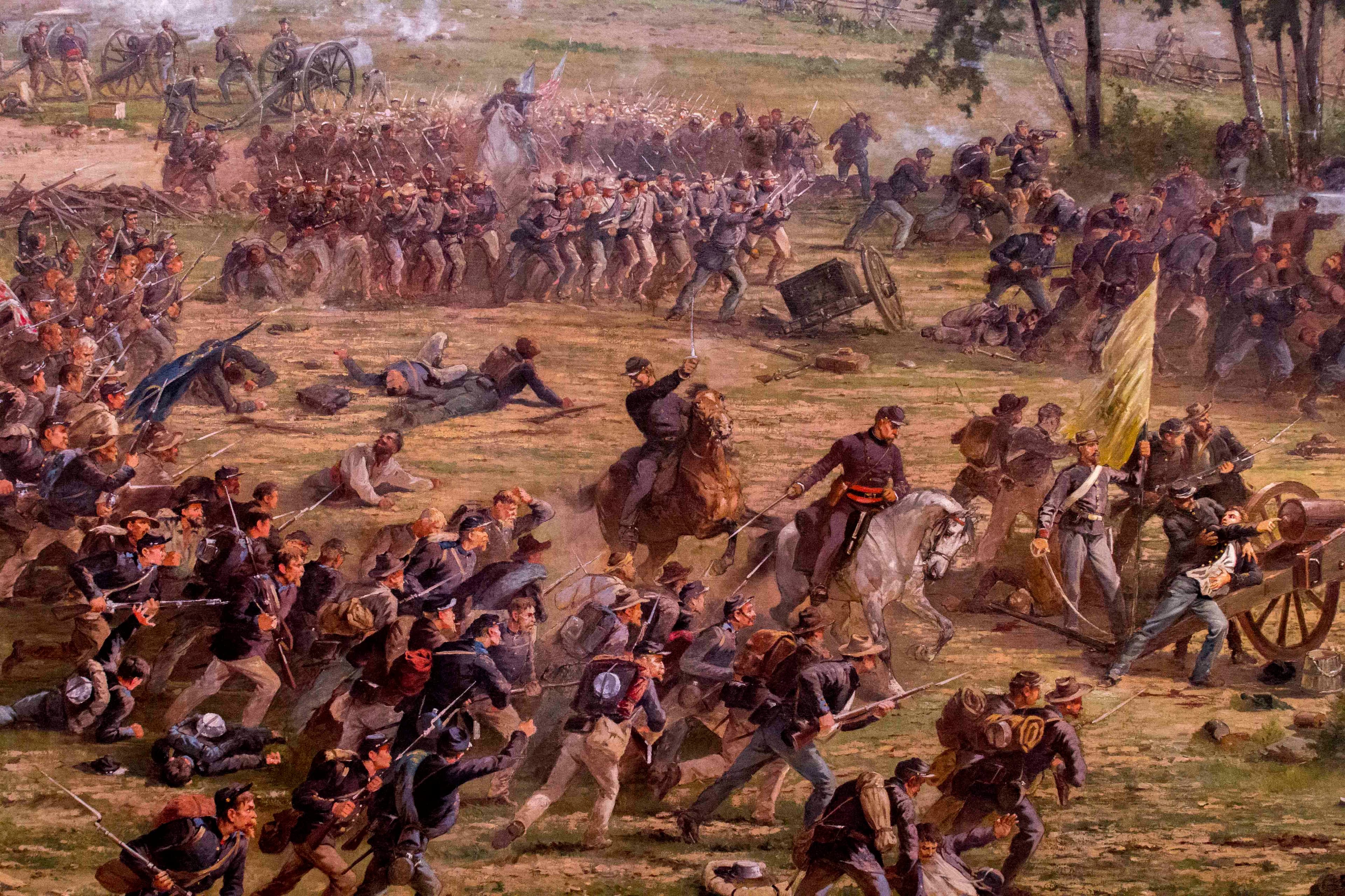
POIFrench artist Paul D. Philippoteaux visited the Gettysburg battlefield in the spring of 1882 and hired William Tipton, a local photographer, to shoot a series of landscape photographs from this location. The final painting, which depicts Pickett's Charge, is a monumental work that enabled people to envision the battle in an immersive environment. Today, the cyclorama is on display in the Gettysburg Museum and Visitor Center.
David Wills House
POIThe home of Gettysburg attorney David Wills was the center of the immense clean-up process after the Battle of Gettysburg and where President Lincoln put the finishing touches on his Gettysburg Address, the speech that transformed Gettysburg from a place of death and devastation to the symbol of our nation's "new birth of freedom."
Devil's Den
POIDevil's Den illustrates how the geology and topography of the land itself profoundly influenced the battle. Devil's Den is a rock outcrop located between the main Federal and Confederate lines during the Battle of Gettysburg. The boulders here were hotly contested on July 2, 1863, when fighting swirled around this spot.
East Cemetery Hill
POIAt dusk on July 2, 1863, US forces repelled a Confederate assault that reached the crest of this hill. By day’s end, the Army of Northern Virginia had attacked both flanks of the Army of the Potomac, but did not break through the US lines.
Eisenhower National Historic Site
POIEisenhower National Historic Site preserves the farm of General and 34th President Dwight D. Eisenhower. Adjacent to the Gettysburg Battlefield, the farm served the president and first lady as a weekend retreat and as a meeting place for world leaders. With its peaceful setting and view of South Mountain, it was a respite from Washington, DC, and a backdrop for efforts to reduce Cold War tensions.
Electric Vehicle Charging Stations at Gettysburg
POIThis electric vehicle charging station located at the Gettysburg National Military Park Museum and Visitor Center is available for public use.
Eternal Light Peace Memorial
POIThe Eternal Light Peace Memorial sits atop Oak Hill on the First Day's Battlefield. President Franklin D. Roosevelt dedicated the memorial in 1938, on the 75th Anniversary of the Battle of Gettysburg.
EVERGREEN CEMETERY GATEHOUSE Then & Now
POIThe Evergreen Cemetery Gatehouse, built in 1855, stands at the summit of Cemetery Hill. The house was used to shelter wounded and suffered damage from the fighting that raged in front of it on the evening of July 2. On the night of July 1, Elizabeth Thorn, wife of then-absent cemetery caretaker Peter Thorn, served supper to General Sickles, General Slocum and General Howard. Photographer Matthew Brady photographed the gate house approximately two weeks after the battle.
Fortifications on Little Round Top Then & Now
POILittle Round Top was not only a valuable defense point because of its height, but also because of its natural geography. The ‘mountain’, as some soldiers called it, was littered with large boulders which provided Union soldiers shelter from Confederate bullets. The three large boulders in this photograph would have given protection to the soldiers taking aim from behind them. Temporary stone walls would have been easy to build with the vast number of rocks nearby.
Gardner & O'Sullivan: Confederate “Sharpshooter” in Original Location near Devil’s Den Then & Now
POIThis photograph, taken by Alexander Gardner's assistant Timothy O'Sullivan, depicts a dead Confederate soldier at the likely location of his death on the western side of Devil’s Den. The body of this soldier would be moved by the photographers from this location to another one some 40 yards away, where he would become the subject of one of Gettysburg’s most indelible images.
General George Meade Equestrian Statue
POIThe equestrian statue of United States General George Gordon Meade, mounted on his favorite horse, “Old Baldy,” depicts the “quiet, resourceful commander” of the Army of the Potomac.
Gettysburg National Cemetery Entrance
POIThe Gettysburg National Cemetery is the final resting place for over 3,500 United States soldiers who lost their lives at the Battle of Gettysburg, as well as 3,307 post Civil-War United States soldiers and veterans. The cemetery is famous throughout the world as the site of Abraham Lincoln’s Gettysburg Address, delivered at the cemetery’s dedication ceremony four and a half months after the battle.
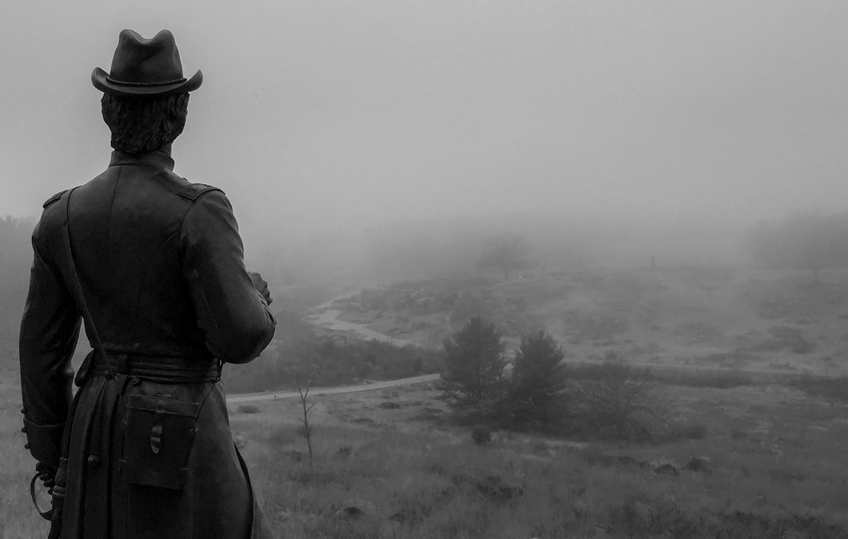
Gouverneur K. Warren Monument – 50th Anniversary of the Battle of Gettysburg Then & Now
POIGeneral Gouverneur Kemble Warren was Chief Engineer of the Army of the Potomac at the Battle of Gettysburg. His monument stands on a large boulder at the summit of Little Round Top. Warren recognized how valuable Little Round Top was for the Union Army’s line on Cemetery Ridge, and discovering it unoccupied, directed Colonel Strong Vincent’s brigade to the hill’s defense followed later by General Stephen Weed’s brigade.
High Water Mark Monument and Copse of Trees
POIHigh Water Mark of the Rebellion Monument Then & Now
POIDedicated in 1892, the High Water Mark of the Rebellion monument represents both the Union and Confederate units that took part in Pickett’s Charge on the third day of battle. It sits in front of the Copse of Trees on Cemetery Ridge.
“Home of a Rebel Sharpshooter” Then & Now
POIOriginally produced in Gardner’s Photographic Sketchbook of the War, this photograph has become one of the most recognizable images of the Civil War. While the gun propped against the rock would almost certainly not have been used by a sharpshooter, nor is it likely that the soldier fell in this location, this photograph nevertheless presents a powerful narrative of the struggle in and around Devil’s Den on July 2, 1863.
HOME OF BASIL BIGGS & FAMILY Then & Now
POIBasil Biggs was a free African-American who made Gettysburg his home in 1858. With the approach of Confederate troops before the battle, Biggs, his wife Mary and their seven children, fled town. Biggs and his family returned soon after the battle ended and worked to repair damage to his property and that of John Fisher, whose farm on the Taneytwon Road would become Biggs’ home that fall. Biggs was hired to work the exhumation of Union dead from battlefield graves for burial.
In the Footsteps of the 4th Texas Infantry
POIJimmie Pickett
POILincoln Address Memorial
POIThe Lincoln Address Memorial commemorates the Gettysburg Address. It is one of the few memorials in the world dedicated to honor a speech. The bronze bust of Lincoln, by sculptor Henry Bush-Brown, reveals the heavy toll the war and the nation’s suffering had upon him. Inscribed in bronze on the right is the Gettysburg Address. On the left is the letter Lincoln received inviting him to speak at Gettysburg.
Little Round Top
POIOn July 2, 1863, US General Dan Sickles left Little Round Top open, exposing the Federal line along Cemetery Ridge to Confederate attack. Quick actions by Brigadier General Gouverneur K. Warren alerted US officers to the threat and brought reinforcements to defend this high ground. The fighting here on July 2 became some of the most famous of the Battle of Gettysburg.
Lutheran Theological Seminary Then & Now
POIBuilt in 1832, the Gettysburg Lutheran Theological Seminary was the first Lutheran seminary in the country. Students studied for the ministry and religious education and continues to operate today. The ridge where the seminary was built would be named Seminary Ridge and this prominent location would become the jumping off point for thousands of Confederate soldiers throughout the battle. Schmucker Hall was used to house wounded from both armies during and after the battle.
Lydia Leister Farm: Meade's Headquarters
POIThis was the home of Lydia Leister and her four children in 1863. During the Battle of Gettysburg, US General George G. Meade established his headquarters here, and from this location coordinated the the Army of the Potomac's response to Confederate offenses on July 2 and 3, 1863. After the battle Mrs. Leister repaired the property and lived here until 1888.
McPherson Farm Then & Now
POIThe Edward McPherson Farm, which lies west of town, was the scene of heavy fighting on the first day of battle, July 1, 1863. While Confederate General Henry Heth’s Division advanced towards Gettysburg against defending Union cavalry commanded by General John Buford, Union reinforcements from General John Reynolds’ First Corps arrived. The fields swarmed with soldiers of opposing forces and the McPherson barn quickly became a sanctuary for the wounded.
McPherson Ridge
POIThe Battle of Gettysburg began at about 8 a.m. on July 1, 1863 near McPherson Ridge as United States cavalry confronted Confederate infantry advancing east along Chambersburg Pike. Heavy fighting spread north and south along the ridgeline north of the town of Gettysburg as additional forces from both sides arrived.
Meade's Headquarters: Lydia Leister House Then & Now
POIIn the afternoon of July 3, Confederate batteries concentrated their missiles on the center of Cemetery Ridge in an attempt to soften up the Union position. Unbeknownst to the Confederate artillerymen, their rounds overshot their intended targets and began to land around Meade’s headquarters causing substantial damage.
Memorial to the Grand Army of the Republic
POIMichigan Cavalry Brigade Monument
POIOn this stretch of open ground halfway between the opposing lines, the last charge by Lee’s and Hampton’s 3,600 horsemen was defeated. As the compact lines of horsemen crossed these fields heading for the Union positions along the Hanover Road, they were attacked on 3 sides by McIntosh’s and Custer’s 3,200 men.
Monument to Gouverneur K. Warren
POIThe monument to General Warren is on the summit of Little Round Top.
North Carolina Monument
POIThe North Carolina Monument is located on West Confederate Avenue, along Seminary Ridge. This monument, dedicated on June 3, 1929, depicts four North Carolina infantrymen participating in Pickett's Charge.
Northern Gathering Area on Little Round Top
POIOak Ridge
POIOn July 1, 1863, United States soldiers held this ridge against a Confederate advance until the line began to crumble in the late afternoon. By the evening of July 1, the Army of Northern Virginia traversed over this position and began forming lines to the south of town, where the US Army of the Potomac was forming a new line.
Oak Ridge Observation Tower
POILocated on the First Day's Battlefield north of town, from the Oak Ridge Observation Tower you can view much of Oak Ridge and the fields of battle from July 1, 1863. Looking south you can observe into the town of Gettysburg.
Pennsylvania Memorial
POIThe largest monument on the Gettysburg Battlefield represents the over 34,000 Pennsylvania soldiers who fought for the United States during the Battle of Gettysburg.
Pitzer Woods
POIIn the afternoon of July 2, 1863 Confederate General James Longstreet placed his troops along Warfield Ridge and anchored the left of his line in these woods, owned by a man named Samuel Pitzer.
Plum Run
POIOn July 2, 1863, while fighting raged to the south at the Wheatfield and Little Round Top, retreating United States soldiers crossed this ground on their way from the Peach Orchard to Cemetery Ridge.
Posed Scene in the Slaughter Pen Then & Now
POIThis photograph, taken by Peter Weaver on November 11, 1863, depicts a group of men posing as dead soldiers among rocks in the Slaughter Pen. The two men standing are doctors, posed as if inspecting the “bodies.” The summit of Little Round Top can be seen in the distance.
Restrooms (Gettysburg National Cemetery)
POIThe restrooms located within the Gettysburg National Cemetery are open year-round. These restrooms are located at the back of the Gettysburg National Cemetery, near Baltimore Street.
Sallie - Dogs of the NPS
POISallie Ann Jarrett, a loyal American Staffordshire Terrier, served as the beloved mascot of the 11th Pennsylvania Volunteer Infantry during the Civil War, marching in parades, braving battles, and even guarding the wounded at Gettysburg. After her death in combat, her regiment honored her memory with a statue on their Gettysburg monument.
Seasonal Restrooms (Pennsylvania Memorial)
POIThe restrooms located near the Pennsylvania Memorial are open seasonally.
Seasonal Restrooms (Spangler's Spring)
POIThe restrooms at Spangler's Spring are open seasonally. These restrooms are located near Spangler's Spring, Auto Tour Stop 13, down a path that runs along Geary Avenue.
Sketch Artist Alfred Waud in Devil's Den Then & Now
POIAlfred Waud was a sketch artist who worked for Harper’s Weekly magazine at the time of the Battle of Gettysburg. This photograph creates a fascinating juxtopostion between the long-standing artform of sketching and the new technology of the day in photography. It is likely that Alfred Waud and the photograpy team of Alexander Gardner, Timothy O'Sullivan, and James Gibson crossed paths during the Civil War and were aware of each other's work.
Soldiers' National Cemetery
POIThe Soldiers' National Cemetery is the final resting place for more than 3,500 United States soldiers killed at Gettysburg. President Abraham Lincoln delivered his Gettysburg Address at the cemetery’s dedication on November 19, 1863. After the war, management of the cemetery was transferred to the federal government and it was used through Vietnam. The Soldiers' National Cemetery now refers to the Civil War period area within the Gettysburg National Cemetery.
Soldiers' National Monument
POIThe Soldiers’ National Monument is the focal point around which burials of United States soldiers who died at Gettysburg are laid out in a semicircle. The monument honors the fallen soldiers and was dedicated in 1869. Figures representing war, history, plenty, and peace sit on the monument’s base, while a figure representing liberty stands on the high pedestal.
South End Guide Station
POIThe South End Guide Station has restrooms available year round. The South End Guide Station is located on the east side of the Emmitsburg Road, south of West Confederate Avenue.
Spangler's Spring
POISpangler's Spring is a natural spring located at the base of Culps Hill. Fierce fighting swirled around this spot during the Battle of Gettysburg, and the location changed hands multiple times over the course of the battle.
Staged Photo at Devil's Den Then & Now
POIThis view of the boulders of Devil's Den shows the western slope of Little Round Top in the distance to the right. This staged photograph was taken more than four months after the battle, by Peter Weaver, on November 11, 1863 and depicts "dead Confederates" strewn among the rocks of Devil's Den.
State of Maryland Monument
POIThe State of Maryland Monument symbolizes the aftermath of the Battle of Gettysburg and the war. It was dedicated on November 13, 1994. The back of the base of the monument has a bronze tablet listing the Maryland commands of both armies that fought at Gettysburg.
Summit of Little Round Top Then & Now
POILittle Round Top was the scene of intense fighting on July 2, 1863. From its summit looking northward, one could see much of Gettysburg, including the Codori farm, Oak Hill, the Brian farm, the “Copse of Trees” and the Wheatfield Road. Many of these places can still be seen today from the same vantage point.
The Angle
POIThis area became known after the Battle of Gettysburg as the Angle. The stone wall at the Angle is the remnant of a wall that was built by the local farmers before the battle and was originally two to three feet high. Federal soldiers used this wall for protection from Confederate fire. This was the only place that Confederate's broke through the Federal line during Pickett's Charge before United States soldiers repelled their assault.
The High Water Mark
POIOn the afternoon of July 3, 1863, in a climactic moment of the Battle of Gettysburg, United States forces repelled the Confederate advance during "Pickett's Charge." This point represents the closest that Confederate General Robert E. Lee came to success in his ultimately failed invasion of Pennsylvania.
The Peach Orchard
POIAfter the Battle of Gettysburg, farmer Joseph Sherfy's peach orchard would forever be associated with the intense fighting that took place there on July 2, 1863. On that day, US General Dan Sickles advanced his troops beyond the Federal line on Cemetery Ridge and occupied the Peach Orchard. A Confederate assault pushed Sickles’ 3rd Corps soldiers into a retreat at around 6:30 pm that evening.
The Trolley Operating on the Battlefield Then & Now
POIWhile some people appreciated that the trolley provided easy access to the battlefield, the trolley construction damaged battlefield resources. The Battlefield Memorial Association opposed the trolley and fought to protect battlefield lands. In 1896, the case ended up in the Supreme Court, where the court determined that Gettysburg National Military Park had the right to acquire the lands from the railway company and to protect those lands in perpetuity.
The Trolley Passes Next to the Gettysburg National Cemetery Then & Now
POIThe Gettysburg Electric Railway Trolley operated from 1893 to 1916. The Gettysburg Electric Railway Company operated the trolley through parts of the battlefield so that visitors could easily access the area from town.
The Wheatfield
POIOn July 2, 1863, charge and countercharge left the Wheatfield and the nearby woods strewn with over 4,000 dead and wounded.
Trostle Barn with Dead Horses from Bigelow’s Battery Then & Now
POIThe scene in this series of photos shows the Trostle barn, made famous by the large cannonball hole in the brick facade. By comparing the two photos, one can see just how many dead horses littered the property where Bigelow’s 9th Massachusetts Battery was overrun by the 21st Mississippi Infantry.
Trostle House with Dead Horses from Bigelow's Battery Then & Now
POIThe Trostle farm was the site of desperate fighting on the afternoon of July 2, 1863 as the men of the 9th Massachusetts (Bigelow’s) Battery made a courageous stand against overwhelming Confederate forces. In an attempt to stave off the advancing Confederates from Kershaw and Barksdale’s brigades, the men of Bigelow’s Battery fought desperately before they were overrun and forced to retreat to Cemetery Ridge.
Turnbull's Battery F & K, 3rd US Artillery
POIThese guns represent the position of Lieutenant John G. Turnbull’s Battery F & K, 3rd U.S. Artillery late on the afternoon of July 3.
Veteran and Boy at the Pennsylvania Memorial Then & Now
POIThis photograph from the 50th Anniversary in 1913 provides a closer look at the bronze tablets lining the base of the Pennsylvania Memorial. The veteran pointing to his name on one of the tablets is Francis A. Culin, a sergeant of the 68th PA Infantry, Company F. A boy, perhaps his grandson, poses in the photograph next to him.
Veteran Points to Scene of Pickett's Charge from the Position of Cushing's Battery Then & Now
POICushing’s Battery A, 4th U.S Artillery went into action at Gettysburg on July 2, 1863. Commanded by Lieutenant Alonzo Cushing, the battery was located in the Angle and was heavily engaged in the cannonade and repulse of Pickett’s Charge. The battery suffered heavy losses: all but one gun was disabled, all horses but three were killed or wounded, 1 officer and 31 men were wounded, and 1 officer and 5 men were killed. The officer killed was Lieutenant Cushing.
Veterans Shake Hands Across the Stone Wall on Cemetery Ridge Then & Now
POIThe 75th Anniversary of the Battle of Gettysburg was the last to host veterans of the Civil War. The theme of national unity was heavily promoted at both the 1938 and 1913 reunions—unity between the North and South and unity between friends who were once foes. In this photograph taken at the stone wall on Cemetery Ridge, a Confederate veteran can be seen greeting a Union veteran. These staged, yet moving, photos were a common occurrence at the battle anniversaries. The top of
Veterans Visit the Monument to General George Gordon Meade Then & Now
POIMajor General George Gordon Meade sits astride his horse, Baldy, on Cemetery Ridge. He faces west towards Seminary Ridge, the main Confederate line during the battle. General Meade was appointed commander of the Union Army of the Potomac just three days before the Battle of Gettysburg, after the resignation of General Joseph Hooker.
Virginia Memorial
POIThe Virginia Memorial was dedicated in 1917 and is the largest of all the Confederate monuments on the Gettysburg Battlefield. The large open field to the east of the Virginia Memorial is where the last Confederate assault of the battle, known as “Pickett’s Charge,” occurred July 3.
Warfield Ridge
POIOn July 2, 1863, Confederate General James Longstreet placed troops along Warfield Ridge. United States troops occupied Devil's Den, the Peach Orchard, and the Wheatfield, while the left flank of the US position at Little Round Top was undefended. At 4 pm, Longstreet began his assaults on these US positions from Warfield Ridge.
West End Guide Station
POIThe West End Guide Station restrooms are open year-round. Seasonally (summer only) volunteers staff the building to provide battlefield information and orientation. The West End Guide Station is located along Chambersburg Road (US 30) just north of Meredith Avenue.
Things to do
Bike Rules and Regulations on the Battlefield
Biking
Campfire Programs at Gettysburg
Rangers present evening campfire talks on a wide variety of topics on the Battle of Gettysburg and the American Civil War. Programs take place at the Pitzer Woods Amphitheater, near Auto Tour Stop #6.
Duration: 45-60 Minutes
Gettysburg Battle Walks
The 2026 Battle Walk program schedule will be announced soon. 5/21/26 Throughout the Summer and Fall, Gettysburg National Military Park staff lead special battle walks that explore aspects of the history of the battlefield in more detail than the usual daily ranger programs.
Duration: 120-180 Minutes
Gettysburg Junior Ranger Program
Discover the history of Gettysburg National Military Park through the Junior Ranger Program, a project for our young visitors to have fun while they learn about the importance and and history that is Gettysburg. The Junior Ranger program is an opportunity for children to apply what they discover on their visit to Gettysburg to make their visit one they will not soon forget!
Duration: 1-2 Hours
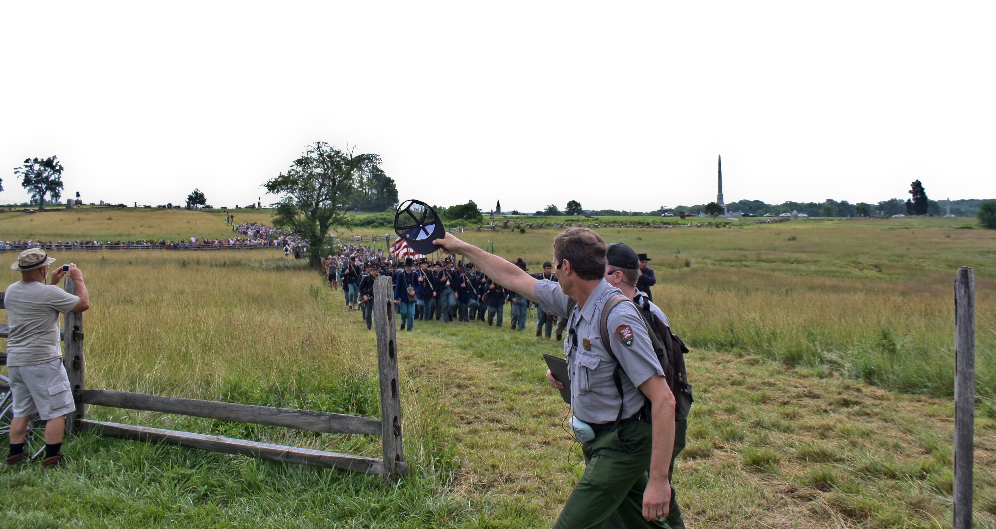
Gettysburg Living History Schedule
From the roar of artillery to the flash of bayonets, living history demonstrations at Gettysburg National Military Park help bring the past to life. On select days, Civil War living historians encamp on the Gettysburg battlefield. Explore their camps, interact with these knowledgeable historians, and witness as they demonstrate the tools, tactics, and firepower of the two armies that waged war across these now hallowed fields.
Gettysburg NMP Museum and Visitor Center
The Gettysburg National Military Park Museum and Visitor Center is the place to begin your visit to the battlefield. Here visitors will find information on how to visit the park and what to see around Gettysburg. The Gettysburg National Military Park Museum and Visitor Center is privately owned & operated by the Gettysburg Foundation (in partnership with the National Park Service).
Duration: 2-3 Hours
Horseback Riding Trails at Gettysburg
Horseback Riding tours on the southern half of the Gettysburg Battlefield
Duration: 2-4 Hours
Visitor centers
David Wills House
The home of Gettysburg attorney David Wills was the center of the immense clean-up process after the Battle of Gettysburg and where President Lincoln put the finishing touches on his Gettysburg Address. The museum features six galleries, including two rooms that have been restored to their 1863 appearance: Wills' office, where he planned for a Soldiers' National Cemetery after the battle; and the bedroom where Lincoln stayed and prepared the Gettysburg Address. Admission to the Wills House is free.
Get directionsMuseum and Visitor Center
Gettysburg National Military Park Museum and Visitor Center is the place to begin your visit to the battlefield. Here you will learn how to visit the park and what to see around Gettysburg. For visitor safety, all bags are subject to inspection. Bags prohibited inside the Museum & Visitor Center building include cooler bags, luggage, and bags with wheels. The Museum and Visitor Center is privately owned and operated by the Gettysburg Foundation, in partnership with the National Park Service.
Get directions
Hours of operation
Battlefield Hours
The battlefield and roads are open thirty minutes before sunrise to thirty minutes after sunset. Visitors can plan their visit and obtain a listing of sunrise and sunset times by day in Gettysburg, PA at: https://sunrise-sunset.org/us/gettysburg-pa.
Mon
Sunrise to Sunset
Tue
Sunrise to Sunset
Wed
Sunrise to Sunset
Thu
Sunrise to Sunset
Fri
Sunrise to Sunset
Sat
Sunrise to Sunset
Sun
Sunrise to Sunset
Activities
Weather
https://www.nps.gov/gett/planyourvisit/weather.htm
Contact
Photos

Stay near this park
No horse-friendly stays listed near Gettysburg National Military Park yet. Know a great barn or property? Help fellow riders by listing it.
List your propertyDirections
Gettysburg National Military Park is located in Adams County, Pennsylvania. The museum and visitor center is located at 1195 Baltimore Pike (Route 97) with a back entrance from the Taneytown Road (State Rt. 134). From North or South, follow US 15 to Gettysburg and watch for signs to direct you to the National Park Service Museum and Visitor Center. From East or West, drive into Gettysburg on US Rt. 30, turn South on Baltimore Street (Rt. 97), and follow signs to the entrance of the visitor center.
Source: nps.gov