
Park Closure
Independence Day Holiday Advisory - Stay Safe While Visiting on July 4th
All parking lots near Golden Gate Bridge are closed on July 4th. Once full, other lots will stay closed all day. Pack your patience and leave valuables at home! Take public transit, walk, or bike since parking will be extremely limited. If you drive, park in legal spaces only. Respect wildlife protection closures and stay away from steep cliffs. Fireworks and drones are prohibited in park. See link below for more info.
More infoPark Closure
Marin Headlands Baker-Barry Tunnel Traffic Control & Detour July 4th
Due to Independence Day holiday, visitors should expect traffic delays when entering the park via Baker-Barry Tunnel from Alexander Avenue. No eastbound vehicular traffic allowed through Baker-Barry tunnel. All vehicles must exit park via Conzelman Road.
Information
Upper Fort Mason Roads and Parking Area Closures Fall 2025 - Fall 2026
Roads and parking areas at upper Fort Mason will have closures during utilities and seismic retrofit projects. Closures planned Fall 2025 through Fall 2026. Lots will be fenced and used as staging areas for projects occurring at Fort Mason. Signs will be posted in advance of utilities work as project progresses through each area at Fort Mason. Read signs and do not park in posted areas. Vehicles will be towed at owner's expense.
Information
Temporary Traffic Control and Detour on Bunker Rd Until July 31, 7AM to 6PM
Contractor will be replacing culvert on Bunker Road near Capehart Housing Area. Allow extra time for traffic delays and detours. Visitors entering the park should expect delays. Visitors exiting park will be routed over Conzelman Road. Please obey traffic controls.
Information
Old Springs Trail near Tennessee Valley Closed until August 2026
The trail will be closed for boardwalk replacement and general maintenance until early August. Surrounding trails will remain open to provide an alternative route. Please pay attention to safety signage and stay out of the closed area.
Information
China Beach Construction Phase 2 Spring - Summer 2026
Project continues with improvements to the lower terrace and picnic areas, rehabbing the interior and exterior of the bathhouse, and installing seating and foot wash station near beach. Projects are expected to take 16-18 months. See link for details.
More infoInformation
Presidio Trust Trails Annual Coyote Pupping Season is April to October
To prevent dog-coyote conflicts, avoid seasonally closed sections of the Park Trail and the Bay Area Ridge Trail to dog walking. Explore open dog-friendly trails instead and remember to keep dogs on leash. Visit the Presidio Trust's website for more details.
More infoInformation
Ocean Beach Fire Season in Effect through October 31, 2026
Fires allowed ONLY in park provided concrete fire rings between Stairwells 15 and 20. Do NOT make fire rings using rocks, logs or other items. For more information, visit the beach fire regulations link below.
More infoCaution
Auto-Theft Warning - Only Bring What You Need to the Park
You can prevent vehicle break-ins in parking lots and scenic overlooks. Before leaving your car for even a short period of time: 1) Remove all valuables, 2) Lock your doors. 3) Take your cell phones and electronics with you. Read article for more details.
More infoGolden Gate National Recreation Area
CA · San Francisco
Experience a park so rich it supports 19 distinct ecosystems with over 2,000 plant and animal species. Go for a hike, enjoy a vista, have a picnic or learn about the centuries of overlapping history from California’s indigenous cultures, Spanish colonialism, the Mexican Republic, US military expansion and the growth of San Francisco. All of this and more awaits you, so get out and find your park.
Riding guide
Highlights
Golden Gate National Recreation Area protects a dramatic stretch of coastal landscape surrounding the entrance to San Francisco…
Riding
Rideable terrain here is noted as 130 miles, giving riders a clearer sense of scale before they ever unload. For equestrians, the recreation area offers an extensive network of multi-use trails across the Marin Headlands and surrounding coastal ridges. Riders can explore routes that wind through grassy valleys, climb scenic ridgelines overlooking the Pacific, and travel along historic military roads that now serve as quiet trail corridors. Many trails connect into longer loops, allowing riders to experience both open coastal viewpoints and sheltered inland terrain during a single ride.
Rideable terrain
130 miles
Trailer parking
Tennessee Valley Trailhead Parking Area (Primary Staging Area) Location End of Tennessee Valley Road near the Tennessee Valley Trailhead in the Marin Headlands unit of Golden Gate National Recreation Area. Why riders use it Primary access point for several horse-friendly trails in the Marin Headlands Direct connections to trails such as the Miwok Trail, Coastal Trail segments, and interior ridge routes Commonly used staging area for riders exploring the southern Marin trail system Facilities Large paved parking lot capable of accommodating horse trailers Space available to maneuver and unload horses Direct access to multi-use trails from the trailhead This is generally considered one of the most reliable equestrian staging locations within the recreation area. Rodeo Valley Trailhead / Bunker Road Parking Area Location Along Bunker Road near Rodeo Valley in the Marin Headlands section of Golden Gate National Recreation Area. Why riders use it Provides access to several equestrian-permitted trails including Rodeo Valley Trail and connections to the Miwok and Marincello trail systems Central location within the Marin Headlands trail network Good access to scenic ridge and valley riding routes Facilities Roadside and trailhead parking areas suitable for trailers Trail access directly from the parking areas Open valley terrain with room to stage horses Bobcat Trail / Tennessee Valley Access Parking Location Along Tennessee Valley Road and nearby access points in the Marin Headlands area. Why riders use it Access to Bobcat Trail and connecting multi-use trail routes used by equestrians Quieter access points compared with the main Tennessee Valley lot Good starting point for longer loop rides across ridge and valley trails Facilities Roadside pull-off parking areas Limited but usable space for staging horses Access to multi-use trails directly from nearby trailheads Important note Because many of these staging areas are located along park roads or shared trailhead lots, riders should ensure trailers do not block traffic or restrict access for other visitors and should confirm posted parking regulations before unloading horses.
Horse regulations
Horses Are Allowed Only on Designated Multi-Use Trails Horseback riding within Golden Gate National Recreation Area is permitted on a network of designated multi-use trails located primarily in the Marin Headlands and surrounding coastal ridge areas. These trails pass through grasslands, valleys, and coastal hills where equestrian use is specifically allowed. Important notes: Horses are not allowed on hiking-only trails, narrow footpaths, or certain coastal bluff routes unless the trail is clearly marked for equestrian use. Riders should always check posted trail signage and park maps before entering a trail. Stay on Designated Routes To protect fragile coastal vegetation and sensitive habitats: Horses must remain on established multi-use trails and approved routes. Riders should avoid traveling across grasslands, dunes, or off-trail areas. Leaving the trail can damage vegetation and contribute to erosion on steep slopes. Respect Historic and Protected Areas Golden Gate National Recreation Area contains historic military structures and protected natural areas. Riders must: Avoid riding near historic batteries, buildings, and protected cultural sites Stay clear of fenced restoration areas or habitat protection zones Avoid disturbing archaeological features or historic structures Protecting these areas helps preserve the park’s cultural and natural resources. Trail Etiquette Many trails in the recreation area are shared with hikers and mountain bikers. Riders should: Slow to a walk when approaching others Announce themselves when passing Maintain control of horses at all times Courtesy helps ensure safe shared use of the trails. Protect Natural Resources The park protects coastal ecosystems, wildlife habitat, and fragile soils. Riders should: Avoid trampling vegetation or creating new trails Keep horses away from wetlands, dunes, and sensitive habitats Pack out trash and manure where required Visitors are encouraged to follow Leave No Trace principles while riding within the park.
Getting here
Use Golden Gate Plaza, San Francisco, California as your primary planning reference before you haul in. Tennessee Valley Trailhead Parking Area (Primary Staging Area) Location End of Tennessee Valley Road near the Tennessee Valley Trailhead in the Marin Headlands unit of Golden Gate National Recreation Area. Why riders use it Primary access point for several horse-friendly trails in the Marin Headlands Direct connections to trails such as the Miwok Trail, Coastal Trail segments, and interior ridge routes Commonly used staging area for riders exploring the southern Marin trail system Facilities Large paved parking lot capable of accommodating horse trailers Space available to maneuver and unload horses Direct access to multi-use trails from the trailhead This is generally considered one of the most reliable equestrian staging locations within the recreation area. Rodeo Valley Trailhead / Bunker Road Parking Area Location Along Bunker Road near Rodeo Valley in the Marin Headlands section of Golden Gate National Recreation Area. Why riders use it Provides access to several equestrian-permitted trails including Rodeo Valley Trail and connections to the Miwok and Marincello trail systems Central location within the Marin Headlands trail network Good access to scenic ridge and valley riding routes Facilities Roadside and trailhead parking areas suitable for trailers Trail access directly from the parking areas Open valley terrain with room to stage horses Bobcat Trail / Tennessee Valley Access Parking Location Along Tennessee Valley Road and nearby access points in the Marin Headlands area. Why riders use it Access to Bobcat Trail and connecting multi-use trail routes used by equestrians Quieter access points compared with the main Tennessee Valley lot Good starting point for longer loop rides across ridge and valley trails Facilities Roadside pull-off parking areas Limited but usable space for staging horses Access to multi-use trails directly from nearby trailheads Important note Because many of these staging areas are located along park roads or shared trailhead lots, riders should ensure trailers do not block traffic or restrict access for other visitors and should confirm posted parking regulations before unloading horses.
Planning your visit
Horseback Riding Is Limited to Designated Multi-Use Trails Golden Gate National Recreation Area allows horseback riding on certain multi-use trails, primarily within the Marin Headlands and surrounding coastal ridge areas. Horses are not permitted on many hiking-only paths, narrow coastal bluff trails, or protected habitat areas. Riders should know: Only trails specifically marked for equestrian or multi-use access allow horseback riding Riders must remain on designated routes at all times Many trails near popular beaches or cliffside viewpoints are hiking-only Checking trail maps and posted signage before riding is strongly recommended. Extensive Trail Network Across Coastal Hills The recreation area contains a large trail system spread across several park units, particularly in the Marin Headlands. These trails provide: Long ridge routes overlooking the Pacific Ocean Valley trails through coastal grasslands and scrub Connections between historic military roads and scenic viewpoints Many equestrian rides combine valley and ridge routes into longer loop rides. Trails Are Shared With Other Visitors Most trails within the recreation area are multi-use routes shared with hikers and mountain bikers. Riders should: Slow to a walk when approaching others Announce themselves when passing Maintain full control of horses at all times Courtesy helps ensure safe shared use of the trails. Limited Equestrian Facilities Horse-specific amenities within the recreation area are limited. Expect: Designated staging areas but few horse-specific facilities Limited hitching posts or water sources Shared trailhead parking areas used by multiple trail users Riders should bring water, feed, and any necessary equipment. Coastal Terrain and Weather Conditions The riding landscape includes: Steep coastal ridges Wind-swept grasslands Rocky and sometimes uneven trail surfaces Weather conditions can change quickly along the coast, with strong winds, fog, and cool temperatures common throughout the year. Coastal Wildlife and Scenic Views The park’s coastal ecosystems support diverse wildlife. Riders may encounter: Deer grazing in grassland valleys Hawks and seabirds soaring along coastal cliffs Marine views across the Pacific Ocean and San Francisco Bay These sweeping coastal landscapes make Golden Gate National Recreation Area one of the most scenic equestrian destinations in the National Park system.
Where to stay
Golden Gate Bridge Welcome Center is the main visitor-contact point tied to this destination, which is helpful when you want current conditions, maps, and stock-use updates before riding. This entry reads best as a bring-your-own-horse destination rather than a horse-rental stop, and amenities should be confirmed directly before travel. For a polished trip plan, pair the ride with lodging, fuel, and resupply planning in or near San Francisco before heading deeper into federal-land access points.
Trails
No trails synced for this park yet.
Campgrounds
Bicentennial Campground
3 sites
Bicentennial Campground is the easiest to reach campground in Golden Gate, approximately 100 yards from the parking area near Battery Wallace. The campground is a great location for those wanting to camp near the city. There is a moderate short hill to climb to/from the campground from the parking area. It is downhill to the site and uphill back to the parking area. Open Year Round. $25.00/per campsite per night
Reserve a siteHawk Campground
3 sites
Hawk Campground is the most remote campground and is located above Tennessee Valley and offers sweeping views of the Marin Headlands. The site is a 2.5 mile uphill hike from the Tennessee Valley Trailhead parking lot, or a 3.5 mile uphill hike from the Miwok Trailhead. There are 3 sites that can accommodate 4 people each. Maximum stay is three nights per year. Campsites are available March-November. $25.00/per campsite per night
Reserve a siteHaypress Campground
6 sites
Haypress Campground is nestled within the coastal scrub of Tennessee Valley, near Mill Valley. The hike to this campground is 0.7 miles from the Tennessee Valley Trail head parking lot, and is an ideal campground for first-time backpackers. Haypress campers often enjoy hiking to Tennessee Beach, where they can admire its dramatic geology and colorful sand. Campground is open March-November. $25.00/per campsite per night
Reserve a siteKirby Cove Campground
6 sites
Kirby Cove is the most popular campground in the Marin Headlands, with spectacular views of San Francisco and the Golden Gate. Enjoy a wooded setting, seclusion and protected campsites which were recently restored for all to enjoy. Campsites are available for use only by prior reservation but anyone can walk down the road to enjoy the vistas and picnic on the bluffs or beach. Campground is open March-November. $40.00/per campsite per night.
Reserve a siteRob Hill Campground
0 sites
Open for public tent camping from April 1 to October 31, Rob Hill offers 4 (2 are accessible) group campsites that each can welcome up to 30 people. Sites must be reserved in advance through Recreation.gov. In addition to providing easy access to Presidio trails and views, each campsite comes with amenities like picnic tables and grills, as well as access to indoor restrooms.
Points of interest
10 - Marsh Dynamics
POIWAYSIDE PANEL TITLE: Marsh Dynamics
10 - San Francisco's Seaside Playground
POIWAYSIDE TITLE: San Francisco's Seaside Playground: Going to the Cliff. TEXT: They made their way across the endless sand dunes on foot, on horseback, in horse-drawn buggies and steam trains.
10 - World's Fair
POIWAYSIDE TITLE: San Francisco Hosts the 1915 World's Fair! PANEL LOCATION: The wayside faces west and is in the northern portion of the Great Meadow Loop Trail. It is just to the side of the large asphalt path. Exercise caution with passing bikes.
11 - Great Meadow
POIWAYSIDE TITLE: The Great Meadow PANEL LOCATION: The wayside faces north and is placed on a brick platform extending into the Great Meadow from the asphalt trail of the Great Meadow Loop. Accessible restrooms are further down the trail on the righthand side.
11 - "Sand" Francisco
POIWAYSIDE PANEL TITLE: "Sand" Francisco PANEL DESCRIPTION: Graphic panel set in metal frame. The wayside faces north, on the northern side of the trail.
11 - Tactile Site Map
POILands End Lookout Visitor Center has a three-dimensional cast concrete tactile map of the area from Lands End Point to Sutro Heights. The model has tactile letters and braille along its surface, as well as raised features representing roads and trails. The model also has a compass rose in alignment with its geographical surroundings.
12 - Phillip Burton
POIWAYSIDE TITLE: Phillip Burton PANEL LOCATION: The wayside faces west along the asphalt path of the Great Meadow Loop Trail. Accessible restrooms are back in the opposite, on your lefthand side. VIEW FROM WAYSIDE: The wayside is on the eastern portion of the Great Meadow and is placed so that the Phillip Burton Statue is directly before you, framed by the Golden Gate Statue in the distance. The statue is encircled by gray bricks and is accessible by an additional walking path
12 - The Last Word in Airfields
POIWAYSIDE PANEL TITLE: The Last Word in Airfields PANEL DESCRIPTION: The wayside faces south, on the south side of the trail at the edge of Crissy Field.
13 - Aviation's Adventuring Years
POIWAYSIDE PANEL TITLE: Aviation's Adventuring Years PANEL DESCRIPTION: The wayside faces south, on the southern side of the trail.
13 - End
POIThe audio described tour ends here at the original wayside near the headquarters building. Thank you for visiting your National Park! If you have any further questions, you can approach the headquarters building to speak with a ranger.
14 - Braving Wind and Waves
POIWAYSIDE PANEL TITLE: Braving Wind and Waves PANEL DESCRIPTION: The wayside faces north, on the northern side of the trail.
15 - The Pacific for its Stage
POIWAYSIDE PANEL TITLE: The Pacific for its Stage PANEL DESCRIPTION: The wayside faces north east, northern side of the trail.
16 - Shaping the Bay
POIWAYSIDE PANEL TITLE: Shaping the Bay PANEL DESCRIPTION: The wayside faces north, on the northern side of the trail.
17 - Enjoying Crissy Field
POIPANEL DESCRIPTION: Located on the western side of the Warming Hut, the kiosk is a four-sided metal structure with three interpretive panels.
18 - Setting a Deadly Obstacle Course
POIWAYSIDE PANEL TITLE: Setting a Deadly Obstacle Course PANEL DESCRIPTION: The wayside is left of the Crissy Field kiosk and faces west.
1906 Earthquake Cottages
POIRestored earthquake cottages used in the relief efforts of the 1906 Earthquake in San Francisco.
19 - Protecting Wildlife
POIPANEL DESCRIPTION: Situated at the western edge of Crissy Field is a four-sided metal kiosk with 3 wayside panels.
1 - Exploring the Coast...and Beyond
POIKIOSK DESCRIPTION: This kiosk has 2 panels side by side. VIEW FROM WAYSIDE: Facing south west, you can see the path that cuts through a grassy field leading to three wayside panels 70 feet away. Also visible is the top portion of a rounded concrete structure poking out of the ground just before the waysides. In front and to the left of you are three picnic tables 30, 75 and 110 feet away, respectively.
1 - Headquarters
POIWelcome to the audio described tour of Fort Mason's waysides. Each stop on this tour describes one of the 12 waysides or kiosks within Fort Mason, Golden Gate National Recreation Area. Each stop will begin with an orientation to where you are in the park and a description of the view from the wayside. Directions to the next wayside will be detailed at the end of every stop.
1 - Introduction: Lands End Lookout
POIWelcome to the Lands End Lookout, perched here on the edge of the Pacific Ocean, at the western boundary of San Francisco. Let's begin by stepping to a quieter part of this space. Stand with your back to the desk and walk carefully forward about six steps until you find a similar counter.
1 - Restoring Habitat - Muir Beach AD
POIWAYSIDE TITLE: Restoring Habitat VIEW FROM WAYSIDE: Standing in front of the kiosk facing south, away from the parking lot, a row of brown recycling and trash bins is to your left. Directly behind you is a 3-D topographic model of Muir Beach and the surrounding area, and, on the edge of the parking lot, a bathroom building.
1 - Sustainability at Golden Gate
POIWAYSIDE PANEL TITLE: Sustainability at Golden Gate PANEL DESCRIPTION: The wayside is located on the south eastern corner of the Crissy Field Center and faces north towards the bay.
20 - Daring Pilots, Youthful Heroes
POIWAYSIDE PANEL TITLE: Daring Pilots, Youthful Heroes PANEL DESCRIPTION: The panel faces north, on the northern side of the trail.
21 - A Tidal-Marsh Extravaganza
POIWAYSIDE PANEL TITLE: A Tidal-Marsh Extravaganza PANEL DESCRIPTION: The wayside faces north on the northern side of the trail.
22 - A Wasteland Transformed
POIWAYSIDE PANEL TITLE: A Wasteland Transformed PANEL DESCRIPTION: The wayside faces north on the northern side of the trail.
2 - Exploring Fort Mason
POIKIOSK LOCATION: The kiosk is a four-sided metal structure with interpretive panels. It is located east of building 201, at the intersection of Macarthur Avenue and Franklin Street. It is close to Fort Mason's flagpole.
2 - Plants of Lands End
POIWAYSIDE PANEL TITLE: Plants of Lands End: What Grows Here? Putting Down Roots. DESCRIPTION OF IMAGE: A large color photo of a shoulder of hillside covered with white wild flowers and green grasses. The hillside drops down to white waves lapping a rocky shore. The sky above is streaked with clouds.
2 - Reduce, Reuse, Recycle
POIWAYSIDE PANEL TITLE: Reduce, Reuse, Recycle PANEL DESCRIPTION: The wayside faces east in front of the Crissy Field Center.
2 - Redwood Creek Watershed Tactile Model
POIMuir Beach Overlook has a three-dimensional cast-bronze tactile map of the Redwood Creek Watershed. The model has tactile letters and braille along its surface, as well as raised features representing roads and trails. Additionally, the model contains a compass rose in alignment with its geographical surroundings. On top of that, it's a working hydrological model of a watershed.
3 - A Geologic Tale
POIWAYSIDE DESCRIPTION: The wayside is located about 80 feet south of the parking lot, just before the convergence of the forking paths that come together just south of the WWII fire control station bunker. This is one of three panels that stand side-by-side facing south west.
3 - Animals of Lands End
POIWAYSIDE PANEL TITLE: Animals of Lands End: Who Goes There? Wild in the City. DESCRIPTION OF IMAGE: A large color photo shows a coyote, with tawny fur and a long tail, looking intently at something in tall grass.
3 - First Stewards - Muir Beach AD
POIWAYSIDE TITLE: First Stewards - Panel Description VIEW FROM WAYSIDE: A mix of green willows, stubby coyote brush and tall dune grasses make up the wetland before you. In the distance, the slope of a hill, red and green from the thick coverage of poison oak, separates the wetland from the beach. Even further away, you can see houses on a hillside on the other side of the beach parking lot.
3 - Fort Mason Historic District
POIWAYSIDE PANEL TITLE: Fort Mason Historic District PANEL DESCRIPTION: The wayside faces north on the sidewalk lining the right side of Macarthur Avenue. It is 23 feet from the gate at Fort Mason's southeast's border.
3 - "The Natural", Off-Set
POIWAYSIDE PANEL TITLE: "The Natural" Off-Set PANEL DESCRIPTION: The wayside faces south west, overlooking the lawn in front of the Crissy Field Center and beyond that, the East Beach parking lot.
4 - An Intimate View of Coastal California
POIWAYSIDE DESCRIPTION: This panel is to the right of the previous wayside and faces south west out over the wide expanse of the Pacific Ocean. PANEL TITLE: An Intimate View of Coastal California
4 - A Place of Renewal
POIWAYSIDE DESCRIPTION: At the edge of the East Beach parking lot, is a kiosk, a four-sided metal structure with three wayside panels. Facing west from the kiosk, the San Francisco Bay Trail is to your right, hugging the edge of the bay, and stretches on into the distance towards Crissy Field and to the north west, the Golden Gate Bridge.
4 - Geology at the Edge
POIWAYSIDE PANEL TITLE: Geology at the Edge DESCRIPTION OF IMAGE: A color photo at far left shows the rocky coast of the Pacific, with some green cliffs at left.
4 - Quarter's 1: The General's Residence
POIWAYSIDE PANEL TITLE: Quarters 1 - The General's Residence PANEL DESCRIPTION: The wayside faces north and is connected to the sidewalk that lines the east side of Macarthur's Avenue.
4 - Red-Legged Frog Returns - Muir Beach AD
POIWAYSIDE TITLE: Red-Legged Frog Returns - Panel Description VIEW FROM WAYSIDE: The wayside looks out over a low-lying wetland. Dark green lupin and coyote brush grow in round bunches amongst tall, yellow-green dune grasses. A row of tall willows grows 100 feet away, their bright green, slender leaves shimmer in the wind.
5 - A Story of Sustainable Living
POIWAYSIDE PANEL TITLE: A Story of Sustainable Living. PANEL DESCRIPTION: The wayside faces east, on the east side of the trail.
5 - Healthy Watershed - Muir Beach AD
POIWAYSIDE TITLE: Collaborating for a Healthy Watershed - Panel Description DESCRIPTION OF IMAGE: A photo of green, rolling hills that form a valley. A winding road passes through the middle of the valley floor and climbs up and out the far end. In the blue sky above the valley, a red tail hawk, its dark head tilted upwards, soars with its wings spread wide. Its reddish-brown and white feathers are on full display.
5 - Officer's Row
POIWAYSIDE PANEL TITLE: Officer's Row PANEL DESCRIPTION: The wayside faces north and is on the sidewalk that lines the east side of Franklin Street. An offshoot of Franklin Street cuts horizontally just ahead of you towards the General's Residence.
5 - Rocks at the Edge
POIWAYSIDE PANEL TITLE: Rocks at the Edge TEXT: The forces that helped build Lands End are now tearing it down. Wind, rain, and waves relentlessly chew at the bluffs, washing away softer rocks while leaving behind the more resistant outcroppings of harder rocks. Isolated harder blocks form the solitary "sea stacks" that dot the shoreline. Seal Rocks are good examples of sea stacks.
5 - Soldiers Guarding the Coast
POIWAYSIDE DESCRIPTION: The wayside panel is to the right of the previous wayside. It is the third of three panels located here and faces south west out over the wide expanse of the Pacific Ocean. PANEL TITLE: Soldiers Guarding the Coast.
6 - Farming and Culture: Muir Beach AD
POIWAYSIDE TITLE: Farming and the Cultural Landscape VIEW FROM WAYSIDE: This panel is set at the gate across the road from the Pelican Inn, a brick building painted white, with steep sloping brown tile roof with a tall chimney.
6 - Heritage of a Bayshore Culture
POIWAYSIDE PANEL TITLE: Heritage of a Bayshore Culture PANEL DESCRIPTION: The wayside faces west, on the western side of the trail.
6 - Resource Partners
POIWAYSIDE PANEL TITLE: Resource Partners: Protecting the Park. TEXT: Hillsides erode and fall into the sea, concrete ruins crumble, native vegetation is choked out by exotic trees and plants, and vandalism destroys natural and historic treasures alike. Lands End is rich in attractions, but many are threatened by human and environmental forces.
6 - Terrace Gardens
POIWAYSIDE PANEL TITLE: Terrace Gardens PANEL DESCRIPTION: The wayside faces east, and overlooks a view of Aquatic Lagoon and the historic ships at Hyde Street Pier. The General's Residence is to the right, and a private residence is to the left.
7 - Greek Classics and Garden Gnomes
POIWAYSIDE PANEL TITLE: Greek Classics and Garden Gnomes: Faded Glory SCULPTURE: Next to the panel is a reproduction of a sculpture of the goddess Diana, hunting with a little stag at her side.
7 - Manifest Destiny
POIWAYSIDE PANEL TITLE: John Charles Frémont and "Manifest Destiny" PANEL DESCRIPTION: The wayside faces north and is placed along a cement path that overlooks the bay.
7 - Original "Wasteland" Filled
POIWAYSIDE PANEL TITLE: Original "Wasteland" Filled PANEL DESCRIPTION: The wayside faces north, on the northern side of the boardwalk.
8 - Black Point Fortifications
POIWAYSIDE PANEL TITLE: Black Point Fortifications (1797 to 1909) PANEL DESCRIPTION: The wayside faces north and is placed along a cement path that overlooks the bay.
8 - Fragments of the Past
POIWAYSIDE PANEL TITLE: Fragments of the Past: A Vanished Landscape. DISPLAY: To the right side of the panel is a waist-high, rectangular counter with a glass top. Beneath the glass are artifacts from different moments in Lands End's past.
8 - Home of the Yelamu
POIWAYSIDE PANEL TITLE: Home of the Yelamu PANEL DESCRIPTION: The wayside faces south west, on the western side of the trail.
9 - Ohlone Life
POIWAYSIDE PANEL TITLE: Ohlone Life: A Bountiful Place.
9 - San Francisco Port of Embarkation
POIWAYSIDE PANEL TITLE: San Francisco Port of Embarkation PANEL DESCRIPTION: The wayside faces northwest and is placed along the side of the large asphalt path that slopes downwards to the great meadow. It is under the shade of Monterrey cypress.
9 - Waterside Treasure
POIWAYSIDE PANEL TITLE: Waterside Treasure
Activities, Officers & Crowding: Philippines War Tour
POIAlmost overnight the Presidio grew in size and importance. Now, in addition to the soldiers stationed here to defend San Francisco Harbor and the west coast, the post took on responsibilities for staging the operations in the Philippines and elsewhere in the Pacific.
Alcatraz Island Climate Change
POIA Mob of Soldiers: Philippines War Tour
POIThis letter illustrates how regional and racial tensions were running high at this time in the country, and the role that these played in the Tennessee volunteers getting their reputation. August 15, 1898 Dear Uncle John, You would certainly laugh were you to visit Frisco about now, and ask a citizen about that Tennessee regiment. He would tell you they are the worst men for fighting you ever saw. The New York boys run from us.
Anza Expedition Camp Site
POIThe Juan Bautista de Anza National Historic Trail enters the Presidio here at Mountain Lake. The trail continues north to the edge of San Francisco, commemorating the route followed by the de Anza's expedition from Sonora, Mexico to the Golden Gate.
Arguello Restaurant
POINamed for former Presidio commander and first governor of Alta California, Luis Antonio Arguello, features delicious Mexican cuisine that's a major step up from the grub once served in the military chow line. The contemporary bar with craft cocktails is perfect for thirsty servicemen and civilians alike.
Arion Press
POIArion Press matches the finest contemporary art with literary treasures past and present in books that are beautifully designed and produced. Tours of the historic printing and bookmaking facilities are held Thursday afternoons at 3:30 p.m. and last approximately an hour and a half.
A Rollicking Past
POIVIEW FROM THE WAYSIDE: This wayside is in a small offshoot off the main boardwalk. The offshoot is surrounded by 3 to 4 foot tall scrubby bushes. Directly overlooking the wayside, the flat, scrubby grassland can be seen in the distance. Behind where you are standing are two benches, both facing the flat grassland. Turning to face the benches, the vast expanse of the rolling hillside can be seen in the distance.
Arrival of Automobiles: Philippines War Tour
POIIn 1903, a new problem arrived at the crowded Presidio - the automobile. At that time, Col. Charles Morris, commander of the Presidio wrote to the president of the Automobile Club of California: "It is with regret that I report that autos are utterly disregarding the posted speed limits. If drivers continued their defiance of the rules, I will be forced to take drastic measures."
Baker Beach
POIBaker Beach, a mile-long sandy stretch, is located in the southwest corner of the Presidio near the 25th Avenue Gate. For stunning views of the Pacific Ocean and Marin Headlands, this is one prime spot. And dog friends are welcome! The picnic area is cozy and sheltered from the wind. The tables are popular when the sun comes out, so get there early to claim a spot, especially on the weekends. The site is equipped with barbeque pits and nearby restrooms.
Baker Beach Trailhead - Presidio Coastal Trail
POIFollow the California Coastal Trail (CCT) for some of the most spectacular views anywhere along the CCT's 1200-mile span. For breathtaking views of the Pacific and the entrance to the bay, take a 3-mile roundtrip walk on the Coastal Trail to the Golden Gate Bridge and back.
Bakers and Cooks School: Philippines War Tour
POIDuring the Spanish-American War, less than 200 men died from battle injuries, but over 5000 died from sickness or disease. And much of the sickness was attributed to the lack of trained cooks. So, in 1905, the War Department opened the first school for bakers and cooks at Fort Riley, Kansas. It soon added schools at the Presidio, at Washington Barracks, D.C., and at Fort Sam Houston, Texas.
Basalt at Point Bonita
POIBelow the suspension bridge to the left is a spectacular stack of pillow basalt rock formations that attracts geologists from around the world. The tunnel and trail you just walked is another example of pillow basalt, an igneous rock that only forms when lava erupts underwater. The rapid cooling of lava by cold water forms the pillow-shaped bodies, which often break open and release more lava from inside.
Battery Alexander Trailhead
POIThe Battery Alexander Trailhead provides access to the Batteries Loop Trail and additional parking for the Point Bonita Lighthouse. Originally constructed as a jeep road between the gun batteries the Batteries Loop Trail has been narrowed to accommodate changes in use. The trail provides access to and allows for exploration of Battery Smith-Guthrie, Battery O'Rorke and Battery Alexander. The loop can be completed in either direction from Battery Alexander.
Battery Boutelle
POIThis battery was completed and armed in 1900 and featured three 5-inch rapid fire guns designed to defend the offshore minefields against mine sweepers and fast torpedo boats. These guns had a range of seven miles and could be fired at the rate of up to thirty rounds per minute.
Battery Chamberlin
POIBattery Chamberlin is named in honor of Captain Lowell A. Chamberlin, First Artillery, who served with distinction in the Civil War and continued as an artillery officer until his death at the Presidio in 1889.
Battery Crosby: Guarding the Minefield
POICompleted in 1900, Battery Crosby was armed with 6-inch guns and designed to protect the underwater minefields outside the Golden Gate. The minefields guarded against minesweepers and fast moving boats trying to navigate through the minefields. Across the water, under and beyond the Golden Gate Bridge, you can see Fort Baker, established in 1901. This post played a prominent role in the San Francisco harbor defenses during WWII, including being the base of operations.
Battery Davis
POILocated in Fort Funston, Battery Davis was constructed in 1936 as a critical part of the Harbor Defenses of San Francisco. During WWII, the army's secret weapon was the 16" gun that was able to shoot over 25 miles out into the Pacific Ocean. During the tense days after Pearl Harbor, soldiers were stationed in concrete look-outs, on 24 hour shifts, scanning the waters and sky for signs of enemy invasion.
Battery Dynamite
POIDespite the army's objections, Congress appropriated $400,000 in 1888 to purchase "pneumatic dynamite guns". In non-technical terms, these were guns that shot payloads of dynamite really, really far. A 50 pound shell went as far as 3 miles and a 500 pound shell went 1 mile. The guns fired charges by means of compressed air, like a potato gun.
Battery Dynamite: A Failed Experiment
POIIn the forested area across Lincoln Boulevard is Battery Dynamite. In 1888, the US Army purchased some experimental "pneumatic dynamite guns." In non-technical terms, these guns shot payloads of dynamite for up to 3 miles out to sea. The guns used compressed air to fire charges, like a potato gun. The army set up two experimental dynamite batteries of three guns each, one here and the other at Sandy Hook, New Jersey.
Battery East
POIBig brick forts full of cannons, like Fort Point, became obsolete during the US Civil War as rifled cannons could knock them down. As a result, work began on several new gun positions behind earthen berms on the coastal bluffs above Fort Point. By 1873, the first emplacement, East Battery, was completed and armed with twelve 15-inch Rodman cannons. West Battery was also constructed along the bluffs overlooking the Pacific as part of this phase of coastal defenses.
Battery Godfrey
POIBattery Godfrey was armed with the largest weapons of the Endicott Period, 12-inch rifled guns mounted on barbette carriages. The guns could match the 12-mile range of battleship guns of that time.
Battery Spencer Overlook
POIParking along Conzelman Road at the battery is limited and often full, so be prepared to walk a little. If you've ever seen a car commercial featuring the Golden Gate Bridge, chances are good that part of it was shot on Conzelman Road leading up to Battery Spencer. At almost 500 feet above the bay, this high cliff-top vantage point makes for great views today and was a prime location for big coastal defense guns when the army was here.
Battery Townsley
POIBattery Townsley is located one ½ mile up from the Fort Cronkhite parking lot near Rodeo Beach. The walk up to the battery is strenuous so please allow at least 45 minutes. It's well worth it for the history lesson and views of Rodeo Beach and the Pacific Ocean. Battery Townsley is one of only two WWII era batteries in the San Francisco area that contained mammoth 16-inch guns. The other is located at Fort Funston, also in the park.
Battery Wallace
POIWhen construction on Battery Wallace began in 1917, making the battery resistant to airstrikes was not considered in the design. The battery's primary weaponry, two 12-inch diameter guns, had no overhead protection against bombers. Despite this flaw, Battery Wallace became instrumental as a defense post during WWII. To give the battery some protection against potential Japanese bomber attacks, the 12-inch guns were buried under thick covers of earth and concrete.
Battery West: A Response To Rifled Guns
POIFort Point became obsolete during the US Civil War due to a shift in weaponry to rifled cannons, which were very accurate and could knock down brick forts by hitting the same spot repeatedly. As a result, the US Army started working on several new gun positions behind earthen berms on the bluffs above Fort Point. By 1873, Battery West was completed and armed with twelve 15-inch Rodman cannons.
Battery Yates
POICompared to other batteries in the region, Battery Yates held relatively small, 3-inch diameter rapid fire rifles, used to protect the bay entrance. In the event of a foreign attack, its guns could fire up to 30 shots per minute at fast moving enemy torpedo boats. During World War II, the guns protected an anti-submarine net that spanned the entrance to the bay.
Bay Area Discovery Museum
POIImagination is the name of the game at the <a href="https://www.baykidsmuseum.org/">Bay Area Discovery Museum</a> . Let your children learn, explore and see the world through new perspectives. Encourage and inspire them with interactive exhibits, tide pools and wind tunnels.
Beniamino Bufano's Madonna
POIItalian-born California artist Beniamino Bufano's <strong>Madonna</strong> sculpture in the Great Meadow is considered to be an expression of Cold War era fears. Set in tile mosaic, a child is superimposed against the tall, protective figure of the mother.
Bird Island Overlook
POIHere you can find stunning views of Bird Island, Rodeo Beach and the Point Bonita Lighthouse. As well as views, you can also explore the nearby Battery Mendell. <br /><br />Limited parking is available at the Point Bonita Lighthouse parking. <br /><br />The overlook is an easy 0.25 mile walk from the parking area. <br />A larger parking lot is available at Battery Alexander, about a 0.5 mile walk.
Birds in the Scrubland
POIKeep an ear and an eye out for signs of song birds. You may notice some elaborate calls and wonder where they're coming from in the brush. That's because several species like to hide out in the scrubland, though some may make themselves more prominent if it's springtime.Some song birds that have been observed at Mori Point include the California thrasher, Anna's hummingbird and several species of sparrows.
"Black Point": A Civilian Neighborhood on Military Land
POIIn the 1850s, private citizens constructed homes on the east side of the street, facing the water; after 1865, the army constructed the west side buildings. Although the military reserved Point San Jose for its purposes, the army had not assigned any soldiers or constructed any buildings. This scenic and underutilized piece of property, known to locals as "Black Point" because of the bluff's dark laurel trees, offered refuge from the rapidly growing city.
Black Point Battery
POIA beautiful and secluded place under the shade of cypress trees, the parapet and Rodman cannon give an impression of the army outpost here in the mid-1800s. Initially called Point San Jose, the Army used the battery in 1863 to defend gold-rich San Francisco against potential Confederate attack. Following the Civil War, the post became the headquarters of the US Army 9th Infantry Regiment, and served as the military headquarters for the US Army on the West Coast.
Black Sands Beach
POIPlace
Blue Whale Skeleton
POIIn 1988, a blue whale washed up on Ocean Beach in San Francisco. The carcass was cut into three pieces and buried in the sand. More than five years passed until the remains, now a cleaned up skeleton, were dug up and moved here. Today the bones are on display, arranged inside an outline of a whale to give a sense of size and shape to these wondrous underwater behemoths.
Bluff Lookout: Mantle Rocks Exposed
POIFrom here you can see excellent examples of blue-green serpentinite rock. Serpentinite is metamorphosed mantle rock formed in subductions zones when water from the sinking ocean crust alters the surrounding mantle rocks. Because serpentinite is less dense than surrounding rocks, it makes its way to the surface along faults, like a cork rising up to float on water.
Bohemian Grove
POIBohemian Grove is a lovely section of John Muir woods that provides opportunities to learn more about the health and ecology of the redwoods. You can see burned redwoods that survived a long-ago fire, redwood burls and a nurse log,
Bolinas Ridge and Climate Change
POIBolinas Ridge Trailhead
POIThe Bolinas Ridge Trailhead is the northern end of the multi-use, dog-friendly 11-mile-long (17-km-long) Bolinas Ridge Trail. The Bolinas Ridge Trailhead parking lot is located along Sir Francis Drake Boulevard 1.1 miles (1.7 km) east of Olema and approximately 5 minutes by car from the Bear Valley Visitor Center.
Bone Beds and Sand Dunes
POIThese modest sand dunes are a remnant of a vast dune field that underlies much of San Francisco. Sand from Ocean Beach was blown up over the hills of San Francisco, forming dunes as far east as San Francisco's Financial District and the bay. The sand originated on a broad coastal plain that stretched 30 miles west, when the sea level was low during the last Ice Age.
Bootlegger's Steps
POIDuring Prohibition, a similar series of steps were used by "rumrunners" to bring illegal shipments of liquor ashore. These steps were used to supply the speakeasy at the Mori Inn and restaurant, located at the top of the bluff. Bootlegging was a profitable but dangerous endeavor. Operating outside of the law meant bootleggers could face violent attack from both lawmen and, in some cases, the more dangerous threat of hijackers, determined to rip off liquor shipments.
Bringing Back Native Plant Habitats
POIYou may notice some rather large tree stumps as you descend the stairs. These are the remnants of Monterey pines and cypresses, invasive species that were removed to encourage growth and the return of native plants. Some of these natives are rare and endangered, like Raven's manzanita and Presidio Clarkia.
Burials and Important Figures - Conclusion: Philippines War Tour
POIThe tragedy of war is nowhere more evident that at our national cemeteries. The Philippine wars are no exception. In the early 1900s there were dozens of fresh graves in the sections to your right. The cemetery saw a huge increase of burials at this time; from 48 in 1898, to a peak of 855 in 1901. Soldier's bodies were first sent to the U.S. Army Morgue and Office of Identification in Manila.
Café RX
POIHealthy food, healthy people. <a href="http://caferxsf.com/">Café RX</a> is your prescription for delicious and nutritious cuisine made from the freshest ingredients.
California Red-Legged Frogs
POIThe freshwater pond and streams inland from this bridge are home to the California red-legged frog, a threatened species native to the state and the largest native frog in the western US. Typically, they are between two and five inches in length with reddish underbellies and legs. They prefer slow-moving or standing deep ponds and streams as habitat and can live up to 10 years. In the winter, the park puts up "Slow down for frog crossing" signs here.
Camera Obscura
POIThe <a href="http://www.giantcamera.com/">Camera Obscura</a> behind the Cliff House is a device based on a design by Leonardo da Vinci that produces 360 degrees of spectacular live images of the waters around Seal Rock.
Cathedral Grove
POICathedral Grove is a silent preserve and home to the tallest, oldest redwoods at Muir Woods. Consider quiet contemplation as you make your way through this part of the woods.
Cavallo Point Lodge
POI<a href="http://www.cavallopoint.com/">Cavallo Point Lodge</a> offers a variety of fine experiences for guests from dining, luxury stays, spa treatment and more.
Cavalry Stables
POIEach of the five cavalry stables built in 1914 were capable of housing 102 horse friends, enough for an entire company. In addition to the stables, there was a paddock, blacksmith shop and barracks that stood on the hill. The horse cavalry was phased out of the military after WWI, and the stables were eventually adapted for use as a K-9 Corps facility and a veterinary hospital.
Chapel of Our Lady
POIThe <a href="https://www.presidio.gov/venues/Chapel-of-Our-Lady">Chapel of Our Lady</a> is a beautiful place to get hitched, but if this venue is a must for you, so must be flexibility; reservations are taken up to two years in advance.
China Beach and Bathhouse
POIChina Beach is a great place to get away from the city without ever leaving. Tucked away in a cozy cove between Lands End and Baker Beach in the Sea Cliff neighborhood, you'll find a relaxing place to picnic, catch some rays, and play against the scenic backdrop of the Marin Headlands and Golden Gate Bridge.
China Beach Monument
POIThe China Beach monument commemorates the legacy of the early Chinese community in San Francisco. Culturally vibrant, the Chinese community helped to shape and grow the city's culture and industry since the 1850s.
Citizen Sutro
POIBorn on April 29th, 1820 in Germany, Adolph Heinrich Joseph Sutro grew up to embody the American immigrant dream. He arrived in California in 1850, during the Gold Rush, and was well educated in the field of mining engineering and business. Somewhat surprisingly, Sutro made his fortune not in gold but in silver during the late 1860s and 1870s at the Comstock Lode in Nevada.
Civilian Conservation Corp at Muir Woods
POIIn the 1930s, the Great Depression loomed over America. In 1933, recently elected President Franklin D. Roosevelt created several new agencies, including the most successful, the Civilian Conservation Corp (CCC). Across the country, this program employed tens of thousands of unemployed and unskilled young men from various backgrounds, including: the Junior Enrollees, (young men ages 18 - 26), Reservation Native Americans, local men with forestry experience, and over 25,000 ol
Cliff House
POIToday's world-famous Cliff House, part of the Sutro Historic Landscape District, is the latest in three incarnations of this destination for locals and tourists. Whether you're in the mood for a casual fun afternoon, an elegant evening out, or a play day with the family, there is always something to do at the Cliff House. Enjoy a casual meal at the Bistro Restaurant on the main level, or a more elegant affair at Sutro's at the Cliff House.
Cliff House - Lands End Tour
POIPart of the Sutro Historic Landscape District, today's world-famous Cliff House is the third incarnation of this iconic locale popular with native San Franciscans and tourists alike. Whether you're in the mood for a casual fun afternoon, an elegant evening out, or a play day with the family, there is always something to do at the Cliff House.
Coastal Bluffs
POIThe Coastal Trail extends along the wind-swept coastal bluffs, which feels like a rugged retreat into the wilderness. The Batteries to Bluffs Trail allows access up and down through some of the most intact natural habitat in the Presidio. This is an area where rare plants such as the Franciscan manzanita have adapted to serpentine soil and cool, foggy conditions.
Coastal Scrub
POIThe cool, windy and foggy conditions that prevail in the Marin Headlands leads to a natural lack of trees. Instead, the area is dominated by coastal scrub communities of low shrubs and prostrate herbaceous species adapted to the extreme wind and salt spray. Vegetative cover may be dense or sparse depending on slope steepness.
Coast Guard Golden Gate
POIThe Coast Guard have been in the San Francisco Bay for over a century. Their modern incarnation, the <a href="https://www.pacificarea.uscg.mil/OurOrganization/District11/DistrictUnits/SectorSanFrancisco.aspx">Coast Guard Station Golden Gate</a> is located at Fort Baker next to the Presidio Yacht Club.
Crissy Airfield
POICrissy Field is the place for you, your friends and anyone else who wants to enjoy a stunning walk or bike ride along a flat, hard-packed promenade with iconic views of the bay and Golden Gate Bridge.
Crissy Field
POICrissy Field is a stunning place to walk or bike along a flat, hard-packed promenade with iconic views of the San Francisco Bay and Golden Gate Bridge. Yessir, Crissy Field has it all. Beaches, picnic spots, scenic overlooks and renowned conditions for windsurfing. Dog friends welcome!
Crissy Field Overlook
POIThe overlook offers an amazing perspective on the revitalization that has come to Crissy Field in this last decade. It's also an opportunity to imagine times when Crissy Field was an active airfield, or when European powers first sailed to the region when it was inhabited by the Ohlone. From here, you can take in the San Francisco skyline, Palace of Fine Arts, Alcatraz, Angel Island and the former Coast Guard station.
Crissy Field - Warming Hut
POI<b>TEMPORARILY CLOSED</b> <br /><br />Please visit the <a href="https://www.parksconservancy.org/services/warming-hut-park-store-cafe-closed">Parks Conservancy</a> website for the most up to date information about the reopening of the Warming Hut.
Crissy Marsh
POIToday's marsh at Crissy Field is a re-creation of part of a much more extensive wetland that extended east, nearly to Fort Mason. The dunes surrounding the marsh are planted with coastal scrub plants that provide a beautiful carpet of flowers in the spring. Efforts to restore this tidal marsh, which feeds into the bay, have been long and arduous because of the environmental damage caused by the army.
Cross Marin Trailhead
POIThe Cross Marin Trailhead is at the northern end of the multi-use, dog-friendly 5.3-mile-long (8.5-km-long) Cross Marin Trail. The Cross Marin Trailhead is located at the northwest corner of the intersection of Sir Francis Drake Blvd. and Platform Bridge Rd., 1.8 miles (2.9 km) east of Olema. The Cross Marin Trail follows the historic North Pacific Coast Railroad right-of-way as it parallels Lagunitas Creek, resulting in a trail that has relatively little change in elevation.
Defending the Bay
POIThe San Francisco Bay Area, long recognized as a land rich with economic opportunity, has historically attracted the attention of expanding nations, including Spain, Mexico, Great Britain, Russia, and the United States. In 1776, the Spanish settlers arrived in this area and established Spain's northernmost outpost, a presidio and a Catholic mission.
Dias Ridge Trailhead
POIFrom here you can take a 3.1 mile out and back up the Dias Ridge Fire Road or if you can connect to the Miwok Trail, Coyote Ridge Trail and return on the Coastal Fire Road for a 4.1 mile trip. There are some brief, steep inclines climbing the ridge, but it is mostly easy going. You'll be walking on dirt fire roads and trails which are fairly exposed for the majority of the loop, so bring a hat and sun protection.
Dune Habitat: A Once Common, Now Rare Commodity
POIThese sand dunes are a remnant of a vast dune field that underlies much of San Francisco. This dune system is composed of sand that has blown up and over the hills of San Francisco from Ocean Beach and Baker Beach. The sand originated on a broad coastal plain that stretched 30 miles offshore during low sea levels of the last Ice Age. It was transported inland during rapid sea level rise as continental glaciers melted between about 18,000 and 5,000 years ago.
Eagle Point Trailhead
POIFrom Eagles Point, the Coastal Trail follows the 1880s roadbed of the Ferries and Cliffhouse Railroad. At every turn of the trail on this windy and rocky northwestern corner of San Francisco, there is another stunning view. Along the way you'll see hillsides of cypress and wildflowers, views of old shipwrecks, access to the epic ruins of Sutro Baths, pocket beaches and a new Lookout Visitor Center.
Earth Wall by Andy Goldsworthy
POIEarth Wall offers a glimpse beneath the surface with heavy nods to archaeology. The sphere is representing an artifact, which is buried by a rammed earth wall, which was excavated by the artist.
East Beach at Crissy Field
POIEast Beach - Crissy Field Promenade
POIEast Beach provides a safe space for all to play in the bay waters and for people-watching. Bring food from home for a picnic or something to throw on the grill and enjoy a meal outdoors overlooking the Bay. Most all the pathways throughout Crissy Field are generally level, making it a nice place to take a leisurely stroll while enjoying vast views of the San Francisco Bay, Golden Gate Bridge and marsh habitat.
El Polín Spring
POILocated at the heart of the Tennessee Hollow Watershed, El PolÃn offers visitors a chance to connect with the Presidio's earliest history, experience some of the park's best birdwatching and enjoy the blooms and wildlife made possible by the year-round flow of the spring.
Ember Ridge Equestrian Center
POIThe <a href="https://halfmoonbay-feedandfuel.com/ember-ridge/">Ember Ridge Equestrian Center</a> is one of the leading boarding facilities on the Coastside. Located in a picturesque canyon on the edge of the 4,200-acre Rancho Corral de Tierra, Ember Ridge is uniquely located to provide easy access to miles of scenic trail riding.<br /><br />
Fallen Log
POIThis redwood fell naturally and has begun decaying on the forest floor. This is an example of what's known as a "nurse log," providing nutrients and shelter to seedlings. When logging occurs and the trees are removed, this cycle is disrupted. Since trees have never been logged at Muir Woods, the natural ecological process goes uninterrupted.
Fern Creek Trailhead
POIFern Creek is the first section of a loop around the Alice Eastwood campground and an access point to Mount Tamalpais State Park. This area, like much of Muir Woods, is home to many animal friends. Despite living in all areas of the woods, from the forest floor to high up in the canopy, most inhabitants are hard to spot, so keep your peepers peeled!
First and Last Stop - Introduction: Philippines War Tour
POIWelcome to the National Park Service, First and Last Stop: Philippine War tour. As you stroll the Presidio and visit the Philippine War sites, you will hear first hand accounts and news reports from the period, giving you a flavor of what it was like to be here during the busiest time in the Presidio's history... as soldiers made their first and last stops here while on their way to and from war in the Philippines.
Fisherman's Wharf Hostel International
POIHoused in historic buildings, the <a href="https://www.hiusa.org/find-hostels/california/san-francisco-building240-fortmason">Fisherman's Wharf Hostel International</a> offers a range of accommodations including both shared dorms and private rooms. The onsite Cafe Franco has beautiful bay views and serves up three meals a day. The hostel's friendly staff lead groups on fun activities in the city, and can point you in whatever direction you like during your stay.<br />
Fort Baker
POIFort Baker, the final "Post-to-Park" conversion in the Golden Gate National Parks, is a 335 acre former 1905 US Army post located immediately north of the Golden Gate Bridge. There are more than 30 historic army buildings, many clustered around a main parade ground. Today, these buildings are home to a number of park partners including Cavallo Point Lodge, the US Coast Guard and the Bay Area Discovery Museum.
Fort Baker Fishing Pier
POIFishing and crabbing off the pier at Horseshoe Cove are popular activities year-round. Fort Baker is home to many tasty morsels including salmon and Red and Rock crabs, which migrate from the ocean to the bay to lay their eggs. The young crabs then hide in the rare offshore eel-grass. A fishing license isn't required on the pier, so grab a pole and a buddy and come on down. California Fish and Wildlife regulations are in effect.
Fort Cronkhite
POIOnce the site of a Coastal Artillery post, Fort Cronkhite in its modern incarnation is used to educate visitors about its past. Its facilities house a number of park partners including the Marine Mammal Center, NatureBridge and the Marin Headlands Nursery.
Fort Cronkhite and Rodeo Lagoon
POIOnce the site of a coastal artillery post, Fort Cronkhite in its modern incarnation is used to educate visitors about its past. Its facilities are also used to house a number of park partners including NatureBridge, the Marin Headlands Nursery, and the Marine Mammal Center. Fort Cronkite during WWII When the US joined the Allied powers in 1941, a real concern grew in the minds of citizens and the armed forces that the California coast was subject to attack by the Japanese.
Fort Funston
POIFort Funston is a great place to lay out and soak up some sun on a fog-free day. But no matter the weather, Fort Funston is a primo spot to chill with your dog friends on or off leash.
Fort Funston Nursery
POI<a href="http://www.parksconservancy.org/get-involved/volunteer/drop-in-programs/fort-funston-nursery.html">Fort Funston Nursery</a> raises 25,000 native plants a year thanks to the hard work of its volunteer staff. The natives are planted all over Golden Gate NRA parklands, contributing to the health and beauty of our parks.
Fort Funston - Sunset Trail
POIFort Funston's paved Sunset Trail meanders along the ocean and dunes, the first wheelchair-accessible trail to be built along the California coastline. This 0.75 mile-long, flat, seaside trail is easy for all. The trail takes visitors past Battery Davis, offering picnic tables and benches along the way. After Battery Davis, the trail heads downhill towards the northern beach access trail. For a flat walk, with no inclines, Battery Davis is a good place to turn around.
Fort Mason
POIIn its modern incarnation, Fort Mason is a lovely spot to spend an afternoon walking, cycling or just relaxing with great views of the San Francisco Bay, Golden Gate Bridge and the Marin Headlands. There are plenty of places to explore right here, including restaurants and shops at Fort Mason Center on the waterfront. If you have a whole day, Fort Mason is a great location to start a journey to the marina, East Beach and Crissy Field.
Fort Mason Center
POIFort Mason Center for Arts & Culture's mission is to engage and connect people with arts and culture on a historic waterfront campus. Once the gateway to the Pacific for many soldiers from the late 19th century through WWII, in its modern incarnation Fort Mason Center is home to many non-profit programs including museums, theater groups, centers for the arts and yummy food places.
Fort Mason Community Garden
POIThe community garden is a beautiful little place to grow some heirloom tomatoes or some prize-winning azaleas. The garden is located behind the Park Headquarters building in Upper Fort Mason. You can drop in for a peek even if you aren't a member. If you have a mind to join this green-thumb community, patience is a virtue: the waiting period is 7 years!
Fort Mason General's Residence
POIOnce known as McDowell Hall, this beautiful structure was built in 1855 and was home to commanding officers before serving as the Fort Mason Officers' Club from 1943 until 2003. Today, the General's Residence is managed by the Fort Mason Center, and a great event or wedding venue with commanding views of the Hyde Street Pier and San Francisco Bay.
Fort Mason - Great Meadow Trail
POIThe Fort Mason Great Meadow is large open area filled with meandering paths surrounded by grassy lawns. There are accessible pedestrian access points into the Great Meadow at the intersections of Marina Blvd and Laguna St, Laguna St and Bay St, Bay St and Octavia St and from inside Fort Mason at MacArthur Ave. If you enter from the Marina Blvd intersection, follow the directional arrows along Laguna St to the accessible route.
Fort Mason - Landmark Building A
POIThe Landmark Buildings are home to a wide range of organizations from dining, entertainment and the arts.
Fort Mason - Landmark Building B
POIThe Landmark Buildings are home to a wide range of organizations from dining, entertainment and the arts.
Fort Mason - Landmark Building C
POIThe Landmark Buildings are home to a wide range of organizations from dining, entertainment and the arts.
Fort Mason - Landmark Building D
POIThe Landmark Buildings are home to a wide range of organizations from dining, entertainment and the arts.
Fort Mason - Landmark Building E
POIThe Landmark Buildings are home to a wide range of organizations from dining, entertainment and the arts.
Fort Mason's Role within the Community
POIEarthquake Relief Early April 18, 1906, a devastating earthquake hit San Francisco and the ensuing destructive fires magnified the earthquake's damage. Brigadier General Frederick Funston, acting commander of the U.S. Army Department of the Pacific, immediately established a command post in the Fort Mason Commanding Officer's residence (Quarters 1).
Fort Point National Historic Site
POIOpen Friday to Sunday, 10 a.m. - 5 p.m. Nestled below the arch at the south end of the Golden Gate Bridge is Fort Point. Built in a style similar to Fort Sumter, this is the only brick fort of its type in the western US. The fort is an iconic symbol of San Francisco's early US history. If you come for a visit, bring a jacket and something to keep your ears toasty! It gets mighty cold and windy this close to the water.
Fort Point - San Martin: Presidio Cannons
POICast in 1684 in Lima, Peru States CUBAS ME FECIT, which means "Cubas made me", for the maker Jose de Cubas. The chase coat of arms of Don Meleher de Navarra Y Rocafal, Duke of Palata, Prince of Masa, 26th Viceroy of Peru. A Spanish Castille and Leon coat of arms on the reinforce. Brought by the Spanish for the Castillo de San Joaquin in 1793.
Fort Scott Baseball Field
POIFort Scott Field, located near the Golden Gate Bridge Plaza, is a great place to play some pickle or even a full-on baseball game or footie match. Be forewarned, leagues frequent these facilities, so they're not always available for an impromptu sandlot-style game.
Fort Scott: Coast Artillery Headquarters
POIThe white Mission Revival buildings across Lincoln Boulevard are part of Fort Scott, an army post built in the Presidio around 1912. Prior to Fort Scott's completion, Coast Artillery soldiers lived at the Montgomery Street Barracks at the Presidio's Main Post, a good thirty minute march from where they performed their duties at the guns. Fort Winfield Scott significantly shortened their morning commute.
Fort Scott Officers' Row
POISome of the most elegant housing in the Presidio, this row of Officers' Quarters was built around 1912. The homes come in a variety of sizes, including quadruplexes, duplexes and single units. The housing is now leased as private residences in a location that's sure to impress.
Fort Winfield Scott
POIThis beautiful campus, once its own US Army post dedicated to defending San Francisco Bay, introduced Mission Revival style architecture to the Presidio. Fort Scott offers amazing views situated near several trails and scenic overlooks. It's also the backdrop for popular volunteer stewardship activities at the Presidio Nursery and the surrounding area. Fort Scott is home to the Presidio Institute, which provides transformational experiences to inspire and empower leaders.
Founders Grove
POIThis redwood grove includes some of the woods' biggest trees, including the Pinchot tree. The health of the towering redwoods depends on the complex soils of the forest floor, a product of fungal decay and recycling of low greenery, understory trees and the redwoods themselves.
Funston Avenue Officers' Family Housing
POIConstructed during the Civil War to house officers and their families, the homes on Funston Avenue have always been as much about form as function. These beautiful homes embody an American ideal, managing to be both urban and pastoral in their aesthetic. In 1878, the order was given for the houses on the west side of Funston to do an about face.
Funston Beach
POIFunston Beach has is a unique oceanside hang to the south of San Francisco with 200 foot bluffs, a network of trails and beach access. The trails are suitable for horses as well as hiking. Please note that Funston Beach is very windy. The way down to the beach is steep and strenuous on the walk up. Additionally, the ocean waves and tides are hard to predict, and can be dangerous. Be vigilant when you or anyone you're with goes near the water.
Godfrey Overlook
POIFrom the edge of the cliff, look south. You can see blue-green serpentinite rock formations moving into a dark gray, rocky mélange, or mixture of rock types that is part of a geologic unit known as the Franciscan Complex. These rock types are telling signs of a tectonic plate boundary, in this case, one that marked the edge of the North American and Farallon plates 100 million years ago. This plate boundary is known as a subduction zone.
Golden Gate Bridge Plaza
POIThe plaza is the starting point for all your bridge-related adventures. From here, you can learn about the history of the bridge and its impact on the Bay Area with the help of interactive installations and models, including a cross-section of the bridge's main suspension cable. There is limited paid parking at the plaza, and we highly recommend that you take public transit.
Golden Gate Club
POIBuilt in 1949, the Golden Gate Club was once the enlisted men's service club and the site of several historic treaty signings. Today it's a popular celebration and meeting venue on the Main Post, available for rentals every day except national holidays. If you have a soirée in mind, it's best to book sooner than later, reservations are taken up to two years in advance.
Golden Gate Dairy
POIThe Golden Gate Dairy Stables is managed by <a href="http://oceanridersofmarin.org/">Ocean Riders of Marin</a> . The space is primarily a trail riding barn whose members are committed to the preservation and upkeep of the historic dairy, and promoting safe and responsible trail sharing.
Golden Gate Overlook
POIHere you can find stunning sunset views as well as views of the Golden Gate Bridge.
Gold Rush Transforms San Francisco
POILook south past Fort Mason, toward the city, and try to imagine this area without the trees, buildings and skyscrapers. When California became a state in 1846, the first government seat was 150 miles away in Monterey and San Francisco was a sleepy port town. There were less than one thousand inhabitants in the city; sailors, fishermen, whalers, and fur trappers lived in temporary wood frame shacks around the waterfront. Except for the Presidio and Mission Delores, young San F
Gray Whale Cove State Beach
POI<a href="http://www.parks.ca.gov/?page_id=528">Gray Whale Cove State Beach</a> is one place to park to access trails at Rancho Corral de Tierra, although it's over a mile long hike in through McNee Ranch State Park.
Greater Farallones National Marine Sanctuary Visitor Center
POIThis visitor center is a great place for kids and families to learn about white sharks, whales and lots of other local ocean creatures. Highlights include a 250 gallon aquarium filled with anemones, sea stars and fish, a shark tooth hunt, and a life-size model of an elephant seal! Information on how to explore your local sanctuary is also available. Family programs are offered on select weekends; visit the website for details. Open Wednesdays to Sundays.
Green Gulch Farms and Zen Center
POIGreen Gulch is a farm and center for the practice of the Japanese Soto Zen tradition. Green Gulch welcomes visitors to participate in year-round events, classes, dharma talks and retreats.
Gulf of the Greater Farallones Marine Sanctuary
POINOAA's Greater Farallones National Marine Sanctuary protects wildlife and habitat for 3,295 square miles along California's northern and central coast. Seasonal upwelling in these waters produces a highly diverse and productive marine ecosystem that includes many threatened and endangered species. Upwelling is a process in which winds blowing across the ocean surface push water away, while water from beneath the surface rises up to replace the water that was pushed away.
Hang Glider Viewing Platform
POIUpdrafts over the coastal bluffs make Fort Funston one of the best hang gliding sites on planet Earth. Fort Funston is especially conducive to flying between March and October, but conditions are enviable year-round. Anyone interested in getting in the air must contact the Fellow Feathers of Fort Funston for more information.
Harbor Seal Viewing Point
POIAs you look down at these little guys laying out on the rocks below, try fighting the urge to yell, "Get a job, seals!" Take it easy. These guys do a lot of swimming, and Point Bonita Cove is one of a handful of significant land sites free of human intruders for them to rest and birth pups between the Bay and Pacific Ocean. Harbor seals are important year-round residents of Bay area waters.
Hawk Hill and Climate Change
POIHawk Hill Overlook
POIHawk Hill offers stunning panoramic vistas overlooking the San Francisco Bay and Golden Gate Bridge. During the fall, as many as 19 different species of raptors fly over Hawk Hill in numbers greater than 20,000. Every year, Golden Gate Raptor Observatory volunteers monitor the migration of these birds of prey.
Headlands Center for the Arts
POIHoused within two three-story converted Army barracks buildings, Headlands Center for the Arts offers a peaceful place for artists to create, commune and share their work. For visitors, it's a great place to get your art on. You're encouraged to attend HCA's open houses and artist talks, or to stop by the center on non-event days from 12 - 5 p.m. to witness art in progress.
Heights History
POISan Fran big-timer Adolph Sutro was committed to sharing the wealth, specifically his wealth, with the citizens of San Francisco. In 1885, he commissioned 20 acres of hilltop land for a lavish garden, Sutro Heights Park, designed to showcase views of the Pacific Ocean and the Golden Gate strait. Sutro spared no expense.
House of Air
POIHouse of Air is an indoor trampoline park located in a converted Presidio airplane hangar along Crissy Field. The facility features over 8,000 square feet of trampoline space. House of Air also has a café and a historical display of Crissy Field.
How Big is the Pacific Ocean?
POIHere is our first view of the Pacific Ocean, the world's largest ocean, encompassing around one-third of the Earth's surface, approximately 64 million square miles - it is significantly larger than Earth's entire landmass, and in the 1800s much of it was uncharted. To successfully navigate a ship, across this ocean to the San Francisco Bay, was a feat-open sea navigation was primarily based on careful celestial navigation.
How Can a Historic Building "Go Green"?
POIBecause of its national historic significance, Fort Baker was listed on the National Register of Historic Places in 1972. When the army transferred the post to the Golden Gate National Parks in 2002, the National Park Service consulted the public on the best future for this site, and a retreat and conference center won approval.
How Did People Get to the Lighthouse Before the Bridge?
POIStop here at the foot of the suspension bridge. You are now at the new footbridge completed in the spring of 2012. The former suspension bridge was closed on January 6, 2010. This bridge is a replica of the previous 156 foot suspension bridge. A comparison of the photograph, taken in the mid 1800s, to the present lighthouse shows that it was originally possible to walk to the lighthouse along a path, but in 1940 erosion caused the trail to crumble and fall into the sea.
How Far Out to Sea Does the Light Shine?
POIAnd here it is, the Point Bonita Lighthouse. Not a tall tower but a squat solid structure. The building on which the tower rests is twenty-four by fourteen feet, and the tower extends sixteen feet above the roof, and is twelve feet in diameter. The lamp is seven feet high, a dominant part of the building itself. The lighthouse light is operational today, as it was when it was first lit.
How Far Out Was the Lightship?
POINow, let's take a moment to lean on this rail facing the vast Pacific Ocean. Take a moment to imagine the shipboard navigator working to bring the vessel safely to its destination. (Land-ho) The navigator would most assuredly have a dog-eared copy of the Lighthouse Board's annual publication, Light List.
How Frequently Does the Fog Horn Blow?
POIWhen the cannon proved ineffectual after four years, it was replaced by a fog bell. And In 1874, a steam siren fog signal was installed here. During heavy fog, the horn will blow a 5-second blast every 35 seconds. In 1910, the fog horn building was converted to the keeper's residence after his home, atop the hill, was destroyed in the 1906 earthquake. At his new wind whipped residence, the 3rd Assistant Keeper, Alexander Martin, had a small yard outside.
How High Above the Water Was the Original Lighthouse?
POIAbove us there is the Coast Guard's current rotating radar station used to track present-day ship traffic. It is built close to the site of the original Point Bonita Lighthouse. It stands 450 feet above sea level. The original lighthouse stood 306 feet above sea level. This radar tower is 125 feet tall, whereas the lighthouse tower was about a quarter of that height at 56 feet. The lighthouse graphic on the sign here is of the elegant slender brick lighthouse built in 1855.
How Long is the Golden Gate Bridge?
POI(Sound of construction and triumphant music) But the spirit of San Francisco was not to be vanquished. From here, there is a beautiful panorama of modern San Francisco. The city rose like a phoenix from the ashes of 1906, and energetically, marched into the modern age, hosting two World's Fairs and ultimately built an unmistakable symbol of San Francisco's pride of place, the magnificent Golden Gate Bridge - 83 years young this year!
How Many Ships Wrecked During the Gold Rush on the Way into San Francisco Bay?
POIWelcome to the Point Bonita Tour: Life on the Edge. We are excited to tell you the Point Bonita story. It is an area where powerful environmental forces have profoundly affected human history. And some might say it all started with...GOLD! The Golden Gate, the Golden Gate Bridge, the gold rush and our golden state, California. The Golden Gate, the body of water that is laid out before you, was named golden before actual gold was discovered.
How Many Ways Can a Harbor Be Defended?
POIFemale voice As one of the first Europeans to see San Francisco Bay, Spanish priest Pedro Font described it 1776... Male voice in Spanish followed by same male voice in English The port of San Francisco...is a marvel of nature, and might well be called a harbor of harbors... I've seen none that pleased me so much as this. And I think if it could be well settled like Europe there would not be anything more beautiful in all the world, for it has the best advantages for found
Immigrant Point
POIA scenic viewpoint with stunning views of the ocean. To the north you can see the Marin Headlands. In the evening, you can catch a breathtaking sunset. Parking is limited, but available along Washington Blvd.
Inn at the Presidio
POICome stay the night at the beautiful historic Inn at the Presidio . Inn at the Presidio offers an authentic historic experience and exceptional recreational opportunities in a setting of immense natural beauty. The historic hotel in San Francisco is located at Pershing Hall, an elegant home for bachelor officers when the Presidio was a U.S. Army post.
Inspiration Point Overlook
POIInspiration Point is a lovely place to begin a hike in the Tennessee Hollow Watershed. Discover Andy Goldsworthy's Spire sculpture among the native plant habitat that's also great for birding. There is a small parking lot available.
It's All Downhill
POIHere at Mori point, park scientists and volunteers have used the natural flow of water on the landscape to create a connected network of pond habitats for the threatened California red-legged frog and the endangered San Francisco garter snake.
Jessie Benton Fremont
POILook in the direction of the path leading north. Imagine a modest Victorian cottage perched at the edge of the bluff, surrounded by rose bushes and garden paths. Jessie Benton Fremont, wife of explorer John Fremont and daughter of Missouri Senator Thomas Hart Benton, lived here at the end of this street. Mrs. Fremont carved out her own special recognition as a bright, courageous, and ambitious woman at a time when these attributes were discouraged in women.
John Harris Civil Rights Battle
POI4th of July, 1897. It's a scorcher in old San Fran. A group of friends decides to cool off by taking a trip out to Sutro Baths, but after paying the entrance fee one of the friends, San Francisco native John Harris, is denied entry to the pools because he's black. Mr. Harris decided to sue Adolph Sutro, owner of the baths.
Korean War Memorial
POILocated just outside the gate to the San Francisco National Cemetery, the Korean War Memorial pays tribute to the one million Koreans and 50,000 Americans that died in that still unresolved conflict. The Presidio's newest memorial honoring those who have served and sacrificed in the military, this war memorial was built in 2016 with supported from the Korean War Memorial Foundation and the Presidio Trust.
Lands End Lookout Visitor Center - Lands End Tour
POIOpen daily, 9 a.m. to 5 p.m. The Lands End Lookout Visitor Center is a great place to begin or end an adventure in this beautiful oceanside landscape. There are exhibits of historic places and colorful stories from the area's past as well as displays of artifacts, landscapes and geology.
Lands End Point and the Labyrinth
POIOn a high terrace overlooking the sea and hidden below the Coastal Trail at Lands End Point, you'll find a thoughtful work of art. Artist Eduardo Aguilera constructed this simple stone outline following the classic seven-circuit Chartres labyrinth design. At different times of the year, the labyrinth is lit with candles to mark the Equinox and Solstice, and, according to Aguilera, in order to create a shrine to peace, love and enlightenment.
Lands End Trailhead
POIThe trailhead at Merrie Way features a large parking lot (with priority spaces for hybrid vehicles), bathrooms, a café and visitor center where you'll find map displays of area trails. The good news is it's free to park here and the easiest access point to the 2.9 mile out-and-back Coastal Trail.
Le Prince de Conde: Presidio Cannons
POIOnly French bronze cannon on Presidio. The name is located on the chase, also the crest of Louis-Charles is located there, the crest sitting in a field of cannon indicates that He was the Grand Master of Artillery, a position He held between 1710-1755. The crest of Louis XV is located on the reinforce, along with the Latin phrase "pluribus nec impar" which translates to "to many not equal."
Letterman General Hospital
POIThe building now known as Letterman General Hospital began providing healthcare in different capacities in 1898. In World War II it was one of the largest hospitals in the country, and continued to function as a hospital into the 1980s. Now, nonprofit organizations reside in what remains of the original hospital building.
Letterman Hospital: Philippines War Tour
POIThe Presidio were ill-prepared to handle sick soldiers from the thousands of volunteer regiments that poured into the post in 1898, and soldiers complained for poor care. "The medical service was very poor. When we arrived in California we were sent to Camp Merritt, near the coast and a very unsanitary place, heavy fog and the men began to develop chest colds and several died from pneumonia.
Limestone
POIThe large, white boulder near the base of Bootlegger's Steps is local limestone. Mori Point is one of the few places in the San Francisco area where limestone occurs in industrial quantities. Mori's limestone interested the people that lived here through the centuries. Native Ohlone people quarried the rock for construction, decoration and trade.
Lobos Creek Trailhead
POILobos Creek Valley provides important native plant and wildlife habitat in an otherwise urban area. A boardwalk winds through the dunes, allowing access to view San Francisco native dune habitats as they were before the city. In fact, a young Ansel Adams grew up in this neck of the woods and frequently explored the valley. This is a great place for aspiring wildlife photographers!
Lodge at the Presidio
POILog Cabin
POIBuilt in 1937 by the Works Progress Administration (WPA), the historic Log Cabin was originally a non-commissioned officers' club. The cabin's rustic wood and stone exterior is unlike any other building in the Presidio, but reminiscent of other WPA buildings in parks around the country. With an open floor plan and wall-to-wall windows, the Log Cabin is one of the park's most popular venues for celebratory events.
Lombard Gate
POIThe Lombard Gate is one of several historic gates marking the entrance to the Presidio and was the main gate to town for much of the post's history. Thanks to concerted efforts by the Presidio Trust, these sandstone gates are restored and preserved as close to their original condition as possible. Two cannons, war trophies acquired from Cuba during the Spanish American War, stand guard at the gates.
Lombard Gate - Agrabiado: Presidio Cannons
POIAgrabiado means Offended The name is located on the chase. The monogram of King Charles the 3rd of Spain is found on the reinforce. No 1974 Sevilla 3 de diciembre de 1783 is located on the breech ring. Collected from Spain at Manilla, Philippine Islands by Admiral George Dewey as a war prize after the Spanish and American War, presented to the City of San Francisco, utilized as decorations on the Presidio since 1900.
Lombard Gate - Agraciado: Presidio Cannons
POIAgraciado means Graceful The name is located on the chase. The monogram of King Charles the 3rd of Spain on the reinforce. No 1254 SEGUILLA. Octobre de 1783 on the breech ring. Collected from Spain at Manilla by Admiral George Dewey as a war prize after the Spanish and American War, presented to the City of San Francisco, utilized as decorations on the Presidio since 1900.
Lovers' Lane
POILovers' Lane is one of the oldest foot trails in the Presidio, having first been used by US soldiers to catch the trolley line into town so they could visit their sweethearts and families in the late 1800s.Lovers' Lane is a great place for a relaxing one-mile stroll.
Lyon Street Steps
POIThe Lyon Street steps connect Cow Hollow to Pacific Heights as well as the Presidio's Broadway Gate. Visitors to the steps will find a series of terraces adorned with finely trimmed hedges and stunning views of the bay. Take this route to avoid a throng of joggers!<br />
Main Post Improvements: Philippines War Tour
POIThrough the years of the Philippine wars, these brick barracks served many functions, from housing troops garrisoned at the Presidio, including possibly the 9th Cavalry troops, to serving as a temporary General Hospital while the Letterman facility was constructed, to being temporary home of the Bakers and Cooks school. Many changes were happening here through this period.
Marine Mammal Center
POIThe Marine Mammal Center's seeks to expand knowledge about marine mammal health, the ocean environment and to inspire global conservation. With state-of-the-art animal care and research facilities, their core mission is the rescue and rehabilitation of sick and injured marine mammals. The center is supported by a corps of dedicated volunteers and an engaged community.
Marin Headlands Native Plant Nursery
POIMake friends and a difference at the Marin Headlands Nursery. Volunteer programs run Wednesdays 1 - 4 p.m. and Saturdays 9 - 12 p.m. The team of nursery staff and volunteers are committed to growing plants in order to preserve and restore the Marin Headlands natural environment.
Marshall's Beach
POIJust beyond the northernmost rocky section of Baker Beach is Marshall's Beach, an isolated shoreline at the base of rising bluffs. The beach is accessed from the Batteries to Bluffs trail. It's an awesome place for birdwatching and has some of the most spectacular ground-level views of the Golden Gate Bridge.
Marshall's Beach: Slip n' slide
POIThe serpentinite here is part of a mélange, a mish-mash of serpentinite, hard ancient sea floor lava and sedimentary rocks as well as soft mud deposits. The mélange likely formed when a variety of marine rocks slipped down into a deep-sea trench during giant earthquakes many tens of millions of years ago.
McCurdy Trailhead
POIPark at the McCurdy Trailhead to hike a steep and overgrown old ranch/fire road that ascends 2 miles through chaparral and some woodlands to the Bolinas Ridge Trail. Pets, bicycles, and horses are permitted on the McCurdy Trail. The trailhead is located along Highway 1 (aka Shoreline Highway) 8.3 miles (13.3 km) south of Olema and approximately 20 minutes by car from the Bear Valley Visitor Center.
McKinley Visit: Philippines War Tour
POIOne of the most momentous events in Letterman Hospital's history occurred on May 24, 1901, when President McKinley visited and addressed veterans and patients from the Philippines at this very spot. The San Francisco Call newspaper gives this account of the President's visit.
Merchant Marine Cemetery Vista and Memorial
POIThe Marine Cemetery vista overlooks a once-forgotten merchant marine cemetery where hundreds of sailors from 30 states and 43 countries were buried between 1881 and 1912. A memorial stone plaque at the vista pays tribute to these seamen from around the world who died at the nearby Public Health Service Hospital. A remnant of oak woodlands persists in this area, making it a good spot for birders.
Merrie Way
POIAmusement parks captured the American imagination after New York's Coney Island was transformed from a seedy area into a park with thrilling rides in 1895. That same year, Merrie Way became an outdoor extension of Sutro Baths. Called a "pleasure ground" and "midway," the short street held several rides and sideshows relocated from the 1894 Midwinter Exhibition in Golden Gate Park.
Milagra Ridge Trailhead
POIThe Milagra Ridge trail is an easy 1.5 mile loop you can complete in under an hour. The trail, which can be accessed from the entrance off Sharp Park Road or from the parking area at the end of Connemara Drive in Pacifica, will take you through lovely scrub habitat with impressive ocean views.
Military Intelligence Service Learning Center
POIThis building is the first site of the Top-Secret Military Intelligence Service Language School, a US military program that trained a group of Japanese Americans to become linguist soldiers for a variety of specialized operations in the Pacific Theater just prior to the US entering WWII.
Military Life at Point San Jose
POIThis area was originally the center of the Civil War-era army post; the western half of the post is gone, but the eastern side remains intact. Once the Civil War started, the army reclaimed Point San Jose. The post's prominent bluff, in tandem with the forts at Alcatraz and Fort Point, served as an ideal location to protect the city from Confederate attacks. The army evicted the civilian residents and tore down the Fremont's home to make way for new gun batteries.
Miwok Livery Stables
POIWhether you're an experienced trail hand or a city slicker who doesn't know a pommel from a stirrup, the Miwok Stables offers exciting horseback riding opportunities for all ages and skill levels. Just a ten minute drive over the Golden Gate Bridge, the stables are open daily, with a credentialed staff ready to get you riding in some of the Bay Area's most scenic terrain.
Model Camp: Philippines War Tour
POIThe army attempted to improve conditions here as the volunteer soldiers returned home. In April 1901, the San Francisco Call paper reported: "The volunteers in camp and regular troops at the Presidio were greatly pleased at the reopening of the Red Cross tent yesterday, and showed their appreciation by crowding the canvas structure. Magazines, newspapers and story books were eagerly grasped by the soldiers.
Montgomery Street Barracks
POIBuilt in 1895 as housing for soldiers, the iconic barracks buildings on Montgomery Street are now home to several organizations including the Presidio Trust , Futures without Violence and the Walt Disney Family Museum .The 30th Infantry Regiment called these barracks home from 1922 - 1941. This unit was known as "San Francisco's Own."
Mori Point
POIMori Point provides great views of the coast, with Mount Tamalpais visible in the far north and Pedro Point to the south. The area is well known for its spring wildflower displays on the bluffs made of reddish, weathered pillow basalt rocks. The best time for flower viewing is in April. Parking at Mori Point trailhead is limited. If you park outside of the parking lot, please be mindful of local street parking regulations.
Mori Point and Climate Change
POIMori Point Frog Ponds
POIMori's freshwater frog ponds are home to our threatened amphibious friends, the California red-legged frog. The ponds are ideal habitat for these cute lil' leapers, and a scenic location for humans to enjoy as well. The ponds are the result of extensive restoration work here in the 32-acre wetlands, made possible by the community's stalwart resistance to a slew of development proposals over two decades.
Mori Point Trailhead
POIMori Point offers several trails, including the Pollywog and Lishumsha Trails and the accessible Old Mori Trail, a 2.5 mile round-trip walk to an ocean overlook known for whale watching and spring wildflowers.
Mori Ridge Trailhead
POIFrom here you can access the Mori Ridge Trail up to Sweeney Ridge and the Portolá Discovery Site.
Morton Street Field
POIMorton Street Field, located in the Tennessee Hollow Watershed at the corner Morton and Rodriguez Streets, is licensed to Town School. When not scheduled to be used by Town School, it's available to the public. First come, first serve.
Mountain Lake
POIMountain Lake is a peaceful oasis and popular location for nature lovers, runners, and cyclists. One of San Francisco's few remaining natural lakes, the fresh waters here make life possible for plants, birds and other wildlife. Though the lake suffered serious degradation for many years, long term efforts to improve the environmental health of the area are proving effective.
Mountain Lake Park
POIMountain Lake Park is a city park that's an awesome place to bring the kiddos. There's swings, slides and things to climb, and all tucked away in a quiet neighborhood.
Muir Beach
POIMuir Beach may not be as big as Stinson Beach further north, but it has a lot to offer. Learn about wetlands restoration efforts at Big Lagoon. Challenge yourself with a steep climb up a rocky trail to get a better view of the beach from atop the cliffs. Or, just lay about and catch up on some beach reading. Dog friends on leashes are cool to hang, but leave your horse at home.
Muir Beach and Climate Change
POIMuir Beach Overlook
POIMuir Beach Overlook offers spectacular views of the Pacific and rocky coastal cliffs, but bring a windbreaker! The steep stair trail out to the furthest lookout point is more than a little blustery, but well worth the view. The overlook is a fine place for a picnic, with many tables along the side of the parking lot closest to the coast. Keep your eyes peeled, you may get lucky and catch a glimpse of migrating whales. Enjoy the quiet serenity high above the water.
Muir Woods and Climate Change
POIMuir Woods Main Trail
POIMuir Woods' main trail begins at the visitor center and follows Redwood Creek on both sides of the stream. Large redwood trees line this trail from the very beginning. Though a level, easy stroll, the walk can be shortened by crossing at the second or third bridge to return. The path consists of firm surfaces, a mixture of wooden boardwalk, asphalt paving, and packed native soil.
Muir Woods National Monument
POIRESERVATIONS ARE REQUIRED FOR ALL VEHICLES AND SHUTTLE RIDERS For parking and shuttle information and reservations go to GoMuirWoods.com or call 1-800-410-2419. The new reservation system will improve visitor experience and enhance habitat protection. Learn more about the new reservation system.
Muir Woods Trading Company
POIOpen daily 9:30 a.m. to 7;00 p.m Muir Woods Trading Company is your one-stop shop for souvenirs and a hot meal in the woods.
NatureBridge
POINature Bridge environmental education programs for schools, groups and families in and around their unique facility located at Fort Barry in the Marin Headlands.
New Restrictions: Philippines War Tour
POIThe building behind the kiosk was the Presidio terminus of the trolley line from the downtown and the wharfs. With the increased in troop activity near the turn of the century came many changes at the Presidio.
Nike Missile Site SF-88
POIThe Cold War was a tense time between the United States and the Soviet Union, two superpowers vying for global influence. To defend against potential Soviet attacks, the US Army built close to 300 Nike missile launch batteries between 1953 and 1979. The Nike missiles were intended to be a last desperate act of defense against H-Bomb carrying Soviet bombers that had eluded interceptor jet aircrafts.
Ocean Beach
POIOcean Beach is a great hang. The sunniest months are September and October, but O.B. always draws a crowd. San Francisco tends to be cool and gray, even at the beach. During the late spring and summer months the coast can get fogged in, but it's still beautiful. Just remember to bring a hoodie and you'll be a lot happier under the fog dome. Running the length of the Sunset and Richmond neighborhoods, there's plenty of space at Ocean Beach for the whole family.
Ocean Beach and Climate Change
POIOhlone Portolá Heritage Site
POIOn November 4, 1769, a group of weary, half-starved hikers climbed what is now known as Sweeney Ridge and became the first Europeans to see San Francisco Bay. This group was led by Spanish explorer Captain Juan Portolá. Portolá, who's party of sixty men (with a caravan of 200 horses and mules for riding and the pack train), came from San Diego in search of Monterey Bay, but failed to recognize it from their overland approach.
Old Post Hospital
POIConstructed during the Civil War, the Post Hospital is one of the oldest standing buildings on the Presidio. Later it became Wright General Hospital, the first general hospital on the Presidio.
Otters and Birds
POIRiver otters in the Marin Headlands River otters became locally extinct in Marin County by 1960, and weren't seen in Marin again until 1987. When otters reappeared, they probably came from a population along the Russian River. Otters can travel up to 25 miles overnight! After they returned to the lagoon, they quickly ate all of the larger fish.
Pacific Overlook
POIA scenic viewpoint with stunning views of the ocean. To the north you can see the Marin Headlands. In the evening, you can catch a breathtaking sunset. There is no parking directly the overlook. Parking can be found 0.2 miles north off of Lincoln Blvd.
Palace of Fine Arts
POIFor nine months in 1915, the Presidio's bay front and much of today's Marina District was the site of the Panama-Pacific International Exposition, where visitors could enjoy all kinds of attractions from the Palace of Machinery to a replica of the Greek Parthenon.
Park Archives and Records Center
POIWalk-in research hours Mondays from 1 to 4 p.m. and Thursdays from 10 a.m. to 1 p.m. Individual appointments are also available by calling (415) 561-2808. Hours may change, so it is highly recommended that you call before visiting. The Park Archives and Records Center contains over 5 million documents, photographic images, oral histories and maps.
Park Headquarters at Fort Mason
POIOpen Monday to Friday, 8 a.m. to 4:30 p.m. The William J. Whalen Building is the National Park Service headquarters for the Golden Gate National Recreation Area. Stop into the front office for maps and park info.
Paul Goode Field
POIPaul Goode Field, in the Tennessee Hollow Watershed just south of Morton Field, is licensed to San Francisco University High School. It's open to public play when not scheduled to be used by SFUHS. First come, first serve.<br />
Pershing Square
POIPershing Square is the heart of the Presidio's main post. The square marks the former site of the Officers' Quarters where General John J. Pershing's family was living when a fire consumed the house, killing Frances Pershing, the commander's wife and suffragette, and three of their four children. Commander Pershing was in Mexico at the time, pursuing Mexican revolutionary, Pancho Villa.
Pershing Square: Presidio Cannons
POITwo bronze cannon at Pershing Square were brought by the Spanish for the Castillo de San Joaquin in 1793. Gathered at Fort Mason for decorations by Gen. Irwin McDowell between 1876-1882, the dates of his known service here. Placed in current position in 1928.
Phleger Estate
POISituated on the northeastern flank of the Santa Cruz Mountains, Phleger Estate was once heavily logged for its redwood trees. Century-old stumps and steam powered sawmill remnants are still visible. Thankfully for nature lovers, so are the redwoods, which have grown back along the creeks and trails.
Pilots' Quarters
POIIn the 1920s, Army pilots at Crissy Field and their families lived in a small neighborhood of officers' housing known as Pilots' Row. Today, it's still a residential space, with quick access to trails in the Presidio and the Golden Gate Bridge. The row is shaped like a pair of wings, and at their center was the home of Crissy Field's commanding officer, Hap Arnold, who went on to command the entire US Air Force during WWII.
Planet Granite
POIPlanet Granite 25,000 square feet of climbing, a full fitness and cardio area, two yoga studios and top out bouldering. So don't delay, belay!
Plants from Near and Far
POINative plant communities are necessary to maintain a healthy ecosystem. Invasive species, in other words plants that are introduced by humans either intentionally or unintentionally, pose a major threat to native species and their communities. Invasives have a tendency to form monocultures, large colonies of a single species, that limit resources and space for native species.
Playland
POIOcean Beach has a long history with merrymaking. Going back to the late 1800s, this site held an elaborate seaside carnival, a tradition that continued in different forms through to the modern era, forming a San Francisco tradition that longtime locals will remember well: Playland at the Beach. Roller coasters, tasty treats like Its-It ice cream sandwiches and all kinds of attractions, like the Camera Obscura (still operational behind the Cliff House) were a draw for decades.
Point Bonita Cove and Climate Change
POIPoint Bonita Lighthouse
POINOTE: There is limited cell service at the lighthouse. To use the app with partial functionality on-site, download the data to your phone ahead of time. To provide seafarers safe passage through the treacherous waters of the Golden Gate Strait, a network of lighthouses was built in the 1850s. The first light on Alcatraz illuminated the path for ships directly in front of Golden Gate, while the second light at Fort Point marked the bay's southern edge.
Point Bonita Lighthouse Trailhead
POIPoint Bonita is generally open Sundays and Mondays 12:30 p.m. to 3:30 p.m. It's best to call the Marin Headlands Visitor Center at 415-331-1540 to confirm before making the trip. A cellphone tour is available 24/7. Sign posts along the trail give instructions on how to use your cellphone to listen to pre-recorded audio with additional information about the history and environment around Point Bonita.
Point Bonita Tunnel
POIThe hand-carved tunnel that cuts a path through pillow basalt on the way to the lighthouse gets a check-plus for spooky atmosphere, but it must have been even scarier walking around the cliff before the tunnel was constructed.
Point Bonita YMCA
POISituated on the bluffs between the Pacific Ocean and the San Francisco Bay, the Point Bonita YMCA offers opportunities for individuals and groups to participate in environmental education, host retreats and engage in physical recreation.
Port of Embarkation
POIThe massive buildings and wharves that house Fort Mason Center once stored army supplies and provided dock space for army ships. Started in 1912 and completed 3 years later, the army constructed the Port of Embarkation (SFPE) to send troops and supplies to an increasing number of US bases in the Pacific, including Hawaii and the Philippines. The SFPE became the physical embodiment of the US' growing supremacy as a new superpower.
Presidio and Climate Change
POIPresidio Bowling Center
POIBowl a game. Have a beer. Munch some snacks. Play foosball, or engage in some arcade fisticuffs.
Presidio Chapel
POIBuilt in 1931 by the US Army, the Presidio Chapel's Spanish Mission Revival architecture features arched stained-glass windows, and a magnificent WPA commissioned fresco by Victor Arnautoff illustrating the history of the Presidio. Architectural features include high ceilings with redwood beams and other fancy accoutrements. Originally a Protestant chapel, it later became a home for interfaith worship.
Presidio Fire Station
POIBuilt in 1917, the Presidio Fire Station was the first permanent fire company with trained firefighters on any US Army post. It was in response to several fires on the post, including the tragic fire that claimed the life of General John Pershing's wife, Frances Warren Pershing, and their three daughters.
Presidio Golf Course
POIBreak out the clubs and your best shoulder-draping cardigan and head down to the Presidio Golf Course for challenging play on a beautiful course. Opened in 1895, the golf course on the Presidio is the oldest west of the Mississippi. There was a long standing agreement that Presidio army officers could knock a few balls around whenever they wanted, and in war time, the grounds were available for military trainings.
Presidio Nursery
POIThe Presidio Nursery is a feel-good kind of place. Not only does it nurture thousands of native plants and trees before they're ready to go in the ground, it also empowers hundreds of volunteers and youth from all over the Bay Area to do this important work. All of this is possible thanks to the collaborative effort of the Presidio Trust, Golden Gate National Parks Conservancy and the National Park Service.
Presidio Officers' Club
POIOpen Tuesday to Sunday, 10 a.m. to 5 p.m. Located at the Main Post of the Presidio, the Presidio Officers' Club has been at the epicenter of the Presidio for almost 250 years. As part of a military post, the small adobe building that would become the Officers' Club served military officers of three nations.
Presidio Officers' Club Exhibit Hall - San Domingo: Presidio Cannons
POICast in 1628 in Lima, Peru You can find the name of the maker on the chase ring "ALEXO D TEXEDA" A coat of arms on the chase for Don Diego Fernandez de Cordoba, Marques de Quadalcasar, Conde de las Posadas, 17th Viceroy of Peru. A Spanish Castille and Leon coat of arms on the reinforce. Brought by the Spanish for the Castillo de San Joaquin in 1793.
Presidio Officers' Club: Presidio Cannons
POIThe two cannons ceremonially guarding the entrance to the Presidio Officers' Club were gathered at Fort Mason for decorations by Gen. Irwin McDowell between 1876-1882, the dates of his known service here. They were placed at this location in the 1920s.
Presidio Pet Cemetery
POIThe pet cemetery is the final resting place for hundreds of loyal animal friends from families stationed at the Presidio. The headstones are typically similar to those found in military cemeteries and sometimes reflect the life and times of the animal friends' military lifestyles including place of origin, their family names and owners' ranks, which include majors, colonels and generals.
Presidio Riding Club
POIIn 1966, the Presidio Riding Club stables were created at the site of the former vehicle sheds and the Balloon Hangar building. The 1940s vehicle sheds were enclosed and turned into horse stalls and the hangar's interior was converted into an indoor riding arena. No public trail rides or lessons are available, but you are invited to bring your horse to enjoy the spectacular location and trails.
Presidio Social Club
POIBrunch, lunch and dinner. Cocktails and dessert. Oysters on the half shell. Reservation opportunities. The Presidio Social Club offers guests fine dining all day at a nice price.
Presidio Transit Center - Temporary
POIThe Presidio Transit Center is temporarily located at the corner of Anza Ave. and Lincoln Blvd. in the Main Post of the Presidio. Visitors, residents and commuters can get to where they're going around the Presidio for free seven days a week. The PresidiGo shuttle, which provides over 40 stops in the Presidio and downtown San Francisco, starts and stops its route here. This is also the location to catch the MUNI 43.
Presidio Tunnel Tops
POIThis new 14-acre park destination is where visitors will connect with nature, where kids will play and grow, and where all of us will be inspired by 360-degree views that were never before possible. The Presidio Tunnel Tops will be where we can escape from the stresses of urban life without ever leaving the city we love.
Presidio Wall Playground
POIPresidio Wall Playground is the place to be for the whole family. The park boasts a playground for the kiddies as well as athletic fields and courts for tennis and basketball. Run by San Francisco Recreation and Parks, Presidio Wall Playground is a happening place for you to get your hustle on.
Presidio YMCA
POIThe YMCA is for everyone. Activities are aimed at inspiring members to live healthfully through recreation, play and social connection. Programs are available on a sliding scale. Facilities located at the Presidio include the Main Post fitness facility and Letterman pool and basketball court.
Public Health Service District
POIThis area was once a hospital campus tending to merchant mariners from around the world. Today, it's home to the Presidio Landmark apartments. The Public Health Service District is an increasingly popular entry point to trails in the Presidio's Southern Wilds. Parking is limited, so arrive early.
Quartermaster's Reach Marsh
POIRancho Corral de Tierra
POIRancho, or Rancho Corral de Tierra, if you're not into brevity, is the latest addition to Golden Gate National Recreation Area. The Spanish viewed the ridge and coastline that spans around present Half Moon Bay as having a similar shape to a large, natural corral, which led to the name Rancho Corral de Tierra, meaning "corral of the earth." Rancho is nearly 4,000 acres of protected agricultural, equestrian-use and undeveloped land.
Randall Trailhead
POIPark at the Randall Trailhead to hike a fairly steep old ranch/fire road that ascends 1.7 miles through Douglas fir and coast redwood forests to the Bolinas Ridge Trail. Pets, bicycles, and horses are permitted on the Randall Trail. The trailhead is located along Highway 1 (aka Shoreline Highway) 6 miles (9.6 km) south of Olema and approximately 15 minutes by car from the Bear Valley Visitor Center.
Redwood Creek Trail
POIRedwood Creek Trail is the main drag through Muir Woods, and connects to a host of other trails leading up the flanks of Mount Tamalpais. From here, you can link up with the Canopy View Trail, Hillside Trail, Fern Creek Trail, the Plevin Cut or the Ben Johnson Trail, and access state park, Marin County Park and Marin Municipal Water District open spaces.
Redwood Cross-Section
POIWhen this tree fell in 1930, this cross-section was put on display. The concentric rings of the tree reveal that it lived 1,021 years. Some redwoods live more than 2,000 years.
Restoring the Wetlands
POIMori Point was once considered for a major development deal that included a seven-story conference center, golf course and housing. During this time, Mori was a popular destination for motorcyclists. The now managed grassland was once severely rutted from unregulated off-road vehicle use, paving the way for the introduction of disturbance-loving invasive species.
Riparian Glade
POIWillow riparian forests are associated with stream banks and the edges of ponds and lakes. The forest here is dominated by arroyo willow, Pacific wax myrtle and creek dogwood, which grow as small trees. Ferns, sedges and rushes are found on the forest floor as well as the bright yellow seep monkey flower. Riparian forests are home to a variety of warblers and other small songbirds.
Rob Hill Campground
POISan Francisco is a bustling metropolis, but you'd be surprised how many opportunities there are to get away from the clamor if you just know where to go. The city is full of peaceful oases like Rob Hill Campground. Atop the Presidio's highest point above Baker Beach and under cover of a forest canopy, Rob Hill can make you forget that you're still in the city.
Rodeo Beach
POIRodeo Beach is a beautiful pebbly beach popular with surfers. Down the hill from Battery Townsley and nestled between Fort Cronkhite, and the Marin Headlands Visitor Center, Rodeo Beach is a great place to start a day's visit in the Headlands. On-site barbecues and picnic tables make it possible to grill out with a group.
Rodeo Beach Geology
POIRodeo Beach formed about 5,000 years ago when sea level rise slowed after melting at the end of the last glacial period. At that time, this sandy barrier beach dammed an ancient stream valley to form Rodeo Lagoon. Strong waves and currents produce the unusually coarse and pebbly beach sand here today. Watchful beachcombers can find a rainbow of pebbles dotting the shore.
Rodeo Lagoon and Climate Change
POISan Francisco National Cemetery
POISan Francisco National Cemetery was the first national cemetery established on the West Coast. It is the final resting place for 30,000 soldiers, their family members and many notable figures from US history including Civil War generals, Medal of Honor recipients and Buffalo Soldiers. The cemetery offers a peaceful setting and beautiful views in which to contemplate duty and sacrifice in the name of national service.
Saving Mori Point
POIFor 20 years, Pacificans and residents from neighboring towns fought to protect Mori Point. This community wrote letters, debated and banded together.
SCA Trailhead
POISCA Trailhead
Sea Level Rise
POIPollution and draining of wetlands has led to a decline in San Francisco garter snake and California red-legged frog populations, making these species particularly sensitive to future habitat disruption. Climate change may further harm these species. Sea level rise due to global warming could allow saltwater to intrude into the low lying freshwater ponds where the frogs and snakes live.
Seal Rocks
POISeal Rocks is a bit of a misnomer, as the name arose from the Steller's and California sea lions who at one time hauled out on the rock. True seals are not known to have sat on these picturesque sandstone rocks jutting out of the sea just off the coast from the Cliff House. From the right angle you can even see an arch in one.
Securing the Golden Gate
POIEuropean colonists realized early on that the unique geography of the Golden Gate held great significance for securing control of the region. Below the Golden Gate Bridge is Fort Point, a Civil War-era US Army post, but this was not the first fortification to be built here. Prior to Fort Point, the Spanish built a fort of their own, Castillo de San Joaquín, which sat on a cliff nearly in the same place as Fort Point, only higher up.
Shelldance Orchid Gardens
POIEstablished in 1949 by orchid legend Herb Hager, the Shelldance Orchid Gardens grow world-class hybrid orchids, often naming them after places in the area. The nursery cultivates hundreds of orchids and bromeliads and is open to the public on weekends, with educational programs by appointment.
Slacker Ridge
POISlide Ranch
POISlide Ranch connects children and adults to nature by cultivating healthy bodies and minds to foster future generations of environmental stewards. By teaching people of all ages to recognize the connection between their own health, a healthy food system and a healthy environment through farming, cooking, caring for animals and exploring wilderness, Slide Ranch is focused on a positive impact into the future.
Sloat Boulevard Ocean Beach Access
POIA large parking lot with an entrance at Sloat Boulevard makes a day at Ocean Beach or a walk on the promenade very inviting.
Smith Road Trailhead
POISmith Road Trailhead provides parking and access to a wide variety of trails including the Gerbode Valley Loop Trail.
Sneath Lane Trailhead
POISneath Lane Trail is the easiest hiking and biking grade up to the crest of Sweeney Ridge-1.8 miles; approximately 600 feet elevation gain. From the ridgetop go south to visit the Portola Discovery Site, or north to the former Radar Control Site for Nike Site SF-51. Nike ground-to-air missile sites protected American Cities from the Soviet Bomber threat during the Cold War from 1955-1974.
Society of California Pioneers
POIEstablished in 1850, Society of California Pioneers is dedicated to the study and enjoyment of California art, history and culture. The Society opened the first library in California in addition to organizing public meetings, lectures and social events over the years. In its modern incarnation, the Society has a research library and a non-profit museum of California history at the Presidio.
Soldiers Return: Philippines War Tour
POIIn May of 1904, Colonel Nobel wrote a letter in explaining why the East Cantonment had such a high desertion rate. The present recruits are of very low quality. Recruiting officers concern themselves more with quantity than quality. The result is a class of men who are of inferior character, many being mere nomads. Also contributing to the desertions are the poor accommodations and deplorable surroundings.
Spire by Andy Goldsworthy
POIAt this site, the cypress trees of the historic forest were removed and replanted, a way to reintroduce the forest in a healthier way. Forty of the logs were selected to create Spire and baby cypress trees were planted around it to replenish the forest.
Sports Basement
POISports Basement is the place for all kinds of activewear and outdoor gear including bike and equipment rentals.
Starbucks Coffee
POIWhether you need to warm up or cool down Starbucks has you covered.
Steaming Down the Track
POIThe trail here is the bed of an old railroad line. In the early days of its development as a recreation destination, Lands End was far removed from San Francisco proper. To make it easier for people to make the trek, a steam powered railroad line was developed along 33rd Avenue from the intersection of California Street and Presidio Avenue. Its final terminal was above the Cliff House, near the parking lot below the USS San Francisco Memorial.
Stilwell Hall: Presidio Cannons
POIThe two bronze cannons here were collected from Spain in Manilla, Philippine Islands by Admiral George Dewey. He collected them as a war prize after the Spanish and American War, then presented them to the City of San Francisco. The cannons have been used as decorations on the Presidio since 1900.
Stinson Beach
POIStinson Beach is awesome. Whether you're looking for a peaceful retreat for a family getaway, some fun with friends, a day to yourself or trying to catch some tasty waves, Stinson's the place. Make a day of it and bring something to throw on the grill (there are lots to choose from in the picnic areas around the parking lots) or grab a bite at Siren Canteen and Café next to the lifeguard tower. Needless to say, the beach is beautiful.
Stinson Beach and Climate Change
POIStinson Beach Lifeguard Station and the Siren Canteen and Café
POI*CLOSED FOR REMODELING* For any emergencies on the beach or in the water, or if you're in need of assistance at Stinson Beach, go to the Lifeguard Station located at the far southern end of the beach. Been surfing all day? Worn out from playing with the kiddies? Need an adult beverage? Come get your grub on at the Siren Canteen. It's right by the beach next to the Lifeguard Station, and offers shaded seating and ocean views for maximum relaximum. No kooks!
Stockade, Stables, and Buffalo Soldiers: Philippines War Tour
POIThe red brick building to your right was the Main Post guardhouse and stockade. During the Philippine war years the stockade, or jail, was kept busy detaining soldiers caught taking absents without leave, participating in barroom brawls, or any number of other offenses.
Supporting the Pacific
POIThe Port of San Francisco was already a shipping hub for the West Coast but by the early 20th century, Fort Mason was transformed from a coastal artillery post into a logistical and transport hub for the U.S. Army. The army constructed massive piers and storehouses at the waterfront to support the needs of new U.S. military outposts on the Philippines, Hawaii, and various Pacific Islands.
Sutro Baths
POIAlong the shoreline of Lands End are the ruins of the once mighty Sutro Baths, the public ocean water bathhouse envisioned and financed by Adolph Sutro in the late 1800s. Right on the beach, the ruins are an interesting place to wander about as the tide rolls in and out.
Sutro Baths - Lands End Tour
POIBelow are the ruins of the once mighty Sutro Baths, the public ocean water bathhouse envisioned and financed by Adolph Sutro in the late 1800s. Adolph Sutro, self-made millionaire and San Francisco mayor developed the lavish Sutro Baths in 1894. With his special interest in natural history and marine studies, he constructed an ocean pool aquarium among the rocks north of the Cliff House.
Sutro Heights Entrance
POISutro Heights is a sprawling garden on a hilltop overlooking the Pacific Ocean and the Cliff House, featuring views of Ocean Beach and the Sunset District. Here you'll find the remains of Adolph Sutro's former mansion residence. Sutro Heights in its modern form may not sport the grandiosity of the original, but the natural beauty and secluded locale are worth a visit.
Sutro Heights Park
POISutro Heights, a sprawling garden on a hilltop overlooking the Pacific Ocean and the Cliff House, features views of Ocean Beach and the Sunset District. Here you'll find the remains of Adolph Sutro's former mansion residence. Sutro Heights in its modern form may not sport the grandiosity of the original garden, but the natural beauty and secluded locale are worth a visit.
Sutro in San Francisco
POIAfter his work in the silver mines, Adolph Sutro moved back to San Francisco where he invested heavily in coastal real estate. In 1881, he purchased 22 acres of undeveloped land, including a high vista overlooking Ocean Beach, the Cliff House and Seal Rocks. Sutro's land boasted some of the best views of the Pacific Ocean, Mount Tamalpais and the Golden Gate.
Sweeney Ridge
POISweeney Ridge is a hilly hiking area of ridges and ravines between San Bruno and Pacifica, about a 25-minute drive south from San Francisco. The ridge's 1,200-foot-high summit, covered with coastal scrub and grassland, slopes down to the San Francisco Bay on one side and to the Pacific on the other. Wildlife at Sweeney Ridge includes hawks, deer, and a plethora of both native and introduced spring wildflowers.
Tennessee Cove
POITennessee Cove is a popular destination for a picnic or for a casual hang at the end of Tennessee Valley. The cove boasts a broad beach surrounded by high, rocky bluffs. A short side trail will take you up a bluff for excellent views from old coastal defense observation posts. If you venture near the water, be careful and use caution. Never turn your back on the ocean.
Tennessee Hollow
POITennessee Hollow holds the largest watershed in the Presidio. Hidden here you'll find majestic forests, creeks, a playground, public art, trails, pretty places for a selfie and links to the past. You'll be among some of the most significant wildlife habitat in San Francisco.
Tennessee Valley Trailhead
POIWith its many trails and wealth of natural beauty, Tennessee Valley is good old-fashioned fun for the whole family. Come out and enjoy the trails, by foot, horseback or bike. Sorry, but dogs are not permitted on most within Tennessee Valley, except the Coastal Trail in the section where the trail crosses the valley, connecting Rodeo Valley and Muir Beach. Dogs are permitted on the Miwok Trail headed, Northeast from the parking area. Dogs are also welcome in Oakwood Valley.
Tennessee Volunteers: Philippines War Tour
POIThis valley, known as Tennessee Hollow, held tent camps for volunteer regiments throughout the Spanish American and Philippine wars. This area is known as Tennessee Hollow because it was the camp site of the notoriously rowdy 1st Tennessee Volunteer Infantrymen, who trained at the Presidio from mid-June 1898 until they left for Manila on November 1.
The Alameda
POIHalfway down Funston Avenue, the Alameda (Spanish for "avenue") served as the official entrance to the Presidio from the 1860s until 1895. During this period, cannonballs lined the streets as a form of decorative curbing and soldiers stood guard at the US Army's preeminent western post. Today, little evidence of the Alameda remains other than the four large Victorian houses that border the old post entrance where Presidio Boulevard meets Funston Avenue.
The Anti-Slavery Movement at Black Point
POIOn your right is Quarters 2, the Brooks House and on your left is Quarters 3, the Haskell House. Please do not proceed past the top of the driveway entrance as these buildings are private residences. The Leonard Haskell residence was the place of U.S. Senator Broderick's untimely death.
The Commissary
POIThe Commissary restaurant is open evenings. Please check their website for the most up to date operational information.
The Enduring Aramai
POIVIEW FROM WAYSIDE: The wayside is set in a corner of the boardwalk. Behind the wayside is the wooden fence of the boardwalk and the flat scrubby grassland that leads up to the rolling hills in the distance. Depending on the time of year, the grassland can be covered in brightly colored wildflowers. In the dryer, winter season, the landscape is more browns and greens.
The Establishment of a People's Park
POIBy the 1950s, the port's role had diminished, as troop movement increasingly relied on air transports instead of ships. Eventually, the Department of Defense identified Fort Mason as redundant to military purposes.
The Fraser River Gold Rush
POIThe Great Meadow
POIThe Great Meadow is a cool hang. Full of palm trees for shade, grassy hills for naps and paved paths for walkers, joggers and cyclists! Although often exposed to wind and fog, there can be great views of the Golden Gate.
The Headlands in SF?
POILooking towards the ocean, the promontory in front of you is made of bedded red chert and graywacke sandstone. These are pieces of a much larger block of ancient sea floor that forms the Marin Headlands across the Golden Gate. To the south of this point until Lands End, the Marin Headlands block also underlies San Francisco.
The Point at Mori Point
POIMori Point is a great place to see marine mammals passing through along the coast. The winter and spring months are great for whale watching. 94% of the worldwide 21,000 gray whale population travel up and down this coast on their 10,000 mile journey between Alaska and Baja California Sur. Adults move south from December to January. Some start heading back north again to feast as soon as February.
The Presidio Trust
POIThe Presidio Trust is a unique federal agency created to save and transform an historic American site, and give it new, lasting purpose into the future. The Presidio's transformation into a national park site is the result of a collaboration between government, private organizations, non-profits and the philanthropic community. The Trust headquarters, located in 103 Montgomery Street, houses rotating exhibits related to the Presidio.
The Spanish American War: Philippines War Tour
POITo many, the Spanish American War is only a faint memory from scant discussion in some distant American History course. If you were living in America in the late 1890s, you would be reading newspaper articles and editorials, particularly in William Randolf Hearst's papers in San Francisco and New York, declaring the Spanish mistreatment of colonial subjects and encouraging the country to go to war to liberate the oppressed Cubans and other Spanish colonies.
The Walt Disney Family Museum
POIThe Walt Disney Family Museum is a celebration of the life and ideas of the man behind the mouse, Walt Disney. Here you'll find an interactive exploration of the ideas and incredible imagination that sparked a media empire known the world over.
Tidewater Goby
POIRodeo Lagoon is monitored annually to track the health of its tidewater goby population.The tidewater goby is a federally endangered fish species native to California found primarily in coastal lagoons, estuaries and marshes. They're a small, brackish water, benthic species, meaning they live on the bottom of shallow bodies of water with low to moderate salinity. The 1900s witnessed an approximately 50% disappearance of the goby.
Tomales Bay Trailhead
POIThe Tomales Bay Trailhead is one of very few hiking access points on the east side of Tomales Bay. The Tomales Bay Trailhead parking lot is located immediately west of Highway 1 1.2 miles (1.9 km) north of the Point Reyes–Petaluma Road junction and approximately 10 minutes by car from the Bear Valley Visitor Center. The Tomales Bay Trail is an easy scenic walk to see the Giacomini Wetlands and Tomales Bay.
Torpedo Wharf
POIJust east of Fort Point is the Fort Point fishing pier, a.k.a. Torpedo Wharf. This pier sits at the mouth of the Golden Gate. Because of its location, fishermen and fisherladies may encounter any species that enters the bay. It's a great spot for fishing and crabbing. No license required. The pier is the original site where ships loaded underwater mines, then called "torpedoes," before transporting and planting them outside the Golden Gate in the 1890s.
Travis Marina and the Presidio Yacht Club
POITravis Marina hosts the Presidio Yacht Club, a community of international boating enthusiasts and servicemen. Although membership is open to the public, the Club retains its strong military heritage. Every second Saturday of the month is an all-volunteer work day at the club, followed by dinner. Active duty personnel enjoy discounted services, including free membership and preference for open berths.
Tree Fall by Andy Goldsworthy
POITree Fall offers a unique interpretation of a root system, and more metaphorically, a glance beneath the surface. The shape of the sculpture fills the rounded shape of the ceiling, referencing the early structural design.
USS San Francisco Memorial
POIIn 1942, the WWII cruiser the USS <strong>San Francisco</strong> sustained 45 hits and 25 fires during the Battle of Guadalcanal in the Pacific. In memory of the valiant efforts of the <strong>San Francisco's</strong> crew, a shrapnel-scarred piece of the bridge tower from the cruiser is accompanied by plaques and a flagpole to honor the ship and its men at this site.
West Bluff Beach - Crissy Field Promenade
POIWith barbecue pits, bathrooms, and space to park all a stone's throw from Fort Point and the San Francisco Bay Promenade, it's no secret that West Bluff is a great place for a picnic. Get there early if you plan to grill, because it's first come, first served.
West Coast World War II Memorial: Losses Remembered
POIThe West Coast World War II Memorial is a curved wall of California granite set in a grove of Monterey pine and cypress. Overlooking the Pacific Ocean, it bears the names of 413 members of the armed forces lost or buried at sea in US Pacific coastal waters between 1941 and 1945. Managed by the American Battle Monuments Commission, the memorial stands as a humble symbol of appreciation and respect.
Western Defense Command
POIThe Western Defense Command was the headquarters for the 6th Army and remained so until base closure in 1994. This is the office where many military decrees were made, most infamously, the order given on April 7th, 1942 to evacuate all persons of Japanese descent from San Francisco regardless of whether they were U.S. citizens or not.
Whale Skeleton
POIIn 1988, a blue whale washed up on Ocean Beach. The carcass was cut into three pieces and buried in the sand. More than five years passed until the remains, now a cleaned-up skeleton, were dug up. Today the bones are on display here in the Headlands. They are arranged inside an outline of a whale to give a sense of size and shape to these wondrous underwater behemoths.
What Did the Army Do Inside This Hill?
POIFemale voice Imagine the buzz of activity here in 1942 when army crews used this area to activate mines and then load them onto mine planting ships moored at today's fishing pier. The ships would then take the mines outside the Golden Gate and plant them in a semicircular underwater minefield surrounding the bay's entrance. In December 1941, mine planter Captain Frank Liwski describes this activity...
What Does This Dock Have to do with World War II?
POIFemale voice Shocked by the bombing of Pearl Harbor in December 1941, the army evacuated alleged enemy aliens and citizens from coastal areas. In February of 1942, the San Francisco Chronicle reported... Male voice San Francisco's waterfront districts ordered swept clean of enemy aliens by February 24. No enemy alien will be permitted to live in the forbidden zone, to work there or even visit there.
What Do Ice Ages Have to do With San Francisco Bay?
POIMale voice So how did San Francisco Bay's dramatic landscape come to be? How and when did the bay and hills around you form? Geologically speaking, they are new features; the result of great tectonic plates colliding and grinding past one another, of sea level rising and falling as ice ages come and go, and of a rushing glacial-fed river cutting a new course to the ocean.
What Edible Treats Pass by These Bluffs?
POIMale voice You are looking at the interface of one of the world's major estuaries and the sea, affecting the area in many ways, providing a rich abundance of sea life, strong ocean currents, and cooling wind and fog. This cliff is the rim of the drowned Sacramento River Canyon. Even today, salmon swimming up the Sacramento River drainage follow the old river channel at the base of this bluff rather than venturing into more southern parts of the bay.
What is the Rust-Colored Patch on the Tunnel Wall?
POIPlease stop here in front of the tunnel entrance. As it must be clear by now-building the Point Bonita Lighthouse was a difficult undertaking, as this closed steel door will attest. To go beyond this point without trained Park Rangers is too dangerous and not allowed. This tunnel opens Sundays, and Mondays at 12:30pm and closes promptly at 3:30pm. We recommend that you begin your hike no later than 2:30pm.
What's So Special About California's Grasslands?
POIMale voice Look up at the grassy hills around Fort Baker... These emerald winter, turned vibrant golden, late summer grasslands are a signature feature of California... Sadly, only one percent of the state's native grasslands are intact, due to overgrazing and introduced European grasses. Yet, the remaining grasslands harbor the majority of the states rare and endangered species.
What Was This Place Like 250 Years Ago?
POIFemale voice Hi, I'm Kristin Baron, an architectural historian with the National Park Service. I was part of the team that helped revitalize Fort Baker. In fact its one of my favorite places, with its rich history and wonderful views. Speaking of which, right now I want you to turn and look out on San Francisco Bay and imagine what it was like 250 years ago, when the air was clean and the landscape clear of the urban core that houses almost a million people today.
When was Point Bonita's Light First Lit?
POIFrom here, you can observe the intricate glass lenses inside the lighthouse. Here is the Fresnel lens inside the lantern room. It is of the second order, first being the largest and brightest. Fresnel lenses are a precision cut system of glass prisms that capture and bend the light into a straight powerful beam. On February 2,1877 this light was lit, 22 years after the construction of the original Point Bonita lighthouse.
Where'd the Beach Go?
POIBig changes could be ahead for Rodeo Beach and the lagoon behind it. When we burn fossil fuels like coal and oil for energy, we add more and more carbon dioxide to the atmosphere. This buildup acts like a blanket that traps heat, warming and expanding ocean waters and melting glaciers. As a result, sea level is rising, and storms are becoming more powerful.
Where Was the First Lighthouse on the West Coast?
POIFrom here, one can observe the placement of the first navigational lights on the West Coast. Alcatraz Island, visible beyond the Golden Gate Bridge, was the first lighthouse built and on June 1, 1854 became the first navigational lamp lit on the west coast. Alcatraz Island's light was meant to guide ships directly in through the Golden Gate. Watch for the flash-the light is still operational today!
Which Types of Rock Straddle the Fault Line?
POIThe relative ease of building the first lighthouse on the lightly slopped hill, made way for what was to become an engineer's nightmare. To reach the new location, at the end of this spit, much preparation was required. Notice how the path winds its way among jagged rock. It is re-enforced here and there with retaining walls to combat erosion and interspersed with bridges over precipices dropping to the sea.
Why a Horseshoe Design?
POIFemale voice Look out towards the flag pole and grassy open parade ground and think back to a hundred years ago. Can you hear the soldiers marching... and officer's children playing on the far side? The layout of Fort Baker and other military posts built around 1900 reflects the highly structured hierarchy of military life. At the top of the parade ground lies the largest and most ornate house, where Fort Baker's commanding major or colonel lived.
Why Build Fort Baker Here?
POIFemale voice Before you lies Fort Baker. Let your imagination carry you back. Way back to 1866, when San Francisco was a growing city and its harbor bustled with activity. This was still ranchland then, newly purchased by the army to build a brick fort to protect the harbor entrance... a fort to match Fort Point which still stands today across the Golden Gate Strait. But the new fort was never built.
Why Did Army Life Improve in the Late 1800s?
POIFemale voice You are standing before 100 year old structures built for the "new army." By the late 1800s, the army realized it had a problem with their recruits. The people who enlisted were often in trouble or flat out broke -- and the poor pay, and low quality of army food, clothing and housing provided little to attract better quality recruits. Col. Richard L. Dodge spoke of this in 1885.
Why Did the Army Plant Forests?
POIFemale voice You are standing under trees planted 100 years ago. The trees you see surrounding this bowl-shaped valley are the remnants of stands planted at that time. In October of 1908 a San Francisco newspaper gave this account of tree planting activities in the Marin Headlands. Male voice Thousands of trees--redwoods, pine, gum and other varieties--will be planted at Fort Baker and Fort Barry military reservations by the U.S. government in the near future.
Why is Battery Cavallo So Unusual?
POIFemale voice Hidden behind this fence and earthen mounds is Battery Cavallo, one of the most outstanding examples of military architecture in Golden Gate's outdoor coast defense museum. Historian Erwin Thompson wrote of this battery... Male voice Of all the coast defense works constructed in the 1870s, the Cavallo Battery is the most handsome architecturally and is the best surviving example of the post-Civil War earthworks batteries.
Why is the Golden Gate Bridge Orange?
POIFemale voice Before you is one of the most notable places in the world where art and engineering meet -- the majestic span of the Golden Gate Bridge. But in 1916, when San Francisco officials started considering a bridge across the bay, many thought a bridge at this location would be impossible. It was too wide for a beam bridge, too deep for a cantilever or truss bridge, and the strong winds might destroy a suspension bridge.
Wildlife at Rodeo Lagoon
POIThe Marin Headlands is home to a variety of wildlife including deer, pumas, bobcats, foxes and coyotes. River otters inhabit the brackish water lagoon and streams. Songbirds like the spotted towhee, American goldfinch, white-crowned sparrow and common yellowthroat frequent the edges of Rodeo Lagoon.
Wildlife Corridors
POIAs you face inland, you'll see several ridges rising up beyond the highway. These areas are GGNRA lands, Milagra Ridge, Rancho Corral de Tierra and Sweeney Ridge, the latter of which shares a border with Mori Point. Route 1 however, presents a serious impediment in getting from one to the other, especially for wildlife. Animal friends don't see land the same way people do, they tend to think they can walk anywhere they please, unaware of hazards like speeding cars.
Wildlife of Rodeo Lagoon Interpretive wayside
POIDiscover how this coastal lagoon supports a variety of wildlife and vegetation.
William Richardson; Hopeless Romantic or Land Grabber?
POIFemale voice After the Spanish colonized the area in 1776, it took some time for Europeans to inhabit the lands north of the Golden Gate. The grasslands of the area did provide good prospect for cattle ranching, and in 1838 during the Mexican period, the Marin Headlands and what would someday become Fort Baker became part of Rancho Sausalito, owned by William Richardson. Richardson tells the story of his life here.... Male voice I spent a large amount of my early years on
Willow Grove: Home to Song and Water Birds
POIOne aspect of serpentinite rocks is an abundance of seeps and springs formed where groundwater moves along fracture surfaces and escapes to the surface. This groundwater is often very alkaline and can be home to plant species specifically adapted to those conditions, like Franciscan thistle. The willows seen here grow naturally in wet areas and are indicative of water near the ground surface, in this case coming from serpentine seeps.
Wood Line by Andy Goldsworthy
POIAlways open Wood Line, in Goldsworthy's words, "draws the place." Filling an empty space between planted rows of a historic forest, Wood Line represents the quiet meandering of the forest and serves as a literal layer adding to the historic site. The artwork is not made to improve the place, but to be engaged and to work with it.
Yoda Fountain
POIIn this courtyard is a bronze statue atop a water fountain in the likeness of Jedi Master Yoda, who, for 900 years, studied and trained young Jedi knights in the ways of the Force. Master Yoda's role in combating the rise of the Galactic Empire took him throughout the galaxy and has earned him a place of reverence long after his passing.
Things to do
Archives Visit
Always open by reservation, The Park Archives and Records Center is excited to host visitors, researchers, and park staff. Here the Presidio's past is bridged to its present by the images, documents, and objects preserved. Come and experience the park by revisiting its past.
Duration: 1-3 Hours
Bike the Bolinas Ridge Trail
Enjoy open, grassy hillsides, redwood forests, decent climbs, and bumpy downhills on this multi-use trail. This trail begins at either at the Bolinas Ridge Trailhead along Sir Francis Drake Boulevard or at the trail's southern end at the Fairfax-Bolinas Road's junction with the West Ridgecrest Road. Allow about 5 minutes to drive from Bear Valley to the trail's northern trailhead. Allow about 30 minutes to drive from Bear Valley to the trail's southern trailhead.
Duration: 1-3 Hours
Bike the Golden Gate Bridge
Bike the Golden Gate Bridge!
Duration: 1-4 Hours
Crissy Field Birdwatching
Birdwatching in Crissy Field
Duration: 1-2 Hours
Crissy Field Restored Wetlands
Walking along the Crissy Field Promenade is a great recreational activity as well as a good wildlife and sightseeing adventure.
Duration: 1-2 Hours
Explore Sutro Baths and Sutro Heights Park
Explore the Sutro Bath Ruins and Sutro Heights Park
Duration: 1-3 Hours
Fort Baker Fishing
Fishing in Fort Baker
Duration: 1-4 Hours
Hawk Hill Birdwatching
Birdwatching in the high hills of the Marin Headlands at Hawk Hill Overlook.
Duration: 1-2 Hours
Hike the Bolinas Ridge Trail
Admire redwood forests and expansive views of the Olema Valley on this dog-friendly, multi-use trail. This up-to-11-mile-long trail begins at either at the Bolinas Ridge Trailhead along Sir Francis Drake Boulevard or at the trail's southern end at the Fairfax-Bolinas Road's junction with the West Ridgecrest Rd. Allow about 5 minutes to drive from Bear Valley to the trail's northern trailhead. Allow about 30 minutes to drive from Bear Valley to the trail's southern trailhead.
Duration: 1-11 Hours
Hike the Main Trail at Muir Woods
Visit the historic, infamous redwood forest at Muir Woods!
Duration: 1-2 Hours
Look for Red-Legged Frogs in Mori Point
Watch for California's red-legged frogs in the restored pond habitat at Mori Point.
Duration: 1-2 Hours
Muir Woods Birdwatching
Birdwatching in Muir Woods
Duration: 1-2 Hours
Nike Missile Site in the Marin Headlands
Visit and explore a Nike Missile site and learn about the role of the military installations here in the Marin Headlands.
Duration: 30-90 Minutes
Presidio Birdwatching
Birdwatching in the Presidio.
Duration: 1-2 Hours
Rodeo Lagoon Birdwatching
Birdwatching in Rodeo Lagoon
Duration: 1-2 Hours
Walk the Cross Marin Trail
The up-to-10.6-miles- roundtrip Cross Marin Trail is a relatively flat, easy trail that follows the historic North Pacific Coast Railroad right-of-way paralleling Lagunitas Creek. Pets are permitted on the Cross Marin Trail and must be on a six-foot or shorter leash at all times. Allow about 5 minutes to drive from Bear Valley to the trail's northern trailhead.
Duration: 1-5 Hours
Whale watch from Muir Beach Overlook
Whale Watch from Muir Beach Overlook
Duration: 0-2 Hours
Wildflower Walk at Fort Funston
Take a walk and enjoy the scenic views of the wildflowers blooming at Fort Funston.
Duration: 1-2 Hours
Visitor centers
Golden Gate Bridge Welcome Center
The plaza is the starting point for all your bridge-related adventures. From here, you can learn about the history of the bridge and its impact on the Bay Area with the help of interactive installations and models, including a cross-section of the bridge's main suspension cable. There is limited paid parking at the plaza, and we highly recommend that you take public transit.
Get directionsLands End Lookout Visitor Center
Facilities include visitor information and gift shop. Exhibits: Indoor exhibits and videos on the natural and cultural history of the Lands End area, Sutro Baths and Sutro Heights. Outdoor 3-D model of Lands End area.
Get directionsMuir Woods National Monument Visitor Center
Please visit gomuirwoods.com for reservations. Starting Saturday, May 28 our new operating hours will be 8:00 a.m. - 6:00 p.m. The Muir Woods Visitor Center is open 8:00 am to 30 minutes before the park closes.
Get directionsWilliam Penn Mott Jr. Presidio Visitor Center
The visitor center is the go to place to find out what is happening and what there is to do in the Presidio. Discover the Presidio through a large relief map, inspiring video, engaging exhibitions on history and nature, interactive tools, and knowledgeable staff that can help you uncover the incredible array of experiences possible here.
Get directions
Hours of operation
Parking Lots
Although this urban park is accessible 24 hours a day in most areas, most parking lots are open between sunrise to sunset.
Mon
All Day
Tue
All Day
Wed
All Day
Thu
All Day
Fri
All Day
Sat
All Day
Sun
All Day
Day Use Areas
These areas are open from 6 a.m. until 1 hour after sunset. Marin County: - Conzelman Rd (west, between traffic circle and Field Rd.) - Kirby Cove (except registered campers with permits) - Muir Beach - Muir Beach Overlook - Stinson Beach San Francisco County - Fort Point (north of the gate and adjacent areas) - China Beach - Fort Mason – Black Point Stairway to Van Ness Ave. - Lands End - Sutro Heights Park
Mon
6:00AM - Sunset
Tue
6:00AM - Sunset
Wed
6:00AM - Sunset
Thu
6:00AM - Sunset
Fri
6:00AM - Sunset
Sat
6:00AM - Sunset
Sun
6:00AM - Sunset
Muir Woods National Monument
Muir Woods National Monument is open daily with hours varying throughout the year. Please check the Muir Woods National Monument park website for the most current, up to date information. In accordance with CDC, state, and local public health guidance related to COVID-19, these hours and availability of programs may vary.
Mon
8:00AM - 6:00PM
Tue
8:00AM - 6:00PM
Wed
8:00AM - 6:00PM
Thu
8:00AM - 6:00PM
Fri
8:00AM - 6:00PM
Sat
8:00AM - 6:00PM
Sun
8:00AM - 6:00PM
Point Bonita Lighthouse (beyond the tunnel)
We are currently open the following days/hours: Monday: 12:30pm - 3:30pm Tuesday: CLOSED Wednesday: CLOSED Thursday: CLOSED Friday: 12:30pm - 3:30pm Saturday: 12:30pm - 3:30pm Sunday: 12:30pm - 3:30pm
Mon
12:30PM - 3:30PM
Tue
Closed
Wed
Closed
Thu
Closed
Fri
12:30PM - 3:30PM
Sat
12:30PM - 3:30PM
Sun
12:30PM - 3:30PM
Nike Missile Site
The Nike Missile Site in the Marin Headlands is open Thursdays, Fridays, and Saturdays from 12pm to 3pm for demonstrations and programs, unless otherwise posted.
Mon
Closed
Tue
Closed
Wed
Closed
Thu
12:00PM - 3:00PM
Fri
12:00PM - 3:00PM
Sat
12:00PM - 3:00PM
Sun
Closed
Battery Townsley
Battery Townsley is open every first Sunday of the month between 12:00pm to 4:00pm for guided tours.
Mon
Closed
Tue
Closed
Wed
Closed
Thu
Closed
Fri
Closed
Sat
Closed
Sun
12:00PM - 4:00PM
Fort Point National Historic Site
Fort Point National Historic Site is open Fridays, Saturdays and Sundays from 10:00 am to 5:00 pm unless otherwise noted on Fort Point's website.
Mon
10:00AM - 5:00PM
Tue
Closed
Wed
Closed
Thu
10:00AM - 5:00PM
Fri
10:00AM - 5:00PM
Sat
10:00AM - 5:00PM
Sun
10:00AM - 5:00PM
Activities
Weather
Winter is characterized by sporadic rain and cool weather punctuated by brilliant sunshine. In winter the grass greens. Trees and flowers dormant through winter start blooming in late February or early March and last until May or June. By July, summer fog predominates in most coastal areas of the park. Grasses and plants have now turned to the golden brown and muted grays characteristic of California summer and fall. September and October skies are clear and sunshine is abundant everywhere in the park.
Contact
Photos
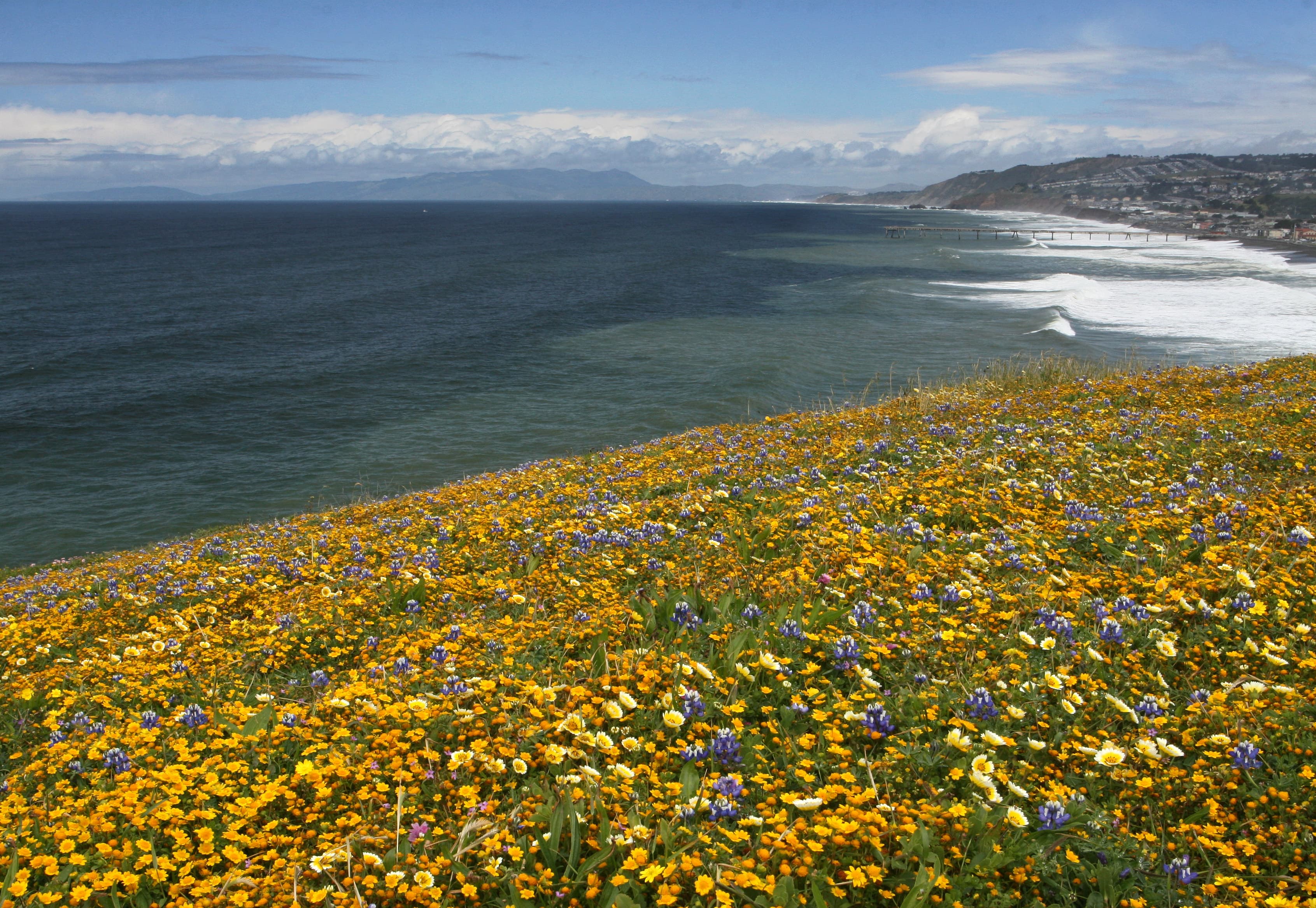
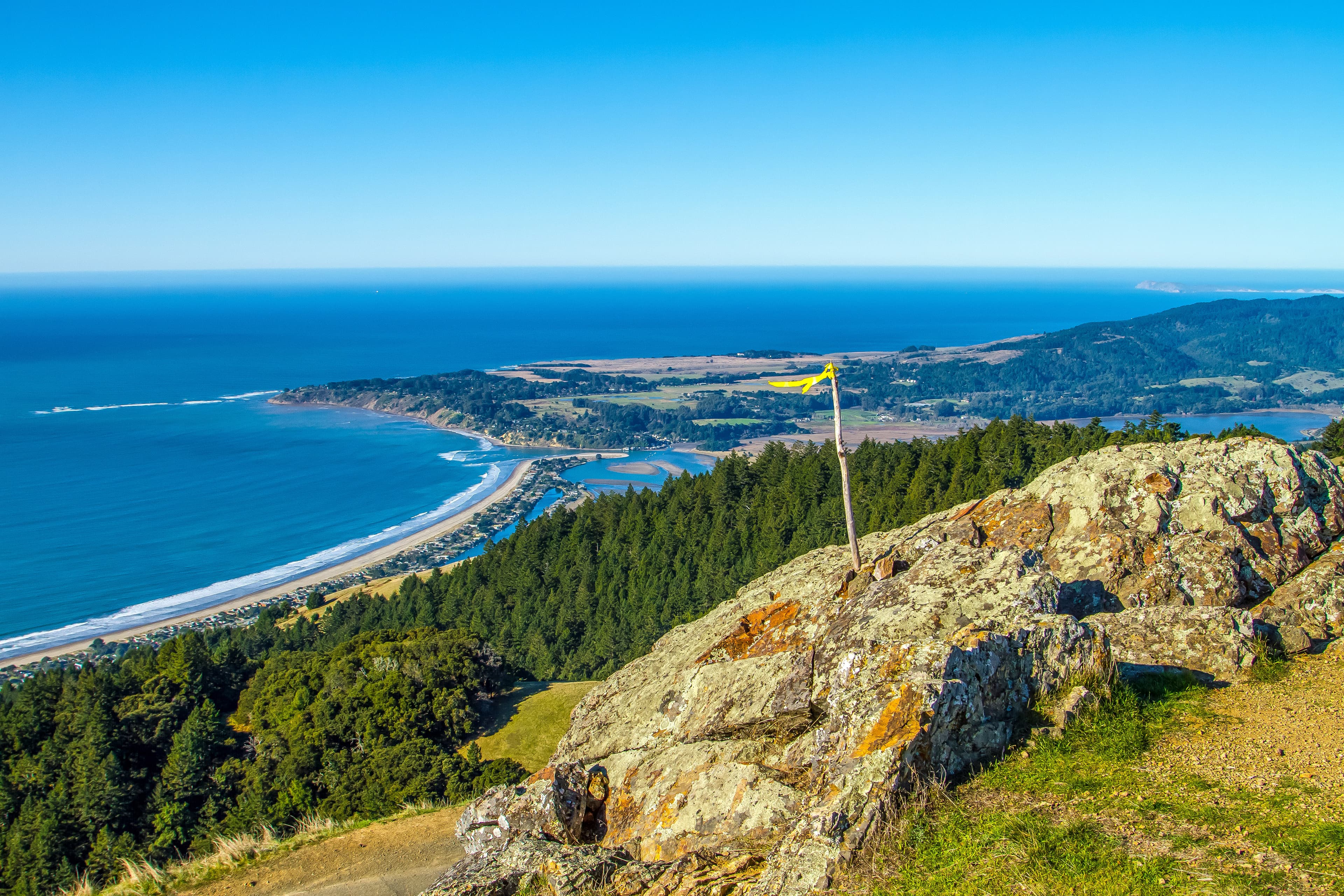
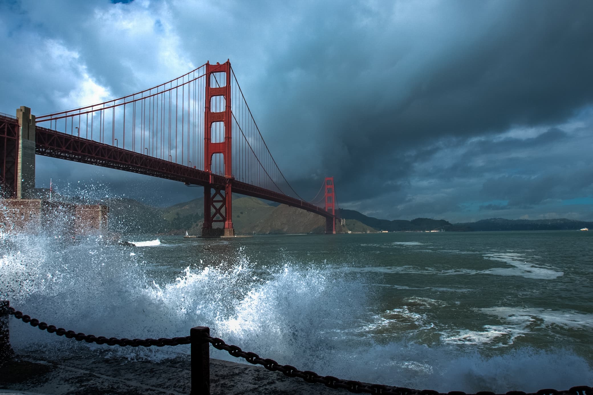

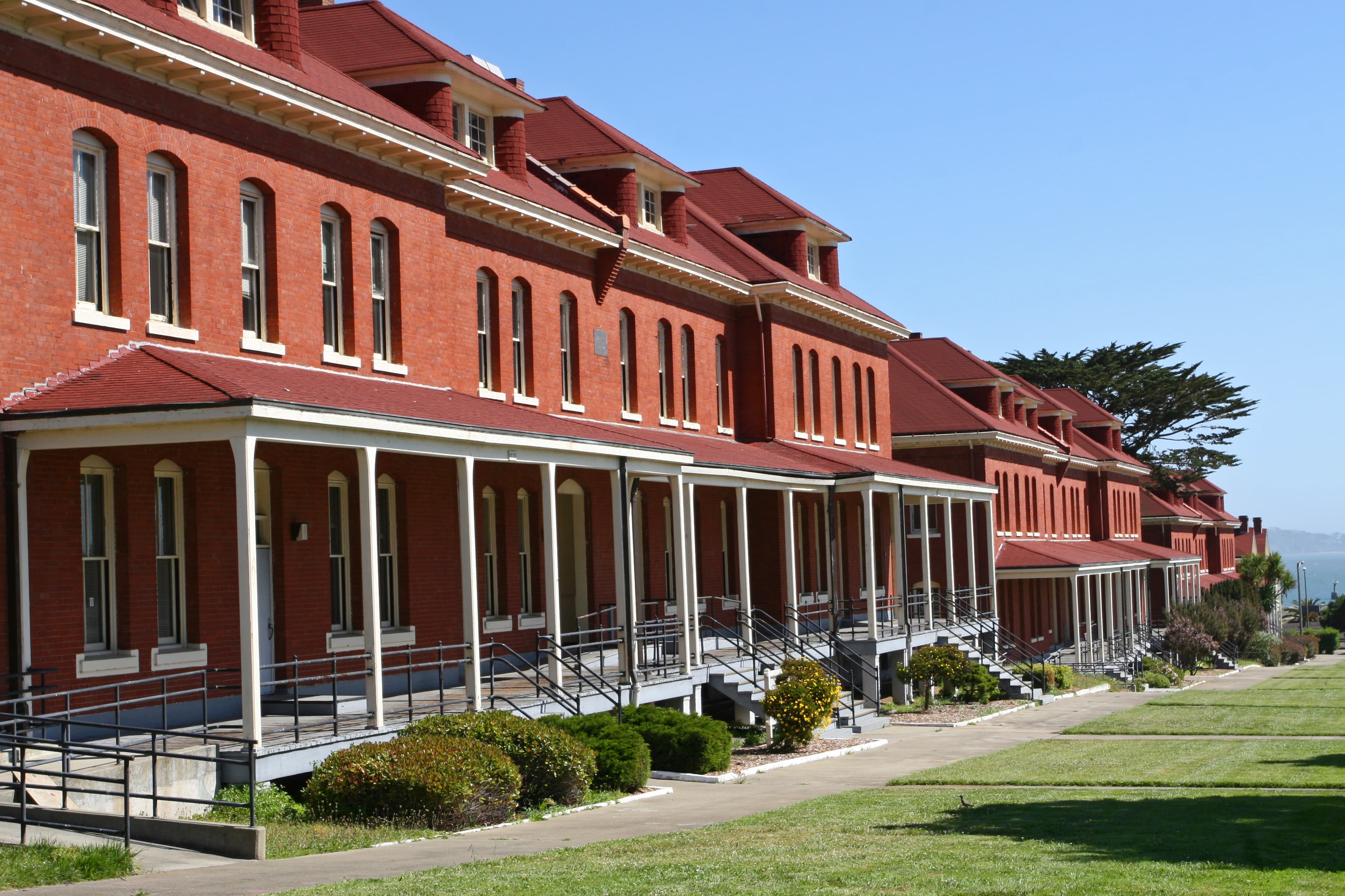
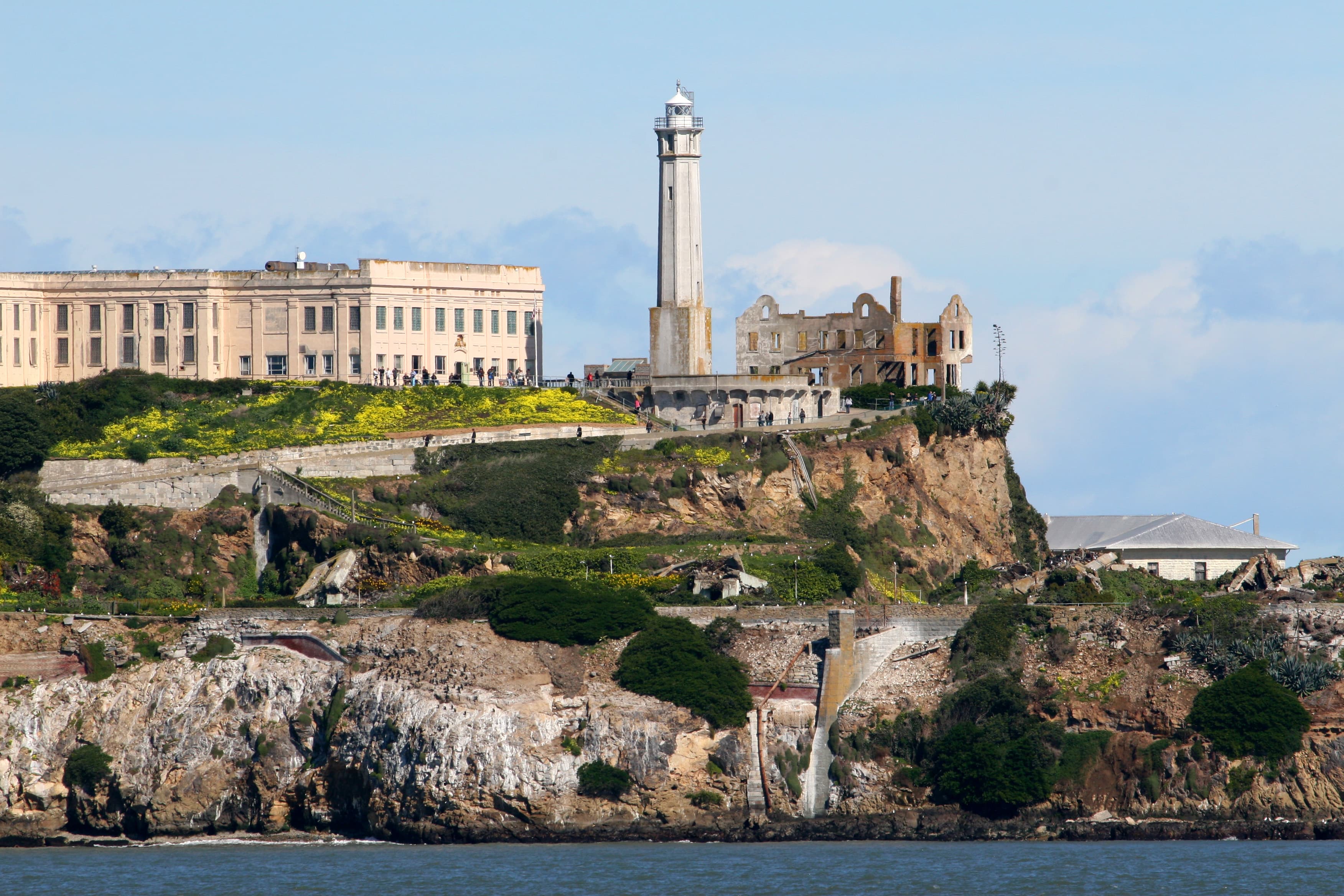
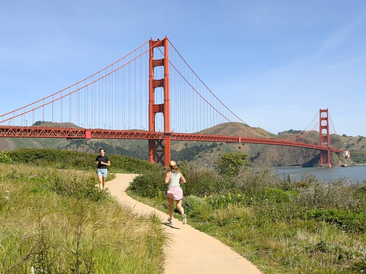
Stay near this park
No horse-friendly stays listed near Golden Gate National Recreation Area yet. Know a great barn or property? Help fellow riders by listing it.
List your propertyDirections
Golden Gate National Recreation Area has many sites that span over 60 miles of mostly coastal areas north and south of San Francisco. Park areas can be reached by Highways 1, 101 and 280 from the north and south San Francisco Bay Area, and by Highway 80 from the East Bay. To access park headquarters at Fort Mason, please use the entrance at Franklin and Bay Streets in San Francisco.
Source: nps.gov