
Caution
Measles case in Teton County confirmed by Wyoming Department of Health
The Wyoming Department of Health (WDH) has confirmed a case of measles in an unvaccinated adult from Teton County. Visitors and residents may have been exposed at several locations in Teton County, including the Colter Bay area in Grand Teton National Park. View exposure locations and guidance from the Wyoming Department of Health.
More infoCaution
Construction in the South End of the Park
Construction projects underway. Moose-Wilson Road open between Granite Entrance and Moose June 19 - Sept. 7. Expect delays of 45 minutes or longer. Death Canyon Road and Trailhead closed. Taggart Trail detour in place.
More infoPark Closure
Death Canyon Trailhead Construction Closure
Death Canyon Road and Trailhead are closed to all use. Start hikes at alternative trailheads such as Granite Canyon, LSR Preserve, and Taggart Lake.
More infoGrand Teton National Park
WY · Loop Moose
Soaring over a landscape rich with wildlife, pristine lakes, and majestic alpine vistas, the Teton Range stands as a testament to generations of stewards. For over 11,000 years, communities have thrived in the valley known as Jackson Hole, turning these mountains into more than just peaks—they embody imagination and enduring human connection.
Riding guide
Horses provided
Highlights
Grand Teton National Park delivers classic Western riding beneath one of the most dramatic mountain skylines in North…
Riding
Rideable terrain here is noted as 150-170 miles, giving riders a clearer sense of scale before they ever unload. Overnight trips require wilderness permits, and much of the park’s stock use centers around true backcountry travel rather than developed horse campgrounds. Wildlife is abundant: moose, elk, bears, and bison are part of the landscape, making preparation and awareness essential.
Rideable terrain
150-170 miles
Trailer parking
Poker Flats Horse Trailer Parking (Moose–Wilson Road) This is one of the primary trailer-accessible equestrian trailheads in the park. Why it’s the best option Dedicated horse trailer parking stalls Designed specifically for truck trailer combinations Hitching posts and loading space nearby Access to stock-permitted trails along Moose-Wilson Road The facility includes six oversized parking stalls built to accommodate truck and horse trailer combinations and even a mounting platform for accessibility. Cathedral Group Turnout Another trailhead used by equestrians. Features: Roadside turnout large enough for trailers Access to several stock-permitted trails Less infrastructure than Poker Flats Taggart Lake Trailhead A large parking area that can sometimes accommodate trailers. However: Shared with heavy hiker traffic Arriving early is important Maneuvering space can be tight during peak season
Horse regulations
Horse Use Regulations Designated Trails Only Stock (horses, mules, burros, llamas) are permitted on designated trails and approved routes. Cross-country travel is not allowed. Some trails may close seasonally due to wildlife activity, snow, or resource protection. Wilderness Permits Required (Overnight) A wilderness permit is required for all overnight backcountry trips with stock. • Trailhead quotas apply • Campsites are assigned by zone • Reservations are strongly recommended during peak season Day riding does not require a wilderness permit. Stock Camping Rules • Stock must camp in designated stock zones • Grazing is regulated and allowed only in specific areas • Certified weed-free feed is required • Highlining or approved tethering methods must be used • Camping near water sources is restricted Party Size Limits Group size limits apply and include both people and stock. Limits vary by zone and campsite designation. Bear Country Protocols Grand Teton is active grizzly and black bear habitat. • All feed and food must be stored properly • Clean camp practices are mandatory • Improper storage can result in citations Front-Country Horse Camping Front-country horse camping is limited within the park. Most stock use is wilderness-based. Riders should confirm trailer access and staging areas before arrival.
Getting here
Use 103 Headquarters, Loop Moose, Wyoming as your primary planning reference before you haul in. Poker Flats Horse Trailer Parking (Moose–Wilson Road) This is one of the primary trailer-accessible equestrian trailheads in the park. Why it’s the best option Dedicated horse trailer parking stalls Designed specifically for truck trailer combinations Hitching posts and loading space nearby Access to stock-permitted trails along Moose-Wilson Road The facility includes six oversized parking stalls built to accommodate truck and horse trailer combinations and even a mounting platform for accessibility. Cathedral Group Turnout Another trailhead used by equestrians. Features: Roadside turnout large enough for trailers Access to several stock-permitted trails Less infrastructure than Poker Flats Taggart Lake Trailhead A large parking area that can sometimes accommodate trailers. However: Shared with heavy hiker traffic Arriving early is important Maneuvering space can be tight during peak season
Planning your visit
• This is true mountain terrain. Elevation, steep climbs, rocky footing, and fast-changing weather are part of the experience. Afternoon storms are common in summer. • Wildlife encounters are likely. Grizzly bears, black bears, moose, elk, and bison all inhabit the park. Proper feed storage and wildlife awareness are essential. • Overnight stock trips require a wilderness permit. Campsites are assigned by zone, and trailhead quotas fill quickly during peak season. • Grazing is regulated and limited to specific areas. Certified weed-free feed is required. • Stock travel is restricted to designated trails and approved camping zones. Cross-country riding is not permitted. • Snow can linger at higher elevations into early summer, and some passes may not be accessible until mid-season. • Front-country horse camping is limited. Most riding here is backcountry-focused, so plan trailer staging carefully. Backcountry users are reminded that your safety is your responsibility. You must rely on your own good judgment, adequate preparation, and constant awareness. You should be in good physical condition and stick to routes that are within your ability and comfort levels. Hypothermia and frostbite can set in quickly, and are difficult to care for while in the backcountry. Traveling alone can be especially dangerous. Always give friends or family a detailed itinerary and stick to that plan.
Where to stay
Grand Teton National Park Headquarters is the main visitor-contact point tied to this destination, which is helpful when you want current conditions, maps, and stock-use updates before riding. This entry indicates both guided ride support and horse-camping potential, making Grand Teton National Park one of the more flexible federal options for riders building a fuller travel plan. For a polished trip plan, pair the ride with lodging, fuel, and resupply planning in or near Loop Moose before heading deeper into federal-land access points.
Entrance fees & passes
- $35.00
Entrance - Private Vehicle
Park entrance fee for 7 days for a private, non-commercial vehicle.
- $30.00
Entrance - Motorcycle
Valid for 7 days. Admits up to 2 private, non-commercial motorcycles with up to 4 total passengers.
- $20.00
Entrance - Per Person
Park entrance fee for 7 days for each visitor 16 years and older entering by foot, bicycle, ski, etc.
- $25.00
Commercial Entrance - Sedan
A commercial tour is defined as consisting of one or more persons traveling on an itinerary that has been packaged, priced, or sold for leisure or recreational purposes by an organization that realizes financial gain through the provision of the service. The cost is $25 + $20 per person. Pass is good for seven days as long as it's the same passenger group.
- $125.00
Commercial Entrance - Van
Based upon the total capacity of a vehicle that can carry 7-15 passengers, regardless of the actual number of passengers. A commercial tour is defined as consisting of one or more persons traveling on an itinerary that has been packaged, priced, or sold for leisure or recreational purposes by an organization that realizes financial gain through the provision of the service. Pass is good for seven days as long as it's the same passenger group.
- $200.00
Commercial Entrance - Mini-bus
Based upon the total capacity of a vehicle that can carry 16-25 passengers, regardless of the actual number of passengers. A commercial tour is defined as consisting of one or more persons traveling on an itinerary that has been packaged, priced, or sold for leisure or recreational purposes by an organization that realizes financial gain through the provision of the service. Pass is good for seven days as long as it's the same passenger group.
- $300.00
Commercial Entrance - Motor Coach
Based upon the total capacity of a vehicle that can carry 26 or more passengers, regardless of the actual number of passengers. A commercial tour is defined as consisting of one or more persons traveling on an itinerary that has been packaged, priced, or sold for leisure or recreational purposes by an organization that realizes financial gain through the provision of the service. Pass is good for seven days as long as it's the same passenger group.
- $0.00
Entrance - Education/Academic Groups
Schools or other bona fide educational institutions (accredited, officially recognized, or tax exempt for educational purposes) may request an educational fee waiver. The fee waiver will allow qualifying groups free entry into the park for educational or scientific purposes. Prior approval required before entry to park. See additional <a href="https://www.nps.gov/grte/planyourvisit/eduwaiver.htm">Education Fee Waiver</a> page.
- $100.00
Nonresident
Each non-US resident aged 16 and older visiting Grand Teton National Park must pay a $100 nonresident fee (in addition to the standard entrance fee), unless admitted with an Annual or America the Beautiful Pass. This includes nonresidents entering as part of a commercial tour group, commercial use authorization (CUA) group, or concessioner tour group.
- $70.00
Annual Entrance - Park
Pass is valid for one year through the month of purchase. Park Annual Pass provides entrance to pass holder and accompanying passengers in a single private non-commercial vehicle to Grand Teton National Park. Purchase your pass at one of Grand Teton's park entrances and permits desks at the Craig Thomas Discovery and Visitor Center and the Colter Bay Visitor Center.
Park map
Trails
No trails synced for this park yet.
Campgrounds
Colter Bay Campground
324 sites
This large campground is in a lodgepole pine forest near Colter Bay Village. While not on the shores of Jackson Lake, a short stroll leads to a spectacular view of Mount Moran and the northern Teton Range. Colter Bay Village has many facilities including a visitor center, restaurants, stores, cabins, and marina. Shower and laundry services are available for additional fee. Departing from the nearby Colter Bay Trailhead, hikers traverse forests and sagebrush meadows enjoying the Teton landscape.
Reserve a siteColter Bay RV Park
112 sites
This RV Park provides full hookups for campers in the park. It is in a lodgepole pine forest near Colter Bay Village. While not on the shores of Jackson Lake, a short stroll leads to a spectacular view of Mount Moran and the northern Teton Range. Colter Bay Village has many facilities including a visitor center, restaurants, stores, cabins, a marina. Shower and laundry services are available for additional fee.
Reserve a siteColter Bay Tent Village
66 sites
The Colter Bay Tent Village at Colter Bay Village is set amidst towering lodgepole pines just a short, picturesque stroll away from Jackson Lake. The Tent Village includes 66 tent cabins, and is open from mid-May to early-September. As with all campgrounds in the park, the Colter Bay Tent Village is very popular and tends to fill up quickly. Visitors are strongly encouraged to plan and book early.
Reserve a siteGros Ventre Campground
279 sites
The park's largest campground is in the southeast part of the park, closest to the town of Jackson. Sagebrush and grasses cover the campground as cottonwoods and blue spruce rise above. The Gros Ventre River is a short stroll away. Some sites offer views of the Grand Teton and Blacktail Butte. Wildlife including bison, moose and mule deer frequent the area.
Reserve a siteHeadwaters Campground
171 sites
This campground has facilities for both tent campers and RVs. Located within the John D. Rockefeller, Jr. Memorial Parkway, Flagg Ranch is only two miles south of Yellowstone and five miles north of Grand Teton. Wilderness surrounds the Headwaters development. The upper reaches of the Snake River flow through meadows mixed with open conifer forest. The campground offers 34 tent sites, 97 full-hookup and pull-through RV sites, and 40 Camper Cabins.
Reserve a siteJenny Lake Campground
61 sites
This small campground is a few hundred yards from the east shore of Jenny Lake. The campground straddles a glacial moraine covered with an open forest of lodgepole pine, subalpine fir and Douglas fir. Across the lake, Teewinot Mountain, Cascade Canyon and Mount St. John dominate the landscape. No trailers, campers, or generators are allowed. Vehicles cannot be over 8 feet high or 14 feet long. Maximum per site is two tents, one vehicle, and six guests for up to 7 nights.
Reserve a siteLizard Creek Campground
60 sites
This rustic campground is in a remote part of Grand Teton National Park. The campground is 11 miles south of Yellowstone and eight miles north of Colter Bay Village providing easy access to both parks. The campsites are in a spruce and fir forest on the shores of Jackson Lake. One mile across the lake is the northern portion of the Teton Range including Webb Canyon, Owl and Ranger peaks. Looking south, the expanse of the Teton Range towers over Jackson Lake.
Reserve a siteSignal Mountain Campground
81 sites
This campground is in an open lodgepole pine forest near the Signal Mountain Lodge. Some sites lie just above Jackson Lake, and other sites are a short walk from the lake. Enjoy spectacular views of Mount Moran and the northern Teton Range. The campground accepts both tents and smaller RVs (up to 30 feet total length). The developed area offers a wide variety of services and amenities including lodging, restaurants, showers, laundry, and marina. Maximum stay is 14 nights.
Reserve a site
Points of interest
A Boat's Purpose
POIAlbright View Turnout
POIFacing west, the southern Teton Range-dominated by Buck Mountain, Static Peak and Albright Peak-towers over the valley of Jackson Hole. Death Canyon slices deep into the range to the south of these peaks. To the east, Blacktail Butte seems a minor hill but it still over 1,000 feet above the highway. The lack of trees on the south facing slopes of Blacktail Butte suggest past logging by settlers. The lack of trees, however, reflects the well-drained soils and exposure to the s
AMK Ranch
POIThe AMK Ranch represents the initial phase of vacation homes in Jackson Hole. Homesteaded by John Sargent in 1890, little remains of his lodge and store that served travelers on the road to Yellowstone. All current buildings date to the W. Lewis Johnson era (1926-1936) and the Alfred Berol era (1936-1976). Both Johnson and Berol built large log vacation homes representing two distinct periods of rustic architecture as well as various other cabins and outbuildings.Berol, presi
Andrew Chambers Barn
POIAndy Chambers homesteaded on Mormon Row in 1912. By 1916, the homestead consisted of a log house and stable. In addition to homesteading, early settlers trapped to help earn a living. Andy Chambers trapped along the Snake River from 1918 to 1928. The hardships of ranching caused farmers to switch from livestock to farming and back. Chambers homestead lacked water so he dry farmed raising oats and wheat until 1927.
A Patchwork of Habitats
POIStop 4 (Jackson Lake Overlook): What effects do repeated fires have on a landscape, and why is that important for forests and wildlife? Explore our Fire History page to see a map of fires in the park over the last several decades, including the ones Diane and Ron discuss.
Approaching the Bar BC
POIThe Bar BC was one of the first dude ranches in Jackson Hole, and perhaps the most iconic. Today, it's the oldest one still standing. It was founded in 1912 by Struthers Burt and Harold Carncross, Easterners who emigrated to Wyoming. Burt and his wife, Katharine Newlin Burt, were prolific writers, so their ranch attracted a more artistic and literary set. The clientele tended to be wealthy Easterners who wanted a rustic vacation experience, away from the constraints of high s
A River Changed
POIA River's Story
POIArizona Island Picnic Area
POIArizona Island picnic area consists of just a few tables in a meadow with mature forests surrounding. Have a snack and enjoy the view when traveling to or from Yellowstone National Park.
Arizona Meadows Turnout
POIThis wet meadow turns blue violet in the early summer when blue camas blooms. Shoshone Indians harvested the bulbs once the flowers bloomed so that they did not confuse the plant with death camas that could be a very deadly mistake! The roasted bulbs formed an important part of their diet. Today, the meadow is an oasis surrounded by lodgepole pine forest.
A Slower Pace of Life
POIMany Bar BC guests of the 1920s and 30s came on vacation to Jackson Hole seeking some of the same things that visitors hope to find today-the peace of being in nature, the splendor of the mountain scenery, and the appreciation of a slower pace of life. Struthers Burt and Horace Carncross selected this site for its beautiful views, its gentle breezes that ruffle the aspen trees, and its solitude, provided by the river valley.
Aspen Knoll
POIAspen Knoll offers minimally obstructed views of Jenny Lake and the Teton Range.
A World of Fish
POIBackcountry Trip Planning
POIBar BC Overlook
POIThe Bar BC Ranch was the second dude ranch in the valley. Started by Struthers Burt and Horace Carncross in 1912, their ranch attracted Eastern Dudes who wanted to experience life in the Old West. Situated on the west bank of the Snake River, the ranch had a swimming hole from water diverted from the river. Today, the park has stabilized many of the cabins. Visitors may wander through the ranch and enjoy a glimpse of early tourist life, but for your safety please do not enter
Blacktail Butte Trailhead
POIAccess the Blacktail Butte Trailhead from US 26/89/191. The parking lot is one mile north of Moose Junction on the east side of the highway. There are no facilities at this trailhead-remember to bring water and use a restroom before you arrive. Bears may be active any place and at any time-travel in groups, make noise and carry bear spray. Hikers cannot access backcountry camping from this trailhead.
Blacktail Ponds Overlook
POIFrom this vantage point, the park's natural communities stretch out before you. The ponds and wet meadows along the Snake River are home to the wetland community. Terraces step up from the Snake River to the sagebrush community covering much of the valley floor. Islands of lodgepole pines take root on glacial moraines that ring glacial lakes. The lower slopes of the mountains support aspen and conifer forest communities.
Cascade Canyon Turnout
POIMost visitors find it challenging to reach the alpine community in the park, but the view from Cascade Canyon turnout provides a glimpse. The canyon climbs through the forest community where many conifers thrive-lodgepole pine, Engelmann spruce, Douglas fir and subalpine fir. Cascade Creek flows near the trail providing islands of wetland community. In the upper part of the canyon, the alpine community thrives-a harsh environment buried in snow most of the year.
Cathedral Group Turnout
POIThe Cathedral Group refers to three peaks: Teewinot Mountain, the Grand Teton and Mount Owen. These spires tower above Cascade Canyon casting long shadows during a summer sunset. Looking west, the Teton fault breaks the lower slope on Rockchuck Peak recording the last several large earthquakes on the fault. This turnout captures both the beauty of the Teton Range and the power of earthquakes to change the landscape.
Catholic Bay Picnic Area
POIEnjoy a picnic with views of Jackson Lake.
Cattlemans Bridge
POIOnce a crossing for cattle, this primitive spot now provides scenic views of the Snake River.
Chapel of the Sacred Heart
POIThe Chapel of the Sacred Heart is on Catholic Bay of Jackson Lake. The beautiful chapel was built in 1937 and is recognized by the Teton County Historic Preservation Board as being more than 50 years old. The Catholic Church owns the chapel and usually offers Sunday services during the summer. A picnic area is next to the chapel and offers views of Jackson Lake. "http://olmcatholic.org/about-the-parish/location/" Visit the Chapel of the Sacred Heart website to learn more.
Chapel of the Transfiguration
POIThe Chapel of the Transfiguration is next to the Menors Ferry Historic District. Maud Noble donated the land to St. John's Episcopal Church in 1925. The chapel served employees and guests from the nearby dude ranches. Today, one of the park's classic views is through the altar window framing the Grand Teton beyond. The chapel usually offers Sunday services during the summer. Visit "http://stjohnsjackson.diowy.org/Worship/chapel-of-the-transfiguration.html" to learn more.
Charles Wort's Boathouse
POIConstructed in 1932 by the National Park Service, the Charles Wort Boathouse was used for winter storage of boats by Jenny Lake boat concessioners. Boat concession operations have existed at Jenny Lake since the 1920’s. This building is now on the National Register of Historic Places.
Christian Pond Trailhead
POI<b>Location</b> : Access the Christian Pond trail from the east edge of the parking lot next to the corrals at the Jackson Lake Lodge. <br /><br /> <b>Notes</b> : There are minimal facilities and limited parking at this trailhead-remember to bring water and use a restroom before you arrive. Bears may be active any place and at any time-travel in groups, make noise and carry bear spray. Hikers cannot access backcountry camping from this trailhead.
Clark & Veda Moulton Homestead
POIIn the early 1900s, Mormon settlers established the community of Grovont along today's Mormon Row. These settlers built homesteads close together to assist with communal efforts. Clark Moulton was TA Moulton's son. He dry-land farmed on Mormon Row until the 1970s when he sold his property. Dry-land farming was unusually by this time. Most farmers used irrigation to support their crops.
Climbers Ranch
POIThe Climbers Ranch offers affordable and accessible lodging for climbers visiting the Grand Teton National Park. The accommodations are primitive co-ed dormitory-style lodging in a communal setting. Guests are housed in open, one-room cabins with other guests, sleeping on wooden bunks. Minimal facilities include bunkhouses, restrooms with showers and a covered cook shelter. The ranch opened in 1970 re-occupying the Double Diamond Dude Ranch that opened in 1924.
Colter Bay Amphitheater
POIEnjoy a variety of ranger programs offered at the Colter Bay Amphitheater. This open-air facility provides a fantastic setting for ranger-led evening programs during the summer. Special programs also occur throughout the season. Check at a visitor center for a current schedule of events.
Colter Bay Cabins
POIThe Colter Bay Cabins and Tent Cabins provide rustic accommodations in Colter Bay Village. Enjoy Jackson Lake, the marina, restaurants, corrals, grocery store and the visitor center all within a short distance. Many of the cabins were part of the Sheffield lodging operation once located below the Jackson Lake Dam. The park service and the Teton Lodge Company moved these cabins to Colter Bay in 1955.
Colter Bay Convenience Store
POIAt the corner of US 89/191/287 and the road into Colter Bay Village, is a large convenience store and gasoline station. Whether you visit the Village or continue on your way, the store and gas station offer a break along the way.
Colter Bay Corral
POIEnjoy a one or two hour horseback ride along the trails south of Colter Bay. The corrals also offer breakfast and dinner horseback or wagon rides. See and feel the park from a different perspective in truly western style! "http://www.gtlc.com/activities/horseback-riding" Visit the Grand Teton Lodge Co. website for more information.
Colter Bay General Store & Launderette
POIThe one stop place for many of your traveling needs! Buy groceries, gifts or sporting goods in the main store. Schedule an activity such as rafting, horseback riding or taking a cruise through the Grand Teton Lodge Company's activities desk. Clean your clothes for the remainder of your trip or take a hot shower if you have been camping for days. "http://www.gtlc.com/dining/the-general-store-colter-bay-village" Visit the Grand Teton Lodge Co. website for more information
Colter Bay–Hermitage Point Trailhead
POILocation: Access the Colter Bay–Hermitage Point Trailhead from Colter Bay Village. Continue ten miles northwest on the main highway from Moran Junction and turn southwest at the Colter Bay Junction. The trailhead is located just south of the visitor center and provides access to trails along the eastern edge of Jackson Lake. Destinations: Gently rolling trails lead out to Hermitage Point. Conifers shade the first part of the trail and give way to sagebrush meadow
Colter Bay Lakeshore Trail
POIAccess the paved Colter Bay Lakeshore trail northwest of the visitor center. Visitor services include a visitor center, restrooms, water, stores, restaurants, laundromat, showers, cabins, corrals, campground and an RV park. Bears may be active any place and at any time-travel in groups, make noise and carry bear spray. Backcountry camping requires a permit-pick one up at a backcountry permits office.
Colter Bay Marina & Boat Launch
POI<b>Location: </b> Colter Bay Village is located west of US 89/191/287 about 10 miles north of Moran Junction. The Village offers a complete complement of visitor services including a visitor center, lodging, restaurants, camping, RV park, groceries, laundry, showers, and more. The marina is full service with boat launch, store, fuel and boat rentals.<br /><br /> <b>Notes: </b> The ramp is paved and accesses a sheltered bay. During low water summers, the boat ramp may become inoperable since Colter Bay is an artificial body of water.<br /> <a href="http://www.gtlc.com/activities"><br />Visit the Grand Teton Lodge Co. website for more information.</a> <br />
Colter Bay Picnic Area & Swim Beach
POIColter Bay picnic area and swim beach is a wonderful place to relax along the shores of Jackson Lake. The largest picnic area in the park has facilities for nearly everyone. There are even tables on the lakeshore hidden back in the trees! Buoys mark off the swimming area to remind boats to remain out of the area. Lodgepole pines shade many of the tables, but some enjoy the sunshine and lake breeze.
Cottonwood Creek Overlook
POIA popular fall photograph captures the Jimmy Manges cabin, the park stock used by the summer trial crew, the aspens turning golden and the Grand Teton towering above. A corral is a classic buck and rail fence used by the early homesteaders. Enjoy the view of the horses and mules, but please do not feed them or touch them. Manges' cabin is thought to be the first two story cabin in the valley. The turnout also includes the Cottonwood Creek Picnic area and a vault toilet.
Cottonwood Creek Picnic Area
POICottonwood Creek picnic area is the first picnic area north of the Moose Entrance Gate. Five tables cluster near cottonwood trees above the creek. Across the Teton Park Road is a fenced meadow where the park houses its pack animals during the summer when they are not in the backcountry. Behind the meadow is the James "Jimmy" Manges cabin thought to be the first two-story cabin in the valley. During fall the aspens that grow on the moraine above the cabin.
Cunningham Cabin
POIJ. Pierce Cunningham established the Bar Flying U Ranch in the 1880s. Today, his "dogtrot" style cabin is one of the few remaining homestead cabins in Jackson Hole. This style cabin was common in eastern states, consisting of two small cabins joined with an open, covered breezeway. Cunningham chose this land because silt sediments deposited from an ancient glacial formed soil that retained moisture and provided better nutrients for raising lush grasses and forbs.
Deadmans Bar
POIDeadmans Bar is one of the major put-in and take-out locations for the Snake River within the park.
Death Canyon Trailhead
POILocation: Access the Death Canyon trailhead from the Moose-Wilson Road. Travel three miles south from Moose and turn north on a spur road. The last mile leading to the trailhead is a narrow, rough dirt road recommended for high-clearance vehicles. Notes: Facilities include a small dirt parking lot, a vault toilet and a seasonally-occupied patrol cabin. Remember to bring water with you. Bears may be active any place and at any time-travel in groups, make noise and carry bear
Discovery Spot: Black Bear
POIWelcome to the Discovery Trail. As you travel down this path, use all of your senses to detect the plants and animals that make this place their home. Observe all that you discover, inducing clues to animal presence such as tracks and burrows. Linger at each of the benches along the path and try to unravel the stories of plant and animal interconnections.
Discovery Spot: Gopher/Marten
POIWelcome to the Discovery Trail. As you travel down this path, use all of your senses to detect the plants and animals that make this place their home. Observe all that you discover, inducing clues to animal presence such as tracks and burrows. Linger at each of the benches along the path and try to unravel the stories of plant and animal interconnections.
Discovery Spot: Moose
POIWelcome to the Discovery Trail. As you travel down this path, use all of your senses to detect the plants and animals that make this place their home. Observe all that you discover, inducing clues to animal presence such as tracks and burrows. Linger at each of the benches along the path and try to unravel the stories of plant and animal interconnections.
Discovery Spot: River Survival
POIDiscovery Spot: Wild Connections
POIDiscover the interconnectedness of plants and animals. How do plants affect wildlife and how does wildlife affect plants? And what does that have to do with a river?
Discovery Spot: Wildlife Walk
POIDiscovery Spot: Woodpecker/Beetle
POIWelcome to the Discovery Trail. As you travel down this path, use all of your senses to detect the plants and animals that make this place their home. Observe all that you discover, inducing clues to animal presence such as tracks and burrows. Linger at each of the benches along the path and try to unravel the stories of plant and animal interconnections.
Ditch Creek Pathway Access
POIThe pathway section from Moose Junction to the Antelope Flats Road is the most recent addition to the multi-use pathway system. This section allows bicyclists to complete a loop on the secondary roads from Antelope Flats to Kelly and return to Gros Ventre Junction without riding on the main highway. There is parking available at the small lot on the north end Blacktail Butte just south of Antelope Flats Road. ADA compliant.
Dornans
POIThe Dornans complex has a long history of providing services to park visitors. This family owned business is actually a park inholding dating back to the 1920s. During summer, visitors may enjoy two restaurants, a wine shoppe, grocery and deli, gasoline, ATM, coffee stand, ice cream cart, gifts, lodging, and adventure sports equipment rental and sales.
Dornans Pathway Access
POILeave from Dornans in Moose to access the multi-use pathway. A short spur connects to the main pathway allowing non-motorized users access to the paved trail system that extends from Jackson to Moose and on to Jenny Lake. Hop on your bike or pull on your shoes to enjoy the park at a slower pace. ADA compliant.
East Boundary Turnout
POIApproaching Grand Teton National Park from Togwotee Pass and Dubois brings visitors along the Buffalo Fork River to the East Gate. On a clear day, the length of the Teton Range stretches to the south. Study the orientation map and learn a bit about your options to explore the park.
Elk Ranch Flats Turnout
POIElk Ranch flats is the park's last operating irrigated cattle and hay ranch. In the early 1900s, David (Si) Ferrin consolidated several homesteads to establish one of the valley's largest cattle ranches. After an agricultural depression in the 1920s, Ferrin sold his land to the Snake River Land Company. These lands became part of the park in 1950. Today, livestock, bison, elk and pronghorn graze in the fields and a few cabins remain.
Exum Mountain Guides
POIGlen Exum first climbed the Grand Teton with Paul Petzoldt in 1929. Together they established the Petzoldt-Exum School of American Mountaineering. They believed that clients should learn the skills necessary to participate actively while climbing to the summits of the high Teton peaks. Today, skilled guides train clients of all ages to experience the mountains. "http://exumguides.com/">Visit the Exum website for more information.
Fire Exclusion
POIStop 2 (north of Colter Bay Visitor Center): Learn about how Europeans managed fire when they arrived in this area, and how the government shaped fire management in the early 1900s.
Fire Just Is
POIStop 8 (Flagg Canyon Picnic Area): "Fire isn't good or bad-it just is." Fire managers from Grand Teton National Park and Bridger-Teton National Forest reflect on the progress of the last 50 years, and what we need to think about for the future.
Fires and Forest Ecology
POIStop 1 (Colter Bay Visitor Center): Learn about the role fire plays in our forests and its importance to this ecosystem.
First Park Entrance Station
POIThis building was once the entrance station that welcomed visitors to Grand Teton National Park. New buildings replaced this historic kiosk and it was moved here to continue to serve its original purpose—welcoming visitors.
First Park Restroom
POIThis comfort station was one of the first buildings constructed by the new Grand Teton National Park after 1929.
Fishing Platforms
POIFlagg Canyon Launch
POI<b>Location:</b> Access from US 89/191/287 just south of the Yellowstone South Gate. A steep dirt road leads from the picnic area down to the boat ramp. The ramp is a log slide that provides access to the river bottom. Except during high water, visitors will need to carry their boat to the water.<br /><br /> <b>Notes:</b> There is a small picnic area above the launch with a vault toilet. The Flagg Canyon trail continues south from the boat launch along the rim of the canyon.
Flagg Canyon Picnic Area
POIFlagg Canyon picnic area is the first picnic area south of Yellowstone National Park. This location has only a few tables and a vault toilet, but it also provides access to the Flagg Canyon trail and a boat launch for the Snake River. Lodgepole pine trees provide shade, and even though the main highway is nearby the site feels secluded.
Flagg Canyon Trailhead
POI<b>Location</b> : Access the Flagg Canyon trail from the picnic area just south of the Yellowstone Entrance. Walk down a steep road from the picnic area to the boat launch and continue south.<br /><br /> <b>Notes</b> : Visitor services include a small picnic area, vault toilet, boat launch and limited parking-remember to bring water. Bears may be active any place and at any time-travel in groups, make noise and carry bear spray. Hikers cannot access backcountry camping from this trailhead.
Flagg Ranch Information Station
POIThe Flagg Ranch Information Station is in the John D. Rockefeller, Jr. Memorial Parkway located between Grand Teton and Yellowstone national parks. For visitors traveling south from Yellowstone, Flagg Ranch is the first stop for trip planning information. <br /><br />From the parking area, strike out to hike the Pole Creek loop or explore the Snake River Canyon. Visitors with high-clearance vehicles may enjoy the drive west along the Grassy Lake Road toward Ashton Idaho.
Flagg Ranch Launch
POI<b>Location:</b> Access from US 89/191/287 south of Flagg Ranch where the highway crosses the Snake River. The launch area is a gravel road, parking lot and ramp.<br /><br /> <b>Notes:</b> There are minimal facilities at this boat launch-remember to bring water with you.
Flagg Ranch Trailhead
POILocation: Access the Flagg Ranch trail from the Flagg Ranch Information Station. Head west from the information station cabin, through the parking lot, and look for a break in the trees. Notes: Visitor services include an information center, restrooms, water, stores, restaurants, showers, lodge, cabins, corrals, campground and RV park. Bears may be active any place and at any time-travel in groups, make noise and carry bear spray. Backcountry camping requires a permit-pick
Float Trip Parking
POIA float trip down the Snake River is one of the most immersive ways to experience Grand Teton National Park. Both commercial and recreational boaters should use this parking lot for vehicles. Vehicles with boat trailers should use the marked spots near the take-out.
Glacier View Turnout
POIAcross the valley, the Teton Range rises abruptly from the valley with no foothills to obscure your view. Glaciers lie sheltered on the northeastern flanks of the highest peaks including the Middle Teton and Teton glaciers. Climate change is causing these glaciers to retreat. Smaller glaciers are retreating more rapidly than larger glaciers. Along the valley floor, conifer and cottonwood trees line the Snake River as it cuts through the sagebrush flats.
Glade Creek Trailhead
POILocation: Access the Glade Creek Trailhead from the Grassy Lake Road 4.5 miles west of Flagg Ranch about 3/4 of a mile after you enter the area burned during the 1988 Greater Yellowstone fires. Notes: There are no facilities at this trailhead-remember to bring water and use a restroom before you arrive. Bears may be active any place and at any time-travel in groups, make noise and carry bear spray. Backcountry camping requires a permit.
Grand Teton
POIThe iconic Grand Teton at 13,775' towers over Jackson Hole and Grand Teton National Park. The jagged summit-formed of 2.7 billion year-old gneiss and 2.5 billion year-old granite-towers over the rest of the range. The Teton fault began lifting the range skyward less than ten million years ago making this one of the youngest mountain ranges in the world. Ice age glaciers sculpted arêtes, ridges and canyons to complete the picture.
Grand Teton Medical Clinic
POIThe medical clinic near the Jackson Lake Lodge offers emergency and urgent care for visitors and residents. They provide x-ray, pharmacy and lab services offered by board-certified providers. The clinic is open during the summer season. No appointment necessary.
Grand Teton North Boundary Turnout
POIThe top of Huckleberry Hill marks the boundary between Grand Teton National Park and the John D. Rockefeller, Jr. Memorial Parkway. The US Forest Service transferred the parkway land to the National Park Service in 1972 in honor of Rockefeller's many contributions. Today Grand Teton National Park manages the 24,000 acres that connects Grand Teton to Yellowstone.Take a picture at the classic wooden sign marking this boundary. Learn about the exploring the park from the wayside
Grandview Point Trailhead
POILocation: Access the Grandview Point Trailhead from the main highway. Travel two miles north from Jackson Lake Junction, turn east on an unmarked dirt road and continue one mile to the end. Notes: These trails are lightly traveled and pass through prime bear habitat. There are no facilities at this trailhead-remember to bring water and use a restroom before you arrive. Bears may be active any place and at any time-travel in groups, make noise and carry bear spray.
Granite Canyon Entrance Station
POITravel 1.5 miles north of Teton Village on the Moose-Wilson Road to access the southern part of Grand Teton National Park. The road crosses through critical wildlife habitat as it winds through sagebrush, forest and wetland communities. Only stop in designated pullouts and maintain a safe distance from all animals. This road becomes congested during peak season.Special restrictions and considerations apply. The park prohibits RVs over 23.3 feet long and trailers. From Novem
Granite Canyon Trailhead
POILocation: Access the Granite Canyon Trailhead one mile north of the Granite Entrance Station on the Moose-Wilson Road. The road is not accessible to vehicles over 23.3 feet long or trailers. The dirt parking lot is small so arrive early in the day to secure your space. Notes: There are no facilities at this trailhead-remember to bring water and use the restroom before you arrive. Bears may be active any place and at any time-travel in groups, make noise and carry bear spra
Grassy Lake Road Campsites
POILocation: The Grassy Lake Road connects Flagg Ranch to Ashton, ID. Follow the road from the John D. Rockefeller, Jr. Memorial Parkway into adjoining US Forest Service land. Please use caution on this dirt road. High clearance vehicles are recommended, and the road is closed for grizzly bear migration until June 1. Sections of the road may open later depending on conditions. Along the road are eight camp areas including 20 campsites. These campsites may not open Summer 2020.
Grassy Lake Road Campsites
POIGros Ventre Amphitheater
POIEnjoy an program at the Gros Ventre Amphitheater. This open-air facility provides a fantastic setting for ranger-led evening programs during the summer. Special programs also occur throughout the season. Check at a visitor center for a current schedule of events.
Gros Ventre Pathway Hub
POIThe Gros Ventre Pathway Hub is one of many locations where you can start or end your bike ride along the multi-use pathway. Enjoy over 20 miles of paved pathway in Grand Teton.
Headwaters Lodge
POIThe Headwaters Lodge is located in the John D. Rockefeller, Jr. Memorial Parkway that connects Grand Teton and Yellowstone national parks. Enjoy comfortable cabins or rustic camper cabins. The main building also houses a dining room, a gift shop and a convenience store. Other services include a campground, gas station, horseback rides and a nearby visitor information station.<br /><br /> <a href="http://www.gtlc.com/lodges/headwaters-lodge-at-flagg-ranch">For more information visit the Headwaters Lodge website.</a>
Hidden Falls
POIHidden Falls engages all your senses - the 230 foot (70 m) cascade fills your view, the thundering water drowns out speech, the spray chills your skin, and the air smells crisp and clean. As the name suggests, these falls are truly hidden. You will not seem them until you are less than 100 yards from the viewpoint! During peak run-off, the water ricochets off the outcrops, but even late in the summer, the water is still forceful.
Historic Comfort Station
POIDuring the Great Depression, the Civilian Conservation Corps constructed this comfort station for the Jenny Lake Campground. After sitting idle for more than 30 years, the building now serves campers once again.
Huck Fire Turnout
POIFire is part of natural western landscapes. Fire helps regenerate the ecosystem by clearing dense underbrush and opening up the forest to sunlight. The Huck Fire was one of many fires during the summer of 1988 that burned across Yellowstone and the John D. Rockefeller, Jr. Memorial Parkway. Today, notice younger, smaller lodgepole pines and subalpine fir interspersed with older, taller trees.
Inspiration Point
POIThe view from Inspiration Point draws thousands of visitors each year. Jenny Lake lies below to the east and the Teton Range towers to the west. On a clear day, you can see the Yellowstone Plateau to the north, the Absaroka and Gros Ventre ranges to the east, and the Snake River Range to the south. You feel as though you are high in the mountains, yet you are only 420 feet above the lake below. You are standing at the mouth of Cascade Canyon.
Irrigation Ditch
POIThe first homesteaders who settled on Mormon Row were dry-land farmers. They relied on snowmelt soaking into the soil and rainfall during the growing season to support their crops. The catastrophic flood of 1927 damaged many of the irrigation works from the Gros Ventre River. Around the same time, the Kelly Warm Springs began to produce more water. Homesteaders cut a ditch from the springs west to irrigate their dry lands.
Jackson Hole Airport
POIThe Jackson Hole Airport is the only commercial airport within a national park in the country. As such, flying into the airport is an awe-inspiring introduction to the valley and park. Establishing the airport took many years and numerous locations were considered prior to settling on today's location. The airport began commercial operation in 1946 prior to park expansion and is now the busiest airport in Wyoming.
Jackson Hole Mountain Resort Aerial Tram Trailhead
POILocation: Access the trailhead from the top of the aerial tram. Teton Village is about one mile south of Grand Teton National Park on the Moose-Wilson Road (WY 390). Notes: Visitor services are extensive in Teton Village including motels, restaurants, shops and activities. Bears may be active any place and at any time-travel in groups, make noise and carry bear spray. Backcountry camping requires a permit-pick one up at a backcountry permits office. For more information ab
Jackson Lake Dam Boat Launch
POIInformational panels on river safety are located at the launch area for you and your group to review. You will find resources like a map, things to do before going on the water, things to bring, and things to know.
Jackson Lake Dam Overlook
POIJackson Lake is a 400 foot-deep natural lake with a dam added on top. The original log-crib dam constructed in 1906-07, failed in 1910. In 1916, the Bureau of Reclamation completed a concrete dam raising the pool level by 39 feet. The increased water level flooded the surrounding forest, drowning many trees. Young men from the Civilian Conservation Corps helped to clear the shores of Jackson Lake and burn the slash piles during the Great Depression.
Jackson Lake Dam Parking and Picnic Area
POIJackson Lake Dam Parking and Picnic area is below the dam on the north side of the Snake River. Large cottonwood trees shade several picnic tables. Minimal facilities include a vault toilet and trash receptacles. A short walk leads to the outwash from the dam. Many visitors launch non-motorized boats to float the river and fish in the turbulent outflow.
Jackson Lake Lodge
POIThe historic Jackson Lake Lodge is one of two National Historic Landmarks in the park. With its concrete textured walls, this building was the first modern lodge built in a national park. Opening in 1955, the Rockefeller Lodge, as it was once known, inspires visitors with a wall of windows over-looking Willow Flats, Jackson Lake and the Teton Range beyond.Today, the great room is a place to relax and enjoy the view or escape from a rainy day.
Jackson Lake Lodge Backdeck
POIThe Jackson Lake Lodge gained recognition as a National Historic Landmark in 2003. The building broke with the National Park Service tradition of rustic log construction. Instead, designers constructed a "modern" lodge of concrete and steel that blended into the landscape. The great room with its wall of windows offers sweeping views across the valley toward the northern Teton Range. Step outside to the back deck and engage all your senses.
Jackson Lake Lodge Corral
POIEnjoy a one or two hour horseback ride along the trails east of Jackson Lake Lodge. See and feel the park from a different perspective in truly western style! "http://www.gtlc.com/activities/horseback-riding" For more information visit the horseback activity page for the Grand Teton Lodge Co.
Jackson Lake Overlook
POIThe north section of US 89/191/287 hugs the eastern shore of Jackson Lake. Across the lake, notice the patchwork of burned forest. The 1974 Waterfalls Canyon fire was one of the first naturally ignited wildland fires allowed to burn. Today, wildland fire management is a critical part of park policy attempting to preserve all aspects of the park's ecosystem. The landscape we enjoy seems to change only with the seasons, but powerful geologic forces continue to shape the earth.
Jackson Point Overlook
POISignal Mountain rises almost 1,000 feet above the valley making it the highest point visitors can drive to in the park. On a clear day you may see several mountain ranges: Teton, Gros Ventre, Absaroka and Yellowstone Plateau. The valley floor records the passage of Pleistocene Ice Age glaciers that scoured the valley and carved lakes. The dimples in the landscape below you are potholes also known as kettles.
Jenny Lake Boat Launch
POIExperience Jenny Lake from a new perspective--on the water! Launch your motorized and non-motorized (motor maximum: 10 horsepower) crafts from this boat launch. There are not facilities. Please review all boating regulations for the park prior to launch. Make sure you have all required permits.
Jenny Lake Climbing Exhibit
POISummit the Teton mountain peaks at this climbing exhibit. Learn about women alpinists, touch multiple elevation benchmarks, and scope out the different peaks.
Jenny Lake Donor Area
POIAt this donor area, read the names of the supporters of the Grand Teton National Park Foundation and a brief history on the longstanding relationship between the park and its partners.
Jenny Lake East Shore Boat Dock
POIVisitors began to flock to the shores of Jenny Lake even before the establishment of Grand Teton National Park. Early entrepreneurs started a boating business to shuttle hikers across the lake to the mouth of Cascade Canyon. Today, Jenny Lake Boating offers shuttle services to sightseers and hikers, and scenic cruises to those who wish to enjoy a quiet trip on the lake.
Jenny Lake Entrance Sign
POIWelcome to Jenny Lake.
Jenny Lake Gateway to Wilderness
POIInterpretive signs introduce the idea of "wilderness". As you head to the western side of Jenny Lake, the developed front country area slips away into an undeveloped, primitive world.
Jenny Lake Lodge
POIThe Jenny Lake Lodge was once known as the Danny Ranch. Today, the lodge exemplifies rustic elegance. Individual and duplex cabins are set back in the trees behind a small lodge. Guest amenities include breakfast, dinner, horseback riding and bicycling. Meals are available to all visitors. Although the lodge is near Jenny Lake, the lake itself is hidden from view. <br /> <a href="http://www.gtlc.com/lodges/jenny-lake-lodge">For more information visit the Jenny Lake Lodge website.</a>
Jenny Lake Orientation
POIJenny Lake Overlook
POIJenny Lake is the most popular destination in the park. The view across the lake toward Cascade Canyon is stunning. Pleistocene glaciers carved the U-shaped canyon and the basin filled by the lake today. Many people have visited in the past-American Indians, fur trappers, survey expeditions, dude ranchers, car campers and adventurers. The lake is named for a Shoshone Indian woman named Jenny who married a British fur trapper named Richard "Beaver Dick" Leigh.
Jenny Lake & Park Orientation
POIPlan your Jenny Lake and park experience by reading these informational signs.
Jenny Lake Pathway Hub
POIThe Jenny Lake Pathway Hub is the most northern point of the multi-use pathway. Read our informational sign about biking and use the bike rack to store your bike while you explore the Jenny Lake area.
Jenny Lake Plaza
POIDive deeper into the history of Grand Teton National Park. Interpretive signs introduce topics like the Greater Yellowstone Ecosystem, grizzly bear research, geologic forces and features, glaciers, and the Hayden Survey. A large bronze tactile relief map will help orient you in relation to where you are in the park. Different peaks, canyons, lakes, falls, and other park features are labeled throughout the map.
Jenny Lake Restrooms
POIThere are two large restroom facilities in the Jenny Lake Plaza area. Each facility has a family restroom in the center. There is also a water fountain and water filling station.
Jenny Lake South Restroom
POIRestroom at the southern end of the Jenny Lake Area. Conveniently located along the pathway to the Jenny Lake Boat Dock
Jenny Lake Store
POIThe Jenny Lake Store offers firewood, ice, clothing, souvenirs, and snacks and is conveniently located near the Jenny Lake Visitor Center and campground.
Jenny Lake Trailhead
POILocation: South Jenny Lake is eight miles north on the Teton Park Road from Moose Junction. The trailhead is located next to the east boat dock and provides access to the core of the Teton backcountry. Notes: Visitor services include a visitor center, restrooms, water, store, ranger station, shuttle boat, boat rentals and campground. The parking lot is often full from 10 am-4 pm. Arrive early to secure your space. Bears may be active any place and at any time-travel in gro
Jenny Lake West Shore Boat Dock
POIThe west shore boat dock is where the shuttle boat drops off passengers who boarded on the eastern side. You can also board the shuttle boat here for a one-way trip back to the eastern side. You can pay for the one-way trip at the East Shore Boat Dock.
John & Bartha Moulton Barn
POIThe John Moulton barn is an iconic structure in Jackson Hole. The sunrise view with the barn in the foreground and the Teton Range as the backdrop is one of the most photographed structures in the valley. The remaining fences and corrals add character to the view. John Moulton and his brother Thomas Alva (T.A.) homesteaded on Mormon Row in 1908. John dry farmed grain until the state built irrigation ditches to the Mormon Row area in the late 1920s.
John & Bartha Moulton Residence
POIThe "Pink House" as it is locally known was once the residence of John and Bertha Moulton. For the first 17 years of their marriage, the couple lived in a small log cabin. Around 1934, they built the pink stucco house. John and his brother T.A. homesteaded on Mormon Row around 1908. Their iconic homesteads provide a glimpse into communal life in Grovont in the early 1900s.
John D. Rockefeller, Jr. Memorial Parkway North Turnout
POIThe north boundary of the John D. Rockefeller, Jr. Memorial Parkway abuts Yellowstone National Park. The headwaters of the adjacent Snake River are east along the Yellowstone, Teton Wilderness Boundary. Lodgepole pines regenerated after the 1988 Yellowstone fires cover the landscape. The parkway is the northern-most parcel of land managed by Grand Teton National Park. Stop at the wayside to learn about activities in the park, the Rockefeller Legacy and a map.
John D. Rockefeller, Jr. Memorial Parkway South Turnout
POIThe top of Huckleberry Hill marks the boundary between Grand Teton National Park and the John D. Rockefeller, Jr. Memorial Parkway. The US Forest Service transferred the parkway land to the National Park Service in 1972 in honor of Rockefeller's many contributions. Today Grand Teton National Park manages the 24,000 acres that connects Grand Teton to Yellowstone.Take a picture at the classic wooden sign marking this boundary.
Journeying to the Bar BC
POIEarly visitors arrived at the Bar BC after a several-day journey by train and wagon. Because the trip took so long and was so expensive, visitors tended to stay at dude ranches for weeks, if not the entire summer. Often, the same families would return year after year. However, with the growing popularity of the automobile in the 1930s and 40s and the advent of the "tin can dude" or automobile tourist, more people wanted to stay for just a few days.
Kelly Post Office
POIThe Kelly Post Office in the southeastern part of the park offers all USPS services, but with limited hours.
Kelly Warm Spring
POIThe spring averages only 80 degrees Fahrenheit, cool compared to hot springs. Families often picnic on the grassy meadow surrounding the pool. Entering the warm spring is not recommended. In spring, bison and elk linger by the pool since the grass greens up early. Over the years, people have released their unwanted tropical fish into the pool disrupting the ecosystem. Some of these non-native species thrive and out-compete native species. Please do not release non-native fish
Lake Creek Overlook
POILake Creek flows south from Phelps Lake as a clear mountain stream. Early season the stream is high and cold with snowmelt. As summer days warm, the flow diminishes but is still shockingly cold! Visitors of all abilities may reach this picturesque spot.You may notice the brownish yellow or white mats clinging to the rocks in the water. This algae bloom, called "didymo" or "rock snot," has spread quickly in the Lake Creek drainage as visitors inadvertently transported the alga
Lakeview Picnic Area
POILakeview picnic area is one of the larger ones in the northern part of the park. Most of the tables are shaded by lodgepole pines. Some sites offer panoramic views of the northern Teton Range across Jackson Lake. Facilities include a vault toilet, trash and recycling bins.
Laurance S. Rockefeller Preserve Trailhead
POILocation: Access the Laurance S. Rockefeller Preserve Trailhead from the Moose-Wilson Road. The Preserve provides access to the last piece of land donated by the Rockefeller family to Grand Teton National Park. This area is not accessible to vehicles over 23.3 feet long or trailers. The 50 vehicle parking lot is often full from 9 am-4 pm, and parking is prohibited along the Moose-Wilson Road. Arrive early to secure your space. Notes: The Preserve Center offers visitor info
Leeks Marina & Boat Launch
POILocation: Access the marina about one-mile north of Colter Bay Village west of US 89/191/287. Follow the paved road to the east shore of Jackson Lake where you will find the marina and Leeks Pizzeria. Notes: Leeks Marina services private boats. The marina runs shuttle boat from the small dock to boats moored on the lake. There are no boat rentals at this location.
Leeks Pizzeria
POILeeks Pizzeria is known for its expansive deck with views of Jackson Lake and the Teton Range and its pizza! Enjoy dinner or a snack on the deck. Choose from traditional pizzas or local favorites. After dinner grab a scoop of ice cream for dessert.<br /> <a href="http://www.signalmountainlodge.com/signal-mountain-dining">Please visit the Signal Mountain website for more information.</a>
Leigh Lake Trailhead
POILocation: Access the Leigh Lake Trailhead from the Jenny Lake scenic loop drive. Turn west at North Jenny Lake Junction, bend north where the road splits and choose from a series of parking lots. The first parking lot is the String Lake Trailhead. The second lot serves as a boat launch for String Lake. The third lot provides access to the Leigh Lake Trailhead and the String Lake Picnic Area. Notes: This area is popular for picnicking and water sports. Parking is often conge
Looking Forward
POIStop 7 (Grassy Lake Road): How is climate change affecting fire behavior, and how will that change forests in Greater Yellowstone? Hear what scientists have to say.
Lower Willow Flats Overlook
POIThe Willow Flats area offers excellent wildlife and scenic viewing opportunities. Elk rear their calves in the protection of the willow-shaded meadows below. Grizzly bears forage on grubs and bulbs and hunt elk calves. Sandhill cranes frequent the open grasslands.The view across Jackson Lake toward the Teton Range highlights the dramatic rise of the mountains above the valley floor.
Lucas-Fabian Homestead
POIGeraldine Lucas bucked tradition by leaving her husband, returning to college as a single mother, and teaching school. Upon retirement in 1913, she joined her siblings in Jackson Hole and homesteaded south of Jenny Lake. In 1924, she met 16-year-old Paul Petzoldt as he set out for his first climb of the Grand Teton. Later that year, Petzoldt guided Lucas, who at age 58 became the second woman to reach the summit of the Grand Teton.Today, eleven of the old homestead buildings
Lunch Tree Hill
POI<b>Location:</b> The short walk to the top of Lunch Tree Hill begins behind the Jackson Lake Lodge from the northwest corner of the back deck.<br /> <b>Notes:</b> The Jackson Lake Lodge is a full-service lodge with restaurants, shops and accommodations. This historic building features a great room with a wall of windows looking out over Willow Flats and Jackson Lake with the northern Teton Range towering in the distance.
Lupine Meadows Trailhead
POILocation: Access the Lupine Meadows Trailhead from the Teton Park Road one mile south of South Jenny Lake Junction. Turn west and follow a gravel road for about one and a half miles. Notes: Visitor services include gravel parking lot, a vault toilet, bear food storage boxes and a trailhead sign. Remember to bring water with you. Bears may be active any place and at any time-travel in groups, make noise and carry bear spray. Backcountry camping requires a permit-pick one up
Maud Noble Cabin
POIMaud Noble's cabin provides a glimpse into the past. Learn about early homesteaders, dude ranchers, and the historical importance of this central meeting place in the Jackson Hole valley.
Menors Ferry District
POIThis homestead once belonged to William D. (Bill) Menor. He moved from Montana to the valley in 1894 and took up this homestead on the banks of the Snake River. His ferry became a vital crossing point for the early Jackson Hole settlers. In addition to the whitewashed cabin, general store, storage shed and smokehouse, the Menor homestead once included barns, a blacksmith shop, a garden, and irrigated hayfields and pastures. Take a self-guided walk through the area to learn so
Menors Ferry - East Side
POIWest of Dornans, Holiday Menor homesteaded along the east bank of the Snake River in 1908. He moved here to join his brother Bill who homesteaded across the river and operated a ferry and general store. Under the shed next to the river is one of the pontoons from the ferry-the last remaining part of the original boat. Holiday operated a limekiln burning limestone at high temperatures to produce pure lime. Settlers used lime to chink cabins and to whitewash their buildings.
Menors General Store
POIMenors General Store is one wing of Bill Menor's original homestead cabin. The cabin was constructed in three distinct phases. Menor built the west wing in 1894 (the Tetons are to the west). Around 1895, he added the central section. The larger east wing was built around 1905. The west wing served as a bedroom and sitting room while the central section housed the kitchen and pantry. Menor opened a store in the east wing where settlers and travelers could purchase tobacco, co
Millionaires and Poets
POIThe BarBC regularly hosted celebrity visitors, including the Rockefeller family, William Faulkner, and Ernest Hemingway, who supposedly stayed in this cabin. Struthers Burt's friendship with Horace Albright, the superintendent of Yellowstone National Park, gradually brought Burt around to the idea of creating a national park in Jackson Hole. Burt became a strong conservationist in his own right and a key advocate for the future Grand Teton National Park.
Moose Entrance Station
POIThe Moose Entrance Station is one of four entrances to Grand Teton National Park. It is one of the first places where you will be prompted to pay an entrance fee since there is no fee to travel on US Highway 89/191/26.
Moose Landing
POIToday, this spot serves as the primary pick-up location for commercial float trips in the park. Always check with your tour operator for specific instructions. Recreational users of the river can also put in and take out from this location. Informational signs and educational exhibits provide further insight and context to the wild nature of the Snake River. Restrooms are available for public use.
Moose Landing Boat Launch
POIInformational panels on river safety are located at the launch area for you and your group to review. You will find resources like a map, things to do before going on the water, things to bring, and things to know.
Moose Landing Hand Launch and Take-Out
POIMoose Orientation
POIMoose Pathway Hub
POIAccess and enjoy our multi-use pathway at the Moose Pathway Hub. This hub is situated along Teton Park Road in front of the Moose Post Office.
Moose Ponds
POIThis two-mile round-trip hike takes you out to and around Moose Ponds. It has earned its namesake numerous times, with moose frequently seen in the water. The shallow water, full of vegetation, is the perfect riparian habit for the large ungulate.
Moose Post Office
POIThe Moose Post Office across the Teton Park Road from the Craig Thomas Discovery & Visitor Center, offers all USPS services but has limited hours.
Moran Entrance Station
POIThe Moran Entrance Station is one of four entrances to Grand Teton National Park. It is one of the first places where you will be prompted to pay an entrance fee since there is no fee to travel on US Highway 89/191/26.
Mormon Row
POIThe buildings on Mormon Row tell the story of a once vibrant community. The Homestead Act of 1862 promised 160 acres to any person willing to build a house and cultivate the land for 5 years. This act enabled the settlement to come together. The promise of land eventually drew settlers to Mormon Row, originally known as Grovont in the 1890s. Healthy sagebrush indicated richer soil and drew the first Mormon families with hopes of beginning a new life. constructed of ranch
Mormon Row North Parking
POIAccess the northern portion of Mormon Row from a small parking area just north of the intersection of Antelope Flats Road and Mormon Row. The adjacent homestead with the prominent Pink House was once owned by John and Bertha Moulton. A short walk north will lead to the Thomas Murphy homestead. Enjoy the rich history of the Mormon Row area.
Mormon Row South Parking
POIEnjoy the rich history of the Mormon Row Historic District. Parking south of Antelope Flats Road on Mormon Row provides access to the southern homesteads including the iconic T.A. Moulton barn, the Chambers homestead, the Thomas Perry Homestead, and the Clark and Veda Moulton homestead. These homesteads were part of the town once known as Grovont. Today, only the Clark and Veda Moulton is occupied seasonally.
Mountain View Turnout
POIThe Teton Range appears unchanging, but the opposite is true. The rocks found in the mountains formed hundreds of millions to billions of years ago. Movement on the Teton fault generated earthquakes that began to lift the mountains less than 10 million years ago. Ice age glaciers carved canyons and lakes. All the while, erosion due to water, wind and ice continue to sculpt the range, and any day another earthquake could violently change the landscape.
Mount Moran Turnout
POIMount Moran, named for the famous landscape painter Thomas Moran, is the dominant peak of the northern Teton Range. The mountain also reflects all the geologic forces that formed the Teton Range. Ancient igneous and metamorphic rocks comprise the mountain core, sedimentary rocks drape the summit and Little Ice Age glaciers flank the slopes. The most noticeable feature is a vein (or dike) of black diabase that slices vertically across the east face of Mount Moran.
Mud Flats Picnic Area
POIMudflats picnic area only has one table, but the view of the Teton Range is spectacular. The name arises from the mud flats that become exposed when water releases from Jackson Lake dam lower the lake level toward the natural pool level. At that point the Snake River carves through the exposed muddy lake-bottom sediments.
Murie Homestead Cabin
POIIn 1945, the Muries bought the STS Ranch, with Adolph and Louise living in the original building now known as the Homestead. In 1926, the Murie brothers began their master's degree programs at the University of Michigan in the young science of ecology. While Olaus' studies were a one-year break in his Biological Survey work, Adolph completed his Ph.D. with a firm commitment to the value of all wildlife.
Murie Ranch
POIBrothers Olaus and Adolph Murie married sisters Margaret and Louise and acquired the STS Ranch in 1945. The Ranch, later known as the Murie Ranch, became the setting for their research, writings, and gatherings. Through science, art and writing, the Muries captured and personified the spirit of wilderness, inspiring generations to visit the Murie Ranch and become advocates of wild places. Olaus and Adolph Murie were pioneering wildlife biologists.
Murie Ranch Trailhead
POIMurie Residence
POIIn 1945 the Murie families jumped at the opportunity to purchase this ranch from Buster and Frances Estes. Buster was a local cowboy while Frances came from a wealthy Philadelphia family. She first came to Jackson Hole as a guest at the Bar B C Dude Ranch where Buster worked.. Olaus and Mardy moved to the ranch one year later and lived in the Alatna cabin before purchasing the adjacent Woodbury home in 1947.
Olaus Murie's Studio
POIIn 1927, Olaus and Mardy Murie moved to Jackson Hole where the federal government assigned him to study the valley's famous elk herd. He published his extensive field research in the book, The Elk of North America. Based on his scientific understanding of elk movements, Olaus lobbied for an expansion of Grand Teton national Pak to account for elk migration through Jackson Hole. Eventually, park boundaries were expanded to include, not just the rugged mountains, but also the v
Outhouse
POIBill Menors Outhouse.
Outlet Overlook
POIOutlet Overlook offers visitors another opportunity to view the beauty of Jenny Lake while learning about the area's indigenous history.
Oxbow Bend Turnout
POIA channel of the Snake River "bends" towards the turnout with the water often reflecting the towering Mount Moran in the background. Year round, Oxbow Bend has some of the most iconic views of the Teton Range.
Pacific Creek Boat Launch
POIInformational panels on river safety are located at the launch area for you and your group to review. You will find resources like a map, things to do before going on the water, things to bring, and things to know.
Pacific Creek Landing
POIPacific Creek Landing is a popular put-in and take-out location for boaters recreating on the Snake River.
Park Headquarters
POIPark headquarters is north of the Craig Thomas Discover & Visitor Center in Moose. This facility houses most park operations, but is not open to the public.
Path of the Pronghorn Turnout
POIPronghorn and bison frequent the sagebrush meadows before you during the summer. Pronghorn are the fastest land animal in North America sprinting to speeds of 60 mph (96 kph). As winter sets in, pronghorn (also known as pronghorn antelope) migrate southeast on the second-longest terrestrial migration in North America. They encounter many obstacles along their route including fences and roads. Studying their migration has led to efforts to protect this pathway.
Potholes Turnout
POIThis odd stand of conifer trees took root in a depression within the sagebrush flats. Locals called these depressions "potholes" while other regions of the country call these features "kettles." As ice-age glaciers retreated, blocks of ice dropped from the glacier's face onto the valley floor. Sediment carried by meltwater buried the ice. Later, the ice melted leaving behind a depression. Water may pond in pothole, and spring runoff and wind may carry sediment into the hole. With time, a pothole develops a micro-ecosystem supporting trees and accompanying wildlife-providing a shady respite from the exposure of the sagebrush flats.
Preserving a Legacy
POIThe Burt family lived in this cabin for many summers on the ranch. Their son, Nathaniel, was even born on the kitchen table one winter. Several other people and families cared for the Bar BC over the decades, including Horace Carncross, Struthers Burt's original partner; Irving Corse and his family, who took the ranch over from the Burts; Peggy Conderman of the neighboring 4 Lazy F Ranch; and Margaretta Sharpless, Irving Corse's widow. The Western Center for Historic Preservation and Grand Teton National Park, in partnership with the Grand Teton National Park Foundation, are working on a multi-year project to stabilize and preserve this cabin and other buildings here, so that visitors can continue to enjoy them and learn about the Bar BC.<br /><br />Though the families who lived here and the guests who came to stay are gone, their legacy remains in these buildings, the beginnings of tourism in Jackson Hole, and the formation of Grand Teton National Park. Visitors to the valley today experience the same wonder and joy at the high peaks, the cool swimming holes, and the novelty of Western life. Though the dudes and wranglers have left, and these cabins are now empty, you can still explore the Bar BC and imagine the experiences they had here.
Price of the Ferry
POIMenor charged 50c for a wagon and team and 25c for a rider and horse. Pedestrians rode free if a wagon was crossing. When the water was too low for the ferry, Menor suspended a platform from the cable and three to four passengers could ride a primitive cablecar across the river. In later years, Menor and his neighbors built a bridge for winter use, dismantling it each spring.Menor sold out to Maude Noble in 1918. She doubled the fares, hoping to earn a living from the growing
Reimer's Cabin
POIJenny Lake has long been a popular destination for recreation. In the early 1930s, new hiking trails, horse rentals, and a shuttle boat service provided visitors an opportunity to explore their new park. Shuttle boat operator Kenneth Reimer built this cabin at the edge of the lake in 1937 to support his business. The cabin is listed on the National Register of Historic Places.
Rock Beach
POIAccess the waters of Jenny Lake at Rock Beach. From here, you can walk south along the shoreline, dip your toes in the water, or even go for a swim. A wheelchair accessible path goes down to the beach from the main walkway, allowing visitors with mobility devices to enjoy the water's edge.
Root Cellar
POIBill Menors Root Cellar.
Saddle Up
POITrail rides were a popular pastime on the ranch, much as they still are in the park today. The tack room was a hub of activity. Wranglers would catch the horses each morning on their pasture and bring them down to the ranch. When guests were ready to go on a trail ride, the wranglers saddled up the horses and brought them out. Dudes often rode the same horse for years, developing a strong attachment. Look for the horses' names written on the wall, above where their saddles would have hung.
Sargents Bay Picnic Area
POISargents Bay picnic area is one of several of small picnic areas in the northern part of the park. This minimal facility includes a few picnic tables and is ABA accessible.
Sawmill Ponds Overlook
POIIn 1923, Al Young relocated his sawmill to the marshy area near Moose that today we call Sawmill Ponds. He produced lumber for buildings in the area. Today these wetlands are home to moose and many other species such as waterfowl and beaver. Dawn and dusk are the best time to look for wildlife, but you may catch a glimpse during the heat of the day.
Schwabacher Landing
POIFrom the parking lot, hike north along a small channel of the Snake River about 350 yards (320 m) to a large beaver dam. Beaver constantly work to enlarge and reinforce their dams. They are most active around dawn and dusk. When the wind is calm, the pond reflects the central Teton Range framed by spruce and cottonwood trees. At one time, enough water flowed through this channel for boats to launch at Schwabachers Landing. Today, the river has shifted course-preventing boats
Signal Mountain
POIEnjoy sweeping views of the valley floor and Teton Range from walking or driving to the top of Signal Mountain.
Signal Mountain General Store
POIThe General Store offers supplies and snacks for camping and outdoor activities. Pick up fishing supplies and bait, camping equipment and toiletries in addition to natural food choices, snacks, drinks and ice. <br /><br /> <a href="http://www.signalmountainlodge.com/signal-mountain-shopping">Visit the Signal Mountain website for more information.</a>
Signal Mountain Launch
POILocation: Three miles south of Jackson Lake Junction is the Signal Mountain Lodge area. This visitor service area includes a campground, lodge, restaurants, convenience store, gas station, gift shops, marina and boat launch. Partly sheltered to the west by Donoho Point, the marina offers stunning views of Mount Moran across the lake. Notes: Signal Mountain is a full service marina and experiences minimal impacts by low-water years on Jackson Lake. The boat launch is east o
Signal Mountain Laundry & Showers
POISignal Mountain Lodge and Campground offers visitors coin operated showers and laundry facilities. Visit their website for more information.
Signal Mountain Lodge
POISignal Mountain Lodge offers a variety of overnight accommodations. Located on the shores of Jackson Lake, spend the night in a rustic cabin or a lakefront suite.
Signal Mountain Marina
POIRent buoy space, rent a motorized or non-motorized boat, or launch your own boat from the Signal Mountain Marina. Check out the Signal Mountain Lodge and Marina website for all offerings and pricing.
Signal Mountain Restaurants & Gift Shops
POIEnjoy dining or shopping at the Signal Mountain Lodge. The Trapper Grill is open all day serving breakfast, specialty sandwiches, burgers and nachos. The Peaks Restaurant offers western bistro fare for dinner. Or step in Deadman's Bar for a drink and a snack. Learn more about dining options. The Needles Gift Store specializes in clothing, accessories, Native American jewelry and gifts. The Timbers Gift Store offers a great selection of apparel and hiking souvenirs. Learn more
Signal Mountain Trailhead
POI<b>Location:</b> Access the Signal Mountain trail through the Signal Mountain campground or drive up the Signal Mountain Summit Road about one mile. Park near the pond and backtrack down the road to cut around the pond to the south.<br /><br /> <b>Notes:</b> This trail is lightly traveled. If you park near the Signal Mountain Lodge or Campground, you will have access to restrooms, water and a store. If you drive up the Signal Mountain Road to begin your hike, there are no facilities. Bears may be active any place and at any time-travel in groups, make noise and carry bear spray. This trail does not access backcountry camping areas.
Sleeping Indian Turnout
POIThe Sleeping Indian is a nickname for Sheep Mountain. Facing east, the long ridge climbs south from the Gros Ventre River rising above tree line as if a person is lying down. Further south, the ridge rises more steeply as a series of limestone cliffs forming the person's crossed arms. A notch forms the neck and chin while the face slopes to the south. Steep limestone cliffs wrap around the face forming the Indian's headdress. Some visualize the Indian quite easily; some do no
Smokehouse
POIBill Menors Smokehouse.
Snake River Overlook
POIAnsel Adams photographed this iconic view of the Teton Range and Snake River from roughly this vantage point. The sweep of the Snake River below the sagebrush flats and the high peaks of the Teton Range towering above enthrall all who visit. Today visitors try to capture this image forgetting that trees have grown and the exact location is not known. Below this point, rafters access the Snake River at Deadmans Bar coming downstream from Pacific Creek or continuing on to Moose.
South Boundary Turnout
POIThis viewpoint offers sweeping views of the Teton Range from a knob in Jackson Hole valley. Stop here to capture a classic image of the wooden park welcome sign and the vista. The National Elk Refuge and the town of Jackson lie to the south. Blacktail Butte is just north. The Gros Ventre Range stretches to the southeast and the Teton Range rises to the west.Notice the abrupt change from the sagebrush flats of the valley floor to the mountains-no foothills block your view. The
Spalding Bay Campsites
POI<b>Location</b> : The Spalding Bay road turns north off the Teton Park Road between the Mountain View and Mount Moran turnouts. The junction is not signed. Follow the dirt road about 2.25 miles to the shore of Jackson Lake. The last part of the road may be rough. Please use caution.<br /><br /> <b>Description</b> : The Spalding Bay campsites face east across the bay and are partly sheltered from the prevailing southwest winds. Enjoy the vista across Jackson Lake toward Donaho Point, and waves lapping on the lakeshore. Conifer trees and grass cover the area.<br /><br />People who want to camp here need to get a backcountry permit in advance. Backcountry permits are available at three permits offices: Moose and Colter Bay visitor centers and the Jenny Lake Ranger Station. Submit reservations between early January and mid-May, or stop by a permit office to see if a site is available (fee charged).
Spalding Bay Launch
POILocation: Turn north from the Teton Park Road about 1.3 miles north of North Jenny Lake Junction or 4.5 miles south of the Signal Mountain Summit Road. The turnoff to Spalding Bay is not marked. The dirt road continues about two miles to Jackson Lake. The bay is sheltered from the prevailing southwesterly afternoon winds and provides views across the lake toward the north and east. The site has parking, picnic tables, vault toilets and bear boxes. Notes: The dirt road into
Stephen Leek Homestead
POIAll that remains of Stephen Leek's 1927 homestead cabin is the stone chimney. Originally a hunting and fishing guide, Leek rose to fame photographing starving elk in Jackson Hole during the harsh winters of the early 1900s. His conservation efforts lead to the establishment of the National Elk Refuge in 1912. Today, thousands of elk congregate on the refuge north of Jackson during winter seeking forage on their native wintering grounds. During summer, look for elk grazing in meadows along the Teton Park Road early in the morning or late in the evening. The heat of the day drives the elk into the cool shade of the adjacent lodgepole pine forest.
String Lake Launch
POILocation: The String Lake Canoe launch is the middle of three parking lots in the String Lake area. Access String Lake from the Jenny Lake Scenic Drive. The farthest parking lot provides access to the String Lake picnic area and the Leigh Lake Trailhead. Notes: This area is very congested during summer especially from late morning through afternoon. Please obey all regulations. There is no boat ramp at this location. Visitors must carry their watercraft to the lake. No moto
String Lake Picnic Area
POIString Lake picnic area is one of the largest and most popular in the park! Tables are scattered along the lakeshore under a stand of lodgepole pines. The lake is the warmest in the park and is a popular place to swim, kayak, canoe or play on a standup paddleboard. Families often spend the afternoon picnicking and enjoying the lake. In addition to water activities, the picnic area is also located between the String and Leigh lake trailheads. Offering access to classic hikes i
String Lake Trailhead
POILocation: Access the String Lake Trailhead from the Jenny Lake scenic loop drive. Turn west at North Jenny Lake Junction, bend north where the road splits and choose from a series of parking lots. The first parking lot is the String Lake Trailhead. The second lot serves as a canoe launch for String Lake. The third lot provides access to the Leigh Lake Trailhead and the String Lake Picnic Area. Notes: This area is popular for picnicking and water sports. Parking is often con
Taggart Lake Trailhead
POI<b>Location:</b> Access the Taggart Lake trailhead from the Teton Park Road three and a half miles northwest from Moose Junction.<br /><br /> <b>Notes:</b> Visitor services include a modest-sized parking lot, a vault toilet, map brochure box, bike rack and a trailhead sign. Remember to bring water with you. Bears may be active any place and at any time-travel in groups, make noise and carry bear spray. Backcountry camping requires a permit-pick one up at a backcountry permits office.
Taggart Pathway Access
POIThe Taggart Lake Trailhead provides a convenient access to the multi-use pathway for those looking for a short outing. With views of the Grand Teton to the west and Cottonwood Creek to the east, the scenery is spectacular. A four-mile trek north will take you to South Jenny Lake, or a three-mile trek south will take you to Moose. The parking lot provides visitors with access to hiking and the pathway and may become congested. ADA compliant.<br /><br />Facilities include a vault toilet and bike rack, but no water.
Talus Slope
POIOn your way to Hidden Falls and Inspiration Point, view this geological feature of large, sometimes house-sized rocks littering the hillside. This is known as a Talus Slope.
T.A. Moulton Barn
POIThe T.A. Moulton barn is an iconic structure in Jackson Hole. The sunrise view with the barn in the foreground and the Teton Range as the backdrop is one of the most photographed locales in the valley.<br /><br />Thomas Alva (T.A.) Moulton and his brother John homesteaded on Mormon Row in 1908. T.A. built a frame house in 1915 and dry farmed grain until the state built irrigation ditches to their property in the late 1920s. In 1930, the Snake River Land Company met with the Mormon Row settlers and many sold their property with most securing lifetime leases. By the 1950s, few remained.
Teewinot Overlook
POIAt Teewinot Overlook, gaze across Jenny Lake and admire a landscape shaped by glaciers.
Teton Glacier Turnout
POITeton Glacier is the largest glacier in the park. A remnant of the Little Ice Age, this patch of ice clings to the northeast flank of the Grand Teton sheltered from the strong summer sun. A pronounced ridge of rocky debris, known as a glacial moraine, lays down-slope of the glacier. During summer, winter snow melts exposing grayish ice and crevasses. These cracks in the glacier show that the ice is still flowing downhill due to gravity even while the warming temperatures melt the ice causing the glacier to retreat.
Teton Point Turnout
POIPleistocene Ice Age glaciers advanced across this valley many times. Each time the glaciers melted, a raging torrent of meltwater flowed across the valley floor. The powerful flow carved terraces that step down to the modern Snake River. Today, conifer and cottonwood trees line the river. Across the valley, the highest peaks of the Teton Range rise abruptly from the valley floor. The Middle Teton lies south of the Grand Teton-the tallest peak in the range. Mount Owen and Teewinot Mountain lie to the north.
The 1988 Fires
POIStop 5 (Huck Fire Turnout): You've probably heard of the 1988 fires in Yellowstone. Listen to hear about their legacy for fire management in the West and what scientists have learned from them.
The Berry Fire
POIStop 6 (Headwaters Lodge parking lot, Flagg Ranch): The Berry Fire, in 2016, was the largest fire in park history. Learn about how it spread across the landscape, and how years of preparation helped protect the buildings at Flagg Ranch.
The Dance Cabin
POIThe dance cabin was the social center of the ranch, where parties entertained dudes and locals alike. Struthers Burt felt it was his duty, as a host, to provide activities and amusement for his guests, from costume parties to dances to card games. In such a remote location-a day's wagon ride from Jackson, in the 1920s-they had to make their own entertainment.
The Ferry
POIMenors Ferry is a simple platform set on two pontoons known as a "reaction ferry." A cable system keeps the ferry from floating downstream, but lets it move sideways. By turning the pilot wheel, the rope tightens on one side of the pulleys and loosens on the other rotating the ferry. When the captain angles the ferry toward the opposite bank, the pressure of the current against the pontoons pushes the ferry across the river. This type of ferry existed in ancient times and was used elsewhere in the United States.<br /><br />Menor charged 50 cents for a wagon and team and 25 cents for a rider and horse. Pedestrians road free if a wagon was crossing. When the water was too low for the ferry, Menor suspended a platform from the pulley, and three to four passengers could ride a primitive cablecar across the river. In later years, Menor and his neighbors built a bridge for winter use, dismantling it each spring.
The Swimming Pool
POILike many visitors to the park today, Bar BC guests looked forward to a swim on hot afternoons. Though the pool here was artificial, its tranquil, reflective surface and cool water were picturesque and welcome additions to the ranch. It was simply a large hollow, fed by a ditch that brought water to the ranch from Cottonwood Creek, over three miles away. Part of the flow was diverted to the garden and corrals, and the rest fed the swimming pool. Wells provided water for drinking and washing. Only two shallow depressions are visible today to mark where the swimming pool once was.
Thomas Murphy Homestead
POIThe northernmost homestead on Mormon Row--the Thomas Murphy homestead boasts a gray stucco house, a large barn and several smaller buildings. Like many other early settlers on Mormon Row, Murphy laid claim to his land in 1908 and gained title in 1915.
Thomas Perry Homestead
POIThomas and Bertha Perry homesteaded near the south end of Grovont on Mormon Row. In the summer of 1917, they sold an acre of land to the Mormon Church to construct a church. School was held in the basement of the church until 1922 when residents built a separate building. Grovont was a vibrant community during that time.
Transportation Barn
POIThe Transportation Barn houses a collection of wagons and coaches representing frontier transportation. The settlement of Jackson Hole was accomplished before paved highways and modern vehicles. Covered wagons brought families full of hope to a new home in Jackson Hole. Other wagons hauled supplies and mail. Imagine a couple riding the Peter Hansen buggy home from an all-night dance. Or picture early visitors in the yellows coaches bumping over dusty, rutted roads to the valley's first dude ranches, the JY and the Bar BC. Think about moving logs with the primitive set of axles or riding for hours in this exposed buggy.
Triangle X Dude Ranch
POIThe Triangle X Dude Ranch offers a classic western experience. All-inclusive vacations include horseback riding, meals, and lodging. Other activities include square dancing, fishing, rafting, sightseeing, and evening entertainment. Programs designed for kids and teens will keep them entertained during the week. The ranch has been run for generations by the Turner family.
Two Ocean Lake Picnic Area
POITwo Ocean Lake picnic area is next to the parking lot and trailhead. The facilities include a few tables, vault toilet, a fire grate and trash. Conifer trees provide some shade and the lake is visible through them. Some visitors will carry their canoe or kayak through the shrubs to launch on the lake. Please remember to buy a boat permit if you do so.
Two Ocean Lake Trailhead
POI<b>Location:</b> Access the Two Ocean Lake Trailhead from the main highway. Travel one mile northwest from the Moran Entrance, turn northeast onto Pacific Creek Road for two miles, and then turn north onto the dirt Two Ocean Lake Road for two and a half miles. Park at the end of the road.<br /><br /> <b>Notes:</b> These trails are lightly traveled and pass through prime bear habitat. Facilities include a small, dirt parking lot, vault toilet and a few picnic tables. Remember to bring water with you. Bears may be active any place and at any time-travel in groups, make noise and carry bear spray. Hikers cannot access backcountry camping in the park from this trailhead.
Upper Willow Flats Overlook
POIThe Willow Flats area offers excellent wildlife and scenic viewing opportunities. A myriad of birds and mammals thrive in these wet meadows below. The best viewing times are early morning and late evening when many animals venture out form the shade of the willows to forage. Even during mid-day, you may catch a glimpse of one of the park's iconic residents.<br /><br />The view across Jackson Lake toward the Teton Range is stunning. Unlike most mountains where foothills obscure the view, the Tetons rise abruptly from the valley floor. Motion on a crack in the Earth's crust, the Teton fault, has lifted the mountains skyward as the valley floor hinges down. Massive earthquakes will happen in the future and the mountains will continue to rise.
Waterfall Experience
POIFeel the cool spray, hear the cascading water, see the clear water and white foam. The Waterfall near the Laurance S. Rockefeller Preserve Center allows everyone to use their senses to experience the power and peace of a cascade.
Waterfalls Canyon Fire
POIStop 3 (Colter Bay Swim Beach): The 1974 Waterfalls Canyon Fire was one of the first fires in the National Park Service that was allowed to burn naturally. Listen to find out how it came to pass and what its legacy has been.
Windy Point Turnout
POIClimbing the hill from the Moose Entrance Gate the central Teton Range fills the skyline. This point has two waysides signs and provides parking for multi-use pathway users who want to avoid climbing the hill from Moose! During fall, the bull elk bugle along this stretch of road at dusk. Their shrill calls pierce the evening quiet. In the past, Lee Manges homesteaded on the east side of the road here. His cabin now serves as the Jenny Lake Ranger Station. As you visit today, imagine choosing this place to live under the majestic Teton Range.
Yellowstone South Entrance Station
POILocated at the boundary between Yellowstone National Park and the John D. Rockefeller, Jr. Memorial Parkway, rangers staff the entrance gate providing visitor information and selling entrance permits. The gate also posts campground availability. Separate entrance fees apply to Grand Teton and Yellowstone national parks, but a combined pass is also available. The road from the South Gate to West Thumb is open to vehicles from mid-May through early November.
Things to do
Aspen Ridge - Boulder Ridge
Travel through aspens and boulders as you hike to Phelps Lake on this loop trail.
Duration: 3-5 Hours
Bearpaw and Trapper Lakes
Hike along the shore of Leigh Lake for panoramic views of Mount Moran.
Duration: 4-6 Hours
Chapel of the Transfiguration
Visit the historic Chapel of the Transfiguration.
Duration: 5-60 Minutes
Christian Pond Loop
Christian Pond Loop is an easy hike through a marsh habitat.
Duration: 1-3 Hours
Death Canyon - Static Peak Divide Junction
Travel into the Teton Range on this strenuous day or overnight hike to Death Canyon.
Duration: 4-6 Hours
Emma Matilda Lake
Hike around Emma Matilda Lake for wildflowers and views of the Teton Range.
Duration: 5-7 Hours
Flagg Canyon
Explore the northern stretch of the Snake River on this hike through Flagg Canyon.
Duration: 2-4 Hours
Forks of Cascade Canyon
Travel deep into the Teton Range on this hike through Cascade Canyon.
Duration: 5-9 Hours
Garnet Canyon
Travel to the heart of the Teton Range on a strenuous hike into Garnet Canyon.
Duration: 4-6 Hours
Grand View Point
Hike to Grand View Point for panoramic views of the Teton Range and Jackson Hole.
Duration: 1-4 Hours
Granite Canyon
Hike through forests and meadows in Granite Canyon on this moderately strenuous to strenuous hike.
Duration: 7-11 Hours
Grassy Lake Road
Grassy Lake Road is a dirt road connecting Flagg Ranch to Ashton, Idaho.
Duration: 1-4 Hours
Hermitage Point
Take a moderately strenuous day or overnight hike to Hermitage Point for views of Jackson Lake and the Teton Range.
Duration: 4-7 Hours
Heron Pond - Swan Lake Loop Trail
Take an easy loop hike for access to Heron Pond and Swan Lake.
Duration: 1-3 Hours
Hidden Falls
Visit the only accessible waterfall in Grand Teton on this easy-moderate hike to Hidden Falls.
Duration: 1-3 Hours
Holly Lake
Hike to an alpine lake on this strenuous day or overnight hike up Paintbrush Canyon.
Duration: 7-9 Hours
Hurricane Pass
Visit a glacier and get panoramic views of the Three Tetons on this strenuous day or overnight hike to Hurricane Pass.
Duration: 12-16 Hours
Inspiration Point
One of the most visited trails in the park, Inspiration Point offers stunning views of Jackson Hole, Cascade Canyon, and the Teton Range.
Duration: 2-4 Hours
Jenny Lake Loop
Hike around Jenny Lake for spectacular views of Cascade Canyon and the Teton Range.
Duration: 3-5 Hours
Jenny Lake Scenic Drive
The Jenny Lake Scenic Drive skirts the east shore of Jenny Lake and provides spectacular views of the peaks
Duration: 15-30 Minutes
Lake Creek - Woodland Trail Loop
Take an easy hike to the shore of Phelps Lake.
Duration: 1-3 Hours
Lakeshore Trail
Take an easy hike on the Lakeshore Trail for views of Jackson Lake and the Teton Range.
Duration: 1-2 Hours
Lake Solitude
Travel to an alpine lake on this day or overnight hike to Lake Solitude.
Duration: 9-13 Hours
Leigh Lake
Take an easy day or overnight hike to Leigh Lake for less crowds and mountain views.
Duration: 1-2 Hours
Lunch Tree Hill
Lunch Tree Hill is an easy walk with spectacular views of the Teton Range.
Duration: 20-45 Minutes
Marion Lake
Head up Granite Canyon to an alpine lake on this very strenuous day or overnight hike.
Duration: 9-13 Hours
Moose Ponds
Be on the lookout for moose on this hike to Moose Ponds.
Duration: 1-3 Hours
Moose-Wilson Road
The Moose-Wilson Road is a corridor road connecting the towns of Moose and Wilson.
Duration: 20-60 Minutes
Moose-Wilson Road in Winter
The Moose-Wilson Road is a corridor road connecting the towns of Moose and Wilson. In the winter the road is closed from the south at the Granite Trailhead and from the north at the Death Canyon Junction, providing 3 miles (4.8 km) of walking, skiing, and snowshoeing. As you ski or snowshoe on the road you will wind through forest and marsh habitats, covered in deep snow and ice. Be aware that not all is frozen underfoot, thin ice can be dangerous—use caution.
Mormon Row
Visit Mormon Row to see the historic Moulton Barns and Teton views.
Duration: 1-2 Hours
Murie Ranch Hike
Hike to the Murie Ranch on this easy out and back trail.
Duration: 30-60 Minutes
North Park Road
Take a drive on the North Park Road to view wildlife and enjoy dramatic views of Jackson Lake and the Tetons.
Duration: 30-60 Minutes
Open Canyon
Take in spectacular views from Mount Hunt Divide on this very strenuous hike.
Duration: 7-14 Hours
Outer Park Road
Take a drive on the Outer Park Road for scenic views and overlooks.
Duration: 60-150 Minutes
Oxbow Bend
Visit Oxbow Bend for iconic views of the Teton Range.
Duration: 5-60 Minutes
Paintbrush Canyon - Cascade Canyon Loop
Loop through Paintbrush and Cascade canyons on this very strenuous day or overnight loop hike.
Duration: 11-14 Hours
Phelps Lake
Travel to the Phelps Lake Overlook and down to the shore of Phelps Lake on this moderate hike.
Duration: 1-3 Hours
Phelps Lake Loop
Circle Phelps Lake and get views of Death Canyon and the Teton Range on this moderate hike.
Duration: 3-5 Hours
Phelps Lake Overlook
Gain a vantage point above Phelps Lake on this easy hike.
Duration: 1-2 Hours
Polecat Creek Loop
Keep an eye out for birds and wildlife on the Polecat Creek Loop hike.
Duration: 1-2 Hours
Signal Mountain Summit Road
Drive the Signal Mountain Summit Road for panoramic views of the Teton Range and Jackson Hole.
Duration: 30-60 Minutes
Signal Mountain Trail
Hike up Signal Mountain for panoramic views of Jackson Hole and the Teton Range.
Duration: 3-5 Hours
Static Peak Divide Trail
Get spectacular views of Alaska Basin and Jackson Hole on this very strenuous hike to the Static Peak Divide.
Duration: 9-11 Hours
String Lake
Travel around String Lake on this easy loop trail.
Duration: 2-3 Hours
Surprise and Amphitheater Lakes
Travel to Surprise and Amphitheater Lakes on this strenuous hike.
Duration: 5-7 Hours
Taggart Lake
Get spectacular views of the Teton Range on this easy hike to Taggart Lake.
Duration: 1-2 Hours
Taggart Lake - Beaver Creek Loop
Take a easy loop hike to Taggart Lake for some of the most stunning views of the Teton Range.
Duration: 2-3 Hours
Taggart Lake - Bradley Lake Loop
Hike to Taggart Lake and Bradley Lake on this moderate loop trail.
Duration: 2-3 Hours
Teton Park Road
The Teton Park Road follows the base of the Teton Range from Moose to Jackson Lake Junction.
Duration: 30-60 Minutes
Teton Park Road in Winter
The Teton Park Road is open to skiing, snowshoeing and walking during winter from Taggart Lake Trailhead to the Signal Mountain Lodge. Located along the base of the Teton Range it offering stellar views. The road is closed to vehicles November 1 to April 30.
Two Ocean Lake
Hike around Two Ocean Lake for a secluded trail with mountain views.
Duration: 3-5 Hours
Two Ocean Lake - Emma Matilda Lake Loop
Circle Two Ocean and Emma Matilda Lakes on this strenuous loop trail.
Duration: 7-9 Hours
Valley Trail - Phelps Lake Overlook
Travel from Teton Village to the Phelps Lake Overlook on this strenuous hike.
Duration: 7-9 Hours
Visitor centers
Colter Bay Visitor Center
A surviving Mission 66 visitor center, the Colter Bay Visitor Center provides great views of Jackson Lake. Home of the Indigenous Arts and Cultural Demonstration Program. Inside, meet artists and view exhibits of Indigenous art. Watch the park film in the auditorium throughout the day. Visit this facility for trip planning information, backcountry, or boating permits. Shop at the Grand Teton Association bookstore, attend a ranger-led program, or visit nearby shops and restaurants.
Get directionsCraig Thomas Discovery & Visitor Center
The grand expanse of the Teton Range rises above the visitor center. Inside, interwoven themes of place, people, preservation, mountaineering, and Indigenous tribes encourage visitors to contemplate the past, present, and future of this place. Visit this facility for trip planning information, backcountry or boating permits. Shop at the Grand Teton Association Park Store, enjoy the variety of exhibits and artwork, attend a ranger program or watch a movie about the park.
Get directionsJenny Lake Ranger Station
In the 1930s, the Jenny Lake Ranger Station and Museum opened as the park’s first visitor facility. Today, climbing rangers provide safety information, issue backcountry and boat permits, share climbing route conditions, and perform mountain rescues. Climbing and day hiking do not require a backcountry camping permit unless camping overnight in the backcountry. Backcountry permits involving climbing or mountaineering, and camping in Garnet Canyon must be obtained at the Jenny Lake Ranger Station.
Get directionsJenny Lake Visitor Center
Harrison Crandall built this cabin in 1921 near the Cathedral Group Turnout as his studio. Today, the visitor center highlights the relationship between art, inspiration, and action in Grand Teton. Rangers are available at the front desk, in the plaza, and on trails for trip planning, park information, and education. Attend one of the many ranger programs offered here or shop at the Grand Teton Association bookstore. The nearby Jenny Lake Ranger Station offers backcountry and boat permits.
Get directionsLaurance S. Rockefeller Preserve Center
The Laurance S. Rockefeller Preserve Center allows visitors to learn about Mr. Rockefeller's vision and his legacy of conservation stewardship. Exhibits engage visual, tactile, and auditory senses through a poem by Terry Tempest Williams, audio recordings of Mr. Rockefeller, videos, photography, and a soundscape room. Visitors may relax in the resource room, attend a ranger program, or strike out on a hike to Phelps Lake. The center does not have a sales area or offer permits.
Get directionsNational Elk Refuge & Greater Yellowstone Visitor Center
The National Elk Refuge & Greater Yellowstone Visitor Center is an visitor center located in Jackson, WY. The visitor center is owned and operated by the U.S. Fish and Wildlife Service on the National Elk Refuge. The six agencies that operate from the visitor center are the Bridger-Teton National Forest, Grand Teton Association, Grand Teton National Park, National Elk Refuge, Jackson Hole Chamber of Commerce, and Wyoming Game & Fish.
Get directions
Webcams
Current view from the Craig Thomas Discovery & Visitor Center in Moose, WY
Currently unavailable.
NPS Air Resources
Currently unavailable.
Teton Park Road Webcam - Seasonal
Currently unavailable.
Hours of operation
Grand Teton National Park
Visitors may enter the park at any time, but visitor services and motor vehicle access vary throughout the year.
Mon
All Day
Tue
All Day
Wed
All Day
Thu
All Day
Fri
All Day
Sat
All Day
Sun
All Day
Activities
Weather
Grand Teton National Park has long, cold winters—snow and frost are possible any month. April, May, & June - Mild days and cool nights alternate with rain and snow. July & August - Warm days and cool nights prevail, with afternoon thundershowers common. September, October, & November - Sunny days and cold nights alternate with rain and occasional snowstorms. December to April - Between storms the days are sunny and nights are frigid. Snow blankets the mountains and valley.
Contact
Photos

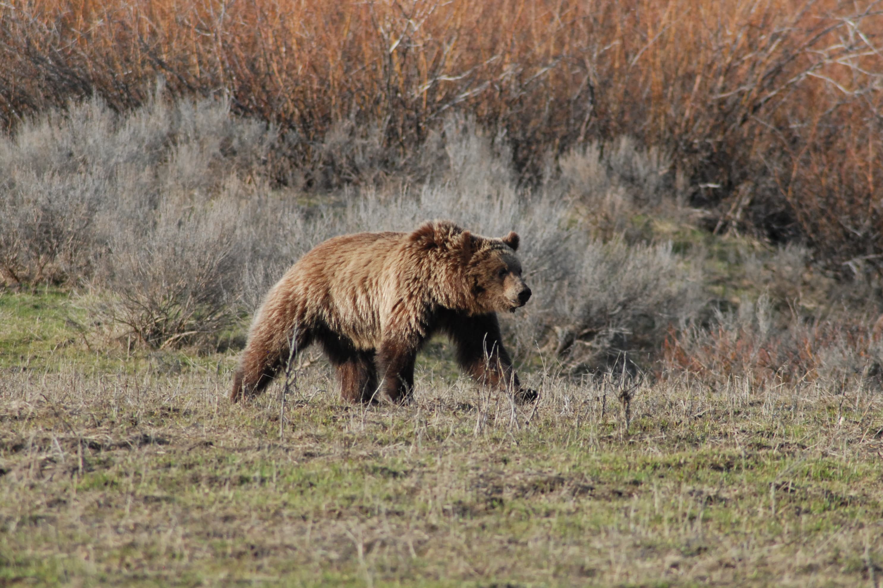

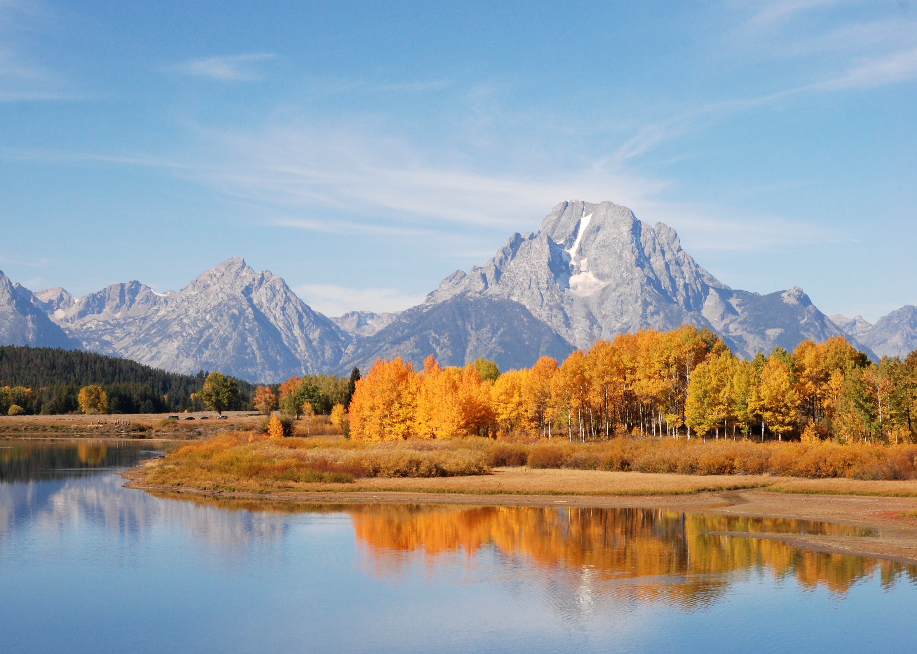
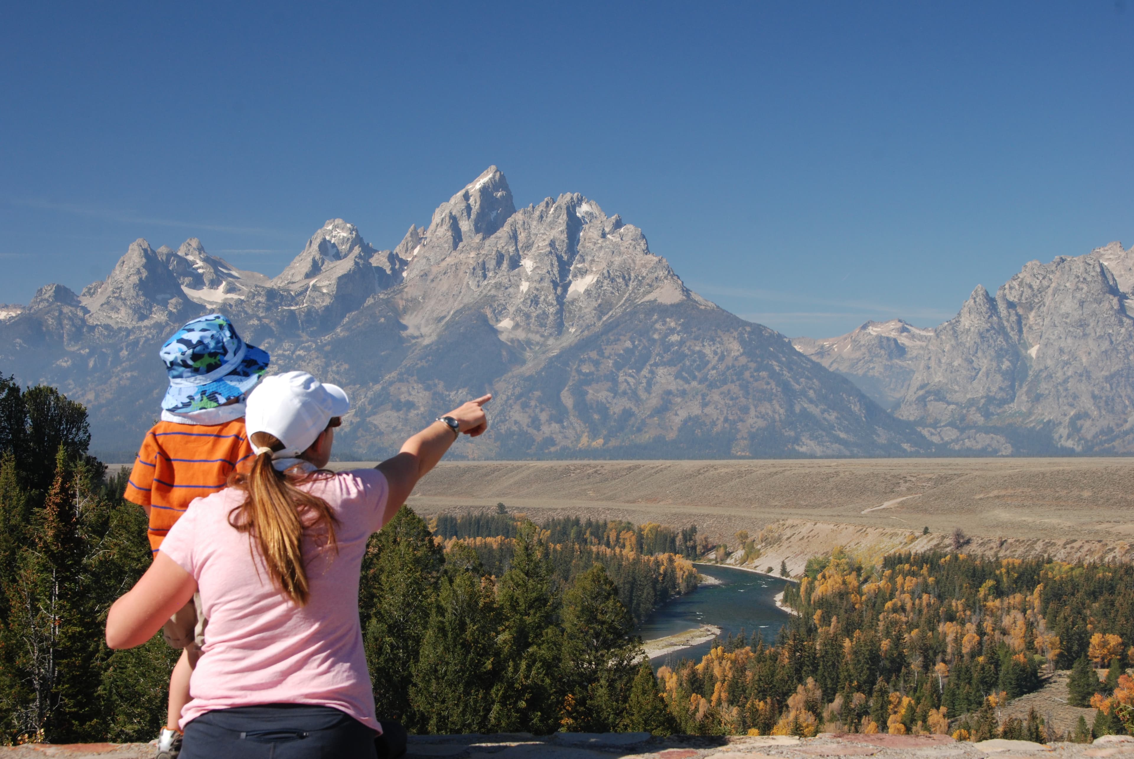
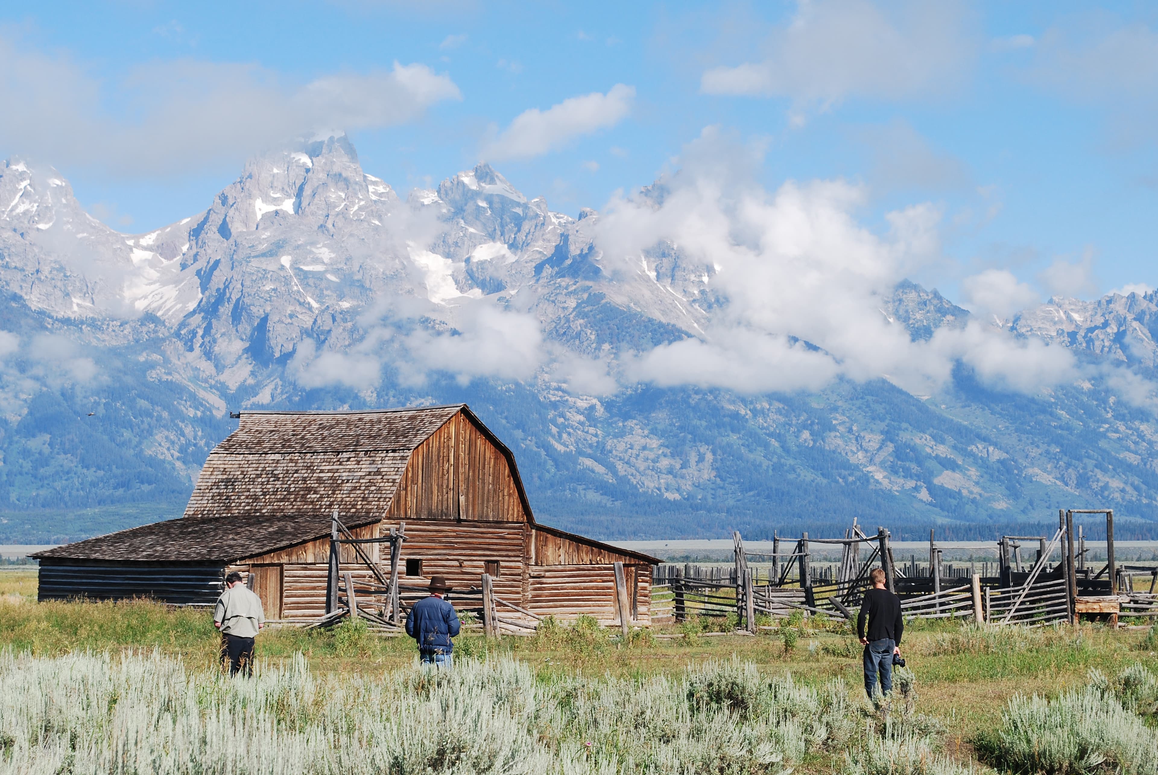

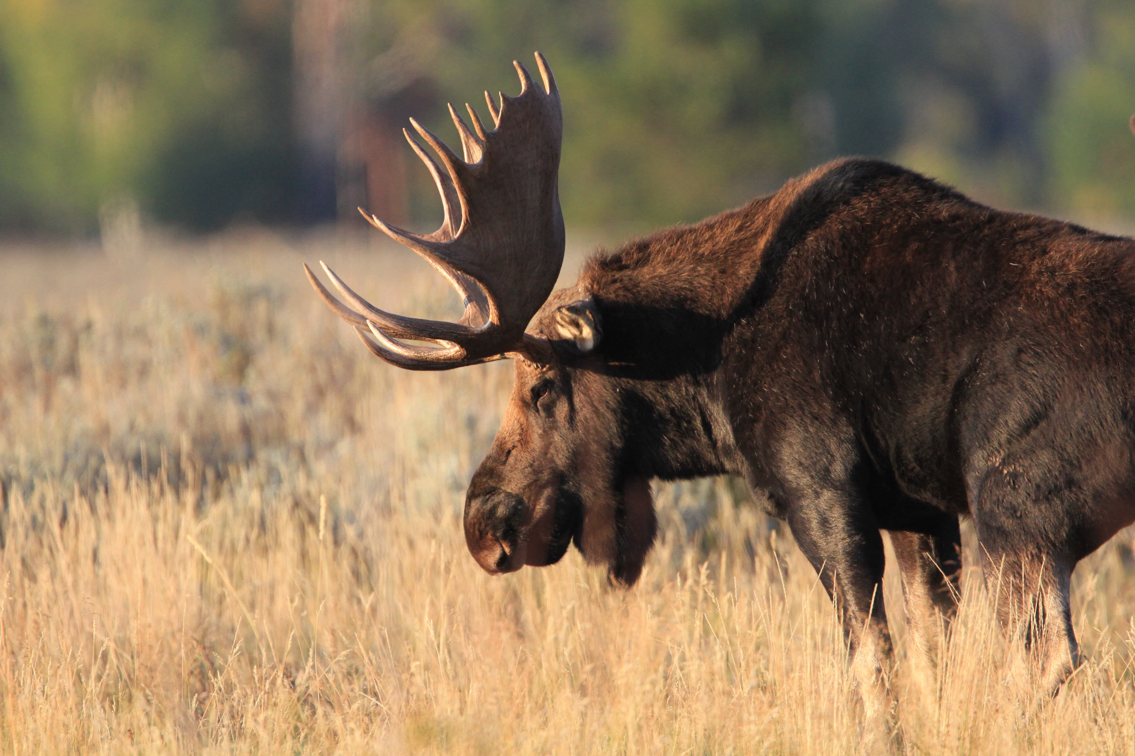
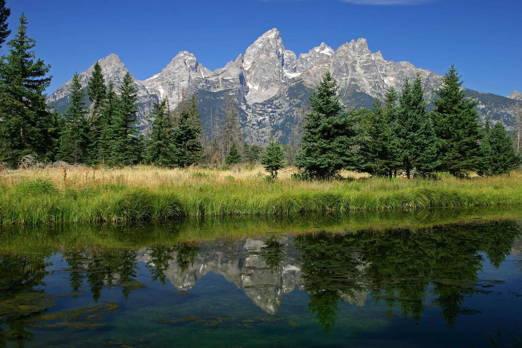
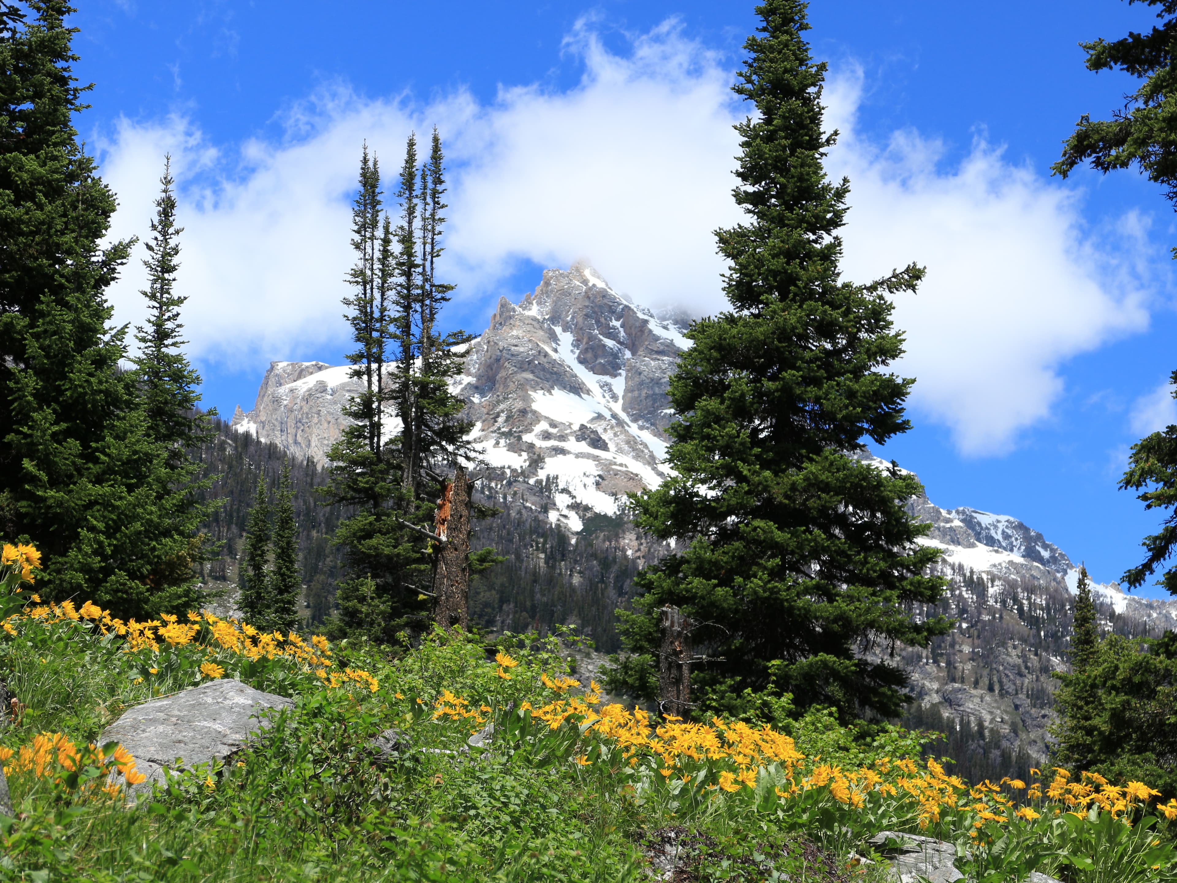
Stay near this park
No horse-friendly stays listed near Grand Teton National Park yet. Know a great barn or property? Help fellow riders by listing it.
List your propertyDirections
Grand Teton National Park is located in northwestern Wyoming; north of the town of Jackson, Wyoming and south of Yellowstone National Park. By car from Salt Lake City, Utah is approximately 300 miles and about 5-6 hours from the park and from Denver, Colorado is approximately 550 miles and about 8-10 hours from the park. Grand Teton National Park is unique in that it is the only national park that has a commercial airport within its border, Jackson Hole Airport (JAC). For current road info:
Source: nps.gov