
Danger
SEASONAL SAFETY MESSAGE
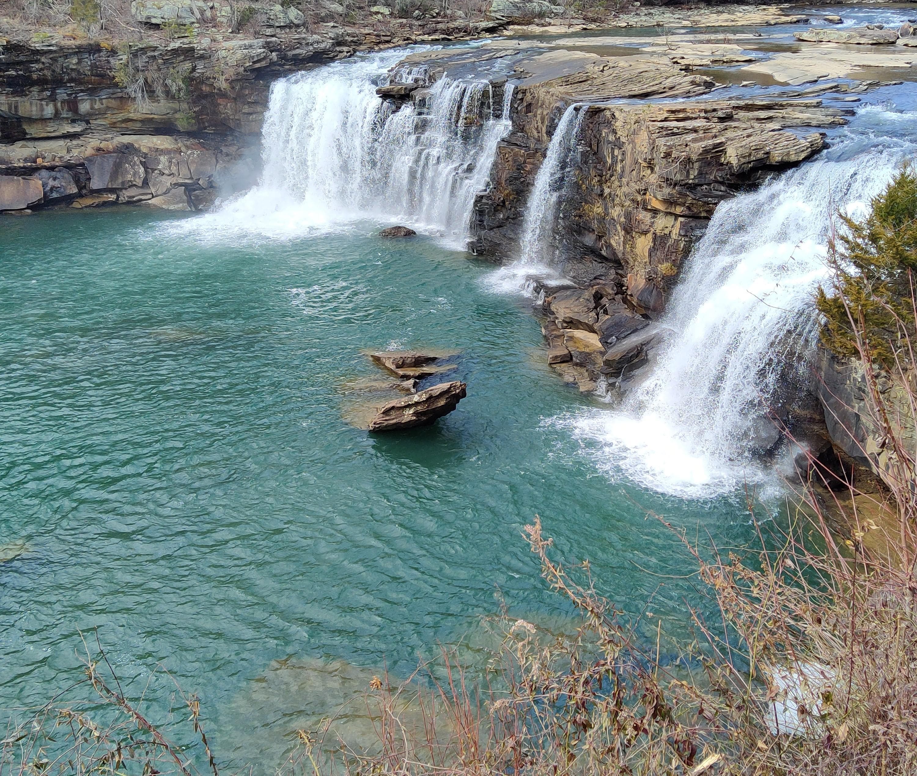
Be careful and safe while out in the canyon! Be cautious of your surroundings, don't cliff jump, don't stray off of the main trails, and don't get too close to Little River Falls or the canyon rim. These activities could result in injury or death.
Little River Canyon National Preserve
AL · Fort Payne
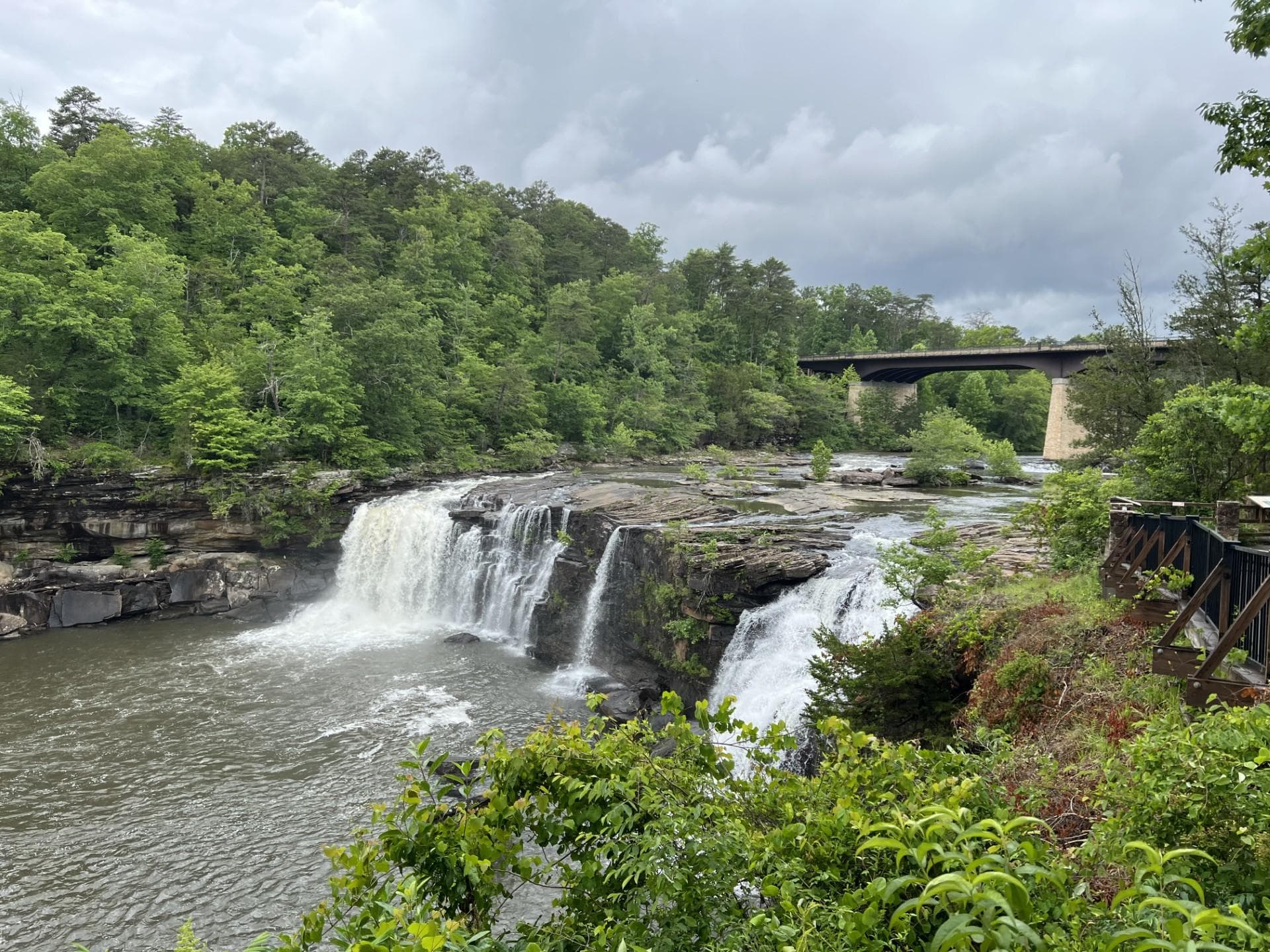
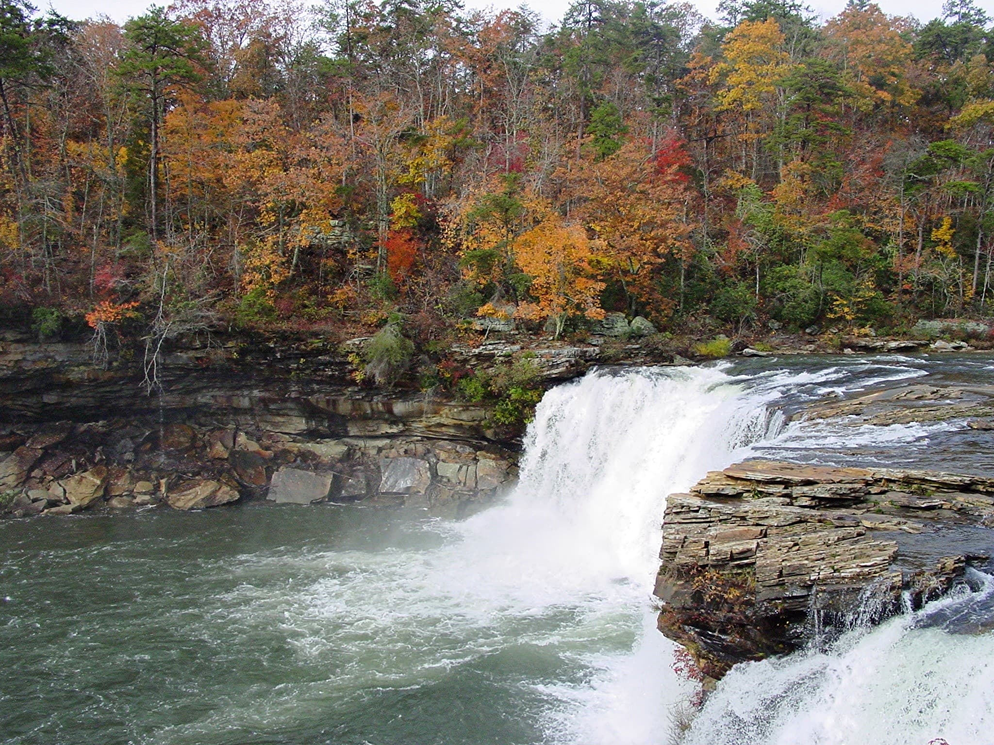
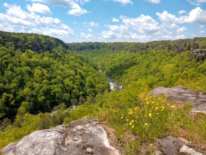
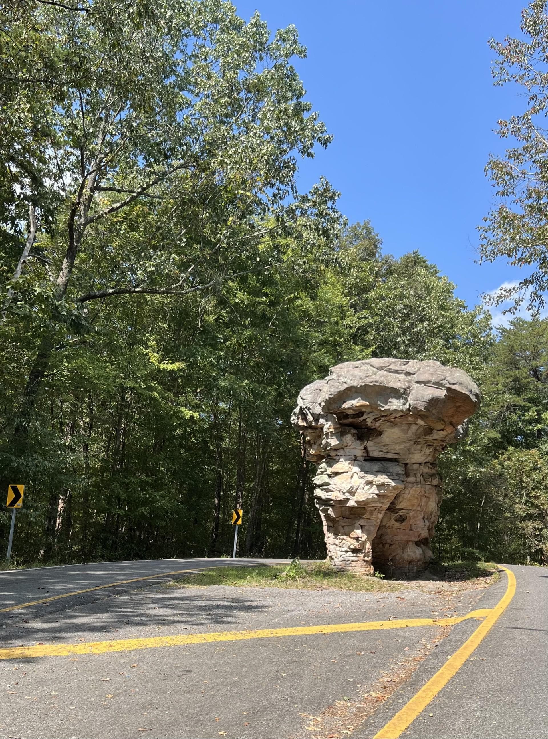
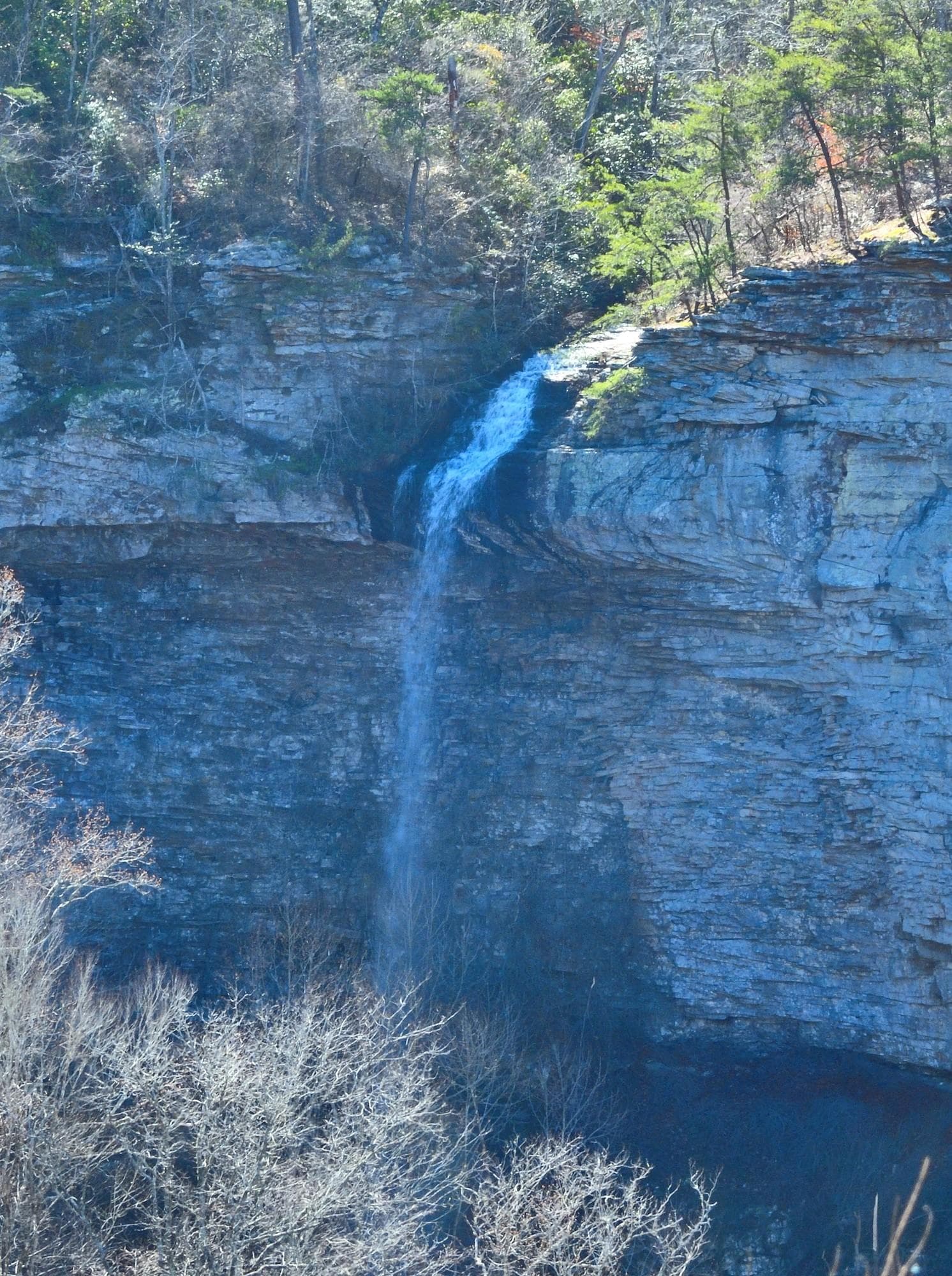
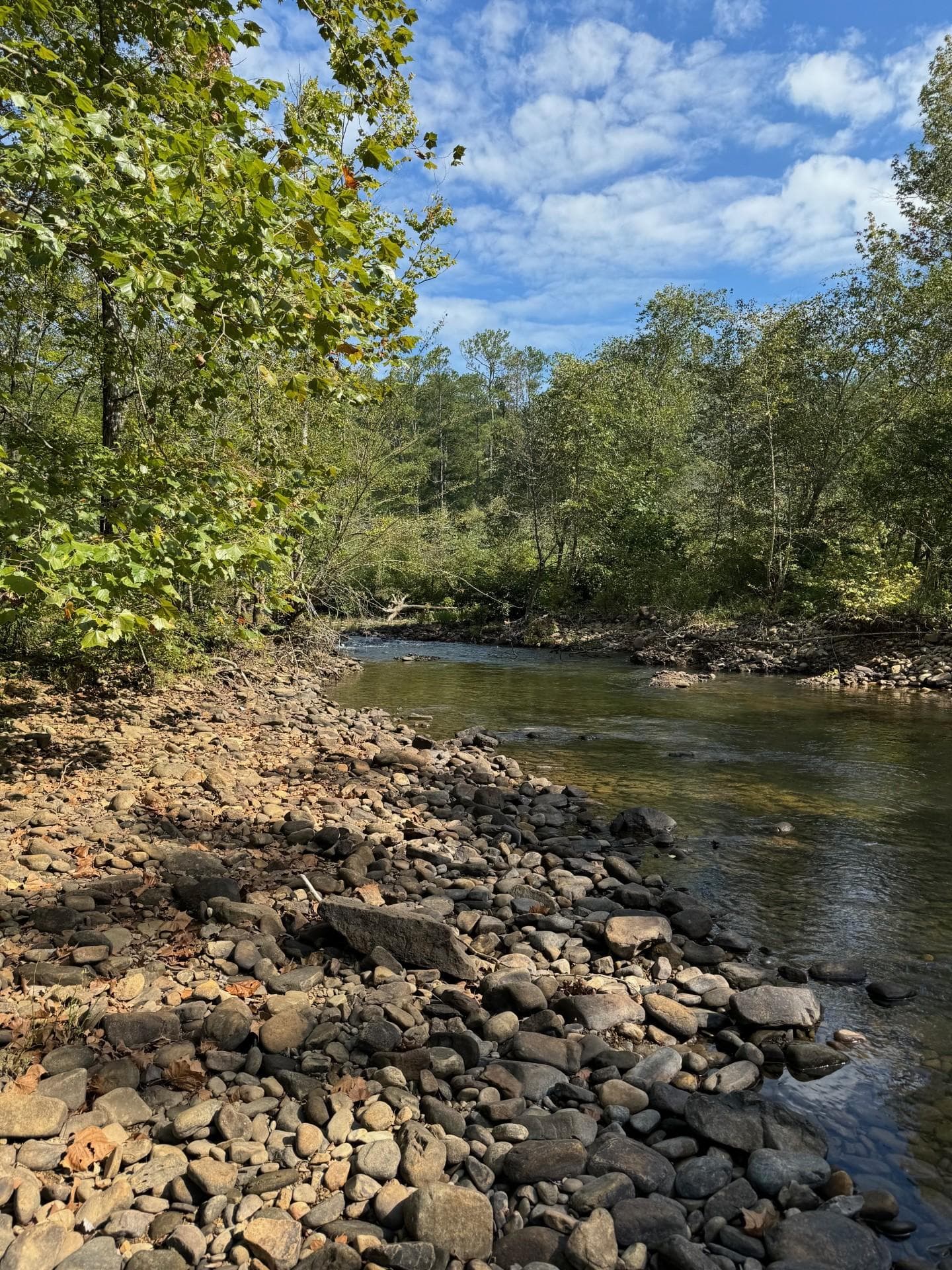
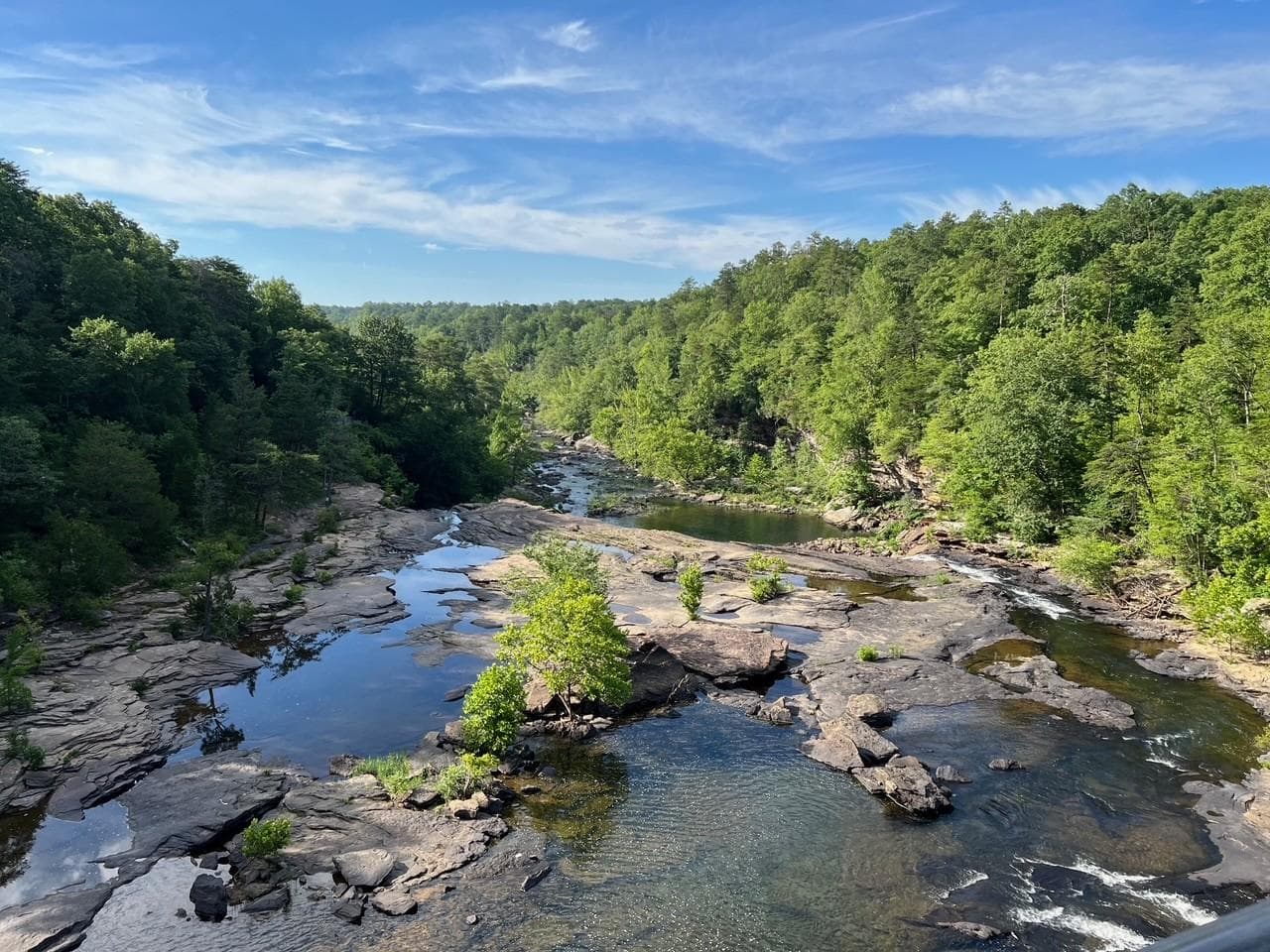
Little River is unique because it flows for most of its length atop Lookout Mountain in northeast Alabama. Forested uplands, waterfalls, canyon rims and bluffs, pools, boulders, and sandstone cliffs offer settings for a variety of recreational activities. Natural resources and cultural heritage come together to tell the story of the Preserve, a special place in the Southern Appalachians.
Riding guide
Highlights
Little River Canyon National Preserve protects one of the deepest canyon systems in the southeastern United States.
Riding
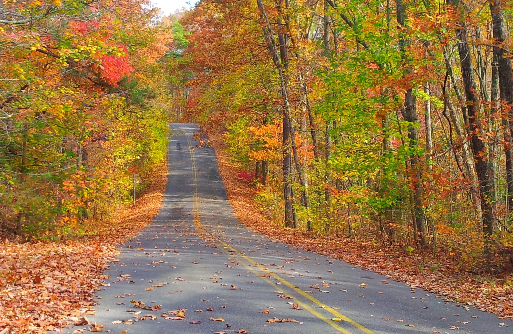
Rideable terrain here is noted as 23 miles, giving riders a clearer sense of scale before they ever unload. For equestrians, riding in the preserve takes place primarily on the backcountry road system rather than traditional narrow trails. Approximately 23 Miles of numbered backcountry roads are open to horseback riding. These routes travel through remote forested sections of the canyon plateau and connect various wildlife and recreation areas.
Rideable terrain
23 miles
Trailer parking
Hunters Check Station Parking Area Location: Off Cherokee County Road 103 near Highway 35 on the east side of the preserve. Why riders use it Primary staging location for equestrians accessing the east-side backcountry roads Gravel parking area large enough for horse trailers Direct access to Backcountry Road 01, which connects to the preserve’s multi-use road network One of the most commonly used equestrian access points in the preserve. County Road 295 Gravel Parking Lot Location: Off DeKalb County Road 295 just south of Highway 35. Why riders use it Main staging area for riding the west-side backcountry road system Gravel parking area suitable for horse trailers Direct access to Backcountry Road 05, which runs through the preserve’s backcountry area Convenient starting point for longer rides through the canyon plateau forests. Helpful tip for equestrians Most horseback riding in the preserve occurs on numbered backcountry roads within the Wildlife Management Area, which are shared with hikers, cyclists, and licensed four-wheel-drive vehicles. Riders typically choose their staging area based on whether they want to explore the east-side or west-side road network. These trailheads are fairly primitive and usually do not provide water, hitching rails, or horse facilities, so riders should plan to be self-sufficient when staging horses at the preserve.
Horse regulations
Horseback riding at Little River Canyon National Preserve is permitted on designated backcountry roads and is managed to protect the preserve’s forests, wildlife habitat, and canyon ecosystem. Riders should review park guidelines before visiting, since horseback travel is limited to specific routes within the preserve. However, several core regulations and best practices apply for riders in the park. Riding Is Only Allowed on Backcountry Roads Horses are permitted only on numbered backcountry roads within the Wildlife Management Area. Riding on hiking trails, canyon rim trails, or areas outside the road system is prohibited. Shared Road Use Backcountry roads are multi-use routes shared by: • hikers • mountain bikers • licensed four-wheel-drive vehicles Riders should remain aware of vehicles and maintain control of horses when encountering other users. Stock Control and Trail Courtesy Riders are expected to: Maintain control of horses at all times Yield appropriately to other trail users Avoid creating new routes or riding off established roads. Feed and Invasive Species Prevention To protect native ecosystems, riders should bring: • certified weed-free hay or feed • clean trailers, tack, and hooves before entering riding areas. Organized Groups and Events Individual riders typically do not need permits, but organized events, commercial operations, or large group rides may require a special use permit from the park.
Getting here
Use 4322 Little River Canyon Trail NE, Fort Payne, Alabama as your primary planning reference before you haul in. Hunters Check Station Parking Area Location: Off Cherokee County Road 103 near Highway 35 on the east side of the preserve. Why riders use it Primary staging location for equestrians accessing the east-side backcountry roads Gravel parking area large enough for horse trailers Direct access to Backcountry Road 01, which connects to the preserve’s multi-use road network One of the most commonly used equestrian access points in the preserve. County Road 295 Gravel Parking Lot Location: Off DeKalb County Road 295 just south of Highway 35. Why riders use it Main staging area for riding the west-side backcountry road system Gravel parking area suitable for horse trailers Direct access to Backcountry Road 05, which runs through the preserve’s backcountry area Convenient starting point for longer rides through the canyon plateau forests. Helpful tip for equestrians Most horseback riding in the preserve occurs on numbered backcountry roads within the Wildlife Management Area, which are shared with hikers, cyclists, and licensed four-wheel-drive vehicles. Riders typically choose their staging area based on whether they want to explore the east-side or west-side road network. These trailheads are fairly primitive and usually do not provide water, hitching rails, or horse facilities, so riders should plan to be self-sufficient when staging horses at the preserve.
Planning your visit
Hunting Season Is Active The preserve overlaps with areas managed by the Alabama Department of Conservation and Natural Resources, and hunting seasons occur during parts of the year. Riders should wear high-visibility clothing and check seasonal hunting schedules before visiting. Backcountry Roads Can Be Rough The preserve’s road system includes chert, gravel, and dirt surfaces that can become rocky, rutted, or uneven. Some sections may require careful riding, particularly after storms or heavy use by vehicles. Flooding Can Affect Access Certain backcountry roads and low-lying sections near the river may become flooded or impassable after heavy rain. Riders should check recent weather conditions and road status before traveling into the backcountry. Limited Infrastructure Trailheads are primitive and typically do not provide water, hitching rails, or horse facilities. Riders should bring all supplies needed for horses and riders. Remote Riding Conditions Cell service can be unreliable in many areas of the preserve. Riders should carry maps, navigation tools, and emergency supplies when exploring the backcountry road network. Heat and Humidity Summer conditions in northeastern Alabama can be hot and humid, especially on exposed road sections. Riders should plan rides during cooler parts of the day and bring adequate water for horses and riders.
Where to stay
Little River Canyon Center is the main visitor-contact point tied to this destination, which is helpful when you want current conditions, maps, and stock-use updates before riding. This entry reads best as a bring-your-own-horse destination rather than a horse-rental stop, and amenities should be confirmed directly before travel. For a polished trip plan, pair the ride with lodging, fuel, and resupply planning in or near Fort Payne before heading deeper into federal-land access points.
Entrance fees & passes
- $15.00
Entrance - Private Vehicle
Admits all persons traveling in a single, private, non-commercial vehicle (car/truck/van/motorcycle) into Canyon Mouth Park for one day. The pass is non-transferable. Insert cash only (no bills larger than a $20) into the fee machine to gain entrance. Place the receipt on the dashboard of your vehicle, making sure the face of the receipt is visible.
- $15.00
Entrance - Motorcycle
Valid for 1 day. Admits up to 2 private, non-commercial motorcycles with up to 4 total passengers. The pass is non-transferable. Insert cash only (no bills larger than a $20) into the fee machine to gain entrance. Place the receipt on the dashboard of your vehicle, making sure the face of the receipt is visible.
- $35.00
Annual Entrance - Park
The Canyon Mouth Park Annual Pass is valid for unlimited visits for one year from the month of purchase. The pass admits the pass holder and occupants of a single, private non-commercial vehicle (car/truck/van/motorcycle), and is non-transferable. Pass must be signed to be valid, ID required with pass. Insert the pass into the fee machine to gain entrance and wait for the lift arm to open.
Trails
No trails synced for this park yet.
Campgrounds
No campgrounds listed for this park.
Points of interest
Little River Canyon National Preserve, the Trail of Tears
POILittle River Canyon National Preserve is a place of beauty that is also host to stories of adversity and survival. Over 1,100 men, women, and children moved through the Little River area during the removal of the Cherokee and Muscogee (Creek) Indians. Cherokee John Benge led the Fort Payne group of American Indians over 798 miles on the Trail of Tears to Indian Territory in what is now Oklahoma, crossing the Little River above the falls near the present-day Highway 35 bridge.
Visitor centers
Jacksonville State University Little River Canyon Center
The Jacksonville State University Little River Canyon Center is located adjacent to Little River Canyon National Preserve. National Park Service staff and Volunteers and Jacksonville State University staff will greet you and help you plan your visit. Amenities include: Information desk, restrooms, movie, gift shop, trails, and picnic tables. Hours are 10 AM - 4 PM Central Standard Time. Closed Thanksgiving, Christmas, and New Years Day.
Get directions
Hours of operation
Little River Canyon National Preserve
The main park is open during daylight hours every day including holidays.
Mon
Sunrise to Sunset
Tue
Sunrise to Sunset
Wed
Sunrise to Sunset
Thu
Sunrise to Sunset
Fri
Sunrise to Sunset
Sat
Sunrise to Sunset
Sun
Sunrise to Sunset
Canyon Mouth Park
Summer Hours - Open Daily from 8:00 AM to 7:00 PM (CST) Fall/Spring Hours - Open Daily from 8:00 AM to 6:00 PM (CST) Winter Hours - Open Daily from 8:00 AM to 5:00 PM (CST)
Mon
8:00AM - 7:00PM
Tue
8:00AM - 7:00PM
Wed
8:00AM - 7:00PM
Thu
8:00AM - 7:00PM
Fri
8:00AM - 7:00PM
Sat
8:00AM - 7:00PM
Sun
8:00AM - 7:00PM
Activities
Weather
The weather in Fort Payne, Alabama is mild. The average temperature in the winter is in the 50's. The average summer temperature is in the high 80's with high humidity. We receive about 55 inches of rain each year. Snowfall varies, but only lasts a few days per event.
Contact
Photos
Stay near this park
No horse-friendly stays listed near Little River Canyon National Preserve yet. Know a great barn or property? Help fellow riders by listing it.
List your propertyDirections
Little River Canyon National Preserve follows along the Little River and covers approximately 40 miles from the northeast corner to the southwest corner. The easiest way to access the park is by Alabama Highway 35 about 10 miles east out of Fort Payne, Alabama. Interstate 59 is the closest interstate.
Source: nps.gov