
Mormon Pioneer National Historic Trail
IL · IA · NE · UT · WY · Santa Fe
Explore the Mormon Pioneer National Historic Trail across five states to see the 1,300-mile route traveled by Mormons who fled Nauvoo, Illinois, to the Great Salt Lake Valley in 1846-1847.
Riding guide
Horses provided
Highlights
The Mormon Pioneer National Historic Trail follows the route taken by thousands of Latter-day Saint pioneers who traveled…
Riding
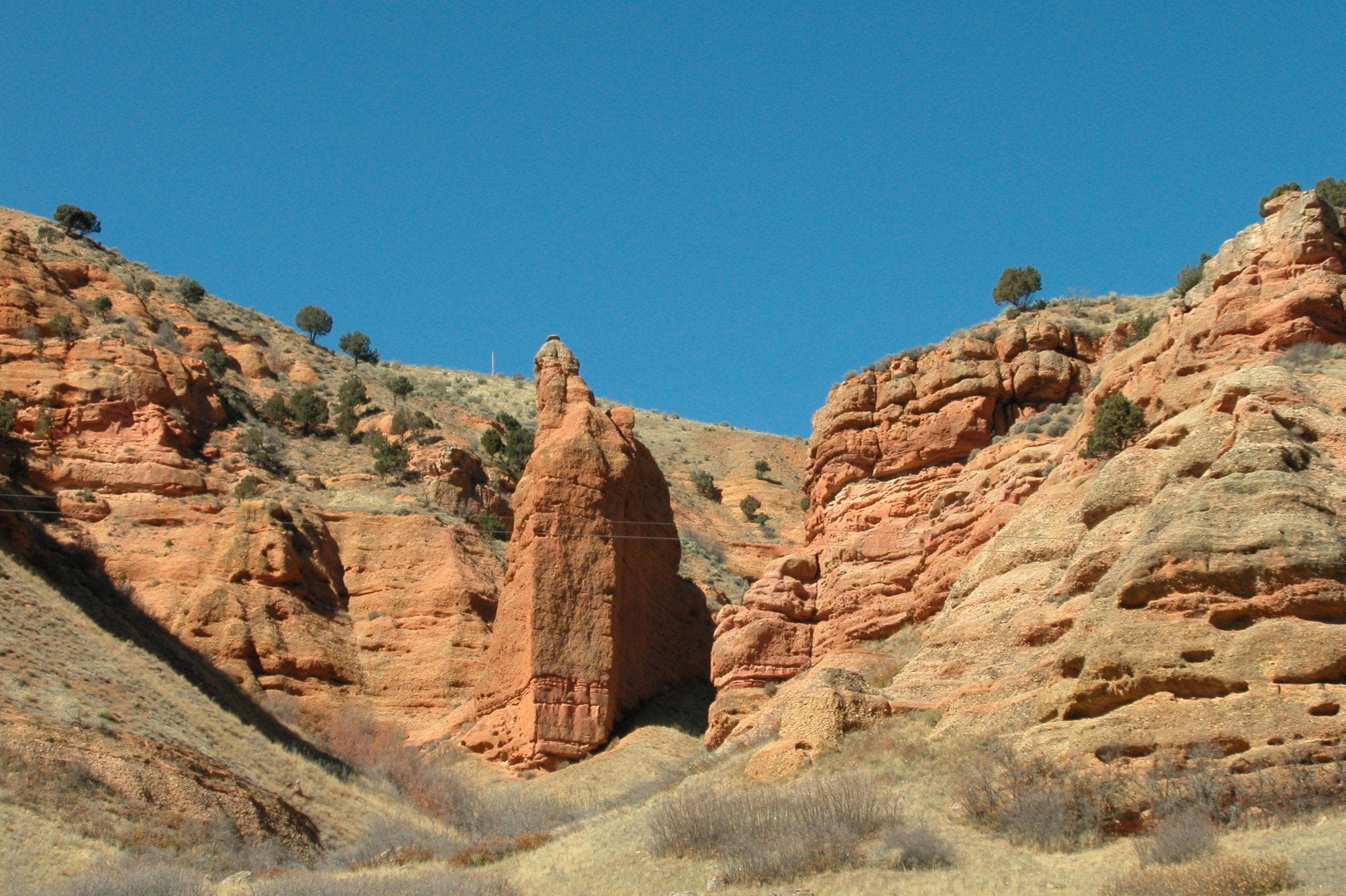
Rideable terrain here is noted as 100 miles, giving riders a clearer sense of scale before they ever unload. Travelers along the route passed through prairies, river valleys, high plains, and rugged mountain landscapes. Much of the journey followed natural corridors such as the Platte River and Sweetwater River valleys, which offered water, grass for livestock, and relatively manageable terrain for wagon travel. Along the way, pioneers established temporary settlements, ferries, and supply points that later became important landmarks in western migration history.
Rideable terrain
100 miles
Trailer parking
Mormon Trail Center at Historic Winter Quarters Area (Nebraska) While primarily a historic site, riders often stage nearby on public land along the Missouri River corridor. Nearby staging areas include: • Chalco Hills Recreation Area – large parking areas and open riding terrain nearby • Glenn Cunningham Lake Park – trailer-friendly parking and trail access These locations allow riders to explore sections of the early trail corridor. Scotts Bluff National Monument Area One of the most famous landmarks along the pioneer trail. Best staging nearby: • Robidoux RV Park and Campground – large parking and trailer maneuvering space • Wildcat Hills State Recreation Area – equestrian trails and trailer parking This region contains some of the best preserved wagon ruts. Fort Laramie National Historic Site Area A major emigrant stop along the trail. Best staging nearby: • Fort Laramie Historic Site Equestrian Parking – trailer-friendly parking areas • Guernsey State Park – excellent equestrian trails and large trailer parking areas Guernsey also preserves deep wagon ruts carved into sandstone by pioneer wagons. National Historic Trails Interpretive Center Area A central interpretive hub for multiple emigrant trails. Best staging nearby: • Alcova Reservoir Recreation Area – large open staging areas • Mud Springs Historic Site – preserved trail corridor Martin's Cove Historic Site One of the most important historic locations on the trail. Best staging nearby: • Martin's Cove Trailhead – parking areas suitable for trailers • Sweetwater River BLM Access Areas – primitive staging along the river corridor This Is the Place Heritage Park Area (Trail Terminus) Marks the end of the pioneer journey. Best staging nearby: • Little Dell Reservoir Recreation Area – trailer-friendly parking • East Canyon State Park – equestrian trails and large parking areas
Horse regulations
Stay on Existing Roads and Trails Much of the historic trail corridor passes through fragile prairie and desert ecosystems. Riders are generally required to stay on: Designated trails Existing dirt roads Historic wagon route corridors where travel is permitted Off-trail riding may be restricted in areas with sensitive vegetation or archaeological resources. Respect Historic Wagon Ruts and Cultural Sites Many portions of the trail preserve original wagon ruts and historic campsites. These are protected cultural resources. Important rules typically include: Do not ride directly through preserved wagon ruts unless specifically permitted Avoid hitching horses to historic structures, markers, or monuments Do not disturb artifacts or historic features Check Land Ownership Before Riding Because the trail crosses public and private land, access varies widely. Riders should verify whether a segment is located on: BLM land National forest State park land Private property Permission may be required in some areas. Backcountry Travel Expectations Many rideable sections are remote with minimal services. Riders should be prepared for: Limited water sources Long distances between access points Primitive camping conditions Variable terrain and weather In some federal lands, backcountry permits may be required for overnight trips with stock. Feed and Invasive Species Rules Most public lands along the trail require: Certified weed-free hay or feed Cleaning trailers, tack, and animals before entering a trail system These rules help prevent the spread of invasive plants. Leave No Trace for Stock Users Many trail segments follow Leave No Trace guidelines for equestrian travel: Pack out trash and manure where required Avoid tying animals directly to trees for long periods Camp on durable surfaces away from water sources Limit grazing in sensitive areas Local Regulations: Always check with the local BLM, National Forest, or state park office for current, specific rules for the area you plan to visit.
Getting here
Use 1100 Old Santa Fe Trail, Santa Fe, New Mexico as your primary planning reference before you haul in. Mormon Trail Center at Historic Winter Quarters Area (Nebraska) While primarily a historic site, riders often stage nearby on public land along the Missouri River corridor. Nearby staging areas include: • Chalco Hills Recreation Area – large parking areas and open riding terrain nearby • Glenn Cunningham Lake Park – trailer-friendly parking and trail access These locations allow riders to explore sections of the early trail corridor. Scotts Bluff National Monument Area One of the most famous landmarks along the pioneer trail. Best staging nearby: • Robidoux RV Park and Campground – large parking and trailer maneuvering space • Wildcat Hills State Recreation Area – equestrian trails and trailer parking This region contains some of the best preserved wagon ruts. Fort Laramie National Historic Site Area A major emigrant stop along the trail. Best staging nearby: • Fort Laramie Historic Site Equestrian Parking – trailer-friendly parking areas • Guernsey State Park – excellent equestrian trails and large trailer parking areas Guernsey also preserves deep wagon ruts carved into sandstone by pioneer wagons. National Historic Trails Interpretive Center Area A central interpretive hub for multiple emigrant trails. Best staging nearby: • Alcova Reservoir Recreation Area – large open staging areas • Mud Springs Historic Site – preserved trail corridor Martin's Cove Historic Site One of the most important historic locations on the trail. Best staging nearby: • Martin's Cove Trailhead – parking areas suitable for trailers • Sweetwater River BLM Access Areas – primitive staging along the river corridor This Is the Place Heritage Park Area (Trail Terminus) Marks the end of the pioneer journey. Best staging nearby: • Little Dell Reservoir Recreation Area – trailer-friendly parking • East Canyon State Park – equestrian trails and large parking areas
Planning your visit
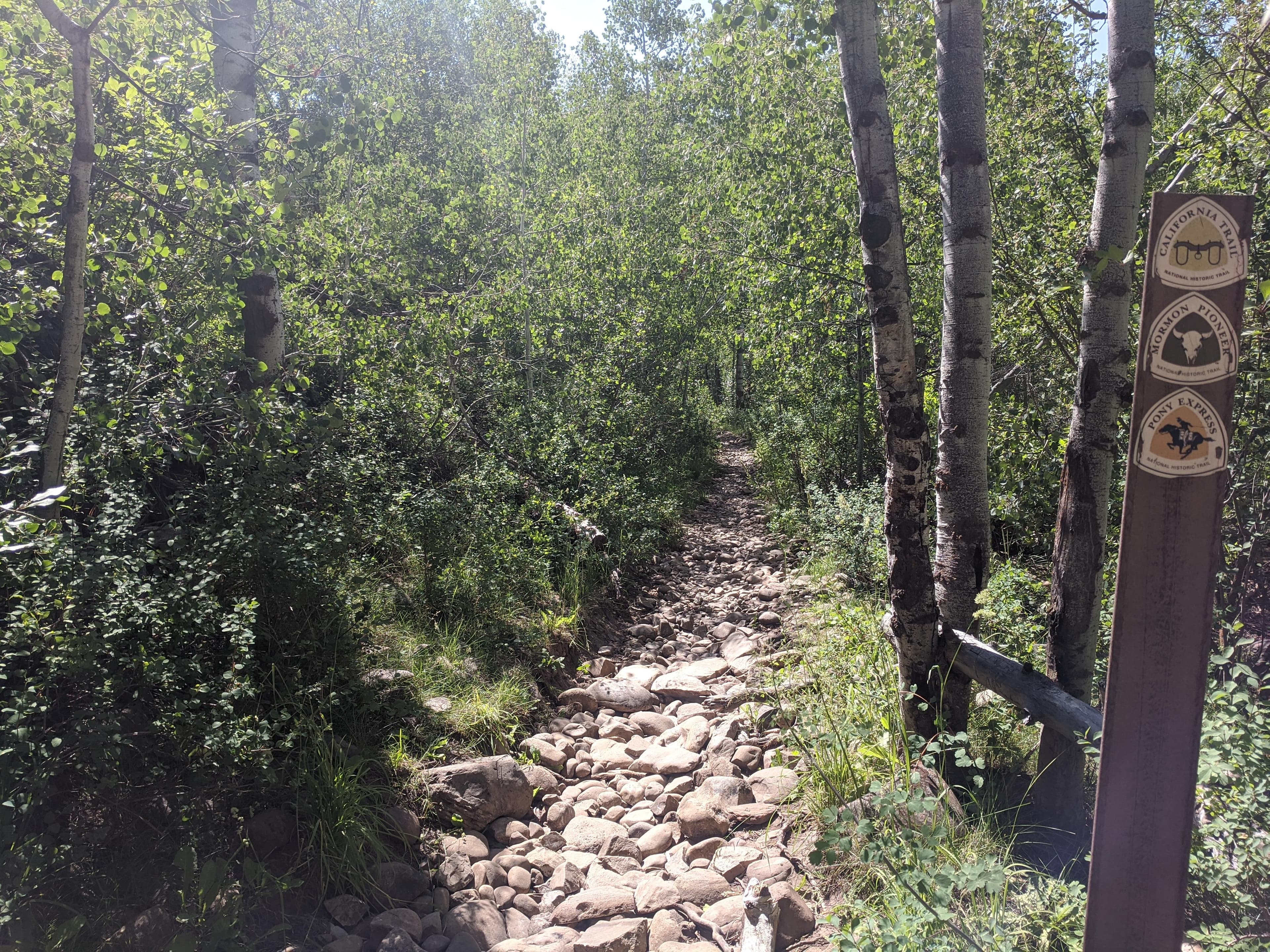
Traveling along the Mormon Pioneer National Historic Trail is very different from visiting a traditional national park. The trail is a 1,300-mile historic corridor crossing five states, and visitors typically experience it through a series of historic sites, trail segments, and interpretive stops rather than one continuous path. Below are some of the most important things travelers should understand before planning a visit or riding a section of the trail. Key Starting and Staging Areas Important mounting, stopping, and resupply locations historically used along the route include: Nauvoo and Montrose — the primary departure points where pioneers crossed the Mississippi River and began the journey west. Garden Grove and Mount Pisgah — early Iowa way stations used for rest, resupply, and settlement support. Mormon Trail Center at Historic Winter Quarters — the largest historic staging area where thousands of pioneers wintered before continuing west. These locations are often considered the primary historical hubs of the migration. The Trail Is Not One Continuous Path Although the trail covers about 1,300 Miles from Illinois to Utah, it does not exist today as a single uninterrupted trail. Travelers will encounter a mix of: Historic wagon tracks and preserved trail segments Primitive dirt or gravel routes County roads and modern highways that follow the original route Historic sites connected by driving corridors Many preserved sections appear in Nebraska and Wyoming, where wagon ruts are still visible on the landscape. Surface and Terrain Conditions Most of the historic trail corridor consists of natural surfaces, including: Dirt and sand tracks Prairie grasslands Gravel roads Desert and high plains terrain in Wyoming and Utah Conditions vary widely depending on the region, weather, and land management agency. Water Access Along the Trail Reliable water sources are not continuous along the trail corridor. Historically and today, water access occurs mainly at major rivers, creeks, and recreation areas. Important water-related points include: Mississippi River crossing at Nauvoo Missouri River near Winter Quarters Creek crossings and river valleys throughout Iowa and Nebraska Recreation areas and reservoirs such as Little Dell Reservoir Outside of these areas, water sources can be scarce, particularly across Wyoming and Utah. Expect a Multi-Site Experience Because the trail spans several states, visiting it usually involves traveling between: Historic forts Pioneer campsites Interpretive museums Scenic overlooks Preserved wagon ruts Many travelers explore the trail as a road trip following the historic migration corridor rather than a single hike or ride. Remote and Rural Sections Large portions of the trail pass through remote plains, ranchlands, and desert terrain. Travelers should plan ahead for: Limited services in rural areas Long distances between towns Weather changes across the Great Plains and Rocky Mountain regions Primitive conditions on some preserved trail segments
Where to stay
Mormon Trail Center at Historic Winter Quarters is the main visitor-contact point tied to this destination, which is helpful when you want current conditions, maps, and stock-use updates before riding. Guided or concession-based riding support is noted here, so riders who are not hauling their own horses may still find an access path into the experience. For a polished trip plan, pair the ride with lodging, fuel, and resupply planning in or near Santa Fe before heading deeper into federal-land access points.
Trails
No trails synced for this park yet.
Campgrounds
No campgrounds listed for this park.
Points of interest
Bonaparte Riverfront Park
POIOn March 5, 1846, the Mormon Pioneers forded the Des Moines River and visited the village of Bonaparte. The Saints visited the village several more times in the following days. They purchased needed supplies, performed musical concerts for its residents, and some even began to establish homes, staying behind when the Vanguard Company left to continue the journey to Utah.
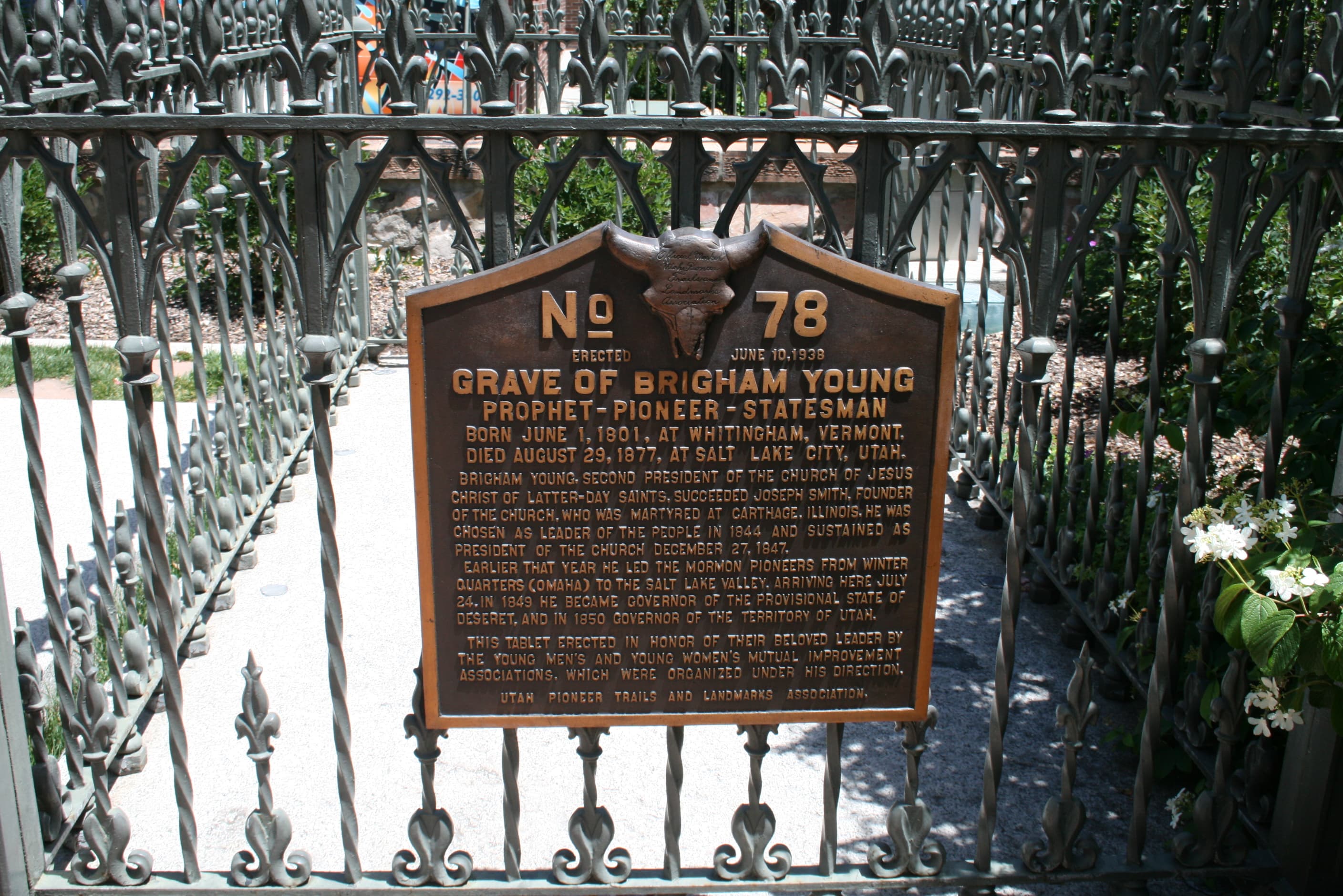
Brigham Young Cemetery
POIThe cemetery is a place of reverence and contemplation for Mormon visitors. In the outer garden stand sculptures of Mormon emigrants and monuments commemorating pioneers William Clayton and Eliza Roxcy Snow.
Brigham Young Historic Park
POIThe park was once a part of Brigham Young’s family farm. Today it includes a water wheel with a wooden flume and lifelike sculptures of pioneers at work and play. It is currently only open for special events.
Brigham Young Monument, Salt Lake City
POIThe monument features a heroic-sized statue of Young created for the 1893 World’s Fair in Chicago, along with smaller sculptures representing the Utah Indian tribes and fur trappers who preceded the pioneers. A plaque on the monument lists the members of the original Mormon advance company.
Carthage Jail
POIA mob assassinated Joseph Smith, founder and first prophet of The Church of Jesus Christ of Latter-day Saints, and his brother, Hyrum, at this historic jailhouse in 1844. It is a place of pilgrimage and contemplation for Latter-day Saints, but all are welcome to join a tour of this nationally significant site.
Chariton River Crossing
POIAfter a difficult crossing of the Chariton River on March 22, 1846, the Mormon vanguard labored across boggy lowlands and up a muddy ridge. There the exhausted emigrants made camp. The 300 wagons spread out over a mile and stayed 10 days, waiting out the rain. A roadside turnout provides an interpretive exhibit, a view of fields and forest, and a path to the river crossing.
Cold Springs State Park
POICold Springs State Park, near Lewis, IA, offers a wayside exhibit commemorating the 1846 Mormon emigration from Nauvoo, and traces of the old wagon trail can be seen on online satellite imagery crossing an adjoining, privately owned field west of the park. The 1846 vanguard company crossed the East Nishnabotna River on a temporary bridge west of Lewis. An 1850s ferry house and an Underground Railroad site with interpretive signs stand on the outskirts of Lewis.
Davis County Historical Complex
POIThe Davis County Historical Complex at Bloomfield, Iowa, includes a single-room, squared-log cabin built by Mormon emigrants between 1846 and 1848. The cabin has been moved from its original location for display purposes.
Deuel Pioneer Log Cabin
POIThe log cabin is an original pioneer home that was built in 1847 at a cost of $60. Only one other Salt Lake home built that year still exists; it is located at This is the Place Heritage Park. Lumber was scarce in the largely treeless valley, and most homes built after 1847 were constructed of adobe brick. The cabin is located between the museum and the Family History Library and is free to visit.
Drakesville, Iowa
POIDrakesville, Iowa is a city along the Mormon Pioneer trail that is full of trail history. The city is at the beginning of the route used by the vast majority of Mormon Pioneers to cross Iowa. The use of the trail near Drakesville started in 1846, immediately after the vanguard, Brigham Young-led companies had started their treks. This route avoided a lot of the hardships such as the thick mud, rattlesnakes, and lack of roads that the vanguard companies had to endure.
Eagle Gate, Salt Lake City
POIThe Eagle Gate spans State Street east of Beehive House. The monumental gateway was originally erected in 1859 at the entrance to Brigham Young’s private family compound. Today a bronze eagle perches atop the gateway. The original wooden eagle is exhibited at the nearby Pioneer Memorial Museum.
Ensign Peak Memorial Garden and Ensign Peak Nature Park
POITwo days after arriving in the valley, Brigham Young and 7 other pioneers climbed this hill to view the valley and begin planning their new city. Today the hilltop provides a stunning view straight down State Street, across the city the pioneers planned, to the south end of the Salt Lake Valley. Ensign Peak Memorial Garden trailhead includes plaques that explain the history and significance of the site.
Fort Caspar
POIIn 1859, Louis Guinard built a trading post and a bridge near the point where the Mormon Pioneer Company crossed the North Platte River in 1847. The Pony Express also established a station at this complex. Pony riders crossed the North Platte River on Guinard's Bridge, but the route stayed close to the north bank of the river until reaching Red Buttes Crossing, where another Pony Express station was located.
Garden Grove - Trailside Historical Park
POIThis 3-acre county park is the site of a small graveyard where Latter-day Saints who died at Garden Grove lie at rest. An interpretive wayside exhibit near the original site exhibit tells the story, and a granite monument commemorates those who lived and died here between 1846 and 1852. Outlines of the emigrant cabins can be seen mowed into the grass.
Grand Encampment
POIThis broad, open area became the stopping place for pioneer companies as they approached the Missouri River. At this site, the current location of the Iowa School for the Deaf, more than 500 volunteers of the Mormon Battalion officially mustered into the U.S. Army for service in the war with Mexico.
Lacey-Keosauqua State Park
POIA pink granite monument with a brown plaque marks the “Ely Ford Mormon Crossing” on the Des Moines River in Lacey-Keosauqua State Park. Brigham Young’s 1846 vanguard wagons did not cross here, but local lore suggests that a later company from Nauvoo used Ely Ford. An interpretive wayside exhibit with the heading “The Road Zion” stands next to the monument.
Locust Creek Campsite
POIAt Locust Creek Camp on April 15, 1846, William Clayton composed lyrics for an inspirational hymn, “Come, Come Ye Saints.” A wayside exhibit at Tharp Cemetery overlooks the site, which is on private land on the opposite side of the road. A visit requires driving several miles on gravel roads. No visible evidence of the camp remains.
Middle Mormon Ferry, Council Bluffs
POIIn June 1846, Brigham Young’s vanguard company established a ferry crossing on the Missouri River between present Council Bluffs, Iowa, and Omaha, Nebraska. The flatboat ferry, capable of carrying three loaded wagons on each trip, took thousands of Mormon pioneers safely to the west side of the great river, where they established a temporary settlement called Winter Quarters. The river channel has migrated about a mile west of its 1846 location, so no visible remnants remain.
Montrose Landing Riverfront Park
POIEarly in 1846, rumors of a raid on Nauvoo were spreading. In response, Brigham Young evacuated the Church's leaders and their families early to show the Saints were leaving in the spring as promised. On February 4, this company crossed the Mississippi River at this location. They camped nearby at Sugar Creek. One month later they left, along with an additional, unexpected 2000+ Church members.
Mormon Handcart Replica
POIHandcarts were a cost effective way for poor Mormon emigrants to move their belongings to the Salt Lake Valley.
Mormon Pioneer National Historic Trail
POIExplore the Mormon Pioneer National Historic Trail across five states to see the 1,300-mile route traveled by Mormons who fled Nauvoo, Illinois, to the Great Salt Lake Valley in 1846-1847.The traverses five states: UT, IL, WY, NE, & IA and is administered by the National Trails Office Regions 6|7|8 in Santa Fe, New Mexico.
Mormon Trail County Park and Pote Farm Swales
POIMormon Trail County Park in Adair County, IA, offers a half-acre stand of lush native grasses and flowers, with a wayside exhibit describing the Mormon emigrants’ experience of the Iowa prairie. About three-quarters of a mile southwest of the park entrance, a stretch of wagon swales (Pote Farm Swales) crosses a pasture on private property. The swales can be viewed from the roadside.
Mount Pisgah Historic Site
POIThe 1846 vanguard company of Latter-day Saints established Mount Pisgah as a waystation to provide relief for needy emigrants. A marble obelisk at the top of the hill marks the burial site of some 150 Latter-day Saints who died here between 1846 and 1852, while the site was occupied. A Union County park and a 1-acre cemetery belonging to The Church of Jesus Christ of Latter-day Saints are at this site today.
Nauvoo National Historic Landmark
POINauvoo was the home of The Church of Jesus Christ of Latter-day Saints from 1839 to 1846, when local vigilantes forced church members to flee. Visit the homes and grave of Joseph and Emma Smith, the reconstructed Nauvoo Temple (open only to members in good standing), the Mississippi River landing where the Mormon emigrants began their journey west, and more.
Nishnabotna River Crossing
POIOlde Town County Park, about 1.5 miles west of present Macedonia, Iowa, is located at a historic, limestone-bottomed crossing of the West Nishnabotna River. In this area, the 1846 Camp of Israel built a wagon bridge to span the swollen prairie stream. Nearby is the site of “Old” Macedonia, established by Latter-day Saint emigrants in 1846. A monument and wayside exhibit at a roadside park commemorate the settlement.
Pioneer Memorial Museum
POIThe Daughters of the Utah Pioneers proudly proclaims the museum as “the world’s largest collection of artifacts on one particular subject.” The claim is easy to believe: this museum is packed with thousands of objects both mundane and fascinating, all part of Mormon history. Allow at least a couple of hours to visit.
Pioneer Trail Museum
POIAs pioneers headed west on the Mormon Trail, some settled near the crossing of the West Nishnabotna River. They established Old Macedonia in 1846 to serve the needs of pioneers traveling west. The Pioneer Trail Museum features a replica handcart, oxen yoke, pictures, and other items related to the pioneers and Mormon Trail.
Prairie Trails Museum
POIPrairie Trails Museum offers exhibits on the Latter-day Saints’ 1846 emigration through this area and about William Clayton, who wrote the inspirational Mormon hymn “Come, Come, Ye Saints.” The museum’s 5 galleries and barns are filled with many objects of local history, including American Indian artifacts, an 1853 log cabin, and antique farming equipment.
Rebecca Winters' Grave
POIThe final resting place of Mormon emigrant Rebecca Winters. Rebecca died of cholera on August 15, 1852. Her grave site was marked with a metal wagon wheel rim that was engraved “Rebecca Winters, Age 50.” The grave had been forgotten for years until 1899 when surveyors for the Burlington Northern Railroad rediscovered it.
Richardson's Point
POIThe Brigham Young-led Vanguard group of 500 wagons camped in this area from March 7-19. Richardson's Point contains the burial sites of the first two of three deaths on the Mormon Trail. This site was used as a stopping point for Mormons traveling for an additional 7 years.
Sevenmile Creek Camp Swales
POIHundreds of passing Mormon wagons cut multiple swales into this lush native prairie at Sevenmile Creek, where the vanguard company camped on May 18, 1846. An elevated platform offers a view of the never-plowed, “virgin” prairie, located about 2.3 miles west of Murray, Iowa. Look for shallow, broad, ditch-like features where the prairie grass may appear taller and greener than the surrounding grass.
Sugar Creek Camp
POISugar Creek Camp, where Latter-day Saints began gathering on February 4, 1846, was the first major stop on the trek west. It was a place of great suffering, as hundreds of families endured weeks of freezing temperatures without adequate shelter, food, or warm clothing and bedding while awaiting Brigham Young’s arrival. Privately owned farmland today, the site can be viewed from along the roadway.
Supplication Hill - Temple Camp
POIThe 1847 Latter-day Saints vanguard company camped beside the Weber River on July 17-18 because some members were too ill to travel. Some of the men climbed the nearby hills to pray for the sick and the welfare of the company. The camp became known as Temple Camp and the prayer site as Supplication Hills. To visit, take I-80 Exit 169 and turn southwest on Echo Canyon Rd. A viewing area is about 0.6 mile beyond the community of Echo, on the right (east) side of the road.
Temple Square
POIVisit the extensive, enclosed formal garden area where the Salt Lake Temple and famous Mormon Tabernacle are located. Many passing emigrants, curious to hear Brigham Young speak, attended open-air Mormon Church services here and described the construction of the temple and tabernacle in their journals. All are welcome to visit the square, but entrance to the temple itself is restricted.
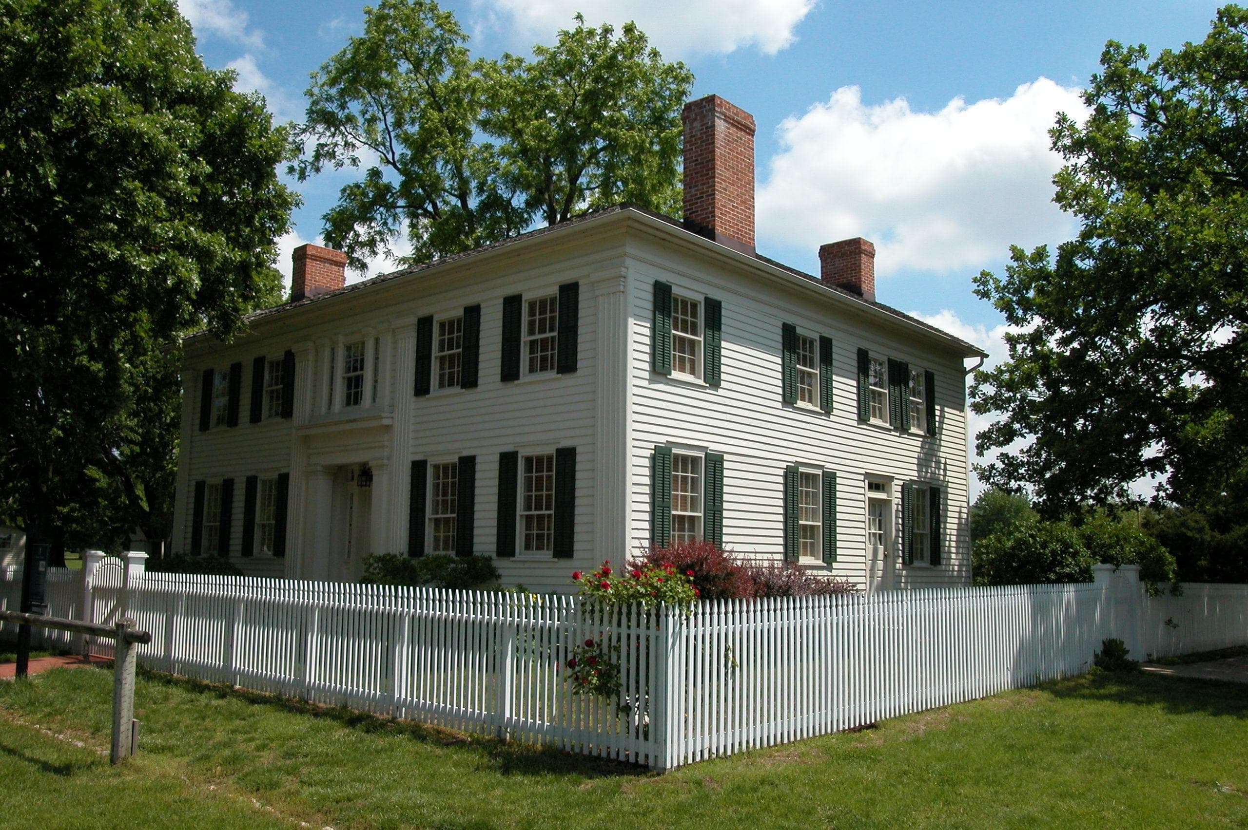
The Beehive House and the Lion House
POIThe Beehive House and the Lion House were the residences of Brigham Young’s large family. The Lion House, named for the stone lions at the front entrance, was built next door in 1856 two years after the construction of Beehive House, next door to the east. It was Young’s family residence and is where he died in 1877.
The Church History Museum, Salt Lake City
POIView exhibits and many important artifacts associated with the Mormon exodus to Utah, including objects related to the assassination of church founder Joseph Smith at Carthage, Illinois; Joseph Smith’s death mask; a wagon with a “roadometer” (odometer) invented by Mormon pioneers during the 1847 trek west; a cannon hauled west from Nauvoo by the advance company; and many personal belongings carried to Utah by the emigrants.
"Two Sides of the River" Wayside
POILearn more about the people who traveled along the North Platte River as they emigrated west.
Upper Platte (Mormon) Ferry 1847
POIOn the grounds of Fort Caspar Museum in Casper, WY, stands a replica ferry modeled after one built by the 1847 Latter-day Saints’ vanguard company to shuttle wagons across the rushing North Platte River. A replica of Guinard’s Bridge stands nearby. The fort museum displays a model of the leather boat, the Revenue Cutter, used by the vanguard to haul supplies over the river.
Things to do
Become a Mormon Pioneer Trail Junior Ranger
Learn about the Mormon Pioneer Trail and earn your junior ranger badge! This activity can be completed virtually or after visiting a site along the Mormon Pioneer National Historic Trail. Booklets can be submitted either electronically or by mail. Take a look and start exploring the trail today!
Hours of operation
Mormon Pioneer National Historic Trail
The Mormon Pioneer National Historic Trail is not a clearly marked hiking trail. Instead it is a corridor that passes through communities, urban areas, public lands, and Wilderness. The route travels across a variety of land ownerships and management, including private land. Each location varies as to the hours of operation and access. Please contact individual trail sites before your visit for more information.
Mon
All Day
Tue
All Day
Wed
All Day
Thu
All Day
Fri
All Day
Sat
All Day
Sun
All Day
Activities
Weather
Due to the length of the Mormon Pioneer National Historic Trail, be sure to consult local weather sources for the region you'll be visiting. Check out the forecast with the National Weather Service and search for the area you'd like to visit: weather.gov
Contact
Photos
Stay near this park
No horse-friendly stays listed near Mormon Pioneer National Historic Trail yet. Know a great barn or property? Help fellow riders by listing it.
List your propertyDirections
The Mormon Pioneer National Historic Trail crosses five states following the route the Pioneer Company of 1846-1847 established from Nauvoo, Illinois, to Salt Lake City, Utah, covering about 1,300 miles.
Source: nps.gov