
Park Closure
Partial Closure of Rocky Springs Trail
The Rocky Springs section is closed from the Rocky Springs campground at milepost 55 to the northern terminus at milepost 59 until further notice. Visitors should observe posted closures. The trail is unsafe due to trail erosion and deteriorated bridges.
Park Closure
Yockanookany Trail Section Closed to Equestrians
The Yockanookany section of the Natchez Trace National Scenic Trail is closed to equestrian use effective immediately, due to safety concerns with trail bridges and boardwalks. The trail will remain open to pedestrians.
More infoNatchez Trace National Scenic Trail
AL · MS · TN · Tupelo
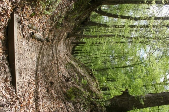
The Natchez Trace National Scenic Trail is five sections of hiking trail running roughly parallel to the 444-mile long Natchez Trace Parkway scenic motor road. The foot trails total more than 60 miles and offer opportunities to explore wetlands, swamps, hardwood forest, and the history of the area.
Riding guide
Highlights
The Natchez Trace National Scenic Trail follows the historic travel corridor known as the Natchez Trace, a route…
Riding
Rideable terrain here is noted as 60 miles, giving riders a clearer sense of scale before they ever unload. For equestrians, the trail offers more than 60 Miles of designated scenic trail segments, many of which allow horseback riding. These trails travel through hardwood forests, rolling hills, creek valleys, and historic sections of the original Trace. Instead of one continuous trail, the scenic trail system is divided into several separate segments that riders can explore individually.
Rideable terrain
60 miles
Trailer parking
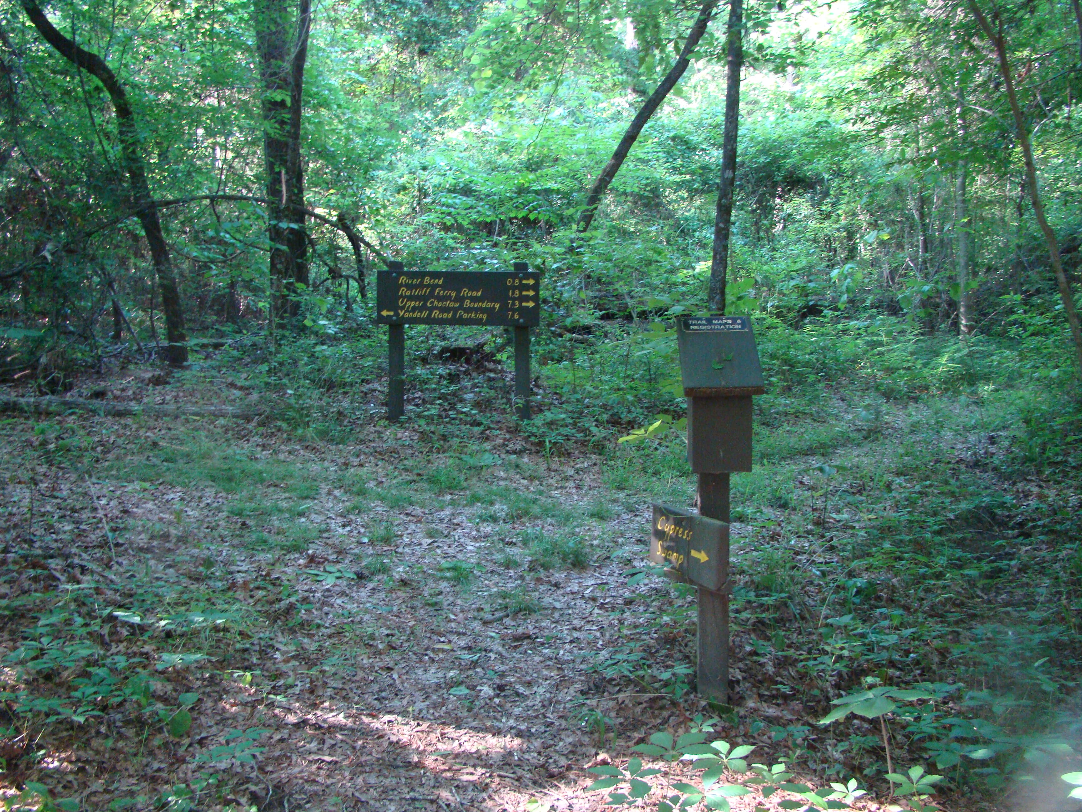
Garrison Creek Trailhead (Highland Rim Section) Location: Milepost 427.6 near Leipers Fork, Tennessee along the Natchez Trace Parkway. Why riders use it Large parking and staging area used for the Highland Rim equestrian trail section Direct access to roughly 25 Miles of trail paralleling the parkway One of the most popular equestrian entry points on the trail system. Highway 50 / Shady Grove Trailhead Location: Milepost 408 near the intersection of TN-50 in Tennessee. Why riders use it Southern access point for the Highland Rim trail segment Parking area commonly used for staging horse trailers Allows riders to explore long wooded sections of the Natchez Trace Scenic Trail. West Jackson Street Staging Area (Blackland Prairie Section) Location: Tupelo, Mississippi near Air Park Road and Jackson Street. Why riders use it Designated parking area for the Blackland Prairie trail loop Paved staging lot suitable for horse trailers Access to a 3.5-mile trail loop and nearby historic Trace sites. Totty Lane Parking Area Location: Just off the Natchez Trace Parkway in Mississippi. Why riders use it Known parking area that accommodates horse trailers Provides access to nearby sections of the Scenic Trail and the Witch Dance horse trail Convenient access point from the parkway corridor. Fly Trailhead (Highland Rim Area) Location: Highway 7 access point near Leipers Fork, Tennessee. Why riders use it Small staging area that can accommodate one or two horse trailers Access to forested sections of the Highland Rim trail network Often used by riders looking for quieter access points. Helpful tip for riders Most equestrian staging areas along the Natchez Trace are basic trailhead parking lots with minimal infrastructure. Riders should expect: Limited horse facilities No water at many trailheads Shared parking with hikers Because the trail system runs parallel to the parkway, riders often choose staging points based on the specific trail segment they want to explore rather than a single central access point.
Horse regulations
Horseback riding along the Natchez Trace National Scenic Trail is permitted on designated trail segments and is managed to protect the trail corridor’s forests, historic landscapes, and natural resources. Riders should review trail guidelines before visiting since horse access is limited to specific sections of the scenic trail. However, several core regulations and best practices apply for riders on the trail. Riding Is Only Allowed on Designated Scenic Trail Segments Horses are permitted only on specific sections of the Natchez Trace National Scenic Trail where equestrian use is allowed. Riding is not permitted along the Natchez Trace Parkway roadway or on hiking-only segments of the trail. Stock Control and Trail Courtesy Riders are expected to: Maintain control of horses at all times Ride single file where trails are narrow Yield appropriately to hikers and other trail users Avoid creating new trails or damaging vegetation. Feed and Invasive Species Control To protect native ecosystems along the Trace corridor, riders should bring: Certified weed-free hay or feed Clean trailers, hooves, and tack before entering riding areas These practices help prevent the spread of invasive plant species. Historic Resource Protection The Natchez Trace corridor contains historic trail segments and archaeological resources. Riders should avoid disturbing historic features or traveling off established routes. Camping With Horses Equestrian camping facilities are not provided directly along most scenic trail segments. Riders planning overnight trips with horses should arrange accommodations at nearby campgrounds or equestrian facilities outside the trail corridor.
Getting here
Use 2680 Natchez Trace Parkway, Tupelo, Mississippi as your primary planning reference before you haul in. Garrison Creek Trailhead (Highland Rim Section) Location: Milepost 427.6 near Leipers Fork, Tennessee along the Natchez Trace Parkway. Why riders use it Large parking and staging area used for the Highland Rim equestrian trail section Direct access to roughly 25 Miles of trail paralleling the parkway One of the most popular equestrian entry points on the trail system. Highway 50 / Shady Grove Trailhead Location: Milepost 408 near the intersection of TN-50 in Tennessee. Why riders use it Southern access point for the Highland Rim trail segment Parking area commonly used for staging horse trailers Allows riders to explore long wooded sections of the Natchez Trace Scenic Trail. West Jackson Street Staging Area (Blackland Prairie Section) Location: Tupelo, Mississippi near Air Park Road and Jackson Street. Why riders use it Designated parking area for the Blackland Prairie trail loop Paved staging lot suitable for horse trailers Access to a 3.5-mile trail loop and nearby historic Trace sites. Totty Lane Parking Area Location: Just off the Natchez Trace Parkway in Mississippi. Why riders use it Known parking area that accommodates horse trailers Provides access to nearby sections of the Scenic Trail and the Witch Dance horse trail Convenient access point from the parkway corridor. Fly Trailhead (Highland Rim Area) Location: Highway 7 access point near Leipers Fork, Tennessee. Why riders use it Small staging area that can accommodate one or two horse trailers Access to forested sections of the Highland Rim trail network Often used by riders looking for quieter access points. Helpful tip for riders Most equestrian staging areas along the Natchez Trace are basic trailhead parking lots with minimal infrastructure. Riders should expect: Limited horse facilities No water at many trailheads Shared parking with hikers Because the trail system runs parallel to the parkway, riders often choose staging points based on the specific trail segment they want to explore rather than a single central access point.
Planning your visit
Riding the Natchez Trace Scenic Trail is generally accessible, but there are several important things riders should know before planning a trip. Trail Segments Are Separated The scenic trail is divided into multiple sections rather than one continuous route. Riders typically select a specific trail segment and plan their ride around that area rather than attempting long-distance travel along the entire corridor. Trailer Parking Is Limited Most trailheads provide simple parking areas rather than dedicated equestrian facilities. Larger horse trailers should plan ahead and confirm that parking areas can accommodate their rigs. Water Is Rarely Available at Trailheads Most equestrian trailheads along the Natchez Trace do not provide water for horses. Riders should plan to bring all water needed for both horses and riders. Expect Shared Trail Use Many segments of the Natchez Trace Scenic Trail are shared with hikers and trail runners. Riders should be prepared for encounters with other trail users and practice safe trail etiquette. Seasonal Trail Conditions Forest trails along the Natchez Trace can become muddy after heavy rains and may have fallen branches or leaf cover during certain seasons. Checking trail conditions before visiting is recommended. RideJoy Planning Level Light to moderate planning recommended The Natchez Trace Scenic Trail offers scenic woodland riding through historic landscapes. While access is relatively straightforward compared with remote backcountry trails, riders should still plan ahead due to separated trail segments and limited equestrian infrastructure.
Where to stay
Natchez Trace Parkway Visitor Center is the main visitor-contact point tied to this destination, which is helpful when you want current conditions, maps, and stock-use updates before riding. This entry reads best as a bring-your-own-horse destination rather than a horse-rental stop, and amenities should be confirmed directly before travel. For a polished trip plan, pair the ride with lodging, fuel, and resupply planning in or near Tupelo before heading deeper into federal-land access points.
Trails
No trails synced for this park yet.
Campgrounds
No campgrounds listed for this park.
Visitor centers
Natchez Trace Parkway Visitor Center
The National Park Service administers the scenic trail site through the Natchez Trace Parkway.Visitors are welcome to learn more about the scenic at the Parkway Visitor Center, located at milepost 266 On the Natchez Trace Parkway near Tupelo, Mississippi. The Parkway Visitor Center is open every day of the year except Thanksgiving. December 25, and January 1 from 9 a.m. to 4:30 p.m. (Central Time).
Get directions
Hours of operation
Natchez Trace National Scenic Trail
The Natchez Trace National Scenic Trail is open every day during daylight hours. Severe weather resulting in washouts and downed trees can cause temporary trail closures. The trail is located entirely within the property boundaries of the Natchez Trace Parkway and questions about the trail and its condition should be directed to the Parkway's visitor center by calling 662-680-4027.
Mon
Sunrise to Sunset
Tue
Sunrise to Sunset
Wed
Sunrise to Sunset
Thu
Sunrise to Sunset
Fri
Sunrise to Sunset
Sat
Sunrise to Sunset
Sun
Sunrise to Sunset
Activities
Weather
Mississippi, Alabama, and most of Tennessee are classified as humid subtropical climates. The weather ranges from mild winters to hot summers. Average high temperatures reach into the high 80's in summer, and into the high 40's in winter. Thunderstorms are common in Mississippi, especially in the southern part of the state, and from June through November, the state is occasionally affected by hurricanes moving north from the Gulf of Mexico. Check local forecasts to plan your trip.
Contact
Photos
Stay near this park
No horse-friendly stays listed near Natchez Trace National Scenic Trail yet. Know a great barn or property? Help fellow riders by listing it.
List your propertyDirections
Directions to the Natchez Trace National Scenic Trail vary greatly depending on what section you are trying to reach. For specific questions concerning how to get to a certain section or trail head of the National Scenic Trail, please call the Visitor Center at 662-680-4027.
Source: nps.gov