
Information
Church Loop Trail Closure
The Church Loop Trail in the Thurmond area of the park is temporarily closed due to downed trees.
Information
Kaymoor Miners Trail Closure
From June 15 through November 19 the upper part of the Kaymoor Miners Trail (from Kaymoor Top down to the mine site at the junction with the Kaymoor Trail) will be closed Monday through Thursday due to a trail rehab project. The trail is expected to be fully open Friday, Saturday, and Sunday.
New River Gorge National Park & Preserve
WV · Glen Jean
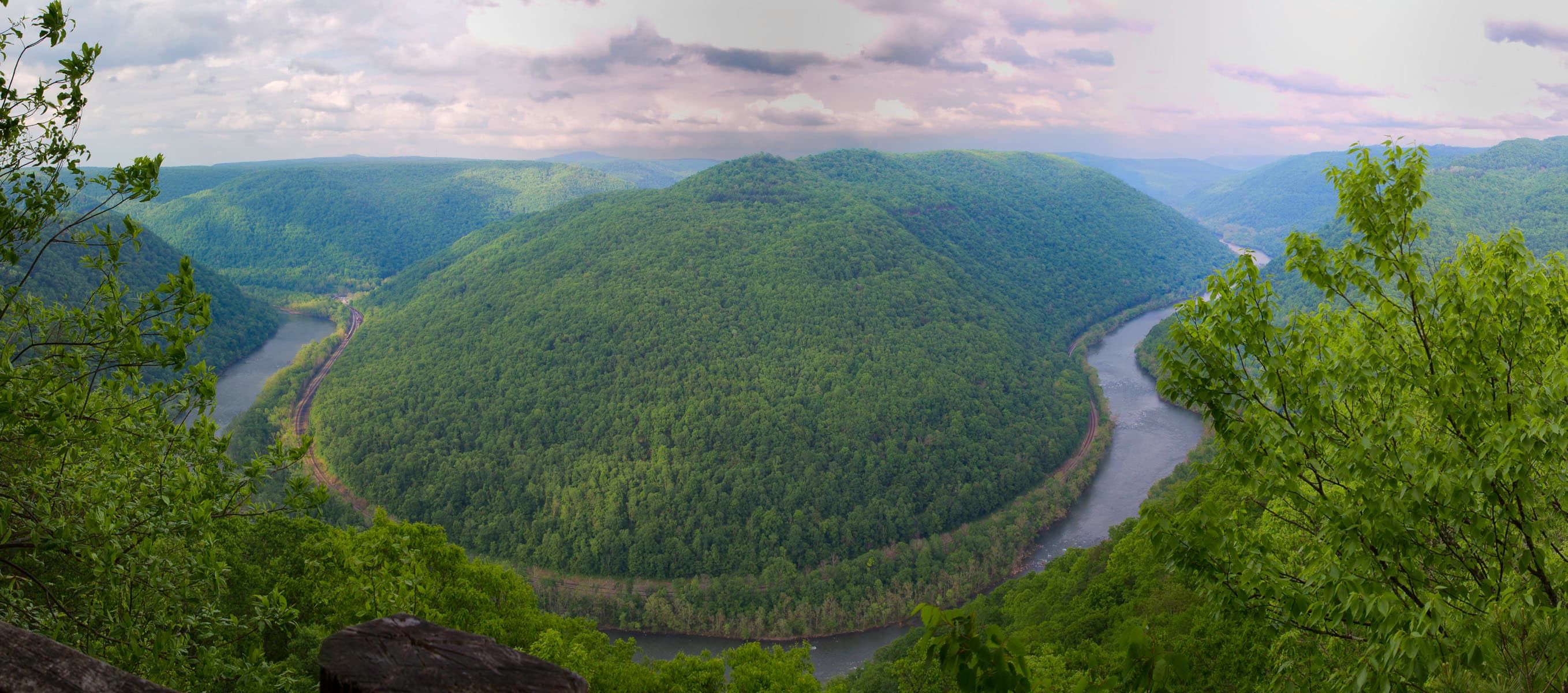
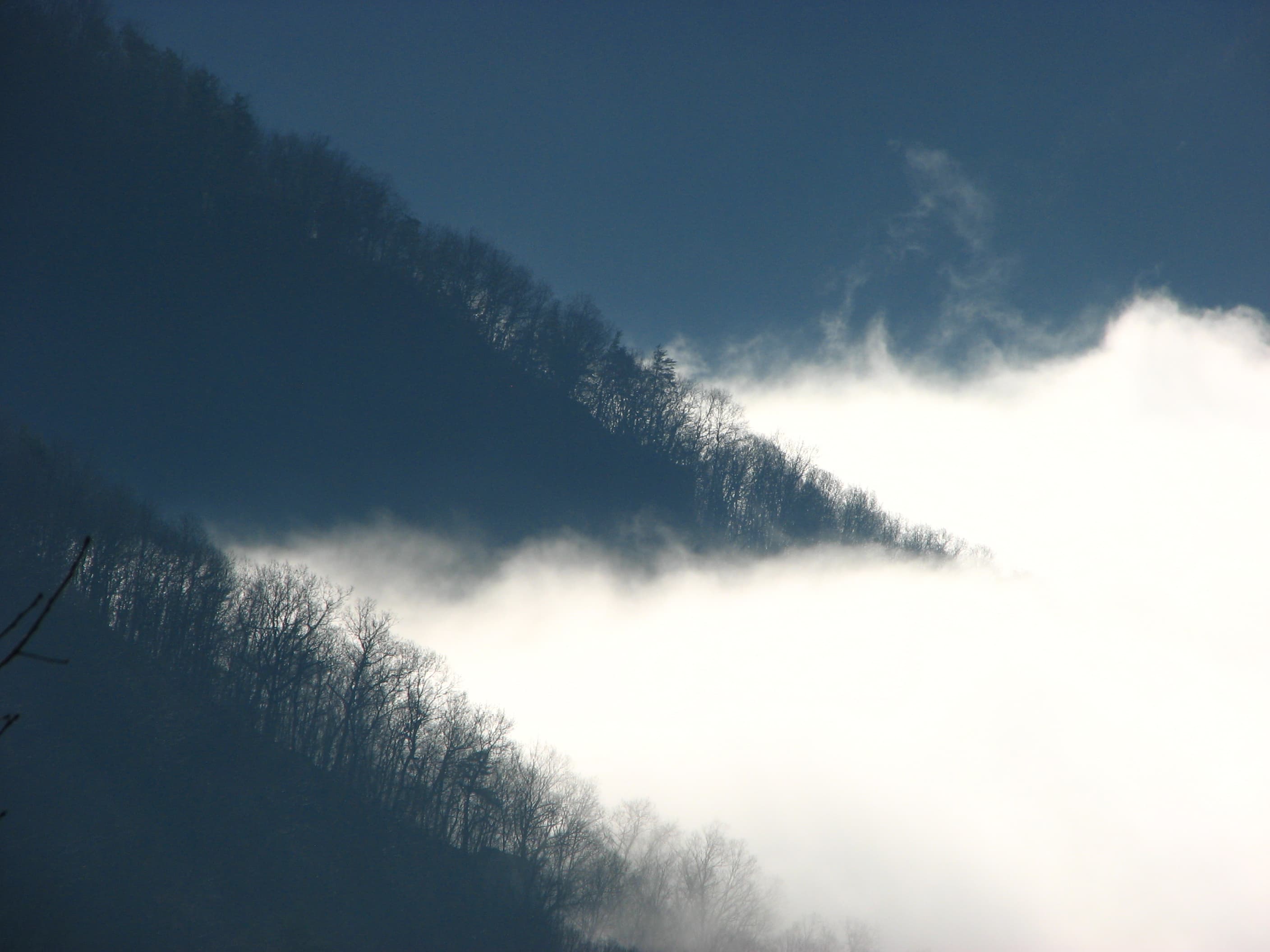
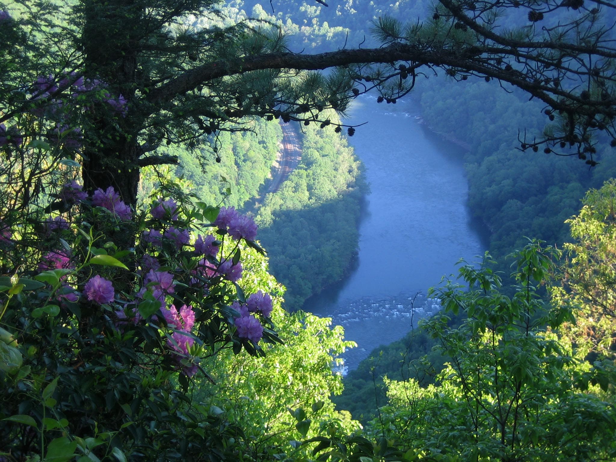
A rugged, whitewater river flowing northward through deep canyons, the New River is among the oldest rivers on the continent. The park encompasses over 70,000 acres of land along the New River, is rich in cultural and natural history, and offers an abundance of scenic and recreational opportunities.
Riding guide
Horses provided
Highlights
New River Gorge National Park and Preserve protects more than 70,000 acres of rugged Appalachian forest, deep river…
Riding
Rideable terrain here is noted as 6 miles, giving riders a clearer sense of scale before they ever unload. For equestrians, the park offers a quieter and more primitive riding experience compared with many national parks. Horseback access is limited to a small number of designated routes, but these trails pass through dense hardwood forests, historic mining corridors, and scenic river valleys that reflect the region’s rich natural and cultural history.
Rideable terrain
6 miles
Trailer parking
Brooklyn Miners Trailhead Location: Brooklyn Road area near Fayetteville on the north end of the park. Why riders use it Primary staging area for the Brooklyn Miners Trail, one of the few trails in the park open to horses Gravel parking area that can accommodate horse trailers Direct access to a historic mining road that descends into the New River Gorge One of the most reliable equestrian access points within the park. Bluestone Turnpike Trailhead Location: Bluestone National Scenic River unit near Pipestem in southern West Virginia. Why riders use it Main access point for the Bluestone Turnpike Trail, which allows horseback riding Large trailhead area with room for trailers Historic river corridor route following an old wagon road Scenic riding along the Bluestone River. Grandview Area Parking (Limited Trailer Use) Location: Grandview area near Beaver, West Virginia. Why riders use it Occasionally used by riders staging outside the main park road system Large visitor parking areas that can sometimes accommodate trailers Convenient access to nearby public lands and regional trail systems. Important Note for Riders Equestrian access within New River Gorge is very limited compared to many national parks. Only a small number of trails allow horseback riding, and most staging occurs at the trailheads listed above. Riders should confirm access and parking conditions before arriving, especially if traveling with large trailers.
Horse regulations
Horseback riding at New River Gorge National Park and Preserve is permitted on a limited number of designated trails and is managed to protect the park’s steep forested terrain, historic mining corridors, and river ecosystems. Equestrian use is restricted to specific routes within the park system, and riders should review park guidelines before visiting since most hiking trails and developed areas are closed to horses. However, several core regulations and best practices apply for riders in the park. Riding Is Only Allowed on Designated Trails Horses are permitted only on specific routes designated for equestrian use. These include the Brooklyn Miners Trail within the New River Gorge unit and the Bluestone Turnpike Trail within the nearby Bluestone National Scenic River unit managed with the park. Riding on other park trails, hiking paths, or developed visitor areas is prohibited. Stock Control and Trail Courtesy Riders are expected to: Maintain control of horses at all times Ride single file where trails are narrow Yield appropriately to hikers and other trail users Avoid damaging vegetation or creating new trails Trail Conditions and Surface Protection The park’s trails pass through steep Appalachian terrain and sensitive forest soils. Riders should avoid using equestrian trails during extremely wet conditions to prevent trail damage and erosion. Feed and Invasive Species Control To help protect native ecosystems within the park, riders should bring: Certified weed-free hay or feed Clean trailers, tack, and hooves before entering riding areas These practices help prevent the spread of invasive plant species. Camping With Horses Horse camping facilities are not provided within the park. Riders planning multi-day trips with horses should arrange accommodations outside the park and return for day rides on the designated equestrian trails. Equine Health Documentation Horses entering the park should comply with applicable state and federal livestock health regulations. Riders may be required to present proof of a current negative Coggins test if requested by park authorities.
Getting here
Use 104 Main Street, Glen Jean, West Virginia as your primary planning reference before you haul in. Brooklyn Miners Trailhead Location: Brooklyn Road area near Fayetteville on the north end of the park. Why riders use it Primary staging area for the Brooklyn Miners Trail, one of the few trails in the park open to horses Gravel parking area that can accommodate horse trailers Direct access to a historic mining road that descends into the New River Gorge One of the most reliable equestrian access points within the park. Bluestone Turnpike Trailhead Location: Bluestone National Scenic River unit near Pipestem in southern West Virginia. Why riders use it Main access point for the Bluestone Turnpike Trail, which allows horseback riding Large trailhead area with room for trailers Historic river corridor route following an old wagon road Scenic riding along the Bluestone River. Grandview Area Parking (Limited Trailer Use) Location: Grandview area near Beaver, West Virginia. Why riders use it Occasionally used by riders staging outside the main park road system Large visitor parking areas that can sometimes accommodate trailers Convenient access to nearby public lands and regional trail systems. Important Note for Riders Equestrian access within New River Gorge is very limited compared to many national parks. Only a small number of trails allow horseback riding, and most staging occurs at the trailheads listed above. Riders should confirm access and parking conditions before arriving, especially if traveling with large trailers.
Planning your visit
Riding at New River Gorge National Park and Preserve can be a rewarding experience, but equestrian access is limited and requires some planning. Riders should understand the park’s terrain, trail restrictions, and staging logistics before arriving. Limited Equestrian Trail Access Only two trails within the park system allow horseback riding: the Brooklyn Miners Trail and the Bluestone Turnpike Trail (in the nearby Bluestone unit). The vast majority of trails within New River Gorge are closed to horses, so riders should plan their outing around these designated routes. Trailer Parking Is Limited Horse trailer staging areas inside the park are limited and relatively small. The Brooklyn Miners Trailhead and Bluestone Turnpike Trailhead are the primary places riders stage trailers. Large rigs should plan carefully, as some access roads are narrow and winding. Steep Terrain and Narrow Roads New River Gorge is known for its steep Appalachian terrain and winding access roads. Riders hauling trailers should expect sharp turns, narrow roads, and elevation changes when traveling to trailheads. Weather Can Impact Trail Conditions The park receives frequent rain, and forest soils can become muddy and slick. Riding during very wet conditions can damage trails and make travel difficult for horses. No Horse Camping in the Park Equestrian camping facilities are not available within the park. Riders planning multi-day trips should arrange horse accommodations at nearby campgrounds, private farms, or equestrian facilities outside the park. Permits and Fees Most day riding within the park does not require a permit or entrance fee, but riders must follow all park regulations and stay on designated equestrian routes. Organized events or commercial guiding operations may require special use permits. Limited Services Near Trailheads Most equestrian access points within the park are undeveloped trailheads without water, hitching rails, or horse facilities. Riders should bring everything needed for the ride, including water for horses and riders. RideJoy Planning Level Light to moderate planning required New River Gorge offers beautiful forest riding and historic trail corridors, but the small equestrian trail network and rugged Appalachian terrain mean riders should plan their route and staging location ahead of time.
Where to stay
New River Gorge National Park and Reserve Headquarters is the main visitor-contact point tied to this destination, which is helpful when you want current conditions, maps, and stock-use updates before riding. Guided or concession-based riding support is noted here, so riders who are not hauling their own horses may still find an access path into the experience. For a polished trip plan, pair the ride with lodging, fuel, and resupply planning in or near Glen Jean before heading deeper into federal-land access points.
Park map
Trails
No trails synced for this park yet.
Campgrounds
Army Camp
11 sites
This campground offers both tent and RV campsites along the banks of the New River at one of its many horseshoe bends. There are 11 drive-in sites for RVs, campers, and tents. Only small (less than 25 feet) and medium (22 - 31.5 feet) RVs or campers are recommended. Large RVs or campers are not recommended. Some sites offer partial shade; others are located in the open with no shade. Camp only at designated sites. RV, camper, or car camping in non-designated sites is strictly prohibited.
Brooklyn Campground
5 sites
This tent only campground is located on the banks of the New River near the Cunard River Access point and Southside Trailhead. It offers 4 walk-in tents sites and 1 tent-only drive-in site. There are no drive-in sites for RVs or campers at this location. RV, camper, or car camping is prohibited.
Burnwood Group Campsite
1 sites
Burnwood is located across Route 19 from Canyon Rim Visitor Center and offers group camping. This site is only for groups of 8 or more people and requires a Special Use Permit. For a permit for the group campsites, contact the permits office at 304-465-6517. Permits require a minimum of 10 business days after the application has been received.
Glade Creek Campground
11 sites
This forested campground offers both tent and RV sites near the banks of the New River and the Glade Creek Trailhead. There are 6 walk-in tents sites and 5 drive-in sites for tents, RVs, or campers. There is 1 accessible site. Only small (less than 25 feet) and medium (22 - 31.5 feet) RVs or campers are recommended. Camp only at designated sites. RV, camper, or car camping in non-designated sites, walk-in sites, or any parking area is strictly prohibited.
Grandview Sandbar
16 sites
This campground offers shaded wooded campsites near the banks of the New River. There are 10 wooded drive-in sites for RVs, campers, car camping, and tents; 6 walk-in tents sites; and 2 accessible sites by the river. Only small (less than 25 feet) and medium (22 - 31.5 feet) RVs are recommended due to the tight access road. Camp only at designated sites. RV, camper, or car camping in non-designated sites, walk-in sites, or any parking area is strictly prohibited.
Meadow Creek Campground
17 sites
This primitive campground located along the New River is only one mile from the Sandstone Visitor Center. It offers 17 sites in an open field. The railroad crossing can be dangerous for larger RVs and trailers. The low grade railroad crossing is not suitable for extended wheelbase RVs such as motorhomes, fifth wheels and travel trailers etc. Campers should expect to hear some noise such as train horns.
Stone Cliff
7 sites
This tent only campground located near the historic railroad town of Thurmond offers 7 walk-in sites, 5 on the sandy beach of the New River and 2 in the nearby forest. There are no drive-in sites at this location. RV, camper, or car camping is prohibited. The Stone Cliff Trailhead also starts at the campground.
Thayer Campground
4 sites
This tent only campground is located near the community of Thayer along the banks of the New River. It has 4 walk-in sites. There are no drive-in sites at this location. RV, camper, or car camping is prohibited. Alcohol is prohibited at this campground.
War Ridge/Backus Mountain Campground
8 sites
This is the only campground in the park that is not along the river. It is located on a ridgetop near Backus Mountain. There are 8 drive-in sites for tents, RVs, or campers. Only small (less than 25 feet) RVs or campers are recommended. Camp only at designated sites. RV, camper, or car camping in non-designated sites or any parking area is strictly prohibited.
Points of interest
Adena Trail
POILabeled (2) on the Arrowhead Bike Trails map; LENGTH: 3.1 miles/4.99km (One-Way). DIFFICULTY: Easy to Intermediate. TRAIL TYPE: Hiking and Biking. DESCRIPTION: This trail loops through the forest on low-grade swooping dips along light uphill and downhill sections. This trail is 30" to 36" wide with a few rock-surfaced sections, wide turns and switchbacks, offering safe and exciting learning opportunities for beginning mountain bikers.
Arbuckle Connector Trail
POILabeled (4) on the Cunard, Thurmond and Stone Cliff Area Trails map LENGTH: 0.3 miles/0.48 km (One-way). DIFFICULTY: Strenuous. TRAIL TYPE: Hiking only. This steep and rocky trail connects the Rend and Southside Trails. Located 1.2 miles from the Thurmond end of the Rend Trail, just past the third trestle, this 0.3 mile connector trail drops off to the right. This trail also provides glimpses of the stonework and coke ovens of the former mining town of Wee Win.
Big Branch Falls
POIBig Branch Trail
POILabeled (5) on the Sandstone Brooks Area Trails map; LENGTH: 2.0 miles/2.74 km (Round-trip). DIFFICULTY: Strenuous. TRAIL TYPE Hiking only. On the west side of the river at Brooks Falls is the Big Branch Trail. This strenuous trail creates a 2 mile loop that is especially scenic in the early spring when wildflowers are in bloom. It can be a great place to see the early bloomers like trout lilies, spring beauties, toothwort, and bloodroot.
Big Buck Trail
POILabeled (2) on the Grandview Area Trails map; LENGTH: 0.9 miles/1.45 km (round trip). DIFFICULTY: Easy. TRAIL TYPE: Hiking only. This easy 0.9 mile trail loops through a rolling section of forest. Tree identification signs along the way celebrate the great diversity of flora found in the Appalachian forest.
Bridge Trail
POILabeled (4) on the Fayetteville - Lansing Area Trails map LENGTH: 0.86 miles/1.38 km (one way). DIFFICULTY: Strenuous. TRAIL TYPE: Hiking only. This occasionally steep and rocky trail offers views of the gorge and the New River Gorge Bridge. The trail passes under the bridge and connects to the Fayetteville Trail.
Bright Hope Lodge
POIBrooklyn Coke Ovens
POIThe beehive-style coke ovens of the Brooklyn Coal Company stand on the opposite side of the Southside trail, closer to the bank of the river.
Brooklyn Mine Trail
POILabeled (1) on the Cunard, Thurmond and Stone Cliff Area Trails map LENGTH: 2.7 miles/4.35 km (One-way). DIFFICULTY: Moderate. TRAIL TYPE: Hiking, biking and equestrian. This 2.7 mile hiking and equestrian Trail follows an old road through the forest to the Brooklyn coal mine site. Scenic views of the river through the trees can be found along the trail.
Brooklyn Mining Complex & Community Ruins
POIBrooklyn was a mining community and complex established in the 1890’s as one of the last coal camps in the area.
Brooks Falls Roadside Park
POIBrooks Island Overlook
POIBurnwood Trail
POILabeled (1) on the Fayetteville - Lansing Trails map LENGTH: 1.2 miles/1.93 km (Round-trip). DIFFICULTY: Easy. TRAIL TYPE: Hiking only. This enjoyable 1.2 mile loop trail leads through old-growth forest and rhododendron thickets. The trail then follows the edge of an open field, loops back through the forest, and returns to the field. This area was a former home site of the Laing family.
Burnwood Trail Stop 10: Old-Growth Forest Network
POIBurnwood Trail Stop 1: Logging in Appalachia
POIBurnwood Trail Stop 2: Defining Old-Growth
POIBurnwood Trail Stop 3: Forest Succession
POIBurnwood Trail Stop 4: Decoding the Old-Growth
POIBurnwood Trail Stop 5: Characteristics of Old Trees
POIBurnwood Trail Stop 6: How Tree Age is Determined
POIBurnwood Trail Stop 7: A Forest Giant
POIBurnwood Trail Stop 8: Decomposition
POIBurnwood Trail Stop 9: Old-Growth Complexity
POIButcher Branch Falls
POIButcher Branch Trail
POILabeled (11) on the Fayetteville - Lansing Area Trails map LENGTH: 0.8 miles/1.29 km (One-way). DIFFICULTY: Moderate. TRAIL TYPE: Hiking only. This wooded trail connects the Kaymoor Top area to the Long Point Trail, with a spur to the popular Butcher Branch climbing area. There are steep sections and a small stream crossing on this trail.
Camp Washington Carver
POICanyon Rim Boardwalk
POILabeled (2) on the Fayetteville - Lansing Trails map LENGTH: 0.1 miles/0.16 km (One-way). DIFFICULTY: Easy/strenuous. TRAIL TYPE: Hiking and accessible to the top overlook This boardwalk offers scenic views of the gorge and New River Gorge Bridge. An easy walk on a fully accessible ramp leads to the first viewing point, while 178 steps descend to the lower overlook.
Castle Rock Trail
POILabeled (4) on the Grandview Area Trails map; LENGTH: 0.6 miles/0.97 km (One-way). DIFFICULTY: Strenuous. TRAIL TYPE: Hiking only. This strenuous 0.6 mile trail begins near Main Overlook and ends where it intersects the Grandview Rim Trail, approximately ½ mile from Main Overlook. Hikers will find close-up views of towering fortress-like rock walls and exposed coal seams. The Castle Rock Trail and Grandview Rim Trail can make a great one mile loop.
Cathedral Falls
POIChapter 1: Canyon Rim Visitor Center
POIChurch Loop Trail
POILabeled (5) on the Cunard, Thurmond and Stone Cliff Area Trails map LENGTH: 0.1 miles/0.16 km (One-way). DIFFICULTY: Moderate to Strenuous. TRAIL TYPE: Hiking only. This 0.1 mile trail loops past the First Baptist Church of Thurmond.
Clovis Trail
POILabeled (1) on the Arrowhead Bike Trails map. LENGTH: 1.1 miles/1.77 km (Loop Trail). DIFFICULTY: Easy to Intermediate. TRAIL TYPE: Hiking and biking. DESCRIPTION: This compact loop trail offers lightly rolling, forested terrain on a tread that is 30" to 36" wide. There are a couple of short, even rocky sections that are simple to navigate on bike or foot. For runners and bikers, this trail offers a nice sense of flow.
Coaling Tower
POIThe tall coaling tower used to load rail cars.
Commissary Building
POIThe old Commissary building that was most recently a U.S. Post Office.
Conveyor Trail
POILabeled (2) on the Nuttallburg Area Trails map; LENGTH: 0.8 miles/1.29 km (One-way). DIFFICULTY: Strenuous. TRAIL TYPE: Hiking only. This steep, rugged trail zigzags from the mid-bench level, not far from the mine entrance, to the old Keeneys Creek railroad line (trail). Views of the conveyor and gorge is visible from time to time, but be sure to watch your footing, for the trail surface is loose and slaggy (old coal debris from the conveyor) in many places.
Craig Branch Trail
POILabeled (10) on the Fayetteville - Lansing Area Trails map LENGTH: 2.4 miles/3.86 km (One-way). DIFFICULTY: Moderate. TRAIL TYPE: Hiking and biking. This forest trail offers views of the river and gorge, plus it connects to the Kaymoor Trail, offering access to the historic Kaymoor coal mine site. There are several steep sections on this gravel trail (administrative road).
Dalton Trail
POILabeled (3) on the Arrowhead Bike Trails map; LENGTH: 6.4 miles/10.3 (One-Way); DIFFICULTY: Intermediate: TRAIL TYPE: Hiking and biking; DESCRIPTION: This trail is more narrow than the easy (green) loops in the Arrowhead Trail system. Trail tread width is 20" to 24" with tight turns and mildly steep hills. From Point N, ride towards Point M along a ridge line, then drop down through a cool rhododendron tunnel.
DuBois High School
POIDunloup Falls
POIEndless Wall Trail
POILabeled (3) on the Fayetteville - Lansing Area Trails map; LENGTH: 2.4 miles/3.86 km (One-way). DIFFICULTY: Moderate. TRAIL TYPE: Hiking only. The Endless Wall Trail is a 2.4 mile moderate walk that passes through rich forest, crosses Fern Creek, then zig-zags along the cliff edge. Many vistas can be seen along the trail.
Engine House
POIThe Engine House was where the railroad crew worked on railcars and engines.
Fayetteville Trail
POILabeled (5) on the Fayetteville - Lansing Area Trails map; LENGTH: 3.96 miles/6.37 km (One-way). DIFFICULTY: Strenuous. TRAIL TYPE: Hiking and biking. This trail connects Fayette Station Road, the town of Fayetteville, and Kaymoor Top with hiking access to Long Point. Be prepared for a creek crossing and up and down terrain. Connections can be made to the following trails: Kaymoor, Bridge, Park Loop, Timber Ridge, Long Point, Butcher Branch, Kaymoor Miners, and Craig Branch
Gauley Bridge Depot
POIGlade Creek Falls
POIGlade Creek Trail
POILabeled (1) on the Glade Creek Trails map; LENGTH: 5.6 miles/9.01 km (One-way). DIFFICULTY: Moderate. TRAIL TYPE: Hiking and biking. This 5.6 mile trail follows an abandoned narrow-gauge railroad along Glade Creek. The trail offers an enjoyable stroll at a very moderate grade, and is popular with hikers of all ages and abilities, as well as being a favorite destination for those in search of swimming holes.
Goodman-Kincaid Building
POIOne of the original buildings of Thurmond that housed Mrs. McClure's diner.
Grandview
POIGrandview Rim Trail
POILabeled (5) on the Grandview Area Trails map; LENGTH: 1.6 miles/2.57 km (One-way). DIFFICULTY: Moderate. TRAIL TYPE: Hiking only. This is the longest trail at Grandview, connecting Main Overlook with Turkey Spur. From Main Overlook to Turkey Spur is a moderate 1.6 mile hike (3.2 miles round trip). Along the way hikers will enjoy many breathtaking views of the gorge and river far below.
Gwinn Ridge Trail
POILabeled (2) on the Sandstone Brooks Area Trails map; LENGTH: 3.0 miles/4.83 km (Round-trip). DIFFICULTY: Strenuous. TRAIL TYPE: Hiking only. South of Sandstone Visitor Center on the east side of the New River off Brooks Mountain Road is the Gwinn Ridge Trail, a three mile loop through a ridge top forest. The south branch of the moderately strenuous trail follows the edge of the ridge where hikers can sometimes (in winter) get views through the trees.
Harlem Heights
POIHawks Nest Tunnel Disaster
POIHeadhouse Trail
POILabeled (1) on the Nuttallburg Area Trails map; LENGTH: 0.7 miles/1.13 km (One-way). DIFFICULTY: Moderate. TRAIL TYPE: Hiking and biking. This gravel trail (administrative road) leads to the entrance of the Nuttall coal mine and top of the coal conveyor which was used to transport coal from the mine to the processing area at river level. Learn more about this mine operation from exhibits at this site. Stairs next to the conveyor allow a closer look at the conveyor structure
Helen, WV
POIHinton Depot
POIHinton, WV
POIIntegration of Schools: DuBois High School; Mount Hope, WV
POIIsland Loop Trail
POILabeled (4) on the Sandstone Brooks Area Trails map; LENGTH: 0.5 miles/0.8 km (Round-trip). DIFFICULTY: Easy. TRAIL TYPE: Hiking only. The Island Loop Trail is an easy ½ mile trail that loops around the largest island below Sandstone Falls. The island was once farmed, grazed, and timbered, and a grist mill once operated here. Today, hikers can observe the natural succession as the old fields transition back to forest.
John Henry Park, Talcott, WV
POIKanawha Falls
POIKates Falls
POIKates Falls Trail
POILabeled (2) on the Glade Creek Trails map; LENGTH: 0.2 miles/0.32 km (One-way). DIFFICULTY: Strenuous. TRAIL TYPE: Hiking only. This is a very short 2/10 mile, steep spur trail leading from the Glade Creek Trail to Kates Falls.
Kates Plateau Trail
POILabeled (3) on the Glade Creek Trails map; LENGTH: 5.1 miles/8.21 km (Round-trip). DIFFICULTY: Strenuous. TRAIL TYPE: Hiking only. Look for signs of beaver, deer, and turkey as you follow old logging roads. The 5.1 mile trail passes through fields, forests, and near wetlands. Initially the trail passes under Interstate 64, then crosses Kates Branch. The creek crossing of Kates Branch can be challenging and involves some steep terrain.
Kaymoor Mine Falls
POIKaymoor Miners Trail
POILabeled (9) on the Fayetteville - Lansing Area Trails map; LENGTH: 1.0 miles/1.6 km (One-way). DIFFICULTY: Strenuous. TRAIL TYPE: Hiking only. This forest trail descends steeply 0.5 miles from the top of the gorge with stairs and switchbacks to the Kaymoor coal mine site, where it crosses the Kaymoor Trail.
Kaymoor Trail
POILabeled (8) on the Fayetteville - Lansing Area Trails map; LENGTH: 8.6 miles/13.84 km (One-way). DIFFICULTY: Moderate. TRAIL TYPE: Hiking and biking. The Kaymoor Trail runs parallel with the middle of the gorge, passing the historic coal mine site at Kaymoor. The northern two miles of the trail, from Wolf Creek trailhead to the old mine site, follows an old road. Wayside exhibits interpret the Kaymoor mine operation and community along the way.
Keeneys Creek Rail Trail
POILabeled (3) on the Nuttallburg Area Trails map; LENGTH: 3.3 miles/5.31 km (One-way). DIFFICULTY: Easy. TRAIL TYPE: Hiking and biking. Enjoy a leisurely stroll or bike ride on this wide trail that criss-crosses the rugged mountain landscape at a 4% grade. Here it is easy to see how the rugged terrain was a great challenge to those who constructed this railroad line over 100 years ago.
Lafayette Hotel
POIThe site of the original Lafayette Hotel in Thurmond, WV
LeCroy Trail
POILabeled (4) on the Arrowhead Bike Trails map; LENGTH: 1.8 miles/2.9 km (One-way); DIFFICULTY: Intermediate; TRAIL TYPE: Hiking and biking; DESCRIPTION: The LeCroy Trail is narrow, with a tread width of 20" to 24". Enjoy a few stretches of rolling and sweeping turns, and cross a challenging rock bridge over a small drainage then be enchanted by a tunnel of rhododendron.
Little Laurel Trail
POILabeled (1) on the Grandview Area Trails map; LENGTH: 2.6 miles/4.18 km (One-way). DIFFICULTY: Strenuous. TRAIL TYPE: Hiking and biking. This strenuous trail connects Grandview with the New River 1,400 feet below. The trail follows an old road for two miles as it descends to the river, passing by the site of an old coal mine at Royal.
Long Point Trail
POILabeled (12) on the Fayetteville - Lansing Area Trails map; LENGTH: 1.6 miles/1.29 km (One-way). DIFFICULTY: Moderate. TRAIL TYPE: Hiking and biking . This trail traverses field and forest on the way to a rock outcrop (Long Point) with panoramic views of the gorge and New River Gorge Bridge. Most of this trail lazily descends through the forest, but it does include one steep section just before you arrive at the point.
Mankin-Cox Building
POIThe Mankin-Cox Building in Thurmond, WV
McKendree Miner's Hospital
POIMt. Chapel Missionary Baptist Church
POINational Bank of Thurmond
POIThe National Bank of Thurmond Building
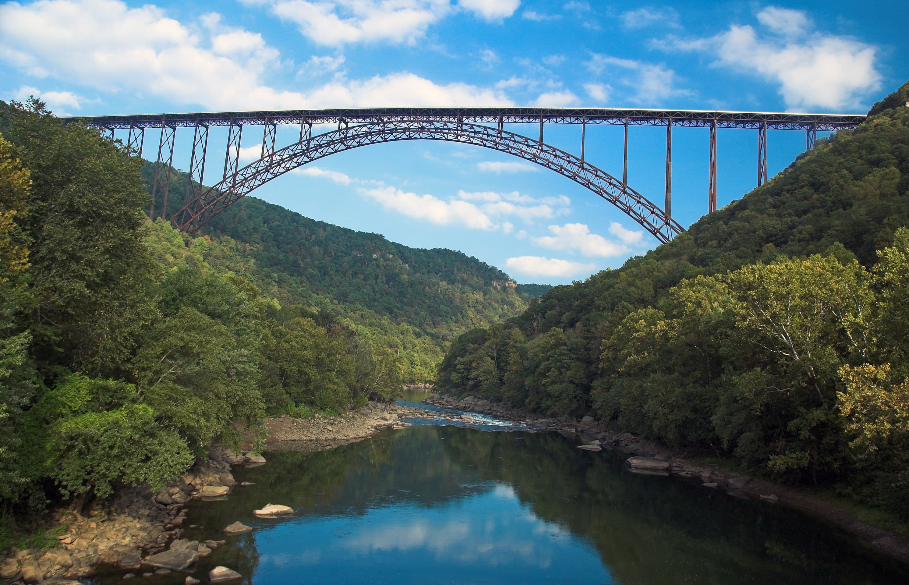
New River Gorge Bridge
POIWhen the New River Gorge Bridge was completed on October 22, 1977, a travel challenge was solved. The bridge reduced a 40-minute drive down narrow mountain roads and across one of North America's oldest rivers to less than a minute. When it comes to road construction, mountains do pose a challenge. In the case of the New River Gorge Bridge, challenge was transformed into a work of structural art - the longest steel span in the western hemisphere.
Nuttallburg
POINuttallburg Historic Site
POIPark Headquarters, Glen Jean
POIPark Loop Trail
POILabeled (6) on the Fayetteville - Lansing Area Trails map; LENGTH: 1.1 miles/1.7 km (Round-trip). DIFFICULTY: Easy. TRAIL TYPE: Hiking and biking. The Park Loop is an enjoyable loop trail that begins at the Town Park in Fayetteville, with a connection to the Fayetteville Trail.
Polls Plateau Trail
POILabeled (4) on the Glade Creek Trails map; LENGTH: 4.9 miles/7.89 km (round trip). DIFFICULTY: Moderate. TRAIL TYPE: Hiking only. Cross several creeks on this 4.9 mile trail that passes through an upland forest and past an old farmstead. Some of the trail follows an old roadbed; the route may not always be obvious due to drainages and other old roadbeds.
Quinnimont Missionary Baptist Church
POIRed Ash Coke Ovens
POIThe Red Ash coke ovens were built in a bread-loaf/vault style, differing from the more common beehive style ovens that were used at Brooklyn and Rush Run (or from the rest of the beehive style ovens in the park, for that matter).
Red Ash Community and Mining Ruins
POIThe mining community of Red Ash was established in 1891 to accommodate its namesake mine, as well as others in the area, including Rush Run and Kaymoor.
Red Ash Island
POIRed Ash Island is a 12-acre pseudo-isle previously used by the Red Ash mining community. The Island had swimming holes, a baseball diamond, dance platform, and most notably, a cemetery.
Rend Trail
POILabeled (3) on the Cunard, Thurmond and Stone Cliff Area Trails map LENGTH: 3.4 miles/5.47 km (One-way). DIFFICULTY: Easy. TRAIL TYPE: Hiking and biking. An easy grade and wide, smooth trail make the Rend Trail one of the most popular trails in the park. It is great for hikers of all ages and levels of fitness, and a great start for beginning mountain bikers.
Richmond Hamilton Farm
POIRush Run Coke Ovens
POIThese beehive coke ovens belonged to the mining company of Rush Run. Evidence supports that there may have been as many as 180 ovens at this site. The ovens run parallel to the river side of the trail.
Rush Run Community Ruins
POIRush Run was established in 1889 by the Rush Run Coal Company as the earliest mining town along the old C & O railway on this tour. It was a busy community that was even equipped with its own post office and saloon. In 1905, five years after the initial tragedy at Red Ash, yet another disaster occurred in the conjoined Red Ash and Rush Run mines, ultimately killing 24 men. After the closure of the Rush Run mine in the 1940s, the town was abandoned.
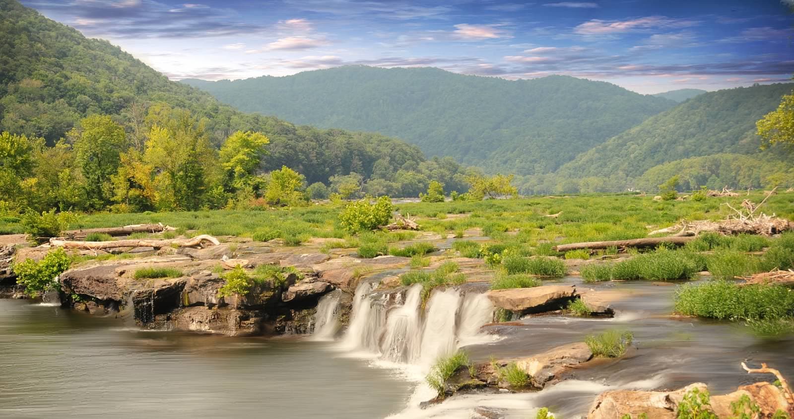
Sandstone Falls
POISandstone Falls Boardwalk
POILabeled (3) on the Sandstone Brooks Area Trails map; LENGTH: 0.2 miles/0.32 km (One-way). DIFFICULTY: Easy. TRAIL TYPE: Hiking and accessible. Sandstone Falls is a sight that should not be missed. This is the largest waterfall on the New River spanning 1500 feet across. Divided by islands, the falls drop from 10 to 25 feet. A ¼ mile, handicapped accessible boardwalk crosses two bridges leading to islands and observation decks offering fantastic views of the falls.
Sandstone Falls Overlook
POILabeled (1) on the Sandstone Brooks Area Trails map; LENGTH: 0.1 mi/0.16 km. DIFFICULTY: Moderate. TRAIL TYPE: Hiking only. See all of Sandstone Falls at this scenic overlook just off of the highway. This short, gravel walkway descends briefly from the parking lot to a view of the falls and river, 600 feet below.
Second Baptist Church, Hinton, WV
POISeldom Seen Trail
POILabeled (7) on the Nuttallburg Area Trails map; LENGTH: 0.3 miles/0.48 km (One-way). DIFFICULTY: Easy. TRAIL TYPE: Hiking and biking. Seldom Seen served as a small residential community for some families of those employed at Nuttallburg. Follow this trail to the town site, where a foundation here or there are all that remain, evidence of an earlier time and life in the New River Gorge.
Slab Fork
POISouthside Trail
POILabeled (2) on the Cunard, Thurmond and Stone Cliff Area Trails map LENGTH: 7.0 miles/11.27 km (One-way). DIFFICULTY: Easy. TRAIL TYPE: Hiking and biking. This easy seven mile riverside trail provides great views of the New River and passes through several abandoned New River Gorge mining towns. Rush Run, Red Ash, and Brooklyn were all once bustling communities located along this abandoned railroad line. The first mile from Cunard River Access is open to motorized vehicles.
Stone Cliff Trail
POILabeled (6) on the Cunard, Thurmond and Stone Cliff Area Trails map LENGTH: 2.7 miles/4.35 km (One-way). DIFFICULTY: Easy to Moderate. TRAIL TYPE: Hiking and biking. This moderate 2.7 mile trail follows an old road along the banks of the New River. Great views and easy access to the river are available along this trail.
Stratton High School
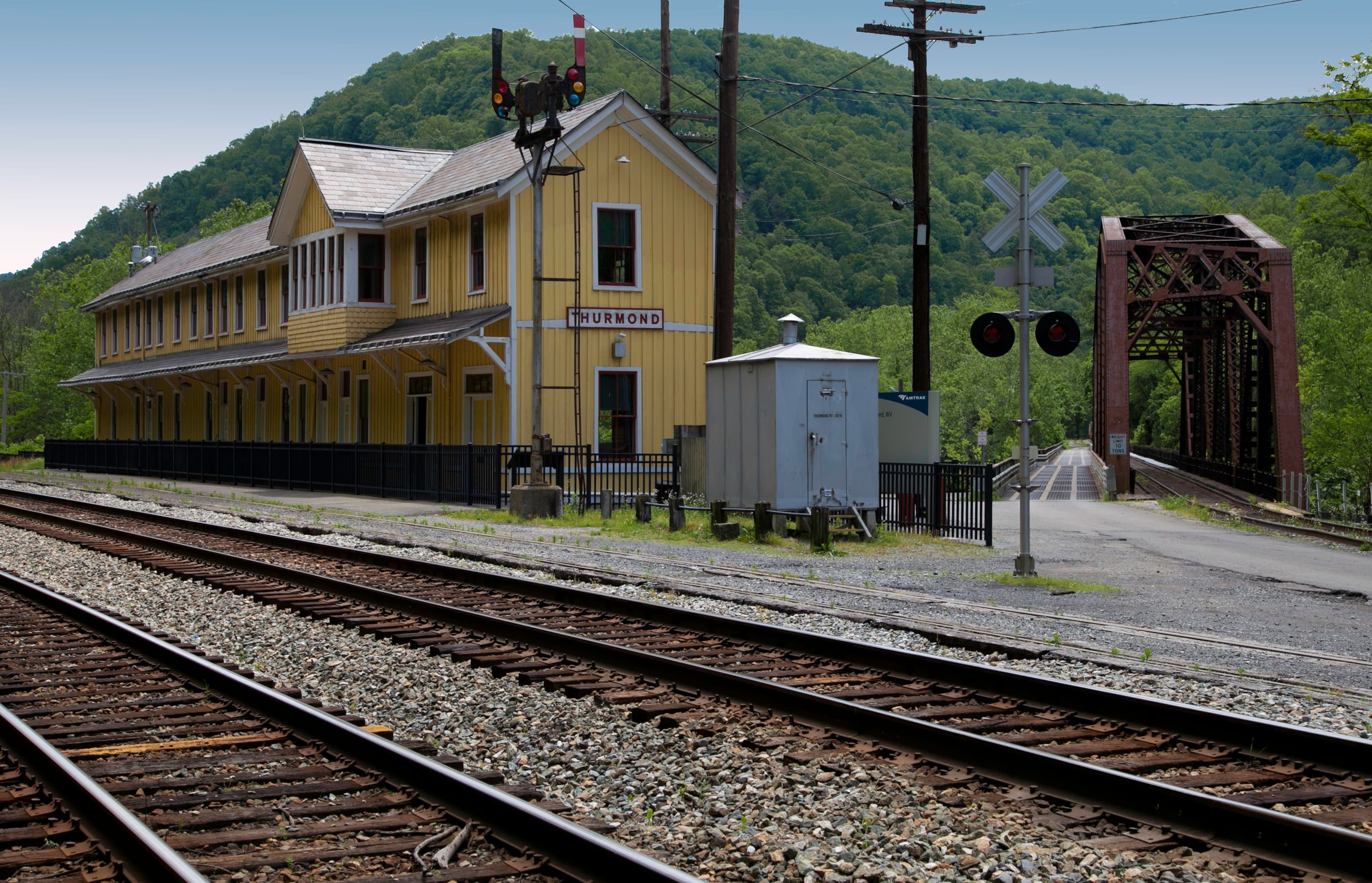
POIThurmond Historic District
POIThurmond Passenger Depot
POIThe historic Thurmond Depot Visitor Center
Thurmond Today
POIThe restored Thurmond Depot Visitor Center
Timber Ridge Trail
POILabeled (7) on the Fayetteville - Lansing Area Trails map; LENGTH: 1.0 miles/1.6 km (One-way). DIFFICULTY: Easy. TRAIL TYPE: Hiking and biking. This old, forested roadbed provides access to the Fayetteville Trail near Wolf Creek.
Tipple Trail
POILabeled (6) on the Nuttallburg Area Trails map; LENGTH: 0.6 miles/0.96 km (One-way). DIFFICULTY: Easy. TRAIL TYPE: Hiking and biking. This trail reveals both the industrial and community side of Nuttallburg through structures and exhibits along the trail. Travel down the trail (west) to see the conveyor and tipple system used in this operation, designed by Henry Ford in the 1920s.
Town Loop Connector Trail
POILabeled (4) on the Nuttallburg Area Trails map; LENGTH: 0.3 Miles/0.48 km (One-way). DIFFICULTY: Moderate. TRAIL TYPE: Hiking and biking. Get a glimpse of Nuttallburg's community life on this trail through a residential area of Nuttallburg. Foundations of a home can be seen along the way; an exhibit in this area shows what life was like in this once bustling community. Note: Climbing, sitting, or walking on walls and other constructed features weakens them.
Town Loop Trail
POILabeled (5) on the Nuttallburg Area Trails map; LENGTH: 0.5 miles/0.8 km (Round-trip). DIFFICULTY: Moderate. TRAIL TYPE: Hiking only. Get a glimpse of Nuttallburg's community life on this trail that loops around a residential area of Nuttallburg. Foundations of a church, school, and homes are visible along the way; exhibits in this area show what life was like in this once bustling community.
Trump Lilly Farm
POITunnel Trail
POILabeled (7) on the Grandview Area Trails map; LENGTH: 0.5 miles/0.8 km (One-way). DIFFICULTY: Moderate. TRAIL TYPE: Hiking only. Cool off along Grandview's shortest and shadiest trail. The moist earth, lush vegetation, and cold-to-the-touch sandstone walls make a stroll along this forest trail a special experience, even on the hottest day. The ½ mile trail passes several tunnels in the rock and passes beneath a large rock overhang.
Water Tank Foundations
POIThe site of the water towers that supplied the town of Thurmond
Winona
POIWoodland Loop Trail
POILabeled (3) on the Grandview Area Trails map; LENGTH: 0.6 miles/0.97 km (Round-trip). DIFFICULTY: Easy. TRAIL TYPE: Hiking only. Explore the rich forest on this leisurely 0.6 mile loop. A variety of wildlife can be seen on this quiet trail including turkey and deer.
Things to do
Bicycling at New River Gorge
New River Gorge National River offers over fifty miles of mountain bike trails, varying from easy to difficult in terrain and distance.
Brooks Overlook
Brooks Overlook is a favorite viewing spot for visitors and locals. There is a pair of Bald eagles that reside, year round, on Brooks Island and catching a glimpse of them is sure to spark delight.
Duration: 5 Minutes
Castle Rock Hike
Amazing hike that brings you right next to the layers of rocks that make-up the gorge. The trail is uneven and requires some scrambling over some of the rock obstacles. The steps are made up of rocks and can be super slippery when wet. This trail is not recommended if there is ice or snow due to potential slipping hazards.
Duration: 30-120 Minutes
Climbing at New River Gorge
With over 1,400 established climbing routes, New River Gorge National Park and Preserve has become one of the most popular climbing locations in the country.
Fishing at New River Gorge
New River Gorge National Park and Preserve offers many outstanding opportunities for fishing in teh New River and its tributaries.
Grandview Main Overlook
The Grandview Main Overlook is located about two football fields in distance from the parking area near the Grandview Visitor Center. There is a kiosk that is a triangular shaped structure with maps and information and the walking path to the Overlook begins at this location.
Duration: 15 Minutes
Hike the Grandview Rim Trail
Hike the Grandview Rim Trail
Duration: 0-2 Hours
Hunting in the Park
Hunting is permitted in any areas designated as National Preserve. Knowing your location and rules for that area are the hunter's responsibility. There are areas where hunting is prohibited in New River Gorge National Park and Preserve, including safety zones near public areas and the 800 acre section of the park at Grandview (these are all the areas designated as New River Gorge National Park, Camp Brookside, the Arrowhead Trail Area, the Park Loop Trail Area, and Burnwood.
Sandstone Falls Overlook
Wildlife Observation Nature Observation
Duration: 10 Minutes
Scenic Drive on Fayette Station Road
The scenic Fayette Station Road provides outstanding views of the gorge and the river while passing under the New River Gorge Bridge three times as it winds up and down the steep sides of the gorge.
Duration: 45 Minutes
Stroll on the Sandstone Boardwalk
Stroll along the Sandstone Falls Boardwalk.
Duration: 30 Minutes
Trail run at Endless Wall
Endless Wall Trail is and excellent place for a trail run but due to the volume of other hikers, this trail runner would recommend that this be an early morning location. The trail is easy to moderate for elevation change and if you make a loop and run on the road to connect the two parking areas, the loop will be approximately 3.0 miles in all. There are a few must sees and that is a detour off the main trail and follow the sign for Diamond Point. The view is amazing.
Duration: 60-120 Minutes
Trail Run Grandview Rim Trail
Trail run that is 3.1 miles. This is an out and back route that is on different compositions. It is mostly a dirt path with varying degrees of hardness. In fall, when leaves are falling, be aware that the leaves can block view of any dips in the trail terrain.
Trail Run or hike the Little Laurel Trail
The 4.0 mile roundtrip trail run or hike is strenuous. The terrain is crushed rock for most of the trail, but there are a few areas that the terrain can be a bit uneven. If you start at the trailhead in the Grandview location, it will be downhill for 2.0 miles and then uphill for 2.0 miles. There will be just over 1000 foot change in elevation for this trail.
Duration: 30-120 Minutes
View the Overlooks at the Canyon Rim Visitor Center
Canyon Rim Visitor Center overlooks for the New River Gorge Bridge and the New River Gorge
Duration: 0-30 Minutes
Whitewater Boating
Whitewater rafting and kayaking is one of the more popular activities at New River Gorge. Boaters can go with an outfitter or on your own if you have the proper experience. The New River is characterised by big, powerful rapids and a boulder strewn river gorge.
Visitor centers
Canyon Rim Visitor Center
Canyon Rim Visitor Center is one of the park's primary, year round visitor centers. It is located at the New River Gorge Bridge, just north of Fayetteville. A wooden boardwalk provides scenic views of the New River Gorge Bridge and the gorge. There are no hiking trails that start at the visitor center. The center features exhibits, information, park film, and a book store.
Get directionsGrandview Visitor Center
The Grandview Visitor Center is one of our seasonal visitor centers, typically open from Memorial Day to Labor Day. Here there are overlooks of the New River, five hiking trails, ranger-led walks and talks, summer outdoor dramas, and picnic areas with playgrounds.
Get directionsSandstone Visitor Center
Sandstone Visitor Center is one of the primary visitor centers for New River Gorge National Park and Preserve. It is a green design building where visitors can learn about the park and the watershed through exhibits and a park film. The center also features a native plant garden, picnic areas, and book store.
Get directionsThurmond Depot Visitor Center
Thurmond Depot is a restored railroad depot located in the historic railroad town of Thurmond. Open seasonally (typically Memorial Day to Labor Day), the Depot is an information center and a park store.
Get directions
Webcams
Canyon Rim Webcam
Currently unavailable.
Canyon Rim Webcam
Currently unavailable.
Hours of operation
New River Gorge National Park and Preserve
The park itself is open 24 hour a day, year round. The park's two main visitor centers at Canyon Rim and Sandstone are open daily from 9:00 am to 5:00 pm (closed on Thanksgiving, Christmas, and New Years Day). There are two seasonal Visitor Centers located in Thurmond and Grandview. They are typically open Memorial Day to Labor Day.
Mon
All Day
Tue
All Day
Wed
All Day
Thu
All Day
Fri
All Day
Sat
All Day
Sun
All Day
Activities
Weather
Weather in the Appalachian Mountains can be unpredictable and can change quickly. Always be prepared for the possibility of sudden storms. Weather in the mountains is often cooler and wetter than the surrounding area. On average, the warmest month is July. The maximum average precipitation also occurs in July.
Contact
Photos
Stay near this park
No horse-friendly stays listed near New River Gorge National Park & Preserve yet. Know a great barn or property? Help fellow riders by listing it.
List your propertyDirections
To reach Park Headquarters take Route 19 North from Beckley to the Glen Jean exit. Upon exiting Rt 19, make an immediate left turn. At the next intersection, turn right. Park Headquarters will be straight ahead on the right. GPS Coordinates for Headquarters: 81.15587W, 37.92775N PLEASE NOTE: Third party search and map apps may direct you to an potentially inaccessible area of the park with no amenities or rangers stations. Please refer to the Visitor Center or Park Headquarters addresses for directions.
Source: nps.gov