
Danger
Crews Responding to Lightning-Caused Mt. Tom Creek Fire
The lightning-caused Mt. Tom Creek Fire is burning on a remote mountain slope on the west side of Olympic National Park. Fire management officials have ordered aviation and ground resources to respond to the fire, including Type 1 and Type 2 helicopters, enhanced reconnaissance aircraft, wildland fire engines, and hand crews. The Lake of the Gods backcountry campsite is closed. Backpackers are encouraged to consider alternative routes. There are no evacuation orders.
More infoPark Closure
Hurricane Hill Road Closed Mon-Thurs Through July 2
Due to a water system rehabilitation project, Hurricane Hill Road will be closed Monday-Thursday through July 2. The road will reopen every Friday-Sunday as long as all vehicles continue to clear the area by Sunday evening and do not impede construction activities on Monday morning. Hurricane Ridge Road will remain open throughout the construction period. See the Hurricane Ridge section on the Alerts and Conditions page for more information.
Caution
Limited Rialto Beach Parking, Mora Rd Construction & Closure Begins July 8
Contractors have begun staging equipment and materials for Mora Road repairs in the Quileute Tribe's parking lot. Parking in the NPS lot at Rialto Beach is very limited. Consider carpooling or visiting other beaches. Beginning July 8th, Mora Road will close to all traffic, including bicycles and pedestrians, at the campground. Rialto Beach will not be accessible via Mora Road during this construction period. Mora Campground will remain open.
Park Closure
Staircase, Adjacent Wilderness Areas Closed due to Bear Gulch Fire Impacts
Park crews have been removing hazard trees and repairing infrastructure. The Staircase developed area will reopen when multiple safety, infrastructure, and visitor services goals are met within Olympic National Park and Olympic National Forest. For a full list of closed trails and campsites, visit our Fire Conditions and Updates page.
More infoInformation
South Shore Quinault Road Washed Out Beyond Park Boundary
South Shore Road – which is maintained by Jefferson County – is closed due to a major wash-out. For more information, visit the Jefferson County website.
More infoOlympic National Park
WA · Port Angeles
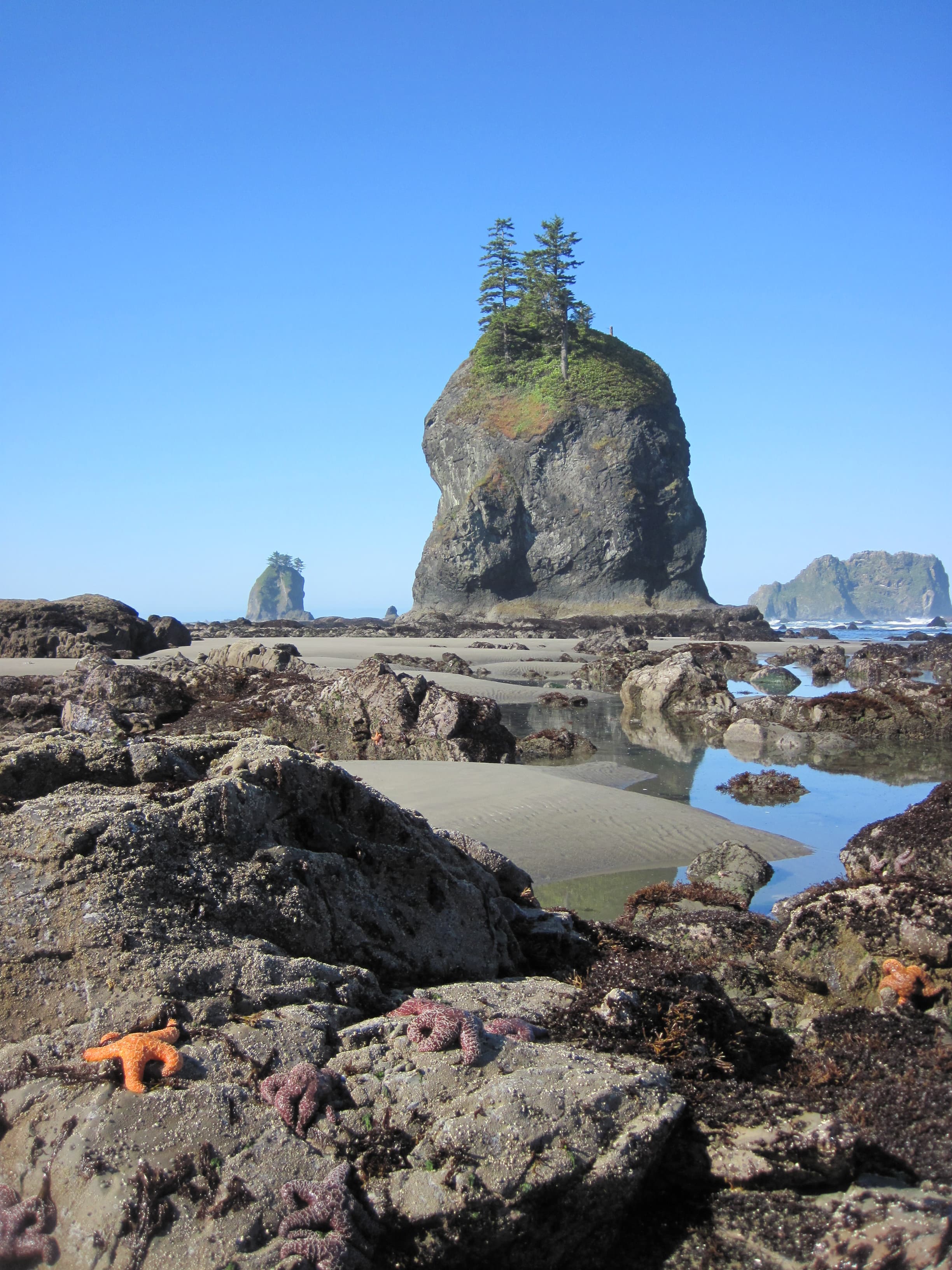
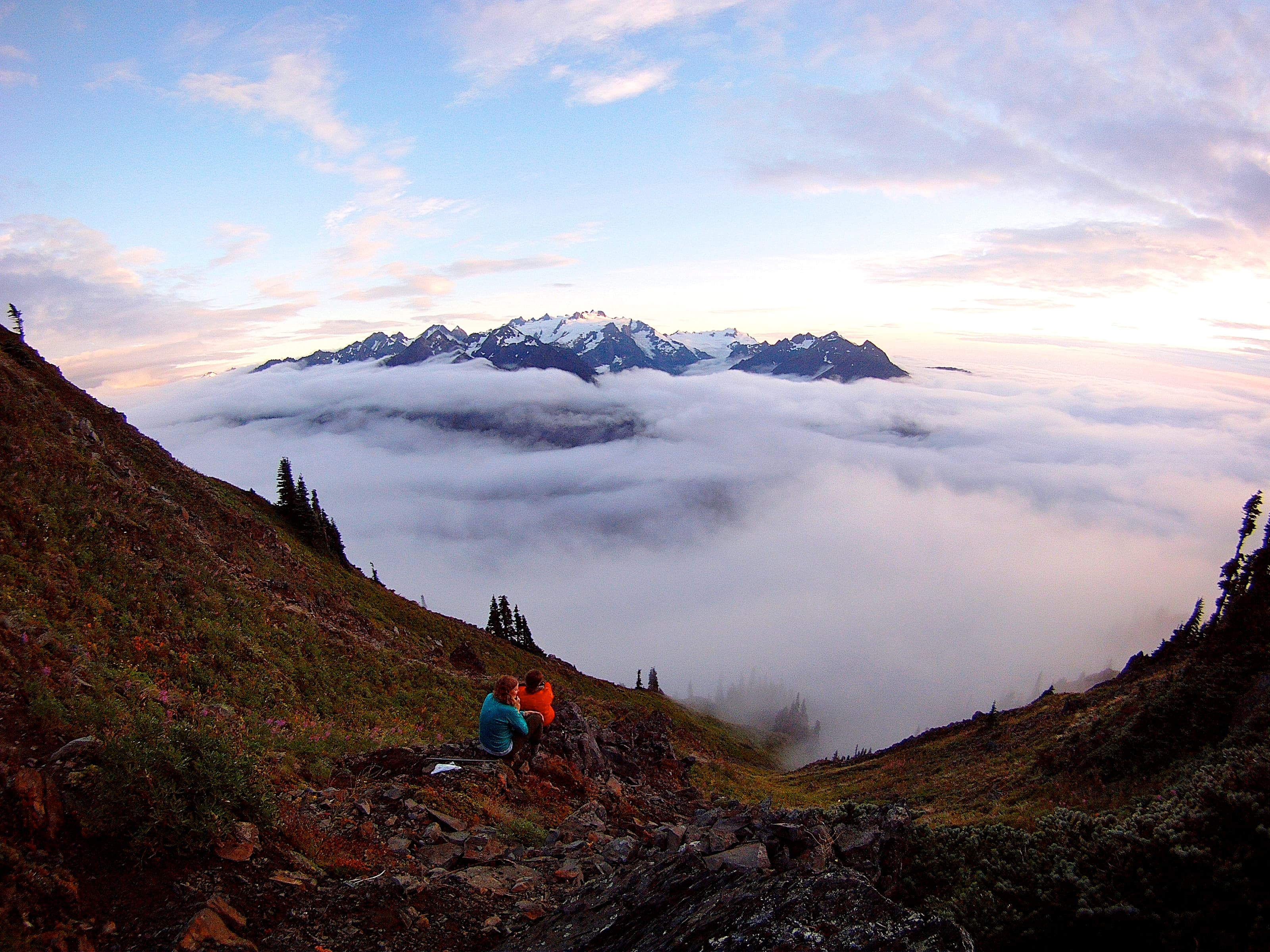
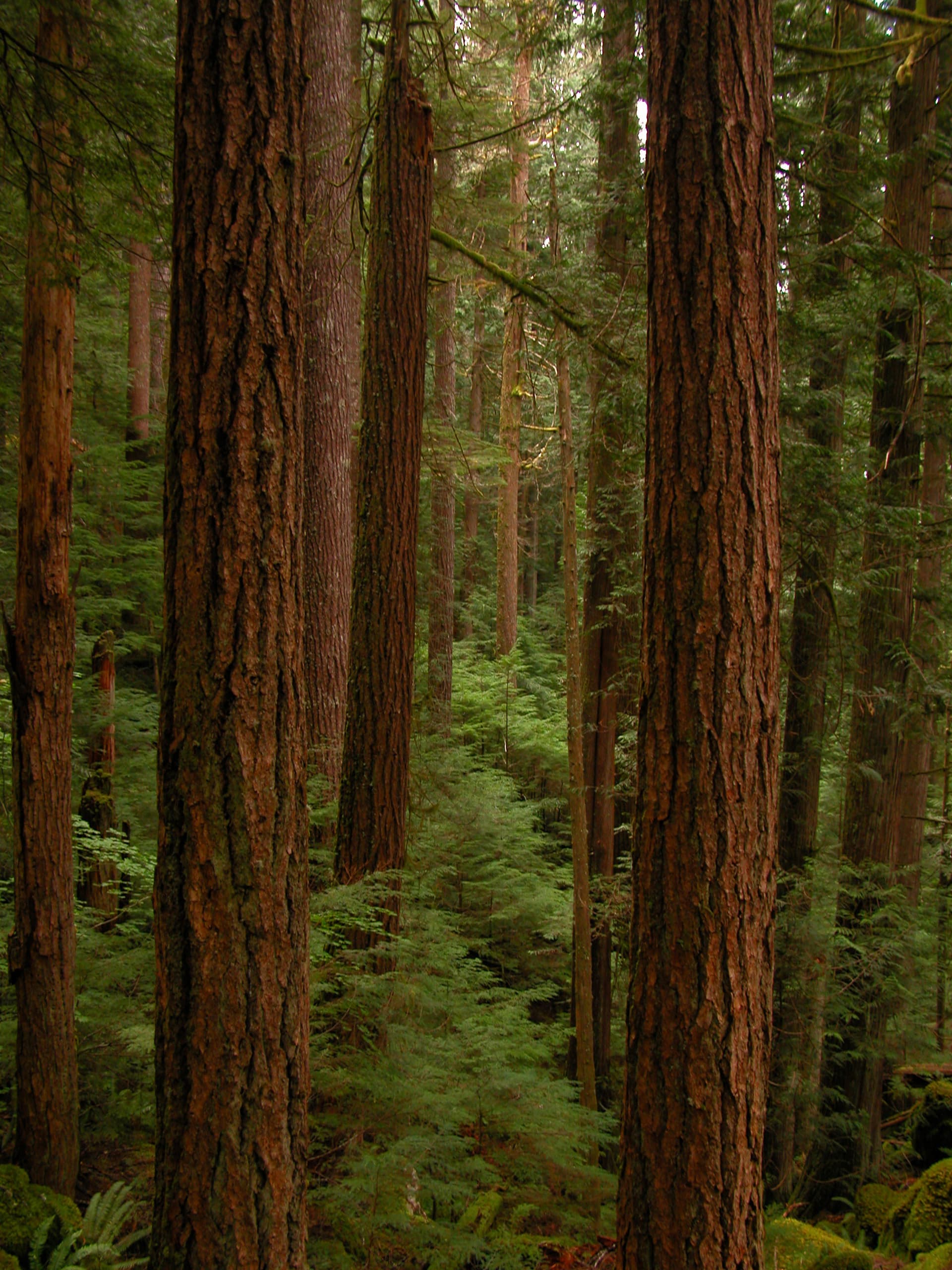
With its incredible range of precipitation and elevation, diversity is the hallmark of Olympic National Park. Encompassing nearly a million acres, the park protects a vast wilderness, thousands of years of human history, and several distinctly different ecosystems, including glacier-capped mountains, old-growth temperate rain forests, and over 70 miles of wild coastline. Come explore!
Riding guide
Horses provided
Highlights
Olympic National Park is one of the most diverse riding landscapes in the country; where temperate rainforest, glacier-capped…
Riding
Rideable terrain here is noted as 365 miles, giving riders a clearer sense of scale before they ever unload. For equestrians, Olympic offers more than 350 Miles of stock-maintained trails that wind through moss-draped forest corridors, along powerful river systems, and into high mountain terrain. It’s a park built for true backcountry riders, the kind who value solitude, self-sufficiency, and dramatic scenery over convenience.
Rideable terrain
365 miles
Trailer parking
Hoh Ranger Station / Hoh River Trailhead This is one of the most common staging areas for equestrians. Why riders use it Trailer-accessible parking near the ranger station Hitching rails and stock facilities nearby Direct access to the Hoh River Trail and backcountry stock camps Large valley trail system that allows multi-day riding This area provides access to some of the longest continuous stock routes in the park. Sol Duc Trailhead Area Features Trailer maneuvering space near the trailhead Hitch racks available for stock Access to Sol Duc valley trails and connections toward Seven Lakes Basin routes Close to the park road, making it easier to reach with larger rigs Whiskey Bend Trailhead (Elwha River Area) This trailhead is a major starting point for equestrian travel in the Elwha Valley. Features Gravel parking area that can accommodate truck and trailer combinations Access to the Elwha River Trail and backcountry stock camps One of the main gateways into the park’s wilderness trail network North Fork Quinault Trailhead A quieter but very good option for riders. Features Trailer-accessible parking area Access to long valley trails and wilderness routes Fewer crowds than some other trailheads
Horse regulations
Horse Use Regulations Permits & Fees • A Wilderness Camping Permit is required for all overnight trips with stock. • Wilderness fees apply (no additional charge for stock). • Some areas require advance reservations check with the Wilderness Information Center (WIC). Group & Animal Limits • Maximum 12 people and 8 head of stock per group. • Only horses, mules, burros, and llamas are permitted. Elevation & Trail Restrictions • Camping with stock above 3,500 feet is prohibited, except in designated stock camps. • Stock may not travel off maintained trails above 3,500 feet. • 365 Miles of trail are maintained for stock use. • Some trails are limited to experienced or very experienced riders due to narrow tread, river crossings, windfall, or steep terrain. • Numerous hiking-only trails are closed to stock always confirm trail eligibility before departure. Feed & Grazing • Loose hay or grain is prohibited. • Supplemental feed must be pellets or rolled grain to prevent weed introduction. • Begin feeding weed-free feed at least 3 days before entering the park. • Grazing is permitted only within ¼ mile of designated stock camps. • Grazing animals must be moved every 12 hours. Feed using a nose bag, do not scatter feed on the ground. Securing Stock • Use hitchrails, highlines, drift fences, or picket lines. • Do not tether to a single tree for more than one hour. • Use trees at least 8 inches in diameter when tying. • Highlines are required overnight and whenever animals are unattended. • Stock must be restrained at least 200 feet from water. Pack animals may not be tied within 150 feet of developed campgrounds. Wildlife & Food Storage • All food, feed, garbage, and scented items must be secured at all times. • Bear-resistant panniers are available from the WIC. Stock Camps & Facilities • Stock camping is limited to designated stock camps only. • Hitchracks and unloading ramps are available at select trailheads. • Some trailheads have limited or no trailer turnaround space, confirm before arrival.
Getting here
Use 3002 Mount Angeles Road, Port Angeles, Washington as your primary planning reference before you haul in. Hoh Ranger Station / Hoh River Trailhead This is one of the most common staging areas for equestrians. Why riders use it Trailer-accessible parking near the ranger station Hitching rails and stock facilities nearby Direct access to the Hoh River Trail and backcountry stock camps Large valley trail system that allows multi-day riding This area provides access to some of the longest continuous stock routes in the park. Sol Duc Trailhead Area Features Trailer maneuvering space near the trailhead Hitch racks available for stock Access to Sol Duc valley trails and connections toward Seven Lakes Basin routes Close to the park road, making it easier to reach with larger rigs Whiskey Bend Trailhead (Elwha River Area) This trailhead is a major starting point for equestrian travel in the Elwha Valley. Features Gravel parking area that can accommodate truck and trailer combinations Access to the Elwha River Trail and backcountry stock camps One of the main gateways into the park’s wilderness trail network North Fork Quinault Trailhead A quieter but very good option for riders. Features Trailer-accessible parking area Access to long valley trails and wilderness routes Fewer crowds than some other trailheads
Planning your visit
Must Know Before You Ride • This is true wilderness. Olympic is remote, wet, and physically demanding. Trails can be narrow, steep, muddy, and root-heavy, especially in rainforest zones. • Elevation rules matter. Stock camping above 3,500 feet is prohibited except in designated stock camps, and off-trail travel above that elevation is not allowed. • Overnight trips require a wilderness permit, and campsites are assigned. Quotas apply in some drainages. • Feed rules are strict. Loose hay and grain are prohibited. Pelletized or rolled supplemental feed is required, and you must begin feeding weed-free feed at least three days before entering the park. • Grazing is limited to within ¼ mile of designated stock camps and animals must be moved every 12 hours. • Highlines are required overnight and whenever stock is unattended. Do not tie to single trees for extended periods. • River crossings are common. Glacier-fed rivers can rise quickly, especially during snowmelt. • Rain is normal. Expect slick bridges, wet decking, and muddy trail conditions much of the year. • Wildlife precautions are mandatory. All food and stock feed must be secured 24 hours a day. Bear-resistant panniers are available through the Wilderness Information Center. • Some trails are for experienced or very experienced stock users only. Windfall, narrow tread, and limited trailer turnaround areas are real considerations. Key water areas located along the Hoh River (including designated, large community corrals past the main lot), the Dosewallips River area, and various backcountry, rugged trails.
Where to stay
Olympic National Park Visitor Center is the main visitor-contact point tied to this destination, which is helpful when you want current conditions, maps, and stock-use updates before riding. This entry indicates both guided ride support and horse-camping potential, making Olympic National Park one of the more flexible federal options for riders building a fuller travel plan. For a polished trip plan, pair the ride with lodging, fuel, and resupply planning in or near Port Angeles before heading deeper into federal-land access points.
Entrance fees & passes
- $30.00
Entrance - Private Vehicle
Valid for seven consecutive days. Applies to private, non-commercial vehicles (15 passenger capacity or less). The pass covers all vehicle occupants.
- $25.00
Entrance - Motorcycle
Valid for 7 days. Admits up to 2 private, non-commercial motorcycles with up to 4 total passengers.
- $15.00
Entrance - Per Person
Valid for seven consecutive days. This fee admits one person without a vehicle, including hikers, bicyclists, and pedestrians. Individuals fifteen years or younger are admitted free of charge.
- $75.00
Commercial Entrance - Van
A commercial tour is defined as persons traveling on an itinerary that has been packaged, priced or sold for leisure recreational purposes by an organization that realizes financial gain through the provisions of the service.
- $100.00
Commercial Entrance - Mini-bus
A commercial tour is defined as persons traveling on an itinerary that has been packaged, priced or sold for leisure recreational purposes by an organization that realizes financial gain through the provisions of the service.
- $200.00
Commercial Entrance - Motor Coach
A commercial tour is defined as persons traveling on an itinerary that has been packaged, priced or sold for leisure recreational purposes by an organization that realizes financial gain through the provisions of the service.
- $55.00
Annual Entrance - Park
The Olympic National Park Annual Pass costs $55 and is good for entry into the park for one year from the month of purchase. Passes can be purchased at Olympic National Park visitor centers and entrance stations.
Park map
Trails
No trails synced for this park yet.
Campgrounds
Deer Park Campground
14 sites
At 5,400 feet in elevation, Deer Park boasts mountain views and starry skies. With a steep and winding gravel access road, Deer Park is not RV accessible.
Fairholme Campground
88 sites
Neighboring Lake Crescent, Fairholme includes lakeside campsites and a nearby boat launch.
Reserve a siteGraves Creek Campground
30 sites
Located in the Quinault Rain Forest, relax near a serene stream at Graves Creek Campground.
Heart O' the Hills Campground
97 sites
Surrounded by old growth forest, Heart O' the Hills offers summer ranger programs and great family fun
Hoh Campground
78 sites
Surround yourself with moss and ancient trees in this temperate rain forest. Hoh campground offers summer ranger programs and some riverside campsites along the Hoh River. Reservations in summer, first come first served the rest of the year.
Reserve a siteKalaloch Campround
170 sites
Oceanside camp at Kalaloch with some sites overlooking the Pacific Ocean. Online reservations accepted for peak season. Check recreation.gov for current season dates. All sites are first-come, first-served in off season.
Reserve a siteMora Campground
94 sites
Situated in a coastal forest, some sites offer views views of the Quillayute River. Mora is located two miles from Rialto Beach.
Reserve a siteNorth Fork Campground
9 sites
Surrounded by temperate rain forest, this small and remote campground is a great spot for campers seeking solitude.
Ozette Campground
15 sites
Adjacent to Lake Ozette, this small campground is great for those that enjoy lakeside camping and water activities
Queets Campground
20 sites
Relax in this secluded campground near the Queets River. This campground is only accessible from the Upper Queets River Road due to a past mudslide
South Beach Campground
55 sites
Positioned on a bluff overlooking the Pacific Ocean, South Beach offers panoramic ocean views and beach access.
Staircase Campground
49 sites
Camp near the Skokomish River and enjoy old-growth forest at Staircase. Summer ranger programs and riverside campsites available.
Reserve a site
Points of interest
Ancient Groves Main Trailhead
POIAt just 0.6 miles (1 km), this lovely loop trail is a bit of peace just off the Sol Duc Hot Springs Road. Within moments, you are immersed in the deep green of classic Olympic Old Growth. The Olympic Peninsula lowlands, with their mild climate, deep soils and generous rainfall, grow giant trees. These old survivors record centuries of history in their massive trunks. When scientists use the term old growth, they are usually referring to Douglas-fir/western hemlock forests wi
Ancient Groves Trail, Secondary Trailhead
POIAt just 0.6 miles (1 km), this lovely loop trail is a bit of peace just off the Sol Duc Hot Springs Road. Within moments, you are immersed in the deep green of classic Olympic Old Growth. The Olympic Peninsula lowlands, with their mild climate, deep soils and generous rainfall, grow giant trees. These old survivors record centuries of history in their massive trunks. When scientists use the term old growth, they are usually referring to Douglas-fir/western hemlock forests wi
Aurora Ridge Trailhead
POIThis trail is a starting point for overnight backpacking trips. Visit nps.gov/olym/planyourvisit/wic.htm to plan a backpacking trip!
Beach 1 Trailhead
POIA trail through Sitka spruce trees, many of them with large, knobby burls, leads to this less-visited beach north of South Beach. The beach itself has countless massive drift-logs, weathered by their time at sea. Look for bald eagles nesting nearby!
Beach 2 Trailhead
POIParking is VERY limited for Beach 2, so if spaces are full, choose another beach rather than parking unsafely along Highway 101. The short trail to this beach features distinctive "burls" on the spruce trees.
Beach 3 Trailhead
POIParking is limited on the shoulder of Highway 101, but this charming beach is worth visiting when you can find a space and brave the steep trail.
Beach 4
POIBeach 4 Overlook
POIBeach 4 - Trailhead and Parking Area
POIA short but rather steep trail through coastal forest leads to a lovely driftwood footbridge and Beach 4. A wonderful place to tidepool and look for seals, with particular treats for those interested in geology - Swiss cheese textured stone! The phenomenon is caused by piddock clams, which burrow into solid rock to protect themselves from the pounding surf.
Beach 6 Overlook
POIThere is no trail at Beach 6, but it's perfect for a quick view of the Pacific. Pull off highway 101 to park safely at the overlook. Bring binoculars to look for sea otters and migrating whales!
Beach Access Trail from Kalaloch Campground
POIThis wide, sandy beach is very popular! The so-called Tree of Life is a beloved photo subject, but it is NOT a safe place to hang your hammock or practice your parallel bars routine. The creek has slowly eroded the earth beneath the tree's roots, and we hope it can hang in there for a long time.
Big Cedar Tree
POIBig Creek Campground - U.S. Forest Service
POIThis campground is managed by the U.S. Forest Service. More information at https://www.fs.usda.gov/recarea/olympic/recarea/?recid=47789
Boat Cleaning Station - Fairholme
POIBoat Cleaning Station - Log Cabin Resort
POIBoat Cleaning Station - Storm King
POIBunch Falls
POICanyon Creek Shelter
POICape Flattery
POICape Flattery Trailhead
POILocated in the Makah Reservation, outside Olympic National Park near the town of Neah Bay. The short (¾ miles/1.2 km each way) trail leads through the forest to a viewing platform, perched on a cliff with a dramatic view overlooking the Pacific. Cape Flattery is the Northwest most point on the contiguous United States. To park at the trailhead, obtain a permit from the Makah Tribe. There is a restroom at the trailhead, and daytime parking for cars and RVs. Please pack out al
Cirque Rim Overlook
POIThis half-mile (0.8 km), easy, paved trail has views of Port Angeles and the Strait of Juan de Fuca. While exploring the ridge please keep your distance from wildlife and stay on paved paths or snow to avoid damaging fragile meadows.
Dickey Boat Ramp
POIDosewallips Road Trailhead
POINo longer accessible to vehicles, the first part of this trail is a former road that begins a trek into the wilderness of the Olympic Mountains. If you plan to make this the start of an overnight backpacking trip, check in with the Wilderness Information Center https://www.nps.gov/olym/planyourvisit/wic.htm
Dungeness National Wildlife Refuge
POILocated on the northern edge of the Olympic Peninsula, just outside of the town of Sequim, WA, Dungeness Spit offers a haven for wild birds and a historic lighthouse. While it is not a part of Olympic National Park, it is popular with locals and visitors alike for its hiking and bird-watching. From the refuge: "At Dungeness National Wildlife Refuge one of the world's longest natural sand spits softens the rough sea waves to form a tranquil bay, fertile tideflats, and beaches
Eagle Ranger Station
POIThe ranger station is not regularly staffed.
Elwha Dam Interpretive Site
POIThis set of exhibits is a great place to learn about the history of the Elwha River, its importance to the Klallam people, and the process of dam removal and river restoration.
Elwha Dam Overlook Trailhead
POIA short hike from the Elwha River Restoration Interpretive Center leads to the site of one of the former dams, where you can see just how much the river valley has changed in the ongoing restoration process. Depending on the time of year, foliage may make it difficult to see the site of the dam.
Elwha Klallam Heritage Center
POIArtistic and cultural exhibits at the heritage center explore the Elwha River restoration and Ä,Ì•ixÊ·ÃcÉ™n village artifacts. (The name of the village site, Ä,Ì•ixÊ·ÃcÉ™n, which means inner harbor.) The building is also used for trainings, gatherings, and tribal offices. Learn more here: elwha.org/departments/elwha-klallam-heritage-center/
Elwha Ranger Station
POICurrently closed. Not staffed.
Elwha River Entrance Station
POIFee Station, Currently closed for road construction
Explore Hurricane Ridge Loop Trailhead
POIFor those looking for longer hikes, you can continue from the High Ridge trail out toward Klahanne Ridge and Mount Angeles, where you may connect to other trails, or simply turn back to Hurricane Ridge.
Fairholme Boat Launch
POIFairholme Campground Loop Alternate Trailhead
POIA 0.8 mile (1.3 km) loop through old growth forest.
Fairholme Campground Loop Trailhead
POIA 0.8 mile (1.3 km) loop through old growth forest.
Fairholme Campground RV Dump Station
POIFairholme Restroom and Campground Registration - Loop A
POIFairholme Restrooms and Campground Registration - Loop B
POIFairholme Restrooms and Campground Registration - Loop C
POIFairholme Store
POIOpen in summer for groceries and boat rentals. olympicnationalparks.com/things-to-do/shopping/fairholme-store/
Fairholme walk-in campsites
POIFalls Creek Campground - U.S. Forest Service
POIManaged by the U.S. Forest Service. https://www.fs.usda.gov/recarea/olympic/recarea/?recid=47745
First Beach - La Push
POILa Push/First Beach is the home of the Quileute Nation. You can learn about the history of this area here: https://quileutenation.org/history/ While visiting the Quileute Nation, please observe proper ettiquette as follows (quoted from Quileute Nation website): "The Quileute Tribe is a Sovereign Nation which means they have their own government inside of the United States that consists of a Tribal Council. The Quileute Tribe makes decisions on how best to balance community a
Gatton Creek Campground - U.S. Forest Service
POIManaged by the U.S. Forest Service. https://www.fs.usda.gov/recarea/olympic/recreation/recarea/?recid=47749&actid=70
Glines Canyon Dam Overlook
POIAccessible via a 3.4 mile ( 5.5 km) hike on the road and bypass trail from the Madison Falls parking lot. Perched on what was once the spillway of the Glines Canyon Dam, visitors can enjoy expansive views of the wide valley that formerly held the Lake Mills reservoir. Lake Mills formed when the Glines Canyon Dam was built between 1925 and 1927, flooding an area known at the time as Smokey Bottom. The overlook also gives people the chance to look down and watch the Elwha's blu
Graves Creek Campground Registration
POIGraves Creek Nature Trail Loop
POIA one mile (1.6 km) loop through the rain forest. Find the trailhead across from the restrooms in the Graves Creek Campground.
Graves Creek Ranger Station
POIUnstaffed.
Graves Creek Trailhead
POIGraves Creek Trailhead is a gateway to the Wilderness, where many backpackers begin their journeys (to make your own backcountry plans, contact the Wilderness Information Center nps.gov/olym/planyourvisit/wilderness.htm. For more information on Wilderness Information Center locations and hours, go to nps.gov/olymp/planyourvisit/wic.htm.) Shorter day trips on this trail will take you over a high bridge above Graves Creek, the first of many creeks the trail traverses through th
Griff Creek Trailhead
POIA steep, 2.8 mile (4.5 km) each way trail, with views of the Elwha River. Due to road washout, park at Madison Falls and take the road and bypass trail to get to the trailhead, about 1.8 miles (2.9 km) down the road. The trail starts behind the (currently non-operational) Elwha Ranger Station.
Hall of Mosses
POIHall of Mosses Trailhead
POIThis short and sweet loop is the definitive rain forest experience. Look for young Coho salmon as you cross Taft Creek, then wander through a wonderland of moss, trees, and ferns - including an iconic moss-draped archway. The trail is just 0.8 miles (1.3 km) long, but you may be tempted to stay for hours!
Hartzell Creek Boat Launch
POIA popular boat launch for boaters and anglers.
Hartzell Creek Restroom
POIHeart O' The Forest Trailhead
POIThis 2.3 mile (3.7) km one way trail is a lovely, level trek through the forest. Starts at Loop E in the Heart O' the Hills campground.
Heart O' The Hills Amphitheater
POIHeart O' The Hills Entrance Station
POIHeart o' the Hills Restroom and Campground Registration - Loop A
POIHeart o' The Hills Restroom and Campground Registration - Loops B & D
POIHeart o' the Hills Restroom and Campground Registration-Loops C&E
POIHoh Amphitheater
POIHoh Campground Picnic Area
POIHoh Campground RV Dump Station
POIHoh Entrance Station
POIHoh Entrance Station Restroom
POIHoh Fishing Access Parking
POIHoh Rain Forest Entrance Sign
POIHoh Restrooms and Campground Registration - Loop A
POIHoh Restrooms and Campground Registration - Loop B
POILocation: The Hoh Rain Forest Area <br />Description: The Hoh Campground is located in the Hoh Rain Forest, near the banks of the Hoh River. Some sites are right next to the river! 88 campsites, one accessible, fire pits with grates, accessible restrooms, water, animal-proof food storage. <br />Open: Year-round.<br />Accessibility: One wheelchair accessible campsite, accessible restrooms.<br />RVs: Sites can accommodate 21-foot RVs, and a few can accommodate 35-foot RVs. No dump station.<br />
Hoh Restrooms and Campground Registration - Loop C
POIHoh River Trailhead
POIThree trails begin just outside the Hoh Rain Forest Visitor Center: The Hoh River Trail (17.4 miles/28 km one way), a starting point for backpackers headed toward Mount Olympus or for a longer day hike, and two short loop trails, the Hall of Mosses and the Spruce Nature Trail. The Hoh is a wildlife hot spot - within just a few steps of the trailhead, you might see Roosevelt elk, river otters, birds, Coho salmon, black bears, or even a bobcat! In winter when the Coho return fr
Hoh River Trail junction
POIThe Hoh River Trail (17.3 miles/27.8 km one way) is a starting point for backpackers headed toward Mount Olympus, but there's no rule that says you have to go that far! (If you do want to, contact the Wilderness Information Center to make a backpacking plan. www.nps.gov/olym/planyourvisit/wilderness.htm has locations and hours). For a peaceful out-and-back day hike (aka just turn around and come back when you're ready), the first section of the Hoh River Trail is mostly level
Hoh Stock Corral
POIHoh Visitor Center Mini-Trail Trailhead
POIHoh Visitor Center Picnic Area
POIHoodsport Wilderness Information Center
POIRangers present intermittently in summer. Located inside the Hoodsport Visitor Information Center, the Hoodsport Wilderness Information Center issues back-country permits and bear cans for safe food storage, and provides current trail and in-depth backpacking information. Get a head start by visiting https://www.nps.gov/olym/planyourvisit/wic.htm
Hurricane Hill Picnic Area A
POIOpen only in summer, located one mile (1.6 km) beyond the visitor center. Lovely meadow area with mountain views, restrooms, water, and paved trails to tables.
Hurricane Hill Picnic Area B
POIOpen summer only, located one mile (1.6 km) beyond the visitor center, with restrooms, water and paved trails to tables. The parking area doubles as overflow parking for the Hurricane Hill Trail, just a short walk through the forest away.
Hurricane Hill Trailhead
POIOne of the most popular day hikes is the Hurricane Hill trail, about 3 miles (4.8 km) round trip and climbing 700 feet (213 meters) to a high point with 360-degree views in clear weather. The trailhead is at the end of the road, just 1.3 miles (2.1 km) past the Hurricane Ridge Visitor Center. Overflow parking is available at Picnic Area B.
Hurricane Ridge Road
POIHurricane Ridge Road This is the easiest way to reach beautiful panoramic views of the Olympic Mountains and explore the subalpine ecosystem, just a 45-minute drive from Port Angeles. Drive carefully and keep an eye out for rocks and wildlife on the road! In winter, the road may be closed certain days (it is generally plowed on weekends as weather allows), and all vehicles are required to carry tire chains in case of icy road conditions. The road to Hurricane Ridge leads up 1
Irely Lake Trailhead
POIThis 2.8 mile/4.5 km round trip, creek-side hike leads through the forest to Irely Lake. There may be stream crossings, and there is a ladder at the end that you will need both hands to climb. Always carry your Ten Essentials, and contact the Wilderness Information Center for trail conditions or to plan an overnight trip in the backcountry.<br />https://www.nps.gov/olym/planyourvisit/wic.htm<br />https://www.nps.gov/articles/10essentials.htm
James Pond Trailhead
POIThis flat, 0.4 mile (0.6 km) loop trail winds through the forest to James Pond. Look for yellow pond lilies in summer!
July Creek Loop Trail Trailhead
POIJuly Creek Picnic Area Trailhead
POIJuly Creek Picnic Area has a short trail to tables for a picnic with a view on the North shore of Lake Quinault.
Kalaloch Amphitheater
POIKalaloch Amphitheater Trailhead
POIKalaloch Beach Trailhead
POIKalaloch Big Cedar Tree - Parking Area
POIAn easy one-mile loop trail leads to this forest giant. Even half-fallen, its height and mass are incredible.
Kalaloch Campground Beach Trailhead
POIKalaloch Campground Fish Cleaning Station and Restroom
POIKalaloch Campground Loop A Beach Access Trail
POIKalaloch Campground Loop D Beach Trail
POIKalaloch Campground Registration
POIKalaloch Campground RV Dump Station
POIKalaloch Creek Nature Trail
POIKalaloch Creek Nature Trail is a short (0.8 mile/1.3 km) loop through coastal rain forest, starting in Loop A of the Kalaloch campground.
Kalaloch Lodge
POIThis striking historic lodge is open year-round and was built in 1953 from wood milled from the giant drift logs that still wash up today. It sits right above the beach, looking out at the water, and has rooms and cabins available upon reservation. There is a dining room with ocean views, a gift shop, and a general store.<br />www.thekalalochlodge.com<br />
Kalaloch Lodge Trailhead
POIBe careful on this trail from Kalaloch Campground to Kalaloch Lodge, much of the short route is right alongside Highway 101.
Kalaloch Ranger Station
POI<b> <strong>The ranger station building is currently closed as Covid-19 safety measure, with information set up outside.</strong> </b> With a whale skull and wooden canoe outside, the Kalaloch Ranger Station is hard to miss! Inside, you'll find exhibits and information, plus maps and books for sale. Pick up a tide chart while you're there to plan your beach hikes or tidepooling! Open summer only.
Kestner Homestead
POILearn about homestead life on this flat, self-guided 1.3-mile (2.1 km) loop from the Quinault Rain Forest Ranger Station.
Kestner Homestead Loop Trail
POILearn about homestead life on this flat, self-guided 1.3-mile (2.1 km) loop from the Quinault Rain Forest Ranger Station.
Kestner Homestead Parking
POIKestner Homestead Trailhead
POILearn about homestead life on this flat, self-guided 1.3-mile (2.1 km) loop from the Quinault Rain Forest Ranger Station.
Lake Angeles and Heather Park Trailheads
POITo reach this trailhead, make sure to drive to the end of the road (you will pass some buildings with parking areas, but these are private housing - not for public use). From here, climb 4 miles (6.4 km) to the wildflower meadows of Heather Park, or 3.4 miles (5.4 km) to the mirror-like waters of Lake Angeles.
Lake Crescent - East Beach
POIEast Beach is a scenic picnic area on the lake shore, with tables, fire pits, and an accessible outhouse.
Lake Crescent Lodge
POIOn the south shore of Lake Crescent, about 25 miles (40 km) west of Port Angeles is historic Lake Crescent Lodge. The lodge was built in 1916 and has cabins, motel rooms and rooms in the historic lodge building available for rent. There is also a dining room, lounge and coffee bar, gift shop and boat rentals. In 1937, President Franklin D. Roosevelt journeyed to the Olympic Peninsula and visited Lake Crescent Lodge! He would go on to sign into law the creation of Olympic N
Lake Crescent Lodge - Marymere Falls Trailhead
POILake Crescent Scenic Pull-Off
POILake Cushman Day Use Area Site 5
POIA picnic and day use area on the shore of Lake Cushman.
Lake Quinault Lodge
POIThe historic lodge walks the line between rustic and luxurious, with lake views, a fireplace, and panoramic lake views in the dining room, but no phones or TVs in most of the guest rooms. Inn style rooms available by reservation. From the Quinault Nation: "The opening ceremonies occurred on August 18, 1926, with Quinault Medicine woman, Sally (James) Freeman providing the Blessing Ceremony; she was the close friend of Stella McNeil, whose husband was a co-owner of the Lodge.
La Poel Picnic Area
POIOpen in summer, La Poel is a forested picnic area with fire pits, picnic tables, an accessible outhouse, and views of Lake Crescent. Not suitable for RVs, trailers, buses - the road is steep, winding, and narrow.
Living Forest Trailhead
POIThis short 0.4 mile (0.64 km) loop trail starts beside the historic Beaumont cabin, behind the Olympic National Park Visitor Center in Port Angeles. May be wheelchair accessible with assistance.
Log Cabin Resort - Boat Rental
POIExplore Lake Crescent by boat, kayak, or paddleboard. Pay for boat rental inside the main lodge building, then head to the rental building.
Log Cabin Resort - Campground
POIFor RV and tent site camping, visit https://www.olympicnationalparks.com/rv-camping/log-cabin-rv-campground/
Log Cabin Resort Entrance
POILog Cabin Resort - Main Lodge
POIOpen in summer, the Log Cabin Resort offers lodging, camping, boat rentals, a restaurant, and a small general store/snack bar. Boat Rental registration is located inside the main lodge. For accommodations visit https://www.olympicnationalparks.com/lodging/log-cabin-resort/
Lower Queets Park Entrance
POIMadison Falls
POIMadison Falls Trailhead
POIAs easy as a walk around the corner, this short, wheelchair-accessible trail leads to the falls. The open field nearby is the site of the late 19th century Sweet family homestead, and is now used in summer for the park's horses and mules to pasture. The mules help keep backcountry trails in shape by helping to carry supplies for the trail crew into the wilderness, where motorized vehicles are not permitted. As cute as they are, please do not feed or touch the animals.
Makah Cultural Institute and Research Center
POIThe Makah Museum interprets and houses 300-500 year old artifacts recovered from the Ozette Archaeological Site, a coastal village covered and preserved by a mudslide which has been called the North American Pompeii. There are also other historic and replica pieces and photographs related to the Makah Tribe on display year-round. For more information on Makah culture and history, please contact the staff at 360-645-2711.
Maple Glade Rain Forest Trailhead
POIFrom the Quinault Rain Forest Ranger Station, enjoy this idyllic half-mile (0.8 km) loop through the big-leaf maples of the Quinault Rain Forest. For a longer walk, continue to the historic Kestner Homestead.
Maple Grove off the Hall of Mosses Trail
POIMarymere Falls
POIMarymere Falls Trailhead
POIThe most popular day hike at Lake Crescent is the 0.9 mile (1.4 km) one way trail to Marymere Falls. This trail goes through old growth forest to a 90-foot (27 meter) waterfall. The trail starts from the Storm King Ranger Station but can also be accessed from Lake Crescent Lodge.
Meadow Loop Trailhead
POIAn easy, paved, 0.25 mile (0.4 km) trail which crosses open meadows with views of the Olympics. While exploring the ridge please keep your distance from wildlife and stay on paved paths or snow to avoid damaging fragile meadows.
Merriman Falls
POIMink Lake / Lovers Lane Trailhead
POIThis route passes through old growth forest and subalpine meadows, passing Mink Lake and Deer Lake if one chooses to complete the full 11 mile/17.7 km loop. Make sure to carry 10 essentials and for trail conditions or to plan a backpacking trip, contact the Wilderness Information Center https://www.nps.gov/olym/planyourvisit/wic.htm
Moments in Time Trailhead
POIThis self-guided Nature Trail begins at Lake Crescent Lodge and is a flat 0.6 mile (1km) loop through lakeside forest. Numerous trail-side signs tell the story of Lake Crescent's natural and cultural history.
Moments in Time trailhead - Marymere
POIMora Amphitheater
POIMora Area Park Entrance Sign
POIMora Campground RV Dump Station
POIMora Ranger Station
POIOpen intermittently in summer as staffing levels permit, with information and bear canisters. Self-register wilderness camping permits available year-round. For more information on Wilderness Information Center locations and hours go to https://www.nps.gov/olym/planyourvisit/wic.htm. Nearest accessible restrooms at Rialto Beach or the nearby Mora campground.
Mora Restrooms and Campground Registration - Loop C
POIMora Restrooms and Campground Registration - Loop D
POIMorse Creek Overlook
POIMouth of the Elwha Beach
POIMouth of the Elwha Beach Trailhead
POIThis sandy beach on the Strait of Juan de Fuca was formed after the dams on the Elwha River were removed in 2011 and 2014, gradually releasing many tons of sediment. It's a great place to appreciate the free flowing Elwha River's journey, not to mention catch a beautiful sunset. Look for geese and beavers in the nearby wetland, eagles and gulls fishing in the river, and seals offshore!Though not part of Olympic National Park, the mouth of the Elwha is a wonderful place to see
NatureBridge Lakeside Moments in Time Trailhead
POINatureBridge Moments in Time Trailhead
POINatureBridge Office
POIThe NatureBridge outdoor education campus hosts school groups, youth science and backpacking trips, teacher development, family programs, and even weddings. Learn more at https://naturebridge.org/locations/olympic
North Fork Ranger Station
POIUnstaffed.
North Fork Restroom and Campground Registration
POINorth Fork Skokomish Trailhead
POIThis trailhead is located above the Ranger Station. Walk past the overflow parking and stock corral to reach it. Dayhikers can walk the valley part of this 15.1-mile (24.3 km) trail that leads eventually to the Duckabush River. If you plan to make this the start of an overnight backpacking trip, check in with the Wilderness Information Center https://www.nps.gov/olym/planyourvisit/wic.htm
North Fork Trailhead (Quinault)
POIFrom the North Fork Campground area, this trail leads up the North Fork of the Quinault River into the Wilderness. To plan a backpacking trip, contact the Wilderness Information Center at http://www.nps.gov/olym/planyourvisit/wilderness.htm. For more information on Wilderness Information Center locations and hours go to https://www.nps.gov/olym/planyourvisit/wic.htm. Shorter day hikes out and back on this trail meander past streams through low elevation rain forest, reaching
North Fork Trailhead (Sol Duc)
POICome prepared when you make this 9.3 mile hike through montane forests! The route includes a river crossing, and changing weather can create hazardous conditions. This trail is not suitable for those who do not have map and compass skills. Always carry your Ten Essentials, and contact the Wilderness Information Center for trail conditions or to plan an overnight trip in the backcountry https://www.nps.gov/olym/planyourvisit/wic.htmhttps://www.nps.gov/articles/10essentials.h
North Kalaloch Beach Access pullout
POINorth Peninsula Overlook
POIOn a clear day, look out at across the valley to the Strait of Juan de Fuca.
North Shore Day Use Area
POIObstruction Point Trailhead
POIAnother option for longer hikes is to drive the narrow, gravel Obstruction Point road and hike along the high alpine ridges or into Grand Valley. The drive is not for the faint of heart (or unwieldy large vehicles like RVs and trailers), but the breathtaking views are worth it.
Olympic Hot Springs Trailhead
POIThe access road to this trailhead is currently open only to foot traffic and bicycles beyond Madison Falls parking area. This adds an additional 8 miles/12.9 km to your hike/ride just to get to the trail head. From there, an additional easy 2.5 mile/4 km hike takes you to the hot spring. Because this is a back country trip, be prepared with your 10 essentials and contact the Wilderness Information Center at https://www.nps.gov/olym/planyourvisit/wic.htm
Ozette Area Information
POIOzette Boat Launch
POILake Ozette is a wonderful place to canoe and kayak, but it can change from calm and tranquil to very windy quickly, and waves several feet high are common during high winds. The water can also be dangerously cold. Always wear life jackets when you're out on the water, and consider wearing wet suits or other thermal clothing in case of accidental immersion. There have been a number of cold-water drownings in Lake Ozette, so be extra careful and remember safety gear for a good
Ozette Ranger Station
POIOpen intermittently in summer only. No bear cans available at this location! If you need a bear can, visit one our <a href="http://https://www.nps.gov/olym/planyourvisit/wic.htm">wilderness information centers.</a>
Ozette Ranger Station Parking
POIOzette Triangle Coastal Trailhead
POIFrom here, hike the Ozette Triangle for a 9-mile (14.5 km) round-trip day hike or overnight, or travel through the forest to connect to longer coastal hiking routes for overnight backpacking. To plan a backpacking trip, contact the Wilderness Information Center at http://www.nps.gov/olym/planyourvisit/wilderness.htm. Wilderness permits are NOT available at the Ozette Ranger Station. When hiking the coast, remember to be aware of tides! Certain routes will become impassible at
Park Headquarters Offices
POINo services. Not open to the public. Administrative offices.
Parking Area for Dickey Boat Ramp
POIPeabody Creek secondary trailhead (unmarked)
POIEnd of loop trail, unmarked.
Peabody Creek Trailhead
POIA half-mile (0.8 km), creekside loop from the visitor center parking area.
Picnic Area along Sol Duc River
POIPillow Basalt view at Morse Creek Overlook
POIAcross the road from the Morse Creek overlook, you may notice interesting rock formations, called "pillow basalt." From the U.S. Geological Survey: Basalt "pillows" form when lava cools quickly under water. The lack of bubbles in the lava suggests that the rock crystallized on the ocean floor under the pressure of deep water (preventing bubbles from forming in the lava).
Pyramid Peak Trailhead from Spruce Railroad Trail
POIThe Pyramid Peak trail is accessed from Camp David Junior Road on the North shore of Lake Crescent. The trail and climbs 2,600 feet in 3.5 miles (792 meters in 5.6 km); one section of the trail crosses a steep, exposed landslide. Like Mount Storm King, the summit has a fantastic panoramic view of the lake and Strait of Juan de Fuca from above, but the hike is longer and much more gradual.
Queets Ranger Station
POINot staffed.
Queets River Boat Launch
POIA broad, rocky beach where boats can be launched for a float down the Queets River.
Queets River Trailhead
POIQueets River Trailhead is the beginning of two trails, the Sam's River Loop (2.8 miles/4.5 km), and the longer (16.2 miles/26.1 km) Queets River Trail. Sam's River Loop is a level day hike through different ages and stages of temperate rain forest, but winter storms often damage this trail, so you may have to scramble over fallen trees and other obstacles! Queets River Trail has somewhat more elevation gain, fluctuating between 240 and 800 feet. It will also require fording t
Quilcene Ranger Station - U.S. Forest Service
POIU.S. Forest Service Ranger Station. The rangers are also able to provide information and permits for Olympic National Park.
Quinault Big Sitka Spruce Tree
POIQuinault Big Sitka Spruce Tree Trail
POIA short trail leads to a record-holding Sitka Spruce tree. This location is managed by a nearby rain forest resort.
Quinault Rain Forest Ranger Station
POIOpen part-time in summer as staffing allows, with information, exhibits, book and map sales.
Rain Forest Nature Trailhead - U.S. Forest Service
POIManaged by the U.S. Forest Service. https://www.fs.usda.gov/recarea/olympic/recarea/?recid=47771
Rayonier Landing on Lake Ozette
POIPrimitive Restroom across the road.
Restroom and Parking at Cushman Dam
POIRestroom, Barnes Point Area
POIRestroom, Log Cabin Resort
POIRestrooms, La Poel Picnic Area
POIRestroom, Sol Duc Entrance
POIRestroom, Staircase Ranger Station Area
POIStaircase area restroom
Rialto Beach
POIRialto Beach is one of the most popular beaches in Olympic, and one of the most accessible. A short path leads to a pebble beach and ocean view. In summer, there is a wheelchair accessible ramp on the path. Rialto is a wonderful place to look for wildlife, from otters and seals to pelicans and bald eagles! You may even see gray whales migrating in summer! Hikers can trek north along the undeveloped coast 1.5 miles (2.4 km) to the formation known as Hole in the Wall, and beyon
Ruby Beach
POIA short hike through coastal forest reveals spectacular Ruby Beach. Its dramatic sea stacks and tide pools make Ruby Beach a favorite among the many beautiful beaches of the Olympic Coast.
Ruby Beach Overlook
POISalmon Cascades
POI5 miles (8 km) up the Sol Duc road, stop by this viewing platform to witness the iconic leap of determined fish up a waterfall on their way to spawn. The view of the cascades is lovely year-round, but if you hope to see fish, look for Coho salmon in September and October, or steelhead trout from late March through May. These anadromous fish (meaning they live in both fresh and salt water) are born in the Sol Duc River, but spend most of their lives in the Pacific Ocean before
Salmon Cascades Overlook
POISam's River Loop Trailhead at Queets River
POIQueets River Trailhead is the beginning of two trails, the Sam's River Loop (2.8 miles/4.5 km), and the longer (16.2 miles/26.1 km) Queets River Trail. Sam's River Loop is a level day hike through different ages and stages of temperate rain forest, but winter storms often damage this trail, so you may have to scramble over fallen trees and other obstacles!
Sam's River Loop Trailhead at Ranger Station
POIA flat 2.8 mile trail through different ages of temperate rain forest. Watch for obstacles on your way - trees may fall across the trail after a windy storm!
Second Beach
POISecond Beach Trailhead
POIThe trailhead is located 14 miles (22.4 km) west of US 101 on La Push Road on the Quileute Indian Reservation. The trail is 0.7 miles (1.1 km), winding through forest before descending 200 feet (61 meters) to a sandy beach with seastacks and tidepools. A statement from the Quileute Tribe for visitors: "The Quileute Tribe is a Sovereign Nation which means they have their own government inside of the United States that consists of a Tribal Council. The Quileute Tribe makes dec
Second Beach Vault Toilet
POISeven Lakes Basin Trail Junction
POIShadow Mountain General Store
POIShi Shi Beach Trailhead
POIShi Shi Beach and Point of Arches are among the most picturesque coastal destinations in Olympic - and the most popular! The 8-mile (12.9 km) round-trip trail begins on the Makah Reservation, and continues into Olympic National Park, so you will need two different permits. You can buy a Makah Recreation permit in the town of Neah Bay at Makah Marina, The Museum at the Makah Culture and Research Center, Washburn's General Store, Makah Mini Mart, Makah Tribal Cetner, or Hobuck
[Sign] 3 Steps Into the Wilderness Interpretive Panels #274a
POI[Sign] 3 Steps Into Wilderness #267a
POI[Sign] A Different Community Wayside #258h
POI[Sign] Aerial Gardens Wayside #107q
POI[Sign] Age of the Forest Wayside #258f
POI[Sign] Alien Plants Wayside #107g
POI[Sign] All in a Row Wayside #258j
POI[Sign] A Window in Time Wayside #107i
POI[Sign] Beach Trail Wayside #170a
POI[Sign] Blow Down Wayside #258p
POI[Sign] Blow-Down Wayside #36
POI[Sign] Cirque Wayside #44
POI[Sign] Coho in the Creek Wayside #258b
POI[Sign] Cultures Carved in Cedar Wayside #189a
POI[Sign] Decor of the Rainforest Wayside #255e
POI[Sign] Douglas Fir Wayside #258d
POI[Sign] Drift Logs and Riptides wayside #170c
POI[Sign] Drift Logs and Riptides Wayside #180b
POI[Sign] Drift Logs and Riptides Wayside #188d
POI[Sign] Drift Logs and Riptides Wayside #191a
POI[Sign] Early Logging Wayside #107j
POI[Sign] Elk in the Forest Wayside #258e
POI[Sign] Elwha River Valley Upright Wayside #80
POI[Sign] Era of Elegance Wayside #133a
POI[Sign] Extended Family Wayside #107k
POI[Sign] First Residents Wayside #107e
POI[Sign] Flute in the Forest Wayside #107s
POI[Sign] Forest Disturbances Wayside #258l
POI[Sign] Forest Elders Wayside #107n
POI[Sign] Forest Fire Scars Wayside #40a
POI[Sign] Forest Healers Wayside #107m
POI[Sign] From Mountains to Sea Wayside #54
POI[Sign] Giant Dimensions Wayside #255g
POI[Sign] Glaciers in Peril Wayside #40d
POI[Sign] Goatsbeard Lichen Wayside 57
POI[Sign] Green Draperies Wayside #258n
POI[Sign] Greener Slopes Wayside #56
POI[Sign] Groundcover Wayside #258m
POI[Sign] Growing Gradually Wayside #59
POI[Sign] Hall of Mosses Trail Wayside #255a
POI[Sign] Hall of Mosses Wayside #255c
POI[Sign] High Ridge Trail Wayside #51
POI[Sign] High Ridge Trail Wayside #52
POI[Sign] How Big Do They Grow Wayside #255f
POI[Sign] Layers of the Forest Wayside #258g
POI[Sign] Lonesome Hatchery Wayside #263a
POIQuileute Fisheries Department
[Sign] Lower Story Plants Wayside #254d
POI[Sign] Marymere Falls Trail Wayside #100a
POI[Sign] Meadow Hill Wayside #63
POIWayside same as #41 and #58
[Sign] Meadow Invasion Wayside #49
POI[Sign] Meadow Recovery Wayside #47
POI[Sign] Meadow Wildlife Wayside #60
POI[Sign] Mini Trail Trailhead Wayside #254f
POIPerhaps the shortest trail in Olympic, the Mini Trail takes you into the rain forest with just a few steps. Perfect for little ones and anyone else with love for the forest but limited mobility.
[Sign] Momentary Meadows Wayside #107r
POI[Sign] Moments in Time Trail Wayside #107a
POI[Sign] Moments in Time Wayside #107h
POI[Sign] Mountain Travelers Wayside #40c
POI[Sign] National Treasure Wayside #149
POI[Sign] Night Shadows Wayside #147
POI[Sign] North Wilderness Coast Hike Wayside #164c
POI[Sign] Nurselogs Wayside #255d
POI[Sign] Olympic Elk Wayside #254c
POI[Sign] Our Coastal Heritage Wayside #170b
POI[Sign] Plant On Plant Wayside #258a
POI[Sign] Primeval Fir Wayside #107L
POI[Sign] Protect Salmon Wayside #139
POI[Sign] Pulse of the River Wayside #128a
POI[Sign] Queets River Trail Wayside #200a
POI[Sign] Quinault Area Park Entrance Sign #204
POI[Sign] Rain Forest Threshold Wayside #254b
POI[Sign] Razor Clams Wayside #188c
POI[Sign] Salmonberry Wayside #258o
POI[Sign] Sea Stacks Wayside #166a
POI[Sign] Shortened Seasons Wayside #41
POI[Sign] Signs of Wildlife Wayside #46
POI[Sign] Spring Water Wayside #258k
POI[Sign] Spruce Railroad Wayside #107d
POI[Sign] Spruce Trail Wayside #258c
POI[SIGN] Staircase wayside #03
POI[Sign] Stand Still Wayside #107p
POI[Sign] Still Standing Wayside #107o
POI[Sign] The Giving Tree Wayside #107c
POI[Sign] The Olympic Mountains Wayside #40b
POI[Sign] The Upper Story Wayside #254e
POI[Sign] Three Steps Into Wilderness Wayside #223a
POI[Sign] Three Steps Into Wilderness Wayside #253a
POI[Sign] Tidepool Life/Drift Logs and Riptides wayside #166b
POI2 waysides
[Sign] Tidepool Life Wayside #170d
POI[Sign] Tidepool Life Wayside #170e
POI[Sign] Tilting Coast Wayside #170f
POI[Sign] Together They Stand Wayside #258i
POI[Sign] Trails of the Hoh Wayside #254a
POI[Sign] Tree Islands Wayside #43
POI[Sign] Tree Skirting Wayside #61
POI[Sign] Tree Survival Wayside #45
POI[Sign] Trees vs. Flowers Wayside #62
POI[Sign] Treetop World Wayside #255b
POI[Sign] Underwater Fire Wayside #69
POI[Sign] Visitor Information Panel #100b
POI[Sign] Washington Geology Wayside #164a
POI[Sign] Washington Geology Wayside #188a
POI[Sign] Welcome to the Whale Trail Wayside #188b
POI[Sign] Whale Watching Wayside #180a
POI[Sign] Whale Watching Wayside #196
POI[Sign] Wild Coast Wayside #164b
POI[Sign] Wild Things Wayside #107b
POI[Sign] Winter Play Wayside 48
POISite of Former Hurricane Ridge Visitor Center
POISki Patrol Ice Station
POISeasonal - winter
Slough Trailhead
POIA fairly level, 0.9 mile (1.4 km) forested trail to the Quillayute River.
Slough Trailhead at Mora Ranger Station
POIA fairly level, 0.9 mile (1.4 km) forested trail to the Quillayute River.
Smoky Bottom Trailhead
POIStarting just past the Glines Canyon Spillway Overlook (currently accessible on foot only, about 3 miles/4.8 km beyond the Madison Falls parking lot), this 1.9 mile/3 km one way trail drops into the valley above the former dam site. As you walk across riverbanks which were under water for nearly a century, you can see how the ecosystem has begun to return to a wilder, more natural state.
Sol Duc Amphitheater
POISol Duc Campground
POIOperated by the Sol Duc Hot Springs ResortLocation: The Sol Duc River valley area, twelve miles (19 km) up Sol Duc Hot Springs Road off of Highway 101. Description: The Sol Duc Campground is located along the Sol Duc River, near the Sol Duc Hot Springs resort and Eagle Ranger Station. Some sites are right along the river! 82 campsites, one group site and one that is wheelchair accessible. Fire rings with grates, accessible restrooms, water, animal-proof food storage, RV dum
Sol Duc Campground Loop B Entrance
POISol Duc Entrance
POISol Duc Entrance Interpretive Exhibit
POISol Duc Entrance Station
POIOpen seasonally only.
Sol Duc Falls
POISol Duc Falls Trail
POIPerhaps the most picturesque waterfall in Olympic, Sol Duc Falls is a treat - a big reward for a fairly easy hike. From the parking lot at the end of the road, the walk through old-growth forest to cascading Sol Duc Falls is just .8 of a mile (1.3 km) and relatively level. Please enjoy the falls from the designated viewing areas, so you don't take an unexpected swim!
Sol Duc Hot Springs Entrance
POISol Duc Hot Springs Resort
POIThe concession-operated Sol Duc Hot Springs Resort has lodging and an RV campground; you can make reservations by calling 888-896-3818. The resort features three hot mineral pools, a swimming pool, dining room, snack bar, massage services, and a gift shop. The resort is open from late March through mid-October.<br />www.olympicnationalparks.com/lodging/sol-duc-hot-springs-resort
Sol Duc Restrooms and Campground Registration - Loop A
POISol Duc Restrooms and Campground Registration - Loop B
POISol Duc River View Picnic Area
POIPause for a picnic, or just to look down over the rushing waters of the Sol Duc River.
Sol Duc RV Dump Station
POISol Duc RV Park
POISouth Beach Access Trailhead
POISouth Beach Restroom and Campground Registration
POISouth Shore Quinault Ranger Station - USFS - NPS
POIBecause Lake Quinault is surrounded by both National Park and National Forest land, this facility is operated jointly by the National Park Service and U.S. Forest Service. Open daily in summer, weekdays only the rest of the year. Information, wilderness permits and bear canisters (summer only).
Spruce Burl Trailhead
POISpruce Nature Trail
POIAnother short rain forest loop, the Spruce Nature Trail packs incredible variety into just 1.2 miles (1.9 km). This is a great place to look for the fascinating phenomenon known as "nurse logs" - fallen trees which provide a place for new seedlings to grow. You can see them at every stage, from the new-fallen log with brand new baby trees sprouting on it to the rows of centuries-old trees whose "nurse log" has long since rotted away, leaving them standing in a perfectly strai
Spruce Railroad Trailhead - Camp David Jr Road
POIAccessed from either the East Beach Road or Camp David Junior Road, the Spruce Railroad Trail hugs the shore of Lake Crescent for 4 miles (6.4 km) along an old railroad route. As a continuation of the Olympic Discovery Trail, bicycles and pets are permitted on this trail.
Spruce Railroad Trailhead - East
POIAccessed from either the East Beach Road or Camp David Junior Road, the Spruce Railroad Trail hugs the shore of Lake Crescent for 4 miles (6.4 km) along an old railroad route. As a continuation of the Olympic Discovery Trail, bicycles and pets are permitted on this trail.
Staircase Amphitheater
POIStaircase Big Cedar Tree
POIStaircase Campground Restroom A
POIStaircase Campground Restroom B
POIStaircase Entrance Sign
POIStaircase Entrance Station
POIRanger present during the summer season.
Staircase Information Panel
POIStaircase Overflow Parking
POIStaircase Picnic Area - North of Skokomish Bridge
POIStaircase Picnic Area - South of Skokomish Bridge
POIStaircase Ranger Station
POIOpen in summer when staffing allows, with information, exhibits, and wheelchair available for checkout. Stock corral, trails and accessible restroom and picnic area nearby. Wilderness permits and bear canisters are available summer weekends only at the nearby Hoodsport Visitor Information Center. For more information on Wilderness Information Center locations and hours go to https://www.nps.gov/olym/planyourvisit/wic.htm.
Staircase Trailhead
POIThe Staircase Rapids Loop is an easy 2 mile/ 3.2 km trail. It winds through old growth forest to a bridge over the North Fork Skokomish River with only a 200-foot elevation gain. A spur trail leads to a huge fallen cedar.
Stock Corral at Graves Creek Quinault
POIStock Corral at North Fork Quinault
POIStock Corral, Staircase Area
POIStorm King Boat Launch
POIStorm King Ranger Station
POIOpen in summer as staffing allows, with information, activities, and ranger programs.
Storm King Trailhead
POIThe Mount Storm King trail branches off from the Marymere Falls trail and switchbacks up 2,000 feet in 2.2 miles (610 meters in 3.5 km) - an intense, steep ascent! If you venture to the top, please: Don't feed that Canada jay! In national parks, keeping wildlife wild is part of our mission. Unfortunately, some visitors forget this and have fed birds on Mount Storm King. When birds become habituated they forget how to be wild and can even become aggressive. This is not the pla
Swan Bay Boat Launch on Lake Ozette
POISwitchback Trailhead
POIA steep series of switchbacks reveals panoramic views and connects to other trails on Klahhane Ridge.
The Beaumont Cabin
POIVisit a historic cabin right behind the Olympic National Park Visitor Center!
The Lost Resort Lodge
POIThe Lost Resort is a general store, deli, and camping resort just outside of the Ozette area of Olympic National Park.
Third Beach
POIThird Beach Trailhead
POIThe trailhead is located on La Push Road, 12 miles (19 km) west of US 101. The trail descends 270 feet over 1.4 miles (82 meters over 2.3 km) through forest to a scenic, sandy beach.
Trailhead from NatureBridge to Moments in Time Trail
POIThe main trailhead for Moments in Time is near Lake Crescent Lodge.
Vault Toilet at Graves Creek Campground
POIWater Journey Overlook
POIA small trail leads to this hidden away view of the Olympic Mountains.
Welcome Sign at Olympic National Park Visitor Center/Hurricane Ridge Road
POIPause for a photo with our Port Angeles area welcome sign! In addition to the English message, it features the phrase "ʔənʔá č’ə́yəxʷ" which means "come, enter" in the Klallam/S'Klallam language. Here is a short video about the meaning of this sign: youtube.com/watch?v=PTmbFBlvbG0
Whiskey Bend Trailhead
POIThe Whiskey Bend trailhead is located 4.6 miles (7.4 km) up a narrow gravel road (for 6.9 miles/11.1 km total, walking up the road from Madison Falls), turning left just past the ranger station. This trailhead is a primary access point for day hikes and backpacking routes.
Willaby Boat Launch
POIWillaby Campground - U.S. Forest Service
POIManaged by the U.S. Forest Service. https://www.fs.usda.gov/recarea/olympic/recarea/?recid=47781
Wolf Creek Trailhead
POIThis trail descends 8 miles to Whiskey Bend in the Elwha Valley. Because of the washout which cuts off Whiskey Bend from the nearest parking, the total length of a hike to Madison Falls parking lot is about 13 miles.
World Heritage Site Plaque
POI
Things to do
Backpack in Olympic National Park
While this app is a great tool for "front country" visits (places you can get to with a car, bike, or short hike), it's not meant to guide you through the back country. For that we have the Wilderness Information Center - WIC for short. The WIC rangers can talk through routes, gear, and trail conditions with you, and set you up with a permit.
Go to the Beach
A trip to the Olympic Coast is sure to be memorable! Olympic National Park contains several beach areas along the coast, each with something to offer. Learn more about popular beaches and start planning your trip!
Observe Animals at Olympic National Park
In the park, we humans are privileged to be visitors to wild animals' home. We can treat their home with respect and care.
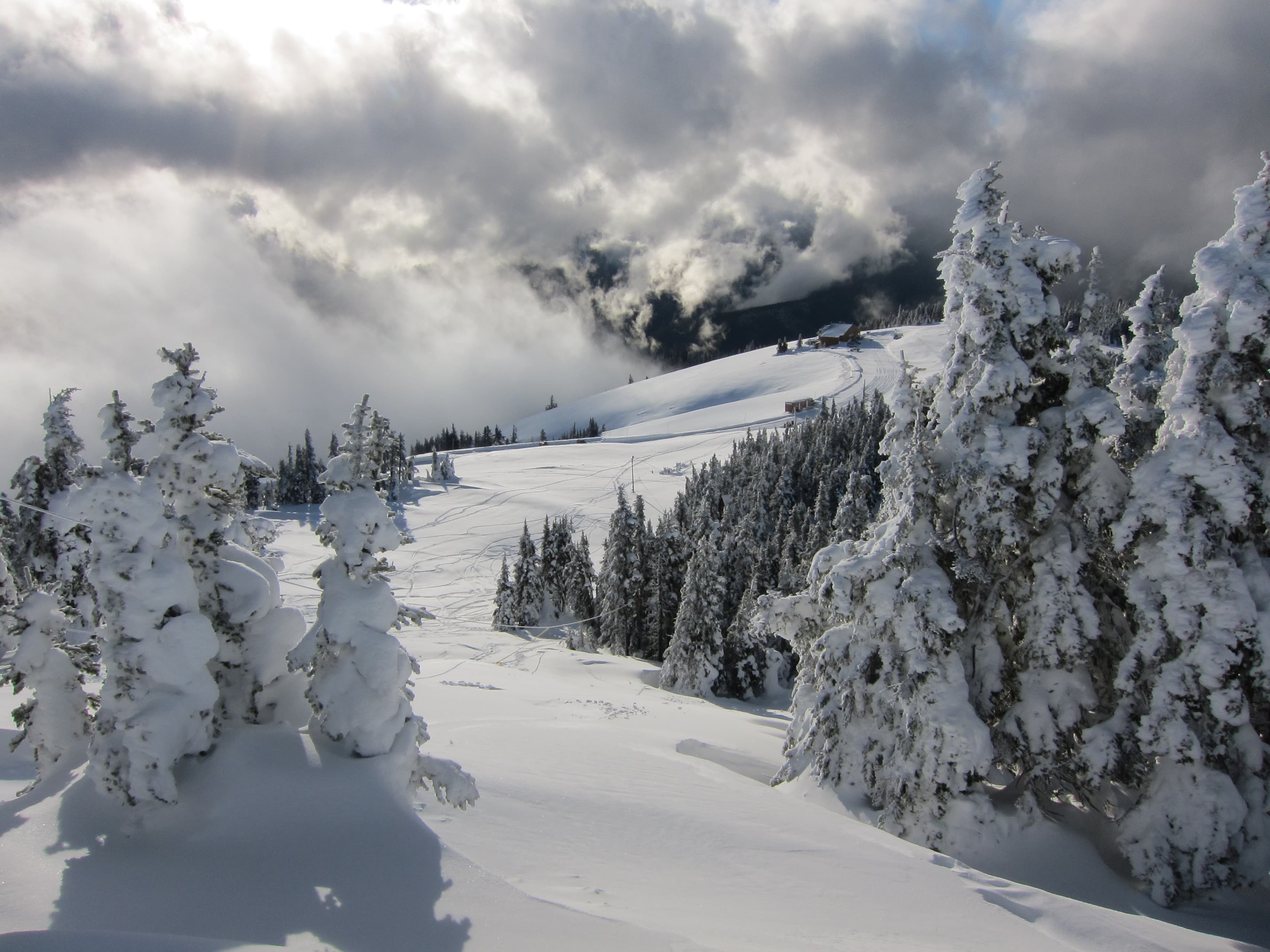
Play in the Snow in the Olympic Mountains
Hurricane Ridge provides opportunities for snowshoeing, cross-country and downhill skiing, snowboarding, tubing and more. Hurricane Ridge's winter season is generally mid-December through the end of March.
See Madison Falls
Madison Falls is a stunning 60-foot waterfall near the Elwha River. It's also one of the most accessible destinations at the park, making it a great stop for families and visitors of all abilities.
Duration: 5-15 Minutes
Take a Pet-Friendly Hike
Pets: they’re our faithful friends and loyal companions. But at Olympic National Park, they aren’t allowed everywhere! You can still have a great time at Olympic with pets, but be sure to read carefully and follow the rules so you know what to do and where to go.
Take a Short Hike Near the Visitor Center
Near the Olympic National Park Visitor Center, two short loop hikes take visitors through peaceful, green lowland forests.
Duration: 15-30 Minutes
Tidepooling on the Olympic Coast
There are special places that allow you to see sea creatures up close without leaving the beach! Tidepools are home to fascinating creatures like sea stars, anemones, barnacles, nudibranchs, crabs, and more.
Duration: 30-180 Minutes
Walk the Moments in Time Trail
Take a peaceful stroll at Barnes Point on Lake Crescent on the Moments in Time Trail.
Duration: 15-30 Minutes
Watch for Salmon at Salmon Cascades
In the late summer and early fall, salmon can be seen leaping from Salmon Cascades on the Sol Duc River! Get a glimpse on a viewing platform located above the cascades.
Duration: 15-45 Minutes
Visitor centers
Hoh Rain Forest Visitor Center
Located in the Hoh Rain Forest. The visitor center is open daily during the summer and intermittently during the winter. Educational exhibits and informational brochures available.
Get directionsHurricane Ridge Visitor Contact Station
While the historic Hurricane Ridge Day Lodge was destroyed in a fire, the small but mighty Visitor Contact Station is here to help! While rangers are present to answer questions during open hours in summer, please be aware there is no indoor space for visitors or running water available.
Get directionsKalaloch Ranger Station
Kalaloch Ranger Station is open daily during the summer and closed the rest of the year. Educational exhibits, informational brochures, a small sales area, and restrooms are available.
Get directionsOlympic National Park Visitor Center
This is the main Visitor Center and Wilderness Information Center for Olympic National Park. Park staff are available daily at the visitor center, and by phone (360-565-3130) or email. Restrooms are available during the day.
Get directionsQuinault Rain Forest Ranger Station
Quinault Rain Forest Ranger Station is open Thursdays-Mondays during the summer and closed during the rest of the year. Educational exhibits and informational brochures available.
Get directions
Webcams
Hurricane Ridge
Currently unavailable.
Hurricane Ridge Parking Lot
Currently unavailable.
Hours of operation
Olympic National Park
Olympic National Park is open 24 hours a day year-round, although some roads, campgrounds and facilities are open seasonally.
Mon
All Day
Tue
All Day
Wed
All Day
Thu
All Day
Fri
All Day
Sat
All Day
Sun
All Day
Activities
Weather
Summers tend to be fair and warm, with high temperatures between 65 and 75 degrees F. July, August and September are the driest months, with heavier precipitation during the rest of the year. While winters are mild at lower elevation, snowfall can be heavy in the mountains. It is common for different weather conditions to exist within the park at the same time. At any time of year, visitors should come prepared for a variety of conditions.
Contact
Photos
Stay near this park
No horse-friendly stays listed near Olympic National Park yet. Know a great barn or property? Help fellow riders by listing it.
List your propertyDirections
You can reach Olympic National Park via the I-5 corridor or by any one of the quieter state roadways. Once you arrive on the Olympic Peninsula connect to Hwy 101 to reach any destinations in and around Olympic National Park. From Olympia: take I-5 to Hwy 101 From Tacoma: take State Route 16 to Bremerton; take State Route 3 north from Bremerton to State Route 104. From Washington/Oregon Coast connect to Hwy 101 in Aberdeen.
Source: nps.gov