
Pea Ridge National Military Park
AR · Garfield
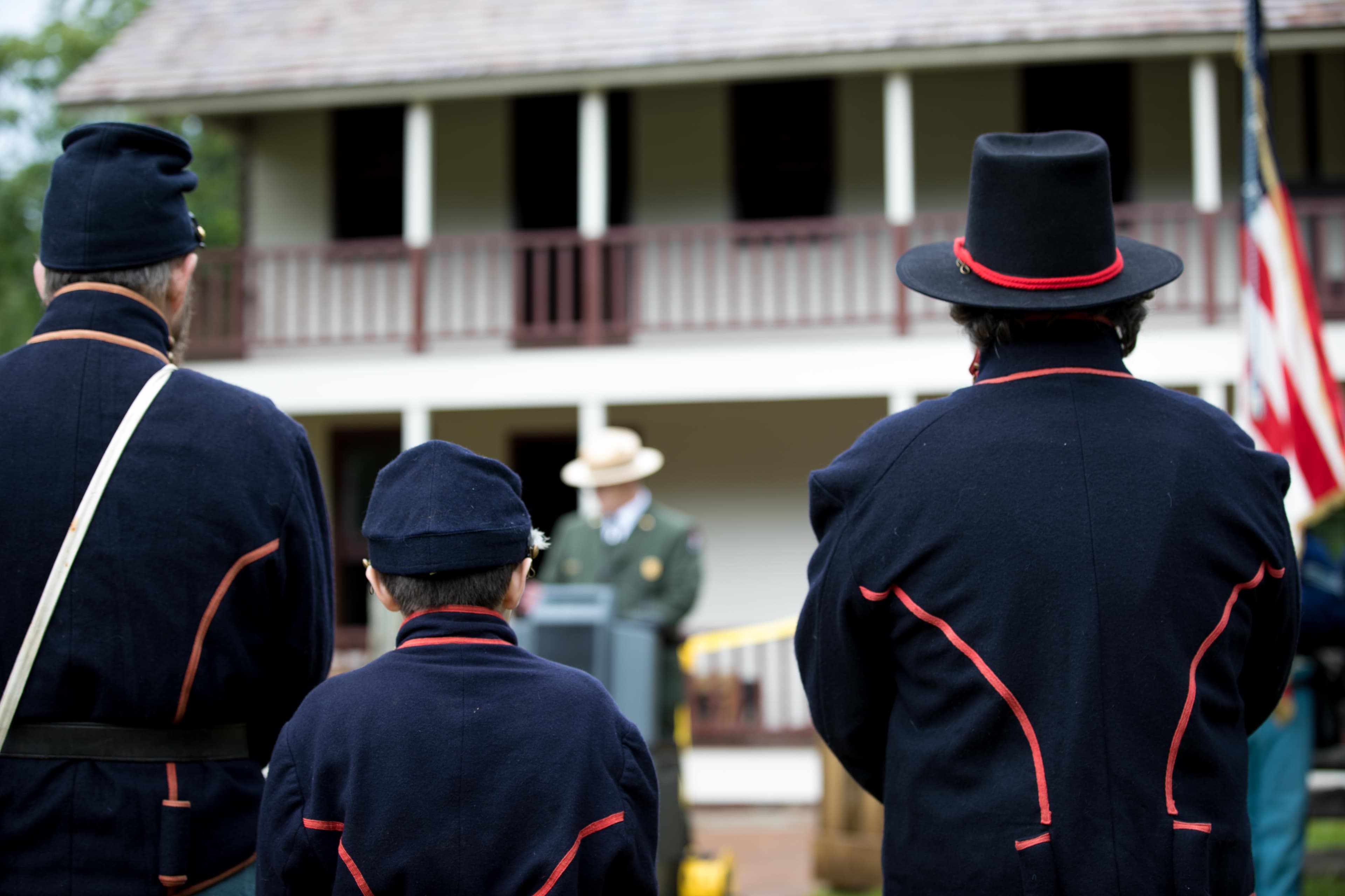
On March 7-8, 1862, over 23,000 soldiers fought here to decide the fate of Missouri which was a turning point of the war in the Trans-Mississippi. This 4,400-acre battlefield honors those who fought and died on these hallowed grounds. Pea Ridge was the most pivotal Civil War battle west of the Mississippi River.
Riding guide
Highlights
Pea Ridge National Military Park preserves one of the best-preserved Civil War battlefields in the United States while…
Riding
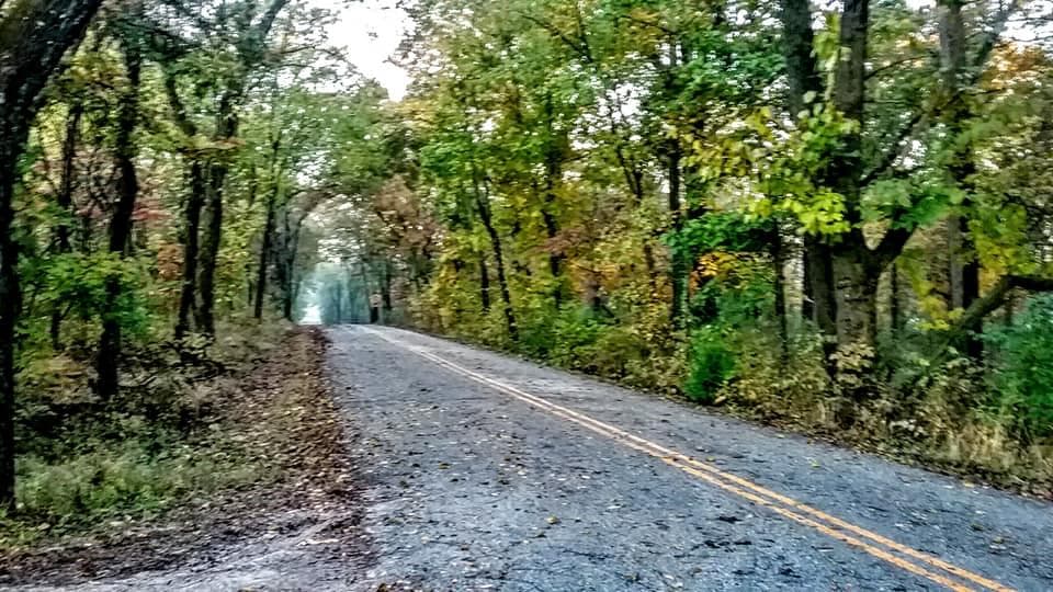
Rideable terrain here is noted as 5-11 miles, giving riders a clearer sense of scale before they ever unload. For equestrians, the park offers about 9 Miles of designated horse trails that wind through wooded hills, grassy meadows, and historic battlefield sites. These trails allow riders to experience the landscape in a way that closely mirrors how soldiers and travelers once moved across the terrain.
Rideable terrain
5-11 miles
Trailer parking
Equestrian Trailhead Location: Just past Tour Stop 2 along the park’s scenic tour road inside Pea Ridge National Military Park. Why riders use it Designated horse trailhead with parking space for approximately 10–15 horse trailers Direct access to both of the park’s equestrian loops, including the shorter battlefield loop and the longer northern loop Gravel staging area with room to maneuver trailers before entering the trail system Located within the park’s main driving route, making it easy to find and access from the entrance road.
Horse regulations
Horseback riding at Pea Ridge National Military Park is permitted on designated horse trails and is managed to protect the park’s historic Civil War battlefield landscape and natural resources. Equestrian use is limited to the park’s established horse trail system, and riders should review park guidelines before visiting since horse access is restricted to specific routes within the park. However, several core regulations and best practices apply for riders in the park. Riding Is Only Allowed on Designated Trails Horses are allowed only on the park’s designated equestrian trails and approved dirt road segments. Horses are not permitted on the paved Battlefield Trail, visitor center grounds, or areas around historic structures. Riders may cross the paved Battlefield Trail or park roads only where necessary to reach authorized riding routes. Restricted Historic Areas To protect sensitive historic sites, horses are not allowed in certain locations within the park, including areas such as Elkhorn Tavern and the Tanyard. These areas contain fragile battlefield resources and historic structures that require additional protection. Stock Control and Rider Responsibility Riders must maintain control of their horses at all times. Horse owners are responsible for the behavior and actions of their animals while in the park and must ensure that horses do not damage historic features, vegetation, or park infrastructure. Equine Health Requirements All horses entering the park must have proof of a negative Equine Infectious Anemia test (Coggins test) conducted within the previous 12 months. Riders should carry documentation and be prepared to present it if requested by park staff. Manure and Feed Management To help prevent the spread of invasive plants and protect the battlefield landscape, riders must remove any manure, hay, or straw left in the trailer parking or staging areas when they leave the park. Horse-Drawn Equipment Horse-drawn wagons, carriages, or other attachments are not permitted on the park’s trails because the trail system is not designed to accommodate their size or turning radius. Day Use Riding Equestrian trails at Pea Ridge are primarily intended for day riding. Riders should plan accordingly, as horse camping facilities are not available within the park.
Getting here
Use 15930 National Park Drive, Garfield, Arkansas as your primary planning reference before you haul in. Equestrian Trailhead Location: Just past Tour Stop 2 along the park’s scenic tour road inside Pea Ridge National Military Park. Why riders use it Designated horse trailhead with parking space for approximately 10–15 horse trailers Direct access to both of the park’s equestrian loops, including the shorter battlefield loop and the longer northern loop Gravel staging area with room to maneuver trailers before entering the trail system Located within the park’s main driving route, making it easy to find and access from the entrance road.
Planning your visit
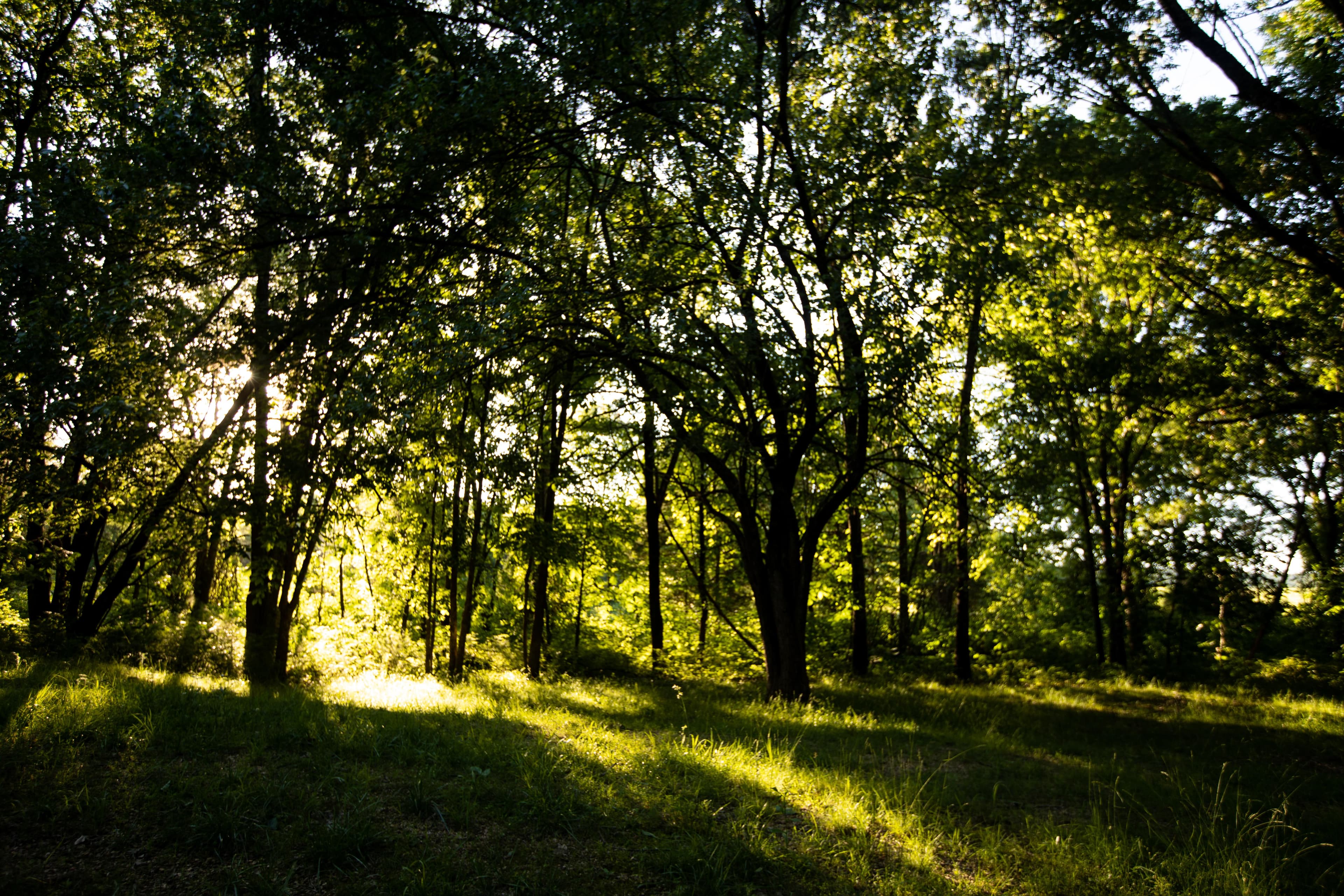
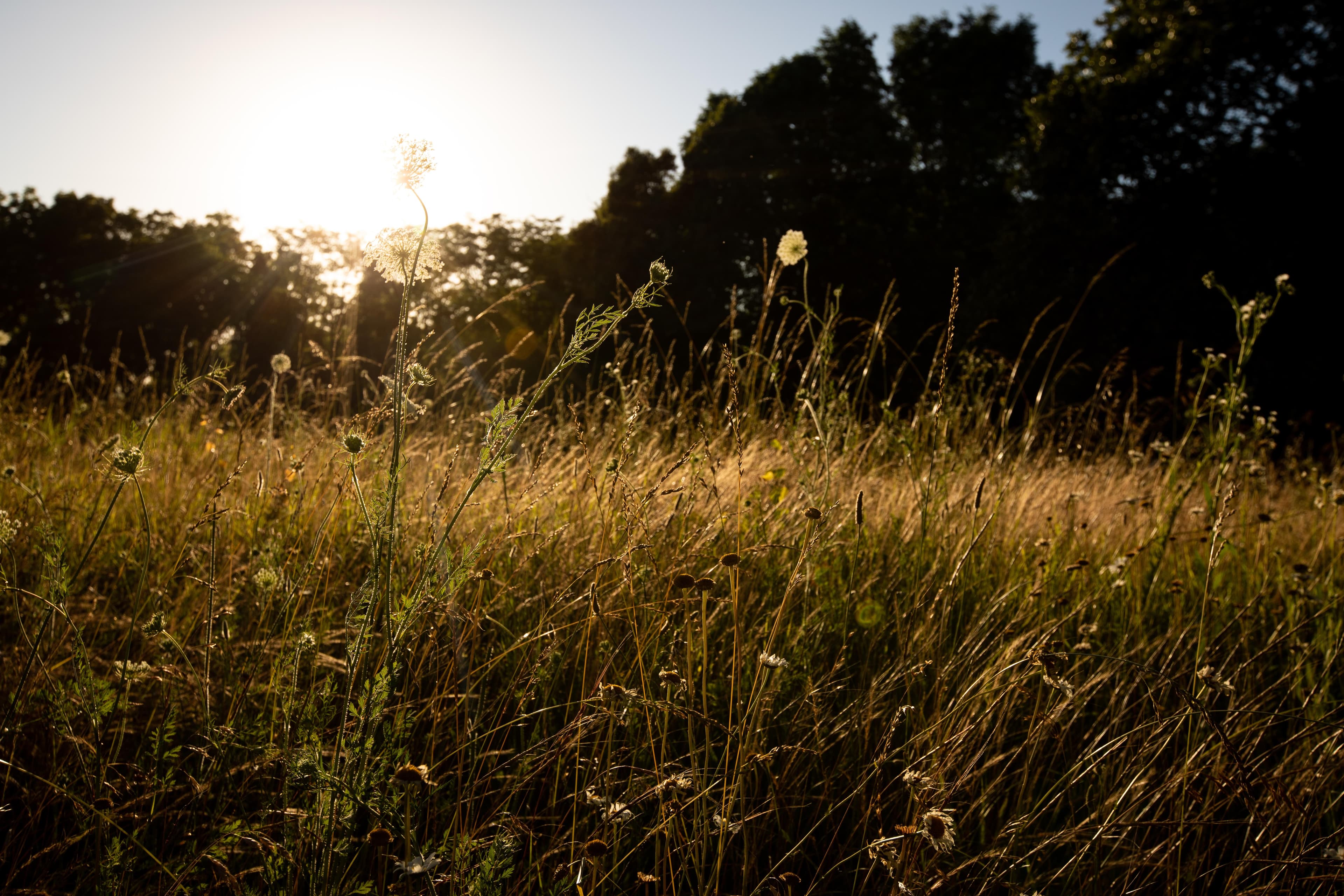
Riding at Pea Ridge National Military Park offers a unique opportunity to explore a preserved Civil War battlefield on horseback. While the park provides a peaceful riding experience through forests and historic fields, there are several important things equestrians should know before visiting. Equestrian Trails Are Limited but Scenic The park offers about 9 Miles of designated horse trails that form two interconnected loop routes. Riders can choose shorter rides or combine sections for longer outings. Trails travel through wooded hills, open fields, and portions of the historic battlefield landscape. Trails May Become Muddy After Rain The Ozark terrain at Pea Ridge contains clay soils that can become very slick and muddy after rainfall. Riders should avoid using the trails during wet conditions to prevent trail damage and reduce the risk of injury to horses. Designated Equestrian Trailhead Horse trailer parking is available at the park’s designated equestrian trailhead along the tour road, which provides direct access to the horse trail system. This is the primary staging location for riders visiting the park. Historic Battlefield Landscape Many areas of the park contain preserved Civil War features such as artillery positions, historic fields, and the nearby Elkhorn Tavern area. Riders should remain on designated horse routes and avoid riding through sensitive historic locations. Wildlife and Quiet Riding Conditions The park’s forests and meadows support wildlife such as deer, wild turkey, and songbirds. Because the equestrian trail system is separate from the busiest visitor areas, riders often experience relatively quiet trails compared with other parts of the park. Day Riding Only Pea Ridge National Military Park does not provide horse camping facilities. Riders planning multi-day trips with horses should arrange overnight accommodations outside the park and return for day rides on the equestrian trail system. Moderate Terrain for Most Horses The equestrian trails feature gentle hills, forest paths, and open meadow sections. While generally considered moderate riding, horses should still be comfortable navigating uneven terrain, roots, and natural trail obstacles.
Where to stay
Pea Ridge National Military Park Visitor Center is the main visitor-contact point tied to this destination, which is helpful when you want current conditions, maps, and stock-use updates before riding. This entry reads best as a bring-your-own-horse destination rather than a horse-rental stop, and amenities should be confirmed directly before travel. For a polished trip plan, pair the ride with lodging, fuel, and resupply planning in or near Garfield before heading deeper into federal-land access points.
Trails
No trails synced for this park yet.
Campgrounds
No campgrounds listed for this park.
Points of interest
East Overlook at Pea Ridge
POIThe view from the East Overlook looking out over the battlefield to the west.
Elkhorn Tavern
POIWas used as Union and Confederate Army headquarters and field hospital during the Battle of Pea Ridge.
Fight at Foster's Farm - Stop Five
POITour stop five of the driving tour.
General Curtis Headquarters - Stop Two
POIUnion Army Headquarters during the Battle of Pea Ridge.
Leetown Hamlet - Stop Three
POILetdown had school, church, a blacksmith shop, store, Masonic lodge. During the Battle of Pea Ridge some of the structures were used as makeshift field hospitals.
Pea Ridge Leetown Battlefield - Stop Four
POIWest Overlook at Pea Ridge - Stop Six
POI
Things to do
Bicycles in Pea Ridge National Park
Cycling at Pea Ridge National Military Park is a great way to discover the true scope of the park, both in size and meaning. It is also a wonderful opportunity to experience a quiet peaceful place of nature in bustling Northwest Arkansas.
Duration: 30-120 Minutes
Williams Hollow Loop Hike
Hiking at Pea Ridge National Military Park is a great way to understand the true scope of the park, both in size and meaning. It is also a wonderful opportunity to experience the quiet peace of nature in bustling Northwest Arkansas.
Duration: 45-90 Minutes
Visitor centers
Pea Ridge National Military Park
The Pea Ridge Visitor Center is located down the new entrance road from Hwy 62. Once inside the Visitor Center, there is a 28-minute orientation film "Thunder in the Ozarks." The park's film was produced in 2001. The park's museum was opened in 1963, but the exhibits have been completely updated as of February 2010. The park's Eastern National Bookstore is also located in the Visitor Center.
Get directions
Hours of operation
Park Grounds
The battlefield driving tour road is open for visitors to tour 7 days a week from 6 am to sunset.
Mon
6:00AM - Sunset
Tue
6:00AM - Sunset
Wed
6:00AM - Sunset
Thu
6:00AM - Sunset
Fri
6:00AM - Sunset
Sat
6:00AM - Sunset
Sun
6:00AM - Sunset
Activities
Weather
Pea Ridge National Military Park is located in the northwestern part of the state and is on a part of the Ozark Plateau. The climate is hot and humid in the summers, has mild temperatures in the fall, and drier and cooler temperatures in the winter. During the spring and summer, active thunderstorms can pop up. During the winter months, the wind chill factor can make the temperature feel much colder than the air temperature. The winters can be cold with some snow and ice.
Contact
Photos
Stay near this park
No horse-friendly stays listed near Pea Ridge National Military Park yet. Know a great barn or property? Help fellow riders by listing it.
List your propertyDirections
The entrance road is located on Highway 62, 1.3 miles east of the intersection of Highways 62 and 72. As one is driving along highway 62, watch for the brown road signs directing one to the entrance road to the park's visitor center.
Source: nps.gov