
Saratoga National Historical Park
NY · Stillwater
In 1777, a large British invasion force met an equally large American army here at Saratoga. After two intense battles, an eight-mile retreat, and a three-day siege, British General John Burgoyne surrendered his entire force. This first ever surrender of a British Army is one of the pivotal moments in determining the outcome of the Revolutionary War, forever changing the future of the world.
Riding guide
Highlights
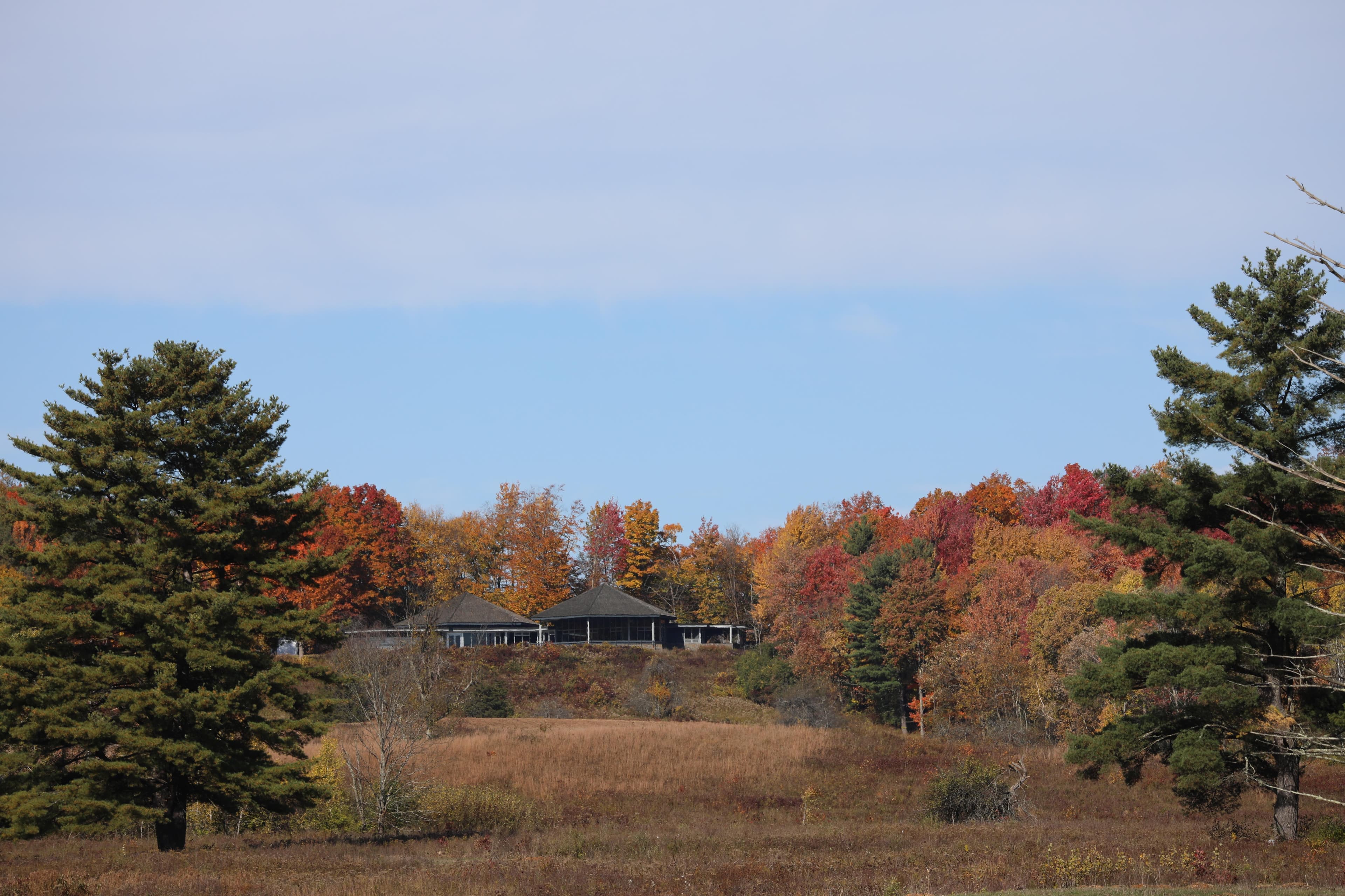
Saratoga National Historical Park preserves the rolling farmland and open fields where the pivotal Battles of Saratoga took…
Riding
Rideable terrain here is noted as 7 miles, giving riders a clearer sense of scale before they ever unload. For equestrians, the park offers a designated horse trail that winds through historic meadows, wooded edges, and quiet sections of the battlefield. Riders travel across broad grassy fields and gentle terrain where American and British forces maneuvered during the campaign that ultimately became a turning point in the Revolutionary War. The trail also passes through forested sections that provide shade and contrast to the open battlefield scenery.
Rideable terrain
7 miles
Trailer parking
Route 32 Horse Trailhead Parking Lot Location: Just off New York State Route 32, near the south entrance of the Saratoga Battlefield unit. Why this is the best option: Designated horse trailer parking spaces are available. It is the official starting point for the park’s Horse Trail. Direct access to the park’s ~7-mile round-trip equestrian route across the battlefield. From this parking area: The horse trail immediately begins and travels through historic fields and wooded sections of the battlefield. The trail crosses the Battlefield Tour Road several times, giving riders access to different parts of the park landscape.
Horse regulations
Where You Can Ride Horseback riding is permitted on designated multi-use trails within the park. Riding is not allowed on the paved Tour Road or on hiking-only trails. Riders must remain on authorized routes at all times. Trailer Parking Horse trailer parking is available at designated trailhead lots. Space may be limited, especially on weekends and during peak foliage season. Large rigs should plan carefully and arrive early. Day Use Only There are no developed horse camping facilities inside the park. Overnight horse camping is not permitted within park boundaries. Feed & Grazing Grazing is not permitted. Riders must bring their own feed. Certified weed-free feed is strongly recommended. Leave No Trace • Remove manure and hay from parking and staging areas • Do not tie horses in ways that damage trees or resources • Yield appropriately to other trail users
Getting here
Use 648 NY-32, Stillwater, New York as your primary planning reference before you haul in. Route 32 Horse Trailhead Parking Lot Location: Just off New York State Route 32, near the south entrance of the Saratoga Battlefield unit. Why this is the best option: Designated horse trailer parking spaces are available. It is the official starting point for the park’s Horse Trail. Direct access to the park’s ~7-mile round-trip equestrian route across the battlefield. From this parking area: The horse trail immediately begins and travels through historic fields and wooded sections of the battlefield. The trail crosses the Battlefield Tour Road several times, giving riders access to different parts of the park landscape.
Planning your visit
• Horseback riding is permitted for day use only. There are no overnight horse camping facilities within the park. • Riders must stay on designated multi-use trails. Horses are not allowed on the paved Tour Road or hiking-only paths. • Trailer parking is available at select trailheads, but space can be limited, especially during weekends and peak fall foliage season. Larger rigs should arrive early and have a backup option in mind. • Grazing is not permitted. Bring your own feed and manage it responsibly. • This is a shared-use historic landscape. Expect hikers, cyclists, and interpretive visitors, and maintain a controlled pace appropriate for mixed trail traffic. • Seasonal conditions can impact footing. Spring may be muddy, and autumn is beautiful but often busy.
Where to stay
Saratoga National Historical Park Visitors Center is the main visitor-contact point tied to this destination, which is helpful when you want current conditions, maps, and stock-use updates before riding. This entry reads best as a bring-your-own-horse destination rather than a horse-rental stop, and amenities should be confirmed directly before travel. For a polished trip plan, pair the ride with lodging, fuel, and resupply planning in or near Stillwater before heading deeper into federal-land access points.
Park map
Trails
No trails synced for this park yet.
Campgrounds
No campgrounds listed for this park.
Points of interest
Boot Monument
POILocated at Stop 7 on the battlefield tour road, or via a short detour from the Wilkinson Trail, the "Boot" monument is perhaps the most popular, unique, and controversial monument of the many placed within the Battlefield.
Freeman's Farm - 6 - John Freeman Farm (Balcarres Redoubt) (Continued...)
POIJohn Freeman and his family established this small farm about 11 years before the battle. Of loyalist sympathies, Freeman had to abandon the farm and move his family to Canada. He returned with Burgoyne as a member of a Loyalist regiment, known as Jessup’s Corps. His small cabin stood just beyond the two artillery pieces you see on the left.
Neilson House
POIRestored home of John and Lydia Neilson which served as a headquarters for the American Army during the Battles of Saratoga. Tiny house, million dollar view!
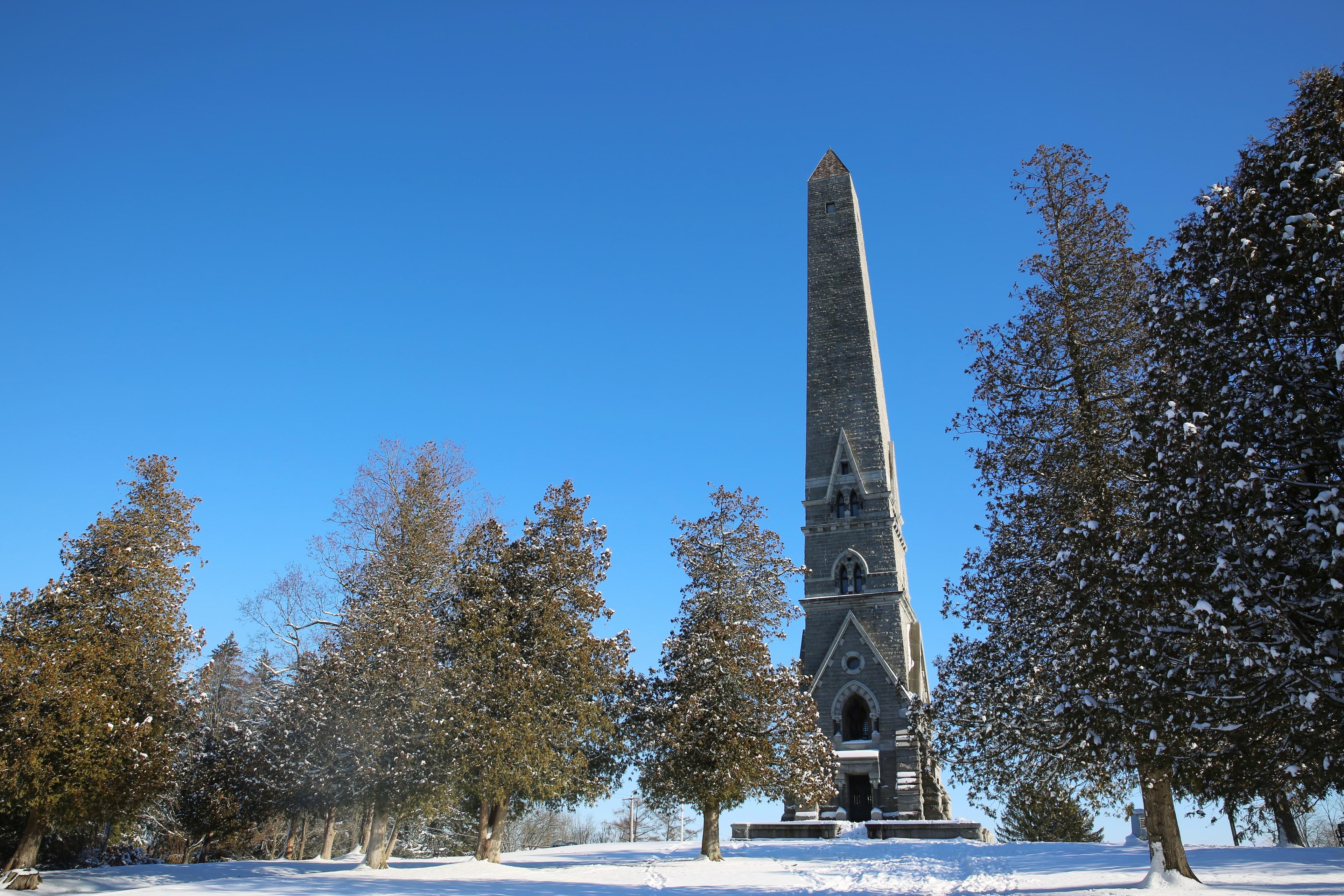
Saratoga Monument
POICommemorating Burgoyne's surrender to Gates, this 155-foot stone obelisk stands where Burgoyne's camp entrenched during the campaign's final days.
Saratoga Surrender Site
POIThe Surrender Site commemorates the location of the first-ever British Army surrender on October 17, 1777.
Schuyler Estate
POIThe country plantation of Philip Schuyler: surveyor, businessman, Revolutionary War general, and supporter of America's canals.
Station A
POIStation A - Since the Revolutionary War's opening shots at Lexington and Concord on April 19, 1775, the British had wanted to bring an end to the rebellion in the American colonies. They hoped that 1777 could be the year.
Station B
POIStation B - The year 1777 in America was a time of great conflict. Many people faced difficult decisions with no easy answers but potentially severe and even deadly consequences.
Station B, Part II
POIThe outcome of the second battle of Saratoga, October 7th, 1777, initiated the events which led to the capture of General Burgoyne's army. On October 8th, after burying General Fraser in a solemn ceremony, Burgoyne had little choice but to withdraw. A chilly, slow, soaking autumn rain turned the road to ankle-deep mud, and made the march even more of an ordeal for the dispirited army. Tired, cold and hungry from the grueling battles, they marched north.
Station C
POIStation C - Troop movement and composition. "On a march, in bad weather and bad roads, when the weary foot slips back at every step, and a curse is provoked by the enormous weight that retards him, it must be a very patient veteran, who has experienced much scarcity and hunger, that is not tempted to throw the whole contents of his haversack into the mire." –British Ensign Thomas Anbury, 24th Regiment of Foot
Station C, Part II
POIWilkinson Trail - Station C, Part II - The fortification at Breymann's Redoubt ran about 100 yards long and was seven feet high. It was named after Lieutenant Colonel Heinrich Breymann, who initially commanded 600 German and American Loyalist troops at this fortification. The two sets of posts configured in small squares to the right signify two cabins manned by French Canadian militia.
Station D
POIOn September 19th, 1777, daybreak was cold and damp with a low-lying fog. The British army advanced south in three columns, a few miles away from the American Camp. As the fog lifted, about 12:30 in the afternoon, the clash began. Some of Daniel Morgan's riflemen brushed with the advanced guard of Burgoyne's center column in the clearing of Freeman's Farm. To the British, the Americans appeared a motley crew, mostly dressed in whatever piecemeal uniforms they could muster.
Station E
POIYou are now crossing a field where several hundred soldiers lost their lives. After a brutal back and forth battle, the British held this field at the end of the day on September 19th. However, British losses were severe...if it hadn't been for the timely arrival of the Germans, Burgoyne might have been defeated that very day.
Station F
POIAt Station F you have a choice to either continue on the Wilkinson Trail straight ahead or turn left and take the short cut Liaison Trail marked by the thin brown posts marked with an L. If you want to hike the shorter Liaison Trail, listen to track F and G as your next two audio tracks...then skip to audio track N when you arrive at the next thick grey post marked station N.
Station G
POIIt is said an army marches on its stomach. Burgoyne's army had difficulties moving through this unfamiliar countryside and even more trouble finding enough rations and supplies. A ration is the amount of food given to a solider for one day.
Station H
POISoldiers typically ranged from 20 to 30 years of age. Sometimes younger boys served as officers' servants, or as drummers or fifers. Occasionally, boys as young as 14 or 15 served as officers in the British army. Civilian camp followers marched with both British and American armies.
Station I
POIWhile men volunteered or were required, by law or circumstances, to serve in the army, how did women contribute to the war effort? Why get involved at all? There were a variety of reasons. As already mentioned, women camp followers were an essential part of both American and British armies in the 18th Century. Their work as nurses, and doing laundry and mending clothes, and scavenging for supplies, were all extremely valuable to the military.
Station J
POIAfter the first Battle of Saratoga on September 19th, Burgoyne's army occupied this area for three weeks waiting for reinforcements that never came. How were thousands of men, women, and children organized into an encampment and what where their living conditions like? There were standard British military regulations for the layout of field camps. In "An Essay on Castrametation" by Lewis Lochée in 1778 gave detailed descriptions.
Station K
POIThe hush of the forest! Imagine yourself moving on a path or wagon track through densely wooded land. You are away from the security of the river and always fearful of an enemy attack. You are a few thousand miles from home and traveling on unfamiliar terrain... your mind wanders as you think about facing American soldiers who believed their very way of life was in jeopardy.
Station L
POIWilkinson Trail - Station L - The dense and varying terrain made it very difficult to stay in communication, both within one's own army and with other individuals farther away. They had only two ways to send a message; word of mouth, or a written message, either of which had to be sent with a messenger. That's right, no e-mail, cell phones, no radios, not even telegraphs!
Station M
POIRevolutionary War weaponry was very effective in killing or wounding soldiers. Amputations, infections and soldiers perishing in the crude field hospitals were all too common.
Station N
POIIn his fortified camp, Burgoyne decided in early October that he could not wait much longer for Clinton's support. Faced by a growing American army, no arriving reinforcements of their own, and with supplies rapidly diminishing, the British army became weaker with each passing day. Burgoyne had to choose between advancing or retreating. Plagued by severe supply shortages, desertions and faced with the onset of colder weather, he was forced to take the initiative.
The Decisive Moment - 7 - Breymann Redoubt (Continued...)
POIThe British army dug in after the fighting of the first battle on September 19th. Their western flank would be protected by two outworks known as “redoubts.” The larger of the two, the Balcarres Redoubt, was erected on the Freeman Farm, a little more than 500 yards south of here at Stop 6. That strong work was described earlier.
The Wilkinson Trail
POIThe Wilkinson Trail is a 4.2 mile looped footpath through fields, woods, and hills in the northern section of the Saratoga Battlefield.
Tour Stop 10: Return to Saratoga
POIAs you look at the picnic area in front of you, you will be facing east. You are welcome to use the picnic tables for cold meals or snacks, and caution you that no fires are permitted in this area. Barbecue grills are provided in the picnic area near the Visitor Center parking lot. The trail, which begins to the right of this parking lot, is a one-mile loop leading down below these heights.
Tour Stop 1: War is Coming
POIStep back in time to the fall of 1777. Two miles in front of you is the Hudson River. To your left, 8 miles up the river, is Saratoga, and the working estate of General Philip Schuyler. It’s Schuylerville today.
Tour Stop 2: Neilson's Farm
POILooking up the ridge in front of you, imagine walls made of horizontal logs with earth packed against the outside, where you see the white stakes. Down the slope, about where we are parked, would have been an abatis of felled trees with their branches sharpened to form a kind of 18th-century barbed wire.
Tour Stop 3: Bemus Heights
POIFrom Stop number 3 one can begin to understand the attraction these heights held for General Gates. These bluffs provide a fairly sheer drop of over 100 feet to the narrow flood plain and the river bed below. Earthworks on the plain below would block any movement south along the river or the road.
Tour Stop 4: Path to War
POIBetween the two Battles of Saratoga on September 19th and October 7th, advanced pickets from both armies faced each other across the middle ravine. The farmhouse that stood here served as an American observation post.
Tour Stop 5: The Tide Turns
POIThe monument at the head of the parking lot is dedicated to Brigadier General Abraham Ten Broeck, and the nearly 1200 militiamen of Albany County who composed this brigade. They played a supportive role in the action that occurred here. The monument was placed here by the Sons of the American Revolution.
Tour Stop 6: Freeman's Farm
POIFrom Stop number 6, you will be looking east at the area that was the farm of John Freeman. A black-topped, looped trail leads south from the parking lot, past “Bloody Knoll,” the cannon platforms on the southern end of Balcarres Redoubt, the Freeman Farmhouse site, which is near the cannons in front of you, and back to the parking lot.
Tour Stop 7: The Decisive Moment
POIYou are now at Stop Number 7 and facing north. The structure to your right is a restroom. The path to your left leads to the Breymann Redoubt site and the famous Benedict Arnold “Boot” Monument.
Tour Stop 8: Behind British Lines
POIThe wayside exhibit marked by the large flags in the field indicates the approximate location of General Burgoyne’s headquarters. It was located near a spring, no longer visible from the surface, but from which water for today’s Visitor Center is drawn.
Tour Stop 9: Loss and Victory
POIThe redoubts occupying this hill top, and the two to your left, were known collectively as the Great Redoubt. They protected the British hospital, artillery park, and baggage train along the narrow flood plain below. A bridge of boats temporarily spanned the Hudson, just below this hill.
Trail Introduction
POIThe trail you are about to embark on is the 4.2 mile Wilkinson Trail. The start of the Wilkinson Trail is a brown kiosk behind the Visitor Center at the end of the lawn.
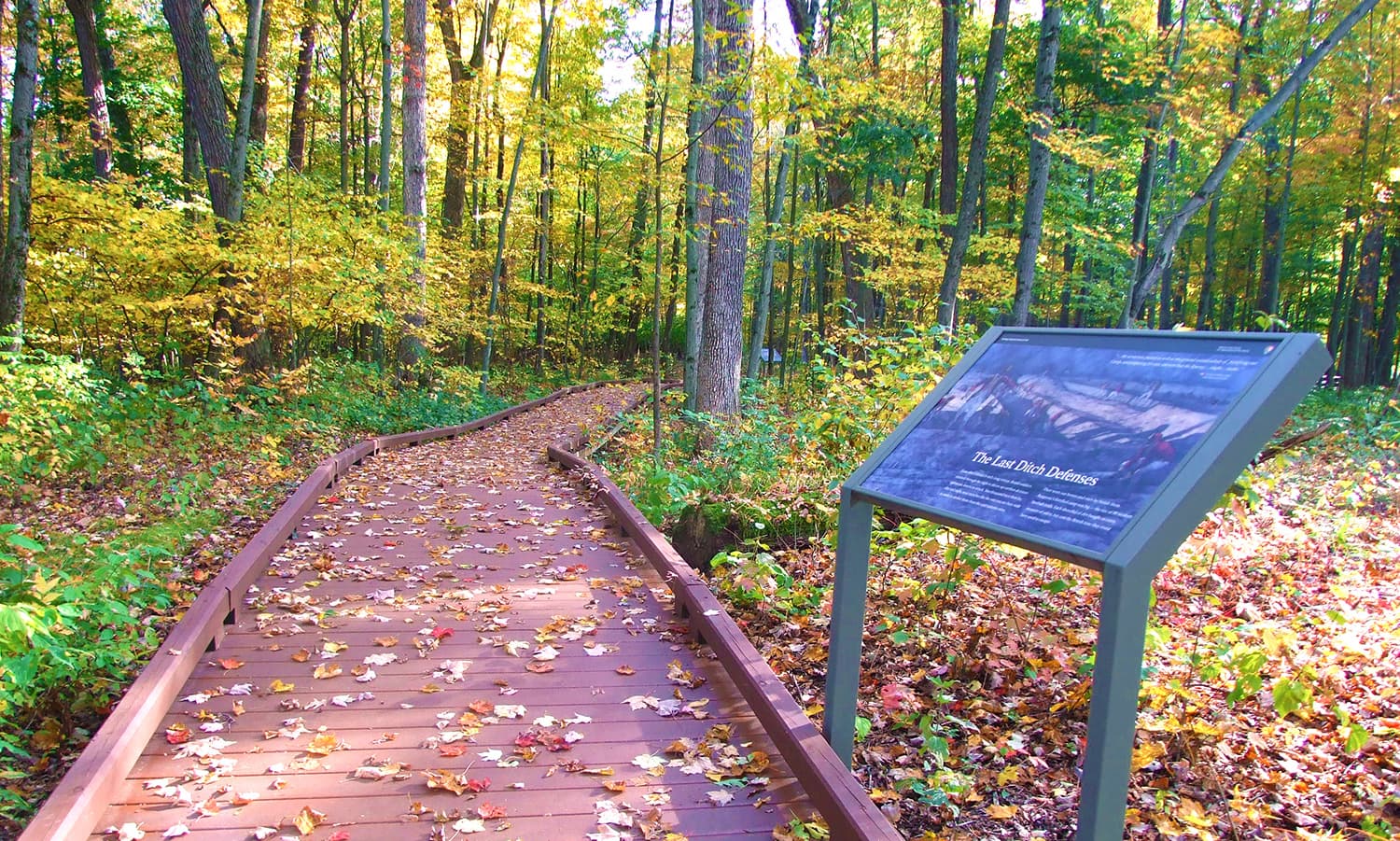
Victory Woods
POIThese 22 acres mark the final encampment site for the British Army under General Burgoyne prior to their October 17, 1777 surrender to American forces. The trail is self-guided and offers a raised, accessible 1/2-mile pathway with interpretive signs.
Wilkinson Trail - Kids Tour - Introduction
POIThe Children’s Version of this audio-guided hike uses a shorter part of the trail, called the Liaison Trail. Narrations for this tour go along with the Trail Station Markers.
Wilkinson Trail - Kids Tour - Station A
POIAs you walk along this trail, you are following in the footsteps of British and American soldiers who fought in the Battles of Saratoga in September and October of 1777.
Wilkinson Trail - Kids Tour - Station B
POIIt is September, 1777. There are a great many people in General Burgoyne’s camp, over seven thousand I am told. One of my duties as a camp follower is helping soldiers with day-to-day life.
Wilkinson Trail - Kids Tour - Station B, Part II
POIAs the British Army retreated north, their route was blocked about eight miles from the battlefield, in the Village of Saratoga, now known as Schuylerville. Trapped in a hastily and poorly built camp, [drumming ends] with little food and even less shelter, they were surrounded by the Americans and forced to surrender just a few days later, on October 17th, 1777.
Wilkinson Trail - Kids Tour - Station C
POIHere at Station C, please follow the trail to your right and proceed to Station D while listening to the narration.
Wilkinson Trail - Kids Tour - Station C, Part II
POIIt is October 7th. Father left for battle once again. We were lucky enough once to have him safely return. I am so afraid he may not return a second time! I heard him mention to Mother how numerous the Rebel forces are. I am also worried about that stupid boy who is going to be leading Father and others into battle. He is only 12 years old! How can someone just two years younger than me be put in charge of leading of men into battle?
Wilkinson Trail - Kids Tour - Station D
POINot far ahead of you is the farm of a local man, John Freeman, who is loyal to our King George. That is where most of the battle took place earlier today, the 19th of September. General Burgoyne advanced his forces [sounds of military fife music, indistinct orders] in three large groups, spread out over 2 miles. Around noon, the middle group saw the Rebels, just north of Freeman’s farm, and the musket fire began.
Wilkinson Trail - Kids Tour - Station E
POIThe Rebel Americans fled earlier today. Much of our army is now camped here on John Freeman’s farm. The soldiers are all so very tired, now that the excitement of battle has passed. Mother and I are exhausted from worry, as we still have no word on whether Father is well, or even alive!
Wilkinson Trail - Kids Tour - Station F
POIHere at Station F, turn left on the Liaison Trail. It goes through the meadow and through a wooded ravine. After the ravine, the trail reconnects with the main part of the Wilkinson Trail at Station N, where you will turn left again.
Wilkinson Trail - Kids Tour - Station N
POIHere at Station N, turn LEFT, back onto the main part of the Wilkinson Trail.
Things to do
Become a Saratoga B.A.R.K. Ranger
Do you think your pet has what it takes to become an official Saratoga Bark Ranger? Learn about B.A.R.K. principles, complete activities, and check in with the rangers at the Visitor Center to get your four-legged friends certified!
Bike the Tour Road
While Saratoga National Historical Park is primarily known for its history, we’re also a very popular spot for cycling; no matter your level of expertise!
Duration: 1-3 Hours
Climb the Saratoga Monument
This 155-foot stone obelisk was built in the last quarter of the 19th century to commemorate the American victory in the Battles of Saratoga. Visitors may climb up its 188 steps to take in amazing views of the surrounding area, with up to 30+ mile visibility on clear days.
Duration: 15 Minutes
Experience Victory Woods
After retreating north from Saratoga Battlefield, the British Army moved west to a ridge top where they made their final defense. Surrounded and nearly out of food, ammunition, and time, they surrendered to the Americans on October 17, 1777. A self-guided, 1/2 mile developed pathway with interpretive signage brings visitors through Victory Woods.
Duration: 20-60 Minutes
Hike the Wilkinson Trail
Saratoga National Historical Park preserves the sites associated with the 1777 Battles of Saratoga. Follow the footsteps of those before you as you hike along hallowed ground.
Duration: 1-3 Hours
Horseback Riding at Saratoga
Ride on the historic grounds of the Saratoga Battlefield where in 1777, a large British invasion force met an equally large American army here. Visitors may bring their own horses to the battlefield unit and make use of our 7+ mile (round trip) Horse Trail.
Saratoga NHP 100 Mile Challenge
Join the 100 mile challenge along the trails within Saratoga National Historical Park - participants are able to hike or bike to complete the challenge. Track your hiking or biking mileage within the park between National Park Week (mid-April) and National Public Lands Day (September). When you reach that magic number -100- you will earn a special prize placing you in an elite group of wilderness pedestrians!
Take a Drive on the Battlefield Tour Road
Explore Saratoga National Historical Park and the Saratoga Battlefield by car, where turning point of the American Revolution took place in 1777.
Duration: 30-120 Minutes
Take a Tour with an Official Saratoga Battlefield Guide
You can hire a private Official Saratoga Battlefield Guide to lead you or your group through the story and setting of one of America's most important battlefields. Guides are throughoughly tested to ensure they provide an informative and enjoyable experience and are only approved after a lengthy vetting process.
Tour the Philip Schuyler Country Estate
Built in 1777, this northern plantation was the economic engine showcasing Philip Schuyler's wealth and success. Enslaved people and paid laborers worked in the timber mills, flax mills, grist mills, gardens, and herring fishery, providing the income to sustain this upper class family. Today, the estate stands as a testament to those who toiled, and to evolving times.
Duration: 15-60 Minutes
Winter Fun at Saratoga
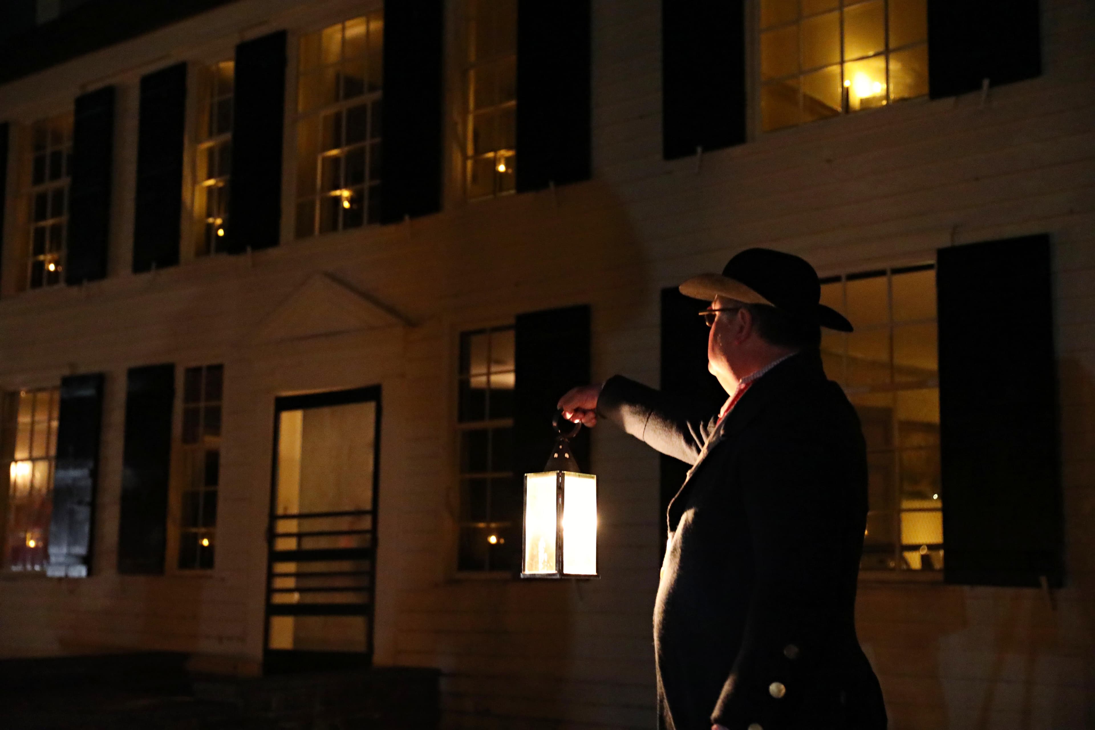
Learn about fun winter activities as Saratoga National Historical Park!
Visitor centers
Visitor Center
This is the park's central Visitor Center, located in the northwest corner of Saratoga Battlefield. It offers restrooms, a 20-minute visitor orientation film, 15-minute fiber-optic battlefield map, exhibits, the park's Eastern National museum store, and park maps and brochures.
Get directions
Hours of operation
Tour Road
The tour road is open to vehicles Apr. 1 through Nov. 30, weather permitting - inclement weather can result in delayed opening or early road closure. Tour road hours vary with the season.
Mon
9:00AM - 5:00PM
Tue
9:00AM - 5:00PM
Wed
9:00AM - 5:00PM
Thu
9:00AM - 5:00PM
Fri
9:00AM - 5:00PM
Sat
9:00AM - 5:00PM
Sun
9:00AM - 5:00PM
Philip Schuyler House
Open Friday, Saturday, and Sunday Tours at 10:00 am, 10:30 am, 11:00 am, and 11:30 am Open House 1:00 pm to 4:00 pm Grounds open sunrise to sunset
Mon
Closed
Tue
Closed
Wed
Closed
Thu
Closed
Fri
10:00AM - 4:00PM
Sat
10:00AM - 4:00PM
Sun
10:00AM - 4:00PM
Saratoga Monument
The grounds are open from Sunrise to Sunset. The interior of the monument is closed for the season. This 155-foot stone obelisk was built in the last quarter of the 19th century to commemorate the American victory in the Battles of Saratoga. Visitors may climb up its 188 steps to take in amazing views of the surrounding area, with up to 30+ mile visibility on clear days.
Mon
Closed
Tue
Closed
Wed
Closed
Thu
Closed
Fri
Closed
Sat
10:00AM - 4:00PM
Sun
10:00AM - 4:00PM
Victory Woods
A self-guided, 1/2 mile developed pathway with interpretive signage brings visitors through Victory Woods. The path is made of plastic lumber and poly-coated pea gravel and is accessible to wheelchairs and strollers. **NOTE** path is NOT maintained in winter. After retreating north from Saratoga Battlefield, the British Army moved west to a ridge top where they made their final defense. Surrounded and nearly out of food, ammunition, and time, they surrendered to the Americans on October 17, 1777.
Mon
Sunrise to Sunset
Tue
Sunrise to Sunset
Wed
Sunrise to Sunset
Thu
Sunrise to Sunset
Fri
Sunrise to Sunset
Sat
Sunrise to Sunset
Sun
Sunrise to Sunset
Pedestrian Access
All hiking trails are for pedestrian use only. Saratoga Battlefield has several miles of hiking trails, including its only marked trail, the 4 1/2 mile Wilkinson Trail - other trails are established but not marked. Pedestrians may also walk the Driving Tour Road on weekends using the marked Multi-Use Lane. **NOTE** Driving Tour Road is NOT plowed or shoveled during winter months.
Mon
Sunrise to Sunset
Tue
Sunrise to Sunset
Wed
Sunrise to Sunset
Thu
Sunrise to Sunset
Fri
Sunrise to Sunset
Sat
Sunrise to Sunset
Sun
Sunrise to Sunset
Saratoga Surrender Site
The grounds are open from sunrise to sunset from April 1 to November 30. This outdoor memorial marks the site of the British Surrender after the Battles of Saratoga. The accessible sidewalk curves through the site and ends at a grand bronze sculpture overlooking the Hudson River. Located on Route 4, one mile south of Schuylerville.
Mon
Sunrise to Sunset
Tue
Sunrise to Sunset
Wed
Sunrise to Sunset
Thu
Sunrise to Sunset
Fri
Sunrise to Sunset
Sat
Sunrise to Sunset
Sun
Sunrise to Sunset
Activities
Weather
The park experiences all four seasons. Temperatures can be as low as -20 degrees Fahrenheit in winter and as high as 100 degrees Fahrenheit in summer. Check local weather reports for more detailed information.
Contact
Photos
Stay near this park
No horse-friendly stays listed near Saratoga National Historical Park yet. Know a great barn or property? Help fellow riders by listing it.
List your propertyDirections
Saratoga National Historical Park is located between U.S. Route 4 and N.Y. Route 32, about 4 miles north of the Village of Stillwater, N.Y. The park is roughly 40 miles north of Albany, N.Y. and 14 miles southeast of Saratoga Springs, N.Y. More detailed directions, and downloadable maps, are available on our website.
Source: nps.gov