
Caution
Extreme heat during holiday weekend
Extreme heat and possible thunderstorms have been issued in the park and surrounding areas from July 1-6, 2026. Temperatures are expected to reach dangerous levels. Visitors should take precautions against extreme heat—hydrate often, plan activities for early morning or late evening, check the weather forecast, and know the signs of heat-related illness.
Information
Shenandoah National Park Moved to Fully Cashless Fee Collection
On July 1, 2025, the park transitioned to a fully cashless system at our fee entrance stations. Only credit cards, debit cards, or mobile payments will be accepted.
Information
Infrastructure Improvements to Old Rag Trailhead
Effective May 4, Shenandoah National Park will begin infrastructure enhancements at the Old Rag Trailhead main parking lot. We expect to complete work by November 2026. Until then, the main parking lot is closed to all vehicle and pedestrian traffic. Visitors can access Old Rag Trailhead via existing overflow parking lots. Day-use tickets are still required from March 1 through November 30 in addition to a park entrance fee.
Caution
Parking at Boundary Access Areas
Visitors are reminded to park in designated parking areas when accessing the park via boundary trailheads. Parking in unauthorized locations may result in your vehicle being towed at the owner's expense. Park on the right side of the road approaching Thompson Hollow. Parking is authorized up to the "No Parking" sign before a private driveway.
Information
Get Skyline Drive Status Updates
Sign up for Shenandoah Alerts by texting SHENALERTS to 888777. Any time there are closures, re-openings, or other important safety-related alerts, subscribers will receive a notification via text. You may unsubscribe at any time.
More infoInformation
Ticket Required to Hike Old Rag
March 1 - November 30 those wishing to hike Old Rag are required to obtain a day-use ticket before arriving.
More infoShenandoah National Park
VA · Stanley
Just 75 miles from the bustle of Washington, D.C., Shenandoah National Park is a land bursting with cascading waterfalls, spectacular vistas, fields of wildflowers, and quiet wooded hollows. With over 200,000 acres of protected lands that are haven to deer, songbirds, and black bear, there's so much to explore...and your journey begins right here!
Riding guide
Horses provided
Highlights
Shenandoah National Park stretches along Virginia’s Blue Ridge Mountains, offering wooded ridgelines, scenic overlooks, and peaceful backcountry Miles.
Riding
Rideable terrain here is noted as 180 miles, giving riders a clearer sense of scale before they ever unload. Shenandoah National Park stretches along Virginia’s Blue Ridge Mountains, offering wooded ridgelines, scenic overlooks, and peaceful backcountry Miles. Equestrians can ride on designated horse trails and selected multi-use routes, with a mix of shaded forest paths and mountain terrain. Seasonal access and specific trail restrictions apply, but for riders seeking East Coast elevation, fall foliage, and classic Appalachian scenery, Shenandoah delivers a beautifully immersive trail experience.
Rideable terrain
180 miles
Trailer parking
Best Horse Trailer Parking Areas Beahms Gap Overlook Location Skyline Drive near Thornton Gap. Why riders use it One of the easiest trailer pull-ins along Skyline Drive Can accommodate larger goose-neck trailers Good access to nearby equestrian trails. Browns Gap Parking Area Location Central section of the park. Why riders use it One of the most consistent trailer-friendly lots Suitable for large trailers including goose-neck rigs Access to several popular riding routes. Fishers Gap Overlook Location Along Skyline Drive near the park’s central section. Why riders use it Large overlook lot Generally reliable trailer parking Direct access to nearby horse-approved trails. Mathews Arm Campground Parking Location Northern section of Skyline Drive. Why riders use it One of the few campground areas where trailers fit comfortably Access to nearby trail networks Typically good availability outside peak weekends. Jenkins Gap Parking Location Near mile 12 of Skyline Drive. Why riders use it Suitable for stock trailers Good staging location for northern park rides. Additional Parking Areas (Smaller Trailers Only) These trailheads may work for 2-horse or small stock trailers but can fill quickly: Beldor Hollow Berry Hollow Boundary Parking Blackrock Gap / Paine Run Gravel Springs Keyser Run Rose River Boundary Parking Important Planning Tip Trailer parking in Shenandoah can fill quickly, especially on weekends. The National Park Service recommends arriving early and having a backup trailhead planned, since a single poorly parked vehicle can block a lot.
Horse regulations
Guided Trail Rides Spring through fall, you may arrange for a guided trail ride leaving from Skyland with the official park concessionaire. View the schedules at GoShenandoah.com Bringing Your Own Horse Shenandoah National Park offers over 180 Miles of trails open to horse use. Some of these trails are relatively smooth, wide, gravel paths, while others are steep, narrow, rocky mountain trails that will challenge the experienced horse and rider. Whether you are new to this area, or are looking for a new place to ride, this website plus a good map will get you started on your Shenandoah adventure. Rules and Best Practices for Bringing Your Horse Read, download, and print the Park's Horse Use Regulations to bring with you on your ride. Yellow-blazed trails are the only trails at Shenandoah designed to accommodate horse use. The Horse Use Regulations above contains a list of these trails. Trail crews do their best to keep the trails clear spring through fall. However, if you encounter a tree completely blocking the trail, please return the way you came rather than leave the trail. Trails may be muddy after a rain or during the winter. If hoof prints are visible, please restrict your riding to graveled trails such as those indicated for winter use. Be prepared to encounter others including other horses, hikers, backpackers, vehicles, and wildlife (including bear, deer, bobcats, and snakes) while riding in the Park. Make sure both you and your horse are in excellent physical condition before attempting long, rocky, rough, or strenuous rides. Allow for more time than you think you will need. Remove or scatter waste from parking areas, high lines and trailheads. Please remove rather than scatter if you have not been using certified weed-free feed prior to your trip. Grazing is not permitted. Be aware of backcountry safety while riding and be prepared with a good topographic map. Always Leave No Trace. Horse Trailer Parking – What to Expect Trailer parking in Shenandoah can be tight. • Many lots are small • One poorly parked vehicle can block access • After 10 a.m. on weekends, lots often fill • Groups with more than 2 trailers should scout parking in advance Always have a backup lot and route in mind. Trailer-Friendly Parking Overview Generally Trailer-Friendly (Gooseneck OK) Beahms Gap Overlook Browns Gap Fishers Gap Overlook Mathews Arm Campground Mt. Marshall Boundary Rapidan Road / Big Meadows Weakley Hollow (Old Rag) Whiteoak Canyon Small Trailer Recommended (2-Horse / Stock) Beldor Hollow Berry Hollow Boundary Blackrock Gap / Paine Run Gravel Springs Graves Mill Boundary Jarman Gap Jenkins Gap Keyser Run Keyser Run / Little Devils Boundary Rose River Boundary ⚠ Limited or Tight Turnaround Meadow Springs South River Overlook Sugar Hollow Reservoir Boundary
Getting here
Use Skyline Drive Milepost 51, Stanley, Virginia as your primary planning reference before you haul in. Best Horse Trailer Parking Areas Beahms Gap Overlook Location Skyline Drive near Thornton Gap. Why riders use it One of the easiest trailer pull-ins along Skyline Drive Can accommodate larger goose-neck trailers Good access to nearby equestrian trails. Browns Gap Parking Area Location Central section of the park. Why riders use it One of the most consistent trailer-friendly lots Suitable for large trailers including goose-neck rigs Access to several popular riding routes. Fishers Gap Overlook Location Along Skyline Drive near the park’s central section. Why riders use it Large overlook lot Generally reliable trailer parking Direct access to nearby horse-approved trails. Mathews Arm Campground Parking Location Northern section of Skyline Drive. Why riders use it One of the few campground areas where trailers fit comfortably Access to nearby trail networks Typically good availability outside peak weekends. Jenkins Gap Parking Location Near mile 12 of Skyline Drive. Why riders use it Suitable for stock trailers Good staging location for northern park rides. Additional Parking Areas (Smaller Trailers Only) These trailheads may work for 2-horse or small stock trailers but can fill quickly: Beldor Hollow Berry Hollow Boundary Parking Blackrock Gap / Paine Run Gravel Springs Keyser Run Rose River Boundary Parking Important Planning Tip Trailer parking in Shenandoah can fill quickly, especially on weekends. The National Park Service recommends arriving early and having a backup trailhead planned, since a single poorly parked vehicle can block a lot.
Planning your visit
Shenandoah is a beautiful park to ride but it’s not built for traditional horse camping. There are no developed horse camping facilities inside the park, and horses are not permitted to stay overnight in front-country campgrounds, at lodges, or in trailers parked overnight. Many riders choose to board their horses just outside the park with nearby private stables, allowing for early trail access without overnighting inside the park. Local boarding facilities and equestrian-friendly lodging options are available throughout the surrounding Virginia countryside. Backcountry Camping with Horses While backcountry camping with horses is technically permitted, it is strongly discouraged due to the fragile mountain ecosystem. If you plan an overnight trip: • A free backcountry permit is required • Camp at least 20 yards from trails and fire roads • Lead horses carefully to campsites to prevent new trail creation • Horses must stay on designated trails while traveling • Grazing is not allowed; bring your own feed • Certified weed-free or “clean” feed is strongly recommended • Use proper highline techniques to protect trees and vegetation • Do not tie horses within 50 yards of streams or springs • Scatter manure and rehabilitate your highline site before leaving Shenandoah asks riders to tread lightly and prioritize preservation over convenience. Tip: Many experienced riders design overnight trips that travel through Shenandoah but camp just outside the park boundary, such as in the nearby Rapidan Wildlife Management Area. This allows for multi-day rides while minimizing ecological impact inside the park.
Where to stay
Harry F. Byrd Sr. Visitor Center is the main visitor-contact point tied to this destination, which is helpful when you want current conditions, maps, and stock-use updates before riding. Guided or concession-based riding support is noted here, so riders who are not hauling their own horses may still find an access path into the experience. For a polished trip plan, pair the ride with lodging, fuel, and resupply planning in or near Stanley before heading deeper into federal-land access points.
Entrance fees & passes
- $30.00
Entrance - Private Vehicle
Unlimited entry for one vehicle and all passengers for seven consecutive days, beginning on the day of purchase. Admits the pass holder and occupants of a single, private non-commercial vehicle.
- $25.00
Entrance - Motorcycle
Valid for 7 days. Admits up to 2 private, non-commercial motorcycles with up to 4 total passengers.
- $15.00
Entrance - Per Person
Entry for walk-up or bicycling visitors, when 16 years of age or older (children under 16 are admitted for free). Includes entering the Park by all means other than a private, non-commercial vehicle. A family traveling together shall pay no more than the vehicle fee.
- $25.00
Commercial Entrance - Sedan
The total cost is calculated: $25 + $10 per passenger.
- $10.00
Commercial Entrance - Per Person
This fee is for commercial use between 1-6 passengers (sedan). The total cost is calculated: $25 for the vehicle + $10 per passenger.
- $75.00
Commercial Entrance - Van
Based upon the total capacity of a vehicle that can carry 7-15 passengers, regardless of the actual number of passengers.
- $100.00
Commercial Entrance - Mini-bus
Based upon the total capacity of a vehicle that can carry 16-25 passengers, regardless of the actual number of passengers.
- $200.00
Commercial Entrance - Motor Coach
Based upon the total capacity of a vehicle that can carry 26 or more passengers, regardless of the actual number of passengers.
- $0.00
Entrance - Education/Academic Groups
National Park Service regulations allow school groups and other approved national and international academic institutions to obtain a waiver of Park entrance fees, provided that visit is for educational or scientific purposes, and the resources or facilities that the group intends to use, support those purposes. Request an academic fee waiver through the education section of our website.
- $15.00
Entrance - Non-commercial Groups
Fee is calculated per person for anyone 16 years of age or older (children under 16 are admitted for free). Groups will not be charged more than the equivalent commercial group fee.
- $55.00
Annual Entrance - Park
Provides unlimited entry for one year to the pass holder and passengers in the same vehicle, not to exceed 4 total adults. Children under 16 are admitted for free and are not included in this total. Purchase online or at any of our entrance stations.
Park map
Trails
No trails synced for this park yet.
Campgrounds
Big Meadows Campground
221 sites
2026 Opening Date: March 25 Big Meadows Campground (mile 51.2) is centrally-located in Shenandoah National Park, providing easy access to many of the most popular destinations in the Park, including Big Meadows, Dark Hollow Falls, and Byrd Visitor Center. All sites include a place for a tent or RV, a fire ring, and a picnic table. All sites at Big Meadows Campground are by reservation only.
Reserve a siteLewis Mountain Campground
30 sites
2026 Opening Date: March 26 Lewis Mountain (mile 57.5), the smallest campground in Shenandoah National Park, appeals to those who want a little more privacy while still staying within a close distance to many of the most popular destinations in the Park, including Big Meadows (7 miles away). Lewis Mountain Campground operates on a self-registration, first-come, first-serve basis. There are no reservable sites. Please follow the posted directions to register once arriving at the campground.
Loft Mountain Campground
207 sites
2026 Opening Date: April 29. Loft Mountain (mile 79.5) sits atop Big Flat Mountain in the southern part of Shenandoah National Park, with outstanding views to east and west. Two waterfalls and the trails into the Big Run Wilderness area are nearby. Loft Mountain has a combination of reservable and first-come, first-served sites. Reservable sites are released in sections.
Reserve a siteMathews Arm Campground
165 sites
2026 Opening Date: April 29. Mathews Arm Campground (mile 22.1) is the nearest campground for those entering Shenandoah National Park from Front Royal, in the northern section of the Park. All sites include a place for a tent or RV, a fire ring, and picnic table. Elkwallow Wayside, with camping supplies and food service, is two miles away. Mathews Arm has a combination of reservable and first-come, first-served sites. Reservable sites are released in sections.
Reserve a site
Points of interest
Appalachian Trail - Tanners Ridge Road Trailhead
POIMilam Gap Parking Area (Mile 52.8) | A fairly level hike that takes you through a former homestead on the famous Appalachian Trail.
Bacon Hollow Overlook
POIFacing south from an elevation of 2,455 ft (748 m), the view from Bacon Hollow Overlook stretches out over a broad hollow that descends to the Piedmont in the distance. The Piedmont is the central region of Virginia between the Blue Ridge Mountains and the Coastal Plains. Literally meaning foothills, the Piedmont region is known for its rolling hills and rural character.
Baldface Mountain Overlook
POIFacing northwest from an elevation of 3,345 ft (1,019 m), the view from Baldface Mountain Overlook glimpses into the Shenandoah Valley below. You are atop a slope of Baldface Mountain. The peak is on the opposite side of the Skyline Drive to the northeast.
Beagle Gap
POIBeagle Gap contains a small parking lot with portable toilets and access to the Appalachian Trail.
Beagle Gap Overlook
POIFacing east from an elevation of 2,495 ft (760 m), the view from Beagle Gap Overlook stretches outside of Shenandoah National Park to the Piedmont region of Virginia. Calf Mountain is the long ridge from the left descending down to the center of the view. If you travelled in a south-eastern direction the first urban center you would hit is the town of Charlottesville, Virginia.
Beahms Gap Overlook
POIBeahms Gap sits at an elevation of 2,485 ft (757 m). During the early years of Shenandoah National Park, there was a 360 degree view from this location, created by clearing the land around Skyline Drive. Over time, trees have grown back and there is no view of the Shenandoah Valley from the Beahms Gap parking lot. If you cross the Skyline Drive on a clear day, you can see Hogback Mountain, Fork Mountain, and Oventop Mountain.
Bearfence Rock Scramble Trailhead
POIBearfence Parking Area (mile 56.4) | Pets are not allowed on this hike. An exhilarating rock scramble leads to a magnificent 360-degree view of the Virginia Piedmont and Shenandoah Valley.
Bearfence Viewpoint Trailhead
POIBearfence Parking Area (mile 56.4) | Pets are not allowed on this hike. This route takes you to a 180-degree view of the Shenandoah Valley without a rock scramble.
Beldor Hollow Overlook
POIFacing southwest from an elevation of 2,345 ft (714 m), the view from Beldor Hollow Overlook expands out to the Blue Ridge Mountains with Skyline Drive in the distance.
Big Meadows
POISkyline Drive (mile 51) | Perched on top of a mountain, this high-elevation meadow can come as a bit of a surprise after the miles of lush, green forests that make up most of Shenandoah National Park. A must-see for every visitor, stop by Big Meadows to explore the trails, grab a bite to eat, or talk to a Ranger at Byrd Visitor Center.
Big Meadows Amphitheater
POINothing adds to the National Park experience quite like enjoying an evening ranger program at Big Meadows amphitheater! Come listen to a Park Ranger present a variety of topics that will help you to connect to Shenandoah on a deeper level.
Big Meadows Gas Station
POIThis refueling station is located next to the Big Meadows Wayside. It is the only gas station located within Shenandoah National Park, so be sure to plan accordingly!
Big Meadows Lodge
POIBig Meadows Lodge has accommodations ranging from main lodge rooms to detached small cabins, preferred and traditional rooms, suites, and pet friendly rooms - all located within walking distance of the main lodge building in the popular Big Meadows area. The Spottswood Dining Room, New Market Taproom, and Craft Shop are aso located in the main lodge building.
Big Meadows Picnic Grounds
POILocated next to the Big Meadows Campground, Big Meadows Picnic Grounds provides an open space to relax, complete with picnic tables and grills.
Big Meadows Wayside
POIBig Meadows Wayside offers a varied menu of regional favorites available for carry-out or sit down dining. The Grab 'n Go kiosk inside offers sandwiches, salads, pastries, snacks and drinks to go. Groceries, gifts, and camping supplies are also available.
Big Run Overlook
POIFacing northwest from an elevation of 2,860 ft (871 m), at Big Run Overlook you will look out toward the Shenandoah Valley below. Unfortunately, the view at this overlook is obstructed by overgrowth most of the year, making it difficult to see the mountains and valley beyond.
Blackrock Summit Trailhead
POIBlackrock Parking Area (mile 84.4) | A short hike to a viewpoint on top of a rocky talus slope with incredible views of the Shenandoah Valley, Massanutten Mountain, and beyond. This hike is also a designated TRACK Trail, featuring a self-guided brochure designed for kids.
Blue Ridge Heritage Project Monument - Albemarle
POIThe Blue Ridge Heritage Project is a non-profit organization whose mission is to build monuments to honor the people who were displaced by the creation of Shenandoah National Park. Currently, six of the eight counties from which mountain residents were relocated have monuments: Madison, Page, Rockingham, Greene, Rappahannock, and Albemarle. Warren has a site selected and Augusta is in the planning stages. Most of the monument sites include exhibits about the families. We invi
Blue Ridge Heritage Project Monument - Augusta County
POIThe Blue Ridge Heritage Project is a non-profit organization whose mission is to build monuments to honor the people who were displaced by the creation of Shenandoah National Park.
Blue Ridge Heritage Project Monument - Greene County
POIThe Blue Ridge Heritage Project is a non-profit organization whose mission is to build monuments to honor the people who were displaced by the creation of Shenandoah National Park. Currently, six of the eight counties from which mountain residents were relocated have monuments: Madison, Page, Rockingham, Greene, Rappahannock, and Albemarle. Warren has a site selected and Augusta is in the planning stages. Most of the monument sites include exhibits about the families. We invi
Blue Ridge Heritage Project Monument - Madison County
POIThe Blue Ridge Heritage Project is a non-profit organization whose mission is to build monuments to honor the people who were displaced by the creation of Shenandoah National Park. Currently, six of the eight counties from which mountain residents were relocated have monuments: Madison, Page, Rockingham, Greene, Rappahannock, and Albemarle. Warren has a site selected and Augusta is in the planning stages. Most of the monument sites include exhibits about the families. We invi
Blue Ridge Heritage Project Monument - Page County
POIThe Blue Ridge Heritage Project is a non-profit organization whose mission is to build monuments to honor the people who were displaced by the creation of Shenandoah National Park. Currently, six of the eight counties from which mountain residents were relocated have monuments: Madison, Page, Rockingham, Greene, Rappahannock, and Albemarle. Warren has a site selected and Augusta is in the planning stages. Most of the monument sites include exhibits about the families. We invi
Blue Ridge Heritage Project Monument - Rappahannock County
POIThe Blue Ridge Heritage Project is a non-profit organization whose mission is to build monuments to honor the people who were displaced by the creation of Shenandoah National Park. Currently, six of the eight counties from which mountain residents were relocated have monuments: Madison, Page, Rockingham, Greene, Rappahannock, and Albemarle. Warren has a site selected and Augusta is in the planning stages. Most of the monument sites include exhibits about the families. We invi
Blue Ridge Heritage Project Monument - Rockingham County
POIThe Blue Ridge Heritage Project is a non-profit organization whose mission is to build monuments to honor the people who were displaced by the creation of Shenandoah National Park. Currently, six of the eight counties from which mountain residents were relocated have monuments: Madison, Page, Rockingham, Greene, Rappahannock, and Albemarle. Warren has a site selected and Augusta is in the planning stages. Most of the monument sites include exhibits about the families. We invi
Blue Ridge Heritage Project Monument - Warren County
POIBridge Along the Limberlost
POIBrown Mountain Overlook
POIBrown Mountain Overlook sits at an elevation of 2,844 ft (866 m). This overlook is long, with views from north to south of Two Mile Ridge, Rocky Mount, Rockytop, Trayfoot Mountain, and the Shenandoah Valley.
Browns Gap Trailhead
POIBrowns Gap Parking Area (mile 83) | This circuit hike leads you through designated Wilderness to Upper and Lower Doyles River Falls, as well as Jones Run Falls.
Browntown Valley Overlook
POILooking west-northwest from an elevation of 2,890 ft (880 m), you will see the view of an historic community and surrounding hills from the Browntown Valley Overlook
Buck Hollow Overlook
POIStop at Buck Hollow Overlook, facing east-northeast from an elevation of 2,710 ft (826 m), and look out over the mountains! Skinner Ridge is visible towards the left, while Buck Ridge makes its way from the right toward the center of the view.
Calf Mountain Overlook
POIFacing west from an elevation of 2,480 ft (755 m), the view from Calf Mountain Overlook is straight out over the town of Waynesboro.
CCC Barracks: Daily Schedule
POIThe enrollment period for the CCC was initially for six months, but an enrollee could re-enlist for up to a maximum of two years. Enrollees were required to take an oath, swearing to obey those in authority and follow all rules and regulations. Some of the boys adjusted more easily to a regimented life than others. Those who had come from rural backgrounds tended to have an easier time with the labor than those from more urban backgrounds. Others suffered from homesickness a
CCC Barracks: Home Away From Home
POIGiven the speed with which the CCC was started, the first enrollees didn't arrive to finished camps in May of 1933 but rather, in the early months, they lived in surplus WWI tents. As the organization of the CCC evolved, more standardization was introduced into the building of the camps but almost all camps were built around a common open space or "Company Street."Shenandoah National Park had 10 different camps at various times throughout the nine years of the Civilian Conser
CCC Barracks: Living Was Sparse
POIIn the beginning, the official requirements for being a CCC enrollee were to be a man between the ages of 18-25, unmarried, and in need of assistance. (Although some older WWI veterans were also allowed to enroll.) Unofficially, some of the CCC boys lied about their ages to enter the Corps. CCC enrollees earned 30 dollars a month, a dollar a day, but $25 were automatically deducted and sent back home to their families, thus spreading the economic benefits of the program to th
CCC Barracks: Near Bathhouse
POIWinters would have been cold here on the mountain but there was no shortage of firewood to heat the stoves. When the CCC boys arrived at Shenandoah, they found a landscape that had been ravaged by the chestnut blight, a fungus that had been unintentionally imported from Asia and which had destroyed the American Chestnut. In the space of 30 years, the majestic trees which made up 25% of the forest ecosystem had died and left a "ghost forest" behind. It was a huge economic and
CCC Barracks: Sports
POILiving in close quarters, with little privacy, conflicts inevitably arose. As well as being fun, participating in competitive sports, including boxing, was one way of dealing with tensions as they arose.The boys came from varied backgrounds, rural and urban, and for many it was their first journey away from home. Being in the CCC exposed these young men to people completely different from themselves and gave them an opportunity to learn how to get along. Many an enrollee left
CCC Camp
POIThe year was 1933. The nation had been struggling for years with the effects of the Great Depression. Unemployment reached as high as 12 million people, equivalent to 25% of the eligible working population. People had lost their savings and livelihoods, bread lines were long and morale was low. Adding to the economic woes, the United States was also facing severe ecological issues. Drought conditions, poor farming practices and indiscriminate timber harvesting were contributi
CCC Education
POIThe legacy of the CCC is vast and varied. The program affected change on both the personal and national levels. For the young men who came in with minimal or poor education, they learned how to properly read and write. Others learned the technical and construction skills that would serve them well in their later careers. Many saw parts of the country they had never seen before.
CCC: Flower Garden
POIThe CCC worked on every aspect of vegetation and reforestation management in the Park. They grew and planted new seedlings, cleared the understory of dead brush and trees, and moved shrubs and trees around from one area to another, particularly by picnic grounds, overlooks and other facilities. What might seem natural to us now is actually the product of extensive landscape manipulation.
CCC Mess Hall
POIWhen setting up a camp, the mess hall was the typically the first building built. The idea behind the CCC was to put men to work, not machines, so they needed proper nutrition to fuel their various labors. <br />The food was basic, but plentiful, and having regular meals three times a day was a welcome change for most of the CCC boys who had been living off more meager rations during the Depression.
CCC Office
POIThere were many agencies involved in getting the CCC men here: the Department of Labor recruited and enrolled the men, the Department of Interior (under which the National Park Service is administered) and Department of Agriculture provided the work projects and the War Department/Army ran the camps. Despite the many agencies involved, the CCC was up and running with incredible speed. From Roosevelt's initial meeting with his Cabinet regarding the CCC on March 9, 1933 to the
CCC Recreation
POIAfter a long, hard day of work, this building must have the place to come for a little relaxation. But the boys wouldn't just stay up on the mountain, even if their dances did sometimes attract hundreds of attendees. Needing a change of scene, they might go on Friday and Saturday nights down into the nearby towns to attend movies and the local dances.
CCC Technical Building
POIThe building of Skyline Drive was a labor-intensive endeavor. Though the CCC did not engineer and build the road itself (that was done by the Bureau of Public Roads) they designed and created the overlooks as well as worked to control the erosion on the hillsides created from it's construction. Additionally, they planted hundreds of thousands of trees and plants, including mountain laurel, creating the beautiful "natural" landscaping we enjoy today as we take a drive along th
Cedar Run - Whiteoak Circuit Trailhead
POIHawksbill Gap Parking Area (mile 45.6) | This hike is very challenging, although those who do it are rewarded with exceptional cascades and waterfalls.
Chimney Rock Trailhead
POIRiprap Parking Area (mile 90) | An out-and-back hike to Chimney Rock, an excellent viewpoint with some very interesting geological features.
Compton Peak Trailhead
POICompton Gap Parking Area (mile 10.4) | A hike through the forest along the Appalachian Trail to a western view and a great look at columnar jointing, an exciting geologic feature.
Crescent Rock Overlook
POIFacing west, with an elevation of 3,550 ft (1,082 m), Crescent Rock Overlook has some of the best views of Hawksbill Peak, the highest peak in Shenandoah, at 4,050 ft (1,234 m). An informational sign located at the overlook shares information about the establishment of Shenandoah National Park and the resettlement of former residents of the land.
Crimora Lake Overlook
POIFacing northwest from an elevation of 2,985 ft (909 m), Crimora Lake Overlook is a good place to contemplate the industrial history of the Shenandoah Valley.
Dark Hollow Falls Trailhead
POIDark Hollow Falls Parking Area (mile 50.7) | Pets are not allowed on this hike. This hike follows a stream to a beautiful waterfall, and is one of the Park’s most traveled trails. The trail is short, but very steep and rocky and the return hike is challenging!
Dickey Ridge Picnic Grounds
POIA beautiful spot to stop for a picnic in the northernmost area of the park. Equipped with tables, fire grates, water, restrooms, and plenty of room to relax! Closed in winter. Call 540-999-3500 for exact dates.
Doyles River Falls Trailhead
POIDoyles River Parking Area (mile 81.1) | This beautiful trek through Wilderness takes you along cool, clear mountain streams to two unique waterfalls.
Doyles River Overlook
POITake in a view to the south from Doyles River Overlook. Sitting atop an elevation of 2,875 ft (876 m), the view here looks out to Browns Cove, nested beyond Little Flat Mountain and Cedar Mountain.
Dundo Overlook
POIFacing west-northwest from an elevation of 2,769 ft (843 m), the view from Dundo Overlook expands to the mountains in the distance.
Dundo Picnic Grounds
POIWelcome to Dundo Picnic Grounds! This picnic grounds is open year round. You will find drinking water, vault toilets, picnic tables, and fire rings for making your picnic the best ever. This location was once the site of a Civilian Conservation Corps camp. Dundo Group Campground is located at the end of the one-way loop drive around the picnic ground.
Eaton Hollow Overlook
POIThe view from Eaton Hollow Overlook is obstructed by vegetation for much of the year. Facing north-northeast from an elevation of 2,500 ft (762 m), you may be able to see a small window between the growth to look out upon the Shenandoah Valley below.
Elkwallow Picnic Grounds
POIElkwallow Picnic Grounds is open year-round and fitted with picnic tables, fire grates, water, and restrooms.
Elkwallow Wayside
POIElkwallow Wayside offers groceries, camping supplies, gifts, and grab 'n go food. Elkwallow usually closes around the beginning of November and reopens in April.
Fishers Gap Overlook
POIFacing northwest from an elevation of 3,070 ft (935 m), Fishers Gap Overlook provides a narrow window to view the Shenandoah Valley.
Fort Windham Rocks Trailhead
POICompton Gap Parking Area (mile 10.4) | A short hike along the Appalachian Trail that leads to an interesting geologic feature.
Fox Hollow Cemetery: Stories Laid to Rest
POIMany families who lived in the mountains had private family cemeteries. Although only a few gravestones are left, generations of the Foxes are buried here. Observe your surroundings. Can you imagine what this spot would have been like when the Fox family still held funerals here? What did this space mean to the family?If you are visiting in spring, you may discover flowers that the Fox family planted years ago - frilly old fashioned daffodils and narcissuses, deep purple bear
Fox Hollow First Trail Post: Tour Introduction
POIPeople once called this place home. Remnants of their lives and the impact they had on this land are still evident if you know where and how to look. In this hollow are the stories of people and a history obscured by the wild, rapid pace of natural flux.
Fox Hollow Right Turn: A Barn was Here
POIAs the trail turns a sharp right, you are very near the location of a barn that belonged to a neighbor of the Foxes, Edgar Merchant. A short section of the trail here is on the Merchant property. Today, the rock foundation of Merchant's barn lies under thick spicebush and multiflora rose.After the turn, you will be walking along an old county road which once connected the Fox family to the town of Front Royal. To your left (and possibly not even visible through the dense fore
Fox Hollow Rock Piles: Things Left Behind
POIThere is not much left of the Foxes and their lives here. These rock piles are one of the few large, visible artifacts of the Fox's farm. What could these rocks be? A wall, a fence, part of a barn, a house? <br />Lemuel Fox Jr. said that he would add rocks to the piles as he found them while plowing the cornfields. The original purpose of these rock piles is unknown.
Fox Hollow Second Trail Post: The Fox Family
POIThe family that chose this hollow as their home were named Fox. Thomas and Martha Fox started farming here - on this ground - in 1856. Their son Lemuel Franklin Fox and his wife, Lucy, planted bluegrass pastures, corn, and wheat after Lemuel returned from the Civil War. Lemuel's grandson Lemuel Fox Jr. courted his future wife, Maude Vaught on the family property. By the time of the establishment of Shenandoah National Park, the Foxes and extended family lived in several frame
Fox Hollow Springbox: Getting Water
POIAre you thinking like an archaeologist? When do you think people made this? Who made this?If you guessed that the Fox family did not build this you would be correct. This is a springbox built after the Fox family left. At one time this springbox helped provide a water supply to the dining room at Dickey Ridge Lodge, currently Dickey Ridge Visitor Center. Though the Fox family did not build this springbox, they did use the water here for their farming and other daily needs. Op
Fox Hollow Stream: Life Abounds
POIA stable water source would have been one of the most important factors in finding a place to live for Thomas and Martha Fox when they began farming here in the 1850s. This water not only provides for farming and human life, but also for a wide variety of plant and animal life as well. One of the reasons Shenandoah is so lush, and how much of the vegetation here seems to grow faster than other places, is the prevalence of water sources like this one here.
Fox Hollow Sycamore Tree: Wilderness to Farm and Back Again
POIWhen Lemuel Fox Jr. walked here with Park Rangers in 1976 he told them that when he was a young man in the 1920s he once attached a windmill to this tree. "[The sycamore] was the only tree on this hill then," Lemuel said, "All the rest of it was cleared from here." Most of the older growth forest was cut down long ago to make way for farmland in the 1800s and early 1900s. Certain trees, maybe a tall red oak here, a white pine over there, or this sycamore before you were spare
Fox Hollow Third Trail Post: Out in the Clearing
POIAs you approach the third trail post, take a second to look out at the clearing. As the forest opens up, imagine what the whole hollow would have looked like if it were cleared like this. When you think about living in the mountains, do you think of a hollow - low, narrow, enclosed on either side - or do you think of a home with a sweeping view? The cleared pastures and farmland certainly would have created some views for the Fox family, but the view was a secondary considera
Fox Hollow Trailhead
POIDickey Ridge Visitor Center (Mile 4.6) | Pets are not allowed on this hike. Discover the cultural history of Shenandoah National Park as you pass by historic rock walls, a cemetery, and periwinkles planted by former residents. This hike is also a designated TRACK Trail, featuring a self-guided brochure designed for kids.
Franklin Cliffs Overlook
POILooking northwest from 3,140 ft (957 m), Franklin Cliffs Overlook views a narrow hollow leading to the town of Stanley in the Shenandoah Valley.
Frazier Discovery - Appalachian Trail Junction
POIFrazier Discovery Trailhead
POILoft Mountain Wayside (mile 79.5) | Pets are not allowed on this hike. This hike features several picturesque overlooks as it passes through woodlands of varying ages on Loft Mountain.
Frazier Discovery Trail - Loft Campground Junction
POIFrazier Trail Geologic Discovery
POIGimlet Ridge Overlook
POILooking north from an elevation of 2,675 ft (815 m), Gimlet Ridge Overlook views the gently descending slope of Gimlet Ridge into the valleys below.
Gooney Manor Overlook
POIFrom Gooney Manor Overlook you are looking southwest from an elevation of 1,930 ft (588 m) into Browntown Valley and the hills beyond.
Gooney Run Overlook
POIFacing northwest at an elevation of 2,085 ft (635 m), Gooney Run Overlook looks down upon Browntown Valley.
Hawksbill Loop Trailhead
POIHawksbill Gap Parking Area (mile 45.5) | A circuit hike to Shenandoah’s highest peak. The viewing platform on top of Hawksbill offers a magnificent 360-degree view of the Shenandoah Valley, the Blue Ridge Mountains, and the Virginia Piedmont.
Hawksbill Summit Trailhead
POIHawksbill Gap Parking Area (mile 45.5) | A shorter, yet steeper route to Shenandoah’s highest peak. The viewing platform on top of Hawksbill offers a magnificent 360-degree panoramic view of the Shenandoah Valley, the Blue Ridge Mountains, and the Virginia Piedmont.
Hawksbill Summit via Upper Hawksbill Trailhead
POIUpper Hawksbill Parking Area (mile 46.5) | A hike to the top of Shenandoah’s highest peak, offering 360-degree views of the Shenandoah Valley, the Blue Ridge Mountains, and the Virginia Piedmont.
Hazel Mountain Overlook
POILooking southeast from an elevation of 2,770 ft (844 m), the view from Hazel Mountain Overlook includes the granodiorite rock formation and Hazel Mountain in the distance
Hazel River Falls Trailhead
POIMeadow Spring Parking Area (mile 33.5) | A trail that leads you through a rugged section of the Park to an exceptional waterfall.
Hazeltop Ridge Overlook
POIGaze upon the Blue Ridge Mountains from Hazeltop Ridge Overlook. The view from this overlook stretches from the northwest to the southwest.
Hemlock Springs Overlook
POIFacing east from an elevation of 3,380 ft (1030 m), Hemlock Springs Overlook is a great place to contemplate the dynamic nature of the forest.
Hensley Hollow Overlook
POILook north from an elevation of 2,560 ft (780 m) at Hensley Hollow Overlook and view the Shenandoah Valley below. Beyond Hensley Ridge is the town of Elkton, Virginia.
Highest Point on Skyline Drive
POIMile 41.7, just at the northern entrance to Skyland is the highest point on Skyline Drive at 3,680 feet. The highest point in Shenandoah is the summit of Hawksbill Mountain at 4,050 feet. Getting to the summit entails a relatively short hike of less than 2 miles.
Hightop Summit Trailhead
POIHightop Mountain Parking Area (mile 66.7) | Wind your way up a ridge on this hike to a rocky viewpoint that stands at 3,296 feet.
Historic Hemlocks of the Limberlost
POIHogback Overlook
POILooking north from an elevation of 3,385 ft (1031 m), Hogback Overlook extends 0.2 miles along Skyline Drive, making it the longest overlook in the park.
Hogwallow Flats Overlook
POIHogwallow Falts Overlook faces southeast from an elevation of 2,665 ft (812 m). You are looking down to Rappahannock County and the town of Flint Hill.
Horsehead Overlook
POILook northwest to the Shenandoah Valley from an elevation of 2,580 ft (786 m) at Horsehead Overlook. You are looking into Augusta County in the southern Shenandoah Valley.
Indian Run Overlook
POIIndian Run Overlook faces east and sits at an elevation of 2,400 ft (731 m). Indian Run is a stream that has formed the hill in front of you through the slow process of erosion.
Iron Mike Statue
POIIron Mike stands outside Byrd Visitor Center. This statue was donated to the Park to honor the young men in the Civilian Conservation Corps who, together, built much of the infrastructure of Shenandoah National Park still in use today.
Ivy Creek Overlook
POIFacing east from an elevation of 2,890 ft (880 m), you will look out to the rolling ridges of Shenandoah National Park from Ivy Creek Overlook. The Appalachian Trail intersects with this overlook, as well.
Jenkins Gap Overlook
POIJenkins Gap Overlook peers onto the Piedmont from a small window above the v-shaped intersection of two hills. Looking east, and at an elevation of 2,355 ft (717 m), you are peering into a hollow formed by the Bolton Branch of the Burgess River.
Jeremys Run Overlook
POILooking west from Jeremys Run Overlook, at an elevation of 2,410 ft (734 m), you will see the hollow formed by Jeremys Run cutting between Neighbor Mountain on the left and Knob Mountain on the right.
Jewell Hollow Overlook
POIFacing north-northwest at an elevation of 3,320 ft (1,011 m), you can see the Blue Ridge Mountains descend into the valley from atop the Jewell Hollow Overlook.
Jones Run Falls Trailhead
POIJones Run Parking Area (mile 84.1) | This hike takes you over a mountain stream, through the forest, and beside a 42’ waterfall.
Knob Mountain - Jeremys Run Trailhead
POIElkwallow Wayside (mile 24) | This hike goes around a beautiful area of the Park featuring one of the most picturesque streams in Shenandoah.
Lake Arrowhead
POIFrom many west-facing overlooks you can see a large lake in the valley. It is Lake Arrowhead and serves as a reservoir and a recreation area for the neighboring town of Luray. Lake Arrowhead features 6 picnic shelters for rent (Call 540-743-5511 for availability), fishing, white sand beach and swimming during the summer, ball field, volleyball nets, horseshoe pits, playground, 1 mile trail that circles the lake, and the Edwin Smith scout camping area. The physical address is
Lands Run Falls Trailhead
POILands Run Parking Area (mile 9.2) | A short hike down a fire road to a series of cascades that descend about 80 feet into a gorge. Note that it may not have water in dry seasons.
Lava Along the Limberlost
POILewis Falls Trailhead
POIBig Meadows Amphitheater (mile 51.2) | This hike leads to an observation point over a beautiful 81’ waterfall.
Lewis Mountain
POIThe Lewis Mountain developed area is a favorite among return visitors. Its small, intimate atmosphere is both beautiful and relaxing. Lewis Mountain usually closes in November and reopens the end of March. Call 877-847-1919 for exact dates. For cabin rental, visit GoShenandoah.com . The campground is first-come, first-served. For more information: nps.gov/shen/planyourvisit/campgrounds.htm Other services in Lewis Mountain include a campstore, showers, a picnic ground, and a
Lewis Mountain Amphitheater
POIEvening programs are held in the amphitheater once a week at night during late spring, summer, and early fall.
Lewis Mountain Cabins
POIThe historic Lewis Mountain Cabins offer comfortable accommodations to families, couples, or anyone seeking an authentic Shenandoah National Park experience.
Lewis Mountain Campstore
POIRegister for a cabin at Lewis Mountain here. Campground registration is at the campground. You'll also find a campstore with groceries and supplies, as well as a few souvenirs, showers, and laundry in this building. Lewis Mountain's coin-operated showers and laundry are open seasonally when the campground and cabins are open.
Lewis Mountain Picnic Grounds
POILewis Mountain Picnic Ground is open April through October. A pleasant, quiet wooded atmosphere makes it a great place to relax and have a picnic.
Limberlost: Life After Death
POILimberlost: Respite and Retreat
POILimberlost TRACK Trail - Kids' Activity
POIThe Kids in Parks TRACK Trails program is a national network of trails designed for kids and families. Each TRACK Trail has one or more self-guided adventures. In Shenandoah, your TRACK Trail activity guide can be used as part of the Junior Ranger Program. Best of all, the learning and fun doesn't stop at trail's end! You can earn Trail TRACKer Gear for each TRACK Trail adventure by registering through the website www.kidsinparks.comThe Limberlost TRACK Trail is a 1.3-mile lo
Limberlost Trailhead
POILimberlost Parking Area (mile 43) | An ADA accessible path through the forest with mountain laurel in the springtime and an example of a columnar jointing geological feature. This hike is also a designated TRACK Trail, featuring a self-guided brochure designed for kids.
Little Devils Stairs Loop Trailhead
POIKeyser Run Parking Area (mile 19.4) | A journey into a rocky gorge with some very rewarding, yet steep, sections along a stream.
Little Devils Stairs Overlook
POIStop at Little Devils Stairs Overlook for a sweeping view to the south. Looking down from an elevation of 3,120 ft (950 m), you are peering into Little Devils Stairs, a rocky gorge with some very steep sections.
Little Hogback Overlook
POILooking north-northeast from an elevation of 3,035 ft (925 m), Little Hogback Overlook gives you a narrow window from which to view Browntown Valley. A section of the Appalachian Trail runs directly below this overlook.
Loft Mountain
POIWelcome to the Loft Mountain area. Here you'll find a campground, amphitheater, campstore and Loft Mountain Wayside! Loft Mountain Campground facilities usually close at the end of October and reopen the beginning of May.
Loft Mountain Amphitheater
POIEvening programs are held in the amphitheater on some nights during late spring, summer, and early fall. The schedule is posted in the bulletin board at the amphitheater entrance and our calendar.
Loft Mountain Campstore, Showers, and Laundry
POIGet camping supplies, take a shower, and do laundry here at Loft Mountain Campstore. Loft Mountain Campground facilities usually close at the end of October and reopen the beginning of May. Call 540-999-3500 for exact dates. https://www.goshenandoah.com/dining/food-groceries
Loft Mountain Overlook
POILooking southeast from an elevation of 2,455 ft (748 m), Loft Mountain Overlook presents you with a view of the Blue Ridge Mountains descending into the foothills that merge with the Piedmont region of Virginia.
Loft Mountain Wayside
POIThe Loft Mountain Wayside is a great stop for a quick meal and souvenirs. Loft Mountain Wayside usually closes around the beginning of November and reopens in April. Call 877-847-1919 for exact dates. There is an orientation shelter in front of the wayside, along with a backcountry registration board, a bike repair station, and picnic tables. https://www.goshenandoah.com/dining/food-groceries
Loft Mountain Wayside Backcountry Registration
POIBackcountry Camping is a wilder, more primitive experience than staying in a campground and requires important planning and appropriate equipment. Backcountry campers are required to have a permit. Register for a backcountry camping permit here.
Luray
POIWhen you are in the central part of the Park, the town you see to the west is Luray, one of Shenandoah National Park's gateway communities.
Marys Rock Summit Trailhead
POIPanorama Parking Area (mile 31.5) | Many legends surround the name of this hike, but there is no denying the beautiful westward views that it provides of the Shenandoah Valley and Massanutten Mountain.
Marys Rock Tunnel
POIThis iconic feature of Skyline Drive is located at mile 32.2. Turn on those headlights and make sure your vehicle has enough clearance before travelling through. The height of this tunnel is 12'8".
Massanutten Lodge
POIMassanutten Lodge is a historic building from the early days of Skyland. Built in 1911, it was the home of Addie Nairn Pollock, co-owner of Skyland Resort and wife of Skyland founder George Freeman Pollock. The lodge houses an exhibit, "The Women of Skyland," which documents the lives of several women who frequented the resort during the roaring 20s. The exhibit is typically open late-spring through fall.
Mathews Arm Amphitheater
POIThe amphitheater at Matthews Arm hosts Ranger programs during the day and in the evening from spring to fall. Check the calendar of events to see if there are any programs during your visit! Closed in winter.
McCormick Gap Overlook
POIView the southern end of the Shenandoah Valley from McCormick Gap Overlook. The Shenandoah Valley is bordered by the Blue Ridge Mountains to the east and the Valley and Ridge Appalachians to the west.
Millers Head Trailhead
POISkyland Amphitheater (mile 42.5) | Take this hike to a spectacular viewpoint at the site of a former fire tower.
Mill Prong - Laurel Prong Loop Trailhead
POIMilam Gap Parking Area (mile 52.8) | A circuit hike to Camp Rapidan, the rustic getaway of President Herbert Hoover and First Lady Lou Henry Hoover. Today, this restful spot features exhibits on the First Couple and their perspectives.
Moormans River Overlook
POIFacing east-southeast from an elevation of 2,975 ft (906 m), Moormans River Overlook looks straight out to the Charlottesville Reservoir, fed by Moorman's River.
Mount Marshall Overlook
POIMount Marshall Overlooks sits at an elevation of 2,850 ft (868 m) and looks southeast onto the Piedmont region of Virginia.
Naked Creek Overlook
POILooking west from an elevation of 3,250 ft (990 m), the view from Naked Creek Overlook stretches out beyond the tree line and out to the hills beyond. Nestled in the foothills below is the small town of Elkton.
Nicholson Hollow via Park Boundary Trailhead
POIOld Rag Parking Area (Park Boundary) | An alternate option for visitors with pets who still wish to hike from the Old Rag parking area. This hike takes you to Corbin Cabin, an old homesite built by a former resident, and features several stream crossings along the way.
No Name Overlook
POIThis unassuming overlook really is named No Name Overlook, but that doesn't mean there is nothing to see! Facing west-northwest and at an elevation of 1,985 ft (605 m), No Name Overlook looks down upon the Shenandoah Valley.
North Entrance
POIEntering the park here at its northern entrance gives you an opportunity to travel south along Skyline Drive's entire length and experience the beauty of Shenandoah National Park. You'll notice mile posts on your right as you travel. Use these as references to find everything from dining and lodging to trails and visitor centers. Be sure to stop at beautiful, historic Dickey Ridge Visitor Center at mile 4.6 for information, an orientation movie, guides and books, and more! Yo
Old Patterson Field
POIOld Rag Circuit Trailhead
POIOld Rag Parking Area (Park Boundary) | Visitors must obtain an Old Rag day-use ticket in advance of this hike. Pets are not allowed. Old Rag is a popular, very strenuous hike with sweeping views and several scrambles across large rocks. This route starts from the Old Rag parking area on the boundary of the Park.
Old Rag Fire Rd. - Limberlost Trail Junction
POIThe junction between the accessible Limberlost Trail and the emergency access Old Rag Fire Rd.
Old Rag Mountain
POIPARK BOUNDARY | Featuring hikes with adventurous rock scrambles and 360-degree views that make you feel like you're on top of the world, there's no wonder why Old Rag Mountain is the most popular destination in Shenandoah National Park. Old Rag is usually accessed from the Park boundary, as accessing it from Skyline Drive makes for an incredibly long hike.
Old Rag Summit via Berry Hollow Trailhead
POIBerry Hollow Parking Area (Park Boundary) | Visitors must obtain an Old Rag day-use ticket in advance of this hike. Pets are not allowed. Old Rag is a popular, strenuous hike with sweeping views. This route starts from the Berry Hollow parking area and allows you to get to the summit without having to navigate the rock scramble.
Old Rag View Overlook
POILooking east-northeast from an elevation of 3,585 ft (1,092 m), Old Rag View Overlook will give you a glimpse of Old Rag, located about 3 miles away.
Overall Run Falls Trailhead
POIMathews Arm Campground (mile 22.1) | A hike through federally designated Wilderness to a view of the highest waterfall in the Park at 93 feet. Unless rain is plentiful, Overall Run Falls may have minimal to no water flow.
Panorama
POIJust south of Thornton Gap Entrance Station is Panorama. Panorama is a large parking lot where there are restrooms with running water, water fountains, and park information on an orientation shelter and bulletin boards. Open year-round.
Pass Mountain Loop Trailhead
POIPanorama Parking Area (mile 31.6) | A hike along the Appalachian Trail to a shelter. Be on the lookout for wildflowers and birds through the fairly open woods along the trail!
Pass Mountain Overlook
POILooking west from an elevation of 2,460 ft (749 m), Pass Mountain Overlook gives you the chance to glance over Kemp Hollow and Neighbor Mountain, into the town of Luray below.
Piney River CCC Building
POIA Civilian Conservation Corps (CCC) Camp was once situated in this area. This building was the camp's technical building and is one of a very few remaining CCC structures. Shenandoah National Park with the help of the National Park Foundation is attempting to raise money to restore this building to its original appearance and install exhibits designed to acquaint visitors with the stories of the CCC in Shenandoah.
Pinnacles Overlook
POILooking south from an elevation of 3,320 ft (1011 m), Hannah Run and Old Rag Mountain can be seen from Pinnacles Overlook.
Pinnacles Picnic Grounds
POIThe picnic grounds are open; the shelter is not. Pinnacles Picnic Grounds is open year round. There are picnic tables, fire grates for cooking, and water. There is also an open pavilion with picnic tables and fireplaces available on a first-come, first-served basis.
Pinnacles Picnic Grounds Shelter
POIThe shelter at Pinnacles Picnic Grounds has a fireplace and is a beautiful stone structure. Use of the shelter is first-come, first-served. Open year-round.
Pinnacles Picnic Grounds Trash and Recycling
POITrash and recycling receptacles at Pinnacles Picnic Grounds. Open year-round.
Pinnacles Picnic Grounds Vault Toilet
POIAccessible vault toilet in Pinnacles Picnic Grounds. Open year-round. No running water.
Range View Overlook
POICome to Range View Overlook for an expansive view of the mountains of Shenandoah. Looking south from an elevation of 2,810 ft (856 m), you are glimpsing into the center of Shenandoah National Park, from Keyser Mountain in front of you all the way to Old Rag and Stony Man Mountain in the distance.
Rapidan Camp
POIRapidan Camp was the beautiful, rustic getaway of President Herbert Hoover and First Lady Lou Henry Hoover during their time in the White House. Exhibits and tours to the area reveal what it was like to lead a nation during the Great Depression, and how this land provided respite and rejuvenation. **This area is only accessible via a shuttle bus tour, or by foot or horseback. The road is closed to all private vehicles.
Rapidan Camp - Five Tents
POIFrom here, you can take the trail to the site of the Hoovers' first night's stay at their new camp. Originally, "Five Tents" was just that: five army tents on wooden platforms. From this vantage point, the Hoovers planned their retreat. Despite eventually becoming a wood-sided much more permanent structure, the building retained its original name. "Five Tents" was one of the ten structures removed during the 1960s renovations. The fireplace remains mark the location of the fo
Rapidan Camp - Five Tents Chimney
POIAll that is left of "Five Tents" is this huge fireplace and chimney built by the Marines. Still, it's not difficult to imagine the rustic building that surrounded it and housed the many guests who came to Rapidan Camp. Many a cool evening was spent by this fireplace most likely accompanied by lively discussions.
Rapidan Camp - Fountain
POIIn keeping with the theme of the relaxing sound of water, this fountain was built. Water came up through the fountain, emptied into pools below, then ran underground before emerging again and then back underground on its way to Hemlock Run.
Rapidan Camp - Hemlock Run
POIWater played an important role in the camp. Early on, when the Hoovers were reviewing sites, Mrs. Hoover said, "My husband's idea was to have a camp down on one of the tree-covered flats beside a stream or at the junction between two streams. He likes to be near enough to hear the water murmuring." As plans developed, the Hoovers endeavored to extend that courtesy to all their guests instructing the Marines to build Hemlock Run. The Laurel Prong was diverted by an upstream sl
Rapidan Camp - Hemlock Run Sluice
POIPresident Hoover was an engineer before he entered public service. Mrs. Hoover accompanied him all over the world and spent many happy years in mining camps. Both loved the simplicity of camp life and wanted to recreate it at Rapidan. They achieved the relaxing sound of the mountain streams even where none originally existed by asking the Marines to construct Hemlock Run. This sluice diverted water from the Laurel Prong sending it through the camp.
Rapidan Camp - Hitching Post
POIHorseback riders are asked to hitch their horses here while exploring the camp. Horses are not allowed beyond this point on the camp's walkways.
Rapidan Camp - Mess Hall
POIThe Hoovers and their guests usually ate their morning and evening meals together in the "Mess Hall" unless the weather was particularly fine, then the evening meal might be served outside or on one of the porches. Meals were informal and served on one or two long wooden tables. One guest described the decor: "The table decorations are a far cry from the massive silver service used for state functions at the White House. There are gay colored dishes. Spritely fall asters or
Rapidan Camp - Mill Prong Bridge
POIThis rustic bridge across the Mill Prong was the site of many photo opportunities. The picturesque mountain stream travels just a few feet further before meeting up with the Laurel Prong to form the headwaters of the Rapidan River. The Rapidan has long been known as a premier trout stream and was, perhaps, the biggest consideration of the Hoovers when choosing the area for their camp. President Hoover once claimed that he believed that "God does not subtract from your life th
Rapidan Camp - National Historic Landmark Plaque
POI"National Historic Landmarks (NHLs) are nationally significant historic places designated by the Secretary of the Interior because they possess exceptional value or quality in illustrating or interpreting the heritage of the United States. Today, just over 2,500 historic places bear this national distinction." So, it is worth noting that Rapidan Camp earned this distinction in 1988 as "Camp Hoover," the name the camp came to be known as during the years it operated as a gover
Rapidan Camp - Outdoor Fireplace
POIAlthough this seems a cozy spot, especially when outfitted with hewn logs for sitting and a crackling blaze, the Hoovers and their guests rarely used this outdoor fireplace. It was primarily used for photo opportunities on the rare occasions the Press was allowed in camp. Like the other fireplaces in the camp's buildings, this massive stone chimney was built by the Marines who were stationed here. Initially, President Hoover refused to have the soldiers stationed here, but wa
Rapidan Camp - President's Walk
POIThough both Hoovers valued the restorative powers of nature, they were not averse to improving upon it. After choosing the Rapidan site, they carefully manipulated and enhanced its natural elements - terrain, boulders, water, and plantings. Their greatest natural artifice, Hemlock Run was created by diverting part of Laurel Prong so that its waters flowed through the heart of the camp in cascading layers, forming waterfalls and feeding the stocked trout pond. Their goal was t
Rapidan Camp - Prime Minister's Cabin
POICLOSED AT THIS TIME. VIST VIA OUR VIRTUAL TOUR: https://www.nps.gov/shen/learn/photosmultimedia/virtual-tours.htmAn interpretive sign indicating the area of the Prime Minister's Cabin which houses an exhibit. The outdoor panels van be viewed year-round. The indoor exhibits are open Memorial Day through October when caretakers are on the grounds. For more information call Byrd Visitor Center. 540-999-3500 ext. 3283
Rapidan Camp - Prime Minister's Porch Exhibit
POIThe porch of the Prime Minister's cabin is a great place to continue your exploration of Rapidan Camp. If the camp overseers are in residence, the cabin will be open and you can enter to experience an exhibit about the Hoovers, their lives, their presidency, and their time here at Rapidan Camp. Regardless of the season, you can learn more about the camp from the panel on the porch which has an historic water color map that shows the locations of most features at the camp and
Rapidan Camp - Recreational Pursuits
POIThis area was adjacent to the building the Hoovers called "Town Hall" where guest met to converse, play cards, read, etc. This area was the site of many famous horseshoe pitching tournaments.
Rapidan Camp Road and Mill Prong Trail Intersection
POIDepending upon how you traveled to Rapidan Camp, you will be coming off the trail or arriving via the road. If you used Mill Prong Trail to hike in, go right and follow the road to the signs where the Camp tour begins. If you came via the road, continue straight.
Rapidan Camp - The Brown House
POIThe Brown House was President and Mrs. Hoover's restful and beautiful answer to their hectic city dwelling, the White House. Tucked between the Mill Prong and the Laurel Prong exactly where they meet to form the headwaters of the Rapidan River, The Brown House features a broad porch from which the President could cast into one of the best waterways on the east coast for trout! Although President Hoover was never known to take the easy way out and spent his time in waders amon
Rapidan Camp - The Brown House Back Entrance
POIThe back porch of the President's Cabin, also known as the Brown House provides an accessible entrance. During the summer and fall seasons, visitors can join a van tour with a Ranger to explore the camp. The van is equipped for wheelchairs and this entrance is provided for those who cannot negotiate the steps. The interior of the Brown House has been historically refurnished to the Hoover era. Note the curved notch in the roof overhang. It was the Hoovers' goal to disturb the
Rapidan Camp - The Creel Cabin
POIDuring the Hoover era at Rapidan Camp, Creel Cabin housed the White House physician, Joel T. Boone. Dr. Boone was at Rapidan every time the president was there. He said of Rapidan, "It was one of the most relaxing places that I have ever known." Today, the Creel houses volunteer caretakers during the season. The President's secretary stayed here when he was in the Camp.
Rapidan Camp - Then and Now: Finding your way around the Camp
POIFrom this spot, you can plan your exploration of Rapidan Camp. Each building (existing and obliterated) is marked with a sign and most of them are on the main path. Be sure to explore the Prime Minister's cabin. When the caretakers are here you can view the exhibit inside, and year-round you can peruse the interpretive panels on the porch. The Brown House, which is historically refurnished to the Hoover era is also a must-do during the summer and fall when the camp is staffed
Rapidan Camp - Town Hall
POITown Hall was the social center of the camp. Used for recreation as well as meetings, the large L-shaped building was outfitted with a variety of chairs, couches, gliders, rockers, bookcases, tables, desks, and a ping-pong table. Guests retired to Town Hall after dinner to smoke and sit by the fires knitting, working jigsaw puzzles, and conversing. By many accounts, conversations were lively, interesting, and enjoyed by all who participated. The large grassy area nearby was a
Rapidan Camp - Town Hall - Famous Town Visitors
POIThis is one of several metal photo signs on posts marking the site of "Town Hall." Colonel Charles A. Lindbergh was a frequent guest to Rapidan. Hoover would hold themed weekends during which he would assemble groups of people with like-interests. He was particularly keen on developing air mail so on one weekend he invited Lindbergh and the Postmaster General to discuss the possibility. Hoover's mail was dropped from an airplane on Big Meadow each day he was in camp.
Rapidan Camp Trailhead
POIMilam Gap Parking Area (mile 52.8) | A hike, featuring three stream crossings, to the rustic getaway of President Herbert Hoover and First Lady Lou Henry Hoover. Today, this restful spot features exhibits on the First Couple and their perspectives.
Rapidan Camp - Trout Pond
POI"Fishing seems to be the sole avenue left to Presidents through which they may escape to their own thoughts and my live in their own imaginings and find relief from the pneumatic hammer of constant personal contacts, and refreshment of mind in the babble of rippling brooks. Moreover, it is a constant reminder of the democracy of life, of humility and of human frailty - for men are equal before fishes. And it is desirable that the President of the United States should be perio
Rapidan Camp - Vault Toilet
POIA vault toilet is maintained at the camp for the comfort of visitors.
Rapidan Road
POIThis road was once part of Skyline Drive - the first part of the Drive ready for traffic! However, it was closed for security reasons when President and Mrs. Hoover were spending their weekends at Rapidan Camp, their "summer white house" and never reopened to the public. Today, Rapidan Road is used to take visitors on a tour of the President's Camp. Check at Byrd Visitor Center for details. If you'd like to hike to the Camp, there are several options. We recommend the beautif
Rattlesnake Point Overlook
POILooking south from an elevation of 3,105 ft (946 m), the view from Rattlesnake Point Overlook extends across a small meadow and out to the distant mountains beyond. Many peaks are visible from here including popular destinations like Marys Rock, Stony Man, and even Old Rag in the far distance if the day is clear enough.
Riprap Overlook
POIFacing west from an elevation of 2,920 ft (890 m), you will look out to Waynesboro and, on a clear day, out to the Alleghenies from Riprap Overlook. In the 1930s, one of the many duties of young men in the Civilian Conservation Corps was to build fire towers and keep them manned around the clock. One of the locations for a fire tower was Wildcat Ridge, straight ahead of this overlook.
Riprap - Wildcat Ridge Trailhead
POIMILE 90 or 92.1 | This loop can be hiked from Riprap Parking or Wildcat Ridge Parking Areas. It takes you through pristine forest, over several stream crossings, and offers beautiful views of the hollows and valley to the west and north.
Robertson Mountain Trailhead
POIOld Rag Parking Area (Park Boundary) | Pets are not allowed on the Ridge or Saddle Trails, although an alternate route is available for pet owners who still wish to do this hike. This hike does not ascend to the summit of Old Rag, but does provide a great view of the mountain.
Rockfish Entrance Station - Historic
POIThis site was the original entrance to Shenandoah from the south. The building was constructed by the Civilian Conservation Corps and served as the welcoming point until the current building just south of here was built in 2010.
Rockfish Gap Entrance
POIRockfish is the southern entrance to Shenandoah National Park. From here you can travel north through Shenandoah National Park. Be sure to notice the mile markers. Use those to find dining, lodging, visitor centers, trailheads, and more. You are starting at mile 105; numbers will descend as you travel north. The first 20 miles or so will be through the quietest part of the Park with beautiful vistas overlooking federally designated wilderness. The Loft Mountain area at mile 7
Rocky Mount Overlook
POIFacing west-northwest from an elevation of 2,445 ft (745 m), the view from Rocky Mount Overlook looks straight out to Rocky Mount. The second largest forest fire in the history of Shenandoah National Park occurred in the Rocky Mount area. The fire began on April 16, 2016. Dry conditions and wind soon caused the fire to spread rapidly. The fire was contained by April 29, leaving a total of 10,326 acres burned.
Rockytop Overlook
POILooking west-northwest at Rockytop Overlook from an elevation of 2,860 ft (871 m), you will see the more rugged south district of Shenandoah National Park. Lewis Mountain is far in the distance, while Loft Mountain is on the right. Loft Mountain is not the location of the Loft Mountain Campground. Rather, the campground is located on Big Flat Mountain. Due to the unappealing nature of the name Big Flat Mountain Campground, park officials decided to use Loft Mountain as the c
Rose River Falls Trailhead
POIFishers Gap Parking Area (mile 49.4) | A hike to a dazzling 67' waterfall. For most of this hike, you’ll be on a beautiful trail in one of the Park’s federally designated Wilderness areas.
Sandy Bottom Overlook
POIFrom Sandy Bottom Overlook you will see the foothills of the Blue Ridge Mountains descending to the Shenandoah Valley below. Sandy Bottom is the small community in the valley. The southern section of the Shenandoah Valley is historically more sparsely populated and remote than the northern section. In the 1790s when turnpikes arose as a means of connecting towns and villages to larger trade routes further east, smaller enclaves in the southern end of the valley were often byp
Sawmill Ridge Overlook
POISee a sweeping view of Shenandoah's south district from Sawmill Ridge Overlook. Facing southwest from an elevation of 2,215 ft (675 m), the mountains visible from here are, from the left, Calf Mountain, further back is Scott Mountain, closer and straight ahead is Ramsey Mountain, and closer still and moving off to the right is Sawmill Ridge. Sawmill Ridge leads up to Turk Mountain.
Sawmill Run Overlook
POIFacing southwest from an elevation of 2,200 ft (670 m), Sawmill Run Overlook gives you a small window to view the distant mountains. To your right is Sawmill Ridge, heading up to Turk Mountain. Straight ahead at the descent of Sawmill Ridge is Sawmill Run. This overlook is obscured by vegetation for much of the year.
Shenandoah-Blue Ridge Parkway
POIThis spot is where Skyline Drive, the scenic byway through Shenandoah National Park joins the Blue Ridge Parkway, another national park unit. The orientation panels in the kiosk here describe the differences between the two. Both are wonderful! If you are traveling north into Shenandoah, welcome! You will encounter a ranger station in less than a mile where you can pay your entrance fee and get a map and other information. Have a great visit in Shenandoah National Park!
Shenandoah National Park Headquarters
POIThis building houses the Park's administrative offices and is open 8:00 a.m. to 4:30 p.m., Monday through Friday. (Closed federal holidays.) The signage out front has a map, and information about some of the natural and cultural resources that make Shenandoah National Park a special place for everyone.
Shenandoah River State Park
POIOn the south fork of the Shenandoah River, this state park contains over 1,600 acres along 5.2 miles of shoreline. Learn more about visiting at <a href="http://www.dcr.virginia.gov/state-parks/shenandoah-river#general_information">their website</a> .
Shenandoah Valley Overlook
POIFacing north from an elevation of 1,390 ft (423 m) you are looking at the northern end of the Shenandoah Valley. Looking to the right you can see Signal Knob. Signal Knob is the northern tip of the Massanutten Mountain, a range that divides the Shenandoah Valley and forks the Shenandoah River. The town of Front Royal is to the right of the view. Front Royal was incorporated in 1788. It is believed that the name Front Royal derived from the French "le front royal," referring t
Signal Knob Overlook
POIFacing west-northwest from an elevation of 2,090 ft (637 m), you are looking across the Shenandoah Valley to the Massanutten Mountain Range. Signal Knob is the northern most point of the Massanutten before the ridge descends back into the valley. During the Civil War, Confederate soldiers held signal knob as a lookout, most notably for the Battle of Cedar Creek. Union soldiers later took control of Signal Knob in 1864. Today, Signal Knob is a part of George Washington Nationa
Skyland
POIWhether you want to sit down to a nice dinner, unwind in one of the many available lodging accommodations, or attend an evening Ranger program, Skyland has you covered. This historic resort predates Shenandoah National Park, marketed as an escape from city life beginning in the 1890s by businessman and promoter George Freeman Pollock. Today, the facilities here are managed by the Park concessioner and still offer that same sense of escape.
Skyland Amphitheater
POINothing adds to the National Park experience quite like enjoying an evening ranger program at Skyland amphitheater! Come listen to a Park Ranger present a variety of topics that will help you to connect to Shenandoah on a deeper level.
Skyland Conference Hall
POIThe Skyland Conference Hall is located on the lower level of Skyland (mile 41.7). The venue can be rented out for private functions.
Skyland Dining Room
POIThis beautiful building on the site of historic Skyland resort gives diners a beautiful view of the Shenandoah Valley below, while offering the chance to relax and unwind after a busy day exploring the Park. There are several different dining options.
Skyland Lodging
POIIf you're staying at Skyland, the Skyland Registration Office will be your first stop to check in. Lodging accommodations range from premium rooms to detached small cabins, preferred and traditional rooms, suites, and pet friendly rooms - located in 28 separate buildings along the ridge and in the wooded areas on over 27 acres of Shenandoah National Park.
Skyland Stables
POIThere is no more genuine way to experience Shenandoah National Park than on horseback. Leaving from Skyland Stables, guided horse and pony rides are typically available throughout the day, May through October, weather permitting. Rides depart from the stables, cross over Skyline Drive, and travel past the Limberlost area through an old apple orchard.
Snead Farm Loop Trailhead
POIDickey Ridge Visitor Center (Mile 5.1) | Hike through old apple orchards and farmlands to an historic barn on the former Snead homesite.
South River Falls Observation Point Trailhead
POISouth River Picnic Grounds (mile 62.7) | From the South River Picnic Grounds, this hike leads you through a verdant forest alive with a wide variety of plant and animal life to a stone-walled observation point overlooking an 83’ waterfall.
South River Falls Trailhead
POISouth River Picnic Grounds Comfort Station (mile 62.7) | From the South River Picnic Grounds, this route is a circuit hike that takes you to an observation point overlooking an 83’ waterfall. A great hike for wildflower and bird enthusiasts, alike!
South River Overlook
POIFacing southeast from an elevation of 2,950 ft (899 m), the view from South River Overlook spans across a field and provides a small window to see Saddleback Mountain in the distance. During late summer the field surrounding this overlook can burst with colorful wildflowers.
South River Picnic Grounds
POIThe South River Picnic Grounds is open year round. There are picnic tables, grates for cooking, restrooms, and water from spring to fall. During winter the water in the picnic grounds is shut off, but the vault toilets will remain open.
Spitler Knoll Overlook
POIStand atop Spitler Knoll Overlook and imagine what it would be like to watch over livestock on the mountain. Looking west-northwest and sitting at an elevation of 3,285 ft (1,001 m) Spitler Knoll Overlook was once the location of Spitler Ranch. Prior to the establishment of Shenandoah National Park, some mountain areas were used to graze cattle and other livestock, while the valley below produced more crops.
Stony Man: A Billion Years in the Making
POIStony Man: A Summit That's More Than Just a View
POIStony Man: Blue Clues to the Mountain Mines
POIStony Man: Essential Habitat for an Elusive Amphibian
POIStony Man: Life Atop
POIStony Man: Our Changing Forest
POIStony Man: Seasons
POIStony Man: The Appalachian Trail
POIStony Man Trailhead
POIStony Man Parking Area (Mile 41.7) | Pets are not allowed on this hike. This enjoyable hike brings you to an outstanding view of the Shenandoah Valley, Massanutten Mountain, and beyond.
Story of the Forest Trailhead
POIByrd Visitor Center (mile 51) | Pets are not allowed on this hike. An easier stroll through the woods that passes next to the Big Meadows Air Quality Station, an important place for scientists and researchers to learn about air quality in Shenandoah.
Sugarloaf Loop Trailhead
POIPiney River Parking Area (mile 22) | Follow the trail to a viewpoint. In the early summer, the showy white flowers of mountain laurel bloom in abundance here.
Swift Run Entrance
POIEntering the park here at Swift Run entrance gives you an opportunity to travel north or south along Skyline Drive and experience Shenandoah National Park. You'll notice mile posts as you travel. Use these as references to find everything from dining and lodging to trails and visitor centers. Travel north and you will reach the Big Meadows area with a scenic meadow, Byrd Visitor Center, and plenty of options for hiking, lodging, and dining. Travel south and you will ride thro
Swift Run Overlook
POIFacing north from an elevation of 2,715 ft (827 m) the view from Swift Run looks out to the Shenandoah Valley and Massanutten Mountain on the horizon. The view here is overgrown for most of the year. There is an orientation shelter at this overlook with information to help you during your visit.
Tanners Ridge Overlook
POILooking northwest from an elevation of 3,465 ft (1,056 m) the view from Tanners Ridge Overlook moves across a field and out to the Shenandoah Valley below. The town of Stanley below, is located in the center of Page County. Stanley began when the railroad was built in the 1880s. The new town grew at an intersection of two railroad lines. In 1900 the town was officially incorporated as Stanley.
The Laurel of the Limberlost
POIThe Oaks Overlook
POIFacing west from an elevation of 3,125 ft (952 m), The Oaks Overlook view is a narrow window into the Shenandoah Valley below. The man-made landscape of the Shenandoah Valley provides a stark contrast from the wilderness in Shenandoah National Park. For hundreds of years American Indians cultivated the land and grew corn, squash, and beans. Later European settlers established permanent farms. While agriculture expanded in the valley, the mountains provided land for smaller ho
The Point Overlook
POILooking west-northwest from an elevation of 3,235 ft (986 m), at The Point Overlook you can view the Blue Ridge Mountains, and on a clear day, out to the Shenandoah Valley. Straight ahead lies Powell Mountain. Further back to the left is Grindstone Mountain. To the left of Grindstone Mountain is Green Mountain. The town of Elkton in the Shenandoah Valley is to the left of Green Mountain, but may or may not be visible depending on the air quality in the valley below. There is
Thornton Gap
POIThornton Gap was one many mountain passes used to access the Shenandoah Valley by both Confederate and Union troops during the American Civil War. Neither side controlled it for very long and its scattered inhabitants were left largely undisturbed by the conflict raging in the valleys below.
Thornton Gap Entrance
POIEntering the park here at Thornton Gap entrance gives you an opportunity to travel north or south along Skyline Drive and experience Shenandoah National Park. You'll notice mile posts on the west side of the road as you travel. Use these as references to find everything from dining and lodging to trails and visitor centers. Travel south and you will reach the Big Meadows area with a scenic meadow, Byrd Visitor Center, and plenty of options for hiking, lodging, and dining. Tra
Thornton Hollow Overlook
POILooking east from an elevation of 2,460 ft (749 m) the view from Thornton Hollow Overlook provides a window into Thornton Hollow and an expansive view of mountains in the distance. Mount Marshall is visible from the left, while Oventop Mountain is visible from the right.
Thorofare Mountain Overlook
POILooking east from 3,595 ft (1,095 m) Thorofare Mountain Overlook is the highest overlook in the park. Straight ahead is Thorofare Mountain. To the left of Thorofare Mountain in the distance is Hazel Mountain, with Pinnacle Ridge further left and a little closer. The slope in the distance to the right is Old Rag Mountain.
Timber Hollow Overlook
POIFacing west at an elevation of 3,360 ft (1,024 m), Timber Hollow Overlooks sits atop Timber Hollow. On either side of Timber Hollow are ridges that descend to the valley. The town of Ida is situated right beyond where the ridge of Nakedtop Mountain descends into the valley. Ida was one of the relocation settlements for families who lived within the park boundary during the establishment of Shenandoah in the 1930s.
Traces Trailhead
POIMathews Arm Campground (mile 22.2) | A hike that follows a trail around Mathews Arm Campground. Along the way, you’ll see traces left behind by former residents of the area.
Trayfoot Mountain Overlook
POILooking south and at an elevation of 2530 ft (771 m), from Trayfoot Mountain Overlook you will see Cedar and Pasture Fence Mountains in the distance. Trayfoot Mountain is far to the right and across Skyline Drive.
Tunnel Parking Overlook
POILooking east at an elevation of 2,510 ft (756 m), from Tunnel Parking Overlook you will view two larger mountains. Skinner Ridge is towards the right. Oventop Mountain is towards the left and a little farther away. Beyond where these two mountains meet is the town of Sperryville. Civilian Conservation Corps workers blasted through the hills of Marys Rock for three months before completing the tunnel that gave this overlook its name in 1932. <br /><br />
Turk Mountain Overlook
POIAt the Turk Mountain Overlook you will look straight to the quartzite covered peak of Turk Mountain. Facing northwest from an elevation of 2,720 ft (829 m) you will also look out to the Shenandoah Valley to the right of Turk Mountain and the Blue Ridge Mountains on the left. Turk Mountain takes its name from a family that lived in the area before the establishment of Shenandoah National Park.
Turk Mountain Trailhead
POITurk Mountain Parking Area (Mile 94.1) | A hike to the 2,981’ summit of Turk Mountain that provides a wonderful view to the west.
Two Mile Run Overlook
POIFacing west-northwest from an elevation of 2,770 ft (844 m), at Two Mile Run Overlook you are face-to-face with the effects of fire on the ecosystem of Shenandoah National Park. The Rocky Mount fire spread through this area in April of 2016. High winds and dry conditions caused the fire to spread quickly. While it is believed that humans caused this fire, fire is a natural part of the ecosystem. Fires can clear out the forests fast-growing undergrowth and helps many native sp
Washington Monument - RENAME
POIOn really clear days and nights, you can actually see the Washington Monument from Thorofare Mountain Overlook, 74 miles in the distance!
Whiteoak Canyon Falls Lower Trailhead
POIWhiteoak Canyon Parking Area (Park Boundary) | An easier hike to the base of the lower falls in Whiteoak Canyon. Note that a Park entrance fee is still required.
Whiteoak Canyon Falls Upper Trailhead
POIWhiteoak Canyon Parking Area (mile 42.6) | This challenging hike to cascades and waterfalls has been popular since the early days of Skyland Resort. This particular hike goes to the upper falls before returning.
Whiteoak Trail - Limberlost Trail Junction
POI
Things to do
All About Hiking - Start Here!
With over 500 miles of trails in Shenandoah National Park, chances are high that you'll be lacing up your hiking boots at some point on your next trip here.
Appalachian Trail - Tanners Ridge Road
MILE 52.8 | A fairly level hike that takes you through a former homestead on the famous Appalachian Trail.
Duration: 1-2 Hours
Bearfence Rock Scramble
MILE 56.4 | Pets are not allowed on this hike. An exhilarating rock scramble leads to a magnificent 360-degree view of the Virginia Piedmont and Shenandoah Valley.
Duration: 1-2 Hours
Bearfence Viewpoint
MILE 56.4 | Pets are not allowed on this hike. This route takes you to a 180-degree view of the Shenandoah Valley without a rock scramble.
Duration: 1 Hour
Blackrock Summit
Blackrock Parking Area (mile 84.4) | A short hike to a viewpoint on top of a rocky talus slope with incredible views of the Shenandoah Valley, Massanutten Mountain, and beyond. This hike is also a designated TRACK Trail, featuring a self-guided brochure designed for kids.
Duration: 1 Hour
Browns Gap
Browns Gap Parking Area (mile 83) | This circuit hike leads you to Upper and Lower Doyles River Falls, as well as Jones Run Falls.
Duration: 7-8 Hours
Cedar Run - Whiteoak Circuit
Hawksbill Gap Parking Area (mile 45.6) | This hike is very challenging, although those who do it are rewarded with exceptional cascades and waterfalls. You will also hike through the Shenandoah Wilderness along the Cedar Run Trail.
Duration: 6-7 Hours
Chimney Rock
Riprap Parking Area (mile 90) | An out-and-back hike into the Shenandoah Wilderness ending at Chimney Rock, an excellent viewpoint with some very interesting geological features.
Duration: 2-3 Hours
Compton Peak
Compton Gap Parking Area (mile 10.4) | A hike through the forest along the Appalachian Trail to a western view and a great look at columnar jointing, an exciting geologic feature.
Duration: 1-2 Hours
Dark Hollow Falls
Dark Hollow Falls Parking Area (mile 50.7) | Pets are not allowed on this hike. This hike follows a stream to a beautiful waterfall, and is one of the Park’s most traveled trails. The trail is short, but very steep and rocky and the return hike is challenging!
Duration: 1-2 Hours
Doyles River Falls
Doyles River Parking Area (mile 81.1) | This beautiful trek takes you along cool, clear mountain streams to two unique waterfalls.
Duration: 2-3 Hours
Fort Windham Rocks
Compton Gap Parking Area (mile 10.4) | A short hike along the Appalachian Trail that leads to an interesting geologic feature.
Duration: 1 Hour
Fox Hollow Trail
Dickey Ridge Visitor Center (Mile 4.6) | Pets are not allowed on this hike. Discover the cultural history of Shenandoah National Park as you pass by historic rock walls, a cemetery, and periwinkles planted by former residents. This hike is also a designated TRACK Trail, featuring a self-guided brochure designed for kids.
Duration: 1 Hour
Frazier Discovery Trail
Loft Mountain Wayside (mile 79.5) | Pets are not allowed on this hike. This hike features several picturesque overlooks as it passes through woodlands of varying ages on Loft Mountain.
Duration: 1-2 Hours
Go Birdwatching in Shenandoah
Birdwatching is a fun activity that the whole family can enjoy, and Shenandoah provides the perfect habitat to spot a variety of different species, including those colorful, neotropical migratory birds!
Hawksbill Loop
Hawksbill Gap Parking Area (mile 45.5) | A circuit hike to Shenandoah’s highest peak. The viewing platform on top of Hawksbill offers a magnificent 360-degree view of the Shenandoah Valley, the Blue Ridge Mountains, and the Virginia Piedmont.
Duration: 2-3 Hours
Hawksbill Summit
Hawksbill Gap Parking Area (mile 45.5) | A shorter, yet steeper route to Shenandoah’s highest peak. The viewing platform on top of Hawksbill offers a magnificent 360-degree panoramic view of the Shenandoah Valley, the Blue Ridge Mountains, and the Virginia Piedmont.
Duration: 1-2 Hours
Hawksbill Summit via Upper Hawksbill
MILE 46.5 | A hike to the top of Shenandoah’s highest peak, offering 360-degree views of the Shenandoah Valley, the Blue Ridge Mountains, and the Virginia Piedmont.
Duration: 1-2 Hours
Hazel River Falls
Meadow Spring Parking Area (mile 33.5) | A trail that leads you into the Shenandoah Wilderness to an exceptional waterfall.
Duration: 5-6 Hours
Hightop Summit
Hightop Mountain Parking Area (mile 66.7) | Wind your way up a ridge on this hike to a rocky viewpoint that stands at 3,296 feet.
Duration: 3-4 Hours
Jones Run Falls
Jones Run Parking Area (mile 84.1) | This hike takes you over a mountain stream, through the forest, and beside a 42’ waterfall.
Duration: 2-3 Hours
Knob Mountain - Jeremys Run
Elkwallow Wayside (mile 24) | This hike goes around a beautiful area of the Park featuring one of the most picturesque streams in Shenandoah. The majority of this hike is in the Shenandoah Wilderness.
Duration: 7-8 Hours
Lands Run Falls
MILE 9.2 | A short hike down a fire road to a series of cascades that descend about 80 feet into a gorge. Note that it may not have water in dry seasons.
Duration: 1-2 Hours
Lewis Falls Trail
MILE 51.2 | Leaving from Big Meadows amphitheater, this hike leads to an observation point over a beautiful 81’ waterfall.
Duration: 4-5 Hours
Limberlost
Limberlost Parking Area (mile 43) | An ADA accessible path through the forest with mountain laurel in the springtime and an example of a columnar jointing geological feature. This hike is also a designated TRACK Trail, featuring a self-guided brochure designed for kids.
Duration: 1-2 Hours
Little Devils Stairs Loop
MILE 19.4 | A journey into a rocky gorge with some very rewarding, yet steep, sections along a stream.
Duration: 8-9 Hours
Marys Rock From Meadow Spring
MILE 33.5 | This alternate route to Marys Rock Summit offers an easier and shorter trek to the same incredible westward views of the Shenandoah Valley. Along the way, hikers will pass by the remnants of the former Meadow Spring Shelter as well as beautiful azalea blooms in season.
Duration: 2-3 Hours
Marys Rock Summit
MILE 31.6 | Many legends surround the name of this hike, but there is no denying the beautiful westward views that it provides of the Shenandoah Valley and Massanutten Mountain.
Duration: 3-4 Hours
Millers Head
MILE 42.5 | From the Skyland amphitheater, take this hike to a spectacular viewpoint at the site of a former fire tower.
Duration: 2-3 Hours
Mill Prong - Laurel Prong Loop
MILE 52.8 | A circuit hike to Camp Rapidan, the rustic getaway of President Herbert Hoover and First Lady Lou Henry Hoover. Today, this restful spot features exhibits on the First Couple and their perspectives.
Duration: 7-8 Hours
Nicholson Hollow
PARK BOUNDARY | An alternate option for visitors with pets who still wish to hike from the Old Rag parking area. This hike takes you through the Shenandoah Wilderness to Corbin Cabin, an old homesite built by a former resident, and features several stream crossings along the way.
Duration: 6-7 Hours
Old Rag Circuit
PARK BOUNDARY | Visitors must obtain an Old Rag day-use ticket in advance of this hike. Pets are not allowed. Old Rag is a popular, very strenuous hike with sweeping views and several scrambles across large rocks. This route starts from the Old Rag parking area on the boundary of the Park.
Duration: 7-8 Hours
Old Rag Summit via Berry Hollow
Berry Hollow Parking Area (Park Boundary) | Visitors must obtain an Old Rag day-use ticket in advance of this hike. Pets are not allowed. Old Rag is a popular, strenuous hike with sweeping views. This route starts from the Berry Hollow parking area and allows you to get to the summit without having to navigate the rock scramble.
Duration: 6-7 Hours
Overall Run Falls
MILE 22.2 | A hike into federally designated Wilderness to a view of the highest waterfall in the Park at 93 feet. Unless rain is plentiful, Overall Run Falls may have minimal to no water flow.
Duration: 4-5 Hours
Pass Mountain Loop
MILE 31.6 | A hike along the Appalachian Trail to a shelter. Be on the lookout for wildflowers and birds through the fairly open woods along the trail!
Duration: 2-3 Hours
Rapidan Camp
MILE 52.8 | A hike, featuring three stream crossings, to the rustic getaway of President Herbert Hoover and First Lady Lou Henry Hoover. Today, this restful spot features exhibits on the First Couple and their perspectives.
Duration: 2-3 Hours
Riprap - Wildcat Ridge
MILE 90 or 92.1 | This loop can be hiked from Riprap Parking or Wildcat Ridge Parking. It takes you through the forests of the Shenandoah Wilderness and over several stream crossings, while offering beautiful views of the hollows and valley to the west and north.
Duration: 8-9 Hours
Rose River Falls
MILE 49.4 | A hike to a dazzling 67' waterfall. For most of this hike, you’ll be on a beautiful trail in the Shenandoah Wilderness.
Duration: 4-5 Hours
Snead Farm Loop
MILE 5.1 | Hike through old apple orchards and farmlands to an historic barn on the former Snead homesite.
Duration: 2-3 Hours
South River Falls
MILE 62.7 | From the South River Picnic Grounds, this route is a circuit hike that takes you to an observation point overlooking an 83’ waterfall. A great hike for wildflower and bird enthusiasts, alike!
Duration: 2-3 Hours
South River Falls Observation Point
MILE 62.7 | From the South River Picnic Grounds, this hike leads you through a verdant forest alive with a wide variety of plant and animal life to a stone-walled observation point overlooking an 83’ waterfall.
Duration: 1-2 Hours
Stargaze in Shenandoah
Shenandoah National Park has distinctly accessible night skies that make stargazing and astrophotography a fun and insightful activity for all ages.
Stony Man
MILE 41.7 | Pets are not allowed on this hike. This enjoyable hike brings you to an outstanding view of the Shenandoah Valley, Massanutten Mountain, and beyond.
Duration: 1-2 Hours
Story of the Forest
MILE 51 | Pets are not allowed on this hike. An easier stroll through the woods that passes next to the Big Meadows Air Quality Station, an important place for scientists and researchers to learn about air quality in Shenandoah.
Duration: 1-2 Hours
Sugarloaf Loop
MILE 22 | Follow the trail to a viewpoint. In the early summer, the showy white flowers of mountain laurel bloom in abundance here.
Duration: 6-7 Hours
Traces Trail
MILE 22.2 | A hike that follows a trail around Mathews Arm Campground. Along the way, you’ll see traces left behind by former residents of the area.
Duration: 1-2 Hours
Turk Mountain
MILE 94.1 | A hike to the 2,981’ summit of Turk Mountain, located in the Shenandoah Wilderness, that provides a wonderful view to the west.
Duration: 2-3 Hours
Whiteoak Falls (Lower)
PARK BOUNDARY | An easier hike to the base of the lower falls in Whiteoak Canyon. Note that a Park entrance fee is still required.
Duration: 1-2 Hours
Whiteoak Falls (Upper)
MILE 42.6 | This challenging hike to cascades and waterfalls has been popular since the early days of Skyland Resort. This particular hike goes to the upper falls before returning.
Duration: 3-4 Hours
Visitor centers
Dickey Ridge Visitor Center
Dickey Ridge Visitor Center (mile 4.6) is located near Front Royal, Virginia, in the northern part of the Park. It's the ideal place for visitors entering through the Front Royal Entrance Station to find restrooms, information, a bookstore, publications, and maps. Right across Skyline Drive from the visitor center you will find the popular Fox Hollow Trail trailhead.
Get directionsHarry F. Byrd Sr. Visitor Center
Byrd Visitor Center (mile 51) is located across from Big Meadows in the center of Shenandoah National Park. Available facilities include: restrooms, information desk, ranger programs, bookstore, publications, maps, and first aid. Within close proximity to countless activities and hikes, it's a great place to start your next trip!
Get directions
Webcams
Big Meadows
Currently unavailable.
Big Meadows Live
Currently unavailable.
Mountain View Cam
Currently unavailable.
The Shenandoah Valley Webcam
Currently unavailable.
Hours of operation
Shenandoah National Park
Shenandoah National Park is always open. However, portions of Skyline Drive, the only public road through the Park, are periodically closed during inclement weather. Visitors can still enter the Park on foot to hike, even when the Skyline Drive is closed. Campgrounds, services, and facilities have separate hours; please see descriptions of those facilities elsewhere on our website.
Mon
All Day
Tue
All Day
Wed
All Day
Thu
All Day
Fri
All Day
Sat
All Day
Sun
All Day
Activities
Weather
Shenandoah National Park has four very distinct seasons. Spring typically brings mild temperatures, rain, and wildflowers. Summer brings lush green forests, but can be hot and very humid. Fall follows with cooler temperatures and spectacular fall foliage. Winter can bring snow and ice. The park spans roughly 100 miles, which means that weather can vary greatly depending on your location. The mountain is usually 10°F cooler than the valley below. Always check the forecast, dress in layers, and be prepared.
Contact
Photos
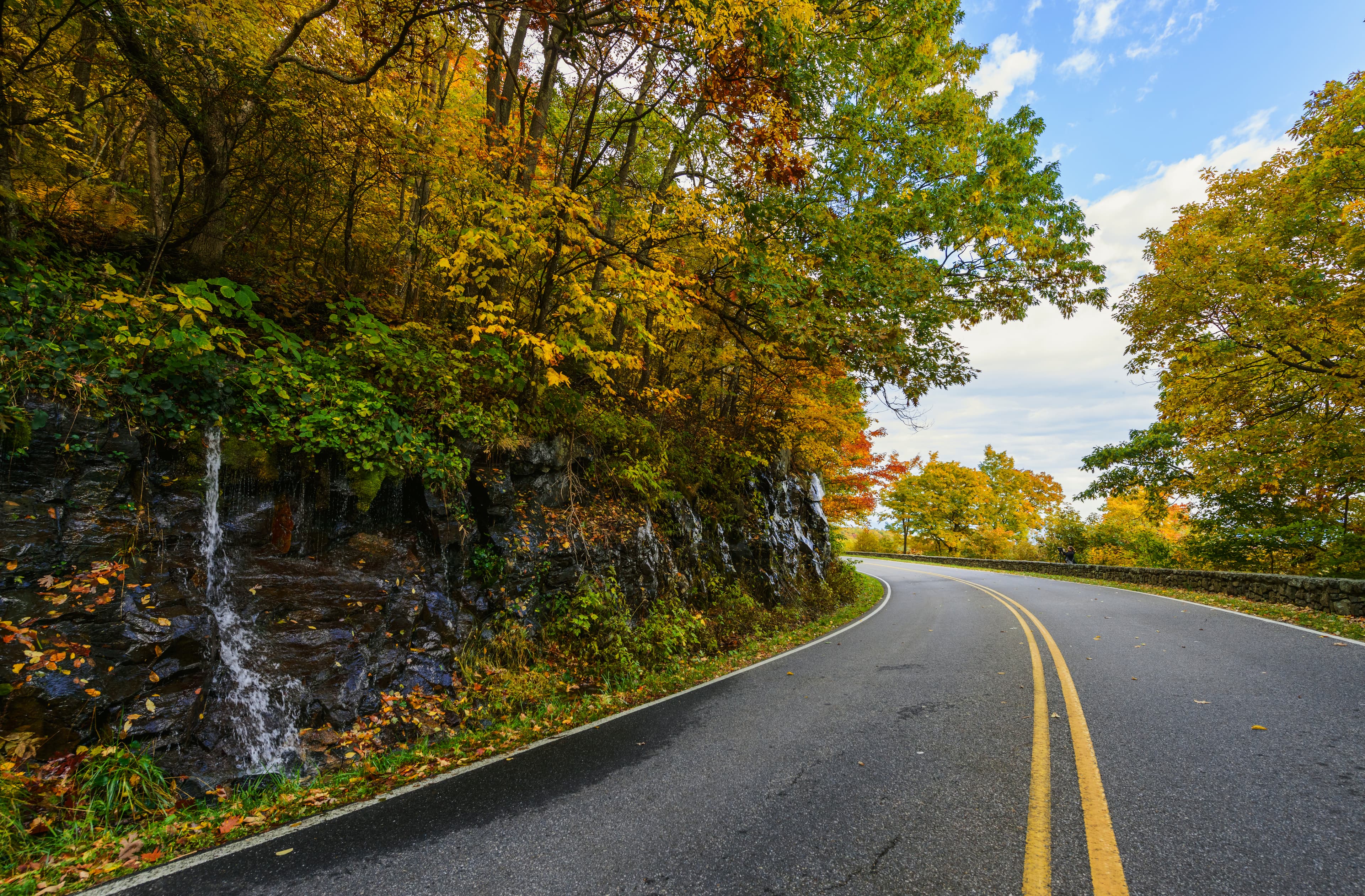
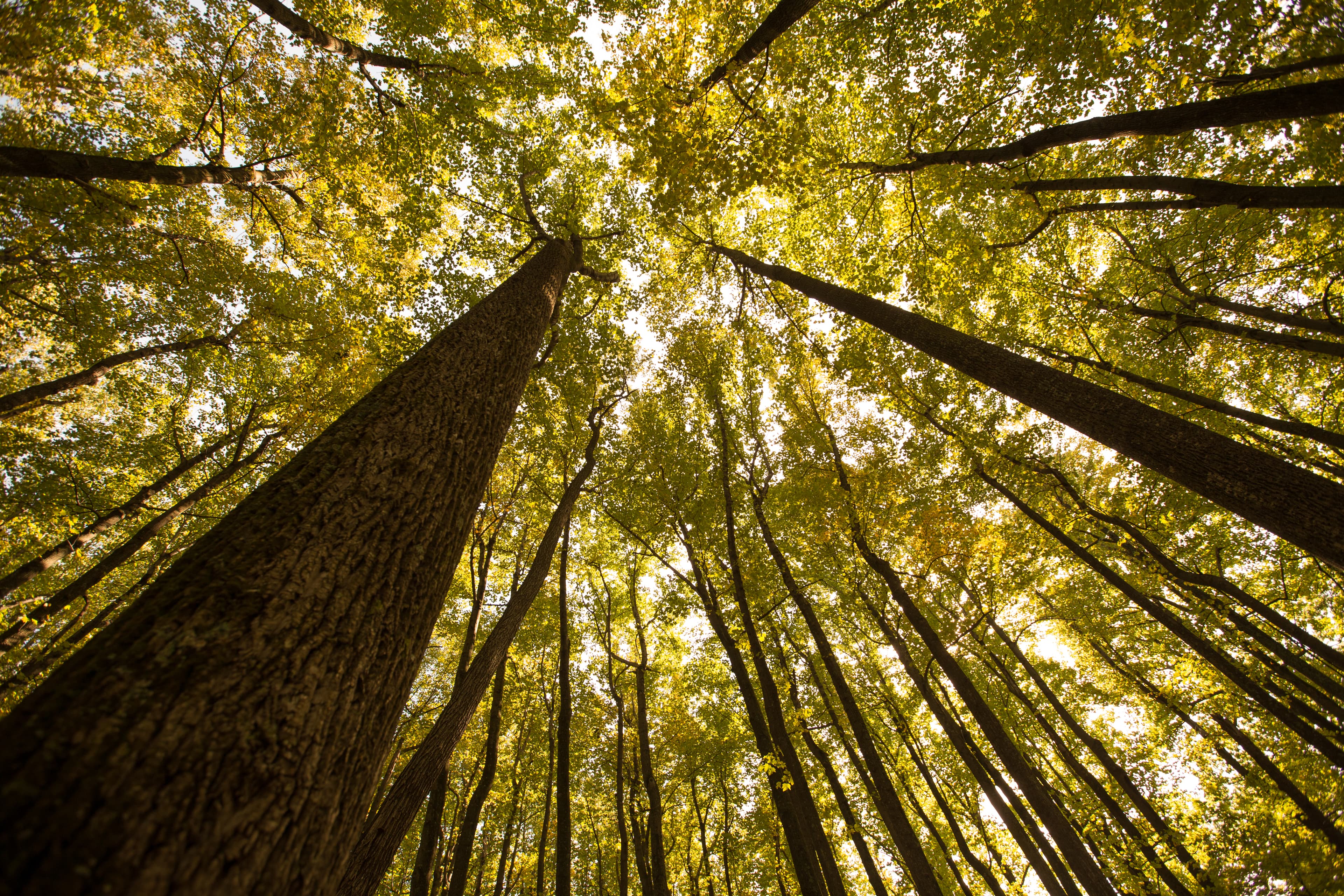
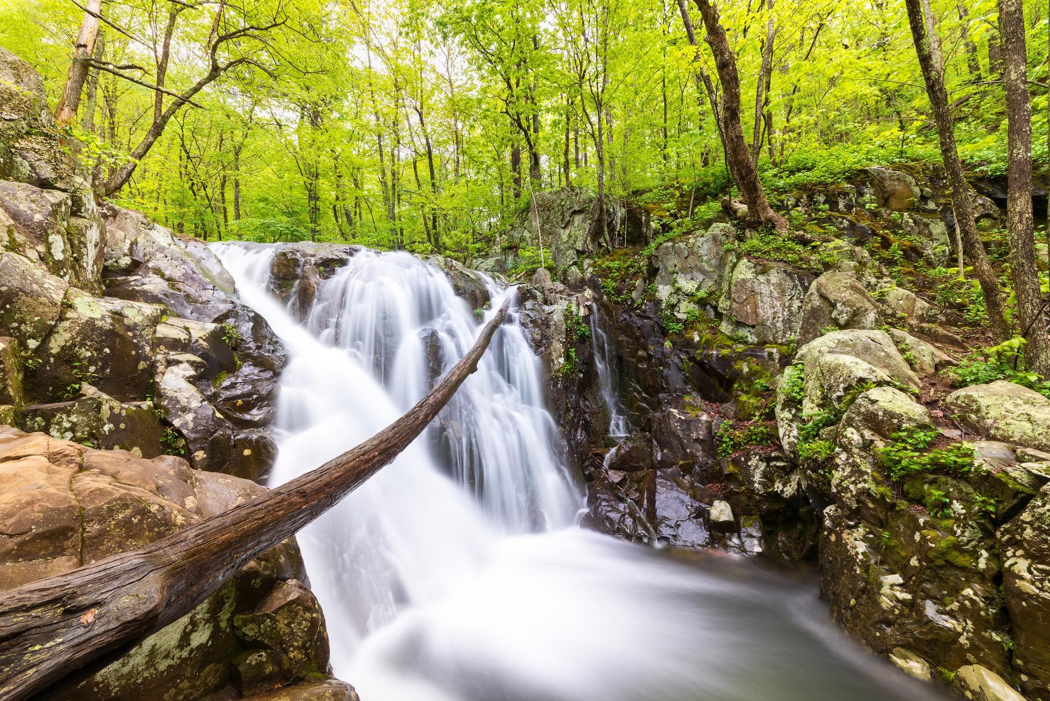
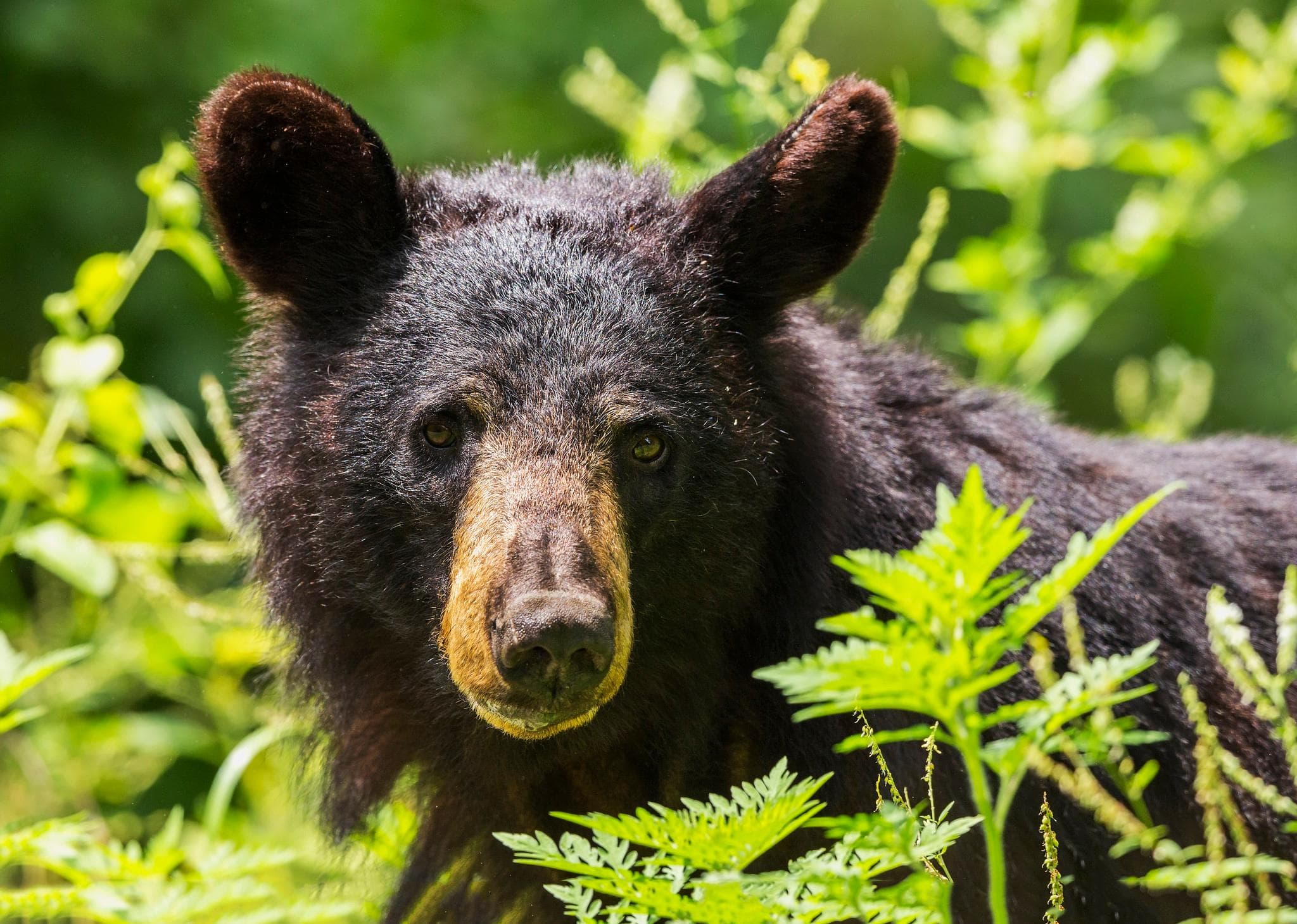
Stay near this park
No horse-friendly stays listed near Shenandoah National Park yet. Know a great barn or property? Help fellow riders by listing it.
List your propertyDirections
Shenandoah National Park is located in the Blue Ridge Mountains of Virginia, west of Washington, D.C. It stretches 105 miles and has four entrances: Front Royal (northern entrance), Thornton Gap, Swift Run Gap, and Rockfish Gap (southern entrance to Shenandoah and the northern entrance to the Blue Ridge Parkway). The physical address listed is to the administrative offices, not the Park itself. GPS can be unreliable for navigating to the Park, so we encourage you to check out our website for more info.
Source: nps.gov