
Park Closure
Biscuit Basin Closed Due to Hydrothermal Explosion
The parking lot, boardwalk, and Firehole River at Biscuit Basin, located north of Old Faithful, is closed to all travel until further notice due to the possibility of another event at the site of a hydrothermal explosion that occurred July 23, 2024.
More infoInformation
Traffic Delays - Gardner River High Bridge
Expect a single lane of traffic with up to 15-minute delays, 24 hours a day, seven days a week, from April 1 through late October 2026. Oversized/overweight vehicles (8'6"+ wide, 75'+ long, 80,000 lbs+ gross vehicle weight) will not be able to cross the bridge during this time.
More infoInformation
Vehicle Entrance Reservation Not Needed
Although an entrance pass is required to enter Yellowstone National Park, vehicle reservations are not needed. You are encouraged to purchase an entrance pass before arriving, but you may also purchase passes at any entrance station upon arrival.
More infoYellowstone National Park
ID · MT · WY · West Yellowstone
Riding guide
Horses provided
Highlights
Yellowstone National Park offers vast, wild terrain for riders seeking true backcountry adventure.
Riding
Rideable terrain here is noted as 700 miles, giving riders a clearer sense of scale before they ever unload. Yellowstone National Park offers vast, wild terrain for riders seeking true backcountry adventure. With hundreds of Miles of designated stock trails winding through alpine meadows, river valleys, and mountain passes, Yellowstone is built for prepared equestrians. Overnight trips require backcountry permits, and stock use is carefully regulated to protect this iconic ecosystem. For experienced riders with solid planning, Yellowstone delivers big country, open skies, and unforgettable wilderness Miles.
Rideable terrain
700 miles
Trailer parking
Tower Ranger Station One of the most popular equestrian staging locations in Yellowstone. Why riders use it Large parking area suitable for trailers Direct access to northern Yellowstone backcountry trails Good starting point for rides into Lamar Valley and the northern range This area is frequently used by riders exploring wildlife-rich regions of the park. Nine Mile Trailhead Benefits Large staging area designed for stock users Access to trails leading into Specimen Ridge and northern wilderness routes Generally easier trailer maneuverability than many smaller trailheads Bechler Ranger Station Why it works well Gateway to the Bechler region, known as Yellowstone’s “Cascade Corner” Access to extensive backcountry trail networks Quieter and less crowded than many northern entrances South Boundary Trailhead Why riders use it Access to the Thorofare region, one of the most remote wilderness areas in the continental U.S. Used for long multi-day pack trips
Horse regulations
Day Rides & Overnight Use Before day riding in Yellowstone, private stock users must obtain a free day ride permit. Only one permit is needed per group per day, but a separate permit is required for each day. Group size is limited to 20 people and 20 stock animals, but there are no limits on the number of permits issued for a given area. Overnight stock use is not permitted before July 1 due to trail conditions and range readiness. A backcountry permit is required for all overnight trips and must be obtained before entering the backcountry. Each backcountry campsite has a limit on the number of people and stock allowed, so reserve campsites in advance for overnight stock trips. Some sites do not allow stock, so use the backcountry trail map to check individual campsite details, including stock limits.
Getting here
Use 30 Yellowstone Ave, West Yellowstone, Montana as your primary planning reference before you haul in. Tower Ranger Station One of the most popular equestrian staging locations in Yellowstone. Why riders use it Large parking area suitable for trailers Direct access to northern Yellowstone backcountry trails Good starting point for rides into Lamar Valley and the northern range This area is frequently used by riders exploring wildlife-rich regions of the park. Nine Mile Trailhead Benefits Large staging area designed for stock users Access to trails leading into Specimen Ridge and northern wilderness routes Generally easier trailer maneuverability than many smaller trailheads Bechler Ranger Station Why it works well Gateway to the Bechler region, known as Yellowstone’s “Cascade Corner” Access to extensive backcountry trail networks Quieter and less crowded than many northern entrances South Boundary Trailhead Why riders use it Access to the Thorofare region, one of the most remote wilderness areas in the continental U.S. Used for long multi-day pack trips
Planning your visit
A free day ride permit is required for all stock day rides in Yellowstone. Check current Backcountry Conditions to confirm trails are open to stock. Submit the form below no earlier than one week before your ride; only one person per group needs to apply.
Where to stay
West Yellowstone Visitor Information Center & Chamber of Commerce is the main visitor-contact point tied to this destination, which is helpful when you want current conditions, maps, and stock-use updates before riding. Guided or concession-based riding support is noted here, so riders who are not hauling their own horses may still find an access path into the experience. For a polished trip plan, pair the ride with lodging, fuel, and resupply planning in or near West Yellowstone before heading deeper into federal-land access points.
Entrance fees & passes
- $35.00
Entrance - Private Vehicle
Unlimited entry for one vehicle and all passengers for seven consecutive days, beginning on the day of purchase. Vehicles must be private, non-commercial, and with a seating capacity of 15 or less.
- $20.00
Entrance - Non-commercial Groups
Non-commercial group (e.g. church groups, scouts) traveling in a vehicle with a capacity of 16 or more people. Cost is per person. Unlimited entry for one vehicle and all passengers for seven consecutive days, beginning on the day of purchase.
- $30.00
Entrance - Motorcycle
Valid for 7 days. Admits up to 2 private, non-commercial motorcycles with up to 4 total passengers.
- $30.00
Entrance - Snowmobile
Valid for 7 days. Admits up to 2 snowmobiles with up to 4 total passengers.
- $20.00
Entrance - Per Person
Entry for visitors on foot, bicycle, ski, etc., when 16 years of age or older.
- $20.00
Commercial Entrance - Sedan
A commercial tour is defined as consisting of one or more persons traveling on an itinerary that has been packaged, priced, or sold for leisure or recreational purposes by an organization that realizes financial gain through the provision of the service. The cost is $25 + $20 per person. Pass is good for seven days as long as it's the same passenger group.
- $125.00
Commercial Entrance - Van
Based upon the total capacity of a vehicle that can carry 7-15 passengers, regardless of the actual number of passengers. A commercial tour is defined as consisting of one or more persons traveling on an itinerary that has been packaged, priced, or sold for leisure or recreational purposes by an organization that realizes financial gain through the provision of the service. Pass is good for seven days as long as it's the same passenger group.
- $200.00
Commercial Entrance - Mini-bus
Based upon the total capacity of a vehicle that can carry 16-25 passengers, regardless of the actual number of passengers. A commercial tour is defined as consisting of one or more persons traveling on an itinerary that has been packaged, priced, or sold for leisure or recreational purposes by an organization that realizes financial gain through the provision of the service. Pass is good for seven days as long as it's the same passenger group.
- $300.00
Commercial Entrance - Motor Coach
Based upon the total capacity of a vehicle that can carry 26 or more passengers, regardless of the actual number of passengers. A commercial tour is defined as consisting of one or more persons traveling on an itinerary that has been packaged, priced, or sold for leisure or recreational purposes by an organization that realizes financial gain through the provision of the service. Pass is good for seven days as long as it's the same passenger group.
- $100.00
Nonresident
Each non-US resident aged 16 and older visiting Yellowstone National Park must pay a $100 nonresident fee (in addition to the standard entrance fee), unless admitted with an Annual or America the Beautiful Pass. This includes nonresidents entering as part of a commercial tour group, commercial use authorization (CUA) group, or concessioner tour group.
- $70.00
Annual Entrance - Park
Provides unlimited entry for one year (valid through the month of purchase) to the pass holder and passengers in the same vehicle, or pass holder and up to three persons where per person fees are charged. Purchase at any entrance station.
Trails
No trails synced for this park yet.
Campgrounds
Bridge Bay Campground
432 sites
Bridge Bay Campground—elevation 7,800 feet (2377 m)—is located near Yellowstone Lake, one of the largest, high-elevation, fresh-water lakes in North America. Campers at Bridge Bay will enjoy spectacular views of the lake and the Absaroka Range rising above the lake's eastern shore. Yellowstone National Park Lodges provides reservations for this campground.
Reserve a siteCanyon Campground
273 sites
Canyon Campground—elevation 7,900 feet (2408 m)—lies in a lodgepole pine forest at Canyon Village, south of the Washburn range and near the breath-taking Grand Canyon of the Yellowstone River. Canyon Village offers stores, restaurants, and lodging. Nearby hikes include Cascade Lake, Mount Washburn, and the Canyon Rim trails. Yellowstone National Park Lodges provides reservations for this campground.
Reserve a siteFishing Bridge RV Park
310 sites
Fishing Bridge RV Park—elevation 7,800 feet (2377 m)—is located near the Yellowstone River where it exits Yellowstone Lake on its way toward the Grand Canyon of the Yellowstone. Only campground in Yellowstone to offer water, sewer, and electrical hookups. Because grizzly bears frequent the area, no tents or tent campers are allowed. Yellowstone National Park Lodges provides reservations for this campground.
Reserve a siteGrant Village Campground
430 sites
Grant Campground—elevation 7,800 feet (2377 m)—is located in Grant Village, just off the Grand Loop Road at the south end of Yellowstone Lake. It is one of the larger campgrounds in the park. Group and wheel-chair accessible sites are available. Nearby there are stores, a restaurant, gas station, visitor center, and boat ramp. Yellowstone National Park Lodges provides reservations for this campground.
Reserve a siteIndian Creek Campground
70 sites
Located about eight miles south of Mammoth Hot Springs on the road to Norris, Indian Creek Campground—elevation 7,300 feet (2225 m)—sits near the base of the Gallatin Mountains and offers breathtaking views of Electric Peak. The area offers easy access to fishing and hiking. The campground is away from the main road and provides a quieter, more primitive, experience than many other locations. This is a reservable campground run by the National Park Service.
Reserve a siteLewis Lake Campground
85 sites
Lewis Lake Campground—elevation 7,800 ft (2377 m)—is about eight miles from the South Entrance and a short walk from the southeast shore of Lewis Lake. A boat ramp is located near the campground information and registration area. Canoes, kayaks, and motor boats are allowed on Lewis Lake. Boat permits and an aquatic invasive species inspection performed by park staff are required. This is a reservable campground run by the National Park Service.
Reserve a siteMadison Campground
276 sites
Madison Campground—elevation 6,800 feet (2073 m)—sits about 14 miles east from the town of West Yellowstone and 16 miles north of Old Faithful. Nearby, the Gibbon and Firehole rivers join to form the Madison River. In early summer, meadows teem with wildflowers and bison. In September and October, you can often hear bugling elk. Yellowstone National Park Lodges provides reservations for this campground.
Reserve a siteMammoth Campground
85 sites
The only campground in the park open year-round, Mammoth Campground—elevation 6,200 feet (1890 m)—is located five miles south of the park's North Entrance. Scattered juniper and Douglas fir trees provide shade during hot summer months. The campground is close to fishing, hiking, and the Mammoth Hot Springs. Great wildlife viewing opportunities abound with elk and bison occasionally passing through the campground. The campground is run by the NPS.
Reserve a siteNorris Campground
112 sites
Norris has been closed to the public for five years and will remain closed for the foreseeable future. Due to Norris’ remote location, the park does not have the staffing required to effectively respond to emergency incidents (law enforcement, emergency medical services etc.) and facility maintenance and repairs. For this reason, we have removed it from Yellowstone’s website and publications.
Pebble Creek Campground
27 sites
Pebble Creek Campground was significantly impacted by the 2022 floods and will remain CLOSED until further notice for flood recovery work.
Reserve a siteSlough Creek Campground
16 sites
Near some of the best wildlife watching opportunities in the park. Located at the end of a two-mile dirt road, this campground is best suited for tents and small RVs. There are plenty of hiking and fishing opportunities in the area, including the Slough Creek Trail which begins nearby. Nighttime offers a quiet, unimpeded view of the stars and the possibility of hearing wolves howl. Elevation: 6,250 ft (1905 m). This is a reservable campground run by the National Park Service.
Reserve a siteTower Fall Campground
31 sites
Tower Fall Campground—elevation 6,600 feet (2012 m)—is located on the north side of the steep, winding, road to Dunraven Pass. The campground is near the Tower General Store and Tower Fall. The Lamar Valley, with spectacular wildlife viewing opportunities, is located nearby as are several hiking trails. Roosevelt Lodge, a short drive from the campground, offers dining and horseback riding. This is a reservable campground run by the National Park Service.
Points of interest
Abyss Pool
POIAlbright Picnic Area
POIPicnic area near the Albright Visitor Center in Mammoth Hot Springs
Anemone Geysers
POIAnemone Geysers are two geysers at Upper Geyser Basin.
Angel Terrace
POIA large terrace along the Upper Terrace Drive that has seen periods of activity and inactivity.
Angler's Bluff Picnic Area
POIPicnic Area near Yellowstone Lake
Apollinaris Spring Picnic Area
POIPicnic area between Mammoth Hot Springs and Norris, near Apollinaris Spring
Arch Park Picnic Area
POIPicnic area near the Roosevelt Arch and the North Entrance
Artemisia Geyser
POIArtemisia Geyser is a large thermal pool in the Upper Geyser Basin.
Artemisia Trailhead
POIThis trailhead provides access to the upper end of the Upper Geyser Basin. Parking is available across the street in the Biscuit Basin parking lot. Use caution when crossing the road.
Artist Point Trailhead (4K8)
POIThis trailhead starts at the eastern end of the Artist Point parking area. The trail leads to the popular Artist Point Overlook. East of the overlook where you can embark on the following trails:- Artist Point-Point Sublime Trail- Clear Lake-Ribbon Lake TrailThere is a large parking lot here, though it is often busy during the peak of the summer season. Vault toilets are located at the western end of the parking lot. Artist Point-Point Sublime Trail This 2.6-mile (4.2-km) the
Artist Point Vault Toilets
POICLOSED
Artists Paintpots Trail
POIThis is a one-mile (1.6 km) trail that enters a partially burned lodgepole pine forest, then winds across a wet meadow on a boardwalk. This trail is a short loop. The hydrothermal area has colorful hot springs, mudpots, and small geysers. Watch out for flying mud. Stay on the trail and boardwalks. AccessibilityThe trail is relatively flat from the parking lot to the hydrothermal features. The trail is over bare ground. There is a mixture of boardwalks and bare ground trails
Artists' Paintpot Vault Toilet
POIAurum Geyser
POIA geyser in the Upper Geyser Basin.
Avalanche Peak Trailhead (5N2)
POIThis trailhead is located on the north side of the East Entrance Road and provides access to the following trail:- Avalanche Peak Trail Avalanche Peak Trail This trail is often snow-covered until early July. This strenuous, high elevation 4.4-mile (7.1-km) there-and-back trail is not recommended for people with heart and/or respiratory problems. Be aware of lightning above treeline. Even on warm summer days, bring rain gear, wool hats, and gloves. Burned trees may fall withou
Avoca Spring
POIAvoca Spring is a hydrothermal feature at Biscuit Basin.
A Wildlife Paradise
POIBaby Daisy Geyser
POIBaby Daisy Geyser is a hydrothermal feature at Biscuit Basin.
Bachelor Officers' Quarters (1909)
POIBuilt in 1909 to house six single officers assigned to duty at Fort Yellowstone.
Back Basin
POIBacon Rind Trailhead (WK4)
POIThe Bacon Rind trailhead is on the northwest side of Yellowstone near U.S. Highway 191. From this trailhead, you can embark on the following trail:- Bacon Rind Trail Bacon Rind Trail A strenuous 10.2-mile (16.4 km) there-and-back trail that climbs 2,400 feet (731 m) through forest (some burned in 2017) and meadow to high alpine meadows and views. CAUTION: Grizzly bears frequent this area. Backcountry RegulationsPermit required for fishing, boating, riding, and overnight cam
Bath Lake
POIAn historic hot spring along the Upper Terrace Drive in the Mammoth Hot Springs of Yellowstone National Park.
Bear Aware (Canyon)
POIBear spray is available for rent at the Bear Aware rental kiosk at the northwest corner of the visitor center plaza, 20 yards from the main entrance.
Bear Aware (Old Faithful)
POIBear spray is available for rent at the Yurt near the Yellowstone Tribal Heritage Center at Old Faithful.
Bearclaw Geyser
POIBeauty Pool
POIA thermal pool in the Upper Geyser Basin
Beaver Lake Picnic Area
POIPicnic area between Norris and Mammoth Hot Springs
Beaver Ponds Trailhead (1N4)
POIThis trailhead is located behind the Mammoth Hot Springs Hotel, next to the start of the Old Gardiner Road. From this trailhead, you can access the following trails:- Beaver Ponds Trail- Selpulchar Mountain TrailThere is no parking at the trailhead. However, there is parking available nearby around the visitor center, hotel, and other nearby facilities. Beaver Ponds Trail A 5-mile (8.3-km) loop trail that begins and ends in the developed area of Mammoth Hot Springs. This mode
Bechler Backcountry Office
POIBechler Ranger Station Trailhead (9K1)
POIThis trailhead is located along the Cave Falls Road, just north of the southern park boundary. This trailhead provides access to the following trails:- Boundary Creek- Bechler River Cutoff Trail- Bechler River Trail- South Boundary Trail: Bechler Ranger Station-Grassy Lake- Robinson Creek Trail Boundary Creek Trail A moderate 17.2-mile (27.7-km) one-way trail that travels across relative flat lands, through forests and meadows, and past several waterfalls around the middle se
Bechler Vault Toilet
POIBeehive Geyser
POIA cone geyser in the Upper Geyser Basin
Beula Lake Trailhead (8K6)
POIThis more remote trailhead can be access by car and provides access to the following trail. The trailhead is at a steep pullout on the north side of the road at the east end of the reservoir.- Beula Lake Trail Beula Lake Trail This is a 5.2-mile (-km) there-and-back trail with a gentle climb at the start of the trail. Beula Lake covers about 107 acres (43 ha) and supports a population of Yellowstone cutthroat trout. If you are looking to fish here, remember to pick up a Yell
Bighorn Pass - Indian Creek Trailhead (1K5)
POIThis trailhead is located at the small picnic area/winter warming hut just after thr turn-off from the Grand Loop Road. This trailhead provides access to these trails:- Bighorn Pass Trail- Bighorn Loop Ski Trail- Indian Creek Loop Ski Trail- Sheepeater Ski TrailParking is available near the vault toilets. Winter access is available via a snowcoach ride from the Mammoth Hot Springs Hotel. Bighorn Pass Trail A strenuous 19.4-mile (31.2 km) one-way trail with lot of open meadows
Bighorn Pass Trailhead (WK6)
POIThe Bighorn Pass trailhead is on the northwest side of Yellowstone near U.S. Highway 191. From this trailhead, you can embark on the following trail:- Bighorn Pass Trail Bighorn Pass Trail This trail can either be a there and back 21.2-mile (35 km) strenuous hike to the top of Bighorn Pass or a 19-mile (30 km) through hike ending at a different trailhead south of Mammoth Hot Springs. (Either plan on leaving a vehicle at one end or arrange a shuttle back to the trailhead.) Th
Biscuit Basin Trailhead (OK4)
POITrailhead in the Old Faithful Area
Black Butte Trailhead (WK2)
POIThe Black Butte trailhead is on the northwest side of Yellowstone near US Highway 191. From this trailhead, you can embark on the following trail:- Black Butte Trail Black Butte Trail This is a strenuous 11.4-miles (18.3 km) there-and-back trail that climbs 3,100 feet (945 m) to the Sky Rim Trail and near Big Horn Peak. CAUTION: Grizzly bears frequent this area. Backcountry RegulationsPermit required for fishing, boating, riding, and overnight camping. More information at t
Black Diamond Pool
POIBlack Diamond Pool is a hydrothermal feature at Biscuit Basin.
Black Dragon's Caldron
POIBlack Opal Pool
POIBlack Opal Pool is a hydrothermal feature at Biscuit Basin.
Black Pearl Geyser
POIBlack Pearl Geyser is a hydrothermal feature at Biscuit Basin.
Black Pool
POIBlack Sand Basin Trailhead
POI1 mile (1.6 km) walk to Black Sand Basin from Daisy Geyser or 1 mile (1.6 km) drive northwest of Old Faithful along the main road.Named for sand derived from black volcanic glass (obsidian), this basin features some of the most splendid hot springs in Yellowstone. Hydrothermal features here:- Emerald Pool- Rainbow Pool- Sunset Lake (actually a geyser, but its eruptions are infrequent and seldom noticed because of the heavy steam over the water)- Cliff Geyser, on the edge of I
Black Sand Pool
POIA large, blue pool in the Upper Geyser Basin
Blacksmith Shop (1909)
POIThe blacksmith shop was conveniently located near the horse stables in Fort Yellowstone.
Blacktail Deer Creek Trailhead (1N5)
POIThis trailhead is located on the Grand Loop Road between Mammoth Hot Springs and Tower. From this trailhead, you can access the following trails:- Blacktail Deer Creek Trail- Blacktail Ponds Spur Trail- Rescue Creek Trail- Yellowstone River TrailParking at this trailhead can fill up quickly. There is additional parking nearby at the Blacktail Deer Creek Stock Trailhead. Blacktail Deer Creek Trail From the Blacktail Deer Creek trailhead it is moderate 11-mile (18-km) there-and
Blood Geyser
POIBlue Funnel Spring
POIBlue Star Spring
POIA clear, deep, blue hydrothermal pool in the Upper Geyser Basin
Boiling River
POIBootjack Gap Trailhead (3N3)
POIThis is a remote trailhead at the eastern boundary of the park that is not accessible by road. From this trailhead, you can embark on the following trails within the park:<br />- Bootjack Gap Trail<br />- Miller Creek Trail
Bridge Bay Backcountry Office
POIBridge Bay Marina Store
POILocated on Yellowstone Lake, this store has supplies for boaters, anglers, campers, and boat tour passengers.
Bridge Bay - Natural Bridge Trailhead
POIThis trailhead is located in the Bridge Bay Developed Area. The following trail can be accessed from this trailhead:- Natural Bridge Trail Natural Bridge Trail An easy 2.5-mile (4-km) there-and-back trail that travels through a forest and along an old service road to a natural bridge, which was cut out of a cliff of rhyolite rock by Bridge Creek. Backcountry RegulationsPermit required for fishing, boating, riding, and overnight camping. More information at the Center Backcoun
Bridge Bay Picnic Area
POIPicnic area on Yellowstone Lake at Bridge Bay
Bridger Lake Trailhead (6K4)
POIThis is a remote trailhead at the southeast boundary of the park that is not accessible by road. From this trailhead, you can embark on the following trails within the park:<br />- Yellowstone Meadows Cutoff Trail- Thorofare Trail<br />- Hawk's Lake Trail<br />- Thorofare-South Boundary Cutoff Trail<br />- South Boundary Trail: Lynx Creek
Brink of Upper Falls Comfort Station
POIBuffalo Fork Trailhead (2N3)
POIThis is a remote trailhead at the northern boundary of the park that is not accessible by road. From this trailhead, you can embark on the following trail within the park:<br />- Buffalo Fork Trail
Buffalo Lake / Boundary Creek Trailhead (9K8)
POIThis is a remote trailhead at the western boundary of the park that is not accessible by road. From this trailhead, you can embark on the following trail within the park:<br />- Boundary Creek Trail
Buffalo Plateau Trailhead (2N2)
POIThis is a remote trailhead at the northern boundary of the park that is not accessible by road. From this trailhead, you can embark on the following trail within the park:<br />- Buffalo Plateau Trail
Bunsen Peak Overlook
POIBunsen Peak Trailhead (1K4)
POITrailhead south of Mammoth Hot Springs
Burned Trees
POICalcite Springs
POICaldera Rim Picnic Area
POIPicnic area along the Gibbon River
Canary Spring (View of Top)
POICanoe Lake Trailhead (3N2)
POIThis is a remote trailhead at the eastern boundary of the park that is not accessible by road. From this trailhead, you can embark on the following trails within the park:<br />- Canoe Lake Trail<br />- Miller Creek Trail
Canyon Gas and Service Station
POICanyon General Store
POILocated at Canyon Village, this store has groceries, ice cream, souvenirs, and apparel available for purchase.
Canyon Lodge
POICanyon Lodge and Cabins
POICanyon Village Post Office
POICanyon Visitor Education Center Warming Lobby
POILocated in the Canyon Visitor Education Center building. Provides shelter and amenities (light snacks, water, restrooms) for skiers, snowshoers, and snowmobilers during the winter season.
Canyon Yellowstone Adventure Store
POILocated at Canyon Village, this store offers camping and outdoor gear, footwear, fishing supplies, and gifts for purchase.
Captains' Quarters (1909)
POIBuilt in 1909 to house two officers and their families.
Cascade Creek Trailhead (4K4)
POIThis trailhead allows you to embark on a series of trails in the north-central part of the park:- Cascade Creek Trail- Cascade Lake Trail- Observation Peak Trail- Howard Eaton Trail: Cascade Lake-Norris CampgroundA small parking lot is available at the trailhead. Cascade Creek Trail A 3.4-mile (5.5-km) there-and-back trail through Cascade Meadow that ends at the junction with the Cascade Lake Trail. Cascade Lake Trail A moderate 4.4-mile (7-km) there-and-back trail that passe
Cascade Creek Trailhead (9K5)
POIThis is a more remote trailhead along the southern boundary of the park, which can be accessed by road. From this trailhead you can embark on the following trails within the park:<br />- Mountain Ash Creek Trail<br />- Terraced Falls Trail
Cascade Lake Picnic Area
POIPicnic area between Canyon and Tower-Roosevelt
Cascade Lake Trailhead (4K5)
POIFrom this trailhead you can embark on the following trails:- Cascade Lake Trail- Observation Peak TrailThere is a dedicated parking lot at this trailhead. The nearest restrooms are location to the east at the Cascade Lake Picnic Area. Cascade Lake Trail A moderate 4.4-mile (7-km) there-and-back trail that passes through open meadows to Cascade Lake where wildflowers abound and wildlife is often seen. The trail can be wet and snowy through July. CAUTION Grizzly bears frequen
Cascade Picnic Area
POIPicnic area along the Yellowstone River between Fishing Bridge and Canyon
Castle Geyser
POIA cone geyser at Upper Geyser Basin
Cauliflower Geyser
POICauliflower Geyser is a hydrothermal feature at Biscuit Basin.
Cavalry Barracks (1891)
POIThe first cavalry barracks built in Fort Yellowstone
Cavalry Barracks (1897)
POIThe second barracks built to house cavalry troops stationed at Fort Yellowstone.
Cavalry Units and New Guardhouse
POISite of historic cavalry barracks and guardhouse at Fort Yellowstone
Cave Falls Picnic Area
POICave Falls Trailhead (9K2)
POIThis trailhead is located along the Cave Falls Road, just north of the southern park boundary. This trailhead provides access to the following trails:- Bechler River Trail- South Boundary Trail: Bechler Ranger Station-Grassy Lake Bechler River Trail A classic, strenuous roughly 30-mile (48-km) one-way backpacking trail in the southwest part of the park that leads past waterfalls and hydrothermal features. The trail starts at either the Bechler Ranger Station or at Lone Star G
Celestine Pool
POIChain Lakes
POIA series of hydrothermal pools in the Upper Geyser Basin
Chapel (1913)
POIThe chapel was built in 1913, and was the last building constructed during the Fort Yellowstone days.
Chinese Spring
POIA hydrothermal pool in the Upper Geyser Basin
Chittenden Bridge/Wapiti Lake Picnic Area
POIChittenden Junction Vault Toilet
POIChittenden Road
POIChittenden Road / Mount Washburn North Trailhead (2K6)
POICLOSED IN 2021 This trailhead provides access to the Chittenden Road-Mount Washburn Trail. Parking is limited at this very popular trail. This moderate 5.8-mile (9.3-km) there-and-back trail is the shortest route up to Mount Washburn. The trail follows a service road over a steady incline through forest and above treeline through alpine vegetation. CAUTION Grizzly bears frequent this area.
Chromatic Pool
POIA hydrothermal pool in the Upper Geyser Basin
Churn Geyser
POIA hydrothermal pool in the Upper Geyser Basin
Churning Caldron
POICistern Spring
POIClear Lake Trailhead
POIThis trailhead is located on the southeast side of the Uncle Tom's parking lot on the South Rim Drive of the Grand Canyon of the Yellowstone. From this trailhead, you can access the following trails:- Ribbon Lake Trail Ribbon Lake Trail An easy 5.8-mile (9.3-km) there-and-back trail. The trail traverses through forest with views of the Grand Canyon. CAUTION: Grizzly bears frequent this area. Backcountry RegulationsPermit required for fishing, boating, riding, and overnight
Cleopatra Spring
POIClepsydra Geyser
POICliff Geyser
POICliff Geyser is a hydrothermal feature at Black Sand Basin.
Colter / Wolverine Trailhead (8K8)
POIThis is a remote trailhead at the southern boundary of the park that is not accessible by road. From this trailhead, you can embark on the following trails within the park:- Colter / Wolverine Trail- South Boundary Trail: South Entrance-Harebell- Snake River Cutoff Trail- Snake River Canyon Trail- Heart Lake Trail Colter / Wolverine Trail An easy 0.5-mile (0.8-km) one-way trail that connects the South Boundary Trail: South Entrance-Harebell to the trails in the USDA Forest Se
Comet Geyser
POIA geyser in the Upper Geyser Basin
Commissary Storehouse (1891)
POIThis was the place in Fort Yellowstone where soldiers could purchase goods.
Congress Pool
POICooking Hillside
POICoral Geyser
POICoral Geyser is a hydrothermal feature at Biscuit Basin.
Coyote Creek Trailhead (2N1)
POIThis is a remote trailhead at the northern boundary of the park that is not accessible by road. From this trailhead, you can embark on the following trail within the park:<br />- Coyote Creek Trail
Crested Pool
POIA hydrothermal pool in the Upper Geyser Basin
Crystal Spring
POIA hydrothermal pool in the Upper Geyser Basin
Cygnet Lakes Trailhead (4N3)
POIThis trailhead in the middle of the park provides access to the following trail:- Cygnet Lakes TrailThere is parking at the trailhead. Cygnet Lakes Trail This 8.2-mile (13.2-km) there-and-back trail is relatively flat and exposed. The trail leads to a series of lakes where waterfowl may be seen. Backcountry RegulationsPermit required for fishing, boating, riding, and overnight camping. More information at the Center Backcountry Office: (307) 344-2160. Hiking Hike in groups of
Dailey Creek Trailhead (WK1)
POIThis trailhead along Highway 191 in the western part of the park provides access to one trail:- Dailey Creek Trail Dailey Creek Trail A strenuous 10-mile (16-km) there-and-back trail that starts near Dailey Creek and heads up to Dailey Pass, where you can reach the Sky Rim Trail. This trail crosses open meadows and provides views of the surrounding Gallatin Range. Backcountry RegulationsPermit required for fishing, boating, riding, and overnight camping. More information at
Daisy Geyser
POIA geyser in the Upper Geyser Basin
DeLacy Creek Picnic Area
POIDeLacy Creek Trailhead (7K2)
POIThis trailhead provides access to the following trail:- DeLacy Creek Trail DeLacy Creek Trail A 5.8-mile (9.3-km) there-and-back trail that travels along a forest's edge and through open meadows to the shores of Yellowstone's largest backcountry lake. Look for sandhill cranes, moose, and water birds. Backcountry RegulationsPermit required for fishing, boating, riding, and overnight camping. More information at the Center Backcountry Office: (307) 344-2160. Hiking Hike in grou
Depression Geyser
POIA geyser in the Upper Geyser Basin
Divide Trailhead
POIThis trailhead provides access to the following trails:- Spring Creek Trail- Divide Trail Spring Creek Trail An easy 8-mile (12.9-km) there-and-back trail that follows a small creek along an old stagecoach route. This is a popular ski trail during the winter season. Divide Trail A moderate 3.4-mile (5.5-km) there-and-back trail that leads to the location where there was once a fire lookout. Backcountry RegulationsPermit required for fishing, boating, riding, and overnight cam
Double Cavalry Barracks (1909)
POIThe largest building constructed by Scottish stonemasons in Fort Yellowstone, it is now the headquarters for Yellowstone National Park.
Double Officer's Quarters (1891)
POIBuilt in 1891, this is one of the four old double officer's quarters built along Officer's Row in Fort Yellowstone.
Double Officer's Quarters (1891)
POIBuilt in 1891, this is one of the four old double officer's quarters built along Officer's Row in Fort Yellowstone and one of the first fort buildings constructed.
Double Officer's Quarters (1897)
POIBuilt in 1897, one of the four double officer's quarters along Officer's Row in Fort Yellowstone.
Double Officer's Quarters (1897)
POIOne of the four old double officer's quarters built along Officer's Row in Fort Yellowstone.
Doublet Pool
POIA hydrothermal feature in the Upper Geyser Basin
Dragon's Mouth Spring
POIDuck Lake Trailhead
POIThis trailhead provides access to the following trail:- Duck Lake Trail Duck Lake Trail This short, 0.8-mile (1.3-km) there-and-back trail climbs a small hill for a view of Duck and Yellowstone lakes, and the expanse of the 1988 fires that swept through this area. Trail descends to the shore of Duck Lake. Backcountry RegulationsPermit required for fishing, boating, riding, and overnight camping. More information at the Center Backcountry Office: (307) 344-2160. Hiking Hike in
Dunraven Pass
POIDunraven Pass - Mount Washburn Trailhead (4K9)
POICLOSED IN 2021 This popular trailhead is situated right at Dunraven Pass. The Mount Washburn South Trail and Mount Washburn Spur Trails can be accessed from here. Due to the popularity of this location, parking can be very limited. A vault toilet is located in the middle of the parking lot. Mount Washburn South Trail is a moderate 6-mile (9.6-km) there-and-back trail to the top of Mount Washburn.
Dunraven Road Picnic Area
POIA picnic area by the Dunraven Pass road.
Dusty Geyser
POIDusty Geyser is a hydrothermal feature at Biscuit Basin.
Eagle Pass Trailhead (6K1)
POIThis is a remote trailhead at the southeast boundary of the park that is not accessible by road. From this trailhead, you can embark on the following trail within the park:<br />- Mountain Creek Trail
Ear Spring
POIA hot spring in the Upper Geyser Basin
East Divide Picnic Area
POIA picnic area on Craig Pass
East Entrance Station
POIEast Entrance Vault Toilet
POIEast Lot Picnic Area
POIA picnic area in the Old Faithful area
Echinus Geyser - Lower Deck
POIEchinus Geyser - Upper Deck
POIEleanor Lake Picnic Area
POI- 2 picnic tables- 1 vault toilet Picnicking Notes- Campfires are allowed only in picnic areas with fire grates.- Camp stoves (liquid or gas) and self-contained charcoal grills may be used for food preparation at all locations.- Do not feed any wild animals, including birds. It is unhealthy and encourages aggressive behavior that may require management action.- All food, trash, coolers, and cooking tools must be kept secure in a bear-proof container unless in immediate use.-
Elephant Back Trailhead
POILocated near Lake Village, this trailhead provides the following hiking opportunity:- Elephant Back Mountain Trail Elephant Back Mountain Trail A popular 3.5-mile (5.6-km) lollipop loop trail near Lake Village, this trail climbs 800 feet (244 m) in 1-½ miles (2.4 km) through the dense lodgepole forest. After 0.8 of a mile, the trail splits into a loop. The left fork is the shortest route to the top, though both join again at the overlook. The overlook provides a sweeping pan
Elk in Mammoth Hot Springs
POIEmerald Pool
POIEmerald Pool is a hydrothermal feature at Black Sand Basin.
Emerald Spring
POIESCAPE to Yellowstone Award Certificate
POIThe congratulations stop for the ESCAPE to Yellowstone adventure.
EV Charging Station (Canyon)
POIEV Charging Station (Haynes Administration Building)
POIEV Charging Station (Mammoth Hot Springs Hotel)
POIEV Charging Station (NPS Headquarters)
POIEV Charging Station (Old Faithful Lodge Cabin Area)
POIEV Charging Station (Snow Lodge East Employee Dorms)
POIEV Charging Station (Teal Lodge Employee Dorms)
POIExcelsior Geyser Crater
POIFairy Falls Trailhead (OK5)
POIThis trailhead provides access to the following trails:- Grand Prismatic Overlook Trail- Fairy Falls Trail Grand Prismatic Overlook Trail An easy 1.2-mile (1.9-km) hike that gradually climbs 105 feet over 0.6 miles from the Fairy Falls Trailhead to a view looking down on Grand Prismatic Spring and the Midway Geyser Basin. Fairy Falls Trail This relatively flat, easy 4.5-mile (7.2-km) there-and-back trail leads to Fairy Falls, which plunges 200 feet (61 m) to create one of Yel
Fan Geyser
POIA cone geyser in the Upper Geyser Basin
Fawn Pass Trailhead (WK5)
POIThe Fawn Pass trailhead is on the northwest side of Yellowstone near U.S. Highway 191. From this trailhead, you can embark on the following trail:- Fawn Pass Trail Fawn Pass Trail This trail can either be a there and back 18-mile (28.9 km) strenuous hike to the top of Fawn Pass or a 21-mile (34 km) through hike ending at a different trailhead south of Mammoth Hot Springs. (Either plan on leaving a vehicle at one end or arrange a shuttle back to the trailhead.) This trail is
Field Officer's Quarters (1909)
POIBuilt by Scottish stonemasons in 1909 for the residence of the post commander.
Firehole Canyon Swimming Area
POIFirehole River
POIThe Firehole River flows through many hydrothermal areas, including Lone Star Geyser Basin, Upper Geyser Basin, Midway Geyser Basin, and the Lower Geyser Basin.
Firehole River Picnic Area
POIA picnic area near the Firehole River
Fire is a Fundamental Force
POIFishing Bridge
POIFishing Bridge Comfort Station
POIFishing Bridge Gas and Service Station
POIFishing Bridge General Store
POILocated at Fishing Bridge, this general store has groceries, ice cream, souvenirs, and apparel available for purchase.
Fishing Bridge Junction Vault Toilets
POIFishing Bridge Picnic Area
POIA picnic area near Fishing Bridge near the mouth of the Yellowstone River.
Fishing Bridge Trailhead (5K2)
POIThis trailhead is located back behind the Fishing Bridge Developed Area. It provides access to the following trail:- Howard Eaton Trail: Fishing Bridge to Canyon Howard Eaton Trail: Fishing Bridge to Canyon This 13.5-mile (21.7-km) one-way trail follows the Yellowstone River after it leaves Yellowstone Lake. Backcountry RegulationsPermit required for fishing, boating, riding, and overnight camping. More information at the Center Backcountry Office: (307) 344-2160. Hiking Hike
Fishing Bridge Warming Hut
POIProvides shelter and restrooms for skiers, snowshoers, and snowmobilers during the winter season.
Fishing Cone
POIFlash Spring
POIForces of the Northern Range Self-guided Trail
POIForces of the Northern Range Trailhead
POIThis trailhead is the start of an enjoyable, short walk for visitors of all ages. The trailhead provides access to the following trail:<br />- Forces of the Northern Range Trail<br /><br />There is a large parking lot at the trailhead.<br /><br /> <b>Forces of the Northern Range Trail</b> <br />This easy, 0.5-mile (0.8-km) lollipop loop trail travels along a boardwalk through a small forest. Outdoor signs interpret the natural forces that shaped, and continue to shape, the surrounding landscape.
Forests and Fens
POILodgepole pine forest and wetland seeps along the boardwalk in the Upper Geyser Basin
Fort Yellowstone Cemetery
POIFort Yellowstone National Historic Landmark
POIFort Yellowstone Overlook
POIFountain Flats Drive / Freight Road Trailhead (OK6)
POIThis trailhead provides access to the following trails:- Sentinel Meadows & Queen's Laundry Trail- Fairy Falls Trail Sentinel Meadows & Queen's Laundry Trail An open, 3.8-mile (6.1-km) there-and-back trail that follows the Firehole River and cross meadows until reaching a hydrothermal area. Look for the large sinter mounds of hot springs and the remains of the old, incomplete bathhouse. Fairy Falls Trail This relatively flat, open meadow 9-mile (14.5-km) there-and-back trail
Fountain Geyser
POIFountain Paint Pot - East
POIFountain Paint Pot Trailhead
POITrailhead in the Old Faithful area
Fountain Paint Pot Vault Toilets
POIFountain Paint Pot - West
POIFrost Lake Trailhead (3N5)
POIThis is a remote trailhead at the eastern boundary of the park that is not accessible by road. From this trailhead, you can embark on the following trail within the park:<br />- Frost Creek Trail
Frying Pan Spring
POIFumaroles
POIFumaroles in Porcelain Basin
POIGardiner Basin
POIGardner River Picnic Area
POIA picnic area near the Gardiner River
Garnet Hill Loop Trailhead (2K2)
POISituated in Pleasant Valley near Tower Junction, this trailhead provides access to the following trail:- Garnet Hill Loop TrailThere is very limited parking at this trailhead. However, a large parking lot is located at the Tower Junction Trailhead just to the south. Garnet Hill Loop Trail This moderate 7.6-mile (12.2-km) loop trail follows a dirt stagecoach road through sagebrush meadows to Yancy's creek. The trail continues north along Elk Creek through meadows and forest un
Gem Pool
POIA large, bright blue pool in the Upper Geyser Basin
Geyser Hill
POIGeyser Hill is home to over 50 geysers in the Upper Geyser Basin
Giantess Geyser
POIA geyser in the Upper Geyser Basin
Giant Geyser
POIA cone geyser in the Upper Geyser Basin
Gibbon Falls
POIGibbon Falls Picnic Area
POIA picnic area near the Gibbon River.
Gibbon Meadows Picnic Area
POIA picnic area near the Gibbon River.
Glacial Boulder
POIGlacial Boulder Trailhead (4K6)
POIThis trailhead is located on the Glacial Boulder pullout on the road to Inspiration Point of the Grand Canyon of the Yellowstone. From this trailhead, you can access the following trails:- Seven Mile Hole Trail- Mount Washburn Spur Trail Seven Mile Hole Trail This strenuous 10-mile (16-km) there-and-back trail that begins and ends at the same trailhead. It traverses through trees near the canyon rim and with some views of Silver Cord Cascade across the canyon. It descends a s
Glen Creek Trailhead (1K3)
POITrailhead in the Mammoth Hot Springs area
Gneiss Creek (WK7)
POIThis trailhead along Highway 191 in the western part of the park provides access to one trail:- Gneiss Creek Trail Gneiss Creek Trail This moderate 13.9-mile (22.4-km) one-way hike that can start at either the Gneiss Creek Trailhead along Highway 191 and the western boundary of the park or at the Seven Mile Bridge Trailhead along the West Entrance Road. The trail is relatively flat and crosses open valleys in the western part of the park that can be frequented by bison, elk,
Golden Gate
POIGranary (1891)
POIBuilt in 1891 to store the feed for the US Army horses.
Grand Canyon of the Yellowstone - Artist Point
POIGrand Canyon of the Yellowstone - Lookout Point
POIGrand Geyser
POIA classic fountain geyser in the Upper Geyser Basin and the tallest predictable geyser in the world
Grand Prismatic Spring
POIGrant Marina
POIGrant Village Backcountry Office
POIGrant Village Dining Room
POIGrant Village Gas and Service Station
POIGrant Village General Store
POILocated at Grant Village, this general store has groceries, ice cream, souvenirs, apparel, footwear, and outdoor supplies available for purchase.
Grant Village Lake House Restaurant
POIGrant Village Lodge
POIGrant Village Mini Store
POIGrant Village Picnic Area
POIA picnic area near the shore of Yellowstone Lake.
Grant Village Post Office
POIGrassy Lake Trailhead (9K6)
POIThis is a more remote trailhead along the southern boundary of the park, which can be accessed by road.
Great Fountain Geyser
POIGrebe Lake Trailhead (4K3)
POIThis trailhead allows you to embark on a series of trails in the north-central part of the park:- Grebe Lake Trail- Howard Eaton Trail: Cascade Lake-Norris Campground- Cascade Lake Trail- Observation Peak Trail Grebe Lake Trail This is a moderate 6.2-mile (9.9-km) there-and-back trail that follows an old fire road through meadows and forest, some of which burned in 1988. At the lake you can connect with the Howard Eaton Trail or return the way you came. CAUTION Grizzly bear
Grizzly Fumarole
POIGrizzly Lake Trailhead (1K8)
POIThis trailhead is along the Grand Loop Road between Roaring Mountain and Obsidian Cliff. From this trailhead, you can access this trail:- Grizzly Lake TrailParking is limited to the pullout near the trailhead. Grizzly Lake Trail A short 3.6-mile (5.79-km) there-and-back trail. The trail follows creeks through meadows and switchbacks up a hill then toward the lake through burned and unburned forest. You may spot elk and bison along this trail. CAUTION: Grizzly bears frequent
Grotto Geyser
POIA popular geyser in the Upper Geyser Basin
Guardhouse (1891)
POIThe original guardhouse for Fort Yellowstone, built in 1891.
Gull Point Picnic Area
POIA picnic area near the shore of Yellowstone Lake.
Hard Road to Travel Picnic Area
POIA picnic area on the shore of Yellowstone Lake.
Harlequin Lake Trailhead
POIThis trailhead along the West Entrance Road in the western part of the park provides access to one trail:- Harlequin Lake Trail Harlequin Lake Trail Follow the gentle, 1-mile (1.6-km) lollipop loop trail to a small lake. Backcountry RegulationsPermit required for fishing, boating, riding, and overnight camping. More information at the Center Backcountry Office: (307) 344-2160. Hiking Hike in groups of 3 or more; keep your group together. Tell someone where you are going and w
Hawks Rest Trailhead (6K5)
POIThis is a remote trailhead at the southeast boundary of the park that is not accessible by road. From this trailhead, you can embark on the following trails within the park:<br />- Thorofare Trail<br />- Hawk's Lake Trail<br />- Thorofare-South Boundary Cutoff Trail
Hayden Valley at Alum Creek
POIHayden Valley (Overlook at Yellowstone River)
POIHeart Lake Trailhead (8N1)
POIThis is a popular backcountry trailhead, from which you can adventure along one trail:- Heart Lake Trail Heart Lake Trail A moderate 17.4-mile (28-km) one-way trail that leads past thermal areas and to Heart Lake. Heart Lake is about 7.2 miles along the trail from the north end of the trail and 10.2 miles from the junction with the South Boundary Trail. NOTE: Due to bear activity, this trail is closed from April 1 through June 30. Backcountry RegulationsPermit required for fi
Heart Spring
POIA hydrothermal feature in the Upper Geyser Basin
Hellroaring Trailhead (2K8)
POINestled a 1/4-mile (0.4-km) off the Grand Loop Road, this trailhead provides access to the following trails:- Buffalo Plateau Trail- Coyote Creek Trail- Garnet Hill Loop Trail- Hellroaring Creek TrailThere is a decent amount of parking at the trailhead. Buffalo Plateau Trail A strenuous, 18.8-mile (30.2-km) there-and-back trail that forks off from the Hellroaring Creek Trail and provides panoramic views of the Yellowstone River and Hellroaring Creek valleys. Coyote Creek Trai
Hoodoo Trailhead (3N4)
POIThis is a remote trailhead at the eastern boundary of the park that is not accessible by road. From this trailhead, you can embark on the following trails within the park: -Hoodoo Basin Trail -Miller Creek Trail
Hospital (1894)
POIThe second hospital built in Fort Yellowstone.
Hospital (1911)
POIThe third hospital built in Fort Yellowstone. After being damaged by an earthquake in 1959, it was later demolished.
Hospital Annex (1913)
POIBuilt in 1913 as an annex to the hospital in Fort Yellowstone.
Hospital Steward's Quarters (1894)
POIBuilt at the same time as the second hospital, this was the home of the hospital steward in Fort Yellowstone.
Howard Eaton Trailhead (OK2)
POIThis trailhead is located just south of the Old Faithful Area. It is access via a trail from the Old Faithful Area. This trailhead provides access to four trails, two of which start at the trailhead and and two more that start at Lone Star Geyser.- Howard Eaton Trail: Old Faithful to Lone Star Geyser- Fern Cascades Trail- Bechler River Trail- Lone Star Geyser Trail Howard Eaton Trail: Old Faithful to Lone Star Geyser A moderately easy, 6.3-mile (10.1-km) there-and-back trail
Ice Lake Trailhead (4K2)
POIThis trailhead in the middle of the park provides access to a series of trails:- Ice Lake Trail- Howard Eaton Trail: Cascade Lake-Norris Campground- Wolf Lake Ice Lake Trail An easy 1-mile (1.6-km) there-and-back trail to leads to a couple of backcountry campsites and the western edge of the forest-lined Ice Lake. Howard Eaton Trail: Cascade Lake-Norris Campground This 10.7-mile (17.1-km) one-way trail passes lakes, forest, meadow, and marsh and begins and ends at different t
Indian Creek Warming Hut
POIProvides shelter and restrooms for skiers, snowshoers, and snowmobilers during the winter season.
Iron Spring Picnic Area
POIA picnic area near the Gibbon River.
Isa Lake
POIJelly Geyser
POIJet Geyser
POIJewel Geyser
POIJewel Geyser is a hydrothermal feature at Biscuit Basin.
Lake Butte Overlook Vault Toilet
POILake General Store
POILocated at Lake Village, this store has groceries, ice cream, souvenirs, and apparel available for purchase.
Lake Lodge Cabins
POILake Lodge Cabins is a reservable lodging facility operated by a park partner. It offers rocking chair view of Yellowstone Lake from the main lodge.
Lake Medical Clinic
POILocated at Lake Village, Lake Medical Clinic is open to the public and equipped for most medical emergencies, as well as for routine care.
Lakeshore Geyser
POILake Village Picnic Area
POIA picnic area on the shore of Yellowstone Lake
Lake Village Post Office
POILake Village Vault Toilet
POILake Yellowstone Hotel and Cabins
POIThe Lake Yellowstone Hotel is the oldest operating hotel in the park. This reservable lodging facility is operated by a park partner.
Lamar Buffalo Ranch: Birthplace of Wildlife Conservation
POIThe Lamar Buffalo Ranch occupies a significant place in the history of American wildlife conservation and management. It was added to the National Register of Historic Places in 1982.
Lamar River Bridge
POILamar Valley at Crystal Creek
POILamar Valley - Evidence of Glaciers
POILamar Valley - Predators and Prey
POILamar Valley - Trophic Cascades
POILamar Valley - Wildlife Watching
POILamar Valley - Wolf Watching
POILava Creek Picnic Area
POIA picnic area near Lava Creek
Lava Creek Picnic Area Trailhead (1N6)
POIThis trailhead starts across the Grand Loop Road from the Lava Creek Picnic Area. The trailhead provides access to the following trails:- Lava Creek Trail- Blacktail Ponds Spur TrailParking and a vault toilet are located at the Lava Creek Picnic Area, though parking can be limited at times. Lava Creek Trail A 4.2-mile (6.7-km) moderate, one-way hike that begins and ends at different trailheads. Either plan on leaving a vehicle at one end, arrange a shuttle back to the start,
Lava Creek Trailhead (1N3)
POISituated across from the Mammoth Campground, the Lava Creek Trailhead provides easy access to- Lava Creek TrailThere is a decent-sized parking lot at the trailhead. Lava Creek Trail A 4.2-mile (6.7-km) moderate one-way hike that begins and ends at different trailheads. Either plan on leaving a vehicle at one end, arrange a shuttle back to the start, or plan on hiking twice as far if doing it as a there-and-back hike. Depending on whether you start from the north or south trai
Leather Pool
POILedge Spring
POILeHardys Picnic Area
POIA picnic area near the Yellowstone River
LeHardys Rapids
POILeHardys Rapids Vault Toilet
POILewis Lake Picnic Area
POI- 9 picnic tables- 2 vault toilets (wheelchair-accessible) Picnicking Notes- Campfires are allowed only in picnic areas with fire grates.- Camp stoves (liquid or gas) and self-contained charcoal grills may be used for food preparation at all locations.- Do not feed any wild animals, including birds. It is unhealthy and encourages aggressive behavior that may require management action.- All food, trash, coolers, and cooking tools must be kept secure in a bear-proof container u
Liberty Cap
POILiberty Pool
POILiberty Pool is a hot spring in the Upper Geyser Basin
Lion Geyser Complex
POIA complex of four geysers and three hot springs in the Upper Geyser Basin
Lodgepole Pines
POILone Star Trailhead (OK1)
POILone Star Geyser Trail This relatively flat, pleasant 4.8-mile (7.7-km) there-and-back trail follows an old service road beside the Firehole River to the geyser. Lone Star Geyser erupts up to 45 feet (13.7 m) from a 12-foot (3.6 m) cone approximately every three hours.This trailhead is located just east of the Old Faithful development area and Kepler Cascades. It and provides access to one trail (and several other trails further down the way):- Lone Star Geyser Trail- Spring
Lost Lake Loop
POILost Lake Trailhead
POIThis trailhead is located at the end of the Pretified Tree Parking Lot. It provides access to the following trail:- Lost Lake TrailParking is at premium at this location, though there also is a high turn-over rate in vehicles. Additional, or winter-time parking can be found in a large pulloff along the Grand Loop Road at the entrance to the parking area. Lost Lake Trail This moderate 2.8-mile (4.5-km) loop trail begins behind Roosevelt Lodge and traverses through forest to th
Lower Terraces - Middle Trailhead
POIThis trailhead starts partway up the Lower Terraces, with boardwalks leading to both Liberty Cap and Palette Spring at the base of the Lower Terraces to the north and Minerva Spring & Terrace to the south. The boardwalk and trail continues into the Lower Terraces, providing views of older, inactive terraces as well as active springs like the top of Palette Spring and New Blue Spring. Mammoth Hot SpringsA network of fractures and fissures form the plumbing system that allows h
Lower Terraces - North Trailhead
POIThis trailhead leads into the the base of the Lower Terraces, with close walks to Liberty Cap and the base of Palette Spring. Taking the fork in the boardwalk that leads south will lead to the rest of the Mammoth Hot Springs trails and boardwalks. Mammoth Hot SpringsA network of fractures and fissures form the plumbing system that allows hot water from underground to reach the surface at Mammoth Hot Springs. Small earthquakes may keep the plumbing open. The water comes from r
Lower Terraces Overlook
POILower Terraces - Palette Spring
POILower Terraces - South Trailhead
POIThis trailhead leads into the the top of the Lower Terraces, with close walks to Mound & Jupiter Terraces, New Blue Spring, Cleopatra Spring & Terrace, and Minerva Spring and Terrace. Continuing along the boardwalk beyond New Blue Spring leads to the Upper Terrace boardwalk. Mammoth Hot SpringsA network of fractures and fissures form the plumbing system that allows hot water from underground to reach the surface at Mammoth Hot Springs. Small earthquakes may keep the plumbing
Madison Junction
POIMadison Junction Picnic Area
POIA picnic area near Madison Junction.
Madison River Picnic Area
POIA picnic area near the Madison River.
Madison Warming Hut
POIProvides shelter and amenities (light snacks, water, restrooms) for skiers, snowshoers, and snowmobilers during the winter season.
Mallard Creek Trailhead (OK9)
POIThis trailhead provides access to the following trail:- Mallard Creek Trail Mallard Creek Trail A moderate 8.6-mile (13.8-km) there-and-back trail that travels through burned conifer woods to Mallard Lake. Backcountry RegulationsPermit required for fishing, boating, riding, and overnight camping. More information at the Center Backcountry Office: (307) 344-2160. Hiking Hike in groups of 3 or more; keep your group together. Tell someone where you are going and when you expect
Mallard Lake Trailhead (OK3)
POIThis trailhead provides access to the following trail:- Mallard Lake Trail Mallard Lake Trail Along this 7-mile (11.2-km) there-and-back trail you will cross the Firehole River, pass Pipeline Hot Springs, and climb rolling hills of partially-burned lodgepole pine and open, rocky areas to Mallard Lake. Backcountry RegulationsPermit required for fishing, boating, riding, and overnight camping. More information at the Center Backcountry Office: (307) 344-2160. Hiking Hike in gro
Mammoth Backcountry Office
POIMammoth Campground Comfort Station
POIMammoth District Ranger Station
POIMammoth Hot Springs Gas Station
POIMammoth Hot Springs General Store
POIMammoth Hot Springs Hotel & Cabins
POIMammoth Hot Springs Hotel and Cabins offer a variety of in-park accommodations as well as the chance of spotting elk grazing outside the hotel. This reservable lodging facility is operated by a park partner.
Mammoth Hot Springs Hotel Dining Room
POIThe main sit-down restaurant in Mammoth Hot Springs, this restaurant serves breakfast, lunch, and dinner.
Mammoth Hot Springs Hotel Terrace Grill
POIFast food style restaurant that is open during the summer season.
Mammoth Hot Springs - Lower Terraces
POIMammoth Hot Springs Post Office
POIMammoth Hot Springs Restrooms
POIMammoth Medical Clinic
POILocated at Mammoth Hot Springs, the Mammoth Medical Clinic is open to the public and equipped for most medical emergencies, as well as for routine care.
Mammoth Picnic Area
POIA picnic area in the Mammoth Hot Springs area.
Mary Mountain East Trailhead (4N1)
POIFrom this trailhead you can embark on the following trail:- Mary Mountain-Nez Perce TrailParking is limited Mary Mountain-Nez Perce Trail This 20.2-mile (32.5-km) one-way trail travels through the center of the park where there are chances to see many of the park's large mammal species. Mary Lake and several backcountry thermal areas and found near the midpoint of the trail. CAUTION: Grizzly bears and bison frequent this area. Backcountry RegulationsPermit required for fis
Midway Geyser Basin Trailhead
POIMidway Geyser Basin is small but spectacular. Excelsior Geyser is a 200 x 300 foot crater that constantly discharges more than 4,000 gallons of water per minute into the Firehole River. Grand Prismatic Spring, Yellowstone's largest hot spring, is 200-330 feet in diameter and more than 121 feet deep. Hot SpringsHot springs are the most common hydrothermal features in Yellowstone. Their plumbing has no constrictions. Superheated water cools as it reaches the surface, sinks, and
Midway Geyser Basin Vault Toilets
POIMinerva Terrace
POIMinute Geyser
POIMirror Pool
POIMirror Pool is a hydrothermal feature at Biscuit Basin.
Monument Geyser Basin Trailhead
POIThis trailhead provides access to the following trail:- Monument Geyser Basin TrailParking is available along the main road in a decent-sized pullout. Monument Geyser Basin Trail A steep 2.4-mile (3.8-km) there-and-back trail that heads to the top of a hillside where a small, rather interesting thermal basin is found. Backcountry RegulationsPermit required for fishing, boating, riding, and overnight camping. More information at the Center Backcountry Office: (307) 344-2160. H
Morgue (~1898)
POIA small morgue built around 1898 in Fort Yellowstone.
Morning Geyser
POIMorning Glory Pool
POIA favorite destination in the Upper Geyser Basin
Morning Glory Pool Vault Toilet
POIMortar Geyser
POIA large sinter cone along the Firehole River in the Upper Geyser Basin
Mound & Jupiter Terraces
POIMountain View
POIMount Everts Viewpoint
POIMount Everts is a 7,846-foot peak in Yellowstone National Park near Mammoth Hot Springs. The peak was named for Truman C. Everts, a member of the Washburn-Langford-Doane surveying expedition of 1870.
Mount Haynes Fishing Platform
POIMount Holmes Trailhead (1K6)
POIThe summit of Mount Holmes has a 360° view including Electric Peak in the north and the Tetons in the south. From the Mount Holmes Trailhead you can embark on the following trails: -Mount Holmes Trail-Trilobite Lake Trail Mount Holmes Trail This is a strenous 18.8-mile (30.2-km) there-and-back trail that traverses through forest, meadows, and talus slopes that gain 3,000 feet (914 m) to reach the 10,336 foot (3,150 m) summit of Mount Holmes. There is an unmanned fire lookout
Mount Washburn
POIMud Caldron
POIMud Geyser
POIMud Volcano
POIMud Volcano Trailhead
POIThe Mud Volcano area has many mudpots and hillsides strewn with trees cooked by steam. The hydrothermal features here are some of the most acidic in the park. Mud Volcano is near the greatest uplift and sinking of the Yellowstone Caldera floor. Many faults converge here and earthquakes are common.Approximately 0.6 mile (1 km) loop trail. The clockwise route is less steep than the counterclockwise route. Start at the south trailhead for a more gradual incline up the hillside.
Mud Volcano Vault Toilets
POIMuseum of the National Park Ranger Overlook
POIMustard Spring
POIMustard Spring is a hydrothermal feature at Biscuit Basin.
Mystic Falls Trailhead
POIThis trailhead provides access to the following trails: -Mystic Falls Trail This 2.4-mile (3.8-km) there-and-back trail follows a lovely creek through mixed conifer forest to the 70-foot Mystic Falls, over which the Little Firehole River drops from the Madison Plateau. -Summit Lake Trail This moderately strenuous 14.5-mile (23.3-km) one-way trail starts a little ways down the Mystic Falls Trail, which starts at the west end of Biscuit Basin.
Narrow Gauge Terrace
POIA fissure-built hot spring terrace in the Upper Terrace of Mammoth Hot Springs of Yellowstone National Park.
Natural Bridge Trailhead
POIThis trailhead is located south of Bridge Bay and has limited parking. The following trail can be accessed from this trailhead:- Natural Bridge Trail Natural Bridge Trail An easy 2.5-mile (4-km) there-and-back trail that travels through a forest and along an old service road to a natural bridge, which was cut out of a cliff of rhyolite rock by Bridge Creek. Backcountry RegulationsPermit required for fishing, boating, riding, and overnight camping. More information at the Cent
New Highland Terrace
POIA hit-spring built terrace that was active from the 1950s through the 1980s.
Nez Perce Ford Picnic Area
POIA picnic area near the Yellowstone River
Nez Perce Picnic Area
POIA picnic area near the Firehole River
Nez Perce Trailhead (OK7)
POIThis trailhead provides access to the following trails:- Mary Mountain-Nez Perce Trail Mary Mountain-Nez Perce Trail This 20.2-mile (32.5-km) one-way trail travels through the center of the park where there are chances to see many of the park's large mammal species. Mary Lake and several backcountry thermal areas and found near the midpoint of the trail. CAUTION: Grizzly bears and bison frequent this area. Backcountry RegulationsPermit required for fishing, boating, riding,
Nine Mile Trailhead (5K5)
POIThis trailhead is located on the eastern side of Yellowstone Lake. The following trails begin at this trailhead:- Turbid Lake Trail- Thorofare Trail Turbid Lake Trail A 6.0-mile (9.7-km) there-and-back trail follows an old road through forests to reach the rather unique Turbid Lake. Thorofare Trail A moderate 33.1-mile (x-km) one-way trail that heads into some of the most remote parts of the park. NOTES: This trail goes through or near three bear management areas . Check the
Non-commissioned Officers' Quarters (1891)
POIOne of the older historic non-commissioned officer's homes.
Non-commissioned Officers' Quarters (1891)
POIOne of the first non-commissioned officer's homes built in Fort Yellowstone.
Non-commissioned Officers' Quarters (1897)
POIFarthest north of the four similar homes built for non-commissioned officers stationed at Fort Yellowstone.
Non-commissioned Officers' Quarters (1897)
POIOne of the historic homes of a US Army non-commissioned officer.
Norris Geyser Basin Museum & Information Station
POIThe Norris Geyser Basin Museum & Information Station—a National Historic Landmark—was designed by Herbert Maier and built in 1930.
Norris Geyser Basin Restrooms
POINorris Geyser Basin Trailhead
POILimited parking, especially 10 am-6 pm. Park at your own risk. When Steamboat Geyser erupts, dissolved minerals in the spray can damage glass and paint on your vehicle.Norris Geyser Basin is one of the hottest and most acidic of Yellowstone's hydrothermal areas. It is outside of the most recent Yellowstone caldera, but inside the first and largest caldera. It sits on the intersection of three major faults and is a very active earthquake area. Constant ChangeEach year, new hot
Norris Geyser Basin Trails (Cistern Spring Junction)
POINorris Geyser Basin is one of the hottest and most acidic of Yellowstone's hydrothermal areas. It is outside of the most recent Yellowstone caldera, but inside the first and largest caldera. It sits on the intersection of three major faults and is a very active earthquake area.Each year, new hot springs and geysers appear while others become dormant. Geologic events trigger many of these changes. Even small earthquakes can alter hydrothermal behavior. Clear pools become muddy
Norris Geyser Basin Trails (Porcelain Springs Junction)
POINorris Geyser Basin is one of the hottest and most acidic of Yellowstone's hydrothermal areas. It is outside of the most recent Yellowstone caldera, but inside the first and largest caldera. It sits on the intersection of three major faults and is a very active earthquake area.Each year, new hot springs and geysers appear while others become dormant. Geologic events trigger many of these changes. Even small earthquakes can alter hydrothermal behavior. Clear pools become muddy
Norris Meadows Picnic Area
POIA picnic area at Norris Meadows close by the Norris Geyser Basin.
Norris Yellowstone Forever Park Store
POINortheast Entrance Station
POINortheast Entrance Vault Toilet
POINorth Entrance Station
POINorth Rim Restrooms
POIOblong Geyser
POIA deep blue pool near the Firehole River in the Upper Geyser Basin
Observation Point Trailhead
POITrailhead for Observation Point Trail in the Upper Geyser Basin
Obsidian Cliff
POIObsidian Creek
POIA creek that runs past Obsidian Cliff.
Old Cone Geyser
POIOld Faithful Comfort Station
POIOld Faithful Gas and Service Station - Lower
POIOld Faithful Gas and Service Station - Upper
POIOld Faithful General Store - Lower
POIBuilt in 1897, this was the very first store in the Old Faithful area.
Old Faithful General Store - Upper
POIDating back to the roaring '20s, this store's grand National Park architecture is front and center, framed by huge log beams and a magnificent fireplace. Groceries, ice cream, souvenirs, and apparel are available for purchase here.
Old Faithful Geyser
POIOld Faithful Geyser is one of the most famous geysers in the world, known for its regular eruptions that shoot water and steam over 100 feet (30 m) into the air.
Old Faithful Inn
POIOld Faithful Lodge Cabins
POIOld Faithful Medical Clinic
POILocated at Old Faithful, Old Faithful Medical Clinic is open to the public and equipped for most medical emergencies, as well as for routine care.
Old Faithful Post Office
POIOld Faithful Snow Lodge & Cabins
POIOld Faithful Warming Yurt
POILocated inside a yurt within the developed Old Faithful area. Provides shelter for skiers, snowshoers, and snowmobilers during the winter season.
Old Mammoth Horse Corral Vault Toilet
POIOld Tardy Geyser
POIA small geyser in the Upper Geyser Basin
Opalescent Pool
POIOpalescent Pool is a hydrothermal feature at Black Sand Basin.
Orange Spring
POIA series of pools filled with orange thermophiles in the Upper Geyser Basin
Orange Spring Mound
POIOtter Creek Picnic Area
POI- 8 picnic tables (2 accessible)- No restrooms Picnicking Notes- Campfires are allowed only in picnic areas with fire grates.- Camp stoves (liquid or gas) and self-contained charcoal grills may be used for food preparation at all locations.- Do not feed any wild animals, including birds. It is unhealthy and encourages aggressive behavior that may require management action.- All food, trash, coolers, and cooking tools must be kept secure in a bear-proof container unless in imm
Oval Spring
POIA medium-sized pool in the Upper Geyser Basin
Palette Hot Spring
POIParade Ground
POIHistoric site of ceremonies and parades at Fort Yellowstone
Pebble Creek Trailhead (3K2)
POIFrom this trailhead you can embark of the following trail:- Pebble Creek TrailThere is limited parking at the trailhead. Additional parking and vault toilets are located at the Pebble Creek Campground. Pebble Creek Trail A 12-mile (19-km) strenuous, one-way hike that begins at the Pebble Creek trailhead and ends at the Warm Creek trailhead. The trail goes through forests and meadows with views of spectacular, rugged peaks. CAUTION Grizzly bears frequent this area. Backcou
Pelican Creek Nature Trailhead
POIThe Pelican Creek Nature Trailhead allows you to embark on the following trail:- Pelican Creek Nature Trail Pelican Creek Nature Trail This diverse, easy 0.6-mile (1-km) loop trail travels through the forest to the lakeshore before looping back to the trailhead. It is a scenic introduction to a variety of Yellowstone's habitats and is a good place for birding. Backcountry RegulationsPermit required for fishing, boating, riding, and overnight camping. More information at the C
Pelican Valley Trailhead (5K3)
POIThe Pelican Valley Trailhead allows you to embark on the following trail:- Pelican Valley Trail Pelican Valley Trail This 6.2-mile (9.9-km) there-and-back trail travels through forests, meadows, and a river valley-all of which are some of the best grizzly bear country in the lower 48 states. CAUTION: Grizzly bears frequent this area. Backcountry RegulationsPermit required for fishing, boating, riding, and overnight camping. More information at the Center Backcountry Office:
Penta Geyser
POIA small, cone geyser in the Upper Geyser Basin
Phantom / Pitchstone Trailhead (8K4)
POIThis trailhead is located on the west side of the South Entrance Road and provides access to the following trail:- Pitchstone Plateau Trail Pitchstone Plateau Trail A moderately strenuous 16.3-mile (26.2-km) one-way trail that rises up onto the Pitchstone Plateau, one of the youngest lava flows in the park. Backcountry RegulationsPermit required for fishing, boating, riding, and overnight camping. More information at the Center Backcountry Office: (307) 344-2160. Hiking Hike
Plume Geyser
POIA geyser in the Upper Geyser Basin
Porcelain Basin Overlook
POIPorcelain Springs
POIPorkchop Geyser
POIPorkchop Geyser - Viewing Platform
POIPost Exchange (1905)
POIThe place where soldiers could relax in Fort Yellowstone.
Post Headquarters (1891)
POIHistoric view of Post Headquarters, shortly after the creation of the National Park Service.
Prospect Spring
POIA changing hot spring along the Upper Terrace Drive of Mammoth Hot Springs.
Pumice Point Picnic Area
POIA picnic area located at Pumice Point near the shore of Yellowstone Lake
Punch Bowl Spring
POIAn actively boiling pool in the Upper Geyser Basin
Purple Mountain Trailhead (MK1)
POIThis trailhead is located just east of Madison Junction and provides access to one trail:- Purple Mountain Trail Purple Mountain Trail A strenuous 6-mile (9.6-km) there-and-back trail that leads up Purple Mountain for panoramic views of the GIbbon and Madison Rivers. Backcountry RegulationsPermit required for fishing, boating, riding, and overnight camping. More information at the Center Backcountry Office: (307) 344-2160. Hiking Hike in groups of 3 or more; keep your group t
Quartermaster Storehouse (1891)
POIStorage building for Fort Yellowstone goods and supplies.
Rainbow Pool
POIRainbow Pool is a hydrothermal feature at Black Sand Basin.
Red Spouter
POIRepublic Pass Trailhead (3N1)
POIThis is a remote trailhead at the eastern boundary of the park that is not accessible by road. From this trailhead, you can embark on the following trails within the park:<br />- Cache Creek Trail<br />- Thunderer Cutoff Trail
Rescue Creek Trailhead (1N2)
POILocated near the North Entrance, this trailhead begins near the Gardiner River at the base of Mount Everts. From this trailhead you can hike this trail:- Rescue Creek TrailThere is a decent-sized parking lot at the trailhead. Rescue Creek Trail An 8-mile (12.8-km) one-way hike that begins and ends at different trailheads. Either plan on leaving a vehicle at one end, arrange for a shuttle back to the start, or plan on the hike being twice as far if doing it as a there-and-bac
Riddle Lake Trailhead (7K3)
POIThis trailhead is along the South Entrance Road and provides access to one trail:- Riddle Lake Trail Riddle Lake Trail This 4.8-mile (7.7-km) there-and-back trail travels through small mountain meadows and forests to the shores of a picturesque little lake. Look for elk in the meadows and for birds near the lake. Backcountry RegulationsPermit required for fishing, boating, riding, and overnight camping. More information at the Center Backcountry Office: (307) 344-2160. Hiking
Riverside Geyser
POIA cone geyser in the Upper Geyser Basin
Riverside Geyser Vault Toilet
POIRiverside Ski Trails Trailhead (WK9)
POIThe Riverside Ski Trail provides several easy options to ski along the Madison River and enjoy views of both the Gallatin and Madison mountain ranges. Boundary Street to loops: 1 mile (1.6 km) Downriver loop, full: 3.5 miles (5.6 km) Downriver loop, short: 2.2 miles (3.5 km) Upriver loop: 1.5 miles (2.4 km) Trailhead: east side of Boundary Street at Madison Avenue. The first mile is through forest to the loop trail junctions above the Madison River. The upriver loop (right),
Roaring Mountain
POIRoaring Mountain is a large, acidic thermal area (solfatara) that contains many steam vents (fumaroles). In the late 1800s and early 1900s, the number, size, and power of the fumaroles was much greater than today.
Robinson Creek Trailhead (9K7)
POIThis is a remote trailhead at the western boundary of the park that is not accessible by road. From this trailhead, you can embark on the following trail within the park:<br />- Robinson Creek Trail
Roosevelt Arch
POIRoosevelt Corral
POIRoosevelt Lodge
POIRoosevelt Mercantile
POIRound Spring
POIThree clear, round pools in the Upper Geyser Basin
Rusty Geyser
POIRusty Geyser is a hydrothermal feature located just off the paved area of the Biscuit Basin parking area.
Sand Point Picnic Area
POIA picnic area in the woods across near the shore of Yellowstone Lake.
Sapphire Pool
POISapphire Pool is a hydrothermal feature at Biscuit Basin.
Sawmill Geyser
POIA geyser in the Upper Geyser Basin
Seasons of the Range
POISedge Bay Picnic Area
POIA picnic area near Yellowstone Lake
Seismograph Pool
POISepulcher Mountain Trailhead (1K1)
POIStarting out at the base of the colorful Palette Spring, this trailhead provides a starting point for these trails:- Beaver Ponds Trail- Sepulcher Mountain TrailThere is a parking lot at the trailhead. However, it is popular during the summer months, so you may need to park elsewhere in the Mammoth Hot Springs area. Sepulcher Mountain Trail A strenuous 11-mile (17.6 km) loop trail where you may spot mountain goats, bighorn sheep, and moose. CAUTION: Grizzly bears frequent t
Seven Mile Bridge Trailhead (WK8)
POIThis trailhead along the West Entrance Road in the western part of the park provides access to one trail:- Gneiss Creek Trail Gneiss Creek Trail This moderate 13.9-mile (22.4-km) one-way hike that can start at either the Gneiss Creek Trailhead along Highway 191 and the western boundary of the park or at the Seven Mile Bridge Trailhead along the West Entrance Road. The trail is relatively flat and crosses open valleys in the western part of the park that can be frequented by b
Sheepeater Cliff
POISheepeater Cliff Picnic Area
POIA picnic area by Sheepeater Cliff
Sheepeater Trailhead
POIThis winter trailhead located north of the Sheepeater Cliff Picnic Area provides access to this ski trail:- Sheepeater Ski TrailWinter access to this trailhead requires a snowcoach ride from Mammoth Hot Springs Hotel. Sheepeater Ski Trail An easy, one-way 5-mile (8 km) ski trail that provides scenic views of Swan Lake Flats. Bison and elk frequent this area. Backcountry RegulationsPermit required for fishing, boating, riding, and overnight camping. More information at the
Shell Spring
POIShell Spring or Shell Geyser is a hydrothermal feature at Biscuit Basin.
Shoshone Lake / Dogshead Trailhead (8K1)
POIThis trailhead is located approximately 5 miles (8 km) south of the Grant Village intersection, just north of Lewis Lake on the west side of the road. The trailhead provides access to the following trail: -Shoshone Lake/Dogshead Trail Shoshone Lake/Dogshead Trail This is a 10.8-mile (17.3-kilometer) there-and-back trail that begins and ends at the same trailhead. This trail gives you a feel for Yellowstone's backcountry. Hike through a lodgepole pine forest to the crystal-cle
Silex Spring
POISilver Globe Geyser Complex
POIA group of hydrothermal features at Biscuit Basin
Sizzling Basin
POISky Rim Trailhead (WN1)
POIThis is a remote trailhead at the northwestern boundary of the park that is not accessible by road. From this trailhead, you can embark on the following trails within the park:<br />- Sky Rim Trail<br />- Daly Creek Trail
Slough Creek Campground Entrance Vault Toilet
POISlough Creek Trailhead (2K5)
POIFrom the Slough Creek Trailhead you can embark on the following trail:- Slough Creek TrailThere is abundant parking, including a parking area for horse trailers. This is a popular trail. During the winter, the gravel road is closed to vehicles. Park in the parking area just off the main road near the vault toilets and ski or snowshoe in to the trailhead. Slough Creek Trail This 3.4-mile (5.4-km) there-and-back trail follows a historic wagon trail into the Absaroka-Beartooth W
Slurp Geyser
POIA small pool in the Upper Geyser Basin
Snake River Backcountry Office
POISnake River / Fox Creek Trailhead (6K3)
POIThis is a remote trailhead at the southern boundary of the park that is not accessible by road. From this trailhead, you can embark on the following trails within the park:<br />- South Boundary Trail: Lynx Creek<br />- Fox Creek Trail<br />- South Boundary Trail: Harebell-Fox Creek Trail
Snake River Picnic Area
POIA picnic area near the Snake River.
Snow Pass Trailhead (1K2)
POIThis trailhead is nestled into the forests south of the Upper Terraces of Mammoth Hot Springs. This trailhead provides access to- Snow Pass TrailParking is available at a nearby pullout. Snow Pass Trail A moderate 2.4-mile (3.8 km) there-and back trail that climbs to the top of Snow Pass. The heavily forested trail ascends 700 feet in 1.5 miles (213 m in 2.4 km) through a series of very steep grades along the trail. CAUTION: Grizzly bears frequent this area. Backcountry Reg
Soda Butte Creek
POISoda Butte Creek Picnic Area
POIA picnic area near Soda Butte Creek
Soda Butte / Lamar River Stock Trailhead (3K1)
POIThis trailhead provides access to the following trails:- Lamar River Trail- Specimen Ridge Trail- Cache Creek Trail- Miller Creek TrailThere is a large parking lot at this trailhead, though it is popular with horseback riding trips and may be full of horse trailers. Vault toilets are available at the trailhead. Lamar River Trail This is a long 33-mile (53-km) there-and-back trail that follows the Lamar River all the way to Cold Creek. The trail stays on the east side of the r
Soda Butte / Lamar River Trailhead (3K1)
POIThis trailhead provides access to the following trails:- Lamar River Trail- Specimen Ridge Trail- Cache Creek Trail- Miller Creek TrailThere is a large parking lot at this trailhead. Lamar River Trail This is a long 33-mile (53-km) there-and-back trail that follows the Lamar River all the way to Cold Creek. The trail stays on the east side of the river through the Lamar Valley and offers chances to see many of the park's large mammal species. CAUTION: Grizzly bears frequent
Solfatara Creek Trailhead (4K1)
POIThis is the southern trailhead for the Solfatara Trail. As the name implies, this trailhead provides access to this trail:- Solfatara Creek TrailThere is parking available at the entrance to the Norris Campground, near the restroom facilities. Solfatara Creek Trail A moderate 6.3-mile (10.13) one-way trail that begins at the Norris Campground. Either plan on leaving a vehicle at one end, arrange a shuttle back to the start, or plan on hiking twice as far if doing it as a ther
Solfatara North Trailhead (1K7)
POIThis is the northern trailhead for the Solfatara Trail. As the name implies, this trailhead provides access to this trail:- Solfatara Creek TrailParking is limited to small pullouts in the area. Solfatara Creek Trail A moderate 6.3-mile (10.13-km) one-way trail that ends at the Norris Campground. Either plan on leaving a vehicle at one end, arrange a shuttle back to the start, or plan on hiking twice as far if doing it as a there-and-back hike. The trail follows creeks throug
Solitary Geyser
POIA geyser up the hillside a short distance away from the majority of geysers in the Old Faithful area
Sour Lake
POISouth Boundary West Trailhead (8K5)
POIThis trailhead is located at the western end of the housing area, south of the entrance station where there is a service road. The following trail can be accessed from this trailhead:- South Boundary Trail: Grassy Lake-South Entrance South Boundary Trail: Grassy Lake-South Entrance This easy 7.9-mile (12.7-km) one-way trail crosses mainly flat lands while following the southern boundary of Yellowstone National Park between the Grassy Lake Trailhead in the west and the South E
South Entrance Station
POISouth Entrance Trailhead (8K7)
POIThis trailhead is found on the east side of the Snake River Picnic Area. The following trail can be accessed from this trailhead:- South Boundary Trail: South Entrance-Harebell South Boundary Trail: South Entrance-Harebell This moderate 11.6-mile (18.7-km) one-way trail follows the Snake River most of the way, passing by a couple of thermal areas. The fording of the Snake River at the western end of the trail can be dangerous, and even during low-water periods can be waist-de
South Entrance Vault Toilets
POISpasm Geyser
POISpasmodic Geyser
POIA fountain geyser in the Upper Geyser Basin
Specimen Creek Trailhead (WK3)
POIThe Specimen Creek trailhead is on the northwest side of Yellowstone near U.S. Highway 191. From this trailhead, you can embark on the following trail:- Specimen Creek Trail Specimen Creek Trail A moderate to strenuous 16.4-mile (26.4 km) there-and-back trail that climbs through recently burned forest and meadows. CAUTION: Grizzly bears frequent this area. Backcountry RegulationsPermit required for fishing, boating, riding, and overnight camping. More information at the Ce
Specimen Ridge Day Hike / Fossil Forest Trailhead
POIThis trailhead only has access to the there-and-back Specimen Ridge Day Hike / Fossil Forest Trail. If you are looking for the Specimen Ridge Trail, that trailhead is about four miles west along the main road. There is limited parking at the trailhead. Specimen Ridge Day Hike / Fossil Forest Trail This stenuous 3-mile (4.8-km) there-and-back trail follows an abandoned service road for about 100 yards (91 m) and then veers right onto an intersecting path and climbs toward the
Specimen Ridge Trailhead (2K4)
POIFrom this trailhead located just east of the Yellowstone River Picnic Area, you can access the following trails:- Specimen Ridge Trail- Agate Creek Trail- Yellowstone River Overlook TrailParking is located on the northern side of the road and the trailhead is on the south side of the road. Use caution crossing the road. Specimen Ridge Trail This is a strenuous 17.7-mile (28.5-km) one-way hike that ascends over 3,300 feet (1000 m) up Amethyst Mountain before descending almost
Spiteful Geyser
POIA deep, clear, actively boiling pool in the Upper Geyser Basin
Splendid Geyser
POIA geyser in the Upper Geyser Basin
Spring Creek Picnic Area
POIA picnic area by Spring Creek on Craig Pass
Spruce-Fir Exhibit Picnic Area
POIA picnic area near Yellowstone Lake
Stables (1891)
POIThe first of four stables built in Fort Yellowstone.
Stables (1897)
POIOne of the horse stables built in Fort Yellowstone.
Stables (1909)
POIOne of the two stone stables built in 1909.
Stables (1909)
POIOne of the stables built in 1909 by Scottish stonemasons.
Steamboat Geyser
POISteamboat Point Picnic Area
POIA picnic area at Steamboat Point overlooking Yellowstone Lake.
Storm Point Trailhead
POIThe Storm Point Trailhead allows you to embark on the following trail:- Storm Point Trail Storm Point Trail This relatively easy, 2.3-mile (3.7-km) loop trail travels by Indian Pond and through a forest to the shores of Yellowstone Lake. Along the way, look for marmots in the rocky area near Storm Point. Backcountry RegulationsPermit required for fishing, boating, riding, and overnight camping. More information at the Center Backcountry Office: (307) 344-2160. Hiking Hike in
Sulphur Caldron
POISulphur Caldron is one of the most acidic hot springs in Yellowstone. Sulphur Caldron's turbulent waters have a pH of approximately 1-2, which is similar to car battery acid or stomach fluids. <br /><br />Its name comes from the large amounts of free sulfur in its waters.
Summit Lake Trailhead (9K9)
POIThis is a remote trailhead at the western boundary of the park that is not accessible by road. From this trailhead, you can embark on the following trail within the park:<br />- Summit Lake Trail
Sunset Lake
POISunset Lake is a hydrothermal feature at Black Sand Basin.
Super Frying Pan Geyser
POISurging Spring
POISylvan Lake Picnic Area
POIA picnic area near Sylvan Lake
Tardy Geyser
POIA shallow, blue pool in the Upper Geyser Basin
Terrace Spring Trailhead
POIThis trailhead starts in a parking area and leads to the following boardwalk trail:<br />- Terrace Spring Trail<br /><br /> <b>Terrace Spring Trail</b> <br />A short 0.2-mile (0.3-km) lollipop loop boardwalk trail to a small thermal area.
The Forest That Needs Fire
POIThe Gallatin Range
POIThe Land Tells the Story
POIThorofare Trailhead (6K2)
POIThis is a remote trailhead at the southeast boundary of the park that is not accessible by road. From this trailhead, you can embark on the following trails within the park:<br />- Thorofare Trail<br />- Hawk's Lake Trail<br />- Thorofare-South Boundary Cutoff Trail
Three Mile Bend Vault Toilet
POIThumb Paint Pots
POITortoise Shell Spring
POIA hot spring near Castle Geyser in the Upper Geyser Basin
Tower Backcountry Office
POITower Creek Trailhead
POIThis trailhead provides access to the following trails:<br />- Tower Creek Trail<br />- Roosevelt Lodge-Tower Fall Trail<br /><br />Parking is limited in the campground. Vault toilets are located in the campground.<br /><br /> <b>Tower Creek Trail</b> <br />A 7-mile (11.3-km) there-and-back hike along Tower Creek that passes through stretches of burned and blown-down forest.<br /><br /> <b>Roosevelt Lodge-Tower Fall Trail</b> <br />A pleasant 2-mile (3.2-km) hike along a forested hillside that goes between Tower Fall Campground and Roosevelt Lodge.
Tower Fall General Store
POILocated at Tower Fall, this store has groceries, ice cream, souvenirs, and apparel available for purchase.
Tower Fall Trailhead
POIThis trailhead leads to an overlook of Tower Fall as well as the following trail:- Tower Fall TrailThere is a large parking lot here, though it is heavily used. Parking can be a challenge to find during the day in the middle of summer. Tower Fall Trail A short, yet steep 1-mile (1.6-km) trail from the Tower Fall Overlook down to the confluence of Tower Creek and the Yellowstone River. The overlook is a short distance down the trail. The trail begins to descend at the overlook
Tower Junction Trailhead (2K2)
POISituated in Pleasant Valley at Tower Junction, this trailhead provides access to the following trails:- Garnet Hill Loop Trail- Lost Lake TrailThere is a large parking lot is located here, as well as vault toilets. The Lost Lake Trailhead is reached by following the road to the Roosevelt Lodge, then taking the path that leads back behind the main lodge building. Garnet Hill Loop Trail This moderate 7.6-mile (12.2-km) loop trail follows a dirt stagecoach road through sagebrush
Tower-Roosevelt Junction Gas Station
POITown Site of Cinnabar, Montana
POIThe Northern Pacific Railroad established Cinnabar in 1883 as the last stop on its branch line to Yellowstone National Park, and caused its abandonment after the railroad was extended to the park boundary in 1902-1903.
Trembling Aspens
POITrout Creek Vault Toilet
POITrout Lake Trailhead
POIFrom this trailhead you can embark on this trail:- Trout Lake TrailParking is available at the trailhead. However, this is a popular hike, so parking can be limited. Trout Lake Trail This is a moderately steep 1.2-mile (1.9-km) lollipop loop trail that begins and ends at the same trailhead. (The trail climbs about 150 feet (45.5 m) through Douglas-fir forest to the lake) CAUTION Grizzly bears frequent this area. Backcountry RegulationsPermit required for fishing, boating,
Tuff Cliff Picnic Area
POIA picnic area near the Madison River
Turban Geyser
POIA large, clear, blue pool near Grand Geyser in the Upper Geyser Basin
Twig Geyser
POITwilight Spring
POITwo connected springs in the Upper Geyser Basin
Twin Geysers
POITwo Ribbons Trailhead - East
POIThis is an easy 0.7-mile (1.1-km) boardwalk loop trail that goes through conifer trees along the Madison River. Interpretive signs along the trail provide additional information about the area. This trail can be accessed from either trailhead.
Two Ribbons Trailhead - West
POIThis is an easy 0.7-mile (1.1-km) boardwalk loop trail that goes through conifer trees along the Madison River. Interpretive signs along the trail provide additional information about the area. This trail can be accessed from either trailhead.
Undine Falls
POIUndine Falls is a 60 foot (18 meter) waterfall along Lava Creek. A viewpoint close to the road makes it easy for visitors to appreciate the falls as it descends in three plunges.
Upper Falls Viewpoints Restrooms
POIUpper Geyser Basin - Orientation West of Old Faithful
POIThe majority of world's active geysers are in the Upper Geyser Basin, including Old Faithful. Only four other locations in the world have large concentrations of hydrothermal features: Russia (Kamchatka), Chile, New Zealand, and Iceland.The heat for the hydrothermal features comes from Yellowstone's volcano. Molten rock or magma may be as close as 3-8 miles (5-13 km) under ground. Rain and snow supply water that seeps downs several thousand feet (more than a kilometer) below
Upper Hellroaring Trailhead (2N5)
POIThis is a remote trailhead at the northern boundary of the park that is not accessible by road. From this trailhead, you can embark on the following trail within the park:<br />- Hellroaring Creek Trail
Upper Slough Trailhead (2N4)
POIThis is a remote trailhead at the northern boundary of the park that is not accessible by road. From this trailhead, you can embark on the following trail within the park:<br />- Slough Creek Trail
Upper Terrace Drive
POIUpper Terrace Drive Vault Toilet
POIUpper Terrace Overlook & Trailhead
POIWalkways lead to the Lower Terraces, overlooks of the Main Terrace, and to Canary Spring. From the nearby overlook, you can view the Main Terrace and its colorful springs from several vantage points.At the beginning of the trail to Canary Spring, a short spur trail takes you to a view of Cupid Spring, which has resumed activity recently. A short set of stairs takes you to a view of the cascading waters of Canary Spring. Mammoth Hot SpringsA network of fractures and fissures f
Upper Terrace Trailhead
POIThis trailhead leads out to the top of Mammoth Hot Springs, with close-up views of Dryad Spring, Canary Spring, Grassy Spring, and Cupid Spring along boardwalks. The boardwalks near Cupid Spring begin descending down through the Mammoth Hot Springs terraces, connecting to the Lower Terraces. Mammoth Hot SpringsA network of fractures and fissures form the plumbing system that allows hot water from underground to reach the surface at Mammoth Hot Springs. Small earthquakes may k
US Army Corps of Engineers Offices (1903)
POIHistoric offices of the US Army Corps of Engineers stationed at Fort Yellowstone.
Virginia Cascade Picnic Area
POIPicnic area on the Virginia Cascades Drive
Wall Pool
POIWall Pool is a hydrothermal feature at Biscuit Basin.
Wapiti Lake Trailhead (4K7)
POIThis trailhead starts at the Chittenden Bridge Picnic Area. A series of trails can be explored from this trailhead:- Wapiti Lake Trail- Howard Eaton Trail: Fishing Bridge-Canyon- Clear Lake-Ribbon Lake Trail- Sour Creek Trail- Wrangle Lake Trail Wapiti Lake Trail This is a long, 30.6-mile (49.2-km) there-and-back trail that travels through forests and meadows, and past lakes and backcountry thermal basins, to a series of backcountry campsites near Wapiti Lake. Howard Eaton Tr
Warm Creek Picnic Area
POIA picnic area near a creek and close by the Northeast Entrance.
Warm Creek Trailhead (3K4)
POIFrom this trailhead you can embark on the following trail:- Pebble Creek TrailParking is available at the trailhead. Vault toilets are available nearby at the Warm Creek Picnic Area. Pebble Creek Trail A 12-mile (19-km) strenuous, one-way hike that begins at the Pebble Creek trailhead and ends at the Warm Creek trailhead. The trail goes through forests and meadows with views of spectacular, rugged peaks. CAUTION Grizzly bears frequent this area. Backcountry RegulationsPer
Washburn Springs Overlook Vault Toilet
POIWest Entrance Station
POIWest Entrance Vault Toilet
POIWest Geyser
POIWest Geyser is a hydrothermal feature at Biscuit Basin.
West Thumb Geyser Basin Trailhead
POITrailhead for the West Thumb Geyser Basin Trail
West Thumb Picnic Area
POIA picnic area near West Thumb Geyser Basin.
West Thumb Warming Hut
POIProvides shelter and restrooms for skiers, snowshoers, and snowmobilers during the winter season.
West Yellowstone VIC Backcountry Office
POIWhat's Blooming
POIWhiskey Flat Picnic Area
POIA picnic area near Midway Geyser Basin.
White Elephant Back Terrace
POIHot-spring terrace forming along a fissure along the Upper Terrace Drive of the Mammoth Hot Springs of Yellowstone National Park.
Willow Park Vault Toilet
POIWolf Lake Trailhead
POIThis trailhead in the middle of the park provides access to a series of trails:- Wolf Lake- Ice Lake Trail- Howard Eaton Trail: Cascade Lake-Norris CampgroundParking is on the south side of the road and the trailhead is on the north side. Use caution when crossing the road. Wolf Lake Trail This 2.4-mile (3.9-km) there-and-back trail travels through forests and swampy meadows on its way to meet up with the Howard Eaton Trail: Cascade Lake-Norris Campground. The highlight of th
Wolf Tracks
POIWraith Falls Trailhead
POIThis trailhead provides access to one trail:- Wraith Falls TrailA decent-sized parking lot is at the trailhead. Wraith Falls Trail An easy 1-mile (1.6-km) there-and-back trail that traverses through sagebrush meadows and some forest with the lovely Wraith Falls as its destination. This is a family friendly hike that is short and relatively flat (it has a climb of 79 feet [24 m] over a half mile including a small climb up to the falls). CAUTION: Grizzly bears frequent this a
Yellowstone Forever Headquarters & Park Store
POIYellowstone Lake
POISome of the earliest intact cultural deposits in Yellowstone National Park have been found at a site on the shore of Yellowstone Lake.
Yellowstone Lake Overlook Trailhead
POIThis trailhead provides access to the following trail:- Yellowstone Lake Overlook Trail Yellowstone Lake Overlook Trail A moderate 1.7-mile (2.7-km) lollipop loop trail that climbs 400 feet (122 m) to a high mountain meadow for a commanding view of the West Thumb of Yellowstone Lake and the distant Absaroka Mountains. Backcountry RegulationsPermit required for fishing, boating, riding, and overnight camping. More information at the Center Backcountry Office: (307) 344-2160. H
Yellowstone Lake - Sedge Bay
POIYellowstone River Picnic Area
POIPicnic area near Yellowstone River
Yellowstone River Picnic Area Trailhead (2K7)
POIFrom the Yellowstone River Picnic Area Trailhead you can embark on the following trails:- Agate Creek- Specimen Ridge- Yellowstone River Overlook TrailParking is limited in the picnic area. There is additional roadside parking nearby. Use caution when walking along the road. Agate Creek Trail A moderate 6.7-mile (10.7-km) there-and-back trail through meadows and forest to the confluence of Agate Creek with the Yellowstone River. You may spot bison, elk and bighorn sheep. CAU
Yellowstone Tribal Heritage Center
POI
Things to do
Abandoned Railroad Bed Bike Trail
An abandoned railroad bed located near the north entrance of Yellowstone makes a beautiful bike trail.
Duration: 2-4 Hours
Avalanche Peak Trail
Experience one of the most strenuous day hikes in the park and be rewarded with stunning views of some of the park’s tallest and most remote alpine peaks.
Duration: 3-4 Hours
Bannock Ski Trail
The Bannock Ski Trail is a 2 mile (3.2 km) easy ski that follows the old road bed that once used to supply the mining town of Cooke City, Montana.
Duration: 1-2 Hours
Barronette Ski Trail
The Barronette Trail is an easy 3.5 mile (5.6 km) one-way section of the Old Cooke City road and winds through conifer forest.
Duration: 1-2 Hours
Beaver Ponds Trail
Hike through forests, meadows of sage, and stands of Douglas-fir and aspen on your way to beaver ponds. You might see beavers or their sign, but you are more likely to see muskrats and water birds.
Duration: 2-5 Hours
Bighorn Loop Ski Trail
The Bighorn Loop Ski Trail is a 5.5 mile (8.85 km), easy to more difficult trail taking skiers on a loop through rolling terrain with outstanding winter landscape views.
Duration: 2-3 Hours
Bighorn Pass Ski Trail
The Bighorn Pass Ski Trail provides a variety of options for skiers to experience the northwest area of Yellowstone National Park.
Duration: 8-10 Hours
Black Butte Ski Trail
The Black Butte Ski Trail is a 14 mile (22.6 km) roundtrip ski that follows Black Butte Creek and offers mountain views.
Duration: 10-14 Hours
Blacktail Deer Creek to Yellowstone River Trail
Follow Blacktail Deer Creek as it descends through rolling, grassy hills and Douglas-fir forest to a suspension bridge over the Yellowstone River.
Duration: 4-5 Hours
Blacktail Plateau Ski Trail
The Blacktail Plateau Ski Trail is an easiest to more difficult 8 mile (12.8 km) one-way ski with two trailhead options. This trail travels open meadows and forests with great wildlife viewing opportunities in winter.
Duration: 2-3 Hours
Brink of the Lower Falls Trail
Descend to the brink of the Lower Falls on this steep trail to catch a glimpse of one of Yellowstone's greatest wonders.
Bunsen Peak Loop Bike Trail
The Bunsen Peak Loop is a ten mi (16 km) bike trail that circles Bunsen Peak.
Duration: 4-6 Hours
Bunsen Peak Trail
Climb to the top of this igneous peak for panoramic views of Swan Lake Flats, the Gallatin Mountain Range, and the Mammoth Hot Springs area.
Duration: 2-3 Hours
Canyon Rim Ski Trail
The Canyon Rim Ski Trail is a 4.5 mile (7.24 km), easiest to more difficult forested trail that takes skiers along the Canyon Rim providing views into the Grand Canyon of the Yellowstone.
Duration: 2-3 Hours
Cascade Lake Trail
Hike through open meadows to Cascade Lake where wildflowers abound and wildlife is often seen.
Duration: 2-3 Hours
Chittenden Loop Ski Trail
The Chittenden Loop Ski Trail is an easiest to more difficult 5.3 mile (8.3 km) loop providing views of Mount Washburn on clear days.
Duration: 4-5 Hours
Chittenden Road - Mount Washburn Trail
Head up the shortest route to the top of Mount Washburn where you can enjoy panoramic views and interpretive exhibits.
Duration: 3-5 Hours
DeLacy Creek Trail
Hike along a forest’s edge and through open meadows to the shores of Yellowstone’s largest backcountry lake. Look for sandhill cranes, moose, and water birds.
Duration: 3-5 Hours
Duck Lake Trail
Climb a small hill for a view of Duck and Yellowstone lakes and the expanse of the 1988 fires that swept through this area.
Duration: 1-2 Hours
Dunraven Pass - Mount Washburn Trail
Starting at the Dunravenn Pass Trailhead you ascend Mount Washburn on a trail with spectacular views. The Mount Washburn Trail and trailhead parking lot at Dunraven Pass will close for improvements August 6-27, 2019.
Duration: 3-6 Hours
Elephant Back Mountain Trail
Hike to the top of this mountain for panoramic views of Yellowstone Lake and the surrounding area.
Duration: 2-3 Hours
Explore the Fort Yellowstone Historic District
From 1886 to 1918, the US Army managed Yellowstone National Park. Starting in 1890, the US Army constructed Fort Yellowstone as a more permanent base of operations.
Duration: 45-60 Minutes
Fairy Falls Ski Trail
The Fairy Falls Ski Trail is a 10 mile (16 km) (with ski drop) skier-tracked, round-trip, easiest to more dificult ski that provides icy views of one of Yellowstone's most popular waterfalls.
Duration: 6-8 Hours
Fairy Falls Trail
Enjoy a hike to one of Yellowstone's most spectacular waterfalls.
Duration: 3-5 Hours
Fawn Pass Ski Trail
The Fawn Pass Ski Trail is an 11 mile (17.7 km), one-way, more difficult ski trail that provides skiers with wide open views of the Gallatin Range.
Duration: 6-8 Hours
Forces of the Northern Range Self-guided Trail
Follow this self-guided trail along a boardwalk that winds through the grassland of Yellowstone's northern range.
Duration: 30-60 Minutes
Fountain Freight Road Bike Trail
Six miles north of Old Faithful, bikes are allowed on the Fountain Freight Road, an old dirt and gravel road now closed to autos.
Duration: 2-4 Hours
Fountain Paint Pot Trail
Explore the four major types of hydrothermal features along this short, popular, boardwalk trail.
Duration: 30-45 Minutes
Garnet Hill Trail
Follow a stagecoach route on a meadow journey around Garnet Hill. The full route cannot be hiked due to a trail washout refer to Backcountry Conditions report.
Duration: 4-5 Hours
Grand Canyon of the Yellowstone
Look out across the Grand Canyon of the Yellowstone or take in the beauty of the Yellowstone River and its waterfalls.
Duration: 1-2 Hours
Grand Prismatic Overlook Trail
Hike up to an overlook of Grand Prismatic Spring.
Duration: 1-2 Hours
Grebe Lake Trail
Hike along an old fire road through meadows and forest, some of which burned in 1988.
Duration: 3-4 Hours
Harlequin Lake Trail
Follow the gentle, uphill trail to a small lake.
Duration: 30-60 Minutes
Hellroaring Trail
Descend down to the Yellowstone River, then continue on through a sagebrush plateau to Hellroaring Creek.
Duration: 3-5 Hours
Howard Eaton Trail (Canyon Area)
Choose your destination on this trail that passes by four lakes, as you hike through forests, meadows, and marshes.
Duration: 5-6 Hours
Howard Eaton Trail (Old Faithful Area)
Hike up a burned hill, continue through spruce-fir forest, and then down to Lone Star Geyser.
Duration: 3-5 Hours
Lewis River Channel/Dogshead Trail
Hike through forest to the crystal-clear waters of the Lewis River Channel. Look for eagles and osprey fishing for trout in the shallow waters.
Duration: 5-8 Hours
Lone Star Geyser Bike Trail
The trailhead for Lone Star Geyser is east of Kepler Cascades pull-out, 3.5 miles (5.6 km) southeast of Old Faithful overpass on Grand Loop Road.
Duration: 2-4 Hours
Lone Star Geyser Trail
Hike this pleasant, partially paved trail beside the Firehole River to Lone Star Geyser.
Duration: 2-3 Hours
Lost Lake Ski Trail
The Lost Lake Ski Trail is a 4 mile (6.4 km) easiest to more difficult one-way trail that takes skiers by Petrified Tree, Lost Lake, and Calcite Springs Overlook.
Duration: 3-4 Hours
Lost Lake Trail
Hike along a trail that offers views of Lost Lake, waterfowl, sagebrush hilltops, wildflowers, possibly beavers, and quite often black bears.
Duration: 1-2 Hours
Mallard Lake Ski Trail
The Mallard Lake Ski Trail is a 6.8 mile (10.9 km) round-trip, skier-tracked, more difficult trail taking skiers on a steep climb to views of Mallard Lake.
Duration: 5-6 Hours
Mallard Lake Trail
Cross the Firehole River, pass Pipeline Hot Springs, and climb rolling hills of partially-burned lodgepole pine and open, rocky areas to Mallard Lake.
Duration: 3-6 Hours
Mammoth Hot Springs Trails
Wander around large travertine terraces, built by ever-shifting hot springs.
Duration: 30-90 Minutes
Mount Washburn Bike Trail
Between Canyon Village and Tower Junction hardy cyclists can ride three miles to the top of Mount Washburn. Access is from the Chittenden Road parking area to the summit of Mount Washburn.
Duration: 2-5 Hours
Mount Washburn Spur Trail
A long hike from the Grand Canyon of the Yellowstone and up the east side of Mount Washburn.
Duration: 8-10 Hours
Mud Volcano Trail
A loop trail leads you by turbulent pools of hot, muddy water; hillsides strewn with trees cooked by steam; strange odors; and a bizarre landscape—welcome to the Mud Volcano area.
Duration: 1-2 Hours
Mystic Falls Trail
Follow a lovely creek through mixed conifer forest to Mystic Falls, over which the Little Firehole River drops from the Madison Plateau.
Duration: 2-4 Hours
Natural Bridge Bike Trail
The Natural Bridge bike trail is 2.5 mi (4km) round-trip ride and begins just south of the Bridge Bay marina off the Grand Loop Road.
Duration: 2-3 Hours
Natural Bridge Trail
Hike through a forest and along an old service road to a natural bridge, which was cut out of a cliff of rhyolite rock by Bridge Creek.
Duration: 1-2 Hours
Norris Geyser Basin Trails
Norris Geyser Basin is one of the hottest and most acidic of Yellowstone’s hydrothermal areas. It is part of one of the world’s largest active volcanoes. Many hot springs and fumaroles here have temperatures above the boiling point (200ºF / 93ºC).
Duration: 30-90 Minutes
North Rim Ski Trail
The North Rim Ski Trail is a 3.0 (7.24 km), easiest to more difficult forested trail that takes skiers along the North Canyon Rim providing views into the Grand Canyon of the Yellowstone.
Duration: 2-3 Hours
Observation Peak Trail
Hike to a high mountain peak for an outstanding view of the Yellowstone wilderness.
Duration: 5-6 Hours
Observation Point Loop Snowshoe Trail
The Observation Point Loop Snowshoe Trail is a 2.0 mile (3.2 km) snowshoe only trail that treats visitors to unobstructed views of the Upper Geyser Basin and the Firehole River.
Duration: 1-2 Hours
Observation Point Trail
Head up switchbacks to a commanding view of the Upper Geyser Basin.
Duration: 1-3 Hours
Old Canyon Bridge Ski Trail
The Old Canyon Bridge Ski Trail is a flat 1 mile (1.6 km) easiest ski that provides skiers a short but beautiful way to see the Yellowstone River in winter.
Duration: 1-2 Hours
Old Faithful Lower General Store to Morning Glory Pool Bike Trail
The paved trail in front of Old Faithful Lodge runs all the way to Morning Glory Pool. Take this short, (2 mi. round-trip) fairly level, paved-path and make stops to see geysers.
Duration: 1-2 Hours
Old Lake Road Bike Trail
The old roadbed near the lakeshore between Lake Hotel and where the roadbed joins the main road south of Lake Junction (1 mile) has a great views of the Yellowstone Lake.
Duration: 1-2 Hours
Osprey Falls Trail
Walk along an old service road through meadows before descending into one of the deepest canyons in the park to see Osprey Falls plunge over the edge of an old lava flow.
Duration: 4-6 Hours
Pebble Creek Ski Trail
The Pebble Creek Ski Trail is a 13 mile (21 km) most difficult, round-trip ski that offers skilled backcountry skiers challenging terrain and beautiful views.
Duration: 8-10 Hours
Pelican Creek Nature Trail
Introduce yourself to a diverse assortment of Yellowstone habitats and look for birds while hike this loop trail through a forest to the shore of Yellowstone Lake.
Duration: 30-60 Minutes
Pelican Valley Trail
Hike through forests, meadows, and a river valley—all of which are some of the best grizzly bear country in the lower 48 states.
Duration: 3-4 Hours
Purple Mountain Trail
Hike up Purple Mountain for panoramic views of the GIbbon and Madison Rivers.
Duration: 3-5 Hours
Rescue Creek Trail
Climb gradually through aspens and meadows, then descend through forests to sagebrush flats that lead to a footbridge across the Gardner River.
Duration: 4-6 Hours
Ribbon Lake Trail
Take a stroll out to Ribbon Lake, also passing by Lily Pad and Clear lakes.
Duration: 3-4 Hours
Riddle Lake Trail
Hike through small mountain meadows and forests to the shores of a picturesque little lake. Look for elk in the meadows and for birds near the lake.
Duration: 2-4 Hours
Ride a snowmobile or snowcoach in Yellowstone
Get a taste of what snowmobiling or riding a snowcoach in Yellowstone is like.
Riverside Bike Trail
Just inside the park's West Entrance, bicyclists can travel on the Riverside trail located just north of and paralleling the main Grand Loop Road. This trail gives access to a section of the Madison River. This is a fairly level trail and mountain bikes are recommended.
Duration: 1-2 Hours
Riverside Ski Trail
The Riverside Ski Trail provides several easy options to ski along the Madison River and enjoy views of both the Gallatin and Madison mountain ranges.
Duration: 1-3 Hours
Roller Coaster Ski Trail
The Roller Coaster Ski Trail is a more difficult 1.8 mile (2.9 km) roundtrip forested trail taking skiers on a rolling course with several steep drop-offs.
Duration: 1-2 Hours
Sentinel Meadows & Queen’s Laundry Trail
Follow the Firehole River and cross meadows until reaching a hydrothermal area. Look for the large sinter mounds of hot springs and the remains of the old, incomplete bathhouse.
Duration: 2-4 Hours
Sepulcher Mountain Trail
Climb to the summit of Sepulcher Mountain while keeping an eye out for mountain goats, bighorn sheep, and moose along the way.
Duration: 6-8 Hours
Seven Mile Hole Trail
Hike along the rim of the Grand Canyon of the Yellowstone, enjoy views of Silver Cord Cascade, and then descend to Seven Mile Hole.
Duration: 5-8 Hours
Sheepeater Ski Trail
The Sheepeater Ski Trail is a skier-tracked, easy, one-way 5 mile (8 km) trail that provides scenic views of Swan Lake Flats.
Duration: 2-3 Hours
Slough Creek Trail
Follow a historic wagon trail that heads toward the Absaroka-Beartooth Wilderness beyond Yellowstone.
Duration: 2-5 Hours
Snow Pass Ski Trail
The Snow Pass Ski Trail is a 4.2 mile (6.76 km), skier-tracked, one-way, easiest to most-difficult, ski that takes skiers through a steep heavily forested area to a semi-flat wide open area with views of Swan Lake Flats.
Duration: 2-3 Hours
Specimen Ridge Day Hike Trail
Hike up to a ridge for magnificent views of Slough Creek Valley and the Absaroka Range.
Duration: 2-4 Hours
Storm Point Trail
Pass by Indian Pond and through a forest to the shores of Yellowstone Lake. Along the way, look for marmots in the rocky area near Storm Point.
Duration: 1-2 Hours
Tower Fall Ski Trail
The Tower Fall Ski Trail is a 5.0 mile (8 km) round-trip easiest trail that allows skiers to enjoy canyon views of the Yellowstone River and Tower Fall.
Duration: 2-3 Hours
Trout Lake Trail
Enjoy a short hill climb through Douglas-fir forest to Trout Lake.
Duration: 1-2 Hours
Watch and Listen to a Geyser
Experiencing the sights and sounds of geysers is a feast for the senses, whether they erupt or are between eruptions.
Duration: 5-120 Minutes
Watch Old Faithful Geyser Erupt
Old Faithful Geyser is the world's best known geyser. Its eruption intervals have varied from 40 to 126 minutes. Find out the eruption times of Old Faithful and other large geysers at the Old Faithful Visitor Education Center, following the @GeyserNPS twitter feed, or using the Geysers app.
Duration: 30-90 Minutes
West Thumb Geyser Basin Trail
Stroll through a geyser basin of colorful hot springs and dormant lakeshore geysers situated on the scenic shores of Yellowstone Lake.
Duration: 30-60 Minutes
Wraith Falls Trail
Cross sagebrush meadows, marshland, and mixed conifer forest to the base of Wraith Falls on Lupine Creek.
Duration: 30-60 Minutes
Yancey's Hole Ski Trail
The Yancey's Hole Ski Trail is a 2.0 mile (3.2 km) easiest ski trail with rolling terrain and wide open views of the Yancey's Hole area.
Duration: 1-2 Hours
Yellowstone Lake Overlook Trail
Hike to a high mountain meadow for a commanding view of the West Thumb of Yellowstone Lake and the distant Absaroka Mountains.
Duration: 1-3 Hours
Yellowstone River Picnic Area Trail
Follow the rim of the Yellowstone River valley, enjoying views of bighorn sheep, the Narrows of the Yellowstone, Overhanging Cliff, and the towers of Tower Falls.
Duration: 2-3 Hours
Visitor centers
Albright Visitor Center
Here you can gather park information, orient yourself to the rest of the park (including road conditions, and campground and lodge availability), shop for souvenirs, explore exhibits to learn more about the wildlife and history of Yellowstone, join a ranger program, pick up a fishing permit (fees are payable by debit or credit card), or use the restrooms.
Get directionsCanyon Visitor Education Center
Stop by the Canyon Visitor Education Center to learn more about the geologic story of the area, including the Yellowstone volcano, and view a room-size relief map of Yellowstone. You can also get orientation information, pick up a fishing permit (fees are payable by debit or credit card), shop for a souvenir, find out what ranger programs are available, watch a 20-minute film, or use the restrooms. Restrooms are available 24 hours a day.
Get directionsFishing Bridge Visitor Center and Trailside Museum
The distinctive stone-and-log architecture of this old building—known as "parkitecture"—was one of several prototypes for park buildings around the country. Today, the visitor center and museum highlight the ecology of Yellowstone Lake, focusing on birds. Also stop by to visit with a ranger and find out when ranger programs are scheduled, buy a fishing permit (payable by debit or credit card), pick up a souvenir, or take in some truly stunning views of Yellowstone Lake and the surrounding mountains.
Get directionsGrant Visitor Center
Fire plays an important, natural role in the ecosystems found in Yellowstone National Park and the surrounding region. Learn more about this and the fires of 1988 in the exhibit hall, gather park information and trip ideas, shop for souvenirs at the park store, join a ranger program, buy a fishing, boating, or backcountry camping permit (fees are payable by debit or credit card), or use the restrooms.
Get directionsMadison Information Station and Trailside Museum
Located about halfway between Old Faithful and West Yellowstone, you can stop here for park information as visitors have been doing since 1930. The structure is an example of "parkitecture" or designing a building in a way that reflects the surrounding ecosystem. You can also shop for souvenirs in the park store or use the restrooms.
Get directionsMuseum of the National Park Ranger
Once a US Army outpost built in 1908, this visitor center houses exhibits that celebrate the history of the park ranger profession. The current structure replaced previous structures dating back to 1884.
Get directionsNorris Geyser Basin Museum and Information Station
Situated on the ridge overlooking the Norris Geyser Basin, this historic building is staffed during the summer with rangers who provide park information and facilitate ranger programs. Visitors have been seeking information here since 1930 when the museum was built as a "trailside museum" to serve people traveling in their own automobiles without a guide. Restrooms are located in the parking lot.
Get directionsOld Faithful Visitor Education Center
Located near Old Faithful Geyser, this visitor center offers views of the geyser's eruption from the tall, windowed front of the visitor center. Additionally, you can gather park information, talk with a park ranger at the front desk, shop for souvenirs in the park store, delve into the natural wonders of Yellowstone in the exhibit hall, join a ranger program, or use the restrooms.
Get directionsWest Thumb Information Station
A small facility at the start of the West Thumb Geyser Basin boardwalks, where you can visit with a park ranger and gather park information, shop for souvenirs in the park store, or join a ranger program. The structure was built in 1925 and is an example of historic ranger-station architecture in Yellowstone.
Get directionsWest Yellowstone Visitor Information Center (Chamber of Commerce Desk)
Located in the town of West Yellowstone, Montana, there is a desk staffed by National Park Service rangers (summer and winters only). The building is open year-round and a second desk is staffed by the West Yellowstone Chamber of Commerce. Stop by to obtain backcountry and fishing permits, get park information or to use the restrooms.
Get directionsWest Yellowstone Visitor Information Center (NPS Desk)
Located in the town of West Yellowstone, Montana, there is a desk and backcountry office staffed by National Park Service rangers (summer and winters only). The building is open year-round and a second desk is staffed by the West Yellowstone Chamber of Commerce. Stop by to obtain backcountry and fishing permits (fees are payable by debit or credit card), to get park information, or to use the restrooms. Call 307-344-2876 for additional information.
Get directions
Webcams
East Entrance - Into Park
Currently unavailable.
East Entrance - Out of Park
Currently unavailable.
Mammoth Hot Springs - Travertine Terraces
Currently unavailable.
Mount Washburn - Northeastern View
Currently unavailable.
Mount Washburn - Southern View
Currently unavailable.
North Entrance - Electric Peak
Currently unavailable.
North Entrance - Out of the Park
Currently unavailable.
Old Faithful & Upper Geyser Basin Livestream
Currently unavailable.
West Entrance - Into the Park
Currently unavailable.
West Entrance - Out of the Park
Currently unavailable.
Hours of operation
All Park Hours
Yellowstone is open daily, year-round, although activities and services are limited at night and certain times of year. The park has five entrance stations, but not all entrance stations are open year-round. Make sure to carefully read about access at each station at different times of year. And remember, all dates are weather-dependent. Please note that camping is possible only in designated campgrounds.
Mon
All Day
Tue
All Day
Wed
All Day
Thu
All Day
Fri
All Day
Sat
All Day
Sun
All Day
West Entrance
Adjacent to the town of West Yellowstone, Montana, the West Entrance is usually open (weather-dependent) to wheeled vehicles from the third Friday in April through early November, and to tracked-oversnow (snowmobiles and snowcoaches) vehicles from December 15 to March 15.
Mon
All Day
Tue
All Day
Wed
All Day
Thu
All Day
Fri
All Day
Sat
All Day
Sun
All Day
North Entrance
Near the gateway community of Gardiner, Montana, the North Entrance is the only park entrance open to wheeled vehicles all year. November through April, the North Entrance provides the only access to Cooke City, Montana. US Highway 212 east of Cooke City is closed to wheeled vehicles November through April. The road from Mammoth to Norris opens to wheeled vehicles the third Friday in April through early November, and to tracked-oversnow vehicles, conditions permitting, from December 15 to early March.
Mon
All Day
Tue
All Day
Wed
All Day
Thu
All Day
Fri
All Day
Sat
All Day
Sun
All Day
East Entrance
Depending on the weather and conditions, this entrance usually opens to wheeled vehicles the first Friday in May and to tracked-oversnow vehicles December 22 through March 15.
Mon
All Day
Tue
All Day
Wed
All Day
Thu
All Day
Fri
All Day
Sat
All Day
Sun
All Day
South Entrance
Open (weather-dependent) to wheeled vehicles from the second Friday in May through early November and to tracked-oversnow vehicles from December 15 to March 15. Limited services are available near the South Entrance.
Mon
All Day
Tue
All Day
Wed
All Day
Thu
All Day
Fri
All Day
Sat
All Day
Sun
All Day
Northeast Entrance
Near the gateway communities of Silver Gate and Cooke City, Montana, this entrance is open year around for wheeled vehicle access to Cooke City through Gardiner, Montana. US Highway 212 east of Cooke City is closed to wheeled vehicles November through April. Opening dates for roads east of Cooke City vary from year to year, depending on the weather. The Beartooth Highway is open from late May/early June (weather dependent) to mid October.
Mon
All Day
Tue
All Day
Wed
All Day
Thu
All Day
Fri
All Day
Sat
All Day
Sun
All Day
Activities
Weather
Yellowstone's weather can vary quite a bit, even in a single day. In the summer, daytime highs can exceed 70°F (21°C), only to drop 20 or more degrees when a thunderstorm rolls through. It can snow during any month of the year, and winter lows frequently drop below 0°F (-18°C), especially at night. Bring a range of clothing options, including a warm jacket and rain gear, even in the summer.
Contact
Photos
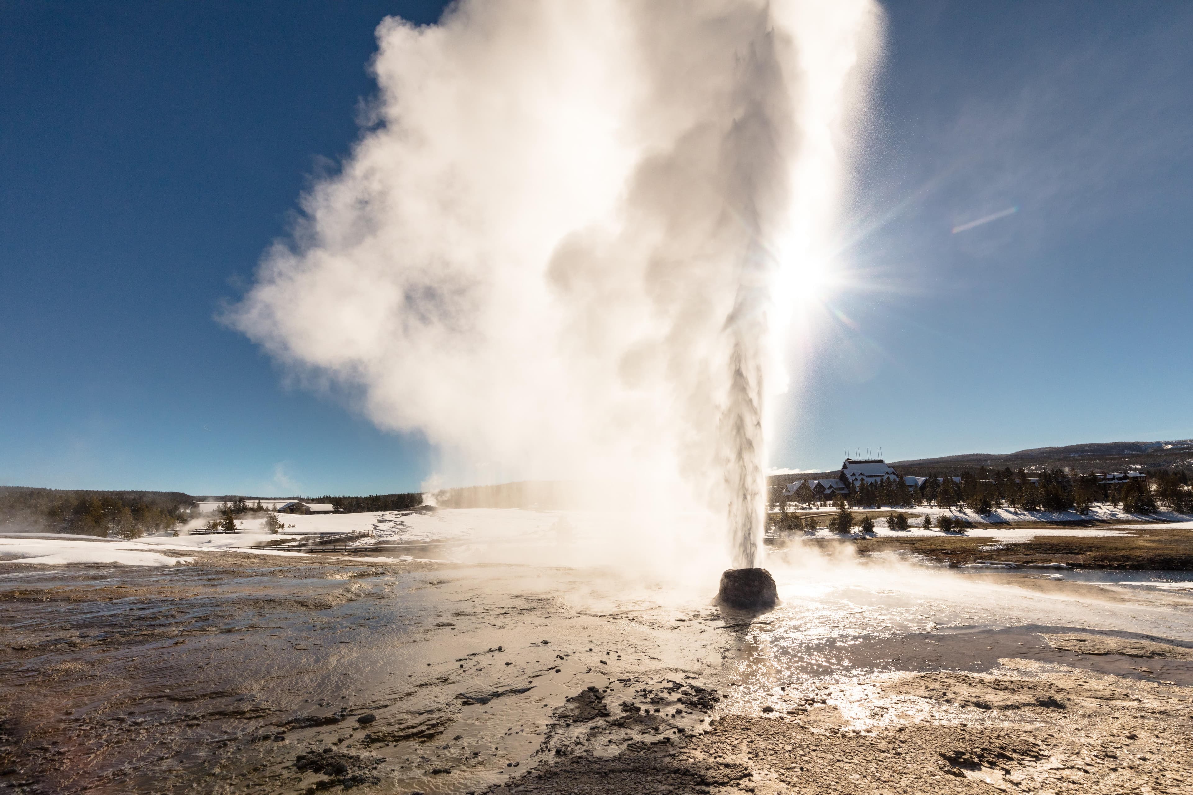
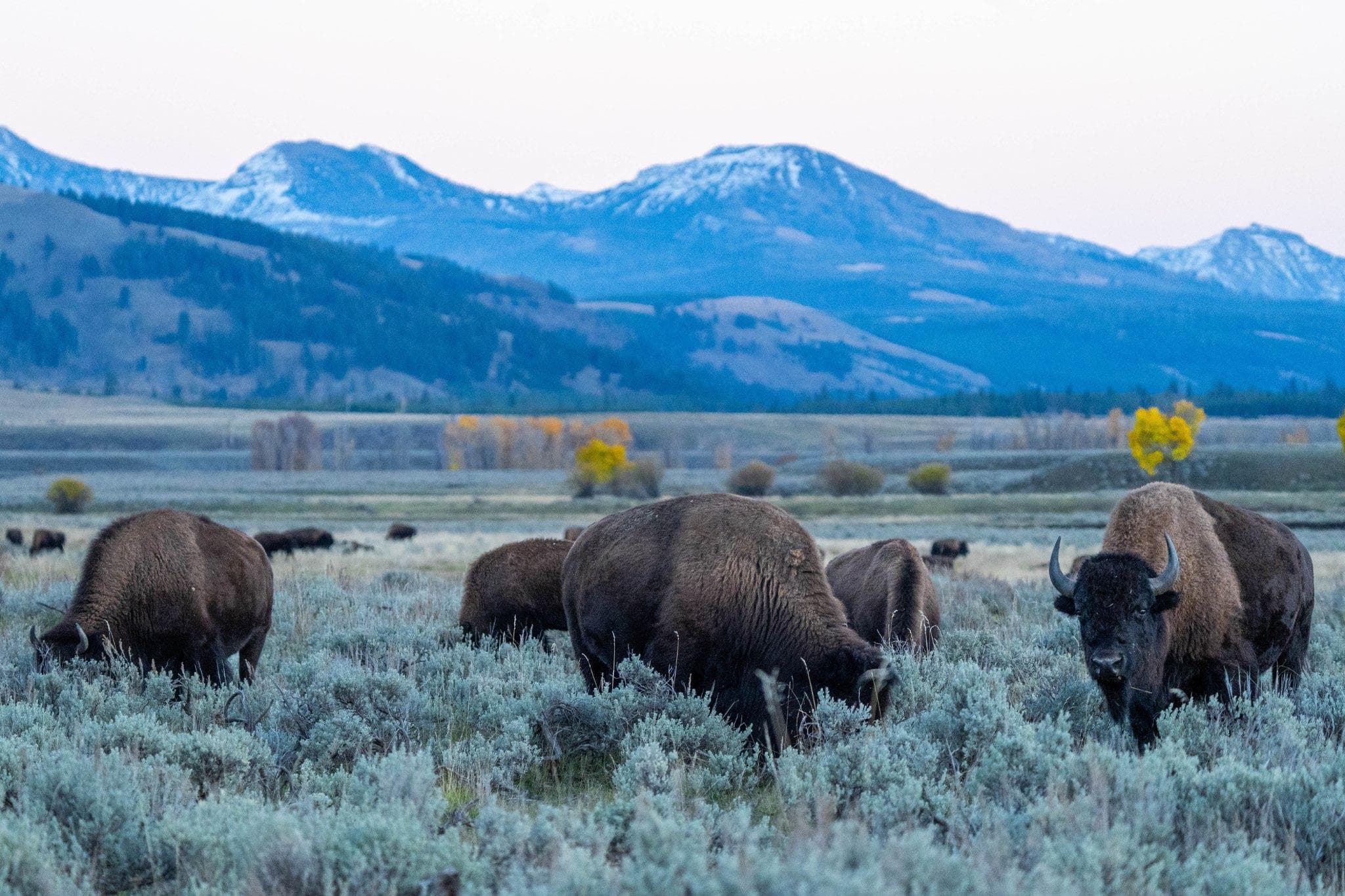
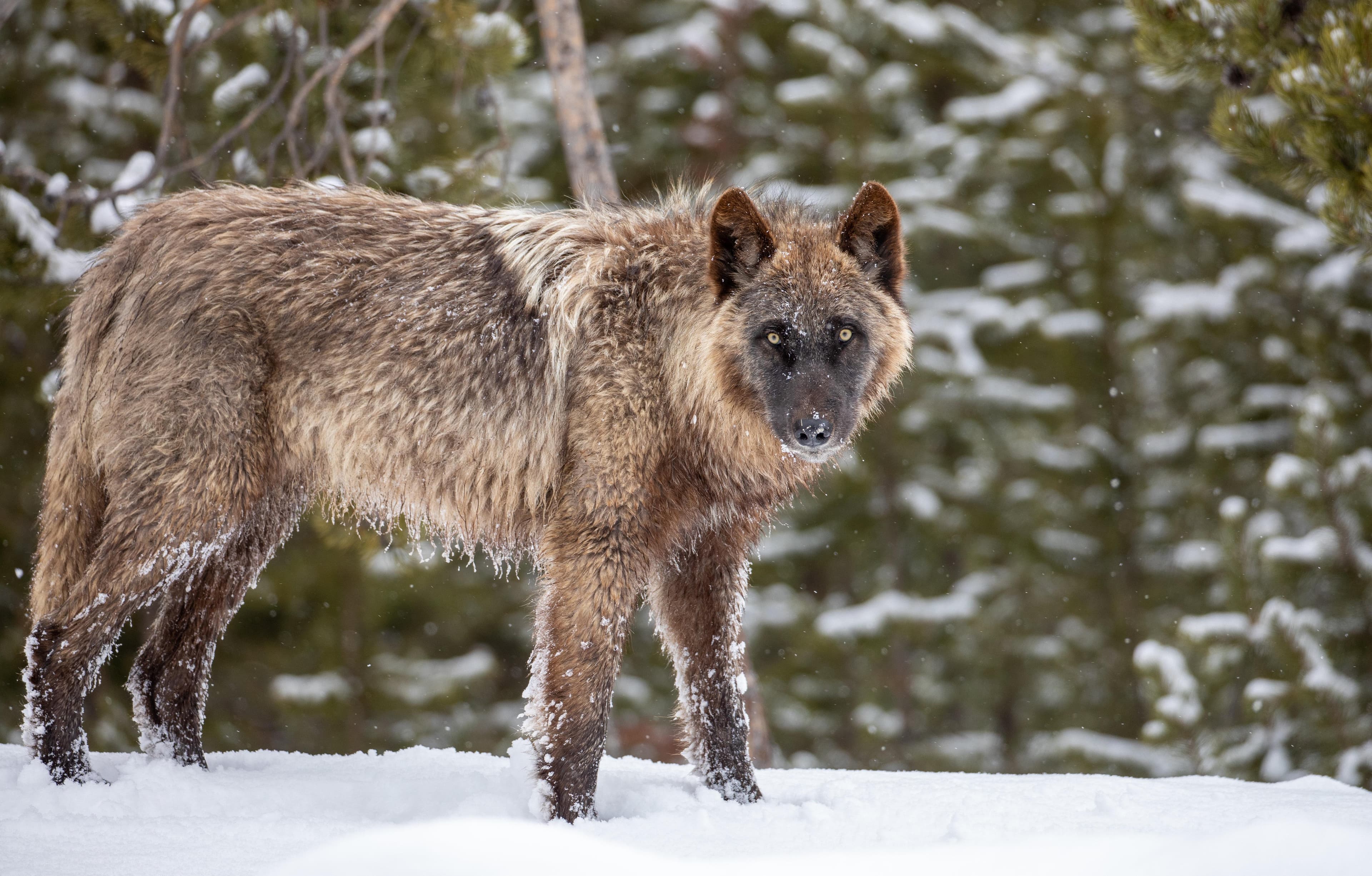
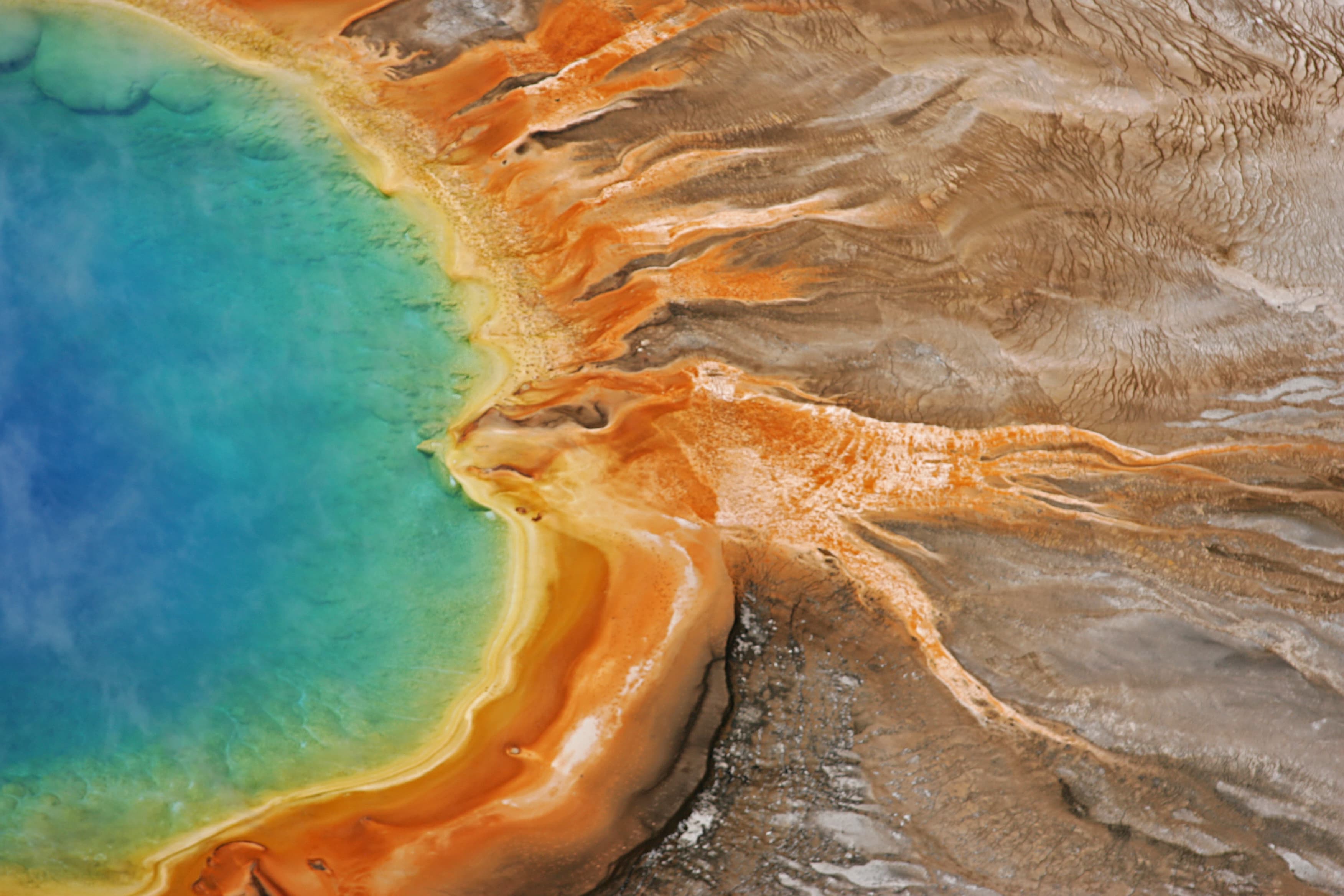
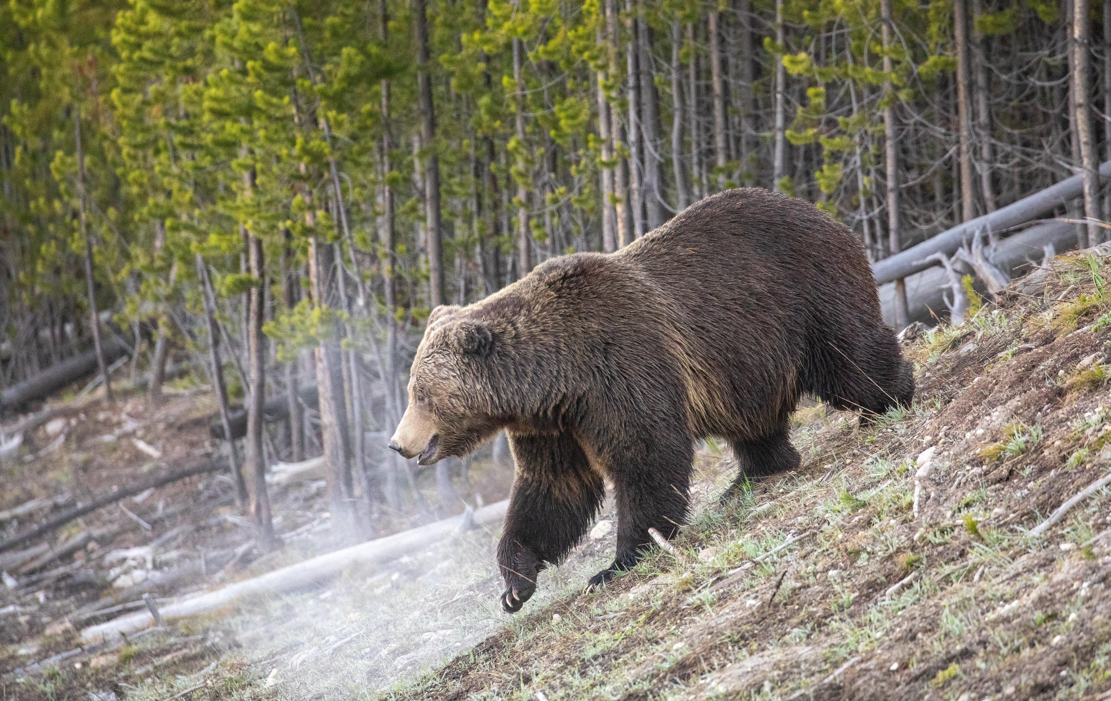
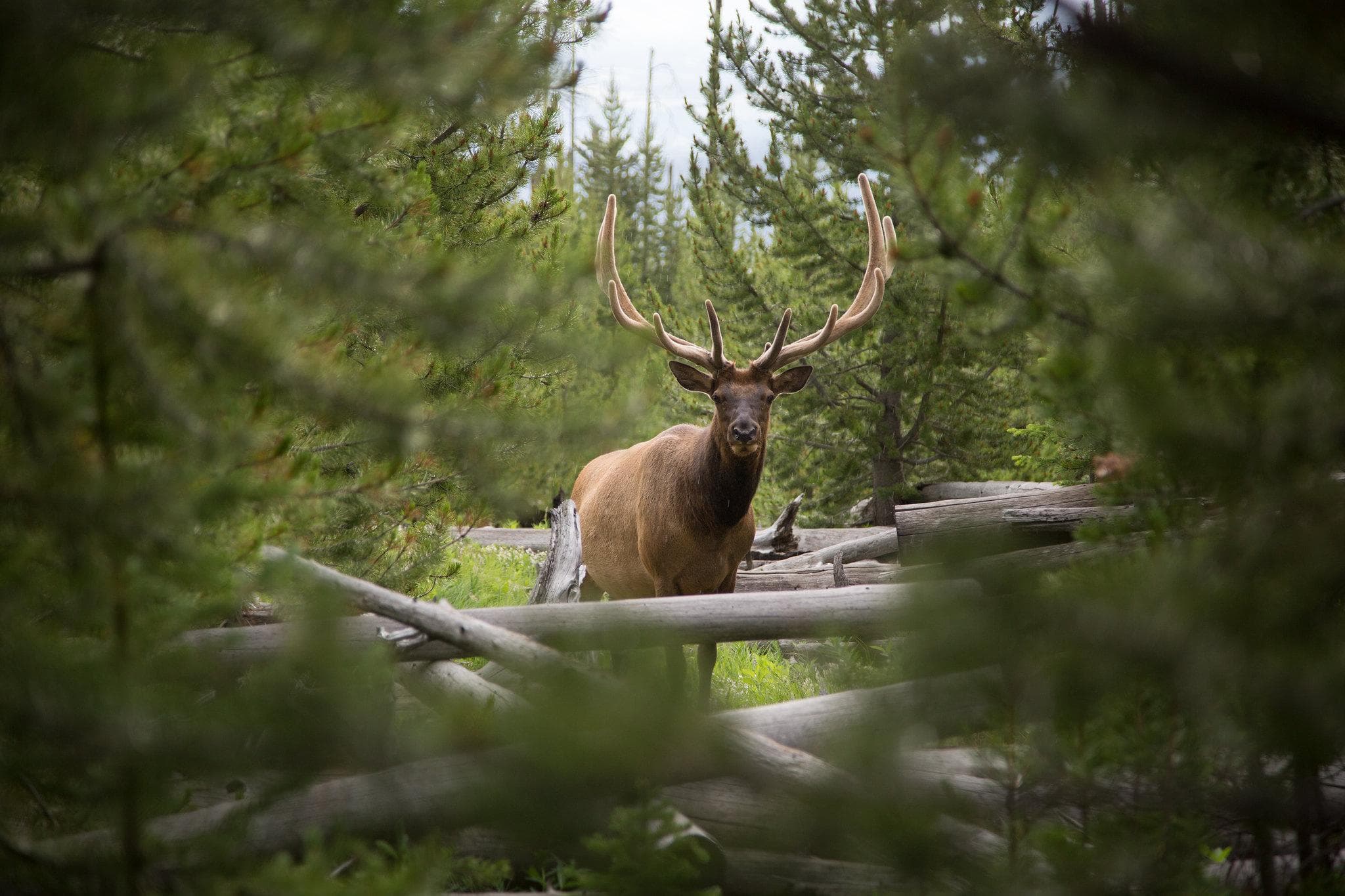
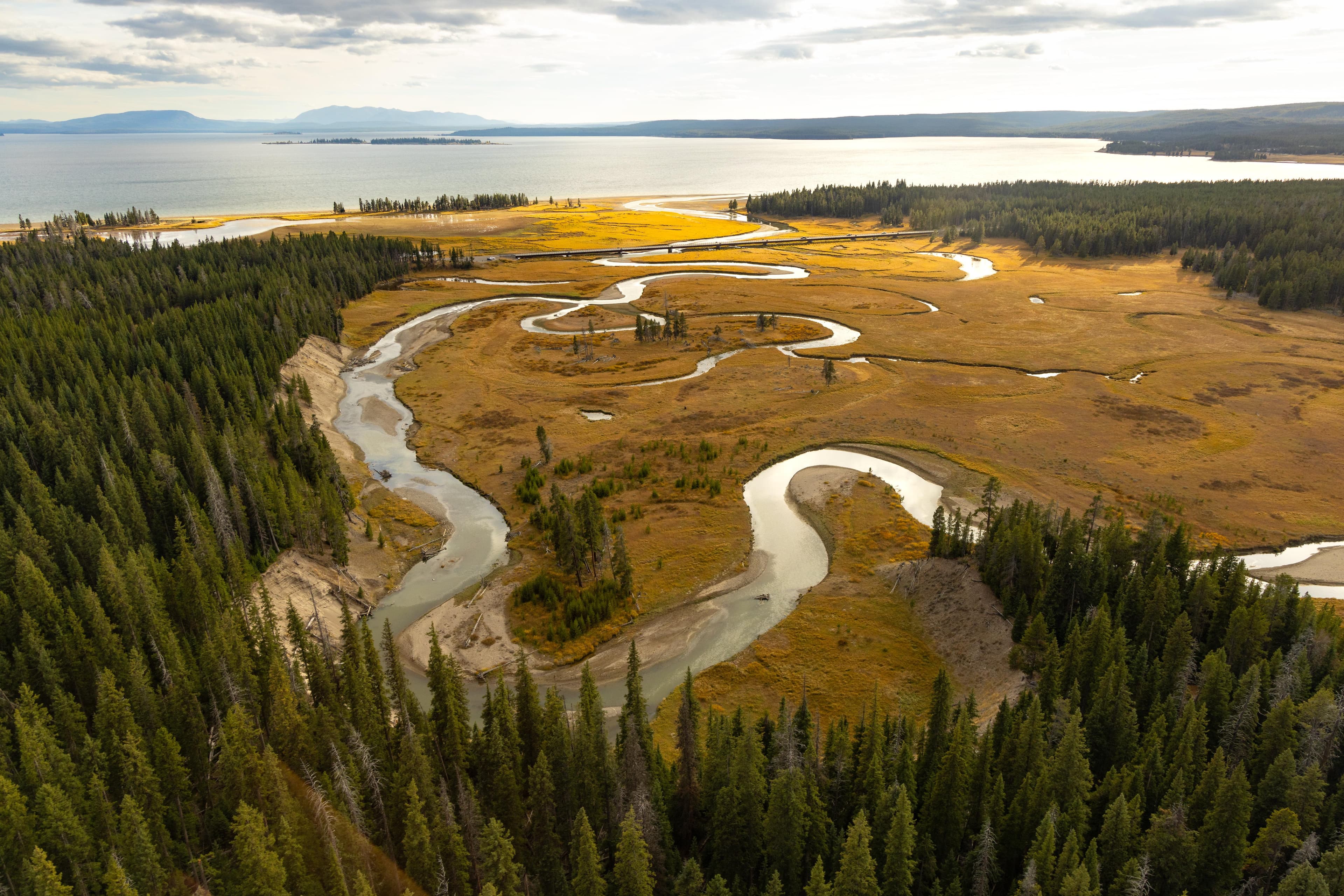
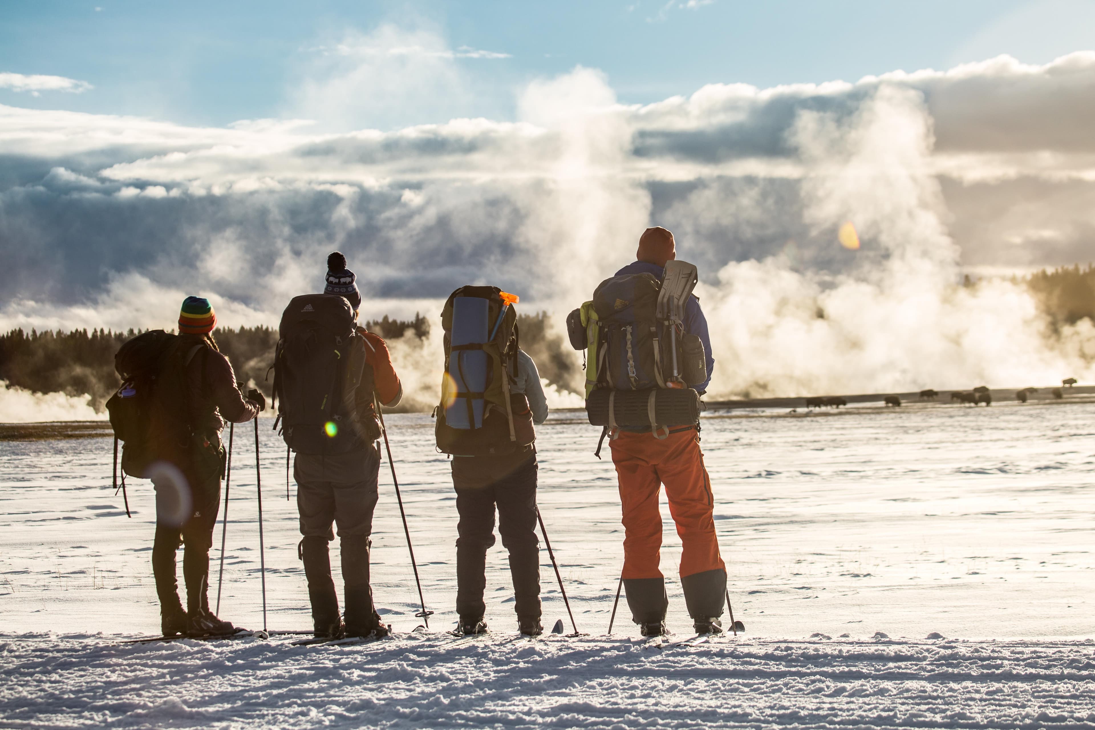
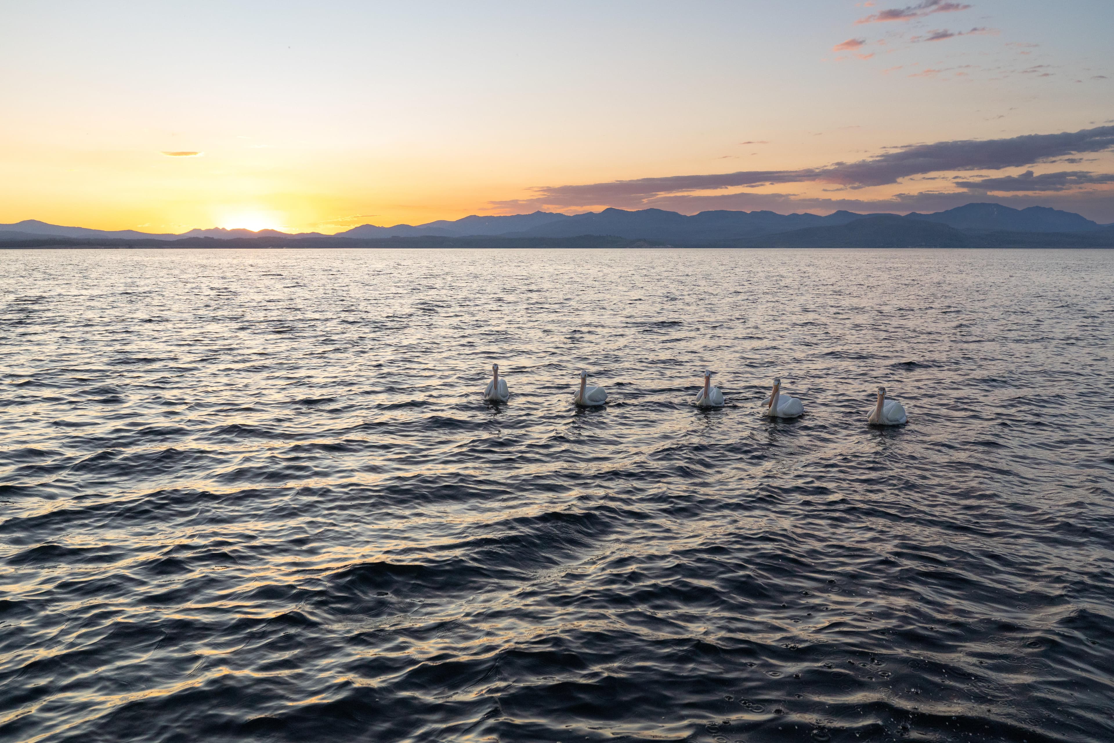
Stay near this park
No horse-friendly stays listed near Yellowstone National Park yet. Know a great barn or property? Help fellow riders by listing it.
List your propertyDirections
Yellowstone National Park covers nearly 3,500 square miles in the northwest corner of Wyoming (3% of the park is in Montana and 1% is in Idaho). Yellowstone has five entrance stations, and several are closed to regular vehicles during winter. It takes many hours to drive between these entrances, so be sure to check the status of roads at the entrance you intend to use while planning your trip and before you arrive.
Source: nps.gov