
Information
Yosemite Traffic Updates
When the park is extremely busy, you can get updates on current traffic conditions in Yosemite by texting ynptraffic to 333111.
Yosemite National Park
CA · Yosemite National Park
Not just a great valley, but a shrine to human foresight, the strength of granite, the power of glaciers, the persistence of life, and the tranquility of the High Sierra. First protected in 1864, Yosemite National Park is best known for its waterfalls, but within its nearly 1,200 square miles, you can find deep valleys, grand meadows, ancient giant sequoias, a vast wilderness area, and much more.
Riding guide
Horses provided
Highlights
Yosemite National Park is a world-renowned Sierra Nevada landscape of granite cliffs, alpine meadows, rivers, and high-country wilderness.
Riding
Rideable terrain here is noted as 700 miles, giving riders a clearer sense of scale before they ever unload. Yosemite National Park is a world-renowned Sierra Nevada landscape of granite cliffs, alpine meadows, rivers, and high-country wilderness. For equestrians, Yosemite offers designated stock trails and backcountry routes that wind through forests, along creeks, and into remote alpine terrain. Riders can experience everything from meadow loops to multi-day wilderness trips, with established stock camps available in select backcountry areas. Seasonal access and wilderness permits apply, but for prepared riders, Yosemite delivers iconic scenery paired with true backcountry immersion.
Rideable terrain
700 miles
Trailer parking
Tuolumne Meadows Stock Trailhead (Best Overall Backcountry Access) Why riders use it Large staging area designed for pack animals Access to High Sierra backcountry routes Starting point for trips into Lyell Canyon, the John Muir Trail, and alpine wilderness areas This is one of the most important equestrian gateways into Yosemite’s high country. Wawona Stock Trailhead Why it works well Dedicated parking for horse trailers Access to southern Yosemite wilderness trails Direct routes toward Mariposa Grove and Chilnualna Falls backcountry The Wawona area is one of the easiest places to stage horses in the park. Bridalveil Creek Horse Camp Area Benefits Equestrian camping and staging area Parking suitable for trailers Access to nearby backcountry trails This site provides one of the park’s few dedicated equestrian campgrounds. Yosemite Creek / Harden Lake Trailhead Area Why riders use it Larger parking areas that can accommodate trailers Access to remote northern backcountry routes
Horse regulations
Where Horses Are Allowed Wawona Horse Camp • A designated horse campground located near Wawona on the south side of the park. • These horse campsites are separate from general sites and require a reservation. • Designed for trailers and horses. Bridalveil Creek Group & Horse Campground • Offers horse campsites along with group and family sites. • A few campsites are specifically reserved for campers with horses/trailers. • Seasonally open (typically mid-summer). Tuolumne Horse Campsites (Tuolumne Meadows) • A horse-only campground in the Tuolumne Meadows area on Tioga Road. • These sites require reservations and are for visitors with stock animals. • Picnic tables, fire rings, water, and toilets available. Stock Camping Rules Horses must be kept in designated stock camps Hitching to trees for extended periods is prohibited Use of weed-free feed is required Grazing restrictions apply in many areas Manure & Feed Rules Certified weed-free hay required Scatter manure away from water and campsites No feeding in ways that attract wildlife Areas Off Limits to Stock Most of Yosemite Valley developed areas Boardwalks and sensitive meadow habitats Certain high-traffic hiking trails
Getting here
Use 9035 Village Dr, Yosemite National Park, California as your primary planning reference before you haul in. Tuolumne Meadows Stock Trailhead (Best Overall Backcountry Access) Why riders use it Large staging area designed for pack animals Access to High Sierra backcountry routes Starting point for trips into Lyell Canyon, the John Muir Trail, and alpine wilderness areas This is one of the most important equestrian gateways into Yosemite’s high country. Wawona Stock Trailhead Why it works well Dedicated parking for horse trailers Access to southern Yosemite wilderness trails Direct routes toward Mariposa Grove and Chilnualna Falls backcountry The Wawona area is one of the easiest places to stage horses in the park. Bridalveil Creek Horse Camp Area Benefits Equestrian camping and staging area Parking suitable for trailers Access to nearby backcountry trails This site provides one of the park’s few dedicated equestrian campgrounds. Yosemite Creek / Harden Lake Trailhead Area Why riders use it Larger parking areas that can accommodate trailers Access to remote northern backcountry routes
Planning your visit
Wilderness Permits Required for all overnight stock trips Trailhead-specific quotas apply Advance reservations strongly recommended during peak season Group Size Limits Combined group size (people stock) is limited Limits vary by trail and zone Commercial groups have separate regulations Seasonality Check Many Yosemite trails are snow-covered into late spring. High elevation routes may not open until June or July depending on conditions.
Where to stay
Yosemite Valley Visitor Center is the main visitor-contact point tied to this destination, which is helpful when you want current conditions, maps, and stock-use updates before riding. Guided or concession-based riding support is noted here, so riders who are not hauling their own horses may still find an access path into the experience. For a polished trip plan, pair the ride with lodging, fuel, and resupply planning in or near Yosemite National Park before heading deeper into federal-land access points.
Entrance fees & passes
- $35.00
Entrance - Private Vehicle
This fee is valid for seven consecutive days for a non-commercial car, pickup truck, RV, or van with 15 or fewer passenger seats. This fee covers the vehicle and everyone inside of it. Per-person nonresident fees still apply.
- $30.00
Entrance - Motorcycle
Valid for 7 days. Admits up to 2 private, non-commercial motorcycles with up to 4 total passengers. Per-person nonresident fees still apply.
- $20.00
Entrance - Per Person
This fee is valid for seven consecutive days for people entering on foot, a bicycle, a horse, or a non-commercial bus or van. People 15 years and younger are free.
- $300.00
Entrance - Non-commercial Groups
The per-person fee is $20 to a maximum of $300 per vehicle. People 15 years and younger are free.
- $0.00
Entrance - Education/Academic Groups
An educational fee waiver is available for educational and scientific groups that are accredited or tax-exempt for educational purposes planning a trip for educational or scientific purposes related to Yosemite that is not primarily recreational.
- $20.00
Commercial Entrance - Per Person
The fee is $20 per person for any resident 16 years or older. For any nonresident the fee is $100 per person for anyone 16 years or older. This fee is valid for seven consecutive days.
- $100.00
Nonresident
Each non-US resident aged 16 and older visiting Yosemite National Park must pay a $100 nonresident fee (in addition to the standard entrance fee), unless admitted with an Annual or America the Beautiful Pass. This includes nonresidents entering as part of a commercial tour group, commercial use authorization (CUA) group, or concessioner tour group.
- $200.00
Commercial Entrance - Mini-bus
This fee is valid for seven consecutive days. For any nonresident there is an additional fee of $100 per person for anyone 16 years or older. A commercial use authorization is required.
- $300.00
Commercial Entrance - Motor Coach
This fee is valid for seven consecutive days. For any nonresident there is an additional fee of $100 per person for anyone 16 years or older. A commercial use authorization is required.
- $70.00
Annual Entrance - Park
Annual pass providing free entrance to Yosemite for 12 months from the date of purchase for US citizens and permanent residents.
Trails
No trails synced for this park yet.
Campgrounds
Bridalveil Creek Campground
110 sites · 3 horse-friendly
The Bridalveil Creek Campground is located along the Glacier Point Road near Bridalveil Creek and is surrounded by a beautiful forest of red fir and lodgepole pine. At an elevation of 7,200 feet (2,200m) the campground is located 7 miles west of Glacier Point, 9 miles east of the Wawona Road turnoff, and is approximately 45 minutes from Yosemite Valley. The spectacular views from Glacier Point are nearby, and numerous hiking trails are located along the Glacier Point Road. There are no services nearby.
Reserve a siteBridalveil Creek Horse Camp
3 sites · 3 horse-friendly
The Bridalveil Creek Horse Camp is within Bridalveil Creek Campground located along the Glacier Point Road near Bridalveil Creek and surrounded by a beautiful forest of red fir and lodgepole pine. At an elevation of 7,200 feet (2,200m) the campground is located 7 miles west of Glacier Point, 9 miles east of the Wawona Road turnoff. The spectacular views from Glacier Point are nearby, and numerous hiking trails are located along the Glacier Point Road. There are no services nearby.
Reserve a siteCamp 4 Campground
61 sites
Camp 4 is located in Yosemite Valley near the base of granite cliffs close to Yosemite Falls. Yosemite Valley is centrally located in the park and boasts some of Yosemite’s most iconic features. This campground is located at 4,000 feet (1,200 m) elevation and can be accessed from all park roads. Camp 4 is within biking and walking distance of many services in Yosemite Valley and is located near the free shuttle route. There are food and grocery services nearby at Yosemite Valley Lodge and Yosemite Village.
Reserve a siteCrane Flat Campground
148 sites
The Crane Flat Campground is located along the Big Oak Flat Road, just west of Crane Flat, about 30 minutes northwest of Yosemite Valley, at 6,200 ft (1,900 m) elevation. There is a gas station and minimal convenience items located nearby at Crane Flat. Trailheads for both the Merced Grove and Tuolumne Grove of Giant Sequoias are located within a short drive of the campground.
Reserve a siteHodgdon Meadow Campground
100 sites
Hodgdon Meadow Campground is conveniently located along the Big Oak Flat Road at the Big Oak Flat Entrance. At an elevation of 4,900 feet (1,219 m), the campground is located along the western edge of the park, 25 miles and approximately 45 minutes from Yosemite Valley. There is a gas station and minimal convenience items located nearby at Crane Flat. Trailheads for both the Merced Grove and Tuolumne Grove of Giant Sequoias are located within a short drive of the campground.
Reserve a siteLower Pines Campground
74 sites
Lower Pines is located along the Merced River in Yosemite Valley. Yosemite Valley is centrally located in the park and boasts some of Yosemite’s most iconic features. This campground is located at 4,000 feet (1,219 m) elevation and can be accessed from all park roads. Lower Pines is within biking and walking distance of many services and trailheads in Yosemite Valley and is located on the free shuttle route. There are food and grocery services nearby at Curry Village and Yosemite Village.
Reserve a siteNorth Pines Campground
81 sites
North Pines is located along the Merced River in Yosemite Valley. Yosemite Valley is centrally located in the park and boasts some of Yosemite’s most iconic features. This campground is located at 4,000 feet (1,219 m) elevation and can be accessed from all park roads. North Pines is within biking and walking distance of many services and trailheads in Yosemite Valley and is located on the free shuttle route. There are food and grocery services nearby at Curry Village and Yosemite Village.
Reserve a sitePorcupine Flat Campground
55 sites
Porcupine Flat Campground is located off the Tioga Road about 30 minutes west of Tuolumne Meadows and over an hour from Yosemite Valley. RVs and Trailers are not recommended for the narrow roads in this more primitive campground. At an elevation of 8,100 feet (2,500 m) elevation, the campground is near Porcupine Creek, which is the only water source (must be filtered, treated, or boiled). The Porcupine Creek Trailhead is nearby. There are no visitor services close to the campground.
Reserve a siteTamarack Flat Campground
52 sites
Tamarack Flat Campground is located off the Tioga Road just east of Crane Flat. The campground is approximately 20 miles (45 minutes) from Yosemite Valley and is tucked away in the forest 3 miles off Tioga Road. RVs and Trailers are not recommended for this harder to access, and more primitive campground. At an elevation of 6,300 feet (1,900 m) elevation, the campground is near Tamarack Creek, which is the only water source (must be filtered, treated, or boiled). There is a gas station nearby at Crane Flat.
Reserve a siteTuolumne Meadows Campground
289 sites · 4 horse-friendly
Tuolumne Meadows Campground is Yosemite’s largest, and is located along the Tioga Road, with some areas located near the Tuolumne River. At 8,000 feet (2,600 m) this campground is open seasonally and has wonderful summer access to many hikes, lakes, and prominent viewpoints. The campground is located approximately 1 hour and 30 minutes from Yosemite Valley but a small store, grill, and post office are located nearby in Tuolumne Meadows.
Reserve a siteTuolumne Meadows Horse Camp
4 sites · 4 horse-friendly
Tuolumne Meadows Horse Campsites are located within Tuolumne Meadows Campground along the Tioga Road. At 8,000 feet (2,600 m) this campground is open seasonally and has wonderful summer access to many hikes, lakes, and prominent viewpoints. The campground is located approximately 1 hour and 30 minutes from Yosemite Valley but a small store, grill, and post office are located nearby in Tuolumne Meadows.
Reserve a siteUpper Pines Campground
236 sites
Upper Pines is located near the Merced River in Yosemite Valley. Yosemite Valley is centrally located in the park and boasts some of Yosemite’s most iconic features. This large campground is located at 4,000 feet (1,219 m) elevation and can be accessed from all park roads. Upper Pines is within biking and walking distance of many services and trailheads in Yosemite Valley and is located on the free shuttle route. There are food and grocery services nearby at Curry Village and Yosemite Village.
Reserve a siteWawona Campground
95 sites
The Wawona Campground is located along the South Fork Merced River close to historic Wawona. At an elevation of 4,000 feet (1,219 m), the campground is located in the southern end of the park, 27 miles and approximately 45 minutes from Yosemite Valley. The majestic Mariposa Grove of Giant Sequoias is just a short drive away and the Yosemite History Center is in nearby Wawona where you can see some of the park’s oldest structures. Wawona offers a visitor center, hotel, and a market.
Reserve a siteWawona Horse Camp
2 sites · 2 horse-friendly
The Wawona Horse Camp is located along the South Fork Merced River adjacent to historic Wawona. At an elevation of 4,000 feet (1,219 m), the camp is located in the southern end of the park, 27 miles and approximately 45 minutes from Yosemite Valley. The majestic Mariposa Grove of Giant Sequoias is just a short drive away and the Yosemite History Center is right next door where you can see some of the park’s oldest structures. Wawona offers a visitor center, hotel, and a market.
Reserve a siteWhite Wolf Campground
68 sites
White Wolf Campground is located off the Tioga Road between Tuolumne Meadows and Crane Flat, approximately an hour from Yosemite Valley at 8,000 feet (2,400 m). The campground is tucked into the forest about a mile from Tioga Road near White Wolf Lodge. Trailheads nearby lead to Lukens and Harden Lakes and the area is popular for those accessing other wilderness destinations. Minimal services may be available at White Wolf Lodge (if open). There are no other visitor services close to the campground.
Reserve a siteYosemite Creek Campground
74 sites
Yosemite Creek Campground is located nearly 5 miles off the Tioga Road (via a rough unpaved road) 26 miles west of Tuolumne Meadows, and a little over an hour from Yosemite Valley. Located in the forest at 7,700 feet (2,300 m) many campsites are close to Yosemite Creek, which is the only water source (must be filtered, treated, or boiled). RVs and Trailers are not recommended for this harder to access, and more primitive campground. There are no visitor services close to the campground.
Reserve a site
Points of interest
Acting Superintendent's Office
POIAlthough Yosemite was set aside as a national park in 1890, the National Park Service had not yet been created. Following the precedent set in Yellowstone, our country's first national park, the U.S. Army Cavalry also patrolled General Grant National Park (now known as Kings Canyon National Park) and Yosemite National Park. Each summer over 200 soldiers, usually cavalry, rode from the Presidio of San Francisco to protect both parks.
Anderson Cabin
POITourist parties provided business for local residents. George Anderson, a miner and blacksmith, worked as a guide in the late 1800s, and escorted visitors on expeditions in Yosemite. In 1875, he was the first person to climb Half Dome. He spent his winters in this building at Big Meadow (now called Foresta), and his summers in Yosemite Valley.
Arch Rock Entrance
POIWelcome to Yosemite National Park! Prepare to let your curiosity guide you to new places. Pick up a map and brochure as you enter your national park. A unique natural feature welcomes visitors to the park, via the Arch Rock entrance. Two house-sized boulders, situated on either side of the inbound road, form an archway for visitors to pass through. It's a truly exceptional experience upon first entering Yosemite National Park. The park entrance fee can be paid upon arrival.
Artist Cabin (Chris Jorgensen Studio)
POIExplorers, writers, and early tourist parties of the 1850s returned from Yosemite with stories of spectacular beauty. Artists were drawn to Yosemite, where they found inspiration in the magnificent scenery. Paintings, drawings, sketches, and photographs publicized and popularized Yosemite. Consequently, many people chose to travel the arduous route to Yosemite and experience the beauty firsthand. Thus, artists played a key role in increased awareness, tourism, and protection.
Badger Pass Ski Area
POISince opening in 1935, Badger Pass Ski Area has been a favorite ski destination for families and Yosemite enthusiasts. The ski area boasts fewer crowds and fun winter activities including skiing, snowshoeing, snowboarding, cross-country skiing, and snow tubing. The ski area is accessible by vehicle or via free shuttle bus from Yosemite Valley.
Big Oak Flat Entrance
POIWelcome to Yosemite National Park! Prepare to let your curiosity guide you to new places. Pick up a map and brochure as you enter your national park. The park entrance fee can be paid upon arrival. Park passes can be purchased here, and park brochures are available.
Big Trees Loop - Anatomy of a Giant
POIThese massive trees grow bigger and live longer than almost any other living things on earth. Which of the following factors do you think is most important to their longevity? Insulating bark? Many tiny seeds? Lifelong growth? Widespread roots? Read this wayside exhibit to find out more.
Big Trees Loop - Ecology of the Grove
POIThink of the grove as a neighborhood, or ecosystem, where the resident plants and animals rely on each other to survive. Read this wayside exhibit to find out more about what roles mammals, birds, trees, snow, fire, and the sun play in this neighborhood.
Big Trees Loop - Grove Restoration
POIThe ground you stand on was once asphalt, which did not give falling sequoia seeds a chance to germinate. Read about recent efforts to restore this area back to a place where giant sequoias can thrive.
Big Trees Loop - How Giants Fall
POIGiant sequoias can survive for thousands of years, but they are not invincible. What conditions threaten a giant sequoias survival? Read this wayside exhibit for more information.
Big Trees Loop - Relics of the Past
POILearn more about the relationship giant sequoias have had with other plants, through the ages, on this wayside exhibit.
Big Trees Loop - Restore and Protect
POIIn 1864 Abraham Lincoln paused during the Civil War to set aside the Mariposa Grove and Yosemite Valley as a protected state reserve "for public use, resort, and recreation." Yosemite National Park was then established in 1890 and this grove incorporated into the park in 1906. Today, we value the quiet majesty of these giant sequoias and share a responsibility as park stewards to limit our impact on them.
Big Trees Loop - Stages of Life
POIThe slender young giant sequoias around you, distinguished by their foliage of round, overlapping scales, distinctive conical profiles, and soft, spongy bark, beat great odds in finding the right conditions to sprout toward maturity. Find out what the perfect conditions are that allow a seed to become a mature giant sequoia, on this wayside exhibit.
Big Trees Loop - The Fallen Monarch
POINo one knows how old this tree is or when it fell. Notice the roots of this tree. Sequoias do not have deep tap roots; instead the roots spread out near the grounds' surface to capture water. While the roots are usually no deeper than six feet (2 meters), they can fan out more than 150 feet (45 meters), providing a stable base to balance the massive trunk. When visitors stay on the road and trails, it minimizes soil compaction that damages these surface roots.
Big Trees Loop - The Wonder of Sequoias
POIYou are standing in the midst of one of Yosemite's natural and cultural treasures-and among the world's most massive living organisms. These trees, Sequoiadendron giganteum, are not the oldest living things. Although the oldest giant sequoias may exceed 3,000 years in age, some living specimens of the ancient bristlecone pine, Pinus arista, are more than 4,600 years old!
Big Trees Loop - Traditional Ecological Knowledge
POIThe Traditionally Associated Tribes of Yosemite National Park worked collaboratively with cultural and natural resource managers to integrate Traditional Ecological Knowledge with science-based adaptive management throughout the park. Read this wayside exhibit to see what practices were used to enhance the biodiversity of the forest environment.
Big Trees Loop - Water and Wetlands
POIMost of these giant sequoias consume a lot of water. Where does the water come from? find out more about the importance of wetland areas to giant sequoias and other plants and animals found in the grove, on this wayside exhibit.
Big Trees Loop - Wildlife in the Grove
POIThe Mariposa Grove provides a protected home for 35 species of mammals and 35 species of birds. Serious threats to Yosemite's wildlife and the ecosystems they occupy include loss of a natural fire regime, non-native species, air pollution, habitat fragmentation, and climate change. Learn about one of Yosemite's rarest species, the Pacific Fisher, on this wayside exhibit.
Blacksmith Shop - Yosemite
POIBy 1900, many people had made the trip to Yosemite on horseback or by horse-drawn stage. Roads were rough on horses and riders. It took eight hours to travel approximately 25 miles from Wawona to Yosemite Valley. A four-up stage (a stage being drawn by four horses) changed horses four times during the trip. Consequently, 16 horses were used to make the journey. Blacksmiths shops were located throughout the park, and "smithys" offered valuable assistance along the roads.
Bridalveil Fall Trailhead
POIA short walk will lead you to the base of Bridalveil Fall, allowing you to get an up close view of this often-windswept waterfall. Plunging 620 feet (189 meters), Bridalveil Fall is the first major waterfall you'll see when entering Yosemite Valley. In spring, it thunders; you can expect to get wet! In some cases the spray is so strong, you may not even be able to easily access the end of the trail. During the rest of the year, look for its characteristic light, swaying flow.
Bridalveil Fall Viewing Area
POIEnjoy an up close view from the base of this often-windswept waterfall. Especially in the spring, expect to get wet while standing at the base of this thundering waterfall that plunges 620 feet (189 meters). In some cases the spray off Bridalveil Fall is so strong, you may not even be able to easily access the end of the trail. During the rest of the year, look for its characteristic light, swaying flow. Expect icy and very slick conditions in winter.
Cathedral Beach
POIPicnic tables and grills are conveniently located at this scenic spot along the Merced River that offers views of El Capitan. This picnic area is available from dawn to dusk. Cathedral Beach Picnic Area, is located on Southside Drive, several miles east of Bridalveil Fall.
Cathedral Lakes Trailhead
POIThe shimmering waters of Cathedral Lakes rest below Cathedral Peak, named by the California Geological Survey (CGS) in 1863. The trail climbs steadily to Upper Cathedral Lake. Near the top of the climb, it passes a spur trail to Lower Cathedral Lake (0.5 mile to lake). The return hike follows the same route. This is one of the busiest trails in the Tuolumne Meadows area.
Chilnualna Falls Trailhead
POIChilnualna Falls, pronounced "Chil-noo-al-na," flows all year, with peak flow in May. It is a strenuous hike, but well worth it for its views of the falls and Wawona Dome. Chilnualna Falls are comprised of five large cascades sliding through and over large granite formations above the Wawona basin - water here is fullest in spring and early summer. This strenuous trail allows for you to view the Chilnualna Falls cascades in many locations along the hike.
Chinese Laundry
POIThe Chinese Laundry houses interactive displays and exhibits that celebrate the Chinese workers who helped make Yosemite what it is today. The exhibits in this historic building highlight a previously forgotten story in Yosemite’s rich and diverse history.
Church Bowl Picnic Area
POILet the views of Half Dome and Glacier Point across Ahwahnee Meadow inspire you as you enjoy a picnic at Church Bowl Picnic Area. There are picnic tables and grills at this scenic spot along Ahwahnee Meadow. Potable water and flush toilets are available.
Cook's Meadow Loop Trailhead
POIWalk through the heart of it all! Enjoy views of Yosemite Falls, Half Dome, Sentinel Rock, and Royal Arches from the center of Yosemite Valley as you saunter through this large open meadow. This short, easy walk offers stunning views of Yosemite Falls, Half Dome, Glacier Point, and Sentinel Rock. From the visitor center, walk west along the bicycle path toward Lower Yosemite Fall. At shuttle stop #6, cross the street and follow the bike path, bearing left as the path forks.
Cook's Meadow Tour - Change: From Lake to Meadow
POINotice how flat the floor of Yosemite Valley is. At the end of the last glacial period, as with each post-glacial warming trend, huge volumes of water from melting glaciers flowed into Yosemite Valley, bringing tons of rock, gravel, sand, and silt. This debris slowly filled the shallow lake. A succession of bogs and marshes thrived before the meadows eventually appeared.
Cook's Meadow Tour - Change: The Pace of Glaciers
POILook up to the granite walls, spires, and cliffs all around you! The rock's story begins about 100 million years ago with granitic magma deep within the earth. This molten material was formed from older continental rock, as it was over-ridden by the westward-moving North American Plate. About 35 million years ago, dramatic uplift began that eventually raised the Sierra Nevada to its current height.
Cook's Meadow Tour - Change: The Passage of Seasons
POIThe weather in Yosemite Valley differs from other places in the Sierra Nevada with similar elevations: summers are warmer and winters are colder. Here, the 3,000-foot-high cliffs trap warm air in the summer and funnel cold air down Merced and Tenaya canyons in the winter. The cliffs also shade half of the Valley because of the low-angled winter sun. The Sierra Nevada enjoys a "Mediterranean" climate, which means relatively dry summers and wet winters.
Cook's Meadow Tour - Change: Yosemite Opens to the World
POIIn 1855, only four years after the Ahwahneechee were forcefully removed from the Valley, the first tourist party came by horseback. Within three years, the first hotel was established, and within ten years, there were four more. Look toward Lower Yosemite Fall and notice the swath in the trees. Early hotel owners cleared this section of forest so guests could easily see Lower Yosemite Fall. Most of the meadows were fenced, plowed, grazed, and sown to grass for hay.
Cook's Meadow Tour - Fire: Friend or Foe
POIIf we are to improve our ability to better care for our national parks, we must learn from the past. For example, early visitors to Yosemite misunderstood the essential role of fire, viewing it as merely destructive and dangerous and responding to it with alarm and fear. We now understand that suppressing natural lightning-caused fires can ultimately harm the plants and animals that have adapted to it.
Cook's Meadow Tour - First People
POIIt is believed that people were present in this valley as early as 8,000 years ago. Archeological evidence suggests that about 4,000 years ago American Indian people established permanent settlements here. The oak grove you are in now may have been a principal winter village area. Acorns from the black oaks were a main food source for the area's first people, known as the Ahwahneechee.
Cook's Meadow Tour - From Yosemite to Our Own Backyards
POIThis is a good place to take a look at what John Muir called "the grandest of all the special temples of Nature I was ever permitted to enter. It must be the sanctum sanctorum of the Sierra (holiest of the holy places)." Changes that created this magnificent scenery occur over long periods of time. The cliffs and waterfalls will remain well into the future no matter what humans do. Changes caused by 150 years of tourism were rapid and damaging to the natural environment.
Cook's Meadow Tour - Looking into the Future
POIIf you are visiting during the busy summer months, you may notice noise and congestion. Since 1980, one of the management goals for Yosemite Valley has been to reduce traffic congestion and crowding. Plans for reducing the impact of automobiles, protecting the natural environment, and enhancing the visitor experience are being implemented.
Cook's Meadow Tour - Merced Wild and Scenic River
POIIn the meadow to the left of the trail is an old river channel where yellow water lilies grow in the summer months. Every spring during high water, the Merced River reclaims this channel and water flows across this trail. Early hotel owners sought to drain areas like this to reduce mosquito ponds and dry the meadows enough to plow for hay production. The main Merced River channel is south of the trail. Its flow changes dramatically with the seasons.
Cook's Meadow Tour - Restoration Efforts
POIThroughout Yosemite National Park's history, countless efforts have been undertaken to preserve its ever-changing natural and cultural landscapes. Although it may not seem obvious today, Cook's Meadow was once one of the Valley's most developed areas. This spot also exemplifies how trees obscure many historic views. One hundred years ago, this cluster of trees was open meadow. Park plans call to restore historic scenic vistas and work is underway throughout the park to do so.
Crane Flat Gas Station
POIThe Crane Flat Gas Station conveniently serves the northern end of the park for your refueling needs and is located at the intersection of the Big Oak Flat and Tioga Roads. The Crane Flat Store is open seasonally from spring through fall.
Curry Village
POIBeneath the grandeur of Glacier Point, Curry Village is known for the same warm, hospitable feeling that was instilled by its founders, David and Jennie Curry in 1899.
Curry Village Bike Stand
POIBiking is one of the best ways to see Yosemite Valley. Yosemite Valley is flat, which makes for easy riding along our 12 miles of designated paths. Bicycles, tag-along bikes for children, trailers, and helmets are available for all ages and abilities. We also offer a select number of tandem bikes and hand-crank bikes for guests with physical limitations. Wheelchairs, electric scooters, and strollers may also be available for rent.
Curry Village EV Charging Station
POILocated in the parking lot west of Curry Village and just east of Stoneman Bridge, this electric vehicle (EV) charging station features 20 level 2 chargers. Chargers have a J1772 connector.
Curry Village: Lounge and Registration Architecture
POICurry Village Parking
POIIn the mid-1800s, European-American settlers planted apple trees around Yosemite Valley to provide fresh produce and cider to the growing number of people drawn to the area. Now, this area serves as a parking lot for visitors who wish to use the Curry Village lodging, dining, and gift shop services, or to use the free shuttle bus. Open year-round for Curry Village overnight guests.
Curry Village: Stoneman House Architecture
POIDegnan's Bakery
POIJohn Degnan settled in Yosemite Valley in 1884, and began working as a laborer and caretaker for state administrators there. His wife, Bridget, added to the family income by selling bread she baked daily in Dutch ovens. As travel to Yosemite increased, the demand for her bread grew. A larger oven, capable of producing 50 loaves per day, was used until 1900, when the Degnans ordered a large brick oven for a more permanent bakery. This bakery was originally connected to the Deg
Degnan's Kitchen
POIDeli sandwiches, signature salads, artisan pizzas, breakfast favorites, coffee / espresso drinks, fresh donuts, baked goods and a wide selection of soft drinks and other beverages are available at Degnan's Kitchen. Numerous seating areas are available to relax and enjoy a quick meal. Open year-round, see website for hours. Located in eastern Yosemite Valley, in Yosemite Village.
El Capitan Meadow
POIEl Capitan Meadow offers a view of both the eastern and western faces of this iconic granite formation, rising over 3,000 feet above the meadow. El Capitan Meadow also provides great views of Lower and Middle Cathedral Rocks as well as the Cathedral Spires. During the full moon, moonlight illuminates El Capitan with an otherworldly glow that can be viewed from this meadow.
El Capitan Picnic Area
POIDelight in the thrill of spotting climbers on El Capitan while you sit back and enjoy your picnic beneath this gigantic granite monolith.Picnic tables and grills are conveniently located at this scenic spot beneath the massive cliff face that is El Capitan. Hours :This picnic area is available from dawn to dusk. Getting Here :Located on Northside Drive, near El Capitan, a few miles west of Yosemite Valley Lodge, at El Capitan shuttle stop E3. Rules & Regulations :Picnic are
Elizabeth Lake Trailhead
POIEnjoy the shimmering waters of Elizabeth Lake, in the heart of the Cathedral Range.The trail climbs steadily to a glacier-carved lake at the base of Unicorn Peak. The return hike follows the same route. Elizabeth Lake (moderately strenuous)4.8 miles (7.7 km) round-trip; 4-5 hours 1,000 ft (305 m) elevation gainFor hiking and trail information, please visit a Wilderness Center or Visitor Center. Hours :Accessible only while Tioga Road is open to vehicles, from late May or
El Portal EV Charging Station
POILocated in the parking lot adjacent to the El Portal Market and Gas Station, this electric vehicle (EV) charging station features two level 2 chargers. Chargers have a J1772 connector with a power output of 11 kW.
El Portal Gas Station and Market
POIThe El Portal Gas Station conveniently serves the western end of the park for your refueling needs. <br /><br />Diesel and propane available. <br /><br /> <b>Hours</b> :<br />8am to 5pm<br />Pay at the pump 24 hours with credit or debit card.<br /><br /> <b>Getting Here</b> :<br />The El Portal Gas Station is located on Highway 140, next to the El Portal Market.<br /><br /> <b>Accessibility</b> :<br />Attendants can assist with fuel service during business hours.
Four Mile Trailhead
POIAwe-inspiring views of Yosemite Falls and Yosemite Valley await hikers on this trail to Glacier Point. The Four Mile Trail has no lack of views; El Capitan and the Cathedral Rocks tower to the west, while Yosemite Falls plummets in the north and Half Dome looms eastward. The Four Mile Trail ends at Glacier Point, where restrooms, parking, and a snack stand (summer only) may be available.
Four Mile Trailhead at Glacier Point
POIAwe-inspiring views of Yosemite Falls and Yosemite Valley await hikers on the descent down into Yosemite Valley. The Four Mile Trail follows a series of switchbacks down the south wall of Yosemite Valley. Although lacking shade during the heat of summer, this trail has no lack of views-El Capitan and the Cathedral Rocks tower to the west, while Yosemite Falls plummets in the north and Half Dome looms eastward. The trail ends about a mile west of Yosemite Village.
Gaylor Lakes Trailhead
POITake in views of beautiful alpine lakes and lofty granite peaks on this picturesque day hike. This hike offers some of the most spectacular high-country views off of Tioga Road.
Geology Hut
POILearn about Yosemite's geologic story while taking in the view of Yosemite Valley, a masterpiece of nature that is ever changing. For over a century, Yosemite's geologic story has always intrigued, inspired, and challenged people. In 1925, Yosemite Natural History Association built this geology hut as an observatory to educate visitors about Yosemite's geologic past.
Geology Tour - Around the River Bend
POIA tour stop where you'll notice that the ground surface is relatively flat, as it is just about everywhere in Yosemite Valley. Glaciers gouged out the valley even deeper than it seems, as the actual bedrock floor of the Valley is nearly 2,000 feet, or 600 meters, below where you are standing.
Geology Tour - Formation of Half-Dome
POIA tour stop that allows you to see Half-Dome, a massive rock formation with a rounded summit and a sheer face that looks like it's been cut in half. Half Dome is one of the most well-known features in Yosemite. To understand how this impressive feature formed, we have to journey back in time again, this time about one hundred million years ago, when the granitic bedrock of Yosemite was forming.
Geology Tour - John Muirs Rockfall Experience
POIOn March 26, 1872 the famed naturalist and conservationist, John Muir, was sleeping in a cabin nearby when he was shaken awake by a strong earthquake. This quake, known as the Owens Valley earthquake, was one of the largest earthquakes in California's history, with a magnitude of at least 7.5 on the Richter scale.
Geology Tour - Origin of Yosemite Falls
POIA tour stop that allows you to notice one of the most iconic features in Yosemite; the cascading waterfalls of Upper and Lower Yosemite Falls.
Geology Tour - Reflections
POILooking upstream from Sentinel Bridge you can often see Half-Dome's reflection in the Merced River. This picturesque view may seem timeless, but in fact it is just a quick snapshot in time.
Geology Tour - Rockfall Hazards
POIAs you walked to this stop, you probably noticed the steep, towering cliff and the piles of boulders, called talus, at the base of the cliff. Some of the talus boulders can be quite large. These boulders were once a part of the cliff face and broke loose in events called rockfalls in which boulders fall, bounce and roll down the cliffs and talus piles.
Geology Tour - Welcome
POIFun facts about Yosemite's geology that will increase your appreciation for the natural beauty all around you.
Geology Tour - Yosemite Underwater: Twentieth Century Floods
POIOn most days, the Merced River flows peacefully beneath Superintendents Bridge. However, on January 2, 1997 the Merced was a raging torrent. The 1997 flood is the most damaging in Yosemite's recorded history. In the center of the valley, floodwaters were more than 10 feet, or 3 meters, deep.
Glacier Point
POIThe Glacier Point Road is closed for 2022. This world renowned overlook gives visitors a grand view of Yosemite Valley from above and a captivating vista of the park's southeastern high peaks. Glacier Point, an overlook with a commanding view of Yosemite Valley, Half Dome, and Yosemite Falls, is located 30 miles (a one-hour drive) from either Yosemite Valley or Wawona. The road stays open as weather permits.
Glacier Point Gift Shop and Snack Stand
POIFind souvenirs, snacks, and convenience items at the Glacier Point Gift Shop and Snack Stand on your visit to this stunning overlook. You will also find gifts, books, apparel, plus a selection of hiking essentials if you're planning a hike down to Yosemite Valley via the Four Mile Trail or the Panorama Trail. You can also enjoy a refreshing ice cream or a quick bite at the Snack Stand.
Glacier Point Ski Hut
POIView Yosemite Valley, Half Dome, and the Yosemite High Country from one of the most gorgeous and breathtaking sites in the Sierra Nevada region, from the Glacier Point Ski Hut.A 10.5-mile cross-country ski trip from Badger Pass Ski Area, on groomed terrain, will bring you to this rustic accommodation. Experienced cross-country skiers can do the entire round-trip in 4 to 5 hours, however, many guests like to explore Glacier Point longer and stay at Glacier Point Ski Hut overni
Glen Aulin and Soda Springs Trailhead
POIHike through meadow and forest on this scenic trail that leads you to Glen Aulin and beyond. Soda Springs Soda Springs-carbonated, cold water bubbling out of the ground-is protected within a log enclosure. A side path leads to the nearby historic Parsons Memorial Lodge, which offers exhibits in the summer. (limited hours-see Yosemite Guide for schedule). Glen Aulin Follow the Tuolumne River as it drops to Glen Aulin. Tuolumne Fall and White Cascade are four miles from the
Grizzly Giant Tour - A Famous Camping Trip
POIA Famous Camping TripLearn about John Muir and President Theodore Roosevelt's famous camping trip that initiated America's best idea, the birth of our National Parks. At their meeting, Muir spoke of environmental degradation, like development, and asked for another layer of protection as a national park to improve management. Muir convinced both Roosevelt and California Governor George Pardee, on that excursion, to recede the state grant and make the Valley and the Mariposa G
Grizzly Giant Tour - Enduring Giant
POIEnduring Giant The Grizzly Giant is one of the largest trees in the Mariposa Grove and is estimated to be 2,900 years old. As you near its base, look at the fires scars that remain. Fire plays a very important role in the growth of a giant sequoia.Giant sequoias have a dependency on natural fires for reproduction, which was not understood until the early 1960s. Lightning-caused fires reduce the competition from other evergreens, burn away the leaf litter on the forest floor,
Grizzly Giant Tour - The Surviving Tunnel Tree
POIThe Surviving Tunnel Tree<br />The California Tunnel Tree was cut in 1895 to allow horsedrawn stages to pass through. Most visitors don't know that two trees in this grove were tunneled, and this is the only one still standing, and still alive! Stroll through this living tree while thinking about its history. Read this wayside exhibit to learn more about this and another tunnel tree.
Grizzly Giant Tour - The World Below
POIThe World Below<br />Tread lightly. Stepping off the trail, even for a quick photograph, may prevent water from reaching the trees' roots. Learn more about the microscopic life that exists beneath your feet, at this wayside exhibit.
Grizzly Giant Trailhead (Accessible)
POIThis tour begins at the Grizzly Giant Accessible Parking area. Winding through a forest with many giant sequoias, this trail features the Grizzly Giant, the largest sequoia tree in the park, the California Tunnel Tree, and interpretive panels on the life and ecology of giant sequoias. This trail is relatively flat and is wheelchair accessible.<br /><br /><br /> <b>Grizzly Giant/California Tunnel Tree </b> (easy)<br />0.26 mile (0.42 km) round-trip; 30-45 minutes<br /><br /><br /> <b>Hours</b> :<br />From approximately December to March, the Mariposa Grove Road is closed to vehicles and the shuttle no longer operates. The road, along with all trails within the Grove, remain open to hikers, snowshoers, and skiers.<br /><br />See <a href="https://www.nps.gov/yose/planyourvisit/mg.htm">website</a> for more information.<br /><br /> <b>Getting Here</b> :<br />Located near Yosemite National Park's South Entrance. Park at the Mariposa Grove Welcome Plaza and take the free shuttle to the Mariposa Grove, when operating. Private vehicles may only enter the Mariposa Grove when the road is open and the shuttle is not operating. Only vehicles displaying a disability placard are permitted to drive into the Grove at any time.<br /><br /> <b>Rules & Regulations</b> :<br />- Stay on established trails<br />- Pets are not allowed on hiking trails<br />- Bears and other wildlife can be present on trails at any time. Feeding or approaching wildlife is dangerous and illegal! Be sure to keep your food within arm's reach at all times, or store properly.<br />- Overnight camping is allowed in the Mariposa Grove from December 1 through April 15, if the Mariposa Grove Road is closed to cars. A wilderness permit is required to camp. Camping is only allowed above the Clothespin Tree.<br />- In the winter, water is only available at the welcome plaza and pit toilets are available in the Mariposa Grove at the arrival area, near the Grizzly Giant, and near the Mariposa Grove Cabin.<br /><br /> <b>Accessibility</b> :<br />Vehicles displaying a disability placard can drive to the Mariposa Grove Arrival Area or Grizzly Giant Accessible Parking, where designated accessible parking spaces are available.
Happy Isles Art and Nature Center
POIThe Happy Isles Art and Nature Center is a family-oriented space designed for nature and art lovers of all ages. The center is open April through October and offers natural history exhibits, interactive displays, and art workshops with professional artists. Nearby, short trails focus on the area's four different environments: forest, river, talus, and fen. You can also see substantial evidence of the huge 1996 rockfall from the Glacier Point cliff far above the nature center.
Harden Lake Trailhead
POIAdmire the views as you hike through a pine forest and pass by small granite domes before reaching boulder-dotted Harden Lake. Hike along a gravel road-part of the original Tioga Road-that follows the Middle Fork of the Tuolumne River for part of the route. At a trail junction 1.75 miles (2.8 km) down the road, follow the signs to the lake. Harden Lake (Moderate)5.8 miles (9.3 km) round trip; 2-4 hours,355-foot (122-m) elevation gain on thereturn trip. Hours :Accessible on
Hetch Hetchy Entrance
POIHidden in Yosemite National Park's peaceful northwest corner, Hetch Hetchy Valley is a treasure worth visiting in all seasons. Located at 3,900 feet, Hetch Hetchy boasts one of the longest hiking seasons in the park and is an ideal place for thundering spring waterfalls and wildflower displays. The Hetch Hetchy Road is open from 8 am - 5 pm.
Hetch Hetchy Reservoir - O'Shaughnessy Dam
POIStand on the O'Shaughnessy Dam and ask yourself, where does my drinking water come from? This reservoir currently supplies drinking water to 2.7 million San Francisco Bay Area residents.After parking your vehicle, take a short walk onto the O'Shaughnessy Dam to get views of the reservoir and two waterfalls, Tueeulala Fall and Wapama Fall, in the distance.
Hetch Hetchy Trailhead
POIGet a bird's-eye view of the Hetch Hetchy area from one of two popular hiking destinations, Lookout Point or Smith Peak. Hetch Hetchy's relatively low elevation provides for one of the longest hiking seasons in Yosemite, and the varied trails include something for everyone.
Homestead Cabin
POIMuch of the high country around Yosemite Valley had been claimed by individuals in the late 1800s. The Hodgdon family, ranchers from the San Joaquin Valley, built this cabin on their homesteaded land in Aspen Valley and grazed cattle there each summer.
Housekeeping Camp
POIPerfect for those who love camping outdoors but don't want the hassle of setting up a tent, Housekeeping Camp is a Yosemite favorite.
Indian Village
POIGo back in time and walk through a re-constructed Indian village to learn more about structures the native people lived in and the plants they used for survival. The reconstructed Indian Village of Ahwahnee offers outdoor displays about the culture and lives of the Ahwahneechee inhabitants of Yosemite Valley. Follow this trail through a re-constructed Yosemite Indian village of the 1870s. Signs along the path will introduce you to the structures in the village and the plants.
Jail, Powder House, and Morgue
POIAs auto-touring increased, the newly-formed National Park Service recognized that roads needed improvement. Road-building in this region was not easy. Granite rock was blasted away to form roadbeds. Powderhouses were used to store blasting powder. In 1933, access to Yosemite Valley from Wawona was improved with the completion of the Wawona Tunnel. The tunnel's power lines, its carbon monoxide sensors, and its high-speed fans made it an engineering feat. Workers used 275 tons
Lembert Dome and Dog Lake Trailhead
POIBeginning from Dog Lake parking, the trail climbs through the forest to Dog Lake, then take a spur to the summit of Lembert Dome. There is no marked trail on the bare rock on Lembert Dome; choose the easiest path to the summit for panoramic views of Tuolumne Meadows and the surrounding peaks.
Lower Pines Campground Restroom Architecture
POILower River Parking
POILower Yosemite Fall Picnic Area
POIPicnic beneath this awe-inspiring landmark, North America's tallest waterfall, Yosemite Falls. Picnic tables are conveniently located at this scenic spot that displays a remarkable view of Yosemite Falls. Drinking water and flush toilets are available. This picnic area is available from dawn to dusk.
Lower Yosemite Fall Tour - Early Tourism & James Hutchings
POIEarly Tourism<br />After leading the first tourist party into Yosemite Valley in 1855, entrepreneur James Hutchings promoted the Valley's "Scenes of Wonder and Curiosity" in his own California Magazine. Not long after, a steadily increasing stream of visitors traveled to the Valley on foot, by horseback, and later by stagecoach. Makeshift hotels were often strained beyond capacity as news of Yosemite's scenic wonders spread.
Lower Yosemite Fall Tour - John Muir Woodcutter
POIIn 1869, innkeeper James Hutchings hired a young woodcutter named John Muir to rebuild and operate his sawmill. Muir worked here for almost two years, milling trees blown down in a storm to build improvements at Hutchings' Yosemite Valley hotel. During his Yosemite years, Muir became an outspoken proponent of America's wild places.
Lower Yosemite Fall Tour - Many Faces of Yosemite Falls
POIJames Hutchings<br />After bringing the first tourists to Yosemite Valley, James Mason Hutchings established Hutchings House in 1864. Using the boardinghouse know-how of his mother-in-law, he and his wife launched a career as Yosemite inn-keepers. Hutchings was a gracious host, whose charm made up for the lack of amenities in his hotel.
Lower Yosemite Fall Tour - Profile of a Waterfall
POIDo you wonder what it's like up at the top of Yosemite Falls, before the water spills over the brink? Learn more at this wayside exhibit.
Lower Yosemite Fall Tour - Shaping Yosemite Valley
POIShaping Yosemite Valley<br />Like giant bulldozers, ice-age glaciers carved and plucked rock from Yosemite Valley's granite walls. As the glaciers receded, "hanging valleys" were left behind. The streams from these ancient valleys now flow over waterfalls-like Yosemite Falls.
Lower Yosemite Fall Tour - Tactile Model
POIBronze Tactile Model of Yosemite Falls<br />Feel the trees, trails, rock formations, cliff faces, and Yosemite Falls, on this bronze tactile model of the Yosemite Falls area.
Lower Yosemite Fall Trailhead
POIWitness the strength of this mighty waterfall by site, sound, and the feel of its mist, when you stand at its base in spring and early summer when the waterfall peaks in volume. The falls are often only a trickle or completely dry by August.
Lower Yosemite Fall Viewing Area
POIYosemite Falls is made of the upper fall, middle cascades, and lower fall, all dropping a total of 2,425 ft. (740 m), and is one of the tallest waterfalls in the United States. Yosemite Creek, which flows over this waterfall, is fed entirely by snow melt. At its peak in late spring, 2,400 gallons per second can flow over the lip of the upper fall. Yosemite Falls usually runs dry by late summer.
Lukens Lake Trailhead from Tioga Road
POIEnjoy fishing, swimming, or viewing the wildflower display that often wraps around the lake in the summer. This short trail winds through a mixed conifer forest, then over a saddle and down to a small mountain lake surrounded by a meadow. Shooting stars and dozens of other species of wildflowers abound, often through July. Please stay on designated trails to protect the meadow, even if the trail is wet or muddy.
Lukens Lake Trailhead from White Wolf
POIEnjoy this small mountain lake surround by a meadow full of shooting stars and dozens of other species of wildflowers in the summer. Follow the trail through a mixed conifer forest to Lukens Lake. The trail crosses the Middle Fork of the Tuolumne River and is wet and muddy until early August. Lukens Lake from White Wolf (Moderate)4.6 miles (7.4 km) round trip; 2-3 hours,400-foot (122-m) elevation gain. Hours :Accessible only while Tioga Road is open to vehicles, from late
Lyell Canyon Trailhead
POILet the overwhelming views of Tuolumne Meadows' peaks and meadows compete for your attention as you venture into Lyell Canyon via the John Muir Trail. Begin across the road from Dog Lake parking area. This trail passes through Lyell Canyon, along the Lyell Fork of the Tuolumne River. Early in the season, the trail can be muddy in places. There are several creek crossings, including Rafferty Creek (bridged) and Ireland Creek (unbridged). Spectacular Kuna Creek cascades down th
Mariposa Grove Arrival Area and Trailhead
POIExplore and experience the wonder of being surrounded by some of the rarest and most remarkable living things on the planet in the Mariposa Grove of Giant Sequoias. Marvel at the towering giant sequoias in the Mariposa Grove Arrival Area, as you prepare to embark on your grand adventure into the grove. All trails begin here at the Mariposa Grove Arrival Area.
Mariposa Grove Picnic Area
POIThe Mariposa Grove Picnic Area is a terrific place to enjoy your meal amongst nature! Whether it's before or after your visit to the Mariposa Grove, refuel your energy levels here, then continue seeing all that Yosemite National Park has to offer. The Mariposa Grove Picnic Area is open at all times to vehicles displaying a disability placard and to those who are hiking the Washburn Trail.
Mariposa Grove Shuttle Stop 1: Arrival Area and Trailhead
POIPark at the Mariposa Grove Welcome Plaza and board the free shuttle bus to get a glimpse of these giants. The Mariposa Grove Shuttle provides free shuttle service between the Mariposa Grove Welcome Plaza, near Yosemite's South Entrance, and the Mariposa Grove from early March through late November. This is the primary way to get to the Mariposa Grove. From approximately December to March, the Mariposa Grove Road is closed to vehicles and the shuttle no longer operates.
Mariposa Grove Shuttle Stop 2: Welcome Plaza and Parking
POIThe Mariposa Grove Shuttle provides free shuttle service between the Mariposa Grove Welcome Plaza, near Yosemite's South Entrance, and the Mariposa Grove from early March through late November. This is the primary way to get to the Mariposa Grove. From approximately December to March, the Mariposa Grove Road is closed to vehicles and the shuttle no longer operates.
Mariposa Grove Welcome Plaza & Parking
POIThe Mariposa Grove of Giant Sequoias is awe-inspiring. Leave noise and civilization behind to walk among these stately giants. Visitors have access to parking, restroom facilities, visitor information, and can board a free shuttle for the two mile ride to the Mariposa Grove Arrival Area.
May Lake Trailhead
POISpend a day, or a night, at this stunning alpine lake that reflects a picturesque view of Mt. Hoffmann. A short trail leads through a conifer forest and across granite slabs to reach May Lake. Enjoy views of Half Dome and surrounding mountains on the way.If the dirt road is closed, the trailhead will require an additional 2 mile hike uproad, one way. May Lake (moderate)2.4 mi (3.9 km) round-trip; 1-2 hours 485 ft (150 m) elevation gainFor hiking and trail information, plea
McGurk Meadow Trailhead
POITraipse through a meadow of wildflowers (while staying on the trail, of course), and embrace the cool sub-alpine air this remarkable hike has to offer. The trail leads downhill to McGurk Meadow and the site of an old cabin that belonged to sheepherder John McGurk. During early summer, look for a tremendous show of wildflowers.
Merced Grove
POIVisit Yosemite's quietest stand of giant sequoias at the Merced Grove.The Merced Grove is home to approximately 20 mature giant sequoias, accessible only on foot. This trail follows an old road that curves down into the Merced Grove, the smallest and most secluded of Yosemite's three sequoia groves. The trail drops down 1.5 miles, making this a moderate hike on the uphill portion.
Mirror Lake Trailhead
POIWith a fresh perspective looking up at Half Dome directly from its base, you'll be rewarded with views of Tenaya Canyon, Mount Watkins, Washington Column, and more. While pleasant at any time of year, Mirror Lake is fullest in spring and early summer. When water is calm, the lake offers beautiful reflections of surrounding cliffs. Mirror Lake is often referred to as Mirror Meadow in late summer due to the lack of water.
Mist and John Muir Trailhead
POIClimb along nature's "giant staircase," where you will be rewarded with close-up views of two waterfalls and numerous geologic features (depending on how far you choose to hike). Powerful and turbulent, these two waterfalls will soak you in spring and entice you year-round.
Mono Meadow Trailhead
POIEnjoy magnificent views of the Clark Range, Mount Starr King, and Half Dome, from Mono Meadow. The trail descends steeply to Mono Meadow-an area that is very wet throughout the summer. Expect log crossings over creeks and lots of mud. Follow the trail from the east end of the meadow for a half mile (0.8 km) to an unmarked clearing. From here, the views will open up to the Clark Range and beyond.
Mono Pass Trailhead
POIFollow the path of Yosemite's first people, over their trade route to the east. This historic, trans-Sierra trail climbs gently at first from the Mono Pass parking area, through wet meadows and rushing creeks. At the Spillway Lake junction, the trail climbs steadily and more steeply to Mono Pass (elevation 10,600 feet). Don't miss the spectacular view of Mono Lake and Bloody Canyon.
Murphy Creek Picnic Area
POIEnjoy this magnificent high-country lake surrounded by granite domes, lodgepole forests, and Yosemite's vast wilderness. Picnic tables are available at this pleasant spot near Tenaya Lake. Picnic areas are available on a first-come, first-served basis (reservations not accepted).
Olmsted Point
POIVisit the vista famous for its picture postcard views of Half Dome, Tenaya Lake and Clouds Rest. Olmsted Point looks down on Yosemite Valley from the east - and from a very different angle. Though you might not immediately recognize Half Dome, it is one of the most prominent peaks you can see from Olmsted Point. Olmsted Point was named after famed landscape architects, Frederick Law Olmsted (best known for his design of New York's Central Park) and his son Frederick, Jr.
O'Shaughnessy Dam
POIThe O'Shaughnessy Dam<br />Named for the chief engineer, the O'Shaughnessy Dam was completed in 1938. Today, this 117-billion-gallon reservoir supplies pristine drinking water to 2.7 million Bay Area residents and industrial users. It also supplies hydro-electric power generated by two plants downstream. The reservoir is eight miles long and the largest single body of water in Yosemite.
Ostrander Lake Trailhead
POIRetreat to nature and encounter the beauty and radiance of this glimmering lake.The first half of this hike gently inclines through forest and meadow where you can observe severe scars and regrowth from a 1987 lodgepole pine forest fire. A steep 1,500 foot (450 m) elevation gain opens up to views of granite domes, Mt. Starr King, and the Clark Range just prior to arriving at Ostrander Lake.
Panorama and Pohono Trailheads
POISome of Yosemite's most iconic natural features can be seen and experienced along these trails. Panorama Trail: This longer route to Yosemite Valley brings hikers past Illilouette, Nevada, and Vernal Falls. Combining this trail with the Four Mile Trail will make for a long, strenuous loop! Pohono Trail: This trail rewards hikers with several viewpoints of Yosemite Valley from the south rim. East to west, these views include Taft Point, Dewey Point, Crocker Point, and others.
Parsons Memorial Lodge
POIConstructed in 1915, the Sierra Club commissioned the Parsons Memorial Lodge to serve as an early gathering place for the organization and a base from which club members could explore Tuolumne Meadows and the surrounding Sierra Nevada high country.
Poopenaut Valley Trailhead
POIEnjoy the wildflowers in spring as you hike down to the Tuolumne River in Poopenaut Valley. Poopenaut Valley (strenuous)2.5 miles (4 km) round-trip; 3 to 4 hours1,229 feet (375 m) elevation gainVisit the Hetch Hetchy Entrance to get more information about hikes in this area. Hours :Year-round, however, winter weather conditions may cause road closures. Call 209-372-0200 for the latest road and weather conditions,Hetch Hetchy Road Daily Hours:8am to 7pm, (April 1 to April 3
Porcupine Creek Trailhead
POIA day hike to North Dome will reward you with exceptional views of the dome of all domes, Half Dome, and the landscape that makes up Yosemite Valley and beyond.Wind through mixed-conifer forest for 0.7 miles (1 km) on a paved path, and cross Porcupine Creek. At each of several trail junctions, follow the signs toward North Dome. The trail passes through a small grassy meadow and descends along a ridge. Near the end of the hike, descend steep rock steps to the base of North Do
Pothole Dome Trailhead
POIGain magnificent views of Tuolumne Meadows' most iconic peaks, domes, and meadows. Pothole Dome Meadow showcases Tuolumne Meadow's most notable natural features. A trail along the western edge of the meadow curves around to the east side of Pothole Dome, an approachable hiking route that accesses the top of the dome along with its unobstructed, exciting panoramic views.
Ranger Patrol Cabin
POIIn 1914, the U.S. Cavalry left Yosemite. The management of this huge park fell to a small group of 15 men who had served as cavalry scouts. Their duties were made more difficult by the fact that automobiles had been allowed to enter the park in August 1913. Buildings such as this were used as automobile check stations. Here drivers paid a $5 fee to enter the park and were informed of regulations.
Rangers' Club Architecture
POISentinel Beach Picnic Area
POISavor the moment while standing amidst the magnificent landscape before you, a landscape showcasing views of Sentinel Rock and surrounding cliff faces. Picnic tables and grills are conveniently located at this scenic spot along the Merced River that offers views of Sentinel Rock and surrounding cliff faces. Hours :This picnic area is available from dawn to dusk. Getting Here :Sentinel Beach Picnic Area, is located on Southside Drive, several miles east of Bridalveil Fall. R
Sentinel Bridge
POISentinel Bridge provides breathtaking views of Half Dome directly, or of its reflection in the waters of the Merced River, especially at sunset.
Sentinel Bridge Parking Area
POIDelight in a leisurely stroll onto Sentinel Bridge and gain an astounding view of Half Dome, especially in the evening when the reddish-orange alpenglow is brought on by the setting sun. Views of the Merced River, Half Dome, and Yosemite Falls through Cook's Meadow, are just a few of the benefits of parking here.
Sentinel Dome and Taft Point Trailhead
POIGet a 360-degree view of the park at Sentinel Dome and/or hike to an expanse on the south rim of Yosemite Valley, getting a close view of El Capitan and Yosemite Valley, at Taft Point.
Soda Springs
POILet your senses take over and take in the sight, sound, and smell of Soda Springs, then read the wayside exhibit about drinking the water. Is it drinkable?
Soda Springs and Parsons Memorial Lodge Trailhead
POIExplore the mystery that is Soda Springs and delve into the history of Parsons Lodge on this delightful walk through Tuolumne Meadows. Walk along the gravel road and pass the locked gate (signed Glen Aulin and Soda Springs). Soda Springs-cold, carbonated water bubbling out of the ground-is protected within a log enclosure. Historic Parsons Memorial Lodge offers exhibits (limited hours-see Yosemite Guide for schedule). A path to the bridge below the lodge continues to the Tuol
Soda Springs/Parsons Memorial Lodge Tour - A Glacier-Carved Landscape
POIYou're standing where glaciers once passed through. Look for evidence of glaciers and read the wayside exhibit to learn more.
Soda Springs/Parsons Memorial Lodge Tour - A Place for People
POIFor thousands of years, the trade routes of local Native Americans passed through this area. What did they trade and who traded with who? Read this wayside exhibit to learn more.
Soda Springs/Parsons Memorial Lodge Tour - A Short Growing Season
POITuolumne Meadows is often covered in snow from approximately October or November to late May, giving plants and animals only a short window of time to prepare for winter again. Read the wayside exhibit to learn about Tuolumne Meadows' short growing season.
Soda Springs/Parsons Memorial Lodge Tour - A Summer Home
POIJean Baptiste Lembert enjoyed this view back in the 1800s. How did he suvive the Tuolumne Meadows winters? Read this wayside exhibit for more information.
Soda Springs/Parsons Memorial Lodge Tour - Baptism in Nature's Warm Heart
POIImmerse yourself in the meadows and think about all the people who have crossed through this area. To learn more read the wayside exhibit.
Soda Springs/Parsons Memorial Lodge Tour - Birth of A Park
POIIt took a discussion around a campfire here, and two magazine articles to convince the American public that this area was worth preserving. Learn more about this area on this wayside exhibit.
Soda Springs/Parsons Memorial Lodge Tour - Eloquent Spokesman
POIThroughout Yosemite, you'll see quotes by John Muir that express his observations, experiences, and spiritual connection with the area. Read this wayside exhibit to learn more about John Muir and how this scenery you're looking at now, inspired him.
Soda Springs/Parsons Memorial Lodge Tour - McCauley Cabin
POIThe McCauley brothers built this cabin in the 1890s and has since exchanged ownership between the Sierra Club, and the National Park Service. Learn a bit more about the history of this cabin on this wayside exhibit. <br />
Soda Springs/Parsons Memorial Lodge Tour - Meadow Dwellers
POITo escape the harsh winters, deer and most birds migrate, while marmots and ground squirrels hibernate. How do other local animals adapt to the winter? Learn more on this wayside exhibit.
Soda Springs/Parsons Memorial Lodge Tour - Meadow in the Sky
POIEach winter the Tioga Road closes for seven or eight months. Only a few hardy skiers experience winter in Tuolumne Meadows. Learn about how this meadow changes over the winter season on this wayside exhibit.
Soda Springs/Parsons Memorial Lodge Tour - Meadows
POITake a look at the vast meadow before you. Meadows are always changing. To learn more about how and why, read the wayside exibit about meadows.
Soda Springs/Parsons Memorial Lodge Tour - Picket Pins
POIAs you stand here, can you hear the sounds of nature? Birds? Picket Pins? To learn more about "picket pins," otherwise known as Belding ground squirrels, read the wayside exhibit, then keep your ears and eyes open to see if you cross paths with one.
Soda Springs/Parsons Memorial Lodge Tour - Tuolumne River Bridge
POIFinish off your tour by standing on this bridge and taking in the panoramic view of the meadows, peaks, domes, and river, and reflect on the natural and cultural history that made this moment possible.
South Entrance
POIWelcome to Yosemite National Park! Prepare to let your curiosity guide you to new places. Pick up a map and brochure as you enter your national park. The park entrance fee can be paid upon arrival. Park passes can be purchased here, and park brochures may be available.
Stoneman Meadow
POIWith views of Half Dome, North Dome, Upper Yosemite Fall, and Washington Column, Stoneman Meadow is an excellent spot for sunset and for appreciating the area's rich meadow ecology. In mid-to-late summer, watch Hooker's evening primrose blossoms open at dusk, attracting sphinx moths to their bright yellow blooms.
Summit Meadow
POIIn the summer, an explosion of color lure people toward this sub-alpine meadow to delight in the spectacular display of wildflowers.
Sunrise Lakes Trailhead
POIIf you're seeking a challenge with a picturesque payoff, Sunrise Lakes won't disappoint. Indeed, a beautiful place to see a sunrise, the lakes at Sunrise reflect the colors in the sky as well as the domed peaks that surround it. There is also a High Sierra Camp located at Sunrise, whose origin dates back to 1916, the earliest days of the National Park Service.
Swinging Bridge
POIExperience a view like none other while standing on the Swinging Bridge. Get a glimpse of Yosemite Falls and its reflection in the Merced River during the day or by full moon at night. The first thing you may notice about Swinging Bridge is that it does not swing. Multiple years of high flood waters took its toll on the previous swinging bridge, until it was finally replaced with a permanently fixed bridge after being damaged in the 1964 flood. Picnic tables and grills are co
Tenaya Lake
POICaught between immense granite domes and clear Sierra Nevada sky, Tenaya Lake is the largest lake in Yosemite's frontcountry. Because of its remarkable scenic qualities, its inviting blue water, and its proximity to Tioga Road, Tenaya Lake is one of the most popular destinations for summer visitors in Yosemite. It is quite popular for picnicking, swimming, and canoeing. Tenaya Lake was named after Chief Tenaya, who was the last chief of the Yosemite Indians.
Tenaya Lake Picnic Area
POIEnjoy this magnificent high-country lake surrounded by granite domes, lodgepole forests, and Yosemite's vast wilderness. Picnic tables are available at this pleasant spot near Tenaya Lake. Picnic areas are available on a first-come, first-served basis (reservations not accepted).
The Ahwahnee
POIKnown for its stunning interior design and architecture, The Ahwahnee was specifically designed to highlight its natural surroundings, featuring Yosemite Falls, Half Dome, and Glacier Point.The hotel holds a historic heritage as it is listed on the National Register of Historic Places and is a National Historic Landmark. The destination of queens and presidents alike, this dis
The Ahwahnee EV Charging Station
POILocated at the southwestern end of The Ahwahnee parking area, this electric vehicle (EV) charging station features six level 2 chargers. These chargers have a J1772 connector. You do not need to be a guest at The Ahwahnee to charge your vehicle, however, you must move your vehicle from the space once it is finished charging.
The Ansel Adams Gallery
POIVisit The Ansel Adams Gallery to explore the works of Ansel Adams, contemporary artists, or to sign up for half-day photography classes, workshops , or camera walks. From its origin in 1902 in a tent in the California Wilderness, Best's Studio, now operating as The Ansel Adams Gallery, has evolved into a center that celebrates the arts and grandeur of our environment.
The Cascades Picnic Area
POIDuring the spring, torrents of water from melted snow thunder over a precipice to form The Cascades waterfall. Bring a picnic and enjoy it while listening to the water of The Cascades and the Merced River.Picnic tables and grills are available at this scenic spot near the Cascades waterfall and along the Merced River. Hours :Year-round Getting Here :Located on El Portal Road (Highway 140), between the Arch Rock Entrance and Yosemite Valley. Rules & Regulations :Picnic areas
Tioga Pass Entrance
POIWelcome to Yosemite National Park! Prepare to let your curiosity guide you to new places. Pick up a map and brochure as you enter your national park. The park entrance fee can be paid upon arrival. Park passes can be purchased here, and park brochures may be available.
Tioga Road - Cones and Needles Wayside Exhibit
POITioga Road - Disappearing Meadows Wayside Exhibit
POITioga Road - Form Follows Fracture Wayside Exhibit
POITioga Road - Glacial Moraine Wayside Exhibit
POITioga Road - High Sierra Stories Wayside Exhibit
POITioga Road - Meadow Wayside Exhibit
POITioga Road - Surviving the Crossing Wayside Exhibit
POITunnel View
POIThe iconic Tunnel View overlook has captured the awe of visitors for more than 75 years. Tunnel View provides one of the most famous views of Yosemite Valley, showcasing the immensity of the granite walls that surround Yosemite Valley and providing a classic view of El Capitan, Half Dome, Sentinel Rock, Cathedral Rocks, and Bridalveil Fall. It is spectacular at sunset or after the clearing of a storm. Wawona Tunnel The construction of the Wawona Tunnel began on January 30, 19
Tuolumne Grove
POIMarvel at nearly two dozen mature giant sequoias in the Tuolumne Grove of Giant Sequoias.Begin at Tuolumne Grove parking lot and follow the Old Big Oak Flat Road-one of the first roads into Yosemite Valley-steeply downhill through sugar pines and white firs. The trail drops 500 feet (150 meters) in one mile. The way down can seem much easier than the uphill return to the parking lot. The trip is moderate on the uphill portion. Within the Tuolumne Grove there is an easy, half-
Tuolumne Meadows
POIVisit one of the largest high-elevation meadows in the Sierra Nevada, Tuolumne Meadows, and see the Tuolumne River meandering quietly through its meadow channel against a backdrop of rugged mountain peaks and glacially carved domes. Tuolumne Meadows embodies the high-country of the Sierra Nevada, with its broad sub-alpine meadows and granite domes and peaks.
Tuolumne Meadows Grill
POIAfter a day of hiking the miles of trails near Tuolumne Meadows, hungry adventurers enjoy hot meals at the Tuolumne Meadows Grill. Breakfast and lunch items are served with vegetarian options. Hamburgers, hot dogs, fries, chili and more, are offered daily. The grill is located along Tioga Road, approximately a half mile east of the Tuolumne Meadows Visitor Center.
Tuolumne Meadows Lodge
POISituated next to the Tuolumne River, this is the perfect place to settle in after hiking in Yosemite-or before embarking on an extended backpacking trip.
Tuolumne Meadows Post Office
POIMail postcards and letters with the Yosemite National Park postmark to family and friends.<br /><br /><br /><br /> <b>Hours</b> :<br />Early June - late September<br />Monday - Friday: 9am to 5pm<br />Saturday: 9am to 1pm<br />Sunday: Closed<br /><br />Questions? Call (209) 372-8236. <br /><br /><br /> <b>Getting Here</b> :<br />Located along Tioga Road, approximately a half mile east of the Tuolumne Meadows Visitor Center, between the store and the grill.<br /><br /> <b>Accessibility</b> :<br />This facility is accessible. Designated accessible parking spaces are available nearby.
Tuolumne Meadows Store
POIStop in at the Tuolumne Meadows Store for a quick snack, groceries or camping supplies for your next wilderness adventure!You will find groceries, gifts, and apparel, plus a selection of camping and hiking essentials if you're planning to camp, climb, hike, or backpack in the Tuolumne Meadows area. Hours :late May - late SeptemberSee website for hours. Getting Here :Located along Tioga Road, approximately a half mile east of the Tuolumne Meadows Visitor Center. Rules & Regu
Tuolumne Meadows Wilderness Center
POIVisit the Tuolumne Meadows Wilderness Center to learn about wilderness safety, pick up wilderness permits and maps, and rent bear canisters. Wilderness permits are required year-round for any overnight stay in the Yosemite Wilderness. Permits are not required for day hikes (except if hiking to Half Dome).
Upper Yosemite Fall Trailhead
POIA steep climb is well rewarded with close-up views of Upper Yosemite Fall and distant views of Half Dome and other Sierra peaks. Along the hike, enjoy a bird's eye view of Yosemite Valley's meadows and the meandering Merced River. Enjoy the views from Columbia Rock, located one mile (and dozens of switchbacks) from the trailhead. The Yosemite Falls Trail is one of Yosemite's oldest historic trails, built 1873 to 1877.
Valley Shuttle Stop 10: Cathedral Beach
POIWhen you arrive, park your car and enjoy the ease and convenience of our free Yosemite Valley shuttle system. Our eco-friendly shuttles will take you throughout Yosemite Valley. The Valleywide shuttle serves all stops in Yosemite Valley, including lodges, food service, campgrounds, and trailheads. Buses arrive every 12 to 22 minutes (depending on conditions) during hours of operation. You can get off and on the shuttle wherever and whenever you wish.
Valley Shuttle Stop 11: Four Mile Trailhead
POIWhen you arrive, park your car and enjoy the ease and convenience of our free Yosemite Valley shuttle system. Our eco-friendly shuttles will take you throughout Yosemite Valley. The Valleywide shuttle serves all stops in Yosemite Valley, including lodges, food service, campgrounds, and trailheads. Buses arrive every 12 to 22 minutes (depending on conditions) during hours of operation. You can get off and on the shuttle wherever and whenever you wish.
Valley Shuttle Stop 12: Housekeeping Camp and Yosemite Conservation Heritage Center
POIWhen you arrive, park your car and enjoy the ease and convenience of our free shuttle system. The Valleywide shuttle serves all stops in Yosemite Valley, including lodges, food service, campgrounds, and trailheads. Buses arrive every 12 to 22 minutes. The East Valley shuttle is limited to Yosemite Village, Curry Village, Pines Campgrounds, and trailheads in eastern Yosemite Valley. Buses arrive every 8 to 12 minutes. This stop is part of both routes.
Valley Shuttle Stop 14: Curry Village Eastbound
POIWhen you arrive, park your car and enjoy the ease and convenience of our free shuttle system. The Valleywide shuttle serves all stops in Yosemite Valley, including lodges, food service, campgrounds, and trailheads. Buses arrive every 12 to 22 minutes. The East Valley shuttle is limited to Yosemite Village, Curry Village, Pines Campgrounds, and trailheads in eastern Yosemite Valley. Buses arrive every 8 to 12 minutes. This stop is part of both routes.
Valley Shuttle Stop 15: Upper Pines Campground
POIWhen you arrive, park your car and enjoy the ease and convenience of our free shuttle system. The Valleywide shuttle serves all stops in Yosemite Valley, including lodges, food service, campgrounds, and trailheads. Buses arrive every 12 to 22 minutes. The East Valley shuttle is limited to Yosemite Village, Curry Village, Pines Campgrounds, and trailheads in eastern Yosemite Valley. Buses arrive every 8 to 12 minutes. This stop is part of both routes.
Valley Shuttle Stop 16: Happy Isles
POIWhen you arrive, park your car and enjoy the ease and convenience of our free shuttle system. The Valleywide shuttle serves all stops in Yosemite Valley, including lodges, food service, campgrounds, and trailheads. Buses arrive every 12 to 22 minutes. The East Valley shuttle is limited to Yosemite Village, Curry Village, Pines Campgrounds, and trailheads in eastern Yosemite Valley. Buses arrive every 8 to 12 minutes. This stop is part of both routes.
Valley Shuttle Stop 17: Mirror Lake Trailhead
POIWhen you arrive, park your car and enjoy the ease and convenience of our free shuttle system. The Valleywide shuttle serves all stops in Yosemite Valley, including lodges, food service, campgrounds, and trailheads. Buses arrive every 12 to 22 minutes. The East Valley shuttle is limited to Yosemite Village, Curry Village, Pines Campgrounds, and trailheads in eastern Yosemite Valley. Buses arrive every 8 to 12 minutes. This stop is part of both routes.
Valley Shuttle Stop 18: Lower Pines Campground
POIWhen you arrive, park your car and enjoy the ease and convenience of our free shuttle system. The Valleywide shuttle serves all stops in Yosemite Valley, including lodges, food service, campgrounds, and trailheads. Buses arrive every 12 to 22 minutes. The East Valley shuttle is limited to Yosemite Village, Curry Village, Pines Campgrounds, and trailheads in eastern Yosemite Valley. Buses arrive every 8 to 12 minutes. This stop is part of both routes.
Valley Shuttle Stop 19: Curry Village Westbound
POIWhen you arrive, park your car and enjoy the ease and convenience of our free shuttle system. The Valleywide shuttle serves all stops in Yosemite Valley, including lodges, food service, campgrounds, and trailheads. Buses arrive every 12 to 22 minutes. The East Valley shuttle is limited to Yosemite Village, Curry Village, Pines Campgrounds, and trailheads in eastern Yosemite Valley. Buses arrive every 8 to 12 minutes. This stop is part of both routes.
Valley Shuttle Stop 1: Yosemite Village Parking
POIWhen you arrive, park your car and enjoy the ease and convenience of our free shuttle system. The Valleywide shuttle serves all stops in Yosemite Valley, including lodges, food service, campgrounds, and trailheads. Buses arrive every 12 to 22 minutes. The East Valley shuttle is limited to Yosemite Village, Curry Village, Pines Campgrounds, and trailheads in eastern Yosemite Valley. Buses arrive every 8 to 12 minutes. This stop is part of both routes.
Valley Shuttle Stop 2: Welcome Center
POIWhen you arrive, park your car and enjoy the ease and convenience of our free shuttle system. The Valleywide shuttle serves all stops in Yosemite Valley, including lodges, food service, campgrounds, and trailheads. Buses arrive every 12 to 22 minutes. The East Valley shuttle is limited to Yosemite Village, Curry Village, Pines Campgrounds, and trailheads in eastern Yosemite Valley. Buses arrive every 8 to 12 minutes. This stop is part of both routes.
Valley Shuttle Stop 3: The Ahwahnee
POIWhen you arrive, park your car and enjoy the ease and convenience of our free Yosemite Valley shuttle system. Our eco-friendly shuttles will take you throughout Yosemite Valley. The Valleywide shuttle serves all stops in Yosemite Valley, including lodges, food service, campgrounds, and trailheads. Buses arrive every 12 to 22 minutes (depending on conditions) during hours of operation. You can get off and on the shuttle wherever and whenever you wish.
Valley Shuttle Stop 4: Degnan's Kitchen
POIWhen you arrive, park your car and enjoy the ease and convenience of our free Yosemite Valley shuttle system. Our eco-friendly shuttles will take you throughout Yosemite Valley. The Valleywide shuttle serves all stops in Yosemite Valley, including lodges, food service, campgrounds, and trailheads. Buses arrive every 12 to 22 minutes (depending on conditions) during hours of operation. You can get off and on the shuttle wherever and whenever you wish.
Valley Shuttle Stop 5: Exploration Center
POIWhen you arrive, park your car and enjoy the ease and convenience of our free Yosemite Valley shuttle system. Our eco-friendly shuttles will take you throughout Yosemite Valley. The Valleywide shuttle serves all stops in Yosemite Valley, including lodges, food service, campgrounds, and trailheads. Buses arrive every 12 to 22 minutes (depending on conditions) during hours of operation. You can get off and on the shuttle wherever and whenever you wish.
Valley Shuttle Stop 6: Lower Yosemite Fall
POIWhen you arrive, park your car and enjoy the ease and convenience of our free Yosemite Valley shuttle system. Our eco-friendly shuttles will take you throughout Yosemite Valley. The Valleywide shuttle serves all stops in Yosemite Valley, including lodges, food service, campgrounds, and trailheads. Buses arrive every 12 to 22 minutes (depending on conditions) during hours of operation. You can get off and on the shuttle wherever and whenever you wish.
Valley Shuttle Stop 7: Yosemite Valley Lodge/Yosemite Falls Parking
POIWhen you arrive, park your car and enjoy the ease and convenience of our free Yosemite Valley shuttle system. Our eco-friendly shuttles will take you throughout Yosemite Valley. The Valleywide shuttle serves all stops in Yosemite Valley, including lodges, food service, campgrounds, and trailheads. Buses arrive every 12 to 22 minutes (depending on conditions) during hours of operation. You can get off and on the shuttle wherever and whenever you wish.
Valley Shuttle Stop 8: El Capitan Picnic Area
POIWhen you arrive, park your car and enjoy the ease and convenience of our free Yosemite Valley shuttle system. Our eco-friendly shuttles will take you throughout Yosemite Valley. The Valleywide shuttle serves all stops in Yosemite Valley, including lodges, food service, campgrounds, and trailheads. Buses arrive every 12 to 22 minutes (depending on conditions) during hours of operation. You can get off and on the shuttle wherever and whenever you wish.
Valley Shuttle Stop 9: El Capitan Meadow
POIWhen you arrive, park your car and enjoy the ease and convenience of our free Yosemite Valley shuttle system. Our eco-friendly shuttles will take you throughout Yosemite Valley. The Valleywide shuttle serves all stops in Yosemite Valley, including lodges, food service, campgrounds, and trailheads. Buses arrive every 12 to 22 minutes (depending on conditions) during hours of operation. You can get off and on the shuttle wherever and whenever you wish.
Valley View
POICatch a glimpse of past glaciers' exposed handiwork from Valley View, a view that highlights El Capitan, Sentinel Rock, Cathedral Rocks, and Bridalveil Fall. Valley View is a remarkable spot to soak in some of Yosemite Valley's unbelievably scenic charm. Although glaciers ended their work carving out Yosemite Valley over 14,000 years ago, the Merced River continues to shape this valley, making Yosemite a very dynamic place.
View of Mirror Lake
POIMirror Lake is famous for its reflections of Half Dome and Mount Watkins and is one of the few lakes that are easily accessible in Yosemite National Park. Mirror Lake is a seasonal lake on Tenaya Creek, in the shadow of Half Dome. Wayside exhibits explain the natural and cultural features of the area. Mirror Lake is in a state of transition. Sand carried by Tenaya Creek collects here, and will eventually form a meadow.
Village Grill
POIDine al fresco at the Village Grill, which features outside seating on an expansive deck. Grilled sandwiches, burgers, hot dogs, and veggie options are available daily. Open March - October, see website for hours. Located in eastern Yosemite Valley, in Yosemite Village, near Yosemite Village Parking. The Village Grill Deck is also located at shuttle stops #2 on the free Yosemite Valley shuttle route.
Village Store
POIIf you left something behind, or just need to stock up, we have everything you need at the Village Store.The Village Store has all the essentials you need - including groceries, meat and produce, baked goods, camping supplies, books, magazines, postcards, ice and firewood. There's also an ATM in the store. Additionally, you'll find all the souvenirs, T-shirts, sweatshirts and hats you could ever want-perfect for gifts or commemorating your Yosemite experience. Hours :Year-rou
Village Store 30-Minute Parking
POIPark in this 30-minute parking area to grab something you may have left behind, or just need to stock up on, at the Village Store. Open year-round, during store hours. See website for store hours. Located in eastern Yosemite Valley, in Yosemite Village, near Yosemite Village Parking.
Village Store Bike Stand
POIBiking is one of the best ways to see Yosemite Valley. Yosemite Valley is flat, which makes for easy riding along our 12 miles of designated paths. Bicycles, tag-along bikes for children, trailers, and helmets are available for all ages and abilities. We also offer a select number of tandem bikes and hand-crank bikes for guests with physical limitations. Wheelchairs, electric scooters, and strollers may also be available for rent.
Wagon Shed
POIHorse-drawn stages were the practical way for visitors to experience the Yosemite, long before automobiles entered the park. Several stages from Yosemite's past are parked in this wagon shed, iconic symbols of the park's history of transportation.
Wapama and Rancheria Falls Trailhead
POIHetch Hetchy is home to a diverse array of plants and animals, and in spring and early summer, home to brightly colored wildflowers. Enjoy a day hike or overnight backpacking trip (wilderness permit required) in this area at any time throughout the year.Hetch Hetchy's relatively low elevation provides for one of the longest hiking seasons in Yosemite, and the varied trails include something for everyone. Wapama Fall five-mile, round-trip hike follows the shoreline of the rese
Washburn Point
POIEnjoy this beautiful overlook that provides views of Half Dome and the eastern crest of the Sierra Nevada. From this vantage point, visitors will see Nevada and Vernal Falls as well as Illilouette Fall. The point is named for the Washburn brothers, who built the first road from Wawona to Yosemite Valley.
Wawona Covered Bridge
POIAll Yosemite-bound traffic through the Wawona area crossed the covered bridge, which was built in 1857 by Galen Clark. Clark opened the first way-station for visitors in Wawona and later became the first guardian of the Yosemite Grant. He sold his land along the river to the Washburns, and they covered the bridge in the style of their native Vermont. Its restoration was the first step in the creation of the Pioneer Yosemite History Center.As you cross the bridge, listen for t
Wawona EV Charging Station
POILocated in the parking lot adjacent to the Wawona Store, this electric vehicle (EV) charging station features 24 level 2 chargers. Chargers have a J1772 connector with a power output of 11 kW.
Wawona Gas Station
POIThe Wawona Gas Station conveniently serves the southern end of the park for your refueling needs. <br /><br />Diesel and Propane available. <br /><br /> <b>Hours</b> :<br />8am to 5pm, Pay at the pump 24 hours with credit or debit card. <br /><br /> <b>Getting Here</b> :<br />The Wawona Station is located on Wawona Road (Highway 41), at Forest Drive.<br /><br /> <b>Accessibility</b> :<br />Attendants can assist with fuel service during business hours.
Wawona Golf Shop
POIThe beginning of your grand golfing adventure in Yosemite starts at the Wawona Hotel Golf Shop. Pay greens fees and rent golf clubs, pull carts, or electric carts here. The shop also provides, apparel, souvenirs, snacks, beverages, and more. Hours :Mid-May to late October, conditions permitting.See website for hours. Getting Here :Located in the Wawona Hotel complex, on the Wawona Road (Highway 41). Accessibility :This facility is accessible. A paved path leads to this firs
Wawona Grey Barn (Washburn Barn)
POIIn the late 1800s, Wawona was the largest stage stop in Yosemite. After hours of bouncing and bumping along uneven dirt roads, inbound stages stopped for the night at the Wawona Hotel before making the eight-hour trip to Yosemite Valley. If a stage needed a repair before the sixteen-hour round-trip journey, the grey barn was the place to visit. The Washburns, proprietors of the Wawona Hotel, used this barn for repairing stages.
Wawona Hotel
POIImmersed in nature, Wawona Hotel is the perfect place to settle in during your Yosemite National Park visit.
Wawona Meadow Loop Trailhead
POITake a relaxing and scenic stroll along a trail that offers breathtaking views of the Wawona Basin and gives the opportunity to see wildlife and wildflowers. Walk on the paved road across the Wawona Golf Course. Once across the golf course, take a left at the sign-posted trailhead. The trail is an unpaved fire road which loops around the meadow and returns to the Wawona Road. You will be sharing the trail with horses, bicyclists, and those that wish to hike with their pets, s
Wawona Picnic Area
POIBe enticed by the refreshing aroma of the forest and the sounds of the burbling river while sitting down to a picnic in Wawona. Picnic tables and grills are available at this scenic spot along the south fork of the Merced River. Hours :Year-round Getting Here :The Wawona Picnic area is located on the Wawona Road, near the Wawona Campground, about a mile north of Wawona. Rules & Regulations :Picnic areas are available on a first-come, first-served basis (reservations are not a
Wawona Post Office
POIMail postcards and letters with the Yosemite National Park postmark to family and friends.<br /><br /><br /><br /> <b>Hours</b> :<br />Year-round,<br />Monday - Friday: 9am to 5pm,<br />Saturday: 9am to Noon,<br />Sunday: Closed<br /><br /><br /><br /><br /> <b>Getting Here</b> :<br />The Wawona Post Office is in the same building as Wawona Store and Pioneer Gift Shop, which is located on the Wawona Road (Highway 41) in Wawona, near the Wawona Hotel.<br /><br /> <b>Accessibility</b> :<br />This facility is accessible. Designated accessible parking spaces are available nearby.
Wawona Stable
POIBeyond hiking, the best way to explore the trails at Yosemite National Park is on a mule ride or horseback riding adventure. Wawona Stable offers the only two-hour ride on mules and horses in the park. Ideal for riders of all ages and abilities, the terrain is flat and the riding is gentle.
Wawona Wilderness Center at Hill's Studio
POIVisit the Wawona Wilderness Center at Hill's Studio to learn about wilderness safety, pick up wilderness permits and maps, and rent bear canisters. Wilderness permits are required year-round for any overnight stay in the Yosemite Wilderness. Permits are not required for day hikes (except if hiking to Half Dome).
White Wolf Lodge
POISet near meadows abundant with wildflowers and surrounded by pine trees, you'll find tranquility here at the remote and peaceful White Wolf Lodge.
Wilderness Center at Big Oak Flat Information Station
POIVisit the Wilderness Center at Big Oak Flat Information Station to learn about wilderness safety, pick up wilderness permits and maps, and rent bear canisters. Wilderness permits are required year-round for any overnight stay in the Yosemite Wilderness. Permits are not required for day hikes (except if hiking to Half Dome).
YARTS Stop: Big Oak Flat
POIEnjoy Yosemite stress free without a car. Save gas, save time, save money, by taking YARTS!The Yosemite Area Regional Transportation System (YARTS) is a regularly scheduled, fixed route, public transit system that operates year-round in the Yosemite region.YARTS provides service into Yosemite National Park and gateway communities in comfortable, air-conditioned buses. Ride YARTS to avoid traffic and safely enjoy the scenery instead of watching the road. This particular route
YARTS Stop: Crane Flat Gas Station
POIEnjoy Yosemite stress free without a car. Save gas, save time, save money, by taking YARTS!The Yosemite Area Regional Transportation System (YARTS) is a regularly scheduled, fixed route, public transit system that operates year-round in the Yosemite region.YARTS provides service into Yosemite National Park and gateway communities in comfortable, air-conditioned buses. Ride YARTS to avoid traffic and safely enjoy the scenery instead of watching the road. The route that provide
YARTS Stop: Curry Village
POIEnjoy Yosemite stress free without a car. Save gas, save time, save money, by taking YARTS!The Yosemite Area Regional Transportation System (YARTS) is a regularly scheduled, fixed route, public transit system that operates year-round in the Yosemite region.YARTS provides service into Yosemite National Park and gateway communities in comfortable, air-conditioned buses. Ride YARTS to avoid traffic and safely enjoy the scenery instead of watching the road. All bus routes provide
YARTS Stop: Mariposa Grove of Giant Sequoias
POIEnjoy Yosemite stress free without a car. Save gas, save time, save money, by taking YARTS!The Yosemite Area Regional Transportation System (YARTS) is a regularly scheduled, fixed route, public transit system that operates year-round in the Yosemite region.YARTS provides service into Yosemite National Park and gateway communities in comfortable, air-conditioned buses. Ride YARTS to avoid traffic and safely enjoy the scenery instead of watching the road. This particular route
YARTS Stop: Tuolumne Meadows Store
POIEnjoy Yosemite stress free without a car. Save gas, save time, save money, by taking YARTS!The Yosemite Area Regional Transportation System (YARTS) is a regularly scheduled, fixed route, public transit system that operates year-round in the Yosemite region.YARTS provides service into Yosemite National Park and gateway communities in comfortable, air-conditioned buses. Ride YARTS to avoid traffic and safely enjoy the scenery instead of watching the road. This particular route
YARTS Stop: Tuolumne Meadows Visitor Center
POIEnjoy Yosemite stress free without a car. Save gas, save time, save money, by taking YARTS!The Yosemite Area Regional Transportation System (YARTS) is a regularly scheduled, fixed route, public transit system that operates year-round in the Yosemite region.YARTS provides service into Yosemite National Park and gateway communities in comfortable, air-conditioned buses. Ride YARTS to avoid traffic and safely enjoy the scenery instead of watching the road. This particular route
YARTS Stop: Wawona Store
POIEnjoy Yosemite stress free without a car. Save gas, save time, save money, by taking YARTS!The Yosemite Area Regional Transportation System (YARTS) is a regularly scheduled, fixed route, public transit system that operates year-round in the Yosemite region.YARTS provides service into Yosemite National Park and gateway communities in comfortable, air-conditioned buses. Ride YARTS to avoid traffic and safely enjoy the scenery instead of watching the road. This particular route
YARTS Stop: White Wolf Lodge
POIEnjoy Yosemite stress free without a car. Save gas, save time, save money, by taking YARTS!The Yosemite Area Regional Transportation System (YARTS) is a regularly scheduled, fixed route, public transit system that operates year-round in the Yosemite region.YARTS provides service into Yosemite National Park and gateway communities in comfortable, air-conditioned buses. Ride YARTS to avoid traffic and safely enjoy the scenery instead of watching the road. This particular route
YARTS Stop: Yosemite Valley Lodge
POIEnjoy Yosemite stress free without a car. Save gas, save time, save money, by taking YARTS!The Yosemite Area Regional Transportation System (YARTS) is a regularly scheduled, fixed route, public transit system that operates year-round in the Yosemite region.YARTS provides service into Yosemite National Park and gateway communities in comfortable, air-conditioned buses. Ride YARTS to avoid traffic and safely enjoy the scenery instead of watching the road. All bus routes provide
YARTS Stop: Yosemite Village
POIEnjoy Yosemite stress free without a car. Save gas, save time, save money, by taking YARTS!The Yosemite Area Regional Transportation System (YARTS) is a regularly scheduled, fixed route, public transit system that operates year-round in the Yosemite region.YARTS provides service into Yosemite National Park and gateway communities in comfortable, air-conditioned buses. Ride YARTS to avoid traffic and safely enjoy the scenery instead of watching the road. All bus routes provide
Yosemite Administration Building Architecture
POIYosemite Bike Share Program
POIThe free Yosemite Bike Share opens for the season in late spring, depending on weather and road safety. When it opens, you can use the bike share for short trips (up to two hours) in Yosemite Valley.
Yosemite Cemetery
POITake a few minutes to gaze back into Yosemite's interesting past by wandering through the Yosemite Cemetery.People buried at the Yosemite Cemetery include American Indians, casual park visitors, and people who played important roles in the development of what is now Yosemite National Park. A guide to the Yosemite Cemetery is available to borrow or purchase at the Yosemite Valley Visitor Center. Hours :Year-round Getting Here :located in Yosemite Valley, in Yosemite Village, a
Yosemite Chapel
POIThe Yosemite Chapel, the oldest structure in Yosemite Valley, has been a place of worship, teaching, fellowship, and weddings for residents and visitors alike for over 140 years. The chapel was listed on the prestigious National Register of Historic Places in 1973.The Yosemite Chapel was originally erected near where the present Four Mile trailhead is located today.
Yosemite Conservation Heritage Center
POIPeruse through the library or attend an evening program at the Yosemite Conservation Heritage Center, Yosemite's first public visitor center and a National Historic Landmark. The Yosemite Conservation Heritage Center, was built by the Sierra Club starting in 1903. For over 110 years, a curator and Sierra Club volunteers have provided information to park visitors about Yosemite, the Sierra Nevada, and the national parks.
Yosemite Creek and Ten Lakes Trailhead
POIWhether hiking or backpacking, travel off the beaten path to a group of pristine lakes or to the incredible views found at the rim of Yosemite Valley. John Muir once described Ten Lakes as "a glacier basin with ten glassy lakes set all near together like eggs in a nest."
Yosemite Creek Picnic Area
POILet the cool breeze of the high-country and the soothing sounds of nature make for an enjoyable time at this shady picnic spot along Yosemite Creek.Five picnic tables line the perimeter of the driveway, beneath a canopy of pine trees and near the Yosemite Creek. Hours :Approximately late May or early June to sometime in November. Getting Here :Located along Tioga Road, a few miles east of White Wolf Road. Rules & Regulations :Picnic areas are available on a first-come, fir
Yosemite Exploration Center
POIFormerly the Yosemite Valley Visitor Center, the newly designed Yosemite Exploration Center hosts numerous exhibits, some interactive, for a fun learning experience for the entire family.
Yosemite Exploration Center (formerly, Valley Visitor Center) Architecture
POIYosemite Exploration Center Theater
POITake in a film about Yosemite during your trip at the Yosemite Theater, located behind the Yosemite Valley Visitor Center. The Spirit of Yosemite, is shown daily on the hour and the half hour in the theater behind the Yosemite Valley Visitor Center. The first showing is at 9:30am, and the last showing is at 4pm, except on Sundays, when the first showing is at noon.
Yosemite Falls Parking
POIPark your car and hit the trails or hop on the free Yosemite Valley Shuttle to see the sites in Yosemite Valley. Open year-round from dawn to dusk. Located in eastern Yosemite Valley, near shuttle bus stops 7 and E2. Sleeping in your car or RV overnight in a parking lot or along the side of the road is not allowed.
Yosemite Falls Parking EV Charging Station
POILocated at the northeast corner of the Yosemite Falls Day Use Parking area, this electric vehicle (EV) charging station features 10 level 2 chargers. These chargers have a J1772 connector.
Yosemite History Center
POIGo back to a time of horse-drawn wagons, a covered bridge, and log cabins. A visit to the Yosemite History Center explores Yosemite's history and explains how Yosemite was the inspiration for national parks across America and around the world. The Yosemite History Center consists of historic structures from different eras of Yosemite history.
Yosemite Medical Clinic
POIProtecting, Promoting, and Fostering Health and Wellness in Yosemite National Park, welcome to the Yosemite Medical Clinic. In the case of an emergency, dial 911. See website for the Yosemite Medical Clinic Notice of Privacy Practice and for information regarding methods of payment and insurance. Open year-round, closed on federal holidays. Located in Yosemite Valley, between Yosemite Village and The Ahwahnee.
Yosemite Museum
POIExplore the cultural history of Yosemite Indians and watch daily traditional demonstrations, tour the art gallery, or take a self-guiding tour through an outdoor Indian Village, at the Yosemite Museum. The Yosemite Museum has displays that interpret the cultural history of Yosemite's native Miwok and Paiute people from 1850 to the present, demonstrations of stone tool making, basket-weaving, beadwork, and traditional games.
Yosemite Transportation Office
POIYosemite Valley was the center for most visitor services. The Yosemite Transportation Office was constructed in Yosemite Valley in 1910 by the Yosemite Valley Railroad Company as a transportation terminal and telecommunications hub. Visitors arriving by horse-drawn or auto stage used this office to make railroad and lodging reservations, place long-distance phone calls, or send telegrams.
Yosemite Valley Lodge
POIYosemite Valley Lodge's close proximity to Yosemite Falls makes it the perfect base camp for exploring Yosemite National Park.
Yosemite Valley Lodge Bike Stand
POIBiking is one of the best ways to see Yosemite Valley. Yosemite Valley is flat, which makes for easy riding along our 12 miles of designated paths. Bicycles, tag-along bikes for children, trailers, and helmets are available for all ages and abilities. We also offer a select number of tandem bikes and hand-crank bikes for guests with physical limitations. Wheelchairs, electric scooters, and strollers may also be available for rent.
Yosemite Valley Lodge EV Charging Station
POILocated at the Yosemite Valley Lodge, this electric vehicle (EV) charging station features four level 2 chargers in front of the Alder building as well as four additional level 2 chargers between the Laurel and Juniper buildings. These chargers have a J1772 connector.
Yosemite Valley Welcome Center EV Charging Station
POILocated in the parking lot on the east side of the Yosemite Valley Welcome Center, this electric vehicle (EV) charging station features four level 2 chargers. Chargers have a J1772 connector.
Yosemite Valley Wilderness Center
POIVisit the Yosemite Valley Wilderness Center to learn about wilderness safety, pick up wilderness permits and maps, and rent bear canisters. Wilderness permits are required year-round for any overnight stay in the Yosemite Wilderness. Permits are not required for day hikes (except if hiking to Half Dome).
Yosemite Village Parking
POIIf you're visiting Yosemite Valley for the day, look for parking in the Yosemite Village Parking. This lot is centrally located to lodging, dining, and recreation in Yosemite Valley. Free shuttle service to destinations throughout Yosemite Valley is available from here. Once you find a place to park, please leave your car parked.
Yosemite Village Post Office
POIMail postcards and letters with the Yosemite National Park postmark to your family and friends.<br /><br /><br /><br /> <b>Hours</b> :<br />Year-round,<br />Monday - Friday <br />8:30am to 5pm,<br />Saturday<br />10am to Noon<br /><br /> <b>Getting Here</b> :<br />Located in eastern Yosemite Valley, in Yosemite Village, near Yosemite Village Parking. The post office is also located near shuttle stop 4 on the free Yosemite Valley shuttle system. <br /><br /> <b>Accessibility</b> :<br />This facility is accessible. There are no designated accessible parking spaces available.
Things to do
Become a Yosemite Junior Ranger
Kids can become a Yosemite Junior Ranger by taking a self-guided handbook with them as they travel around the park and complete the activities that are the best fit for them. The Yosemite Junior Ranger handbook is available for free at visitor centers. When you are done, share your booklet with a park ranger at any Yosemite visitor center during operating hours to receive your badge.
Go Skiing at Badger Pass
The Badger Pass Ski Area is open from mid-December through March (weather and conditions permitting). You can downhill ski, cross-country ski, go tubing, or snowshoeing all from this historic winter resort.
Hiking in Yosemite
From a short walk to the base of a waterfall to a multi-day hike deep into the Yosemite Wilderness, taking a hike is one of the best ways to experience Yosemite's spectacular scenery. Yosemite has an extensive network of over 800 miles of hiking trails.
Learn Art in the Park
Yosemite has a long history of inspiring visitors to create art. From world-renowned artists like Ansel Adams and Chiura Obata to everyday people who love art for fun, pausing to create something beautiful is a special way to experience Yosemite's towering cliffs, dramatic waterfalls, enormous trees, and granite high country.
Ride a Bike in Yosemite Valley
Cycling is a great way to experience the park and allows you to cover more ground during your time here. You can rent a bike, bring your own, or borrow one through the bike share program (2-hour limit). Hand-crank and tandem bicycles are also available for rent. Over 12 miles of paved bike paths are available in Yosemite Valley (speed limit is 15 mph). In addition, bicyclists can ride on regular roads (if they obey traffic laws).
Duration: 1-6 Hours
Rock Climbing in Yosemite
Yosemite is one of the world's greatest climbing areas. Climbers here can enjoy an endless variety of challenges--from the sustained crack climbs of the Merced River Canyon to pinching crystals on sun-drenched Tuolumne Meadows domes to multi-day aid climbs on the big walls of the Valley. Yosemite is not just a climber's playground, however: its walls and crags are an integral part of a larger ecosystem, protected as Wilderness.
Scenic Driving in Yosemite
All of the roads in Yosemite National Park are scenic, but the most famous scenic drive is along the Tioga Road, a 46-mile (62 km) drive from Crane Flat to Tioga Pass. The road is typically open from late May or early June through sometime in November.
Visit the Yosemite Cemetery
The Yosemite Cemetery is full of stories, told and untold. Some of those laid to rest here are well-known figures in the history of the park. Some spent their entire lives in Yosemite and are now almost forgotten. Others were visitors about whom very little was known, even at their time of their deaths.
Duration: 10-60 Minutes
Visit the Yosemite Exploration Center
The Yosemite Exploration Center features interactive displays and exhibits highlighting Yosemite's many stories and resources. Bring the family and learn more about Yosemite's history, the people who originally called this place home, as well as more about meadows, animals, and sequoias!
Visit the Yosemite History Center
Go back to a time of horse-drawn wagons, a covered bridge, and rustic cabins. The Yosemite History Center is a collection of historic buildings where outdoor interpretive signs tell the stories of people who moved here from around the world and shaped the park’s development. During the summer, visit exhibits inside the Chinese Laundry and the Acting Superintendent's Office, take a ride on our horse-drawn wagon, or watch blacksmiths forge iron tools on a coal forge!
Visit the Yosemite Museum
Open year-round, the Yosemite Museum has displays that interpret the cultural history of Yosemite's native Miwok and Paiute people from 1850 to the present, demonstrations of stone tool making, basket-weaving, beadwork, and traditional games. In front of the museum is a cross-section of a giant sequoia tree that visitors can touch and a re-creation of an umacha, a Miwok and Paiute cedar bark house. The gallery inside the museum is open periodically with rotating exhibits.
Duration: 30 Minutes
Watch the "Spirit of Yosemite" Film
The park film, The Spirit of Yosemite, is shown daily on the hour and the half hour in the theater behind the Yosemite Exploration Center. The first showing is at 9:30am, and the last showing is at 4pm.
Wildlife Safety in Yosemite
Yosemite National Park supports more than 400 species of vertebrates including fish, amphibians, reptiles, birds, and mammals. The high diversity of species is the result of diverse habitats in Yosemite that are largely intact. The park’s rich habitats range from thick foothill chaparral to conifer forests to expanses of alpine rock. Animals feel at home in each location.
Visitor centers
Big Oak Flat Information Station
The Big Oak Flat Information Station has an information desk, wilderness permit desk, and Yosemite Conservancy bookstore. In the winter, self-registration wilderness permits for the Crane Flat area and Tioga Road trailheads only, are available on the front porch. You must bring your own bear canister when the information station is closed. Designated accessible parking spaces are available in front of the facility. This facility is wheelchair accessible.
Get directionsTuolumne Meadows Visitor Center
The Tuolumne Meadows Visitor Center has an information desk, Yosemite Conservancy bookstore, and an exhibit area detailing the area's geology, plant and animal life, and history. A designated accessible parking space and entrance are available. From the main parking lot, drive up the service road to the visitor center. Park in the designated accessible parking space and follow the paved path in front of the visitor center to the rear entrance. Accessible restrooms are adjacent to the main parking lot.
Get directionsWawona Visitor Center at Hill's Studio
The Wawona Visitor Center has an information desk, wilderness permit desk, and Yosemite Conservancy bookstore. It includes an exhibit of Thomas Hill’s work, recreating a "salon hanging"—paintings covering the wall from floor to ceiling, typical of Victorian galleries in the nineteenth century. In the winter, self-registration wilderness permits are available on the front porch. You must bring your own bear canister when the information station is closed. This facility is wheelchair accessible.
Get directionsYosemite Valley Welcome Center
The Yosemite Valley Welcome Center is the destination for visitor information in Yosemite Valley. The welcome center has an information desk, informational exhibits, and a Yosemite Conservancy bookstore. The welcome center is located near Yosemite Village Parking and the Village Store in Yosemite Valley (shuttle stops 1 and 2.) In the winter, self-registration wilderness permits for Yosemite Valley trailheads are available. This facility is wheelchair accessible.
Get directions
Webcams
Badger Pass Ski Area
Currently unavailable.
El Capitan
Currently unavailable.
El Capitan
Currently unavailable.
Half Dome
Currently unavailable.
Half Dome
Currently unavailable.
Half Dome
Currently unavailable.
Merced River at Happy Isles
Currently unavailable.
MR a HIB
Currently unavailable.
Tuolumne Meadows (summer only)
Currently unavailable.
Turtleback Dome & Air Quality
Currently unavailable.
Yosemite Falls
Currently unavailable.
Yosemite High Sierra
Currently unavailable.
Yosemite High Sierra
Currently unavailable.
Hours of operation
Yosemite National Park
Yosemite National Park is open 24 hours per day, 365 days per year.
Mon
All Day
Tue
All Day
Wed
All Day
Thu
All Day
Fri
All Day
Sat
All Day
Sun
All Day
Hetch Hetchy
Hetch Hetchy area is only open from sunrise to sunset (except for permitted backpackers). All day visitors must exit Hetch Hetchy by sunset. The road is also closed to all vehicles (including backpackers) from sunset to sunrise.
Mon
Sunrise to Sunset
Tue
Sunrise to Sunset
Wed
Sunrise to Sunset
Thu
Sunrise to Sunset
Fri
Sunrise to Sunset
Sat
Sunrise to Sunset
Sun
Sunrise to Sunset
Activities
Weather
Yosemite National Park covers nearly 1,200 square miles (3,100 square km) in the Sierra Nevada, with elevations ranging from about 2,000 feet (600 m) to 13,000 ft (4,000 m). Yosemite receives 95% of its precipitation between October and May (and over 75% between November and March). Most of Yosemite is blanketed in snow from about November through May. (Yosemite Valley can be rainy or snowy in any given winter storm.)
Contact
Photos
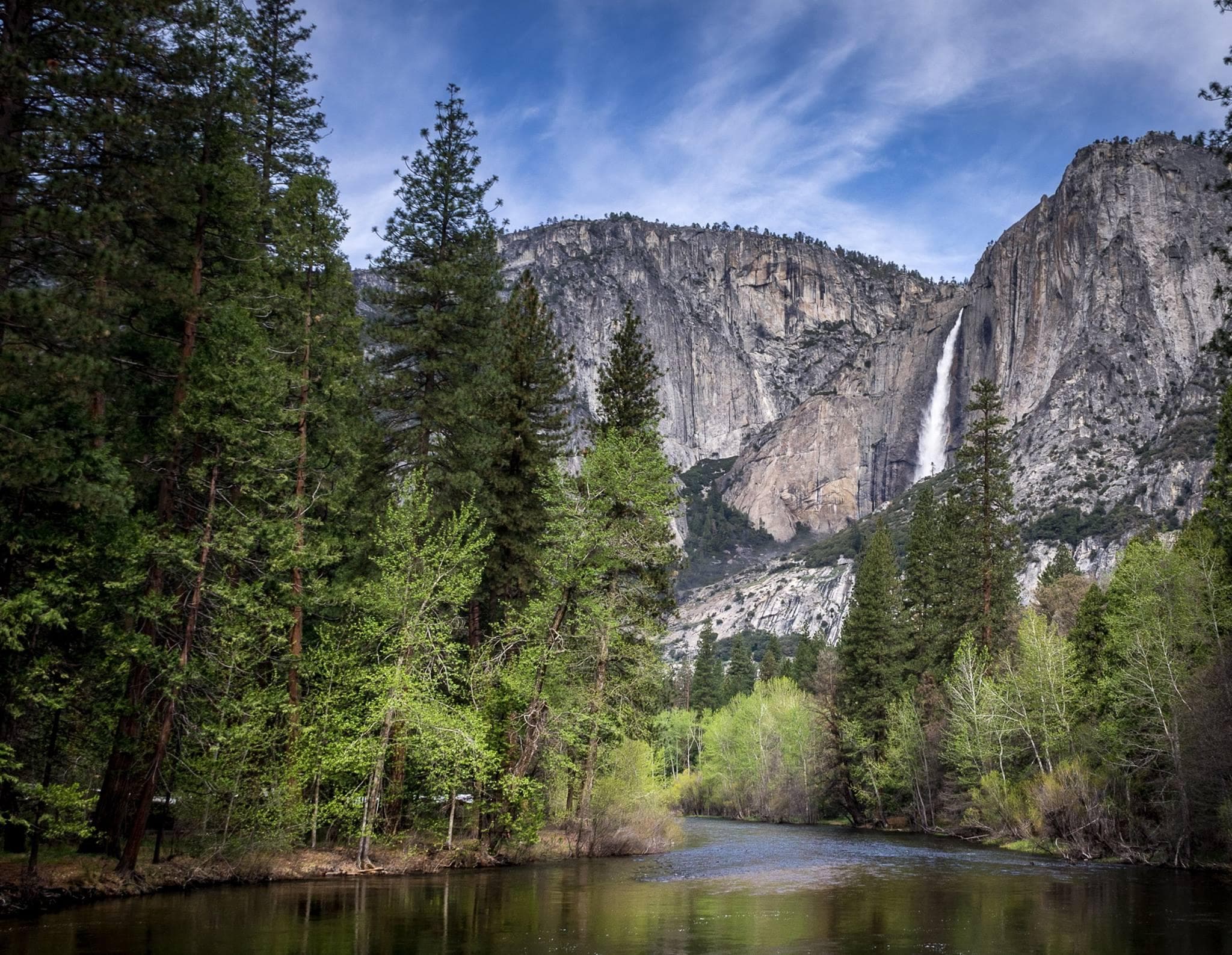
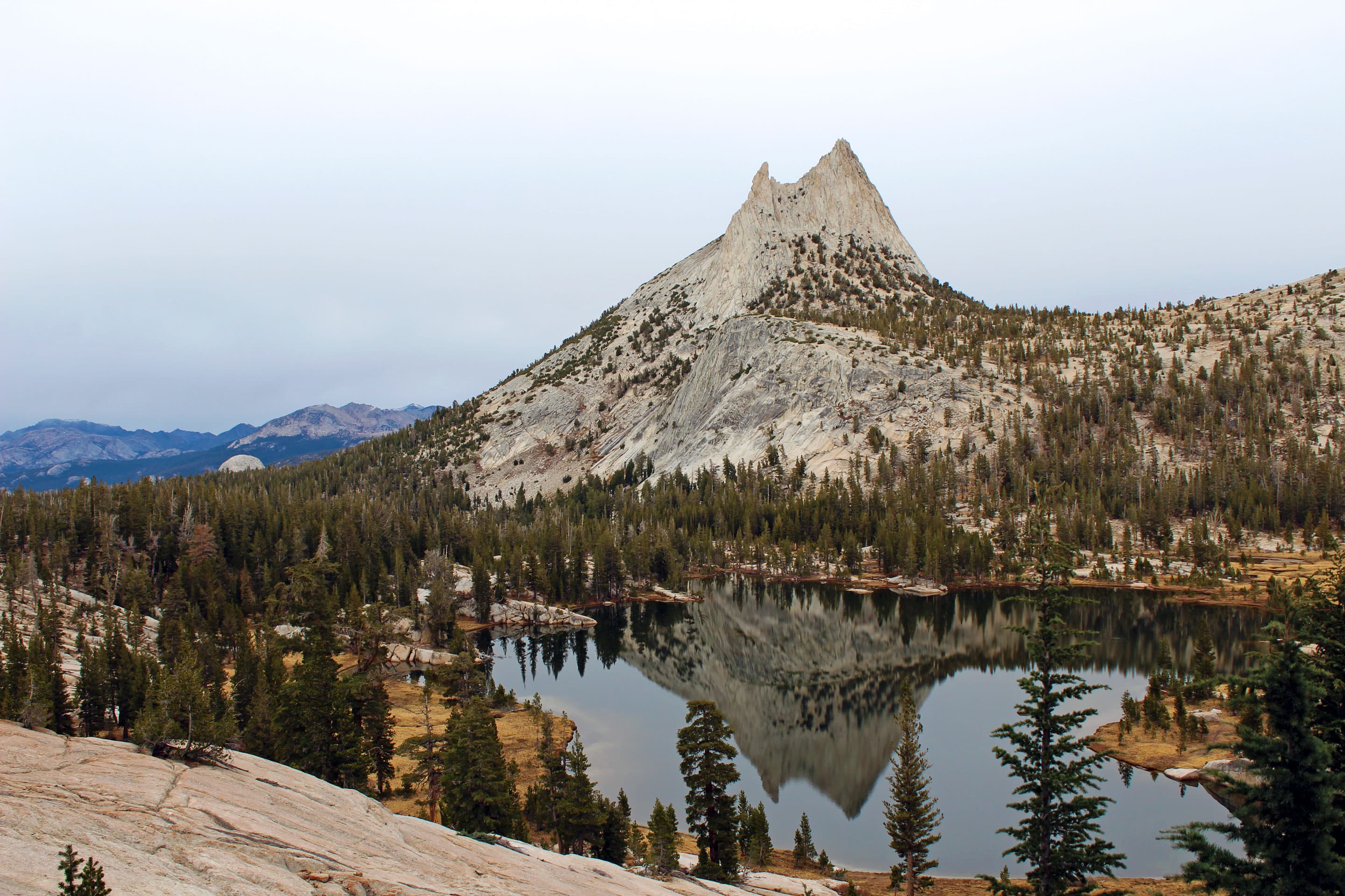
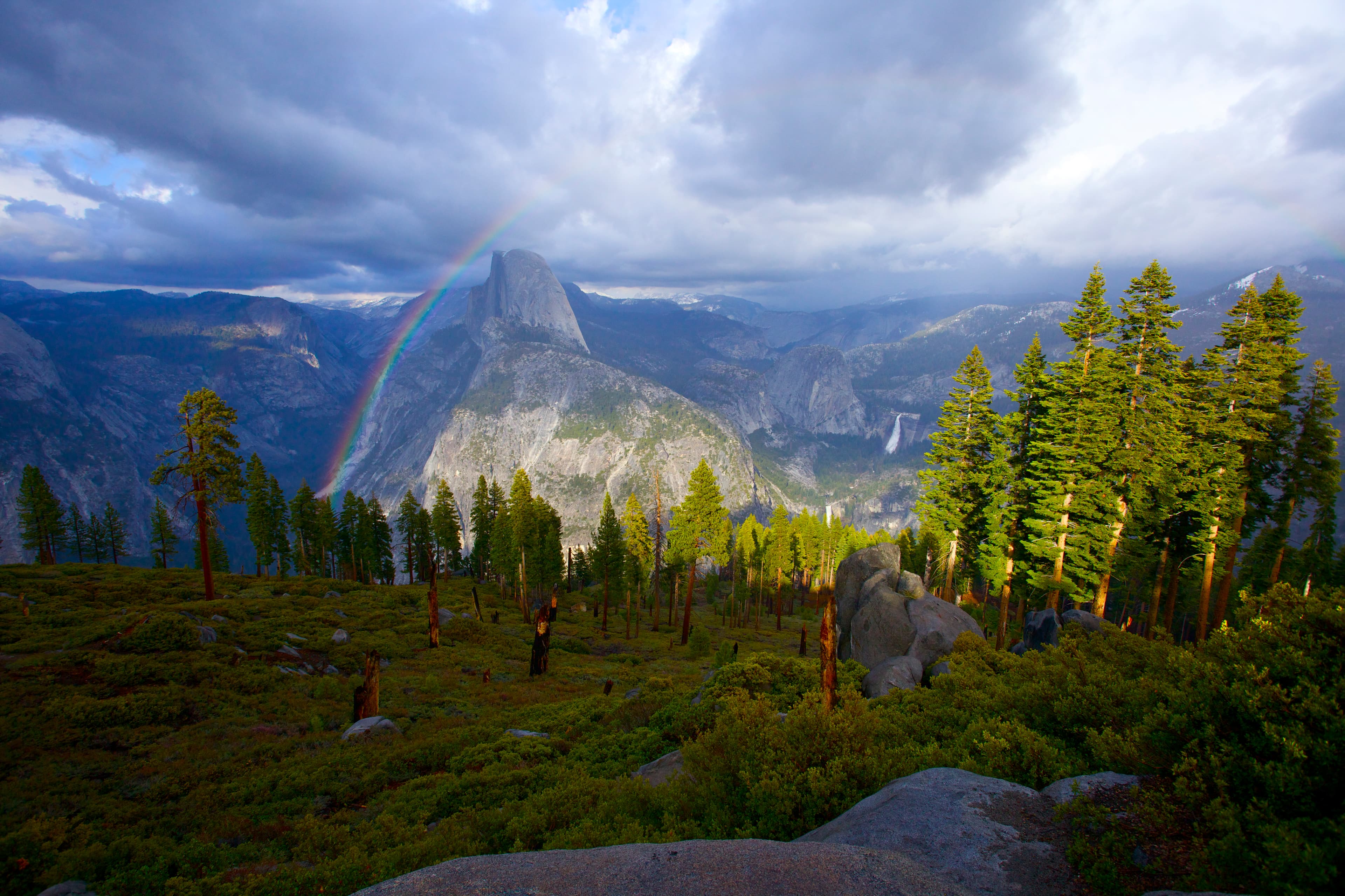
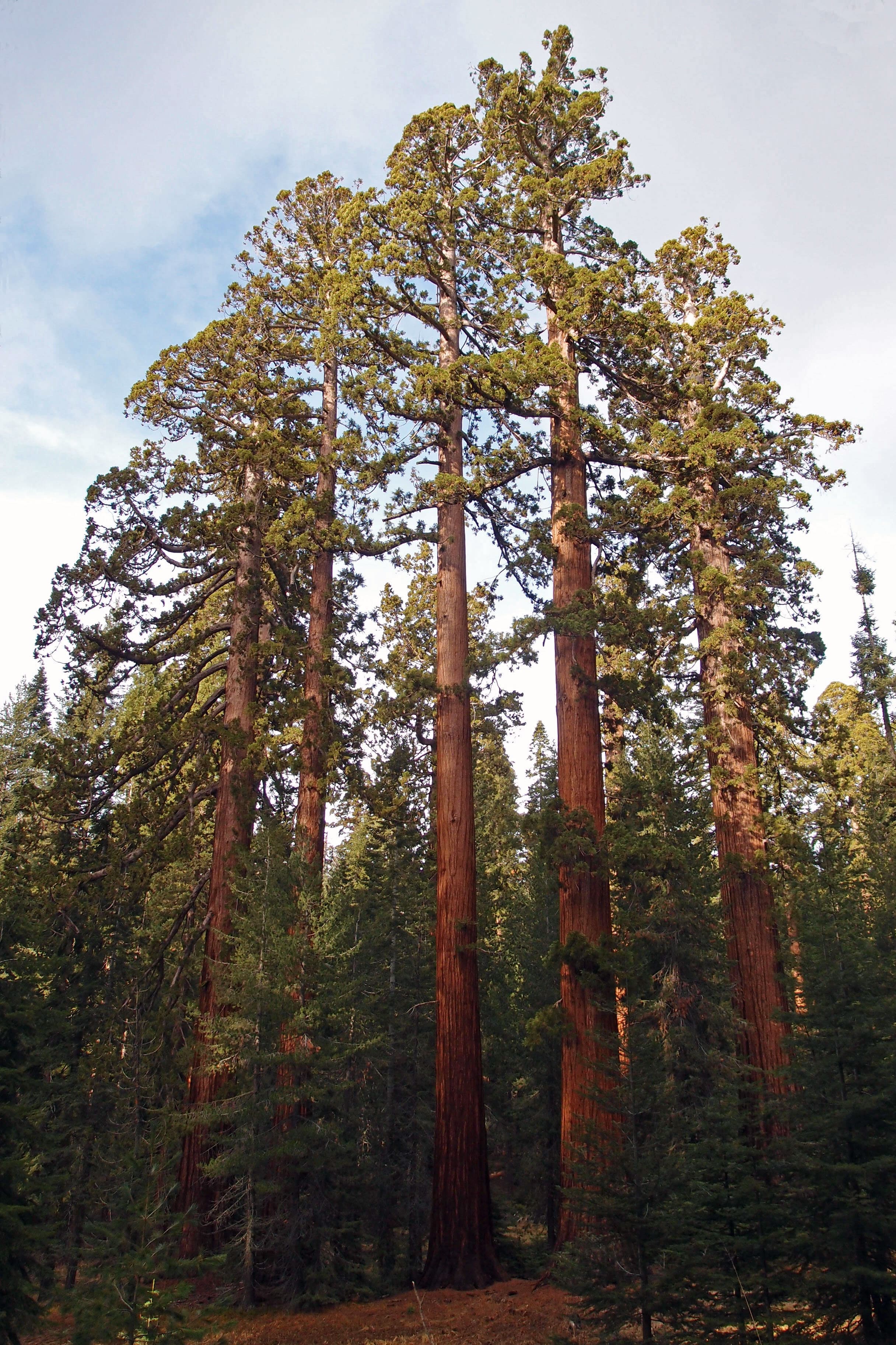
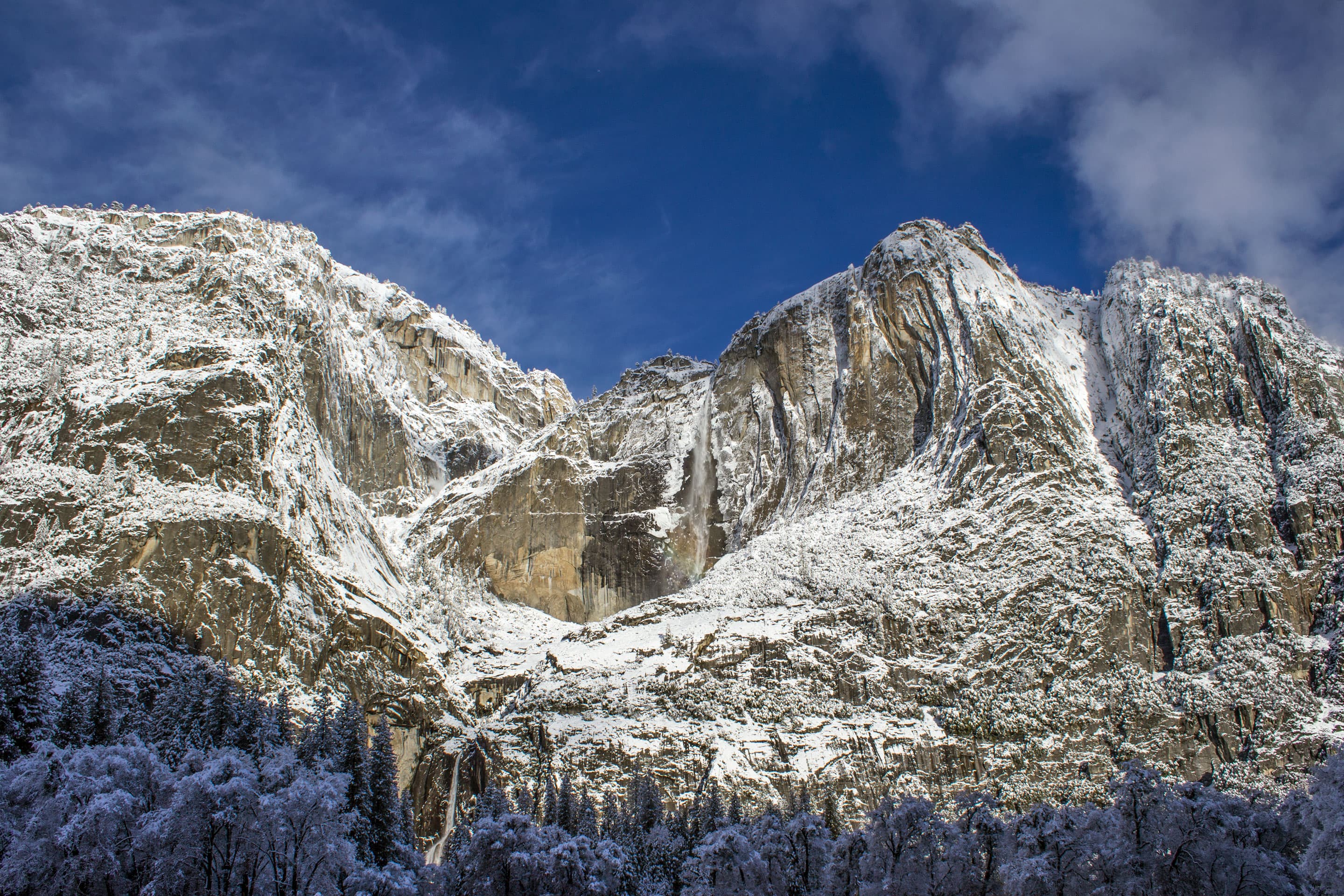
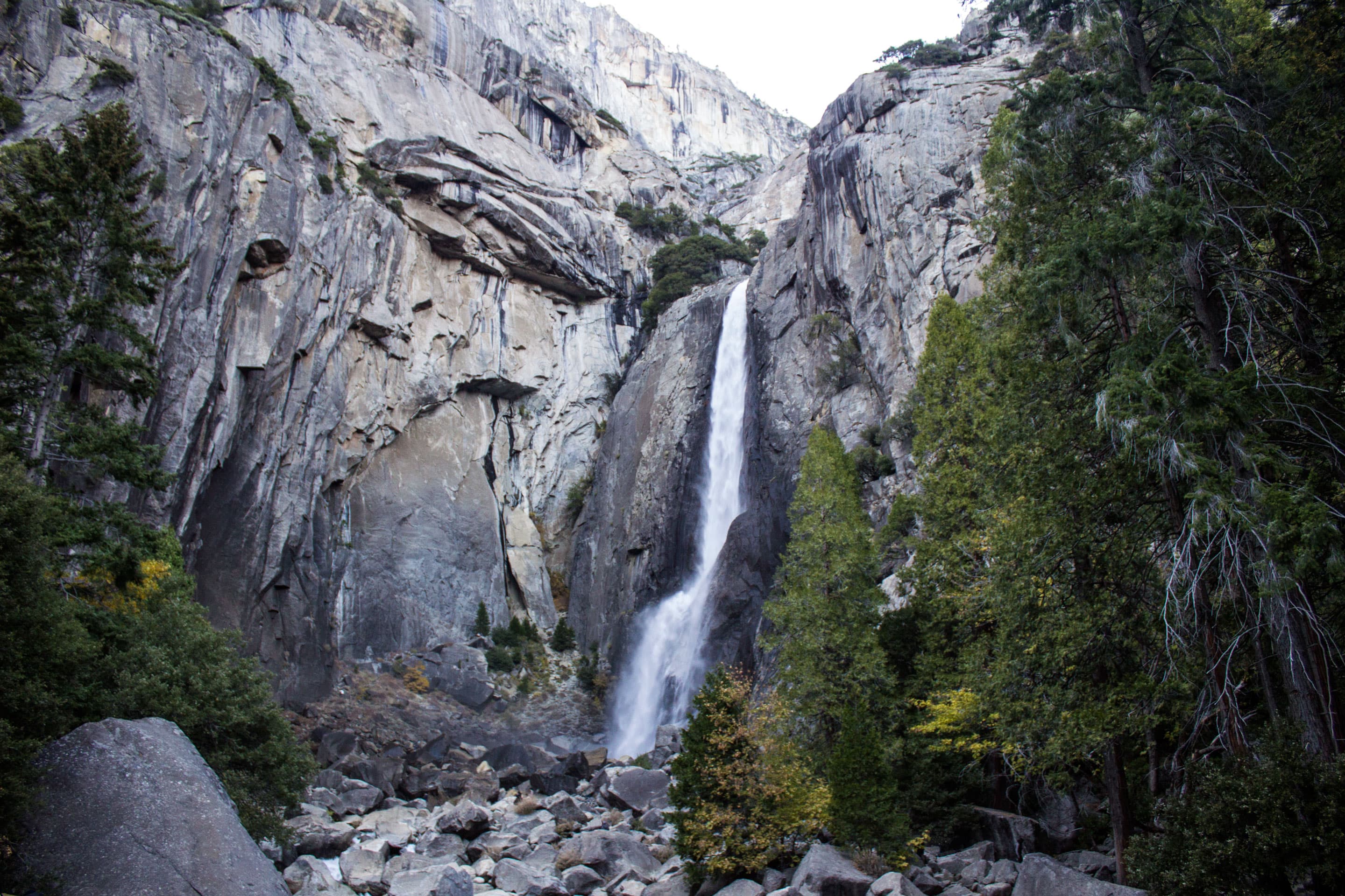
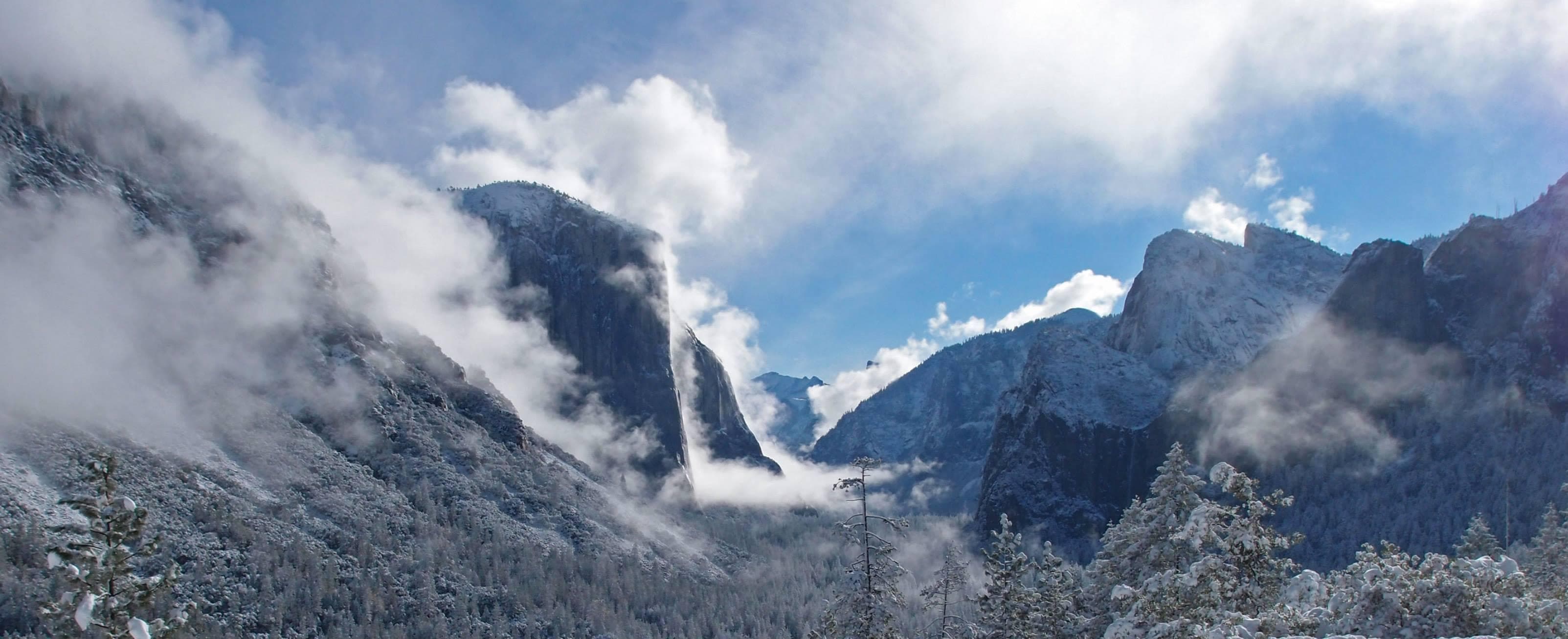
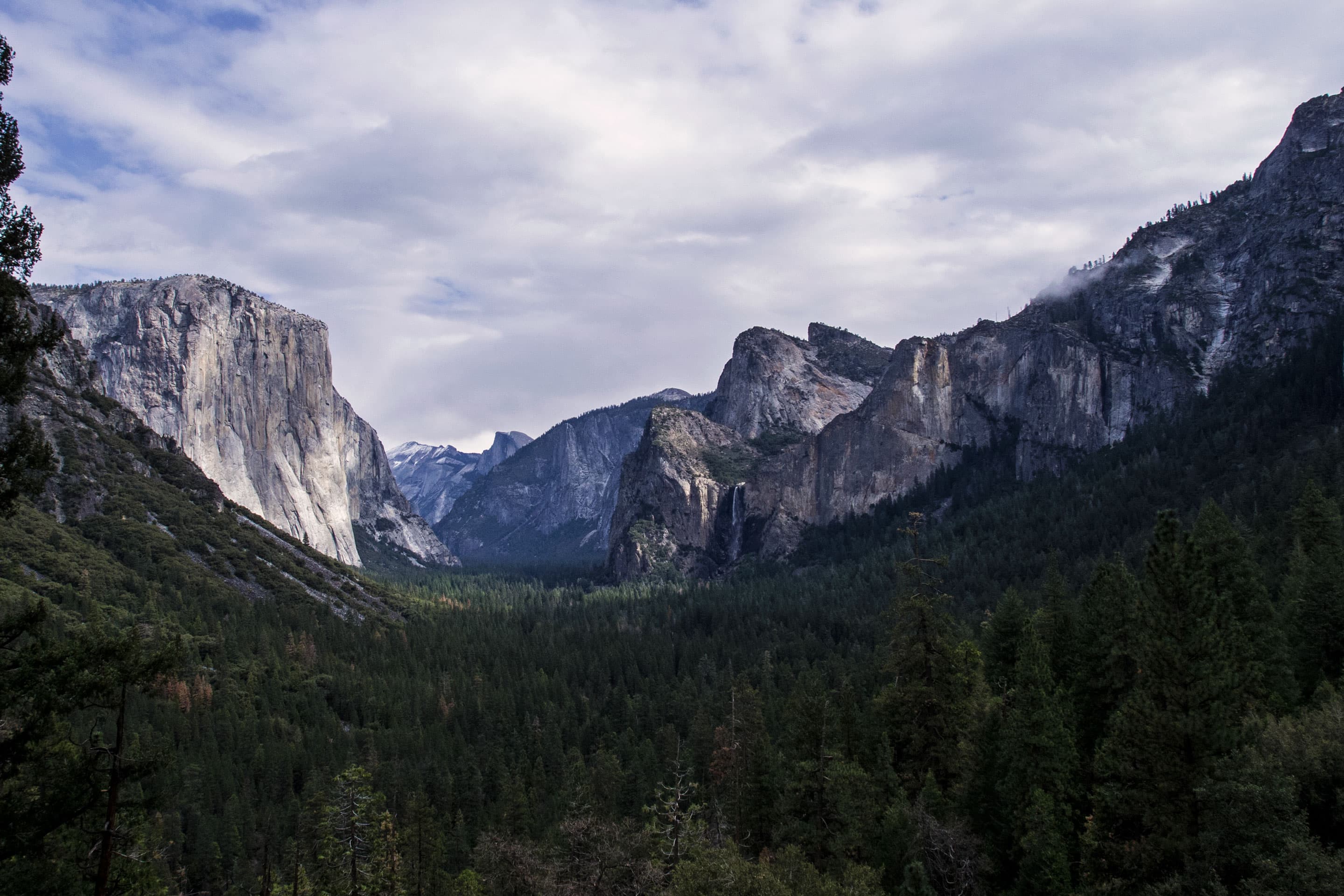
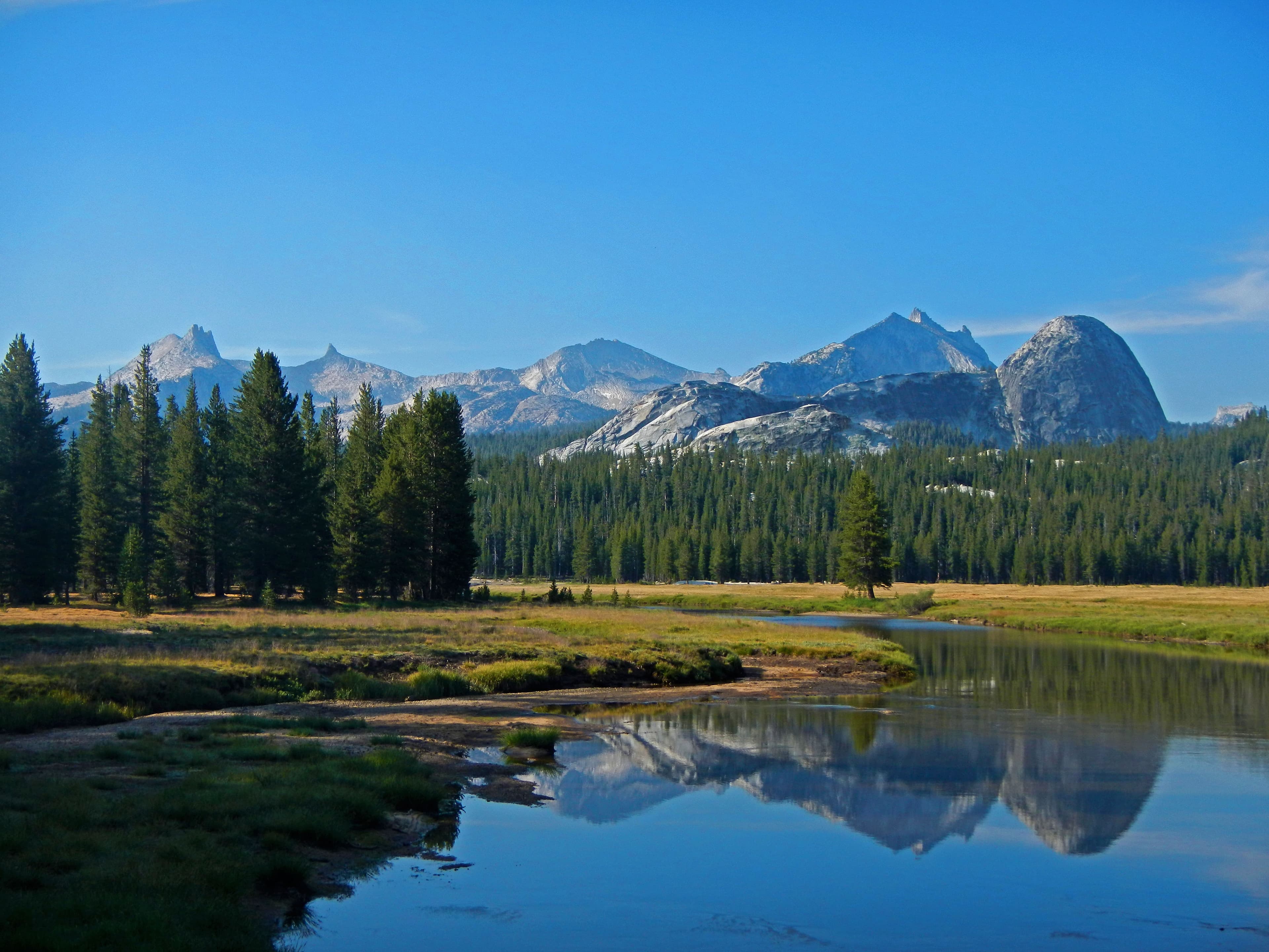
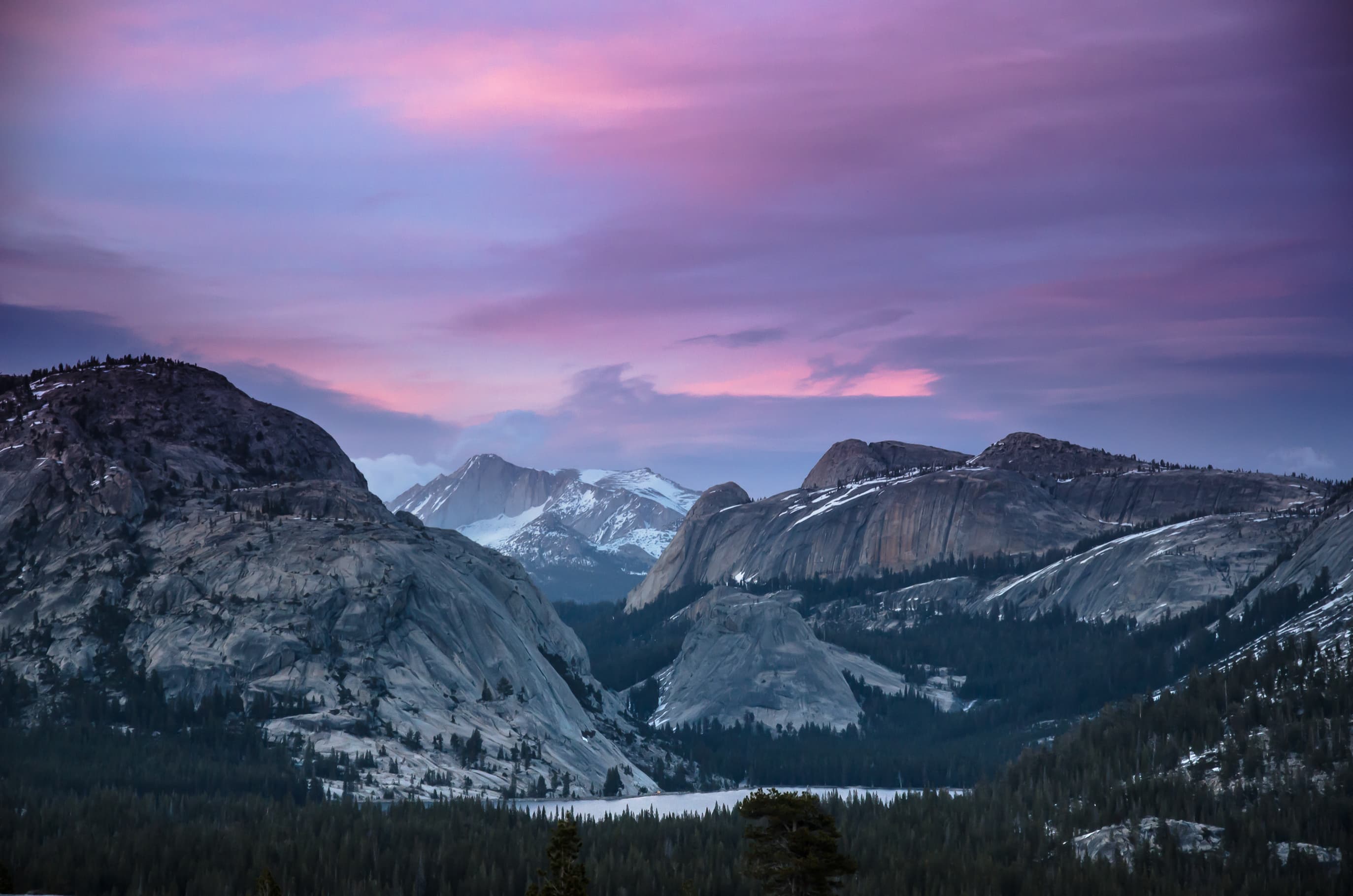
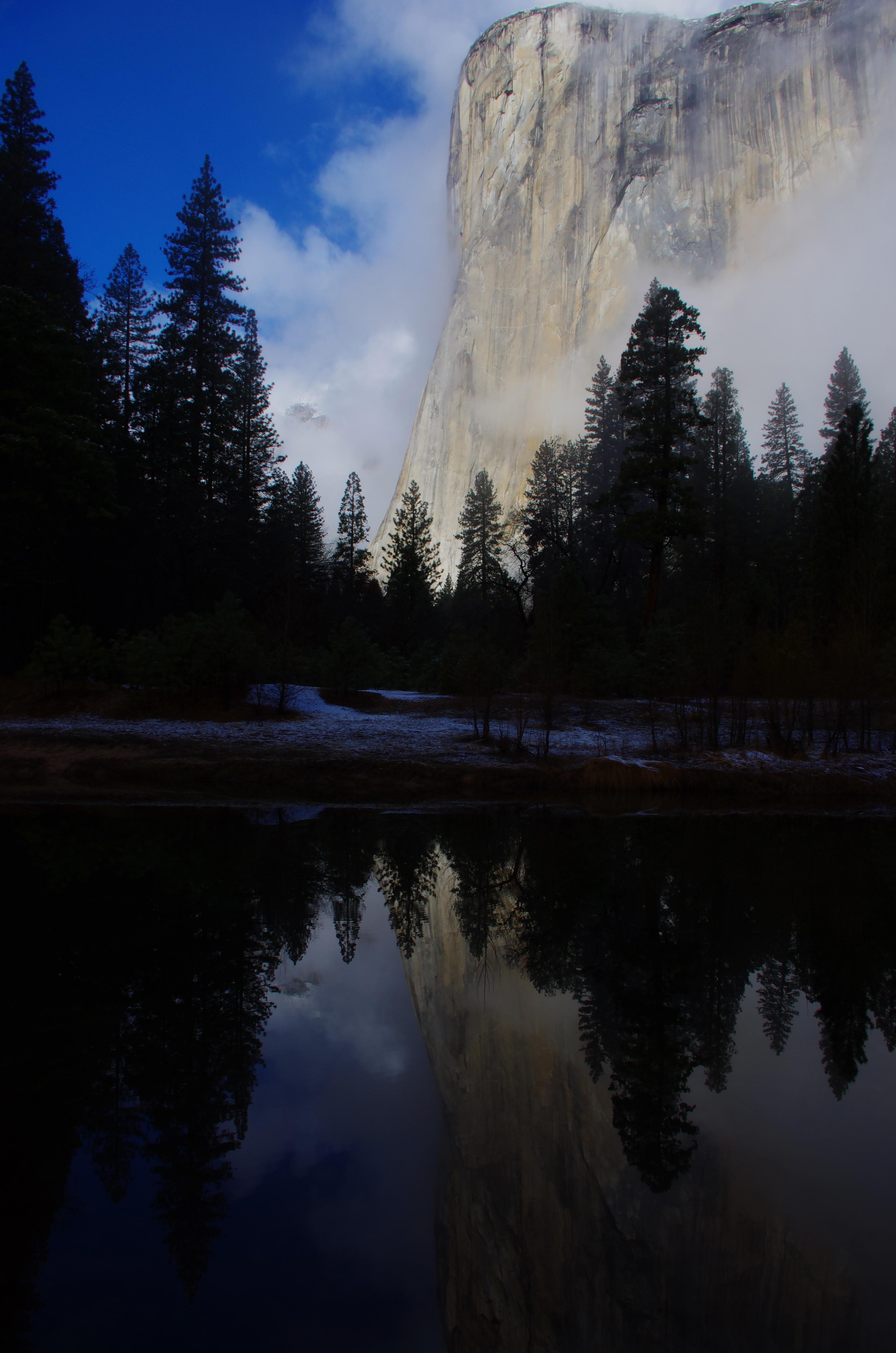
Stay near this park
No horse-friendly stays listed near Yosemite National Park yet. Know a great barn or property? Help fellow riders by listing it.
List your propertyDirections
You can drive to Yosemite year-round and enter via Highways 41, 140, and 120 from the west. Tioga Pass Entrance (via Highway 120 from the east) is closed from approximately November through late May or June. Hetch Hetchy is open all year but may close intermittently due to snow. Please note that GPS units do not always provide accurate directions to or within Yosemite.
Source: nps.gov